Downloaded 90 times


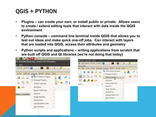
![INSTALLING QGIS PLUGINS
[ open up QGIS, show where the plugins are housed]
[install a random public one]
[show how you can investigate the .py files using a terminal window in
/.qgis2/python/plugins]
[encourage folks to change parameters and recompile to see how layers
change, once they check out Python QGIS Cookbook]](https://image.slidesharecdn.com/pyladies08062014-140806095835-phpapp01/85/I-Maps-Quantum-GIS-Python-23-320.jpg)


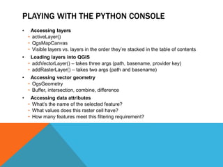
The document discusses Geographic Information Systems (GIS) and its significance in mapping and analyzing spatial data, including definitions, components, and common uses. It introduces Quantum GIS (QGIS) as an open-source tool for visualizing and managing geographic data and emphasizes the importance of Python in extending QGIS functionalities. The document also outlines various applications of GIS in sectors such as emergency services, environmental monitoring, and business planning.