SlideShare a Scribd company logo
1 of 30
Download to read offline
Rocky Mountain UAS
Professionals
16 August 2017
Unmanned Aerial Systems for Precision Mapping
Tetra Tech Geomatic Technologies Group
Just the facts
• Founded in 1966
• $2.6 billion annual revenue in
FY2016
• 16,000 employees worldwide
• A network of approximately 400
offices
• Worked on 60,000 projects in more
than 100 countries in FY2016
• Publicly traded on NASDAQ
as TTEK
2CompanyOverview
Geomatic Technologies Focus Areas
3
 Photogrammetric Mapping
 Digital Orthoimagery
 Airborne Light Detecting and Ranging (LiDAR)
 Multi & Hyperspectral Technology
 Satellite Imagery Collection & Analysis
 Geographic Information Systems (GIS)
 Data Management & Visualization
 Web Mapping Applications
 Historical Aerial Photography
 Oblique Imagery
 Thermal Imagery
 Magnetometry
 Unmanned Aerial Surveys (UAS)
 Mobile and Terrestrial LiDAR
Capabilities: Precision Mapping and Imagery Tools
Current and Historical Aerial
Photography
– provides information about land use
and change detection. CIR imagery
detects stress or vigor of vegetation.
3D Terrain Models & Topographic
Maps
– shows detailed changes in terrain
elevation to support engineering design,
hydrologic modeling, linear routing or
line of site assessments.
LightDetecting& Ranging(LiDAR)
– feature extraction to create as-builts of
existing structures, vegetation and high
resolution terrain mapping.
Hyperspectral Technology
– identify, map and analyze spectrally
unique plant communities, soil types,
and water conditions for baseline &
monitoring.
Airborne ThermalSensing
– thermal infrared imagery overlaying
digital ortho photographs depicts the
distribution of water temperatures.
Airborne Magnetometry
– identify subsurface anomalies such as
High Resolution Aerial Imagery
Tetra Tech project Name: Los Medanos / Location: Contra Costa, California
Compiled Mass-Points, Breaklines and Planimetry
Tetra Tech project Name: Los Medanos / Location: Contra Costa, California
TIN (Triangulated Irregular Network)
Created from Compiled Data
Tetra Tech project Name: Los Medanos / Location: Contra Costa, California
Multispectral and Hyperspectral Imagery
Introduction to LiDAR
LiDAR – High Resolution Terrain Model
First Image:
Highest hit
LiDAR points in
heavily
vegetated
region. LiDAR
point density
collection was
8.9pts/sq.
meter.
Second Image:
Terrain model
with vegetation
points removed
shows ground
detail (terrain
changes, roads,
river banks, etc.
Unmanned Aerial Systems (UAS)
 Ideal for Small Area/Sensitive Area Collection
 Faster mobilization to remote areas
 Emergency Response
 Faster product generation
 Time-sensitive projects
 Ability to collect with multiple sensors/ change sensors
in the field
 Cost effective
 Below cloud deck acquisition
 Oblique acquisition
UAS Applications
 Oblique Imagery: Capture of cliffs or other coastal features
allows for mapping where manned sensors cannot
 High resolution imagery: less than one centimeter GSD
 Volumetrics: With high relative accuracy, measurements will
be approximately 3 cubic cm without GCPs
 Tide coordinated acquisition: With the ability to fly below
clouds and at night (with a waiver), specific high or low tide
conditions can be captured
 Rapid Response: FAA emergency waivers and UAS flight
flexibility make UAS a great tool
 Thermal imagery to detect wildlife, plant life, etc. in a more
economic and localized way than with manned aircraft
Unmanned Aerial Systems
 DJI Phantom and Inspire (Multi-Rotor)
 Very Cheap Consumer Grade ($1350-$3000)
 Sufficient Electronics to Meet FAA Restrictions
 High resolution Video (1080P and photographs)
 Limited georeferenced output with Pix4D
 Semi-Autonomous
 Vertical landing
 SenseFly ebee (fixed wing)
 Longer flight duration time
 Ideal for larger area collection
 GSD of 1.5 cm pixel
 Limited georeferenced output with Pix4D
 Semi-Autonomous
 Beyond line-of-sight
 Requires a larger landing area
Unmanned Aerial Systems
 SkyProwler (VTOL)
 Switchblade mechanism allows for
longer/faster flights
 Hover and vertical take off/landing
 Gimbal stabilizationfor camera
 16MP camera with NIR filter
 Cargo drop door
 Beyond line-of-sight and dusk collection
UAS Sensors
 Color imagery cameras
 High definition video cameras
 4-band RGBI cameras
 Thermal sensors (FLIR)
 Topographic LiDAR
 Hyperspectral
 Standard frame camera
 Frame based video
camera
 Metric frame camera
 LiDAR
 FLIR
Data Collection
 Ground control
 Specialized pre-flight
planning software
 Airspace considerations
 Safety considerations
 License
Data Processing
 Orthoimagery
 Digital Surface Model (DSM)
 Digital Elevation Model
(DEM)
 Contours
 Planimetrics
 3-D Point Cloud
 Feature extraction
 Classification
Deliverables
 Orthoimagery
 Contours
 Planimetrics
 Classified LiDAR
 Topographic DEM
 Intensity/Reflectance
 NIR Imagery
 Volumetric Calculations
 Slope Calculations
 Change DetectionAnalysis
 Heat DetectionAnalysis
 VegetationAnalysis
Project Example: Diablo Canyon Bluff Study
 LiDAR and Aerial Photography of a Seacoast
Bluff near the Diablo Canyon Power Plant on the
Central California Coast
 Comparison of 2010 to 2015 LiDAR and to
several epochs of photogrammetric mapping
 Highlighted areas of greatest change and
presented suggestions for future studies of bluff
erosion
 Change detection analysis
Project Example: Quarterly Landfill Mapping
 Aerial Photography of Six Local Landfills
 Developed methods to quickly generate
terrain models for volumetric analysis
 Delivery within one week included terrain
models and contour maps
 Results reviewed by stereo inspection
and accuracy routinely tested by
comparison to landfill and haul records
 Acquisition below fog/cloud cover was
key to meeting schedule deadline
Project Example: Pismo Beach Bluff
21
Project Example: Bennett Landfill
Considerations:
 Flight Planning
 Ground Control Points
 Accuracy
 Datasets
 Data points are a DSM (surface, not ground)
 Size of Project
 Turn-around Time
Project Example: UAV Modeling and Accuracy Evaluation
Vasco Road is close to our office in Lafayette
UAV Modeling and Accuracy Evaluation: Vasco Road
Vasco Road is close to our office in
Lafayette so we thought to deploy
our UAV as a test.
800+ Photos were taken
UAV Modeling and Accuracy Evaluation: Vasco Road
High Resolution Imageryproduces adetailed DTM
UAV Modeling and Accuracy Evaluation: Vasco Road
0
2
4
6
8
10
12
14
16
18
-1 -0.8 -0.6 -0.4 -0.2 0 0.2 0.4 0.6 0.8 1
Distribution of Error
mz = -.11’
s = .35’
UAV Modeling and Accuracy Evaluation: Vasco Road
Tested in 72 Locations
UAS Lessons Learned
 Value of UAS comes from the data, not the platforms
 Project objectives determine approach
 Even “easy to fly” systems can be challenging
 Not everyone who has a UAS can/should fly
commercially
 Accuracy and mapping requirements are not just
processing
 Ground checkpoints/targets
for accuracy reporting
 FAA Regulations for UAS are set
to aviation industry standards –
practice them, keep our standards high
Accuracy Lessons Learned
• Lens Stability, Resolution and Software are Key:
▪ The Sony sensor produced accuracies comparable to manned cameras
▪ UAS lenses are not calibrated and contain instabilities
• Data points are a DSM surface: software can only model
what is visible
• Contours of 2ft can be generated to accepted standards
easily.
• With proper control for checking and measurement the
1ft contours are possible
• Size of the project matters
• Accuracy and mapping requirements must be met by
proper hardware and planning - not just software.
Contact Information
Renee Walmsley, PMP, GISP
Remote Sensing Program Manager
Tetra Tech, Inc.
925.584.0049
Renee.Walmsley@tetratech.com

More Related Content

What's hot

chapter19. Terrestrial and Close-Range Photogrammetry.pdf
chapter19. Terrestrial and Close-Range Photogrammetry.pdfchapter19. Terrestrial and Close-Range Photogrammetry.pdf
chapter19. Terrestrial and Close-Range Photogrammetry.pdfssuser3f7a17
 
LiDAR technology
LiDAR technology LiDAR technology
LiDAR technology shlokdoshi
 
Digital Elevation Models
Digital Elevation ModelsDigital Elevation Models
Digital Elevation ModelsBernd Flmla
 
Applications of AI in the geospatial domain
Applications of AI in the geospatial domainApplications of AI in the geospatial domain
Applications of AI in the geospatial domainErik Van Der Zee
 
Global navigation satellite system based positioning combined
Global navigation satellite system based positioning   combinedGlobal navigation satellite system based positioning   combined
Global navigation satellite system based positioning combinedMehjabin Sultana
 
Mission planning v1.0
Mission planning v1.0Mission planning v1.0
Mission planning v1.0mandalanil
 
LiDAR Data Processing and Classification
LiDAR Data Processing and ClassificationLiDAR Data Processing and Classification
LiDAR Data Processing and ClassificationMichal Bularz
 
Drone and its application
Drone and its applicationDrone and its application
Drone and its application14209276
 
Processing Drone data @Scale
Processing Drone data @ScaleProcessing Drone data @Scale
Processing Drone data @ScaleDr Hajji Hicham
 
Remote Sensing with a Drone
Remote Sensing with a DroneRemote Sensing with a Drone
Remote Sensing with a DroneTravis Peterson
 
Remote sensing with drones: The challenges of obtaining truly quantitative da...
Remote sensing with drones: The challenges of obtaining truly quantitative da...Remote sensing with drones: The challenges of obtaining truly quantitative da...
Remote sensing with drones: The challenges of obtaining truly quantitative da...ARDC
 
Semi-Automatic Classification Algorithm: The differences between Minimum Dist...
Semi-Automatic Classification Algorithm: The differences between Minimum Dist...Semi-Automatic Classification Algorithm: The differences between Minimum Dist...
Semi-Automatic Classification Algorithm: The differences between Minimum Dist...Fatwa Ramdani
 

What's hot (20)

chapter19. Terrestrial and Close-Range Photogrammetry.pdf
chapter19. Terrestrial and Close-Range Photogrammetry.pdfchapter19. Terrestrial and Close-Range Photogrammetry.pdf
chapter19. Terrestrial and Close-Range Photogrammetry.pdf
 
LiDAR technology
LiDAR technology LiDAR technology
LiDAR technology
 
Photogrammetry-part 1
Photogrammetry-part 1Photogrammetry-part 1
Photogrammetry-part 1
 
Digital Elevation Models
Digital Elevation ModelsDigital Elevation Models
Digital Elevation Models
 
Applications of AI in the geospatial domain
Applications of AI in the geospatial domainApplications of AI in the geospatial domain
Applications of AI in the geospatial domain
 
Global navigation satellite system based positioning combined
Global navigation satellite system based positioning   combinedGlobal navigation satellite system based positioning   combined
Global navigation satellite system based positioning combined
 
LIDAR
LIDARLIDAR
LIDAR
 
Introduction to global position system
Introduction to global position systemIntroduction to global position system
Introduction to global position system
 
Mission planning v1.0
Mission planning v1.0Mission planning v1.0
Mission planning v1.0
 
LiDAR Data Processing and Classification
LiDAR Data Processing and ClassificationLiDAR Data Processing and Classification
LiDAR Data Processing and Classification
 
GPS HISTORY
GPS HISTORYGPS HISTORY
GPS HISTORY
 
Remote sensing
Remote sensingRemote sensing
Remote sensing
 
Drone and its application
Drone and its applicationDrone and its application
Drone and its application
 
Processing Drone data @Scale
Processing Drone data @ScaleProcessing Drone data @Scale
Processing Drone data @Scale
 
Remote Sensing with a Drone
Remote Sensing with a DroneRemote Sensing with a Drone
Remote Sensing with a Drone
 
Photogrammetry
PhotogrammetryPhotogrammetry
Photogrammetry
 
Remote sensing with drones: The challenges of obtaining truly quantitative da...
Remote sensing with drones: The challenges of obtaining truly quantitative da...Remote sensing with drones: The challenges of obtaining truly quantitative da...
Remote sensing with drones: The challenges of obtaining truly quantitative da...
 
photogrammetry
photogrammetryphotogrammetry
photogrammetry
 
drone
dronedrone
drone
 
Semi-Automatic Classification Algorithm: The differences between Minimum Dist...
Semi-Automatic Classification Algorithm: The differences between Minimum Dist...Semi-Automatic Classification Algorithm: The differences between Minimum Dist...
Semi-Automatic Classification Algorithm: The differences between Minimum Dist...
 

Similar to Unmanned Aerial Systems for Precision Mapping

LiDAR Technology and Geospatial Services
LiDAR Technology and Geospatial Services LiDAR Technology and Geospatial Services
LiDAR Technology and Geospatial Services MattBethel1
 
Vijay Persaud, Riegl
Vijay Persaud, RieglVijay Persaud, Riegl
Vijay Persaud, RieglsUAS News
 
"Why LiDAR?" Presentation
"Why LiDAR?" Presentation"Why LiDAR?" Presentation
"Why LiDAR?" PresentationLidar Blog
 
Laser ScanningLaser scanning is an emerging data acquisition techn.pdf
Laser ScanningLaser scanning is an emerging data acquisition techn.pdfLaser ScanningLaser scanning is an emerging data acquisition techn.pdf
Laser ScanningLaser scanning is an emerging data acquisition techn.pdfanjaniar7gallery
 
Lidar : light detection and rangeing
Lidar : light detection and rangeingLidar : light detection and rangeing
Lidar : light detection and rangeingRahul Bhagore
 
LiDAR Aided Decision Making
LiDAR Aided Decision MakingLiDAR Aided Decision Making
LiDAR Aided Decision MakingLidar Blog
 
Global Airbone lidar market
Global Airbone lidar marketGlobal Airbone lidar market
Global Airbone lidar marketDefense Report
 
ScanMapBrochure2016_loRES
ScanMapBrochure2016_loRESScanMapBrochure2016_loRES
ScanMapBrochure2016_loRESJohn Taylor
 
Laser-beams, spacecraft and archaeology; recent approaches to the recording, ...
Laser-beams, spacecraft and archaeology; recent approaches to the recording, ...Laser-beams, spacecraft and archaeology; recent approaches to the recording, ...
Laser-beams, spacecraft and archaeology; recent approaches to the recording, ...Paul Cripps
 
Remote Sensing Field Camp 2016
Remote Sensing Field Camp 2016 Remote Sensing Field Camp 2016
Remote Sensing Field Camp 2016 COGS Presentations
 
DDI Dense Point Cloud Processing Presentation Oct2009
DDI Dense Point Cloud Processing Presentation Oct2009DDI Dense Point Cloud Processing Presentation Oct2009
DDI Dense Point Cloud Processing Presentation Oct2009Direct Dimensions, Inc.
 
DDI Dense Point Cloud Processing Presentation Oct 2009
DDI Dense Point Cloud Processing Presentation Oct 2009DDI Dense Point Cloud Processing Presentation Oct 2009
DDI Dense Point Cloud Processing Presentation Oct 2009Direct Dimensions, Inc.
 
light-detection-and-ranging(lidar)
 light-detection-and-ranging(lidar) light-detection-and-ranging(lidar)
light-detection-and-ranging(lidar)sandeep reddy
 
Commercial Drone Best Practices: How to Incorporate Data and Job Specs
Commercial Drone Best Practices: How to Incorporate Data and Job SpecsCommercial Drone Best Practices: How to Incorporate Data and Job Specs
Commercial Drone Best Practices: How to Incorporate Data and Job SpecsColin Snow
 

Similar to Unmanned Aerial Systems for Precision Mapping (20)

LiDAR Technology and Geospatial Services
LiDAR Technology and Geospatial Services LiDAR Technology and Geospatial Services
LiDAR Technology and Geospatial Services
 
Vijay Persaud, Riegl
Vijay Persaud, RieglVijay Persaud, Riegl
Vijay Persaud, Riegl
 
"Why LiDAR?" Presentation
"Why LiDAR?" Presentation"Why LiDAR?" Presentation
"Why LiDAR?" Presentation
 
Laser ScanningLaser scanning is an emerging data acquisition techn.pdf
Laser ScanningLaser scanning is an emerging data acquisition techn.pdfLaser ScanningLaser scanning is an emerging data acquisition techn.pdf
Laser ScanningLaser scanning is an emerging data acquisition techn.pdf
 
Lidar
LidarLidar
Lidar
 
Lidar : light detection and rangeing
Lidar : light detection and rangeingLidar : light detection and rangeing
Lidar : light detection and rangeing
 
LiDAR Aided Decision Making
LiDAR Aided Decision MakingLiDAR Aided Decision Making
LiDAR Aided Decision Making
 
Global Airbone lidar market
Global Airbone lidar marketGlobal Airbone lidar market
Global Airbone lidar market
 
Writing Successful GIS RFPs (2010)
Writing Successful GIS RFPs (2010)Writing Successful GIS RFPs (2010)
Writing Successful GIS RFPs (2010)
 
McKim Creed
McKim CreedMcKim Creed
McKim Creed
 
ScanMapBrochure2016_loRES
ScanMapBrochure2016_loRESScanMapBrochure2016_loRES
ScanMapBrochure2016_loRES
 
Laser-beams, spacecraft and archaeology; recent approaches to the recording, ...
Laser-beams, spacecraft and archaeology; recent approaches to the recording, ...Laser-beams, spacecraft and archaeology; recent approaches to the recording, ...
Laser-beams, spacecraft and archaeology; recent approaches to the recording, ...
 
Remote Sensing Field Camp 2016
Remote Sensing Field Camp 2016 Remote Sensing Field Camp 2016
Remote Sensing Field Camp 2016
 
Light Detection and Ranging Technology for Energy Sector
Light Detection and Ranging Technology for Energy Sector Light Detection and Ranging Technology for Energy Sector
Light Detection and Ranging Technology for Energy Sector
 
DDI Dense Point Cloud Processing Presentation Oct2009
DDI Dense Point Cloud Processing Presentation Oct2009DDI Dense Point Cloud Processing Presentation Oct2009
DDI Dense Point Cloud Processing Presentation Oct2009
 
DDI Dense Point Cloud Processing Presentation Oct 2009
DDI Dense Point Cloud Processing Presentation Oct 2009DDI Dense Point Cloud Processing Presentation Oct 2009
DDI Dense Point Cloud Processing Presentation Oct 2009
 
LIDAR
LIDARLIDAR
LIDAR
 
Maps Across Texas
Maps Across TexasMaps Across Texas
Maps Across Texas
 
light-detection-and-ranging(lidar)
 light-detection-and-ranging(lidar) light-detection-and-ranging(lidar)
light-detection-and-ranging(lidar)
 
Commercial Drone Best Practices: How to Incorporate Data and Job Specs
Commercial Drone Best Practices: How to Incorporate Data and Job SpecsCommercial Drone Best Practices: How to Incorporate Data and Job Specs
Commercial Drone Best Practices: How to Incorporate Data and Job Specs
 

More from UAS Colorado

April 20, 2020 United States Air Force Awards Black Swift Technologies Contract
April 20, 2020 United States Air Force Awards Black Swift Technologies Contract April 20, 2020 United States Air Force Awards Black Swift Technologies Contract
April 20, 2020 United States Air Force Awards Black Swift Technologies Contract UAS Colorado
 
UAS RMUASP Meetup with PIX4D
UAS RMUASP Meetup with PIX4D  UAS RMUASP Meetup with PIX4D
UAS RMUASP Meetup with PIX4D UAS Colorado
 
Emerald Ash Borer Identification using Drones
Emerald Ash Borer Identification using DronesEmerald Ash Borer Identification using Drones
Emerald Ash Borer Identification using DronesUAS Colorado
 
August 2017 Rocky Mountain UAS Professionals Meetup
August 2017 Rocky Mountain UAS Professionals MeetupAugust 2017 Rocky Mountain UAS Professionals Meetup
August 2017 Rocky Mountain UAS Professionals MeetupUAS Colorado
 
Tornado Disaster Response using Drones
Tornado Disaster Response using DronesTornado Disaster Response using Drones
Tornado Disaster Response using DronesUAS Colorado
 
Rocky Mtn. UAS Professionals - June 2017 Meetup
Rocky Mtn. UAS Professionals - June 2017 MeetupRocky Mtn. UAS Professionals - June 2017 Meetup
Rocky Mtn. UAS Professionals - June 2017 MeetupUAS Colorado
 
UAS Technology for Construction
UAS Technology for ConstructionUAS Technology for Construction
UAS Technology for ConstructionUAS Colorado
 
April 2017 Rocky Mountain UAS Professionals
April 2017 Rocky Mountain UAS ProfessionalsApril 2017 Rocky Mountain UAS Professionals
April 2017 Rocky Mountain UAS ProfessionalsUAS Colorado
 
UAS Applications for Civil Engineering
UAS Applications for Civil EngineeringUAS Applications for Civil Engineering
UAS Applications for Civil EngineeringUAS Colorado
 
UAS Industry Growth: forecasting Impact on Regional Infrastructure, Environme...
UAS Industry Growth: forecasting Impact on Regional Infrastructure, Environme...UAS Industry Growth: forecasting Impact on Regional Infrastructure, Environme...
UAS Industry Growth: forecasting Impact on Regional Infrastructure, Environme...UAS Colorado
 
Esri Presentation
Esri Presentation Esri Presentation
Esri Presentation UAS Colorado
 
October 2016 Rocky Mountain UAS Professionals Meetup
October 2016 Rocky Mountain UAS Professionals MeetupOctober 2016 Rocky Mountain UAS Professionals Meetup
October 2016 Rocky Mountain UAS Professionals MeetupUAS Colorado
 
Use of UAV Assessment in Navajo Nation Abandoned Uranium Mine Cleanup
Use of UAV Assessment in Navajo Nation Abandoned Uranium Mine Cleanup Use of UAV Assessment in Navajo Nation Abandoned Uranium Mine Cleanup
Use of UAV Assessment in Navajo Nation Abandoned Uranium Mine Cleanup UAS Colorado
 
Rocky Mountain UAS Professionals - Sept. 2016
Rocky Mountain UAS Professionals - Sept. 2016Rocky Mountain UAS Professionals - Sept. 2016
Rocky Mountain UAS Professionals - Sept. 2016UAS Colorado
 
July RMUASP: Front Range UAS Presentation
July RMUASP: Front Range UAS PresentationJuly RMUASP: Front Range UAS Presentation
July RMUASP: Front Range UAS PresentationUAS Colorado
 
July RMUASP Meetup
July RMUASP MeetupJuly RMUASP Meetup
July RMUASP MeetupUAS Colorado
 
June 2016 Rocky Mtn. UAS Professionals Meetup
June 2016 Rocky Mtn. UAS Professionals MeetupJune 2016 Rocky Mtn. UAS Professionals Meetup
June 2016 Rocky Mtn. UAS Professionals MeetupUAS Colorado
 
Unmanned Aerial Systems (UAS) Data Quality and Accuracy Realities
Unmanned Aerial Systems (UAS) Data Quality and Accuracy RealitiesUnmanned Aerial Systems (UAS) Data Quality and Accuracy Realities
Unmanned Aerial Systems (UAS) Data Quality and Accuracy RealitiesUAS Colorado
 
April Rocky Mountain UAS Professionals Meetup
April Rocky Mountain UAS Professionals Meetup April Rocky Mountain UAS Professionals Meetup
April Rocky Mountain UAS Professionals Meetup UAS Colorado
 

More from UAS Colorado (20)

April 20, 2020 United States Air Force Awards Black Swift Technologies Contract
April 20, 2020 United States Air Force Awards Black Swift Technologies Contract April 20, 2020 United States Air Force Awards Black Swift Technologies Contract
April 20, 2020 United States Air Force Awards Black Swift Technologies Contract
 
UAS RMUASP Meetup with PIX4D
UAS RMUASP Meetup with PIX4D  UAS RMUASP Meetup with PIX4D
UAS RMUASP Meetup with PIX4D
 
Rid ppt dpf2
Rid ppt dpf2Rid ppt dpf2
Rid ppt dpf2
 
Emerald Ash Borer Identification using Drones
Emerald Ash Borer Identification using DronesEmerald Ash Borer Identification using Drones
Emerald Ash Borer Identification using Drones
 
August 2017 Rocky Mountain UAS Professionals Meetup
August 2017 Rocky Mountain UAS Professionals MeetupAugust 2017 Rocky Mountain UAS Professionals Meetup
August 2017 Rocky Mountain UAS Professionals Meetup
 
Tornado Disaster Response using Drones
Tornado Disaster Response using DronesTornado Disaster Response using Drones
Tornado Disaster Response using Drones
 
Rocky Mtn. UAS Professionals - June 2017 Meetup
Rocky Mtn. UAS Professionals - June 2017 MeetupRocky Mtn. UAS Professionals - June 2017 Meetup
Rocky Mtn. UAS Professionals - June 2017 Meetup
 
UAS Technology for Construction
UAS Technology for ConstructionUAS Technology for Construction
UAS Technology for Construction
 
April 2017 Rocky Mountain UAS Professionals
April 2017 Rocky Mountain UAS ProfessionalsApril 2017 Rocky Mountain UAS Professionals
April 2017 Rocky Mountain UAS Professionals
 
UAS Applications for Civil Engineering
UAS Applications for Civil EngineeringUAS Applications for Civil Engineering
UAS Applications for Civil Engineering
 
UAS Industry Growth: forecasting Impact on Regional Infrastructure, Environme...
UAS Industry Growth: forecasting Impact on Regional Infrastructure, Environme...UAS Industry Growth: forecasting Impact on Regional Infrastructure, Environme...
UAS Industry Growth: forecasting Impact on Regional Infrastructure, Environme...
 
Esri Presentation
Esri Presentation Esri Presentation
Esri Presentation
 
October 2016 Rocky Mountain UAS Professionals Meetup
October 2016 Rocky Mountain UAS Professionals MeetupOctober 2016 Rocky Mountain UAS Professionals Meetup
October 2016 Rocky Mountain UAS Professionals Meetup
 
Use of UAV Assessment in Navajo Nation Abandoned Uranium Mine Cleanup
Use of UAV Assessment in Navajo Nation Abandoned Uranium Mine Cleanup Use of UAV Assessment in Navajo Nation Abandoned Uranium Mine Cleanup
Use of UAV Assessment in Navajo Nation Abandoned Uranium Mine Cleanup
 
Rocky Mountain UAS Professionals - Sept. 2016
Rocky Mountain UAS Professionals - Sept. 2016Rocky Mountain UAS Professionals - Sept. 2016
Rocky Mountain UAS Professionals - Sept. 2016
 
July RMUASP: Front Range UAS Presentation
July RMUASP: Front Range UAS PresentationJuly RMUASP: Front Range UAS Presentation
July RMUASP: Front Range UAS Presentation
 
July RMUASP Meetup
July RMUASP MeetupJuly RMUASP Meetup
July RMUASP Meetup
 
June 2016 Rocky Mtn. UAS Professionals Meetup
June 2016 Rocky Mtn. UAS Professionals MeetupJune 2016 Rocky Mtn. UAS Professionals Meetup
June 2016 Rocky Mtn. UAS Professionals Meetup
 
Unmanned Aerial Systems (UAS) Data Quality and Accuracy Realities
Unmanned Aerial Systems (UAS) Data Quality and Accuracy RealitiesUnmanned Aerial Systems (UAS) Data Quality and Accuracy Realities
Unmanned Aerial Systems (UAS) Data Quality and Accuracy Realities
 
April Rocky Mountain UAS Professionals Meetup
April Rocky Mountain UAS Professionals Meetup April Rocky Mountain UAS Professionals Meetup
April Rocky Mountain UAS Professionals Meetup
 

Recently uploaded

SIP trunking in Janus @ Kamailio World 2024
SIP trunking in Janus @ Kamailio World 2024SIP trunking in Janus @ Kamailio World 2024
SIP trunking in Janus @ Kamailio World 2024Lorenzo Miniero
 
Vertex AI Gemini Prompt Engineering Tips
Vertex AI Gemini Prompt Engineering TipsVertex AI Gemini Prompt Engineering Tips
Vertex AI Gemini Prompt Engineering TipsMiki Katsuragi
 
Artificial intelligence in the post-deep learning era
Artificial intelligence in the post-deep learning eraArtificial intelligence in the post-deep learning era
Artificial intelligence in the post-deep learning eraDeakin University
 
APIForce Zurich 5 April Automation LPDG
APIForce Zurich 5 April  Automation LPDGAPIForce Zurich 5 April  Automation LPDG
APIForce Zurich 5 April Automation LPDGMarianaLemus7
 
Build your next Gen AI Breakthrough - April 2024
Build your next Gen AI Breakthrough - April 2024Build your next Gen AI Breakthrough - April 2024
Build your next Gen AI Breakthrough - April 2024Neo4j
 
Benefits Of Flutter Compared To Other Frameworks
Benefits Of Flutter Compared To Other FrameworksBenefits Of Flutter Compared To Other Frameworks
Benefits Of Flutter Compared To Other FrameworksSoftradix Technologies
 
My Hashitalk Indonesia April 2024 Presentation
My Hashitalk Indonesia April 2024 PresentationMy Hashitalk Indonesia April 2024 Presentation
My Hashitalk Indonesia April 2024 PresentationRidwan Fadjar
 
Dev Dives: Streamline document processing with UiPath Studio Web
Dev Dives: Streamline document processing with UiPath Studio WebDev Dives: Streamline document processing with UiPath Studio Web
Dev Dives: Streamline document processing with UiPath Studio WebUiPathCommunity
 
Science&tech:THE INFORMATION AGE STS.pdf
Science&tech:THE INFORMATION AGE STS.pdfScience&tech:THE INFORMATION AGE STS.pdf
Science&tech:THE INFORMATION AGE STS.pdfjimielynbastida
 
AI as an Interface for Commercial Buildings
AI as an Interface for Commercial BuildingsAI as an Interface for Commercial Buildings
AI as an Interface for Commercial BuildingsMemoori
 
Connect Wave/ connectwave Pitch Deck Presentation
Connect Wave/ connectwave Pitch Deck PresentationConnect Wave/ connectwave Pitch Deck Presentation
Connect Wave/ connectwave Pitch Deck PresentationSlibray Presentation
 
"Federated learning: out of reach no matter how close",Oleksandr Lapshyn
"Federated learning: out of reach no matter how close",Oleksandr Lapshyn"Federated learning: out of reach no matter how close",Oleksandr Lapshyn
"Federated learning: out of reach no matter how close",Oleksandr LapshynFwdays
 
Kotlin Multiplatform & Compose Multiplatform - Starter kit for pragmatics
Kotlin Multiplatform & Compose Multiplatform - Starter kit for pragmaticsKotlin Multiplatform & Compose Multiplatform - Starter kit for pragmatics
Kotlin Multiplatform & Compose Multiplatform - Starter kit for pragmaticscarlostorres15106
 
Beyond Boundaries: Leveraging No-Code Solutions for Industry Innovation
Beyond Boundaries: Leveraging No-Code Solutions for Industry InnovationBeyond Boundaries: Leveraging No-Code Solutions for Industry Innovation
Beyond Boundaries: Leveraging No-Code Solutions for Industry InnovationSafe Software
 
Nell’iperspazio con Rocket: il Framework Web di Rust!
Nell’iperspazio con Rocket: il Framework Web di Rust!Nell’iperspazio con Rocket: il Framework Web di Rust!
Nell’iperspazio con Rocket: il Framework Web di Rust!Commit University
 
Human Factors of XR: Using Human Factors to Design XR Systems
Human Factors of XR: Using Human Factors to Design XR SystemsHuman Factors of XR: Using Human Factors to Design XR Systems
Human Factors of XR: Using Human Factors to Design XR SystemsMark Billinghurst
 
Bun (KitWorks Team Study 노별마루 발표 2024.4.22)
Bun (KitWorks Team Study 노별마루 발표 2024.4.22)Bun (KitWorks Team Study 노별마루 발표 2024.4.22)
Bun (KitWorks Team Study 노별마루 발표 2024.4.22)Wonjun Hwang
 
My INSURER PTE LTD - Insurtech Innovation Award 2024
My INSURER PTE LTD - Insurtech Innovation Award 2024My INSURER PTE LTD - Insurtech Innovation Award 2024
My INSURER PTE LTD - Insurtech Innovation Award 2024The Digital Insurer
 

Recently uploaded (20)

SIP trunking in Janus @ Kamailio World 2024
SIP trunking in Janus @ Kamailio World 2024SIP trunking in Janus @ Kamailio World 2024
SIP trunking in Janus @ Kamailio World 2024
 
Vertex AI Gemini Prompt Engineering Tips
Vertex AI Gemini Prompt Engineering TipsVertex AI Gemini Prompt Engineering Tips
Vertex AI Gemini Prompt Engineering Tips
 
E-Vehicle_Hacking_by_Parul Sharma_null_owasp.pptx
E-Vehicle_Hacking_by_Parul Sharma_null_owasp.pptxE-Vehicle_Hacking_by_Parul Sharma_null_owasp.pptx
E-Vehicle_Hacking_by_Parul Sharma_null_owasp.pptx
 
Artificial intelligence in the post-deep learning era
Artificial intelligence in the post-deep learning eraArtificial intelligence in the post-deep learning era
Artificial intelligence in the post-deep learning era
 
APIForce Zurich 5 April Automation LPDG
APIForce Zurich 5 April  Automation LPDGAPIForce Zurich 5 April  Automation LPDG
APIForce Zurich 5 April Automation LPDG
 
Build your next Gen AI Breakthrough - April 2024
Build your next Gen AI Breakthrough - April 2024Build your next Gen AI Breakthrough - April 2024
Build your next Gen AI Breakthrough - April 2024
 
Benefits Of Flutter Compared To Other Frameworks
Benefits Of Flutter Compared To Other FrameworksBenefits Of Flutter Compared To Other Frameworks
Benefits Of Flutter Compared To Other Frameworks
 
My Hashitalk Indonesia April 2024 Presentation
My Hashitalk Indonesia April 2024 PresentationMy Hashitalk Indonesia April 2024 Presentation
My Hashitalk Indonesia April 2024 Presentation
 
Dev Dives: Streamline document processing with UiPath Studio Web
Dev Dives: Streamline document processing with UiPath Studio WebDev Dives: Streamline document processing with UiPath Studio Web
Dev Dives: Streamline document processing with UiPath Studio Web
 
Science&tech:THE INFORMATION AGE STS.pdf
Science&tech:THE INFORMATION AGE STS.pdfScience&tech:THE INFORMATION AGE STS.pdf
Science&tech:THE INFORMATION AGE STS.pdf
 
AI as an Interface for Commercial Buildings
AI as an Interface for Commercial BuildingsAI as an Interface for Commercial Buildings
AI as an Interface for Commercial Buildings
 
Connect Wave/ connectwave Pitch Deck Presentation
Connect Wave/ connectwave Pitch Deck PresentationConnect Wave/ connectwave Pitch Deck Presentation
Connect Wave/ connectwave Pitch Deck Presentation
 
"Federated learning: out of reach no matter how close",Oleksandr Lapshyn
"Federated learning: out of reach no matter how close",Oleksandr Lapshyn"Federated learning: out of reach no matter how close",Oleksandr Lapshyn
"Federated learning: out of reach no matter how close",Oleksandr Lapshyn
 
Kotlin Multiplatform & Compose Multiplatform - Starter kit for pragmatics
Kotlin Multiplatform & Compose Multiplatform - Starter kit for pragmaticsKotlin Multiplatform & Compose Multiplatform - Starter kit for pragmatics
Kotlin Multiplatform & Compose Multiplatform - Starter kit for pragmatics
 
Beyond Boundaries: Leveraging No-Code Solutions for Industry Innovation
Beyond Boundaries: Leveraging No-Code Solutions for Industry InnovationBeyond Boundaries: Leveraging No-Code Solutions for Industry Innovation
Beyond Boundaries: Leveraging No-Code Solutions for Industry Innovation
 
Nell’iperspazio con Rocket: il Framework Web di Rust!
Nell’iperspazio con Rocket: il Framework Web di Rust!Nell’iperspazio con Rocket: il Framework Web di Rust!
Nell’iperspazio con Rocket: il Framework Web di Rust!
 
Human Factors of XR: Using Human Factors to Design XR Systems
Human Factors of XR: Using Human Factors to Design XR SystemsHuman Factors of XR: Using Human Factors to Design XR Systems
Human Factors of XR: Using Human Factors to Design XR Systems
 
Bun (KitWorks Team Study 노별마루 발표 2024.4.22)
Bun (KitWorks Team Study 노별마루 발표 2024.4.22)Bun (KitWorks Team Study 노별마루 발표 2024.4.22)
Bun (KitWorks Team Study 노별마루 발표 2024.4.22)
 
Vulnerability_Management_GRC_by Sohang Sengupta.pptx
Vulnerability_Management_GRC_by Sohang Sengupta.pptxVulnerability_Management_GRC_by Sohang Sengupta.pptx
Vulnerability_Management_GRC_by Sohang Sengupta.pptx
 
My INSURER PTE LTD - Insurtech Innovation Award 2024
My INSURER PTE LTD - Insurtech Innovation Award 2024My INSURER PTE LTD - Insurtech Innovation Award 2024
My INSURER PTE LTD - Insurtech Innovation Award 2024
 

Unmanned Aerial Systems for Precision Mapping

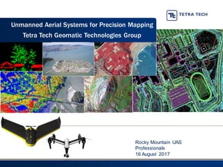
  • 1. Rocky Mountain UAS Professionals 16 August 2017 Unmanned Aerial Systems for Precision Mapping Tetra Tech Geomatic Technologies Group
  • 2. Just the facts • Founded in 1966 • $2.6 billion annual revenue in FY2016 • 16,000 employees worldwide • A network of approximately 400 offices • Worked on 60,000 projects in more than 100 countries in FY2016 • Publicly traded on NASDAQ as TTEK 2CompanyOverview
  • 3. Geomatic Technologies Focus Areas 3  Photogrammetric Mapping  Digital Orthoimagery  Airborne Light Detecting and Ranging (LiDAR)  Multi & Hyperspectral Technology  Satellite Imagery Collection & Analysis  Geographic Information Systems (GIS)  Data Management & Visualization  Web Mapping Applications  Historical Aerial Photography  Oblique Imagery  Thermal Imagery  Magnetometry  Unmanned Aerial Surveys (UAS)  Mobile and Terrestrial LiDAR
  • 4. Capabilities: Precision Mapping and Imagery Tools Current and Historical Aerial Photography – provides information about land use and change detection. CIR imagery detects stress or vigor of vegetation. 3D Terrain Models & Topographic Maps – shows detailed changes in terrain elevation to support engineering design, hydrologic modeling, linear routing or line of site assessments. LightDetecting& Ranging(LiDAR) – feature extraction to create as-builts of existing structures, vegetation and high resolution terrain mapping. Hyperspectral Technology – identify, map and analyze spectrally unique plant communities, soil types, and water conditions for baseline & monitoring. Airborne ThermalSensing – thermal infrared imagery overlaying digital ortho photographs depicts the distribution of water temperatures. Airborne Magnetometry – identify subsurface anomalies such as
  • 5. High Resolution Aerial Imagery Tetra Tech project Name: Los Medanos / Location: Contra Costa, California
  • 6. Compiled Mass-Points, Breaklines and Planimetry Tetra Tech project Name: Los Medanos / Location: Contra Costa, California
  • 7. TIN (Triangulated Irregular Network) Created from Compiled Data Tetra Tech project Name: Los Medanos / Location: Contra Costa, California
  • 10. LiDAR – High Resolution Terrain Model First Image: Highest hit LiDAR points in heavily vegetated region. LiDAR point density collection was 8.9pts/sq. meter. Second Image: Terrain model with vegetation points removed shows ground detail (terrain changes, roads, river banks, etc.
  • 11. Unmanned Aerial Systems (UAS)  Ideal for Small Area/Sensitive Area Collection  Faster mobilization to remote areas  Emergency Response  Faster product generation  Time-sensitive projects  Ability to collect with multiple sensors/ change sensors in the field  Cost effective  Below cloud deck acquisition  Oblique acquisition
  • 12. UAS Applications  Oblique Imagery: Capture of cliffs or other coastal features allows for mapping where manned sensors cannot  High resolution imagery: less than one centimeter GSD  Volumetrics: With high relative accuracy, measurements will be approximately 3 cubic cm without GCPs  Tide coordinated acquisition: With the ability to fly below clouds and at night (with a waiver), specific high or low tide conditions can be captured  Rapid Response: FAA emergency waivers and UAS flight flexibility make UAS a great tool  Thermal imagery to detect wildlife, plant life, etc. in a more economic and localized way than with manned aircraft
  • 13. Unmanned Aerial Systems  DJI Phantom and Inspire (Multi-Rotor)  Very Cheap Consumer Grade ($1350-$3000)  Sufficient Electronics to Meet FAA Restrictions  High resolution Video (1080P and photographs)  Limited georeferenced output with Pix4D  Semi-Autonomous  Vertical landing  SenseFly ebee (fixed wing)  Longer flight duration time  Ideal for larger area collection  GSD of 1.5 cm pixel  Limited georeferenced output with Pix4D  Semi-Autonomous  Beyond line-of-sight  Requires a larger landing area
  • 14. Unmanned Aerial Systems  SkyProwler (VTOL)  Switchblade mechanism allows for longer/faster flights  Hover and vertical take off/landing  Gimbal stabilizationfor camera  16MP camera with NIR filter  Cargo drop door  Beyond line-of-sight and dusk collection
  • 15. UAS Sensors  Color imagery cameras  High definition video cameras  4-band RGBI cameras  Thermal sensors (FLIR)  Topographic LiDAR  Hyperspectral  Standard frame camera  Frame based video camera  Metric frame camera  LiDAR  FLIR
  • 16. Data Collection  Ground control  Specialized pre-flight planning software  Airspace considerations  Safety considerations  License
  • 17. Data Processing  Orthoimagery  Digital Surface Model (DSM)  Digital Elevation Model (DEM)  Contours  Planimetrics  3-D Point Cloud  Feature extraction  Classification
  • 18. Deliverables  Orthoimagery  Contours  Planimetrics  Classified LiDAR  Topographic DEM  Intensity/Reflectance  NIR Imagery  Volumetric Calculations  Slope Calculations  Change DetectionAnalysis  Heat DetectionAnalysis  VegetationAnalysis
  • 19. Project Example: Diablo Canyon Bluff Study  LiDAR and Aerial Photography of a Seacoast Bluff near the Diablo Canyon Power Plant on the Central California Coast  Comparison of 2010 to 2015 LiDAR and to several epochs of photogrammetric mapping  Highlighted areas of greatest change and presented suggestions for future studies of bluff erosion  Change detection analysis
  • 20. Project Example: Quarterly Landfill Mapping  Aerial Photography of Six Local Landfills  Developed methods to quickly generate terrain models for volumetric analysis  Delivery within one week included terrain models and contour maps  Results reviewed by stereo inspection and accuracy routinely tested by comparison to landfill and haul records  Acquisition below fog/cloud cover was key to meeting schedule deadline
  • 21. Project Example: Pismo Beach Bluff 21
  • 22. Project Example: Bennett Landfill Considerations:  Flight Planning  Ground Control Points  Accuracy  Datasets  Data points are a DSM (surface, not ground)  Size of Project  Turn-around Time
  • 23. Project Example: UAV Modeling and Accuracy Evaluation Vasco Road is close to our office in Lafayette
  • 24. UAV Modeling and Accuracy Evaluation: Vasco Road Vasco Road is close to our office in Lafayette so we thought to deploy our UAV as a test.
  • 25. 800+ Photos were taken UAV Modeling and Accuracy Evaluation: Vasco Road
  • 26. High Resolution Imageryproduces adetailed DTM UAV Modeling and Accuracy Evaluation: Vasco Road
  • 27. 0 2 4 6 8 10 12 14 16 18 -1 -0.8 -0.6 -0.4 -0.2 0 0.2 0.4 0.6 0.8 1 Distribution of Error mz = -.11’ s = .35’ UAV Modeling and Accuracy Evaluation: Vasco Road Tested in 72 Locations
  • 28. UAS Lessons Learned  Value of UAS comes from the data, not the platforms  Project objectives determine approach  Even “easy to fly” systems can be challenging  Not everyone who has a UAS can/should fly commercially  Accuracy and mapping requirements are not just processing  Ground checkpoints/targets for accuracy reporting  FAA Regulations for UAS are set to aviation industry standards – practice them, keep our standards high
  • 29. Accuracy Lessons Learned • Lens Stability, Resolution and Software are Key: ▪ The Sony sensor produced accuracies comparable to manned cameras ▪ UAS lenses are not calibrated and contain instabilities • Data points are a DSM surface: software can only model what is visible • Contours of 2ft can be generated to accepted standards easily. • With proper control for checking and measurement the 1ft contours are possible • Size of the project matters • Accuracy and mapping requirements must be met by proper hardware and planning - not just software.
  • 30. Contact Information Renee Walmsley, PMP, GISP Remote Sensing Program Manager Tetra Tech, Inc. 925.584.0049 Renee.Walmsley@tetratech.com