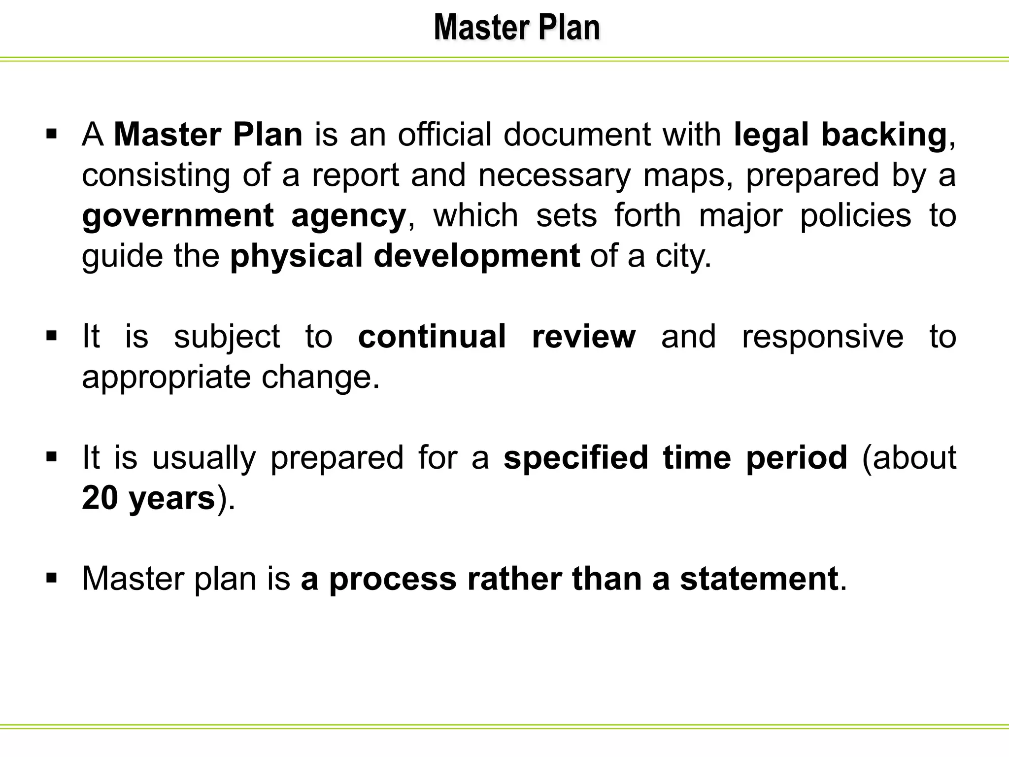
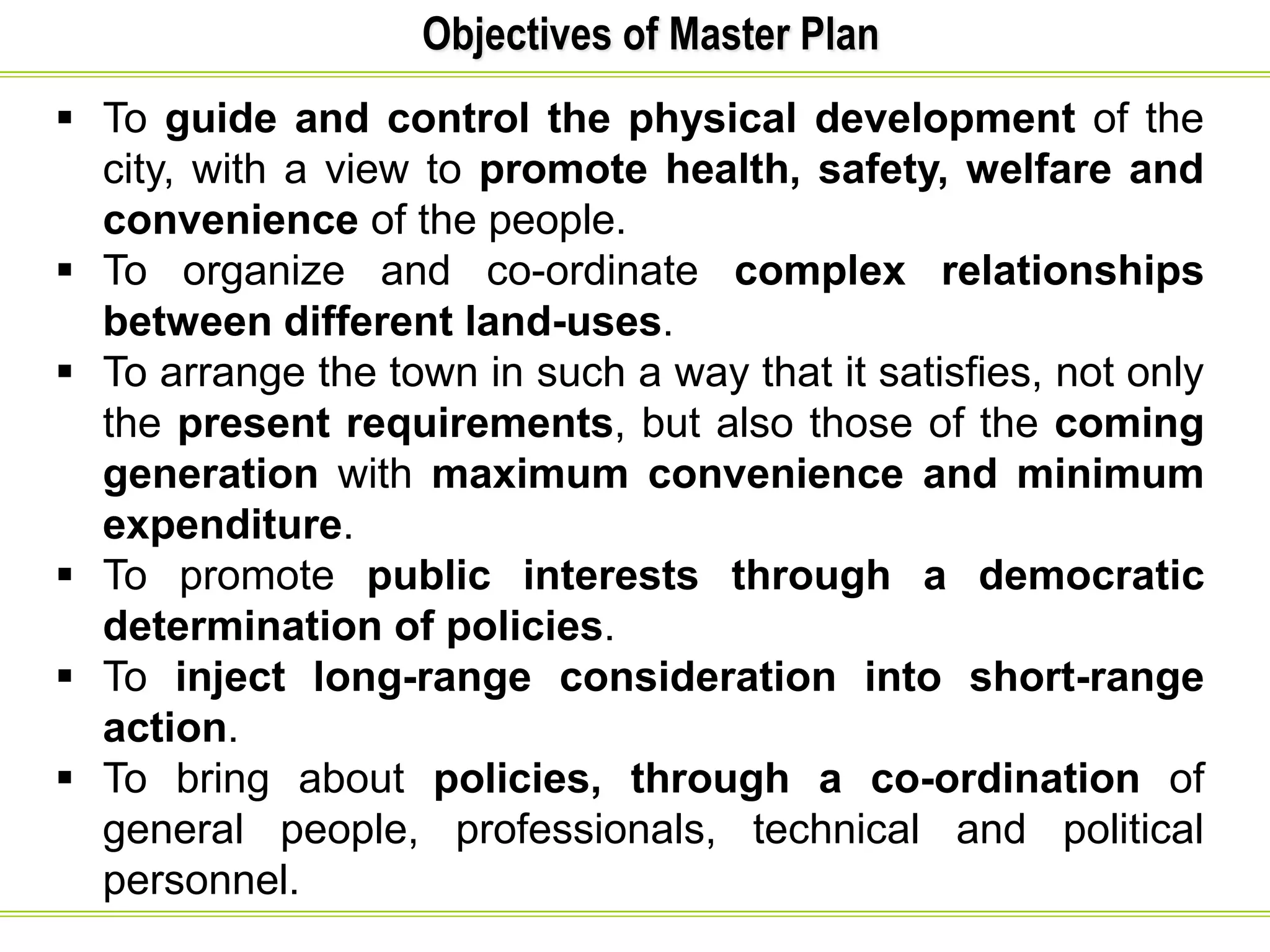
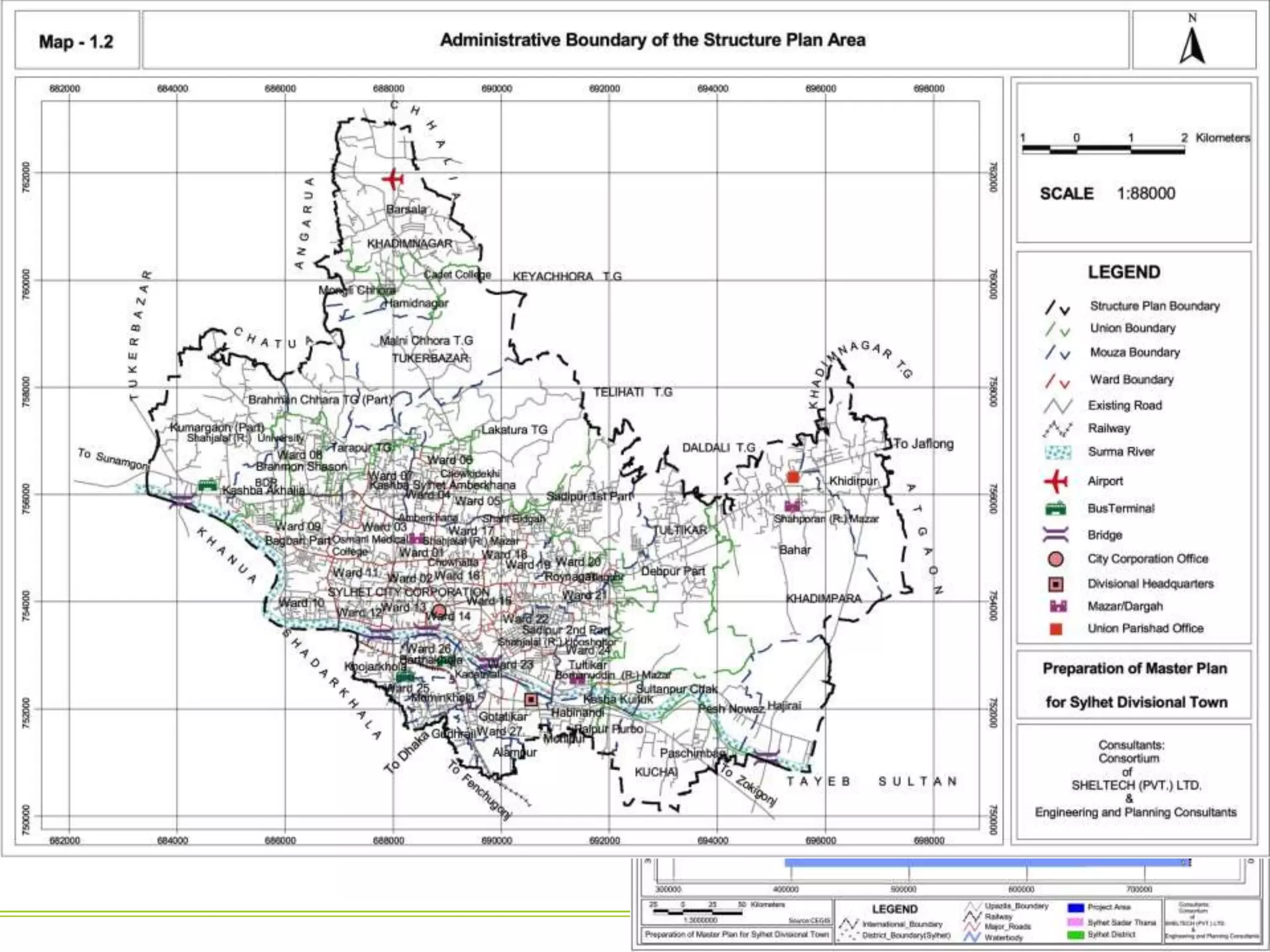
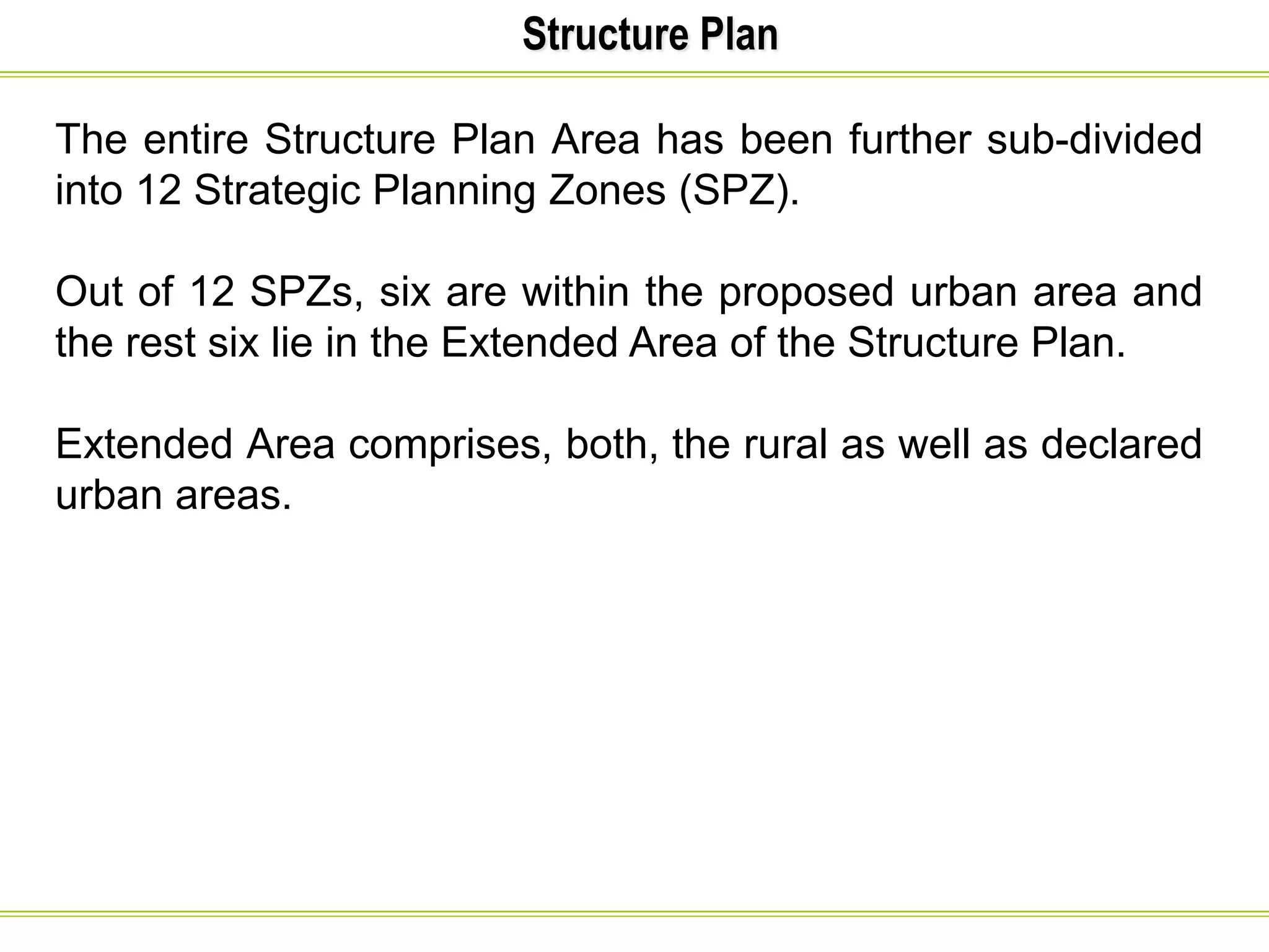
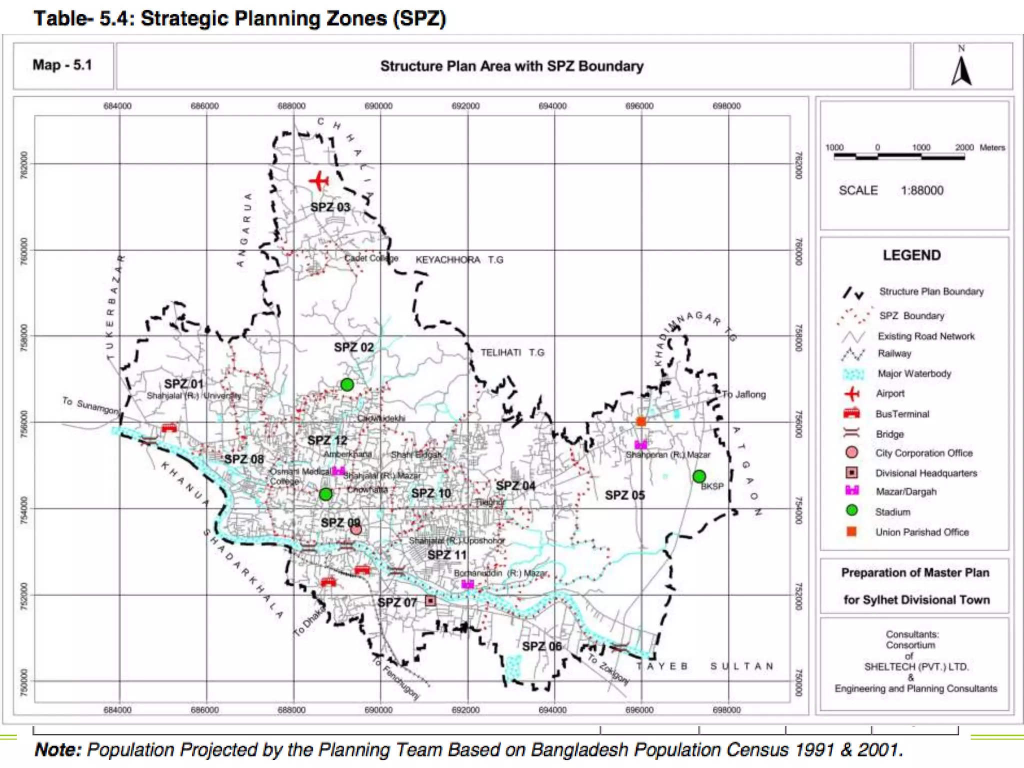
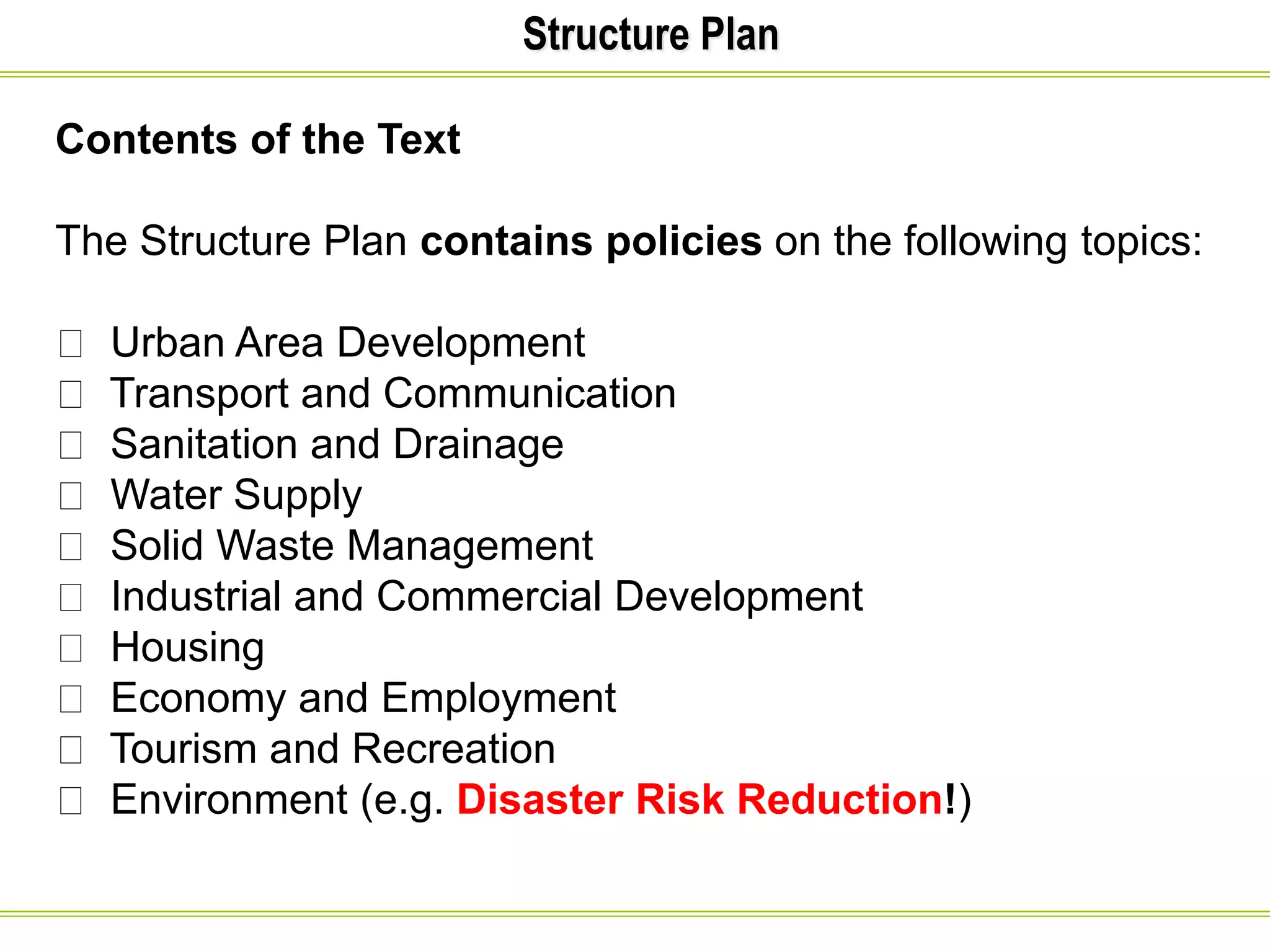
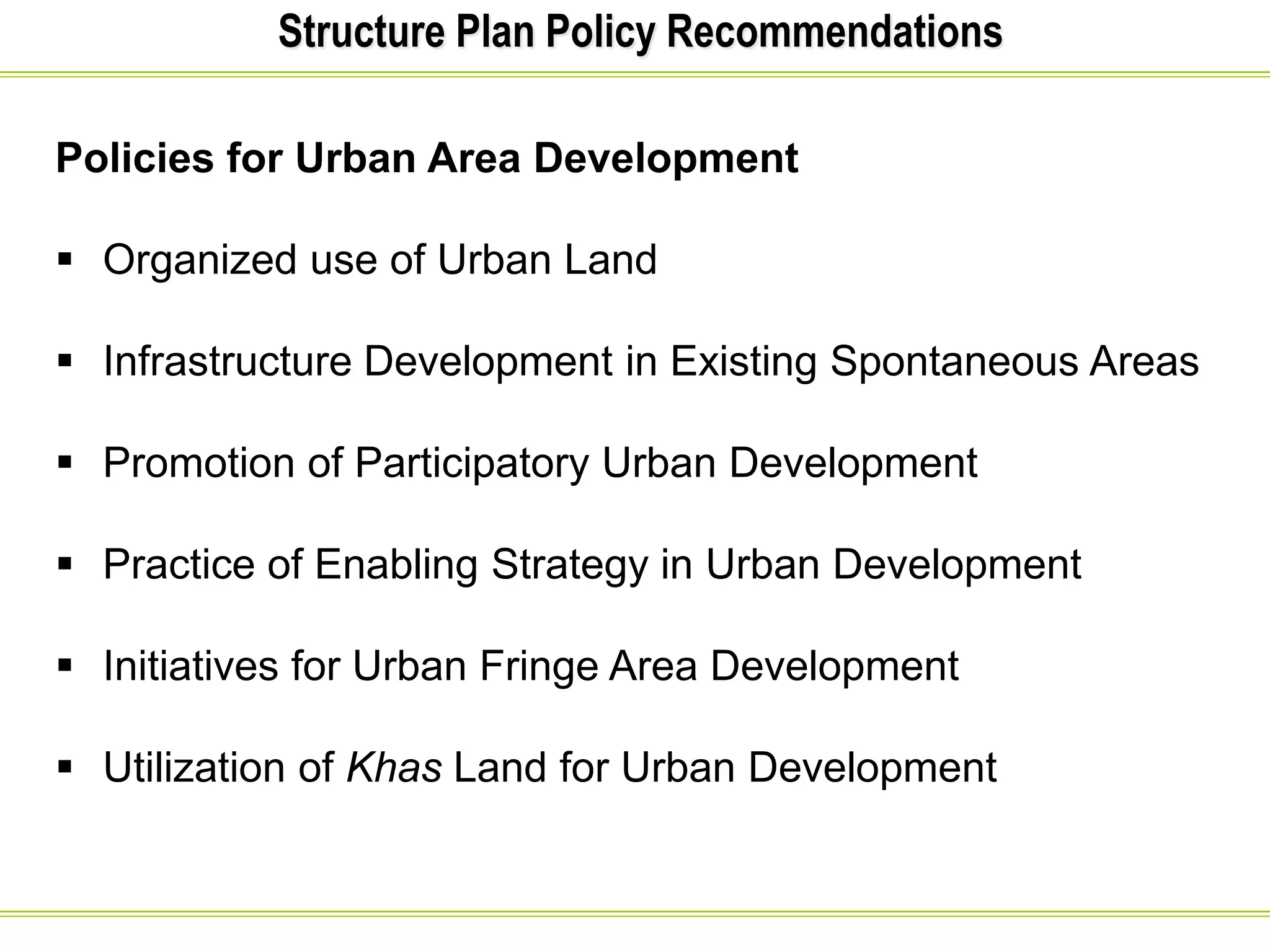
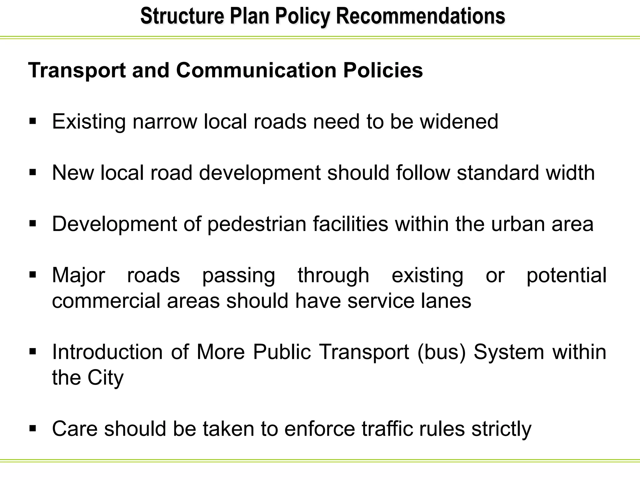
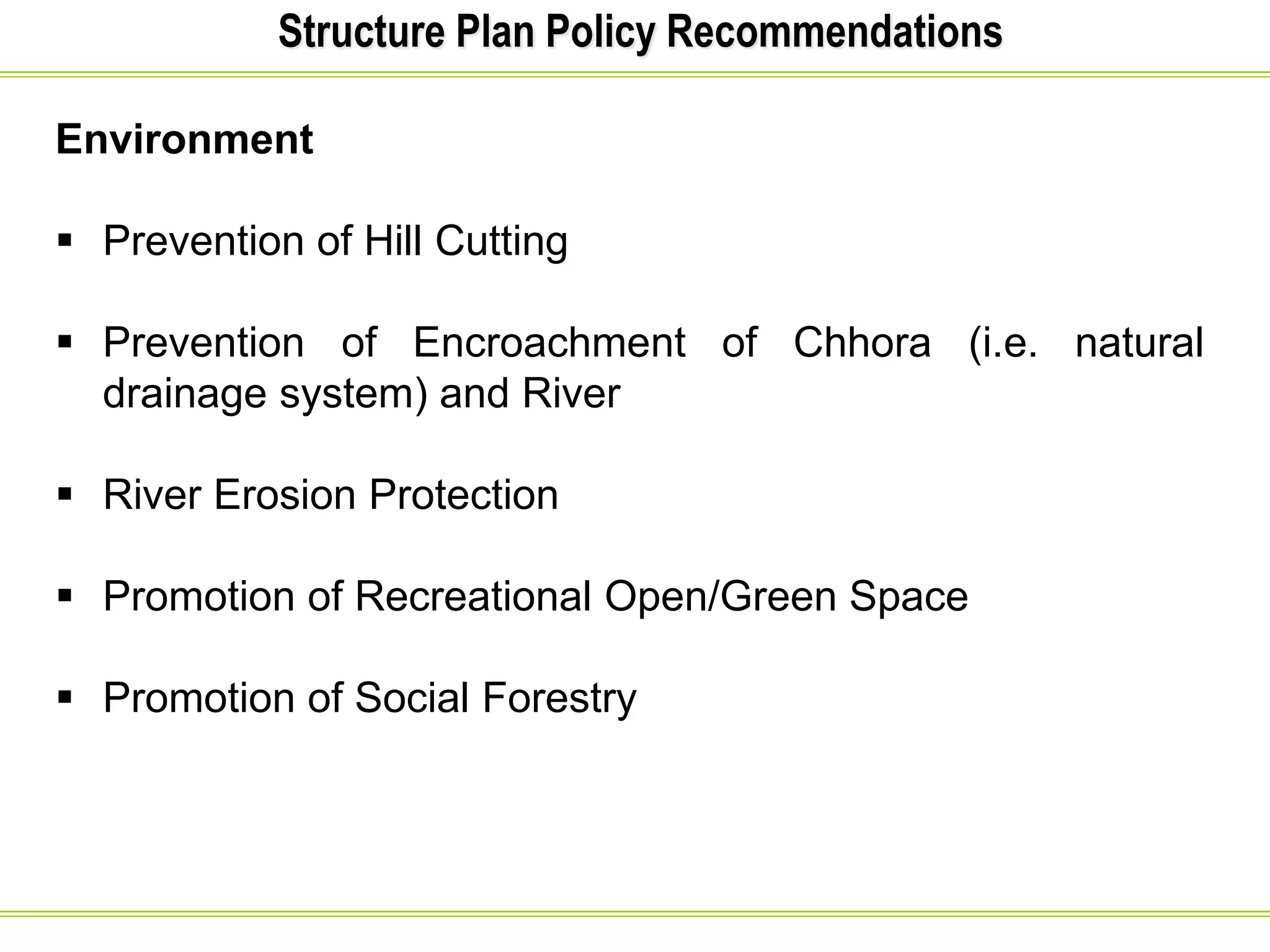
Welcome to Lecture 01
to Lecture 01We
DSMHT 305: Urban and Regional Planning:
Risk Mitigation Concept
Department of Disaster Science and Management
University of Dhaka
Bangladesh
Prepared by-
BAYES AHMED
10 DECEMBER 2015
Welcome to Lecture 04
Master Plan
 A Master Plan is an official document with legal backing,
consisting of a report and necessary maps, prepared by a
government agency, which sets forth major policies to
guide the physical development of a city.
 It is subject to continual review and responsive to
appropriate change.
 It is usually prepared for a specified time period (about
20 years).
 Master plan is a process rather than a statement.
Objectives of Master Plan
 To guide and control the physical development of the
city, with a view to promote health, safety, welfare and
convenience of the people.
 To organize and co-ordinate complex relationships
between different land-uses.
 To arrange the town in such a way that it satisfies, not only
the present requirements, but also those of the coming
generation with maximum convenience and minimum
expenditure.
 To promote public interests through a democratic
determination of policies.
 To inject long-range consideration into short-range
action.
 To bring about policies, through a co-ordination of
general people, professionals, technical and political
personnel.
Master Plan (Current Practice)
• Example: Master Plan for Sylhet Divisional Town (2010-
2030)
 Urban Development Directorate (UDD) prepared a
Structure Plan for Sylhet Town back in 1987 under
external aid.
 Because of population growth and increasing
remittance pouring into the local economy the
importance of the town increased and the town was
upgraded as a Divisional Town in 2002, which made the
former Structure Plan outdated.
Master Plan (Current Practice)
 In this situation UDD took an initiative to revise and
update the previous Structure Plan aiming to meet the
increasing pressure for urban infrastructure and basic
services.
 This project was necessary to contain a composite
development plan overlooking for next 20 years. UDD
initiated the current planning process, out of the urge to
streamlining the prevailing uncontrolled and
unmanageable spatial development of the rapidly
growing urban Sylhet.
Master Plan
• The Master Plan package consists of three levels and
types in a hierarchical order. These are:
1. The Structure Plan (SP) or general development plan;
2. The Urban Area Plan and
3. The Detailed Area Plan (DAP).
Master Plan
Structure Plan Area
The Sylhet City is governed by a City Corporation
comprising 27 Wards and 278 Mahallahs and with an area of
26.5 sq. km.
The proposed Structure Plan area has been estimated to
be 85.18 sq. km or 21,039 acres that includes, apart from
the City Corporation, the potential urban areas within its
vicinity.
Structure Plan
• Structure Plan is a broad, indicative and open ended plan
that contains policy framework for further plans and
development actions.
• Based on the Structure Plan policy framework elaborate
development proposals are prepared at subsequent lower
levels.
• It is not the aim of structure plan to go for plot to plot land
use proposals or local or access roads and detailed
services and facilities. Instead it identifies areas where
growth is likely to take place in future and addresses the
major issues only. It also marks the possible areas of
future expansion.
Structure Plan
Objectives of the Structure Plan
To guide long term growth within the Structure Plan Area by
means of:
Demarcation of the future growth areas;
Indication of important physical infrastructure.
• Setting out policy recommendations for future
development.
Structure Plan
Structure Plan Area
The Structure Plan Area will be the whole study area,
whereas the Urban Area Plan includes only those areas
which have development potentials for the upcoming 10
years.
The proposed SP area is 85.18 sq. km.
Structure Plan
Style and Format
As a long term policy plan the span of structure Plan runs
over 20 years.
It is presented in the form of written document supported
by tables, maps, and graphs.
The written text analyses the issues that are not possible
to be presented as diagrams, drawings and maps.
It is an indicative and policy level plan, which will be
detailed out in Urban Area Plan and in the Detailed Area
Plans.
Structure Plan
The Structure Plan Map shows:
Existing Features:
- Major roads, Rail Line and Bridges
- Key Establishments (indicative)
- Main Rivers and Khals
- Hills and Tea Gardens
- Rural and agricultural area
- Flood Protection Structure (indicative)
- Existing Built up Area
- Special Security Establishment and Important key point
installations like Police line, Power Plant etc. (indicative)
Structure Plan
The Structure Plan Map shows:
Major Development Proposals
Proposed Major roads,
City Corporation Boundary
New Urban Land Development Area
Natural Conservation area
Location indication of Major Infrastructure (Surface Water
Treatment Plant, Solid Waste Disposal Site)
Natural Drainage Network
Location of Major Open Space (indicative)
Strategic Planning Zones (SPZ)
Structure Plan
The entire Structure Plan Area has been further sub-divided
into 12 Strategic Planning Zones (SPZ).
Out of 12 SPZs, six are within the proposed urban area and
the rest six lie in the Extended Area of the Structure Plan.
Extended Area comprises, both, the rural as well as declared
urban areas.
Structure Plan
Following are justifications for dividing the Structure Plan
Area into SPZs:
1. Detailed Area Plans need certain boundaries to
separate one plan from the other and also to phase out
Detailed Area Plan preparation.
2. Uniformity of existing land use has been taken as the
basis for demarcation of area of SPZs.
3. Administrative boundaries (like, Ward and mouza) have
been taken as SPZ boundaries. This is done to make
planning and plan implementation easier from
administrative point of view.
Structure Plan
Contents of the Text
The Structure Plan contains policies on the following topics:
Urban Area Development
Transport and Communication
Sanitation and Drainage
Water Supply
Solid Waste Management
Industrial and Commercial Development
Housing
Economy and Employment
Tourism and Recreation
Environment (e.g. Disaster Risk Reduction!)
Structure Plan Policy Recommendations
Policies for Urban Area Development
 Organized use of Urban Land
 Infrastructure Development in Existing Spontaneous Areas
 Promotion of Participatory Urban Development
 Practice of Enabling Strategy in Urban Development
 Initiatives for Urban Fringe Area Development
 Utilization of Khas Land for Urban Development
Structure Plan Policy Recommendations
Transport and Communication Policies
 Existing narrow local roads need to be widened
 New local road development should follow standard width
 Development of pedestrian facilities within the urban area
 Major roads passing through existing or potential
commercial areas should have service lanes
 Introduction of More Public Transport (bus) System within
the City
 Care should be taken to enforce traffic rules strictly
Structure Plan Policy Recommendations
Environment
 Prevention of Hill Cutting
 Prevention of Encroachment of Chhora (i.e. natural
drainage system) and River
 River Erosion Protection
 Promotion of Recreational Open/Green Space
 Promotion of Social Forestry
Thank You for Listening!
Any Question?
Contact Email:
bayesahmedgis@gmail.com

Lecture 4: Urban & Regional Planning (Risk Mitigation Concept)

  • 1.
    Welcome to Lecture01 to Lecture 01We DSMHT 305: Urban and Regional Planning: Risk Mitigation Concept Department of Disaster Science and Management University of Dhaka Bangladesh Prepared by- BAYES AHMED 10 DECEMBER 2015 Welcome to Lecture 04
  • 2.
    Master Plan  AMaster Plan is an official document with legal backing, consisting of a report and necessary maps, prepared by a government agency, which sets forth major policies to guide the physical development of a city.  It is subject to continual review and responsive to appropriate change.  It is usually prepared for a specified time period (about 20 years).  Master plan is a process rather than a statement.
  • 3.
    Objectives of MasterPlan  To guide and control the physical development of the city, with a view to promote health, safety, welfare and convenience of the people.  To organize and co-ordinate complex relationships between different land-uses.  To arrange the town in such a way that it satisfies, not only the present requirements, but also those of the coming generation with maximum convenience and minimum expenditure.  To promote public interests through a democratic determination of policies.  To inject long-range consideration into short-range action.  To bring about policies, through a co-ordination of general people, professionals, technical and political personnel.
  • 4.
    Master Plan (CurrentPractice) • Example: Master Plan for Sylhet Divisional Town (2010- 2030)  Urban Development Directorate (UDD) prepared a Structure Plan for Sylhet Town back in 1987 under external aid.  Because of population growth and increasing remittance pouring into the local economy the importance of the town increased and the town was upgraded as a Divisional Town in 2002, which made the former Structure Plan outdated.
  • 5.
    Master Plan (CurrentPractice)  In this situation UDD took an initiative to revise and update the previous Structure Plan aiming to meet the increasing pressure for urban infrastructure and basic services.  This project was necessary to contain a composite development plan overlooking for next 20 years. UDD initiated the current planning process, out of the urge to streamlining the prevailing uncontrolled and unmanageable spatial development of the rapidly growing urban Sylhet.
  • 6.
    Master Plan • TheMaster Plan package consists of three levels and types in a hierarchical order. These are: 1. The Structure Plan (SP) or general development plan; 2. The Urban Area Plan and 3. The Detailed Area Plan (DAP).
  • 7.
    Master Plan Structure PlanArea The Sylhet City is governed by a City Corporation comprising 27 Wards and 278 Mahallahs and with an area of 26.5 sq. km. The proposed Structure Plan area has been estimated to be 85.18 sq. km or 21,039 acres that includes, apart from the City Corporation, the potential urban areas within its vicinity.
  • 8.
    Structure Plan • StructurePlan is a broad, indicative and open ended plan that contains policy framework for further plans and development actions. • Based on the Structure Plan policy framework elaborate development proposals are prepared at subsequent lower levels. • It is not the aim of structure plan to go for plot to plot land use proposals or local or access roads and detailed services and facilities. Instead it identifies areas where growth is likely to take place in future and addresses the major issues only. It also marks the possible areas of future expansion.
  • 9.
    Structure Plan Objectives ofthe Structure Plan To guide long term growth within the Structure Plan Area by means of: Demarcation of the future growth areas; Indication of important physical infrastructure. • Setting out policy recommendations for future development.
  • 10.
    Structure Plan Structure PlanArea The Structure Plan Area will be the whole study area, whereas the Urban Area Plan includes only those areas which have development potentials for the upcoming 10 years. The proposed SP area is 85.18 sq. km.
  • 11.
    Structure Plan Style andFormat As a long term policy plan the span of structure Plan runs over 20 years. It is presented in the form of written document supported by tables, maps, and graphs. The written text analyses the issues that are not possible to be presented as diagrams, drawings and maps. It is an indicative and policy level plan, which will be detailed out in Urban Area Plan and in the Detailed Area Plans.
  • 12.
    Structure Plan The StructurePlan Map shows: Existing Features: - Major roads, Rail Line and Bridges - Key Establishments (indicative) - Main Rivers and Khals - Hills and Tea Gardens - Rural and agricultural area - Flood Protection Structure (indicative) - Existing Built up Area - Special Security Establishment and Important key point installations like Police line, Power Plant etc. (indicative)
  • 13.
    Structure Plan The StructurePlan Map shows: Major Development Proposals Proposed Major roads, City Corporation Boundary New Urban Land Development Area Natural Conservation area Location indication of Major Infrastructure (Surface Water Treatment Plant, Solid Waste Disposal Site) Natural Drainage Network Location of Major Open Space (indicative) Strategic Planning Zones (SPZ)
  • 14.
    Structure Plan The entireStructure Plan Area has been further sub-divided into 12 Strategic Planning Zones (SPZ). Out of 12 SPZs, six are within the proposed urban area and the rest six lie in the Extended Area of the Structure Plan. Extended Area comprises, both, the rural as well as declared urban areas.
  • 15.
    Structure Plan Following arejustifications for dividing the Structure Plan Area into SPZs: 1. Detailed Area Plans need certain boundaries to separate one plan from the other and also to phase out Detailed Area Plan preparation. 2. Uniformity of existing land use has been taken as the basis for demarcation of area of SPZs. 3. Administrative boundaries (like, Ward and mouza) have been taken as SPZ boundaries. This is done to make planning and plan implementation easier from administrative point of view.
  • 16.
    Structure Plan Contents ofthe Text The Structure Plan contains policies on the following topics: Urban Area Development Transport and Communication Sanitation and Drainage Water Supply Solid Waste Management Industrial and Commercial Development Housing Economy and Employment Tourism and Recreation Environment (e.g. Disaster Risk Reduction!)
  • 17.
    Structure Plan PolicyRecommendations Policies for Urban Area Development  Organized use of Urban Land  Infrastructure Development in Existing Spontaneous Areas  Promotion of Participatory Urban Development  Practice of Enabling Strategy in Urban Development  Initiatives for Urban Fringe Area Development  Utilization of Khas Land for Urban Development
  • 18.
    Structure Plan PolicyRecommendations Transport and Communication Policies  Existing narrow local roads need to be widened  New local road development should follow standard width  Development of pedestrian facilities within the urban area  Major roads passing through existing or potential commercial areas should have service lanes  Introduction of More Public Transport (bus) System within the City  Care should be taken to enforce traffic rules strictly
  • 19.
    Structure Plan PolicyRecommendations Environment  Prevention of Hill Cutting  Prevention of Encroachment of Chhora (i.e. natural drainage system) and River  River Erosion Protection  Promotion of Recreational Open/Green Space  Promotion of Social Forestry
  • 20.
    Thank You forListening! Any Question? Contact Email: bayesahmedgis@gmail.com