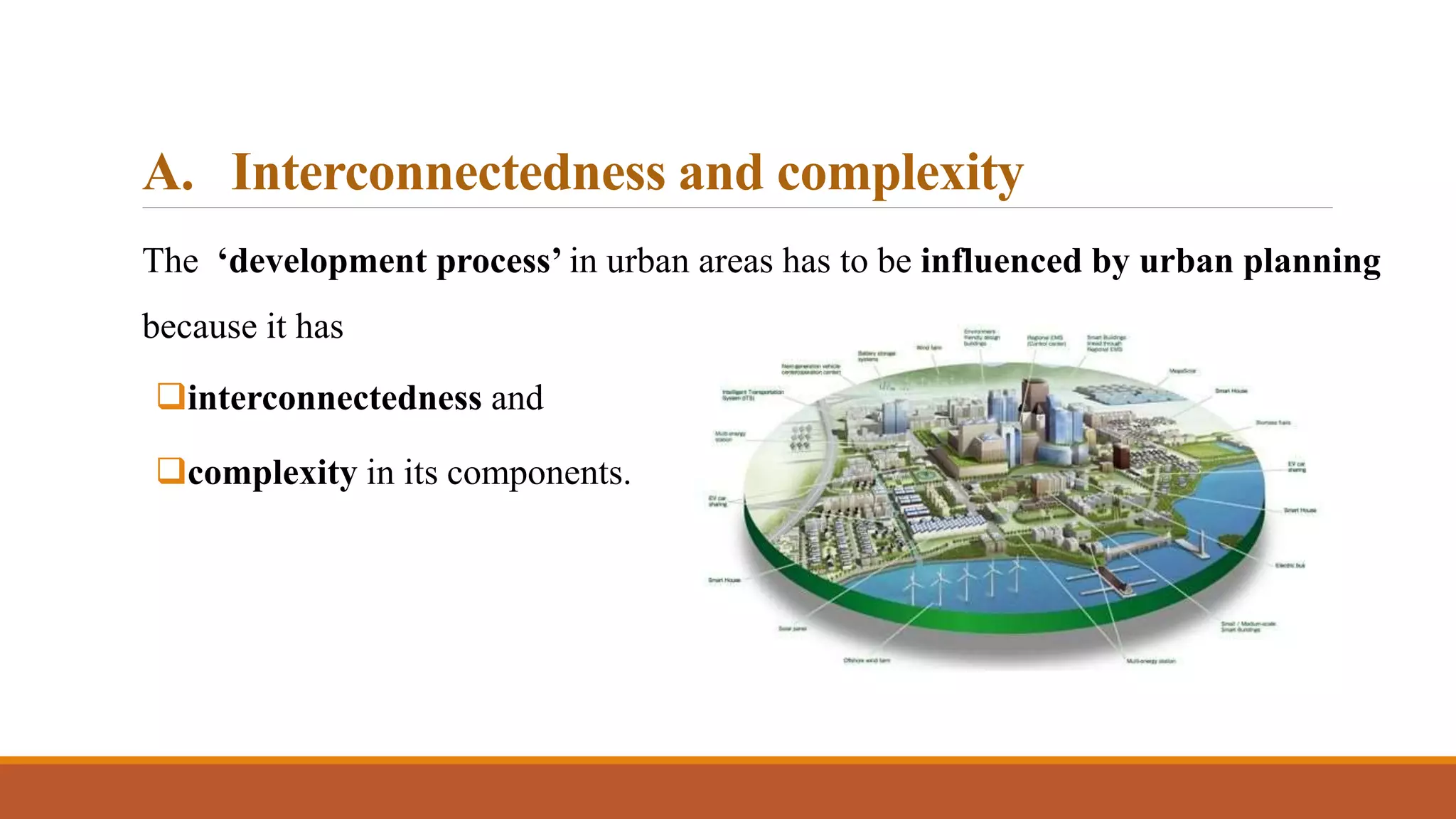
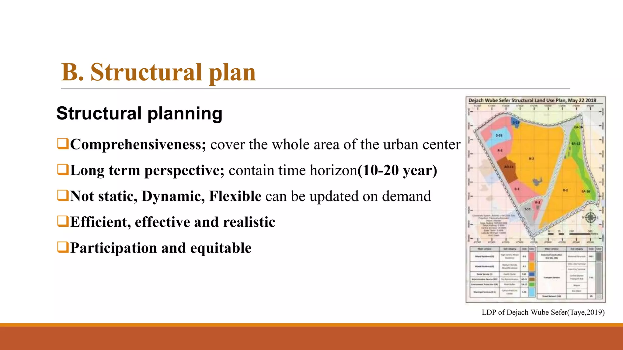
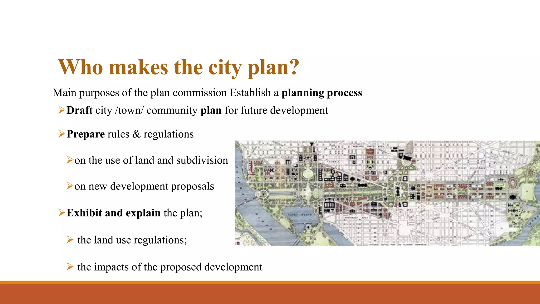
The document discusses various topics related to urban and regional planning, including urban sociology, the relationship between sociology and urban planning, theories of urbanization, Karl Marx's theory of urbanization, economic uplift and backwardness, poverty alleviation, consumption of resources and production/maintenance of viable communities, and types of plans used in urban planning such as master plans, zonal plans, local area plans, sector plans, and neighborhood plans.
Mumbai is a global city with a population of over 12 million people. It has become a major financial center and contributes greatly to India's economy. Mumbai has a highly developed transportation system, with over half of commuters using the extensive suburban rail network or buses. To further improve transportation, a new metro system is being constructed. Mumbai also has two major airports connecting it to cities around the world, highlighting its status as a global city in India and South Asia.
This document discusses various socio-economic factors related to urban housing in India. It covers topics like housing affordability, tenure types, factors affecting housing supply, equity in housing development, slum upgrading with community participation, and government schemes like Rajiv Awas Yojana. The key points are:
1. Housing affordability depends on factors like income, cost of land, availability of financing. Tenure types include ownership, renting, leaseholding.
2. Sites and services schemes provide serviced land plots to low-income groups for self-built housing. Equity is built up over time as the mortgage is paid off.
3. Slum upgrading aims to improve slums in-sit
Comprehensive mobility plan jaipur
National Urban Transport Policy
Mobility issues – snapshot of today
Transport demand for the future
Evaluating and implementation of cmp
Strategy and Options for Planning Inclusive CitiesJIT KUMAR GUPTA
Presentation looks at the context of inclusive cities, its relevance in the Indian context, problems faced by Indian cities and what are the options to make cities inclusive, and sustainable
Urban complexity's role in a practical emergent urbanismMathieu Hélie
The document discusses theories of urban complexity and emergent urbanism. It explores the history of urbanization from organic processes to modern planning. Complexity theories view cities as complex systems that emerge from the bottom-up interactions of many actors following simple rules. The author argues urbanization processes should allow for emergent order through shared geometric rules rather than top-down planning. Redesigning urban development processes at various scales could lead to more organic, fractally complex cities.
This document discusses Transit Oriented Development (TOD) as a tool for effective and sustainable urban growth. TOD aims to integrate land use and transportation planning by encouraging high-density, mixed-use development within walking distance of public transit stations. The document reviews the concept and basic structure of TOD, including its benefits like reduced traffic, pollution and infrastructure costs. Case studies from cities like Surabaya and Jabodetabek demonstrate how TOD can help address issues of urbanization, mobility and greenhouse gas emissions. Overall, the document argues that TOD provides a strategic approach to sustainable planning and design that can solve common problems faced by growing cities.
This document discusses enabling high performance transit-oriented development (TOD). It summarizes that TOD requires high quality public transportation, appropriate urban form and density around transit stations, integrated transport services and pricing, and street networks designed for walking and biking. Case studies from Portland, Charlotte, and Washington D.C. show how TOD can reduce traffic, emissions, and parking needs when supported by policies around land use, pricing, and coordination across agencies. The document provides an inventory of opportunities for TOD in D.C. and recommends actions like education, prioritizing investment, and station area planning to implement TOD.
The document discusses the goals and principles of physical planning. Physical planning aims to design sustainable and livable communities through land use planning, transportation infrastructure, and consideration of environmental and cultural resources. It can take either a rationalistic approach through comprehensive master plans or an incremental approach through smaller individual projects. The goals of physical planning are evaluated using indicators to monitor progress and the social, environmental, and economic impacts of development plans.
This document summarizes a graduate report presentation on affordable housing in India. It defines affordable housing according to various organizations and provides statistics on India's growing urban population and resulting housing shortage. In particular, it notes that the urban housing shortage at the end of the 10th five-year plan was estimated at 24.71 million households. It also discusses factors affecting the supply and demand of housing, critical issues in affordable housing like scarcity of land and rising costs, and the various central government policies and schemes aimed at addressing the shortage.
Jane Jacobs was an influential writer and activist in urban planning in the mid-20th century. She opposed the widespread replacement of urban communities with high-rise buildings and advocated for mixed-use neighborhoods with a focus on walkability. Along with Lewis Mumford, she is considered a founder of the New Urbanist movement. New Urbanism aims to reduce car dependence and create livable, walkable neighborhoods with a mix of housing, jobs, and commercial areas. Some examples of New Urbanist developments include Seaside, Florida, the first fully New Urbanist town, and Stapleton in Denver, Colorado. However, New Urbanism has also faced some criticisms around issues like lack of privacy and questions about how well it achieves
- Jane Jacobs was an influential urban theorist and activist known for her 1961 book "The Death and Life of Great American Cities". She challenged conventional urban planning practices through empirical observation.
- She advocated for mixed-use development and bottom-up community planning. She saw cities as complex ecosystems and argued diversity of uses and users were crucial to generate vibrant urban life.
- Jacobs argued high density was not inherently problematic and could support local economies if designed properly with mixed uses, short blocks, and old buildings to generate diverse street life.
Evaluating Urban Renewal in India: What questions to ask of the JNNURMAnupam Saraph
What should be the basis for evaluating urban renewal in India? The Jawaharlal Nehru National Urban Renewal Mission (JNNURM) has been "renewing" urban India. What should be the questions to evaluate its success at renewal?
Summary of a presentation to the School of Habitat Studies,
Tata Institute of Social Sciences and Parisar at Yashada.
This presentation is about Urban Development Policy and related programmes/ missions running in India.
'Public policy provides signals and sets the regulatory and institutional framework that influence the actions of all actors including private investors and consumers.', UN Conference on Climate Change 2021.
This presentation brief about National Urban Policy Framework, 2018 and the talks about various policies running for various sectors int the year 2022, like the Economic sector, Housing sector, Transport sector, Infrastructure, Industry, Informal sector, Tourism, Environment and Climate Change.
Presentación sobre los espacios urbanos, elaborada para la asignatura de ciencias sociales de la sección bilingüe del I.E.S. Fray Pedro de Urbina (Miranda de Ebro)
Urban design involves the arrangement, appearance, and function of cities and their public spaces. It coordinates all elements that make up cities, including buildings, transportation networks, public spaces, and landscaping. Throughout history, cities have taken different forms. Ancient Greek cities often had an acropolis, agora, and irregular streets in older cities but grid plans in newer colonies. Elements like streets, squares, landmarks, and districts guide how people experience and navigate urban areas. Urban design aims to create lively, safe, and sustainable city environments for residents.
Challenges of urban Growth in India: By Anumita Roychowdhurybmbks321
The document summarizes key challenges related to rapid urban growth in India and around the world. It notes that urban populations are growing exponentially, putting pressure on land, resources, and environment. Specifically in India, urban growth is very uneven, with a few large cities dominating. This skewed growth patterns leads to issues like pollution, congestion, poverty and spread of informal settlements. The dominance of personal vehicles like cars in cities exacerbates these problems by consuming significant road space and land. There is a need to shift towards more sustainable public transportation-oriented urban development models.
This document provides an overview of key concepts in town planning and planning processes. It defines town planning as ordering the use of land and infrastructure to maximize economy, convenience and beauty. Important concepts discussed include Ebenezer Howard's Garden City model, which aimed to combine benefits of urban and rural living; Patrick Geddes' triad focusing on the organic relationship between social, physical and economic environments; and neighborhood planning by Clarence Perry. The document also outlines the roles of planners, aims of town planning, types of surveys and plans, and the planning process.
Development plan case study (nagpur & lasvegas)ABHI PATEL
The document provides details of the Vision 2045 Downtown Las Vegas Master Plan. It summarizes that Las Vegas is located in the center of the Las Vegas Valley and functions as the urban core region. The master plan was created over 18 months to update the previous centennial plan and guide growth through 2045. It establishes goals around land use, mobility, sustainability, and economic development. The planning process included land use, mobility/sustainability, and economic development components with community participation. The master plan is expected to provide environmental, social, and economic benefits to the downtown community through job creation, affordable housing, open space, and other improvements.
Summarizing Urban Form Urban forms in History Urban forms of a few Indian citiesSomesh Siddharth
This document discusses urban morphology and the urban forms of various Indian cities. It begins by outlining the learning objectives, which are to understand urban forms through examples. It then discusses the effective factors in the formation of urban form, including the economy, society, and nature. The document also discusses elements that define a city's figure, such as entrances/exits, solid/void spaces, skylines, and silhouettes. Specific case studies of the urban forms of Hyderabad, Ahmedabad, and Bangalore are provided, outlining the historical development and characteristics of the fabric in different areas of each city.
A Presentation made to the student of BDevS at Center for Development Studies, National College for Higher Education, KU in October 2014, kathmandu, Nepal
It is an assignment on urban design basic factors, whereas a designer should keep in mind in urban designing.
Here I tried to describe factors by pointing as anyone could find a basic concept o urban design. Hope it'll be helpful.
This document discusses site planning and housing design considerations. It covers factors to consider when selecting a housing site such as physical characteristics, location, orientation, climate, and topography. It also discusses traditional and modern housing typologies in India as well as integrating services, parking, and sustainable practices like prefabrication into housing design. Specific site selection criteria discussed include access, topography, rights of way, neighboring properties, flood risk, and protecting natural environments. Sustainable design principles covered are social, economic, cultural, and institutional sustainability as well as using cost-effective and sustainable materials.
Urban planning concept,principles and elementes TeshagerMengesha
This document summarizes key elements of urban planning, including:
1) Elements of urban planning such as communications, built-up areas, open areas, public utility services, and public amenities.
2) Principles of urban planning including green belts, housing, transportation, recreation, zoning, public buildings, and road systems.
3) Concepts of urban planning like the Garden City Concept which proposed self-contained settlements that balance urban and rural lifestyles.
Current Concepts of Urban Regeneration slides for Urban Dynamics & Regeneration course.
Master of Science in Sustainable Urban Design, Razak Faculty, UTM Kuala Lumpur
This document discusses various types of urban planning and their key characteristics. It identifies 7 major types of urban planning: 1) Master/Comprehensive Planning, 2) Structure Planning, 3) Strategic Planning, 4) Basic Plan, 5) Local Development Planning, 6) Action Planning, and 7) Development Planning. For each type, it provides details on their legal basis, spatial scale, study requirements, and time span. It also discusses concepts like urban renewal, upgrading, and land development processes. Participatory planning principles and tools are outlined as well.
Final Guidelines in the 6 UN languages (Arabic, Chinese, English, French, Spa...Graciela Mariani
UN-Habitat Governing Council approves the International Guidelines on Urban and Territorial Planning (IG-UTP)
We are pleased to inform you that the International Guidelines on Urban and Territorial Planning have been approved by the UN-Habitat Governing Council last Friday.
We are grateful for the instrumental support of the co-sponsors of the Resolution (France, Japan, South Africa and Uganda)….
We attach here some relevant documents (also available on-line at http://unhabitat.org/gc25/) that we encourage you to use and share with your constituencies, partners and professional networks:
1. Resolution 25/L5 that approves the Guidelines and gives a mandate for their implementation and monitoring.
2. Press Release that you may wish to adapt and disseminate as appropriate.
3. Final Guidelines in the 6 UN languages (Arabic, Chinese, English, French, Spanish, Russian): currently being put in a proper lay-out for outreach and communication purposes.
4. Compendium of Inspiring Practices: sample of an on-going, larger and open initiative to document inspirational and international experiences on Urban and Territorial Planning that illustrates the Guidelines….
We will continue to explore…avenues to inform global and regional agendas as well as country operations. An immediate activity could be to translate the Guidelines in other languages (eg: Portuguese, Indonesian...) for broader outreach and impacts. We are open to suggestions and count very much on your feedback and active participation….
We thank you for your continuous engagement and commitment. We look forward to keeping you with us in this exciting IG-UTP journey.
This document provides guidance on developing an effective urban design process and policy. It discusses establishing a steering committee representing local stakeholders to guide a project. The process involves defining objectives, budgets and participation methods before creating deliverables like project briefs and execution plans. Key steps include appreciating the local context through analysis, creating an urban structure with land uses and connections, detailing the place through public realm design, and ensuring long-term implementation and management. The document emphasizes an integrated, iterative approach and establishing policies at different scales to support high-quality, sustainable placemaking.
The 24-year-old Wheeler native died Dec. 22, 2005 when an improvised explosive device detonated near his position during a dismounted patrol in Baghdad , Iraq.
The document discusses planning at various levels and aspects. It defines planning as ordering land use and development to maximize efficiency, convenience and aesthetics. Without planning, development occurs haphazardly, ignoring public needs. Ancient civilizations recognized the need for planning guidelines.
The scope of planning includes housing, employment, infrastructure and balancing growth with conservation. Physical planning deals with buildings and transportation infrastructure while economic and social planning address related systems. The planning process involves defining objectives, analyzing data, developing alternative plans, selecting the best option, and implementing and monitoring the plan. Authorities at various levels in India are responsible for planning.
town planning on SlideShare, one of the lecture of town planningZubairRahoojo
Town planning is the process of managing land resources and controlling existing and new developments to ensure future requirements are met. It involves analyzing social, economic, and physical characteristics of an area to establish development objectives and coordinate land use with infrastructure. The goals of town planning include removing slums, providing housing and basic services, organizing transportation and communication, allocating space for industry, parks, and public facilities, and arranging for education, health services, and sanitation. As urban populations grow rapidly, town planners must create sustainable and resilient communities that accommodate diverse human needs.
The document summarizes the Planning Program at CEPT University in Ahmedabad, India. It outlines that the Faculty of Planning was established in 1972 to educate professionals in sustainable and equitable urban development. The program offers undergraduate and postgraduate degrees in planning. The undergraduate program provides students with core concepts, skills, and thematic specializations over 8 semesters. The postgraduate program offers a 2-year Masters in Planning degree with options for majors in areas like urban and regional planning, housing, environment, and infrastructure.
The document summarizes the key points of the Regional and Urban Planning Bill (2009) and its implications for urban planning in Chipata District, Zambia. The bill aims to promote integrated and decentralized planning. It establishes new planning bodies like planning committees and tribunals. It introduces new planning documents like Integrated Development Plans, Local Area Plans and Sectoral Local Plans to guide development. The bill's principles around public participation, sustainability and local economic development must be reflected in all planning documents and processes. Implementing the bill in Chipata will help prepare the district for growth and make planning more responsive to local needs.
Additional characteristics of an Urban Space urban morphologySomesh Siddharth
This document provides information on urban morphology and urban design techniques from a course at Amity School of Architecture and Planning. It defines key characteristics of urban spaces like permeability, variety, and legibility. It also outlines the process of urban design, including problem identification, goal setting, situational analysis, synthesis, evaluation, and implementation. Finally, it discusses components and techniques for conducting a visual survey of an urban area, including mapping physical features, activity patterns, and problem areas.
Re orienting urban-planning towards local agenda 21Ankur Bansal
The document discusses reorienting urban planning towards Local Agenda 21. It begins by defining urban planning and Local Agenda 21. It then outlines some problems with current urban planning policies, such as poor transport and industrial planning leading to pollution. Local Agenda 21 offers a participatory process to integrate sustainability into land use plans. The document proposes integrating LA21 into urban planning processes and structures through capacity building, consultation, research, and partnerships. It provides an example of this approach in Nakuru, Kenya, where issues like waste management and revenue collection were addressed.
The document discusses the fundamentals of comprehensive urban planning. It defines a comprehensive plan as an official statement that sets forth goals, analyzes existing conditions, and outlines policies to implement a vision for a community's future development over 20 years. Key elements of a comprehensive plan include land use, transportation, housing, economic development, community facilities, natural hazards, and agriculture. The plan provides guidance for public and private decisions to achieve a coordinated development pattern.
The document summarizes learnings from participatory budgeting experiments in Pune, India. It discusses what participatory budgeting is, how it has been implemented in Pune from 2007-2013, key findings and recommendations. The process in Pune engaged 700-900 citizens annually who suggested 500-850 projects, with 16-35% of the capital budget allocated for participatory budgeting projects. However, the process faced issues with lack of publicity, information and transparency, as well as low participation of disadvantaged groups.
This document provides an overview of advancements in city design. It discusses how city design has evolved over time from organically growing cities to more planned cities with modern technology and aesthetics prioritized. The document outlines the table of contents and abstract of an independent study on advancements in city design. It covers the background and history of city development, highlights elements of good urban design like transportation and facilities, and discusses how modern cities are pursuing optimized land use and architectural aesthetics to improve livability. The research aims to analyze disparities in city designs and define standards for infrastructure and aesthetics to promote urban prosperity.
Incorporating Participatory Planning and Quality Function Deployment in Urba...civej
Urban Planning is a technical process concerned with the control of the use of land and design of urban
environment to guide and ensure the orderly development of settlements and communities. Outcomes from
the urban planning process are detailed plans. In Bahrain the detailed plans are developed through a
lengthy two-stage process, namely, design and implementation. During this lengthy process the documented
design variations were found to be the main cause for implementation delay. In addition, it was discovered
that land owners exclusion from the urban planning process caused major disagreements, between the
urban planning authorities and the land owners. Accordingly, this paper presents an investigation into the
applied urban planning process in Bahrain, and proposes a solution that incorporates Quality Function
Deployment (QFD) technique. The study is based on face-to-face interviews, questionnaire, Delphi method,
and a case study (North Tubli). The results of this study concluded that using participatory planning and
QFD within the urban planning process enables evaluation of the different alternative plans, based on
scientific and systematic procedures. In addition, it ensures that land owners and community members
requirements are satisfied.
Incorporating Participatory Planning and Quality Function Deployment in Urban...civejjour
Urban Planning is a technical process concerned with the control of the use of land and design of urban
environment to guide and ensure the orderly development of settlements and communities. Outcomes from
the urban planning process are detailed plans. In Bahrain the detailed plans are developed through a
lengthy two-stage process, namely, design and implementation. During this lengthy process the documented
design variations were found to be the main cause for implementation delay. In addition, it was discovered
that land owners exclusion from the urban planning process caused major disagreements, between the
urban planning authorities and the land owners. Accordingly, this paper presents an investigation into the
applied urban planning process in Bahrain, and proposes a solution that incorporates Quality Function
Deployment (QFD) technique. The study is based on face-to-face interviews, questionnaire, Delphi method,
and a case study (North Tubli). The results of this study concluded that using participatory planning and
QFD within the urban planning process enables evaluation of the different alternative plans, based on
scientific and systematic procedures. In addition, it ensures that land owners and community members
requirements are satisfied.
Neighbourhood planning - Urban Vision Dave ChetwynHACThousing
Neighbourhood plans allow local communities to shape development in their area. They become part of the statutory development plan once approved at referendum. The process involves gathering evidence of community preferences, drafting plan policies and site allocations, consulting the community, undergoing examination, and approval by referendum. Key issues addressed often include housing, design standards, and identifying sites for development. The plan must meet basic conditions of national policy and sustainable development to be adopted.
1. The document outlines the scope of work and responsibilities of a town planner, which includes planning human settlements, analyzing community facilities, and developing long-term plans for cities while working with other construction professionals.
2. It describes the various tasks of a town planner at different stages of construction, from building partnerships to setting goals to analyzing issues to proposing and getting approval for plans.
3. Town planners utilize various types of drawings in their work, including zoning maps, site plans, community plans, transportation plans, and master plans to plan land usage and development.
A Digital Planning Tool for Shaping Up the Landscaping Architecture.pdfIJEACS
Landscape architecture is a comparatively new concept and is gaining prominence in town and country planning exercises. People marveled at the design of new towns when the infrastructure looks nice and well placed. However, when the planning exercise is not done properly this results in the implementation of poor infrastructure with narrow roads, lack of green spaces, no parking spots, congested streets and so. Architects are still using traditional hand drawing for their designs and sketches which have several limitations. Developing a landscape architecture planning system with appropriate tools will facilitate architects’ tasks and others to have an appropriate to ensure proper landscape planning without unnecessarily wasting time manually. This paper aims to present a desktop application with features for generating appropriate cartography which allows users to place appropriate objects representing real-world urban structures and buildings. The Waterfall methodology was used to build and implement the proposed system. The latter is expected to help in the reduction of parking problems and increase the number of green areas in towns. The application proposed includes appropriate validation techniques to allow users to plan a site and made sure that the standards set for parking spaces and green areas are being respected.
Similar to Lecture_ Introduction to Urban Planning (20)
LAND USE LAND COVER AND NDVI OF MIRZAPUR DISTRICT, UPRAHUL
This Dissertation explores the particular circumstances of Mirzapur, a region located in the
core of India. Mirzapur, with its varied terrains and abundant biodiversity, offers an optimal
environment for investigating the changes in vegetation cover dynamics. Our study utilizes
advanced technologies such as GIS (Geographic Information Systems) and Remote sensing to
analyze the transformations that have taken place over the course of a decade.
The complex relationship between human activities and the environment has been the focus
of extensive research and worry. As the global community grapples with swift urbanization,
population expansion, and economic progress, the effects on natural ecosystems are becoming
more evident. A crucial element of this impact is the alteration of vegetation cover, which plays a
significant role in maintaining the ecological equilibrium of our planet.Land serves as the foundation for all human activities and provides the necessary materials for
these activities. As the most crucial natural resource, its utilization by humans results in different
'Land uses,' which are determined by both human activities and the physical characteristics of the
land.
The utilization of land is impacted by human needs and environmental factors. In countries
like India, rapid population growth and the emphasis on extensive resource exploitation can lead
to significant land degradation, adversely affecting the region's land cover.
Therefore, human intervention has significantly influenced land use patterns over many
centuries, evolving its structure over time and space. In the present era, these changes have
accelerated due to factors such as agriculture and urbanization. Information regarding land use and
cover is essential for various planning and management tasks related to the Earth's surface,
providing crucial environmental data for scientific, resource management, policy purposes, and
diverse human activities.
Accurate understanding of land use and cover is imperative for the development planning
of any area. Consequently, a wide range of professionals, including earth system scientists, land
and water managers, and urban planners, are interested in obtaining data on land use and cover
changes, conversion trends, and other related patterns. The spatial dimensions of land use and
cover support policymakers and scientists in making well-informed decisions, as alterations in
these patterns indicate shifts in economic and social conditions. Monitoring such changes with the
help of Advanced technologies like Remote Sensing and Geographic Information Systems is
crucial for coordinated efforts across different administrative levels. Advanced technologies like
Remote Sensing and Geographic Information Systems
9
Changes in vegetation cover refer to variations in the distribution, composition, and overall
structure of plant communities across different temporal and spatial scales. These changes can
occur natural.
The chapter Lifelines of National Economy in Class 10 Geography focuses on the various modes of transportation and communication that play a vital role in the economic development of a country. These lifelines are crucial for the movement of goods, services, and people, thereby connecting different regions and promoting economic activities.
This presentation was provided by Racquel Jemison, Ph.D., Christina MacLaughlin, Ph.D., and Paulomi Majumder. Ph.D., all of the American Chemical Society, for the second session of NISO's 2024 Training Series "DEIA in the Scholarly Landscape." Session Two: 'Expanding Pathways to Publishing Careers,' was held June 13, 2024.
Temple of Asclepius in Thrace. Excavation resultsKrassimira Luka
The temple and the sanctuary around were dedicated to Asklepios Zmidrenus. This name has been known since 1875 when an inscription dedicated to him was discovered in Rome. The inscription is dated in 227 AD and was left by soldiers originating from the city of Philippopolis (modern Plovdiv).
Chapter wise All Notes of First year Basic Civil Engineering.pptxDenish Jangid
Chapter wise All Notes of First year Basic Civil Engineering
Syllabus
Chapter-1
Introduction to objective, scope and outcome the subject
Chapter 2
Introduction: Scope and Specialization of Civil Engineering, Role of civil Engineer in Society, Impact of infrastructural development on economy of country.
Chapter 3
Surveying: Object Principles & Types of Surveying; Site Plans, Plans & Maps; Scales & Unit of different Measurements.
Linear Measurements: Instruments used. Linear Measurement by Tape, Ranging out Survey Lines and overcoming Obstructions; Measurements on sloping ground; Tape corrections, conventional symbols. Angular Measurements: Instruments used; Introduction to Compass Surveying, Bearings and Longitude & Latitude of a Line, Introduction to total station.
Levelling: Instrument used Object of levelling, Methods of levelling in brief, and Contour maps.
Chapter 4
Buildings: Selection of site for Buildings, Layout of Building Plan, Types of buildings, Plinth area, carpet area, floor space index, Introduction to building byelaws, concept of sun light & ventilation. Components of Buildings & their functions, Basic concept of R.C.C., Introduction to types of foundation
Chapter 5
Transportation: Introduction to Transportation Engineering; Traffic and Road Safety: Types and Characteristics of Various Modes of Transportation; Various Road Traffic Signs, Causes of Accidents and Road Safety Measures.
Chapter 6
Environmental Engineering: Environmental Pollution, Environmental Acts and Regulations, Functional Concepts of Ecology, Basics of Species, Biodiversity, Ecosystem, Hydrological Cycle; Chemical Cycles: Carbon, Nitrogen & Phosphorus; Energy Flow in Ecosystems.
Water Pollution: Water Quality standards, Introduction to Treatment & Disposal of Waste Water. Reuse and Saving of Water, Rain Water Harvesting. Solid Waste Management: Classification of Solid Waste, Collection, Transportation and Disposal of Solid. Recycling of Solid Waste: Energy Recovery, Sanitary Landfill, On-Site Sanitation. Air & Noise Pollution: Primary and Secondary air pollutants, Harmful effects of Air Pollution, Control of Air Pollution. . Noise Pollution Harmful Effects of noise pollution, control of noise pollution, Global warming & Climate Change, Ozone depletion, Greenhouse effect
Text Books:
1. Palancharmy, Basic Civil Engineering, McGraw Hill publishers.
2. Satheesh Gopi, Basic Civil Engineering, Pearson Publishers.
3. Ketki Rangwala Dalal, Essentials of Civil Engineering, Charotar Publishing House.
4. BCP, Surveying volume 1
Leveraging Generative AI to Drive Nonprofit InnovationTechSoup
In this webinar, participants learned how to utilize Generative AI to streamline operations and elevate member engagement. Amazon Web Service experts provided a customer specific use cases and dived into low/no-code tools that are quick and easy to deploy through Amazon Web Service (AWS.)
How to Make a Field Mandatory in Odoo 17Celine George
In Odoo, making a field required can be done through both Python code and XML views. When you set the required attribute to True in Python code, it makes the field required across all views where it's used. Conversely, when you set the required attribute in XML views, it makes the field required only in the context of that particular view.
4. Introduction, The need for urban planning
A. Because of Interconnectedness and
complexity of urban areas
B. Scarce resource
C. Health & Safety
D. Equity
E. Adaptability
F. Conflict resolution
G. Guidance
5. A. Interconnectedness and complexity
The ‘development process’ in urban areas has to be influenced by urban planning
because it has
interconnectedness and
complexity in its components.
6. A. Interconnectedness and complexity
today population is large and technology is complex
producing many at the same time complex sectors (service, manufacturing &
industry, trade and urban agriculture)
This means
and decision in one sector affects many other sectors requiring urban planning
interventions.
7. A. Interconnectedness and complexity
Sample illustration of interconnectedness, adapted from Levy (20
08)
Few
hectares of
land
Character
of the
area
shaped
Walk through (traffic)
Drive through (traffic)
Who lives in (housing)
Kind of jobs generated (economy)
Natural environment
Social Services
Education
health
Police
Fire protection
Recreation
Decision
to develop affects
8. A. Interconnectedness and complexity
The high level of
interconnectedness between different
sectors also require ‘systems that
span many communities urban
planning interventions.
This Photo by Unknown Author is licensed under CC BY
9. B. Scarce resource
The market cannot be trusted to produce rational and
efficient land use system
Urban land is a scarce resource and needs stewardship
to balance the claim of one interest group against
another by urban planning.
This avoids economic, social, environmental and
physical chaos/disorder.
10. C. Health & Safety
Planning sets rules and standards
Limit overcrowding
Sets level for adequacy and capacity
of utilities (access to health institution,
pure water……)
construction regulations
Rules for environmental degradation
11. D. Equity
Planning sets the stage for equitable distribution
of resources which means it
Avoids privilege and exclusion between the
society /regardless of race, age, gender, social
status/ regarding access to urban resources
specially land /spatial inequalities
12. E. Adaptability
Establish regulations and controls to
adapt to urban development and its
consequences
E.g. adapting the new expansion
environment of the city because of
social disconnection like community
organization Idir, Mahiber, equb
13. F. Conflict resolution
Resolve conflicts between competing objectives and uses through control and
regulatory framework
E.g. the conflict between Residence and industries
14. G. Guidance
Direct the development
and growth of urban centers
in efficient way
‘a key role of the planning system is to
enable the provision of homes and
buildings, investment and jobs in
such a way which is consistent with
the principles of sustainable
development. It needs to be positive in
promoting competitiveness while being
protective towards the environment and
amenity.
(DTLR quoted in Syms Paul,2007)
17. Urban planning classification
Major planning type
A. Master planning (MP)
B. Structural planning (SP)
C. Strategic planning (St.P)
D. Local Development planning (LDP)
18. A. Master Plan
Started in the early 1940s
Grand/ large plans in scale
In preparation few selected participate (elite based)
It doesn’t give room for abuse/corruption.
Are Static: difficult to change on demand
Statutory /backed by law/
Addis Ababa Master plan(Greenery)
19. A. Master Plan
Comprehensive Planning of the urban physical pattern: Land
use ,road networks and transportation routes of cities
Three important factors of this planning type are
Inclusion of all land area subject to the planning or
regulatory jurisdiction
Inclusion of all subject matter related to the development
of the city
A long time horizon above 20 years
20. B. Structural plan
Structural planning
Also called ‘guide planning’ or ‘framework planning’
is a framework to guide the future development including
land use patterns,
areas of open space,
infrastructure
transportation links
socio-economic
housing development
urban redevelopment
environmental
industry zone
21. B. Structural plan
Structural planning
Comprehensiveness; cover the whole area of the urban center
Long term perspective; contain time horizon(10-20 year)
Not static, Dynamic, Flexible can be updated on demand
Efficient, effective and realistic
Participation and equitable
LDP of Dejach Wube Sefer(Taye,2019)
22. B. Structural plan
Structural planning
Comprise one or more maps, plans or diagrammatic representations of the
proposed layout, features, character and links for areas
The maps or plans not detail
The maps, plans or representations are usually supported by text
23. C. Strategic planning
It is an instrument of managing changes through the following three steps
i. Diagnosis: Analysis the existing situation
ii. Vision: Identify where we wish to be in the future
iii. Strategies: How to get /arrive to the defined vision
24. C. Strategic planning
Realistic not idealistic
It plans the future
Adaptable to changes: modification
Participation, bargaining, share decision making
Includes not only physical planning but also urban development management
more typically 3-5 years
25. D. Local Development planning
Statutory or non-statutory planning
Deal with detail planning issues (2D/3D)
zooms out the general structure plan
Based on area specific policies such as:
a. upgrading,
b. renewal,
c. new land development and
d. conservation areas
26. D. Local Development planning
medium term development 5-10 years. It indicate
Zoning the use types, building height and density
Local streets and layout of basic infrastructure
Organization of transportation system
Housing typology and neighborhood organization
Green space ,open space ,water bodies
proposals of key socio-economic measures,
Implementation strategies, regulations,
Standards & norms LDP of Dejach Wube Sefer(Taye,2019)
27. What is City plan?
It is an instrument with which urban planning can
identify a decision and thus
intervene in the development process
It is an organized way of
Finding city’s needs
Creating vision
Setting goals and objectives
Lecorbusier, plan
New York city plan
28. Who makes city plan?
Governing body
initiating the planning process
Approving the plan
Planning commission
Organizing the process
Putting ideas in to plan
Citizens/ community
Initiating the planning process
Participation
Stakeholders
participation
29. • Initiating the
planning process
•participation
Planning commission
Planning organization
Appoint
Governing body
•Decision to plan
•Commit resources
Hire
planning staff or
consultant
Citizens/
community stakeholders
The city plan
•participation
•Organizing the process
•Putting ideas in to plans
30. Who makes the city plan?
Main purposes of the plan commission Establish a planning process
Draft city /town/ community plan for future development
Prepare rules & regulations
on the use of land and subdivision
on new development proposals
Exhibit and explain the plan;
the land use regulations;
the impacts of the proposed development
31. Who makes the city plan?
Main purposes of the professional planner
Gather, Analyze and interpret data
Organize and facilitate meetings
Compile, organize and analyze comments from meetings
Project current trends and develop alternative scenarios
Turn decisions in to a plan document
32. Who makes the city plan?
Main purposes of the professional planner
Making plan document accessible and meaningful to the public
Preparing and publishing the final plan
Educating government officials and the public about the plan
Involves monitoring and implementation
33. Who approves the city plan?
Planning
commission
Planning
organization
Governing
body
community
Approve
Proposed
plan
disapprove
Suggest changes
The governing body , the community or both
approve the plan
35. Approaches to the planning process
There are five approaches
1. Vision driven
2. Goal driven
3. Trend driven
4. Opportunity driven
5. Issue driven
36. Vision driven
• Setting overarching goal that controls the whole
process
• In preparing plans sticking to a single approaches
oversimplifies the planning process.
• Therefore it is important to blend two or more of the
approaches to meet specific planning needs
37. Goal driven
Establishes long range goals
The goals guide the rest of the planning process
The goals based on public participation
goals framed by planning body or governing body
Establishing long range goals is complex requiring sophisticated
management
38. Trend driven
Projecting population and land use trends in to future
Use this projection for planning
Technical not participatory
Trends are not reliable they may change
Thus not an ideal approach as core planning process
Useful point of reference for other planning approaches
39. Opportunity driven
Assessing future based on opportunities, strengths and constraints
Based on citizen participation
40. Issue driven
Identification of critical issues and focusing planning efforts
on these issues
Broadly participatory
E.g supply of water vs electricity/road
42. The planning process
The planning process has four steps
A. Initial phase
B. Preliminary phase
C. Decision phase
D. Follow-up phase
43. A. Initial phase
Decision to plan and commit resources
Information gathering such as qualitative and quantitative inventory
/survey of
land uses
Infrastructure
Economic base
Population
Natural environment
44. B. Preliminary phase
Identification of what changes should occur and what should stay the same
Trend analysis / population, land use
Problem identification
Problem analysis
SWOT analysis
Development of goals and objectives
Public involvement
Vision: set of ideas how the community should change
45. C. Decision Phase
Identification of alternative solutions
Selection of solution and plan of action
Approval
Implementation
46. D. Follow up Phase
Monitoring and feedback
Benchmarking/standared: setting measurable targets such as
• land supply,
• road improvement,
• number of jobs
Assess the progress toward the benchmarks
Adjustment of solution
47. Information resources for planning
Human resources
Community volunteers tell us about realities of local situation
Published data
Census results
• Population, family income, housing
Health statistics: Births ,deaths etc
Education
Business activity
• Resources
• Environmental quality
48. Information resources for planning
Visual data
Areal photographs
Google earth maps
Base maps
housing
Land use
Community facilities
Transportation
Flood prone areas
Soils
topography