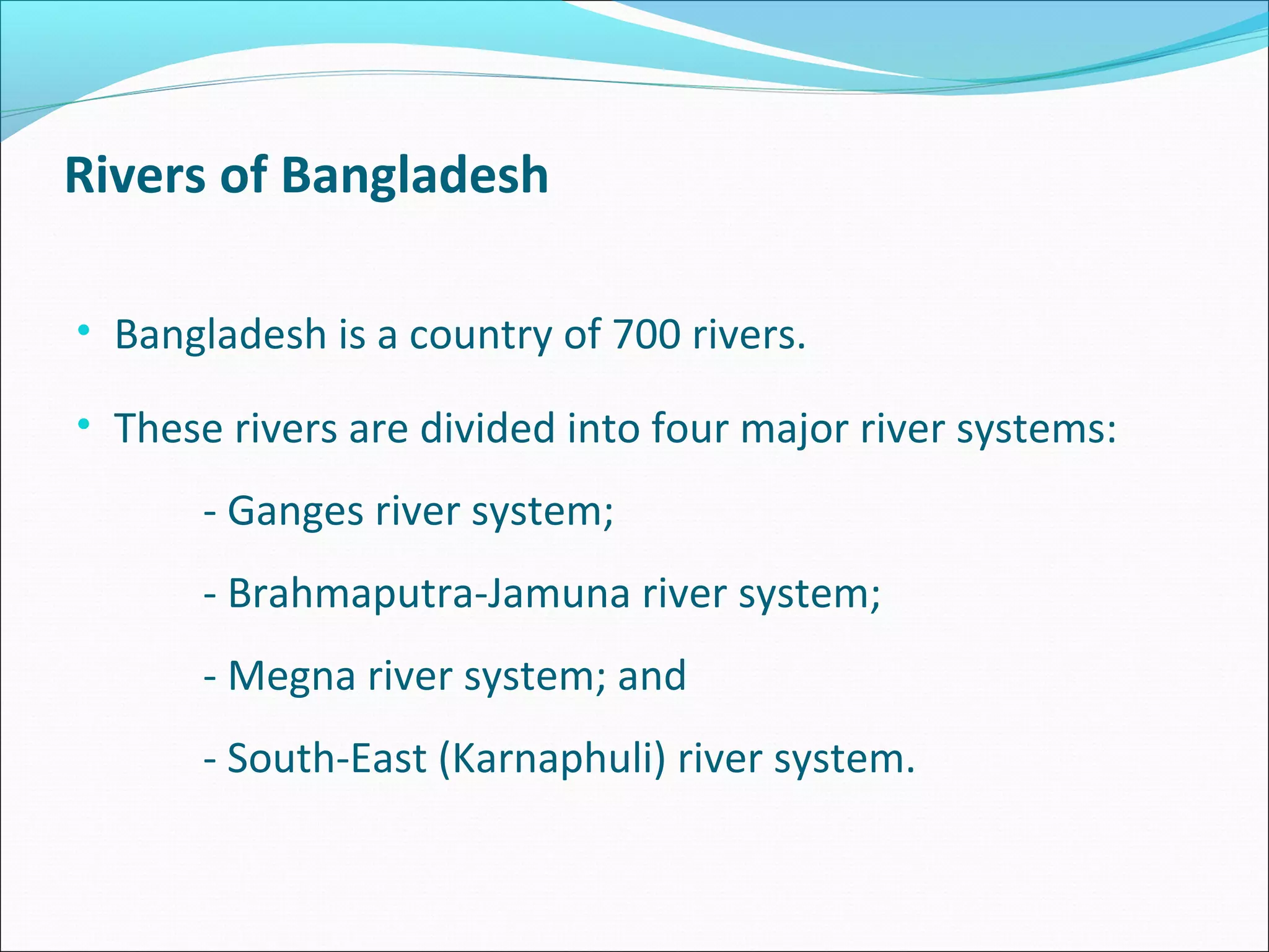
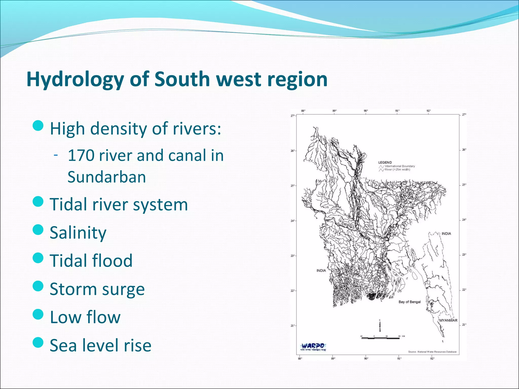
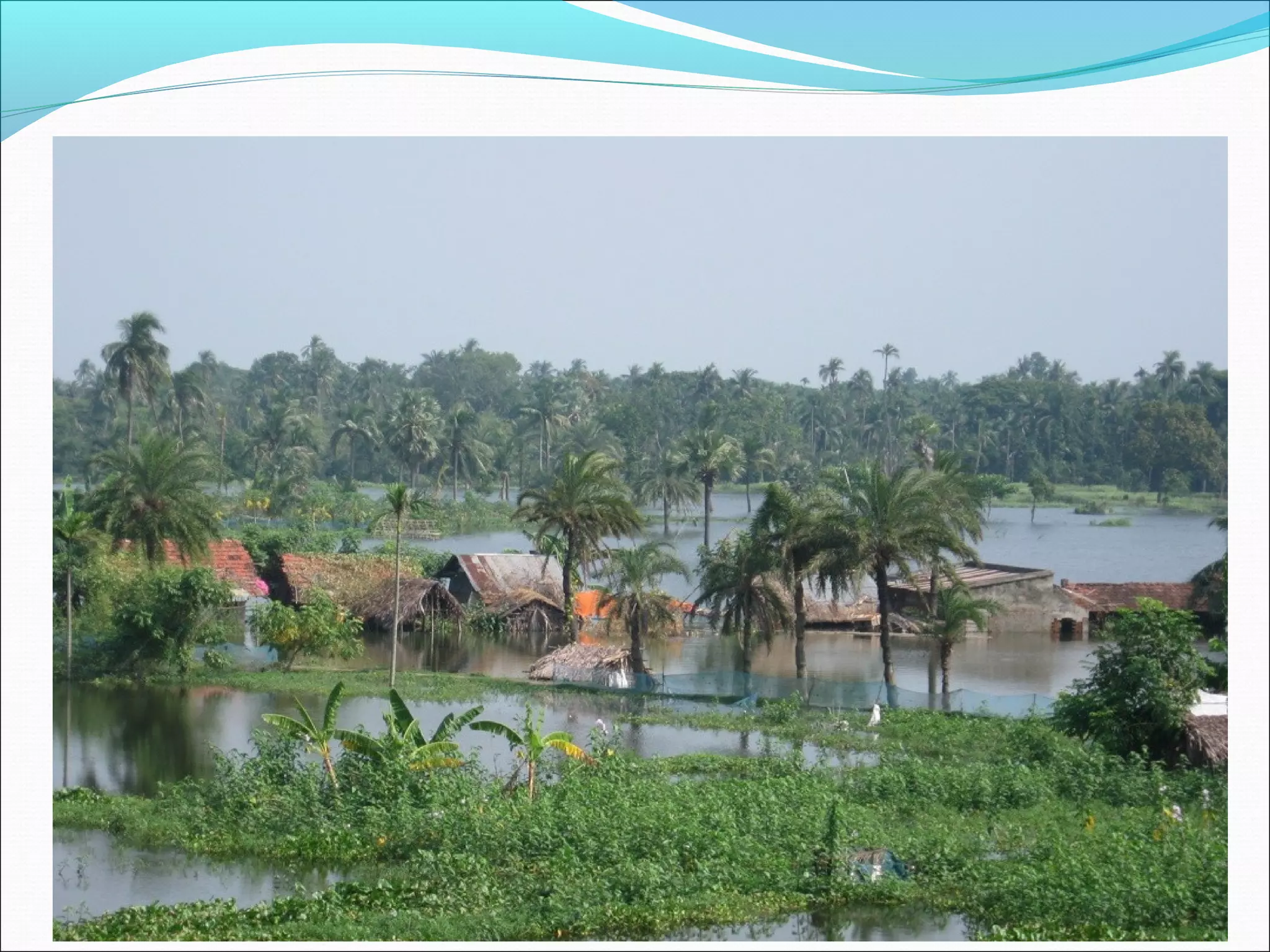
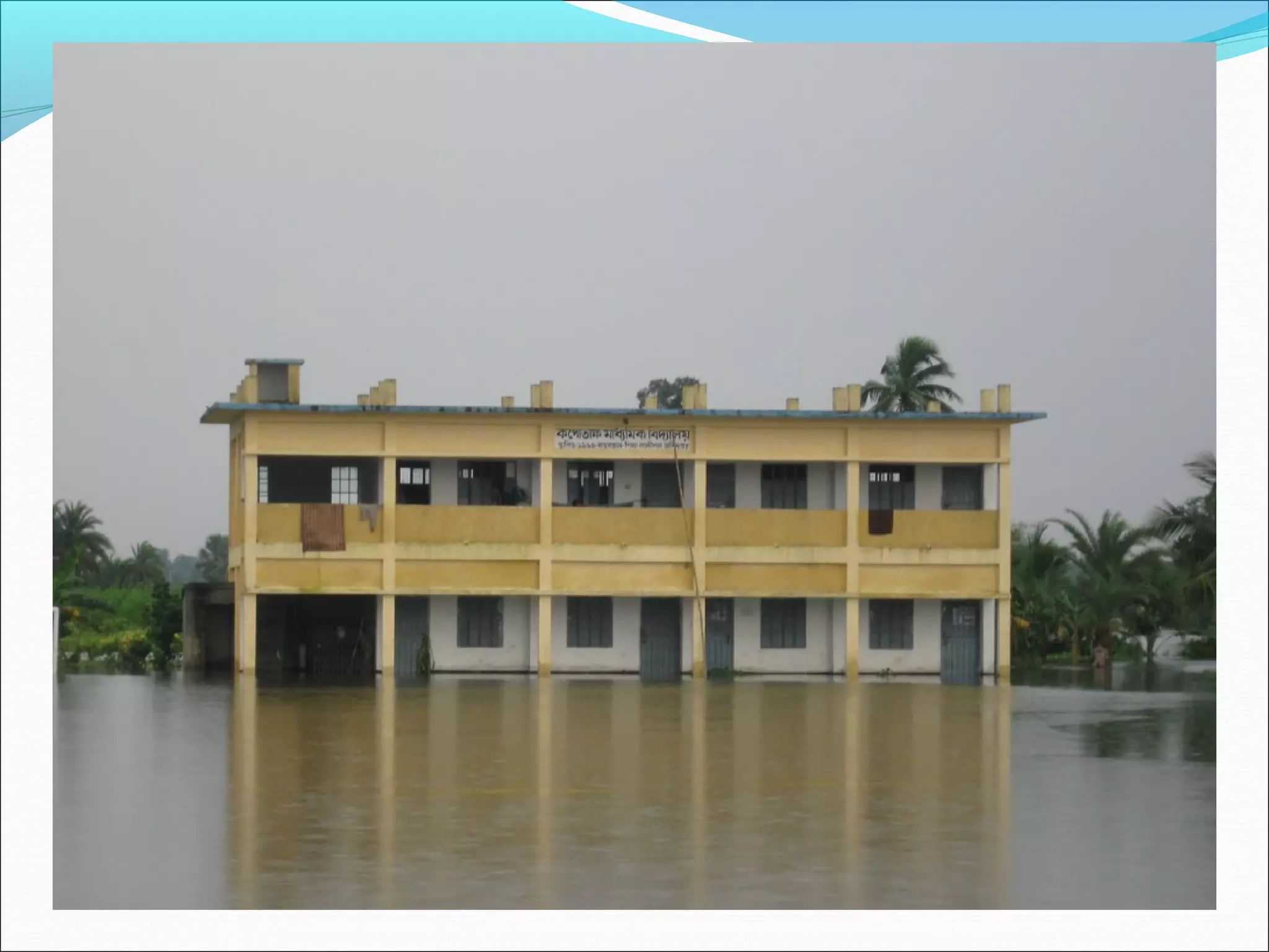
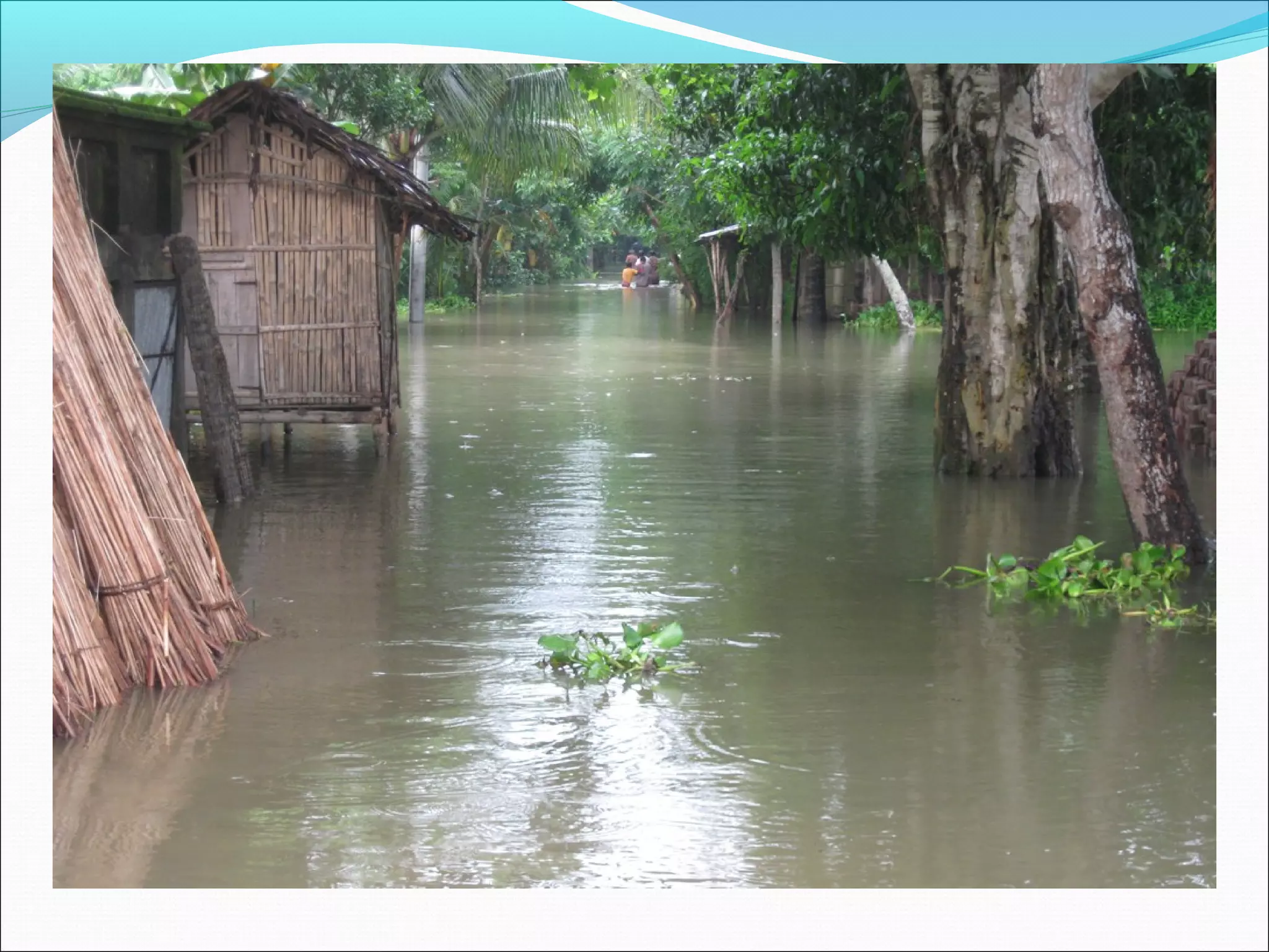
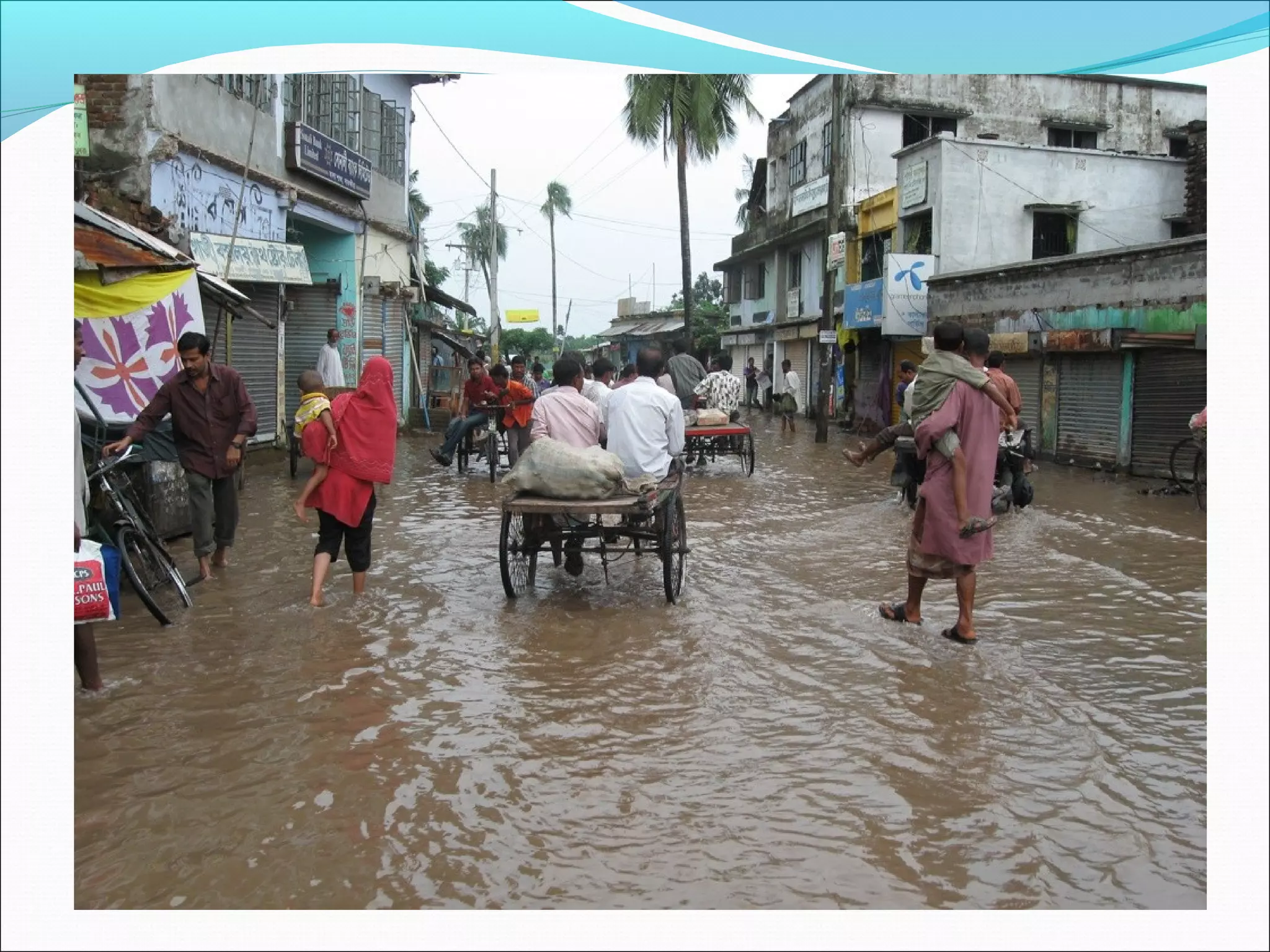
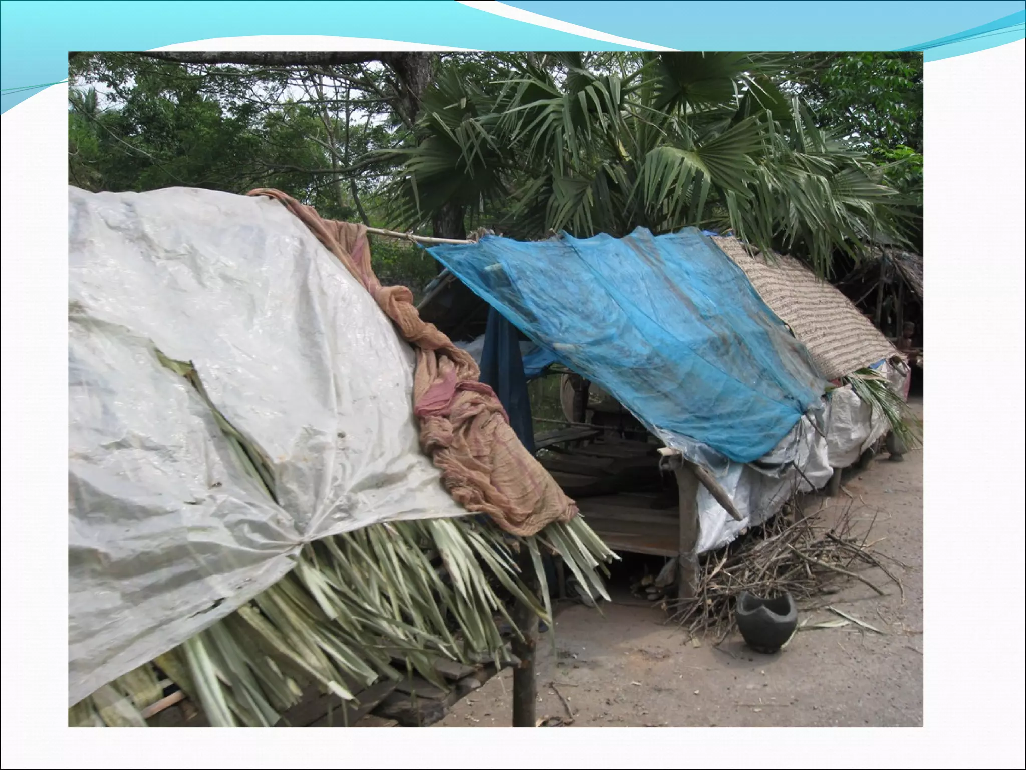
Hamidul Huq, PhD
Institute of Livelihoods Studies
Rivers of Bangladesh

• Bangladesh is a country of 700 rivers.

• These rivers are divided into four major river systems:
      - Ganges river system;
      - Brahmaputra-Jamuna river system;
      - Megna river system; and
      - South-East (Karnaphuli) river system.
Hydrological Regions of Bangladesh

                                                 1. South West
    4. NW                        2. NE           2. North East
                    3. NC
                                                 3. North Central
                                                 4. North West
                             6. SE
                             6. SE
                                                 5. South Central
         1. SW
         1. SW
                     5. SC
                     5. SC
                                 8. RE
                                 8. RE
                                         7. EH
                                         7. EH   6. South East
                                                 7. Eastern Hill

                                                 8. River & Estuary
Source: Mozaddad Faruque, 2009
Southwest Region:

 • The Southwest region is covered by Ganges river
   system.
   This system is again divided into two types:
        - Rivers originated from the mountain like Padma
   and its braches; and
        - the Tidal Rivers.
 • There are about 170 river and canals in Sundarban
   alone.
Hydrology of South west region
High density of rivers:
  - 170 river and canal in
    Sundarban
Tidal river system
Salinity
Tidal flood
Storm surge
Low flow
Sea level rise
Tidal River System
Rivers of South West zone are tidal.
Two high tide and two low tide times in every 24 hours. The
 whole area gets inundated during high tide time and water
 gets receded during low tide time.
Southwest region was dominated by capillary tidal rivers’
 network including 170 river and canals of Sundarban.
Rivers of this region are Muroly, Rupsa, Bhoirab, Kapotakhkha,
 Horihor, Muktashawry, Sree Nodi, Hori Nodi, Bhodra,
 Buribhodra, Shalota, Sholemary, Telipati, Gaury, Modhumati,
 Nobogonga, Chitra, and Isamoti on the Indian Border.
Tidal River System
This region was known as floodplain. The rivers of South West
 zone are Bay of Bengal bound and brought fresh water from
 Padma/Ganges in the past until the Padma was dried up with
 the influence of Farakka.
On the other hand, tidal water brought saline water from the
 Bay of Bengal that damaged the crops.
Local people built seasonal earthen dyke to protect their crop
 field preventing saline water intrusion. They called it
 Ostomashi bandh (eight months time dyke).
Functions of Floodplain
Floodplains perform an important hydraulic function by acting as
 detention reservoir. The detention function moderates the flood
 flow.
The inter-tidal lands create a flushing action through alternate
 storage and release of water that helps in maintaining the river
 morphology.
Floodplain water regime provides conditions for rich aquatic
 habitat for fish, turtles and birds, and resort to migratory birds, and
 harbor and support animal and plant bio-diversity.
The ecological resources of floodplain is an important source of
 livelihood for the poor section of the society.
Storage of flood water   Fish
Soil formation           Shells
Groundwater recharge     Crabs
Land/soil fertility      Snail
Navigation               Duck
Fish breeding site       Shapla (Water Lily)
Fish nursery             Shaluk
Wild life                Grass for fodder
Wild birds               Medicinal plant
Irrigation               Water hyacinth
Domestic uses of water
Coastal Embankment Project (CEP)

With the objectives of protecting crops, increasing agricultural
  products/grow more food and goal of creating permanent
  agro-based production structure and food security, the
  Pakistan Government implemented the “Coastal Embankment
  Project” in Southwest Region.

During the period of 1960 - 1970, 37 Polders, 4000 km dyke
  and 780 sluice gates were built and 540,000 ha floodplain
  were brought under polders in Southwest region.
•Farmers could grow double, even triple amount
crops in following 10-15 years of CEP
implementation.
•Road communication improved.
Water Logging
Water logging appeared due to these polders, sluice gates and
 embankment and got escalated over the period since 1985.
The whole floodplains of SW region got affected by water
 logging.
Agriculture collapsed totally & Farmers were helpless.
Agriculture laborers became unemployed.
Fishermen became vulnerable.
Overall livelihoods had turned into extreme vulnerable,
 people were forced live in permanent hazards.
Khulna-Jessore Drainage Rehabilitation Project
KJDRP
BWDB implemented Khulna-Jessore Drainage Rehabilitation
 Project during the period of 1994 – 1997
The objectives was “poverty reduction through increased
 agriculture production and creation of on-farm employment in
 the project area”.
Specific objective was “to provide/enhance improved drainage
 and flood control facilities to 100600 ha of gross benefitted
 area”.
KJDRP was seriously contested, protested and opposed by the
 local people because of its engineering physical structural
 approach to address the water logging issues. But the KJDRP
 continued.
KJDRP generated extreme level of Water logging in the area.
TRM by the local people

The Water Logging condition escalated up to an extreme level
 in 1997.
Local people got organised under Pani Committee (water
 committee)
Facilitated a ‘public cut’ of the embankment on Beel Vayena
 to reopen the free flow tidal system,
Which made the area water logging free.
This system continued for four years and three months.
Impact of TRM
70,000 ha land got free from water logging
The linked Hori river bed level was higher than Beel Vayena
 before TRM, which got free from siltation by the TRM and bed
 if 10-12 meter deep and wideness of this river increased up to
 two to three times.
Beel Vayena bed is leveled with the siltation, because 90% of
 the tidal silt got deposited into the beel.
Villages are now free from water logging.
Agriculture is back to the area.
Livelihoods opportunities are also back to some extent.
TRM by BWDB
Drawing upon a report of CEGIS on People’s TRM, BWDB
 initiated TRM project in 2002.
BWDB labeled the people’s initiated TRM as “unplanned TRM”.
BWDB implemented a planned TRM in Beel Kedaira during the
 period of 2002- 2005.
This TRM generated extreme water logging in the area
 because, only 1/13th amount of tidal silt got deposited into the
 beel and the rest of the tidal silt got deposited into the river.
The planned TRM was again engineering physical infrastructure
 dominant.
TRM by BWDB
BWDB initiated their 2nd TRM in 2006 in Beel Khukshia.
Local people demanded compensation.
BWB agreed. Implementation of this project continued
 without paying compensation.
Local people think, it will need at least 10 years to fill up
 Beel Khukhsia up to cultivation level.
Local people cannot use this beel.
More than 2000 families of 13 villages around Beel
 Khukhsia are rather victims of this TRM project of BWDB.
TRM by BWDB

Local people expected that the BWDB should use the
 knowledge and experience of people’s initiated TRM
But unfortunately BWDB followed their own traditions.
Hence, their “planned TRM” project failed.
TRM may be efficient and effective if it is embedded in
 ‘counter-development’ approach.
Acknowledgement

 Prof. Rezaur Rahman, 2011
 Crossing Boundaries project, 2011
 CEGIS, 2011
 Nandi

Hamidul Huq "Into the beel"

  • 1.
    Hamidul Huq, PhD Instituteof Livelihoods Studies
  • 2.
    Rivers of Bangladesh •Bangladesh is a country of 700 rivers. • These rivers are divided into four major river systems: - Ganges river system; - Brahmaputra-Jamuna river system; - Megna river system; and - South-East (Karnaphuli) river system.
  • 3.
    Hydrological Regions ofBangladesh 1. South West 4. NW 2. NE 2. North East 3. NC 3. North Central 4. North West 6. SE 6. SE 5. South Central 1. SW 1. SW 5. SC 5. SC 8. RE 8. RE 7. EH 7. EH 6. South East 7. Eastern Hill 8. River & Estuary Source: Mozaddad Faruque, 2009
  • 4.
    Southwest Region: •The Southwest region is covered by Ganges river system. This system is again divided into two types: - Rivers originated from the mountain like Padma and its braches; and - the Tidal Rivers. • There are about 170 river and canals in Sundarban alone.
  • 5.
    Hydrology of Southwest region High density of rivers: - 170 river and canal in Sundarban Tidal river system Salinity Tidal flood Storm surge Low flow Sea level rise
  • 6.
    Tidal River System Riversof South West zone are tidal. Two high tide and two low tide times in every 24 hours. The whole area gets inundated during high tide time and water gets receded during low tide time. Southwest region was dominated by capillary tidal rivers’ network including 170 river and canals of Sundarban. Rivers of this region are Muroly, Rupsa, Bhoirab, Kapotakhkha, Horihor, Muktashawry, Sree Nodi, Hori Nodi, Bhodra, Buribhodra, Shalota, Sholemary, Telipati, Gaury, Modhumati, Nobogonga, Chitra, and Isamoti on the Indian Border.
  • 7.
    Tidal River System Thisregion was known as floodplain. The rivers of South West zone are Bay of Bengal bound and brought fresh water from Padma/Ganges in the past until the Padma was dried up with the influence of Farakka. On the other hand, tidal water brought saline water from the Bay of Bengal that damaged the crops. Local people built seasonal earthen dyke to protect their crop field preventing saline water intrusion. They called it Ostomashi bandh (eight months time dyke).
  • 8.
    Functions of Floodplain Floodplainsperform an important hydraulic function by acting as detention reservoir. The detention function moderates the flood flow. The inter-tidal lands create a flushing action through alternate storage and release of water that helps in maintaining the river morphology. Floodplain water regime provides conditions for rich aquatic habitat for fish, turtles and birds, and resort to migratory birds, and harbor and support animal and plant bio-diversity. The ecological resources of floodplain is an important source of livelihood for the poor section of the society.
  • 9.
    Storage of floodwater Fish Soil formation Shells Groundwater recharge Crabs Land/soil fertility Snail Navigation Duck Fish breeding site Shapla (Water Lily) Fish nursery Shaluk Wild life Grass for fodder Wild birds Medicinal plant Irrigation Water hyacinth Domestic uses of water
  • 10.
    Coastal Embankment Project(CEP) With the objectives of protecting crops, increasing agricultural products/grow more food and goal of creating permanent agro-based production structure and food security, the Pakistan Government implemented the “Coastal Embankment Project” in Southwest Region. During the period of 1960 - 1970, 37 Polders, 4000 km dyke and 780 sluice gates were built and 540,000 ha floodplain were brought under polders in Southwest region.
  • 11.
    •Farmers could growdouble, even triple amount crops in following 10-15 years of CEP implementation. •Road communication improved.
  • 12.
    Water Logging Water loggingappeared due to these polders, sluice gates and embankment and got escalated over the period since 1985. The whole floodplains of SW region got affected by water logging. Agriculture collapsed totally & Farmers were helpless. Agriculture laborers became unemployed. Fishermen became vulnerable. Overall livelihoods had turned into extreme vulnerable, people were forced live in permanent hazards.
  • 13.
    Khulna-Jessore Drainage RehabilitationProject KJDRP BWDB implemented Khulna-Jessore Drainage Rehabilitation Project during the period of 1994 – 1997 The objectives was “poverty reduction through increased agriculture production and creation of on-farm employment in the project area”. Specific objective was “to provide/enhance improved drainage and flood control facilities to 100600 ha of gross benefitted area”. KJDRP was seriously contested, protested and opposed by the local people because of its engineering physical structural approach to address the water logging issues. But the KJDRP continued. KJDRP generated extreme level of Water logging in the area.
  • 20.
    TRM by thelocal people The Water Logging condition escalated up to an extreme level in 1997. Local people got organised under Pani Committee (water committee) Facilitated a ‘public cut’ of the embankment on Beel Vayena to reopen the free flow tidal system, Which made the area water logging free. This system continued for four years and three months.
  • 21.
    Impact of TRM 70,000ha land got free from water logging The linked Hori river bed level was higher than Beel Vayena before TRM, which got free from siltation by the TRM and bed if 10-12 meter deep and wideness of this river increased up to two to three times. Beel Vayena bed is leveled with the siltation, because 90% of the tidal silt got deposited into the beel. Villages are now free from water logging. Agriculture is back to the area. Livelihoods opportunities are also back to some extent.
  • 22.
    TRM by BWDB Drawingupon a report of CEGIS on People’s TRM, BWDB initiated TRM project in 2002. BWDB labeled the people’s initiated TRM as “unplanned TRM”. BWDB implemented a planned TRM in Beel Kedaira during the period of 2002- 2005. This TRM generated extreme water logging in the area because, only 1/13th amount of tidal silt got deposited into the beel and the rest of the tidal silt got deposited into the river. The planned TRM was again engineering physical infrastructure dominant.
  • 23.
    TRM by BWDB BWDBinitiated their 2nd TRM in 2006 in Beel Khukshia. Local people demanded compensation. BWB agreed. Implementation of this project continued without paying compensation. Local people think, it will need at least 10 years to fill up Beel Khukhsia up to cultivation level. Local people cannot use this beel. More than 2000 families of 13 villages around Beel Khukhsia are rather victims of this TRM project of BWDB.
  • 24.
    TRM by BWDB Localpeople expected that the BWDB should use the knowledge and experience of people’s initiated TRM But unfortunately BWDB followed their own traditions. Hence, their “planned TRM” project failed. TRM may be efficient and effective if it is embedded in ‘counter-development’ approach.
  • 25.
    Acknowledgement Prof. RezaurRahman, 2011 Crossing Boundaries project, 2011 CEGIS, 2011 Nandi