Downloaded 107 times
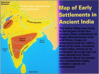
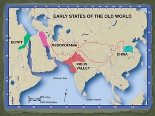
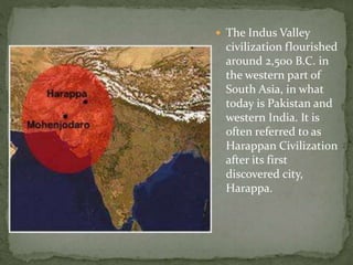
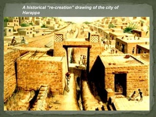
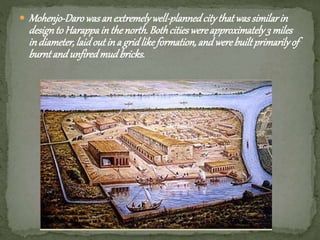
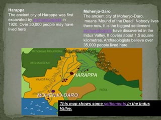


The document summarizes key aspects of the ancient Indus Valley civilization. It flourished around 2,500 BC along the Indus River valley in what is now Pakistan and western India. Two major cities, Harappa and Mohenjo-Daro, had populations over 30,000 and were laid out in organized grid patterns with structures made of baked and unbaked bricks. While ruins remain, the civilization's writing system has yet to be deciphered and many questions surround its people. The Indus River and surrounding geography, including protection from invaders, supported trade and development despite unpredictable climate conditions like flooding and drought.