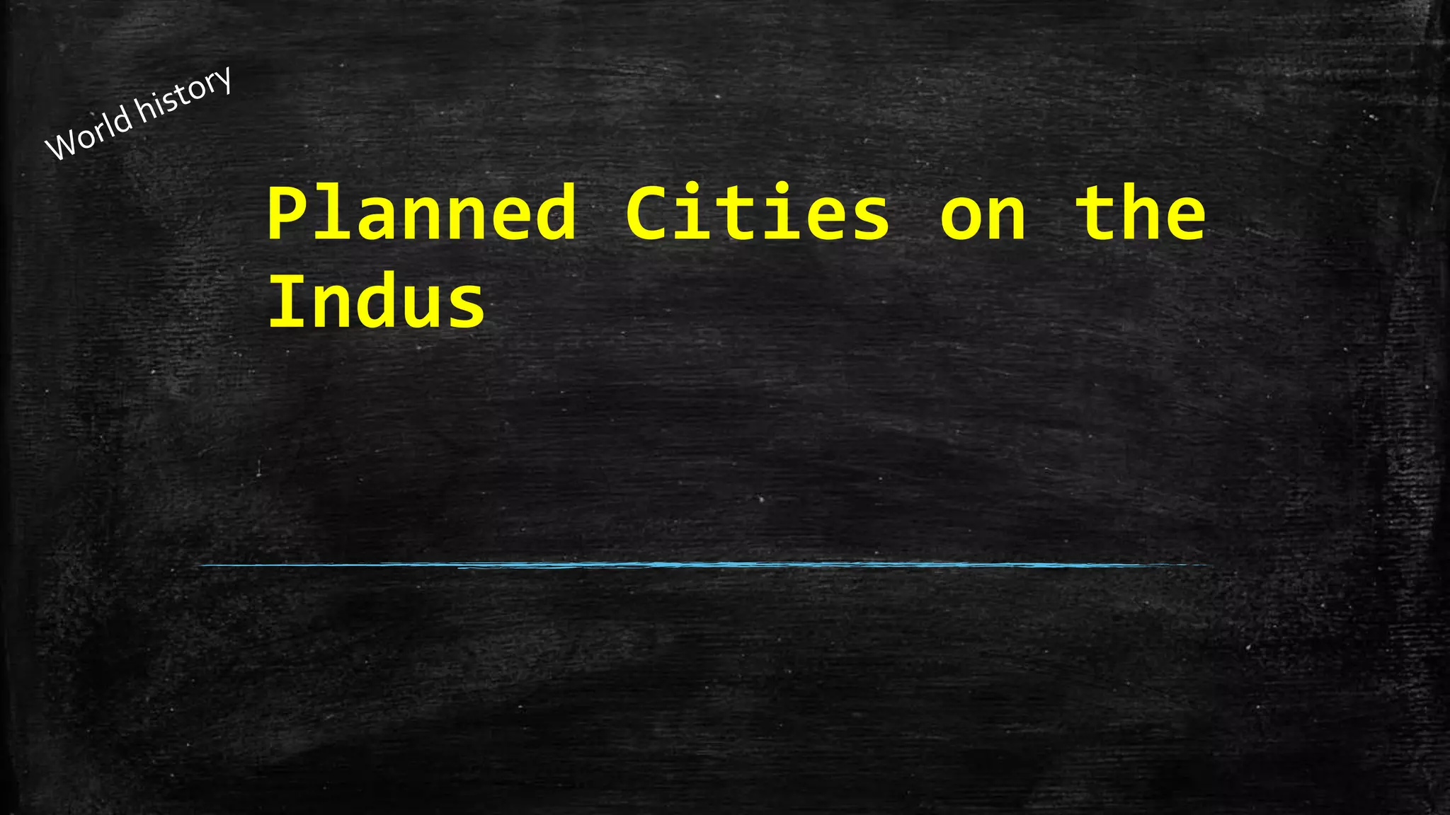
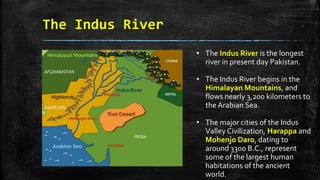
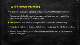
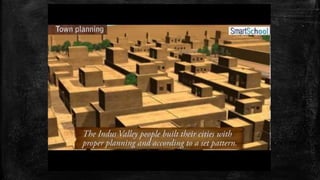
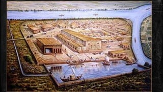
Planned Cities on the
Indus
The Geography of the Indian
Subcontinent
▪ Includes India, Pakistan, and Bangladesh.
▪ The highest mountains in the world separate this region from the rest of
Asia.
▪ The mountains and a large desert to the east provide natural defense for
the Indus River region.
▪ Fertile plains created by the Indus and Ganges Rivers.
▪ The Indo-Gangetic Plain stretches about 1,700 miles across northern India.
▪ Monsoons are seasonal winds that carry moisture.They dominate India’s
climate.They often create flooding. Droughts may happen when they fail
to appear.
The Indus River
• The Indus River is the longest
river in present day Pakistan.
• The Indus River begins in the
Himalayan Mountains, and
flows nearly 3,200 kilometers to
the Arabian Sea.
• The major cities of the Indus
Valley Civilization, Harappa and
Mohenjo Daro, dating to
around 3300 B.C., represent
some of the largest human
habitations of the ancient
world.
Environmental Challenges
• Flooding was unpredictable.
• Floods were beneficial by spreading nutrient-rich silt over a large area.
• Monsoons and their wet and dry seasons they brought were unpredictable.
• Too little rain and crops would fail.
• Too much rain produced floods that could wash away the crops.
The Emergence of civilization on
the Indus
• Evidence of agriculture and sheep domestication is dated to 7000 B.C.
• Around 2500 B.C. India’s first cities were built.They built earthen walls
and levees to keep the water from flooding the cities.
• Archeologists have found more than 100 settlements around the Indus
and its tributaries., mostly in modern-day Pakistan.
• The largest cities found were Harappa, Kalibangan, and Mohenjo-Daro.
• IndusValley civilization is sometimes called Harappan civilization.
Early Urban Planning
• Cities were built using a precise grid system, unlike Mesopotamian cities.
• Sophisticated plumbing and sewer systems that would have rivaled the
systems of the systems of the early 1800s.
• Harappa was built on mud-brick platforms to protect it from flooding.
• Thick brick wall about three and a half miles surrounded the city for protection.
• Houses featured bathrooms where wastewater flowed out to the street and
then to sewage pits.
Harappan Culture
• Developed a language made up of about 400 symbols. It was based upon
stamps and seals made of carved stone. It has yet to be deciphered.
• Housing suggests that there were probably not much social division. Artifcats
suggest relative prosperity.
• Rulers are believed to have had close ties to religion. Archeologists believe this
culture was a theocracy.
• They conducted trade with other cultures in the region.They crafted jewelry
from gold and silver from present-day Afghanistan.
• The Indus River provided access to the sea and a route to trade with distant
peoples, including the Mesopotamians.
The End of the Indus Valley Culture
• Evidence of tectonic plate shifts
• Earthquakes and floods may have changed the course of the Indus River.
• Trade would have been affected by the changes in the river.
• Production of food would have been impacted by the changes in the river.
• People may have left the cities in order to survive.
• Aryans, a nomadic people from the north, swept into the IndusValley around
1500 B.C.

Planned cities on the indus

  • 1.
  • 2.
    The Geography ofthe Indian Subcontinent ▪ Includes India, Pakistan, and Bangladesh. ▪ The highest mountains in the world separate this region from the rest of Asia. ▪ The mountains and a large desert to the east provide natural defense for the Indus River region. ▪ Fertile plains created by the Indus and Ganges Rivers. ▪ The Indo-Gangetic Plain stretches about 1,700 miles across northern India. ▪ Monsoons are seasonal winds that carry moisture.They dominate India’s climate.They often create flooding. Droughts may happen when they fail to appear.
  • 3.
    The Indus River •The Indus River is the longest river in present day Pakistan. • The Indus River begins in the Himalayan Mountains, and flows nearly 3,200 kilometers to the Arabian Sea. • The major cities of the Indus Valley Civilization, Harappa and Mohenjo Daro, dating to around 3300 B.C., represent some of the largest human habitations of the ancient world.
  • 4.
    Environmental Challenges • Floodingwas unpredictable. • Floods were beneficial by spreading nutrient-rich silt over a large area. • Monsoons and their wet and dry seasons they brought were unpredictable. • Too little rain and crops would fail. • Too much rain produced floods that could wash away the crops.
  • 5.
    The Emergence ofcivilization on the Indus • Evidence of agriculture and sheep domestication is dated to 7000 B.C. • Around 2500 B.C. India’s first cities were built.They built earthen walls and levees to keep the water from flooding the cities. • Archeologists have found more than 100 settlements around the Indus and its tributaries., mostly in modern-day Pakistan. • The largest cities found were Harappa, Kalibangan, and Mohenjo-Daro. • IndusValley civilization is sometimes called Harappan civilization.
  • 6.
    Early Urban Planning •Cities were built using a precise grid system, unlike Mesopotamian cities. • Sophisticated plumbing and sewer systems that would have rivaled the systems of the systems of the early 1800s. • Harappa was built on mud-brick platforms to protect it from flooding. • Thick brick wall about three and a half miles surrounded the city for protection. • Houses featured bathrooms where wastewater flowed out to the street and then to sewage pits.
  • 8.
    Harappan Culture • Developeda language made up of about 400 symbols. It was based upon stamps and seals made of carved stone. It has yet to be deciphered. • Housing suggests that there were probably not much social division. Artifcats suggest relative prosperity. • Rulers are believed to have had close ties to religion. Archeologists believe this culture was a theocracy. • They conducted trade with other cultures in the region.They crafted jewelry from gold and silver from present-day Afghanistan. • The Indus River provided access to the sea and a route to trade with distant peoples, including the Mesopotamians.
  • 10.
    The End ofthe Indus Valley Culture • Evidence of tectonic plate shifts • Earthquakes and floods may have changed the course of the Indus River. • Trade would have been affected by the changes in the river. • Production of food would have been impacted by the changes in the river. • People may have left the cities in order to survive. • Aryans, a nomadic people from the north, swept into the IndusValley around 1500 B.C.