Remote sensing and GIS techniques can provide timely and accurate information for agricultural monitoring over large areas. Remote sensing uses sensors aboard satellites or drones to capture electromagnetic radiation reflected or emitted from crops and soil. GIS allows integration of spatial data for analysis. Applications include crop identification and acreage estimation, growth monitoring, soil moisture and fertility assessment, pest and disease detection, and yield estimation. Various sensors such as multispectral, thermal, LIDAR and hyperspectral are used to analyze vegetation, soil properties, and assess crop health. Drones equipped with different sensors can assist with crop scouting, inventory management and precision agriculture.
APPLICATION OF REMOTE SENSING AND GIS IN AGRICULTURELagnajeetRoy
India is a country that depends on agriculture. Today in this era of technological supremacy, agriculture is also using different new technologies like some robotic machinery to remote sensing and Geographical Information System (GIS) for the betterment of agriculture. It is easy to get the information about that area where human cannot check the condition everyday and help in gathering the data with the help of remote sensing. Whereas GIS helps in preparation of map that shows an accurate representation of data we get through remote sensing. From disease estimation to stress factor due to water, from ground water quality index to acreage estimation in various way agriculture is being profited by the application of remote sensing and GIS in agriculture. The applications of those software or techniques are very new to the agriculture domain still much more exploration is needed in this part. New software’s are developing in different parts of the world and remote sensing. Today farmers understand the beneficiaries of these kinds of techniques to the farm field which help in increasing productivity that will help future generation as technology is hype in traditional system of farming.
Application of Remote Sensing in AgricultureUTTAM KUMAR
Remote sensing has been found to be a valuable tool in evaluation, monitoring and management of land, water and crop resources. The launching of the Indian remote sensing satellite (IRS) has enhanced the capabilities for better utilization of this technology and significant progress has been made in soil and land cover mapping, land degradation studies, monitoring of waste land, assessment of crop conditions crop acreage and production estimates
In India, agriculture is one of the major application areas of the remote sensing technology. Various national level agricultural applications have been developed which showcases the use of remote sensing data provided by the sensors/satellites launched by the country’s space agency, Indian Space Research Organisation (ISRO)
Remote sensing application in agriculture & forestry_Dr Menon A R R (The Kera...India Water Portal
This presentation by Dr A R R Menon, Emeritus scientist, CED on Remote Sensing applications in agriculture and forestry was made at at the Kerala Environment Congress, Trivandrum organised by the Centre for Environment and Development
Agriculture plays a dominant role in economies of both developed and undeveloped countries. Agricultural remote sensing is not new, starts in back 1950s, but recent technological advances have made the benefits of remote sensing accessible to most agricultural producers. Pakistan is a country of different agro-climatic regions.
The soil is a major part of the natural environment and is vital to the existence of life on the planet.
Satellite imagery will provide the visible boundaries of soil types and a shallow penetration of soils.
Precision agriculture is an art and science of utilizing innovative, site-specific techniques for management of spatial and temporal variability using affordable technologies… for enhancing output, efficiency, and profitability of agricultural production in an environmentally responsible manner
GIS in agriculture helps farmers to achieve increased production and reduced costs by enabling better management of land resources. The risk of marginalization and vulnerability of small and marginal farmers, who constitute about 85% of farmers globally, also gets reduced.
Agricultural Geographic Information Systems using Geomatics Technology enable the farmers to map and project current and future fluctuations in precipitation, temperature, crop output etc.
GIS Applications for Smart Agriculture-Case Studies & Research Prospects.AdityaAllamraju1
My special webinar talk about 'GIS Applications for Smart Agriculture-Case Studies & Research Prospects’ is a part of the webinar series on October 31st, 2020 organized by the TGISlab, a GIS Consultancy that is an initiative to fill the gap in GIS/Remote Sensing field to aware people about space technology for Earth Science & its applications. TGISLab works on different GIS Applications work and offers training/webinars/workshops to a wider community. It is based at Ahmedabad in Gujarat, India.
Drones-as-a-Service for agricultural applications (by Philipp Trénel)TUS Expo
At TUS Nordics 2017, Philipp Trénel gave the presentation ‘Drones-as-a-Service for agricultural applications’ in our Arctic track, on Thursday 12 October 2017.
India being agricultural driven country faces lot of challenges in agricultural sector because of several reasons. I have listed how GIS Technology can help in overcoming such issues
In India, agriculture is one of the major application areas of the remote sensing technology. Various national level agricultural applications have been developed which showcases the use of remote sensing data provided by the sensors/satellites launched by the country’s space agency, Indian Space Research Organisation (ISRO)
IJERA (International journal of Engineering Research and Applications) is International online, ... peer reviewed journal. For more detail or submit your article, please visit www.ijera.com
International Journal of Engineering Research and Applications (IJERA) is an open access online peer reviewed international journal that publishes research and review articles in the fields of Computer Science, Neural Networks, Electrical Engineering, Software Engineering, Information Technology, Mechanical Engineering, Chemical Engineering, Plastic Engineering, Food Technology, Textile Engineering, Nano Technology & science, Power Electronics, Electronics & Communication Engineering, Computational mathematics, Image processing, Civil Engineering, Structural Engineering, Environmental Engineering, VLSI Testing & Low Power VLSI Design etc.
To meet the various information requirements in forest management, different data sources like field survey, aerial photography, and satellite imagery is used, depending on the level of detail required and the extension of the area under study.
Use of remote sensing techniques for nutrient studies in soil and plant _Knig...KnightNthebere
Remote Sensing Techniques used in nutrient studies in plant and soil . Prospects as far as space technology is concerned in agriculture. The usefulness of Hyperspectral and multispectral remote sensing in agriculture sector. How can remote sensing protect the soil from degradation and increase food production with sustainable management practice of agricultural land?
Characterization of Diatraea saccharalis in Sugarcane (Saccharum officinarum)...Agriculture Journal IJOEAR
Abstract— Applications of remote sensing in agriculture have increased in recent years, especially for the development of sensors with better spatial and spectral resolutions. The objective of this study was to assess and evaluate the spatial and spectral variability of infection Diatraea saccharalis of sugarcane (Saccharum officinarum) through optical sensors in the Huasteca, Mexico. The methodology consisted in to make in situ measurements with a hyperspectral spectroradiometer in areas with and without apparent damage by the plague. For spatial and scaling representation Landsat 8 images were used. The data obtained in the field showed the spectral behavior of the plague; and the space-spectral reflectance variation was made by visibles and infrared bands for the vegetation. This process is an important approach to take a look from the geographical point of view to the problems related to the risk assessment of plague and diseases, their incidence, spread and severity, as well as support for sampling and monitoring activities. The used of these technologies provides advantages in research and in the implementation of precision farming techniques.
PRECISION FARMING
It is an approach where inputs are utilized in precise amounts to get increased average yields, compared to traditional cultivation techniques. It is also known as precision Agriculture, A science of improving crop yield and assisting management decisions using high technology sensor and analysis tools. It is an approach to farm management that uses information technology (IT).
Spectroscopy - A new paradigm for Evidence-based Land &Soil Management recomm...Stankovic G
AfriLAB: Regional Soil Laboratory Network for Africa | First meeting. 21 - 24 May 2019 | Nairobi, Kenya
Ermias Betemariam, Erick Towett & Andrew Sila World Agroforestry (ICRAF), Kenya
Similar to Seminar on 'Remote Sensing, Drone in Agriculture' (20)
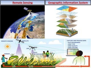
How to Make a Field invisible in Odoo 17Celine George
It is possible to hide or invisible some fields in odoo. Commonly using “invisible” attribute in the field definition to invisible the fields. This slide will show how to make a field invisible in odoo 17.
Welcome to TechSoup New Member Orientation and Q&A (May 2024).pdfTechSoup
In this webinar you will learn how your organization can access TechSoup's wide variety of product discount and donation programs. From hardware to software, we'll give you a tour of the tools available to help your nonprofit with productivity, collaboration, financial management, donor tracking, security, and more.
The French Revolution, which began in 1789, was a period of radical social and political upheaval in France. It marked the decline of absolute monarchies, the rise of secular and democratic republics, and the eventual rise of Napoleon Bonaparte. This revolutionary period is crucial in understanding the transition from feudalism to modernity in Europe.
For more information, visit-www.vavaclasses.com
Introduction to AI for Nonprofits with Tapp NetworkTechSoup
Dive into the world of AI! Experts Jon Hill and Tareq Monaur will guide you through AI's role in enhancing nonprofit websites and basic marketing strategies, making it easy to understand and apply.
Unit 8 - Information and Communication Technology (Paper I).pdfThiyagu K
This slides describes the basic concepts of ICT, basics of Email, Emerging Technology and Digital Initiatives in Education. This presentations aligns with the UGC Paper I syllabus.
June 3, 2024 Anti-Semitism Letter Sent to MIT President Kornbluth and MIT Cor...Levi Shapiro
Letter from the Congress of the United States regarding Anti-Semitism sent June 3rd to MIT President Sally Kornbluth, MIT Corp Chair, Mark Gorenberg
Dear Dr. Kornbluth and Mr. Gorenberg,
The US House of Representatives is deeply concerned by ongoing and pervasive acts of antisemitic
harassment and intimidation at the Massachusetts Institute of Technology (MIT). Failing to act decisively to ensure a safe learning environment for all students would be a grave dereliction of your responsibilities as President of MIT and Chair of the MIT Corporation.
This Congress will not stand idly by and allow an environment hostile to Jewish students to persist. The House believes that your institution is in violation of Title VI of the Civil Rights Act, and the inability or
unwillingness to rectify this violation through action requires accountability.
Postsecondary education is a unique opportunity for students to learn and have their ideas and beliefs challenged. However, universities receiving hundreds of millions of federal funds annually have denied
students that opportunity and have been hijacked to become venues for the promotion of terrorism, antisemitic harassment and intimidation, unlawful encampments, and in some cases, assaults and riots.
The House of Representatives will not countenance the use of federal funds to indoctrinate students into hateful, antisemitic, anti-American supporters of terrorism. Investigations into campus antisemitism by the Committee on Education and the Workforce and the Committee on Ways and Means have been expanded into a Congress-wide probe across all relevant jurisdictions to address this national crisis. The undersigned Committees will conduct oversight into the use of federal funds at MIT and its learning environment under authorities granted to each Committee.
• The Committee on Education and the Workforce has been investigating your institution since December 7, 2023. The Committee has broad jurisdiction over postsecondary education, including its compliance with Title VI of the Civil Rights Act, campus safety concerns over disruptions to the learning environment, and the awarding of federal student aid under the Higher Education Act.
• The Committee on Oversight and Accountability is investigating the sources of funding and other support flowing to groups espousing pro-Hamas propaganda and engaged in antisemitic harassment and intimidation of students. The Committee on Oversight and Accountability is the principal oversight committee of the US House of Representatives and has broad authority to investigate “any matter” at “any time” under House Rule X.
• The Committee on Ways and Means has been investigating several universities since November 15, 2023, when the Committee held a hearing entitled From Ivory Towers to Dark Corners: Investigating the Nexus Between Antisemitism, Tax-Exempt Universities, and Terror Financing. The Committee followed the hearing with letters to those institutions on January 10, 202
Instructions for Submissions thorugh G- Classroom.pptxJheel Barad
This presentation provides a briefing on how to upload submissions and documents in Google Classroom. It was prepared as part of an orientation for new Sainik School in-service teacher trainees. As a training officer, my goal is to ensure that you are comfortable and proficient with this essential tool for managing assignments and fostering student engagement.
2. DEPARTMENT OF SOIL SCIENCE AND
AGRICULTURAL CHEMISTRY,
COLLEGE OF AGRICULTURE, LATUR
Master Seminar
On
“Advances on Remote Sensing, GIS and Drone Technique in
Agriculture”
Presented to Seminar Incharge
Dr. V. G. TAKANKHAR
Associate Professor,
Dept. of Soil Science and Agril. Chemistry,
College of Agriculture, Latur
Presented by
SHRIVASTAV AKSHAY SHITALKUMAR
Reg. No. 2018A/46ML
3. Introduction
• Remote sensing technique widely used in agriculture.
• Use of remote sensing is necessary as monitoring of agricultural activities
faces special problems not common to other economic sectors.
• Production depends on the physical landscape (e.g., Soil type), as well as
climatic driving variables and agricultural management practices.
• All variable are highly variable in space and time. Moreover, as productivity
can change within short time periods, due to unfavorable growing conditions,
agricultural monitoring systems need to be timely.
• Remote sensing with help of GIS can significantly contribute to providing
timely and accurate picture of the agriculture sector, as it is very suitable for
gathering information over large areas with high revisit frequency.
• These technologies have many applications such as crop identification and
crop acreage estimation, crop growth monitoring, soil moisture estimation,
soil fertility evaluation, crop stress detection, detection of disease and pest
infestation, drought and flood condition monitoring, yield estimation,
weather forecasting, mapping and monitoring natural resources.
FAO, 2011 and Shanmugapriya et al., (2010)
4. Image courtesy : Google Images
What is Remote Sensing and GIS?
Remote Sensing: Methodology
EARTH STATION
ATMOSPHERE
IRS SATELLITE
PATH RADIANCE
WHEAT FIELD
INDIA
INDIA
INDIA
INDIA
SUN
Capture
Storage
Manipulate
Visualization
5. Electromagnetic spectrum
Invisible radiation Detected by RS instrument and used for our advantage
IR (0.7 um – 100 um)
- Reflected IR (0.7 um – 3.0 um)
- Em/ther IR (3.0 um – 100 um)
Image Courtesy: Google
7. Relation between plant pigment and spectral reflectance of maize
VNMKV, Parbhani Zagade (2011)
Total chlorophyll concentration
established linear relationship
with RVI, NDVI and SAVI
8. Crop identification
The spectral profiles of various Agricultural crops
Uttarakhand, MP, UP and Maharashtra Navalgund et al., (1991)
• Understanding of the physical and physiological properties of plant and their
interaction with the incident radiation is the key element in crop identification
through remote sensing. (Sai et al. 2004)
9. Crop identification with high resolution
GPBU&T, Pantnagar
Identification of representative sites of various crops and their heterogeneity on image based
on ground truth
Uttarakhand, MP, UP and Maharashtra Navalgund et al., (1991)
10. Crop acreage estimation
Sesha Sai, M.V.R., Ramana, K.V., and Hebbar R., (2004) Remote sensing application. NRSC (1) : 1-19.
Digitally Classified Image
NRSC, Hydrabad Sai et al., (2004)
11. Growth Profile for Identification
Land use/Land cover mapping
Ausa, Latur Sayambar (2015)
Fig. Land use/Land cover map of Tungi watershed
Table. Land use/Land cover classes of Tungi
watershed
92.89 % area of watershed is under cultivation
12. Growth Profile for Identification
Varietal discrimination
NRSC, Hydrabad Thenkabail (2002)
• Thenkabail (2002) had found that to discriminate between crops
(wheat, barley, chick pea, cumin lentil and vetch) four most optimum
hyperspectral bands are 547, 675, 718 and 904 nm and in discriminating
between sugercane varieties 550, 680 and 800 nm useful.
13. Silt loam reflectance spectra for various moisture contents
Moisture estimation in soil
SAC, Ahmadabad Tripathy (2018)
• Inverse relationship exist between soil moisture content and spectral
reflectance.
• OH bond
14. Narrow water absorption band
Narrow absorption band
Paris basin Kruse et al. (1991)
• Absence of bound water in
Kaolinite shows a weak band
at 1.9 um.
• Montmorillonite shows
very strong bands at 1.9 um
as well as 1.4um.
• Clay minerals have major
influence on the VNIR
portion of spectral
reflectance.
15. Pest and disease infestation
Forest Research Institute, Dehradun Acharya et al., (2015)
• Green peak at circa 550 nm
• Indices of diseased plant present lower value.
16. Pest and disease infestation
Brinjal with a pest “28-spotted ladybird and change in spectral signature
Forest Research Institute, Dehradun Acharya et al., (2015)
19. Visual sensors
• It is used for aerial mapping
and imaging
• Plant counting
• Surveillance
• Emergency response
• Surveying and Land use
application
College of Engineering, Lucknow Kumar (2012)
20. Multispectral sensors
• They range in numbers
of bands.
• Multispectral Sensors
are widely used in:
Plant health
measurement
Water quality
assessment
Vegetation index
Plant counting
College of Engineering, Lucknow Kumar (2012)
21. Thermal sensors
• Thermal sensors are best utilized in:
Heat signature detection
Livestock detection
Surveillance and security
Water temperature detection and water source detection
Emergency response
College of Engineering, Lucknow Kumar (2012)
22. LIDAR sensors
• 270º scanning
• Useful in 3D digital surface
modeling.
• Surface variation detection and
flood mapping.
• Penetrates through vegetation:
It can perform plant height
measurement by collecting
range information from the
plant canopy and the ground.
College of Engineering, Lucknow Kumar (2012)
23. Hyper spectral Sensors
Hyper spectral sensors are widely used in:
• Plant health measurement
• Water quality assessment
• Vegetation index calculation
• Full spectral sensing
• Spectral research and development
• Mineral and surface composition surveys
College of Engineering, Lucknow Kumar (2012)
FAO, 2011 and Shanmugapriya et al., (2010)
24. How drones can be used in Agriculture
Crop monitoring Chemical applications
Land & building management Crop & livestock inventory
management
College of Engineering, Lucknow Kumar (2012)
25. Conclusion
Remote sensing is useful in assessing various abiotic
and biotic stresses in different crop and in detecting and
management of various crop issues even at small farm
holdings. To effectively utilize the information on crops for
improvement of economy there is need to develop decision
support system based on available information on various
crops derived from remote sensing and GIS approaches.
The governments can use remote sensing data in order to
make important decisions about the policies they will adopt
or how to tackle national issues regarding agriculture.
28. Hyper Spectral Remote Sensing Applications in Soil Research : Techniques, ISRO, Ahemdabad
Spectroscopy
• It is technology of detection and analysis of absorption feature of chemical bonds to
identify materials and their composition.
• Specific chemical compounds has specific absorption feature at specific wavelength,
hence narrow bandwidth helps to pick those specific absorption feature unlike
broadband.
• Sensors are capable to acquire the strength of reflection and radiation in each
wavelength. From the observation data, we can understand the status of forests,
ocean pollution and desertification.
• Also, the strength of reflection and radiation differs according to the condition of
objects, such as type of plants, status (dead, weak, etc.) or contamination of water.
Spectral indices used in
determination of
relationship between
vegetation and reflectance.