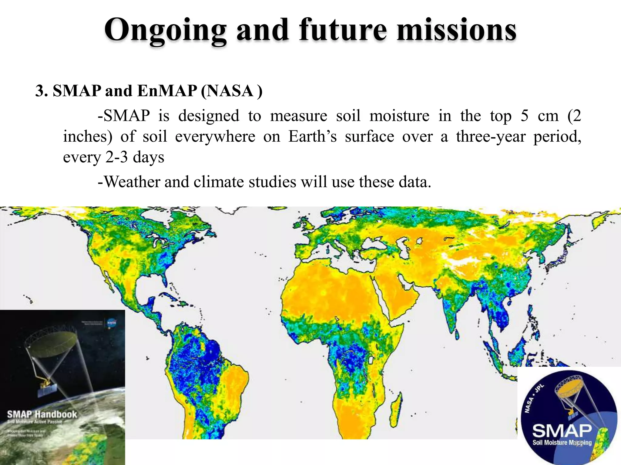
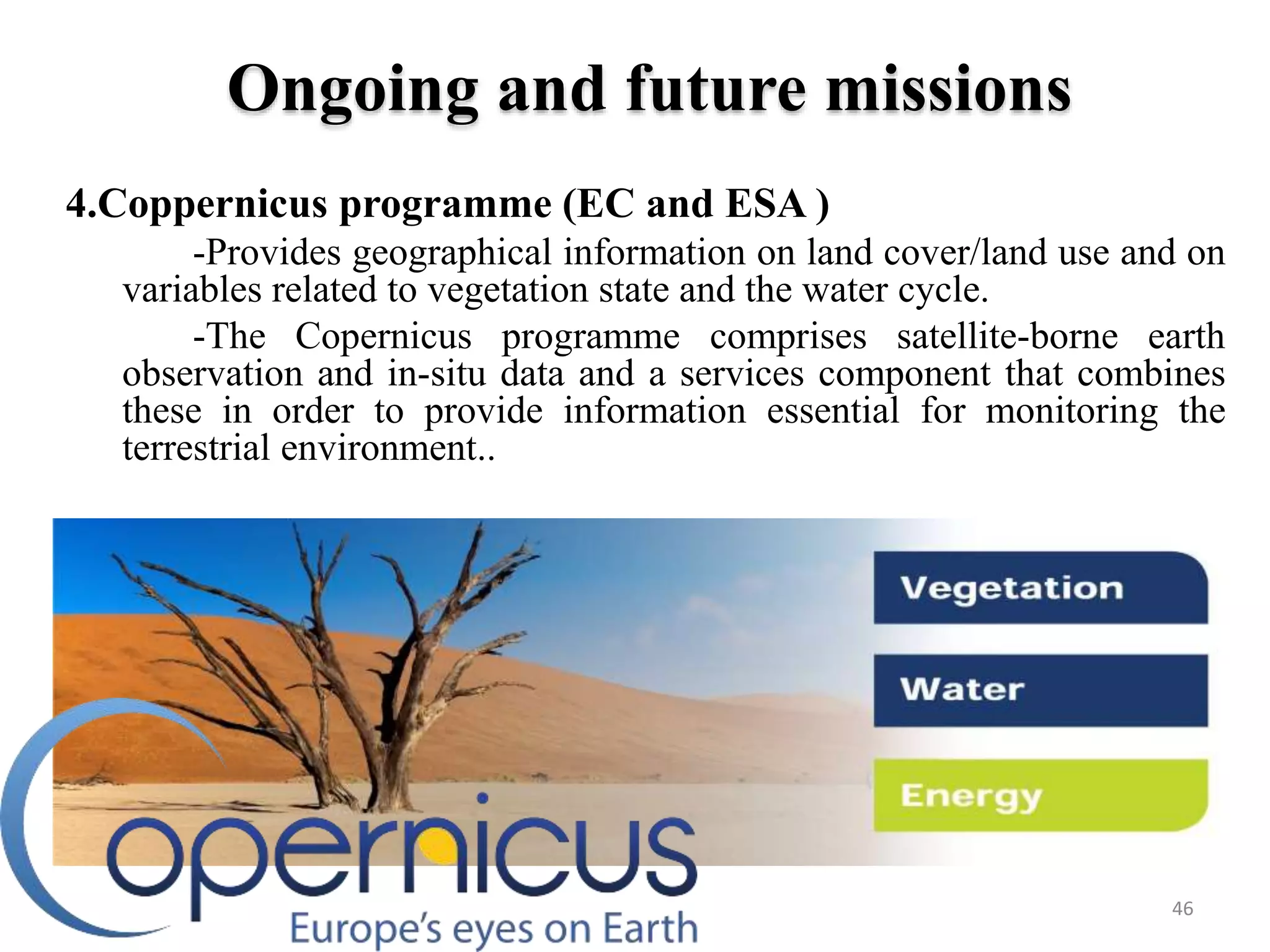
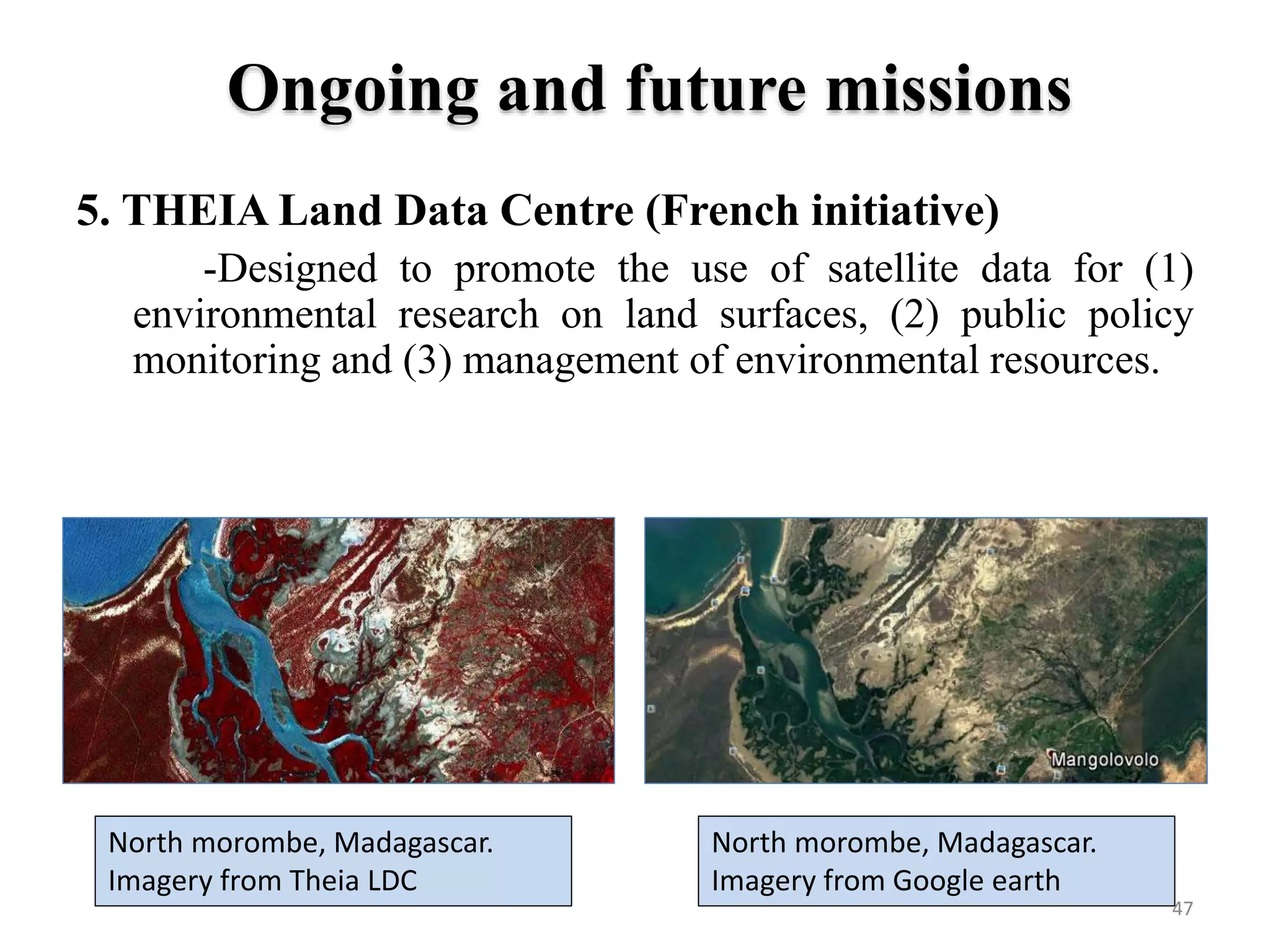
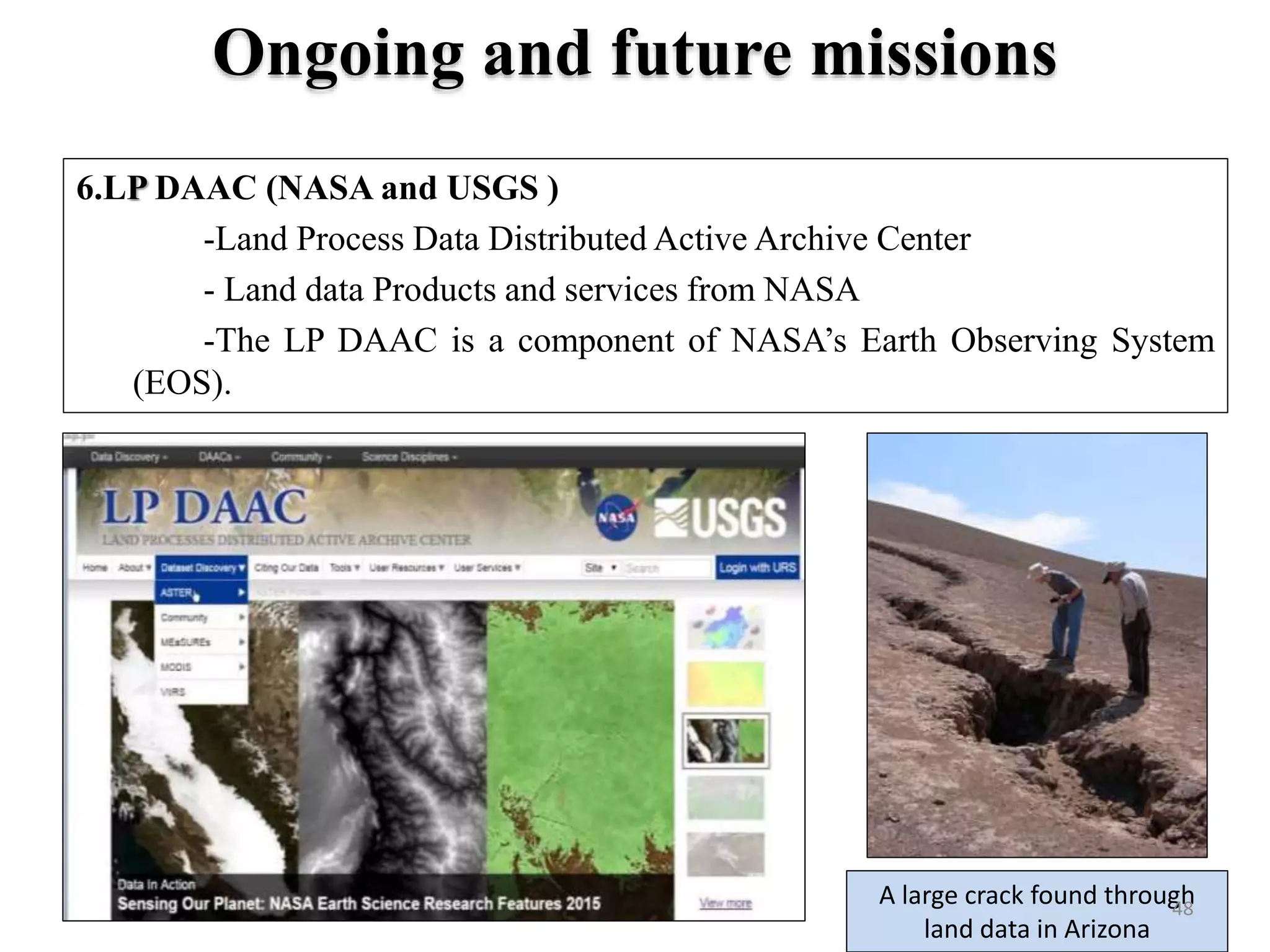
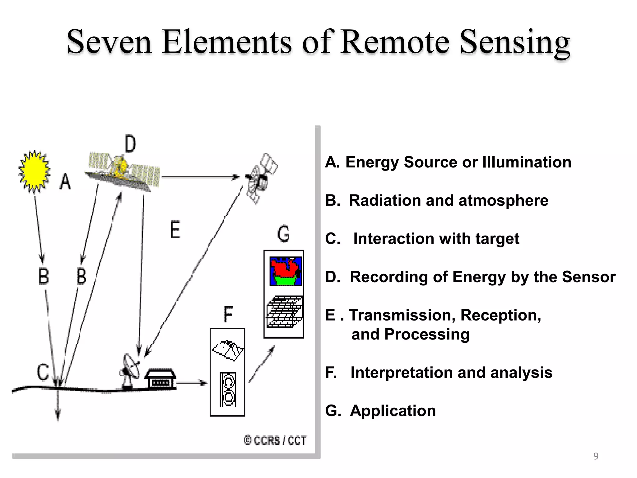
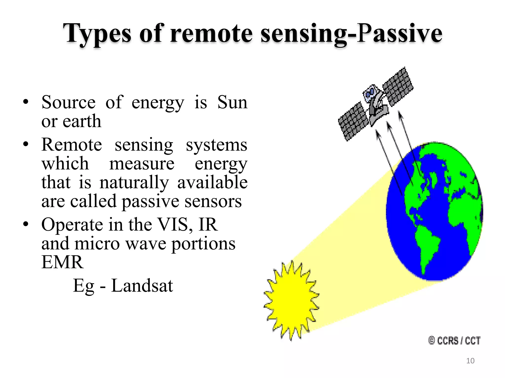
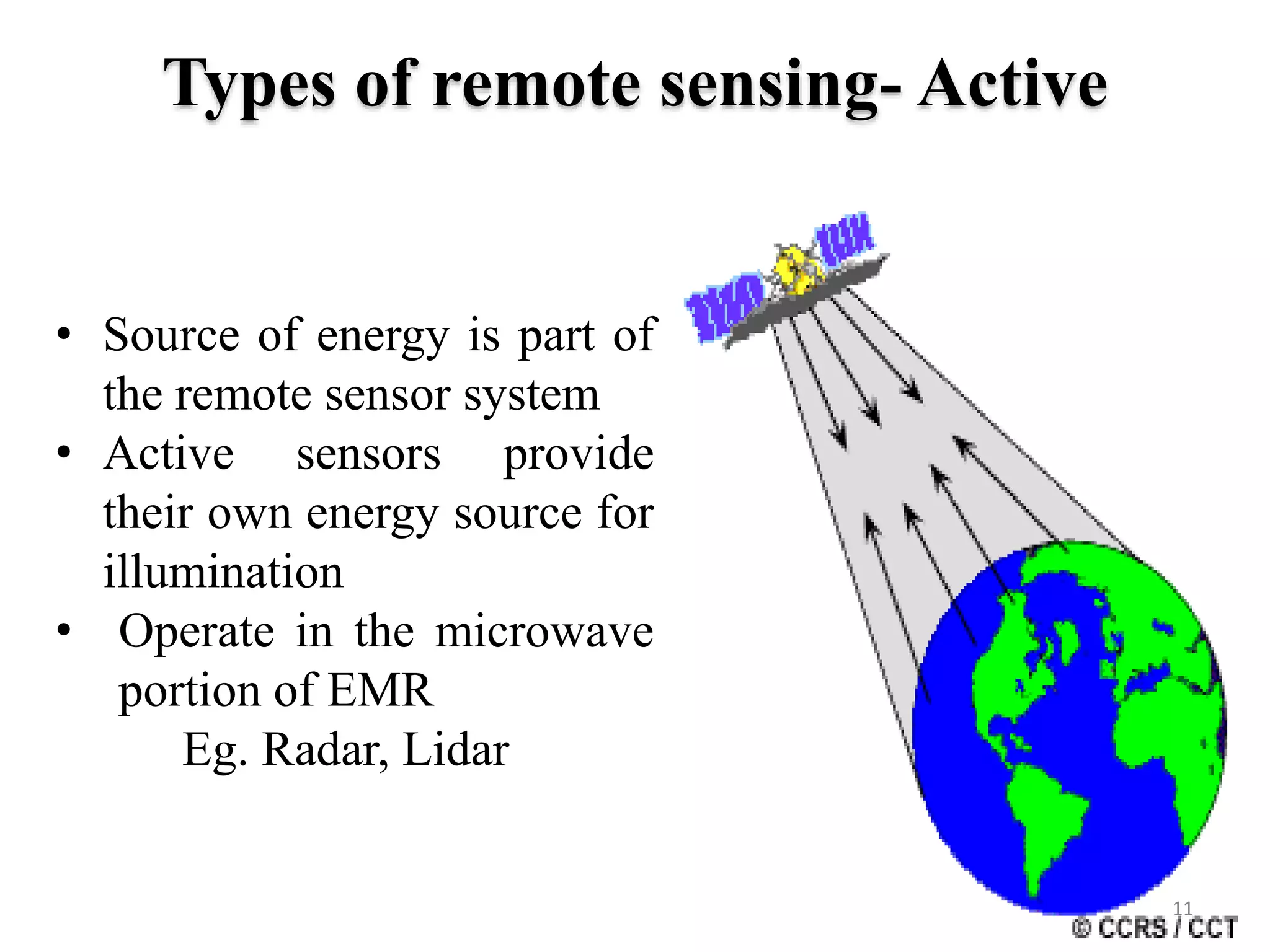
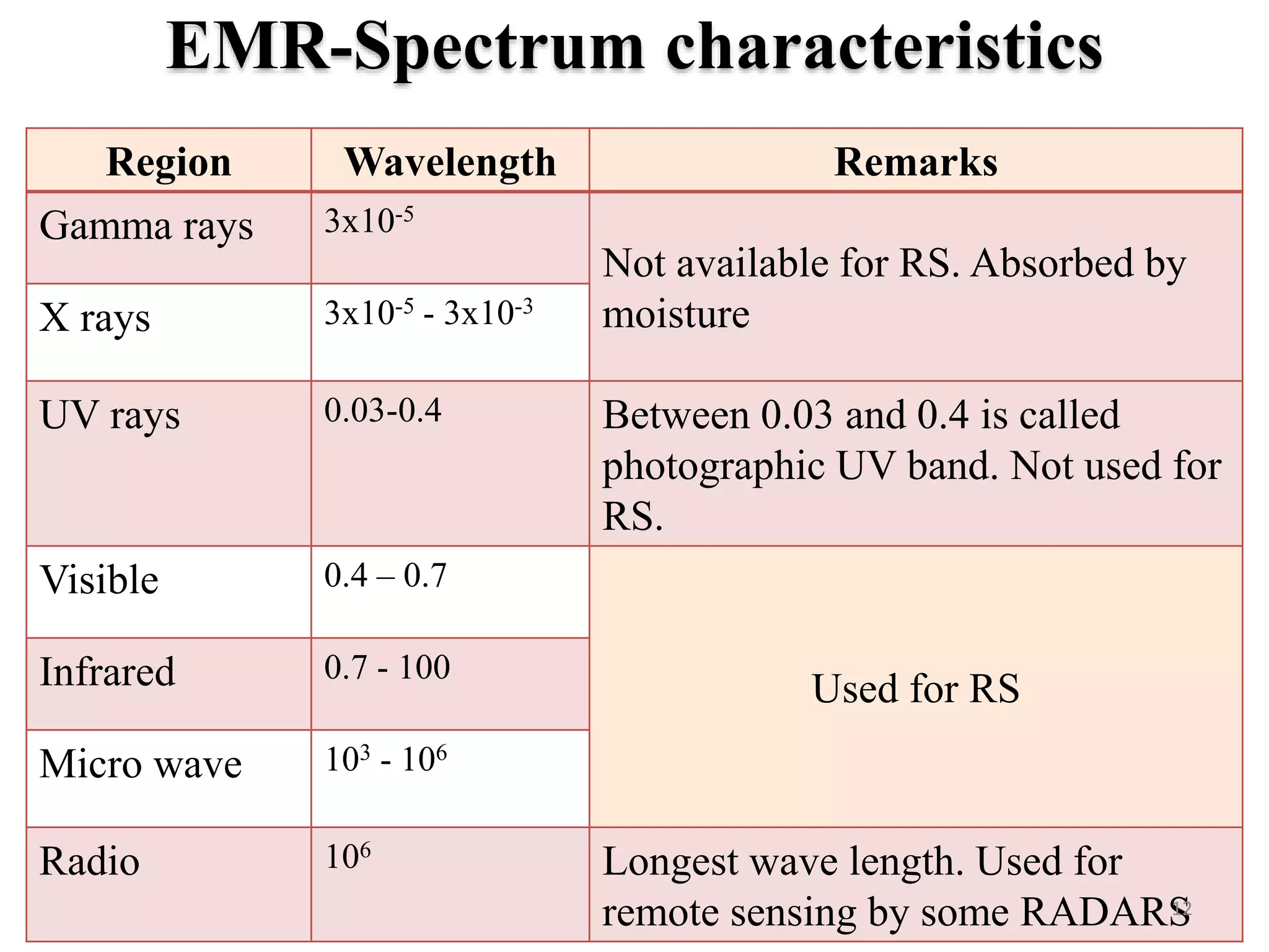
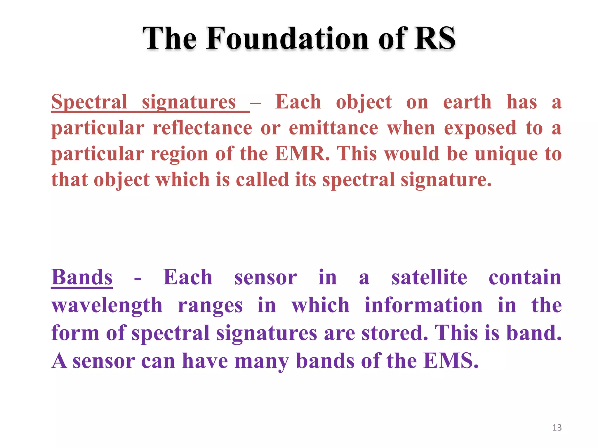
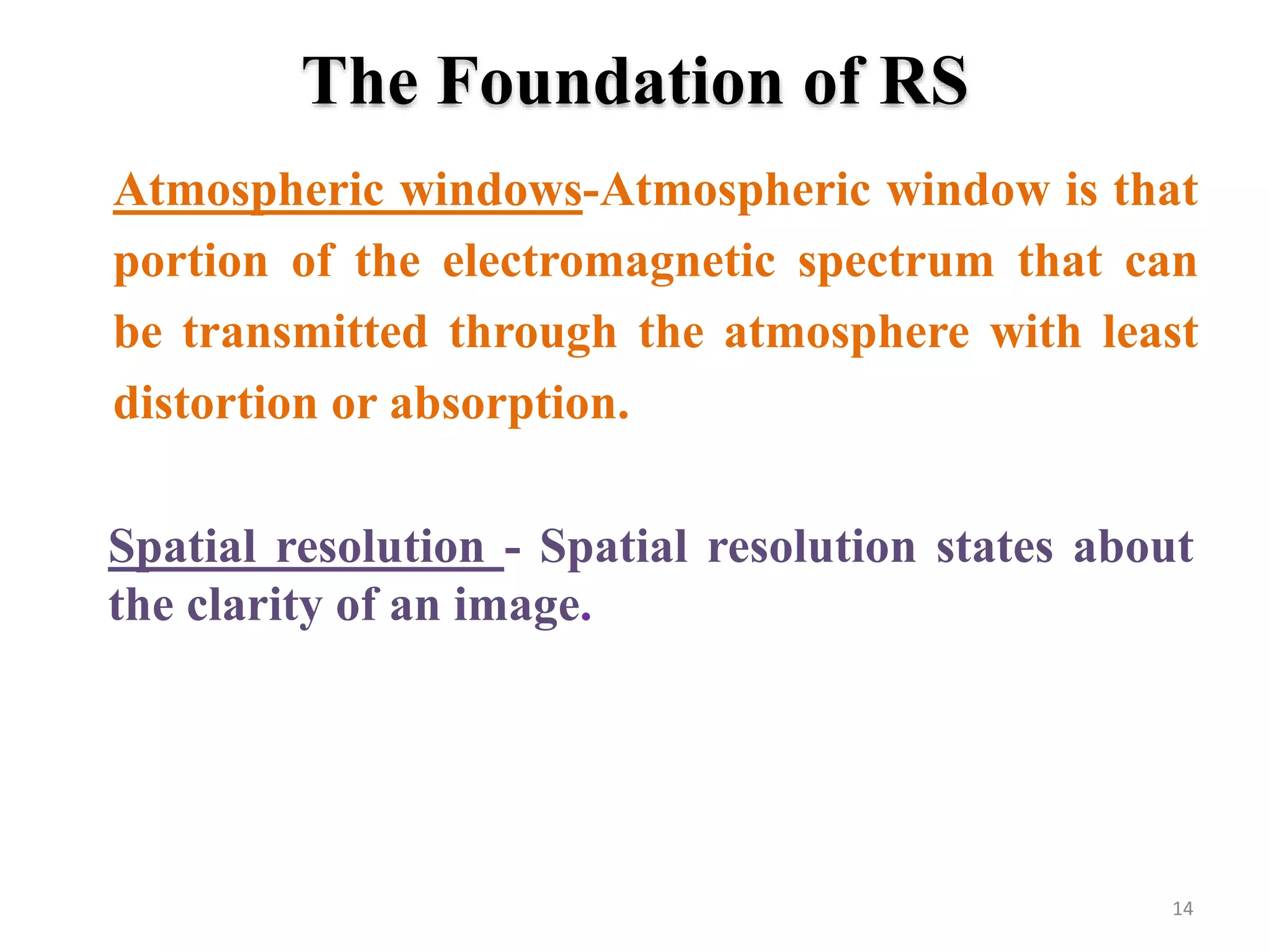
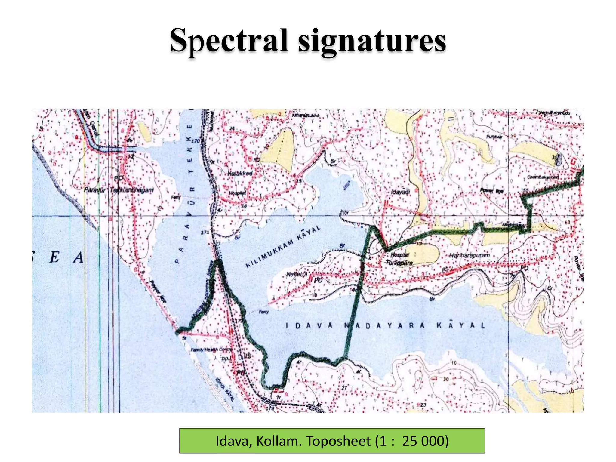
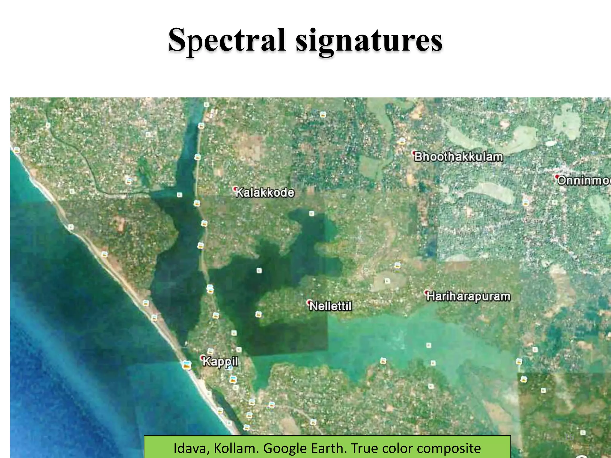
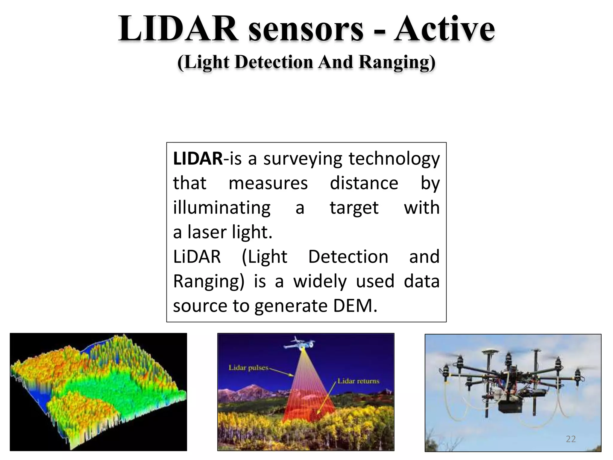
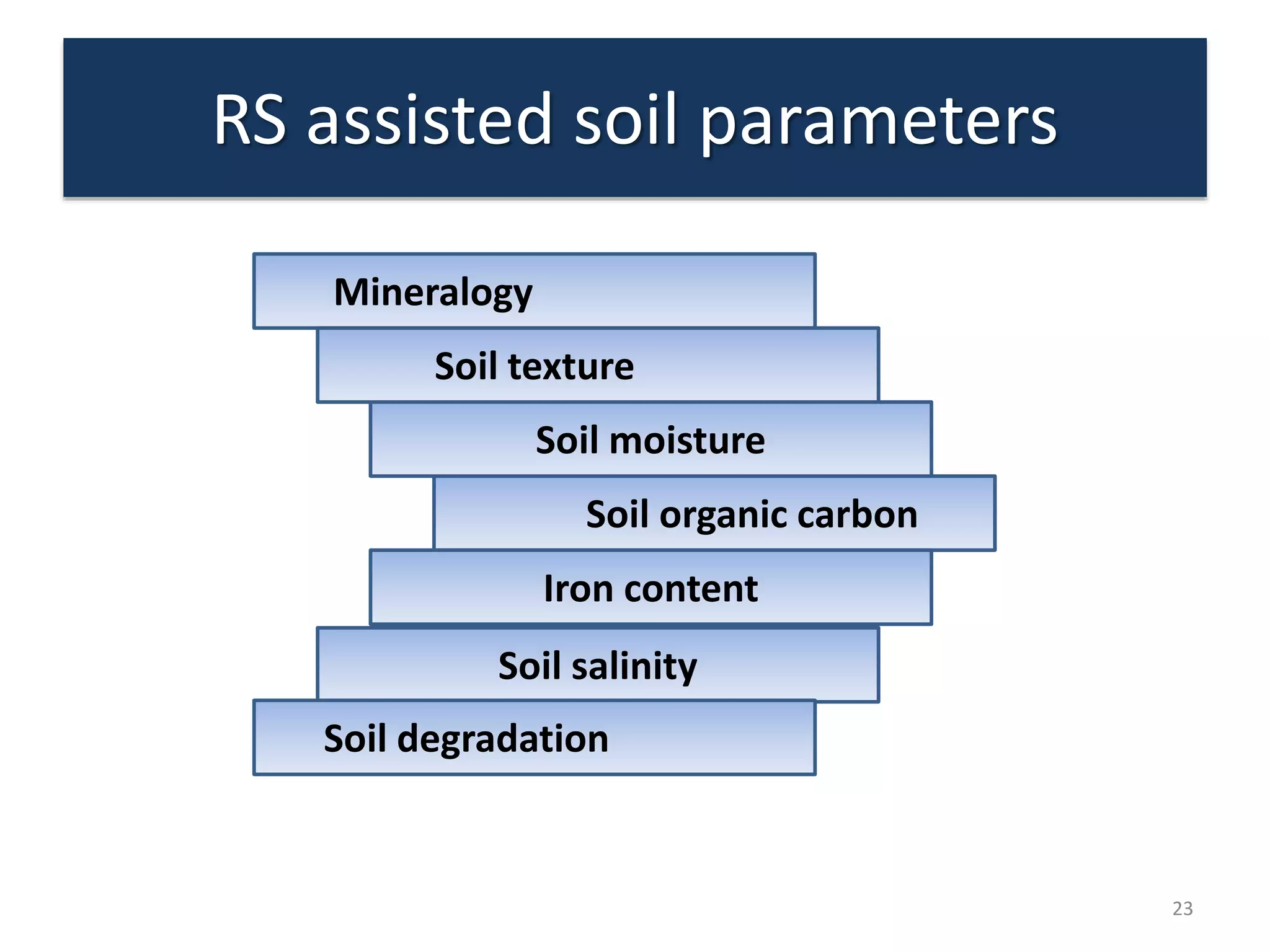
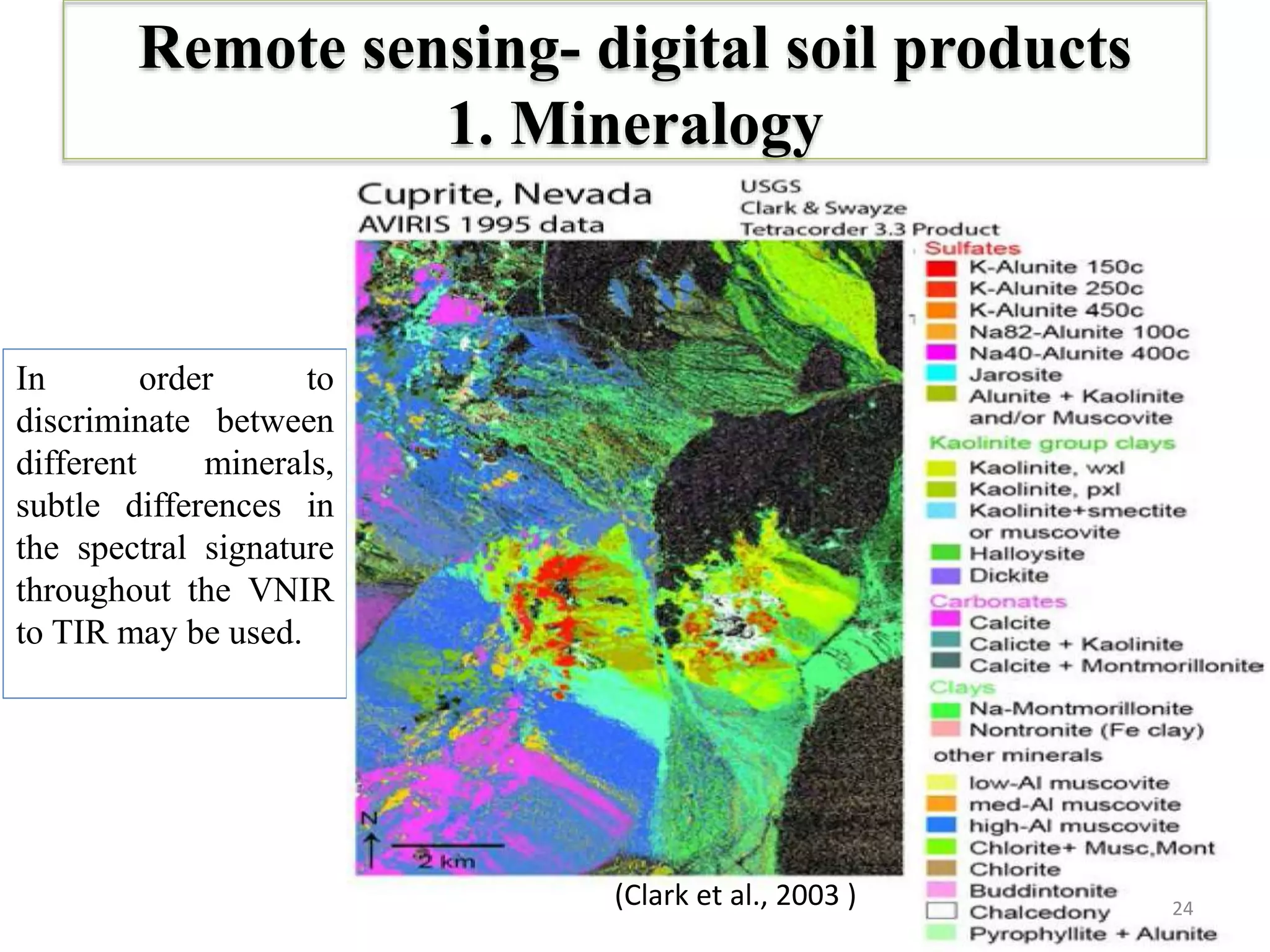
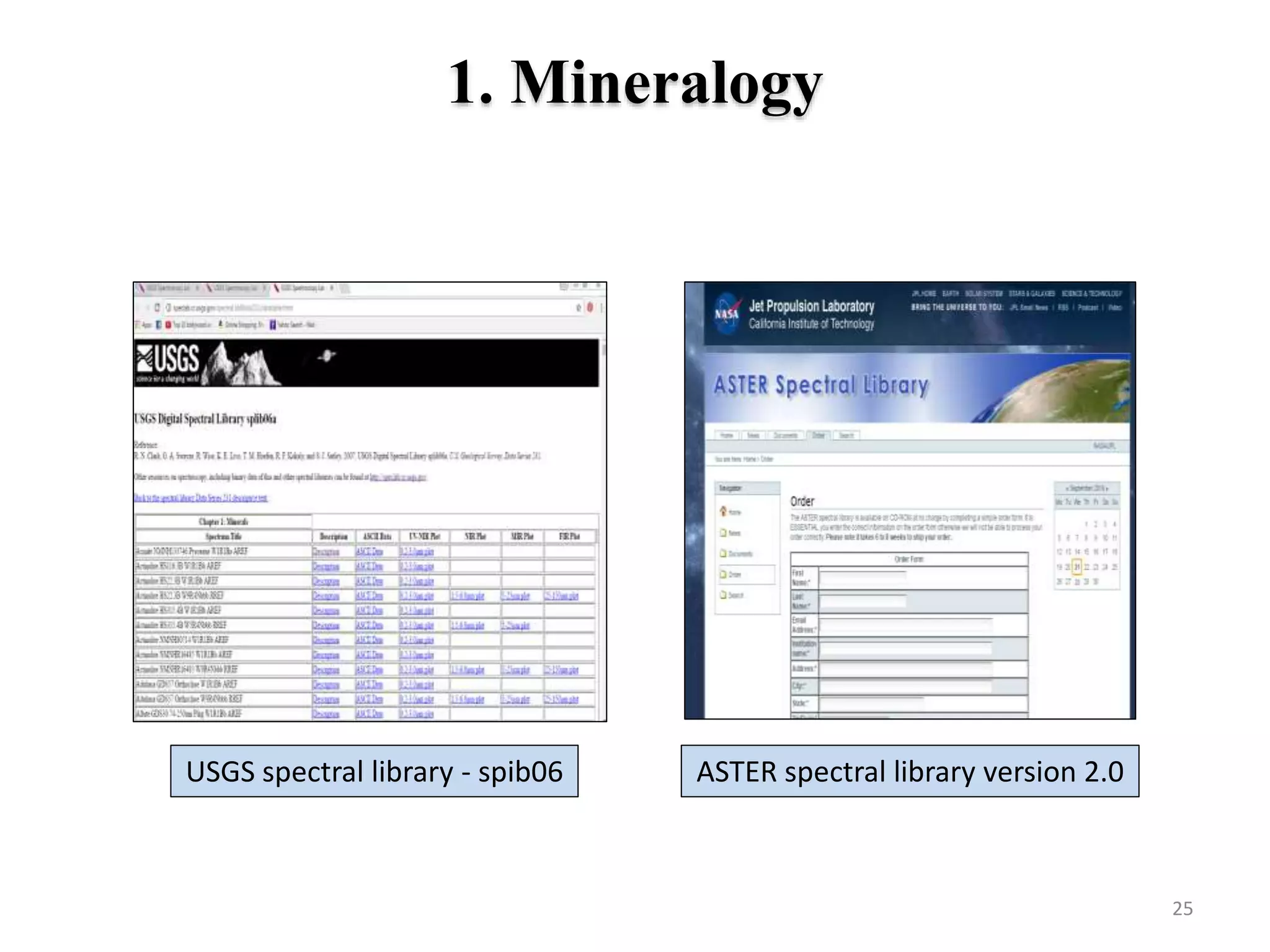
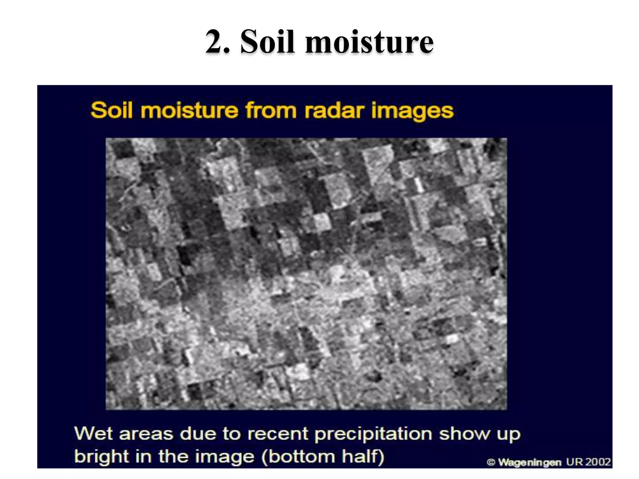
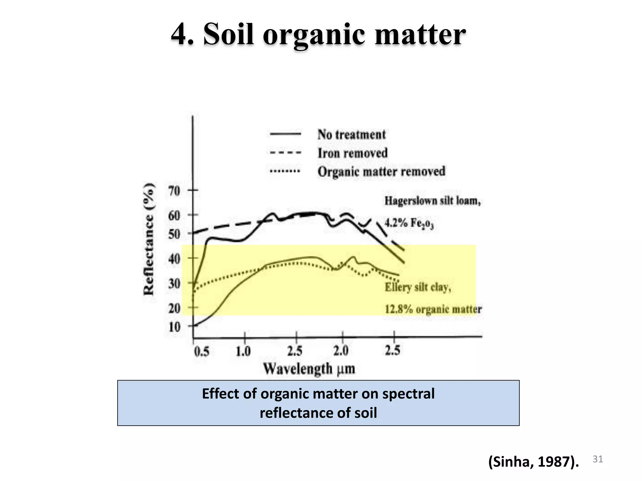
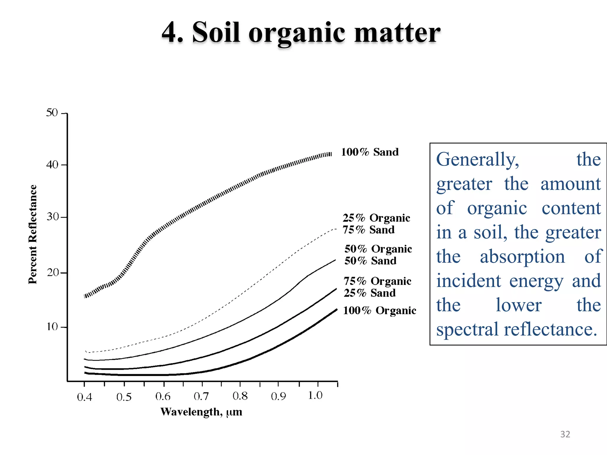
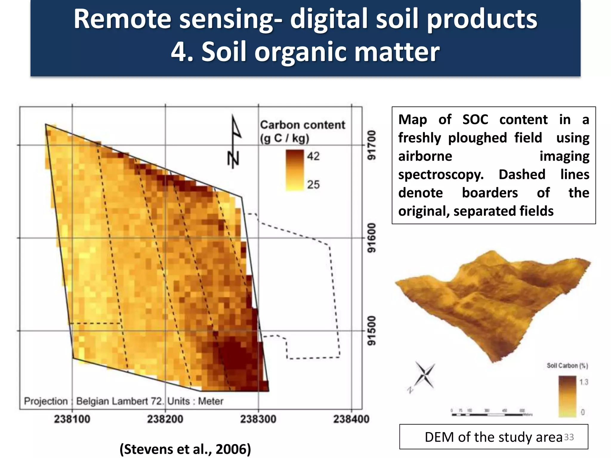
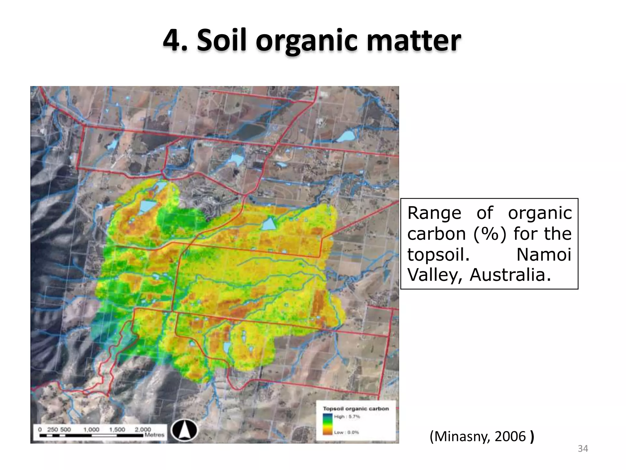
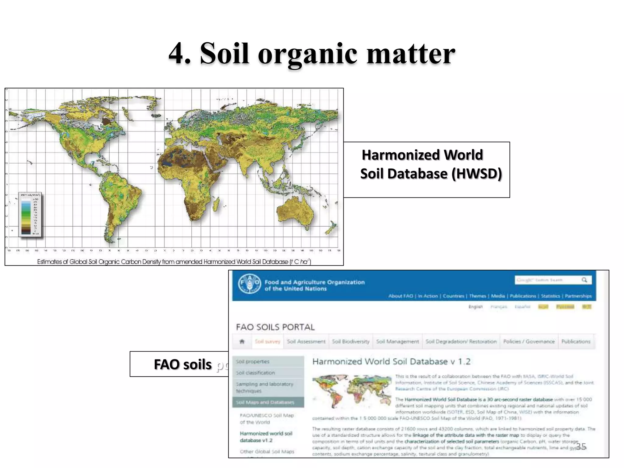
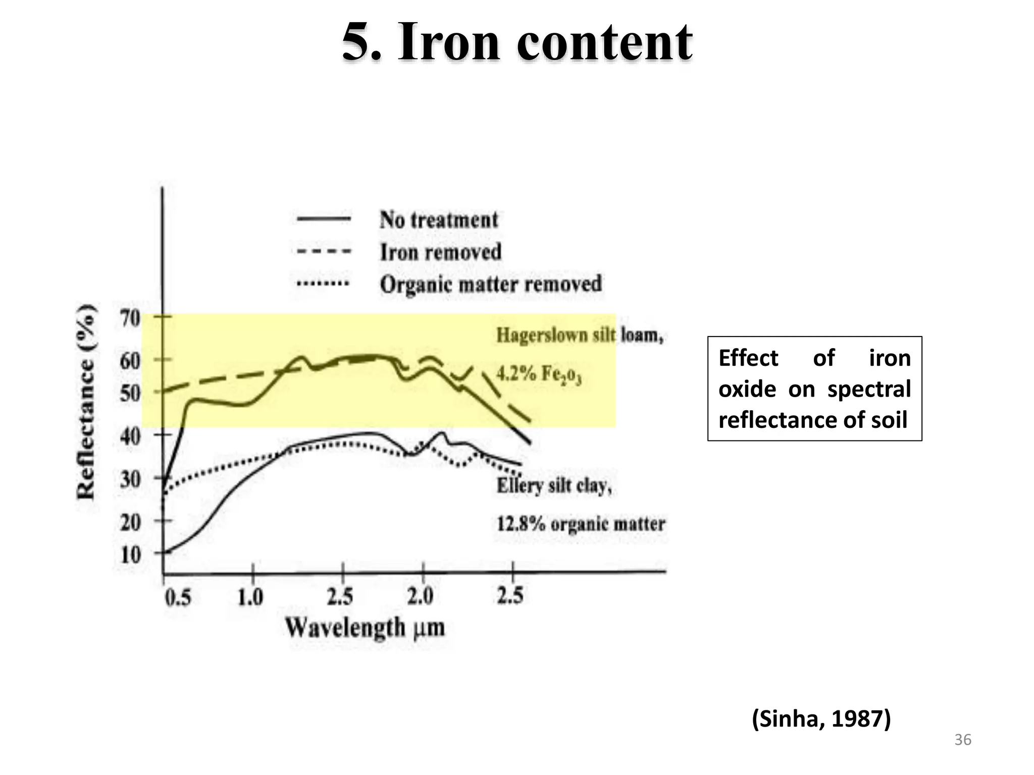
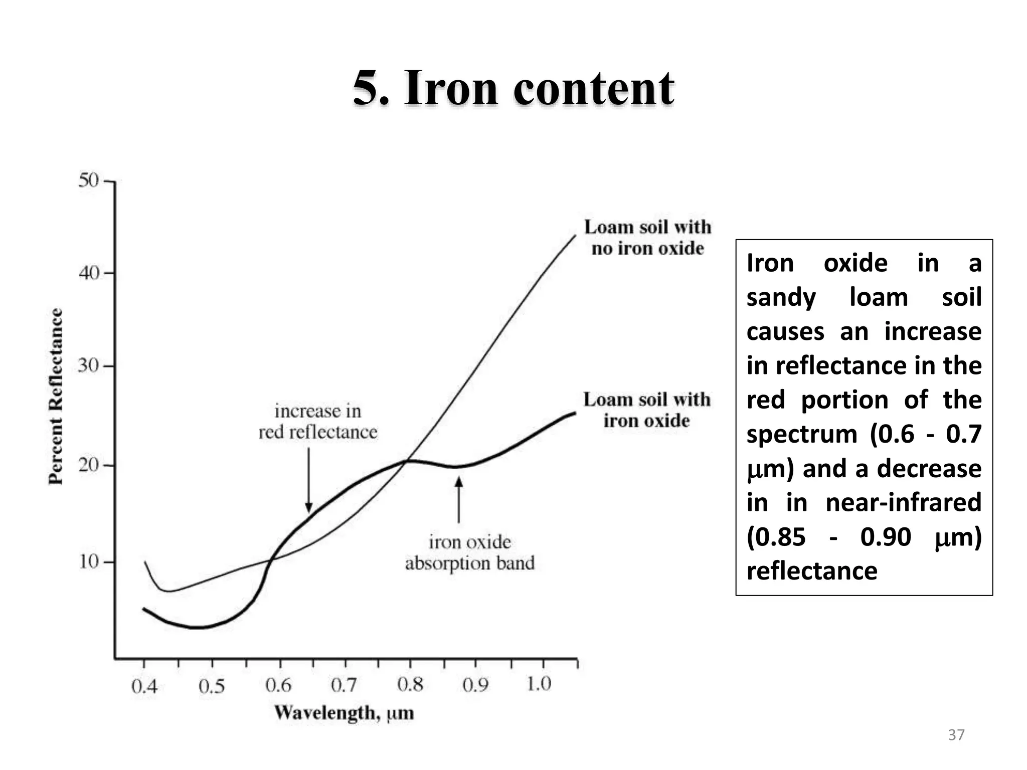
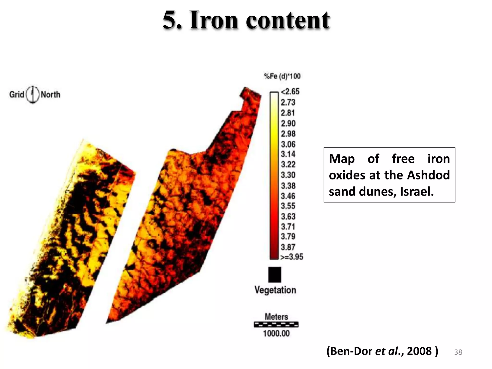
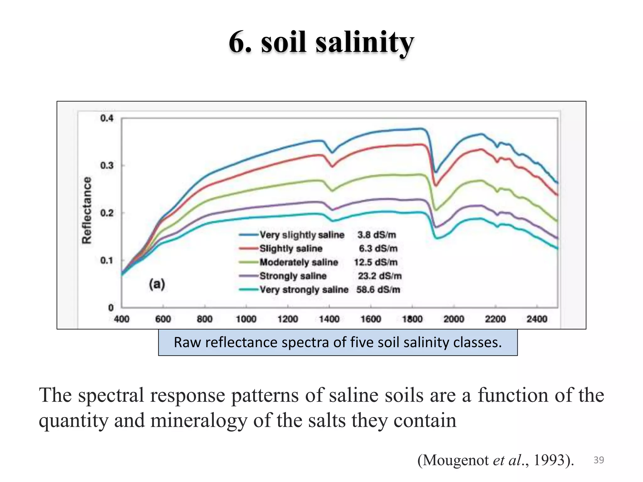
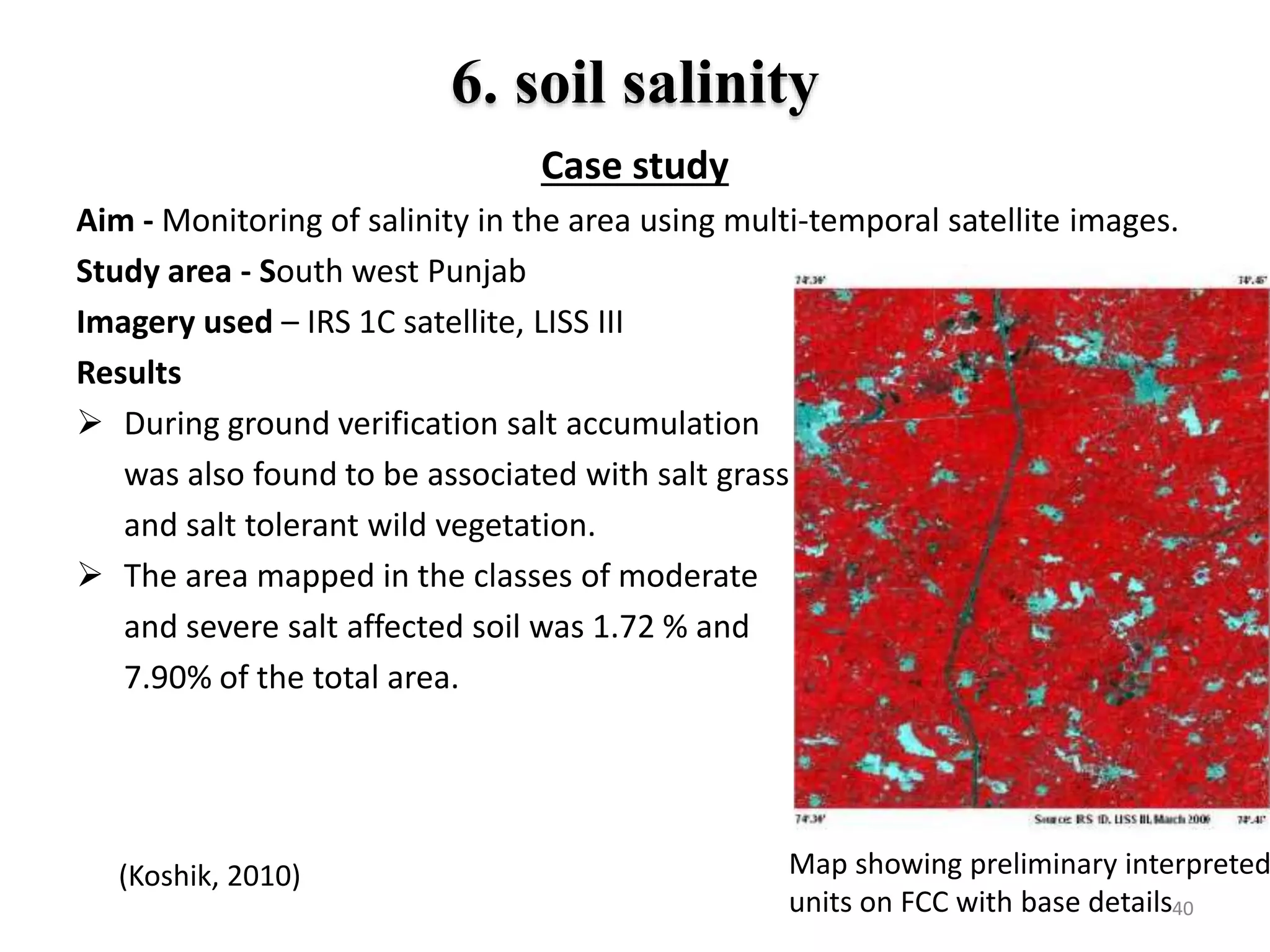
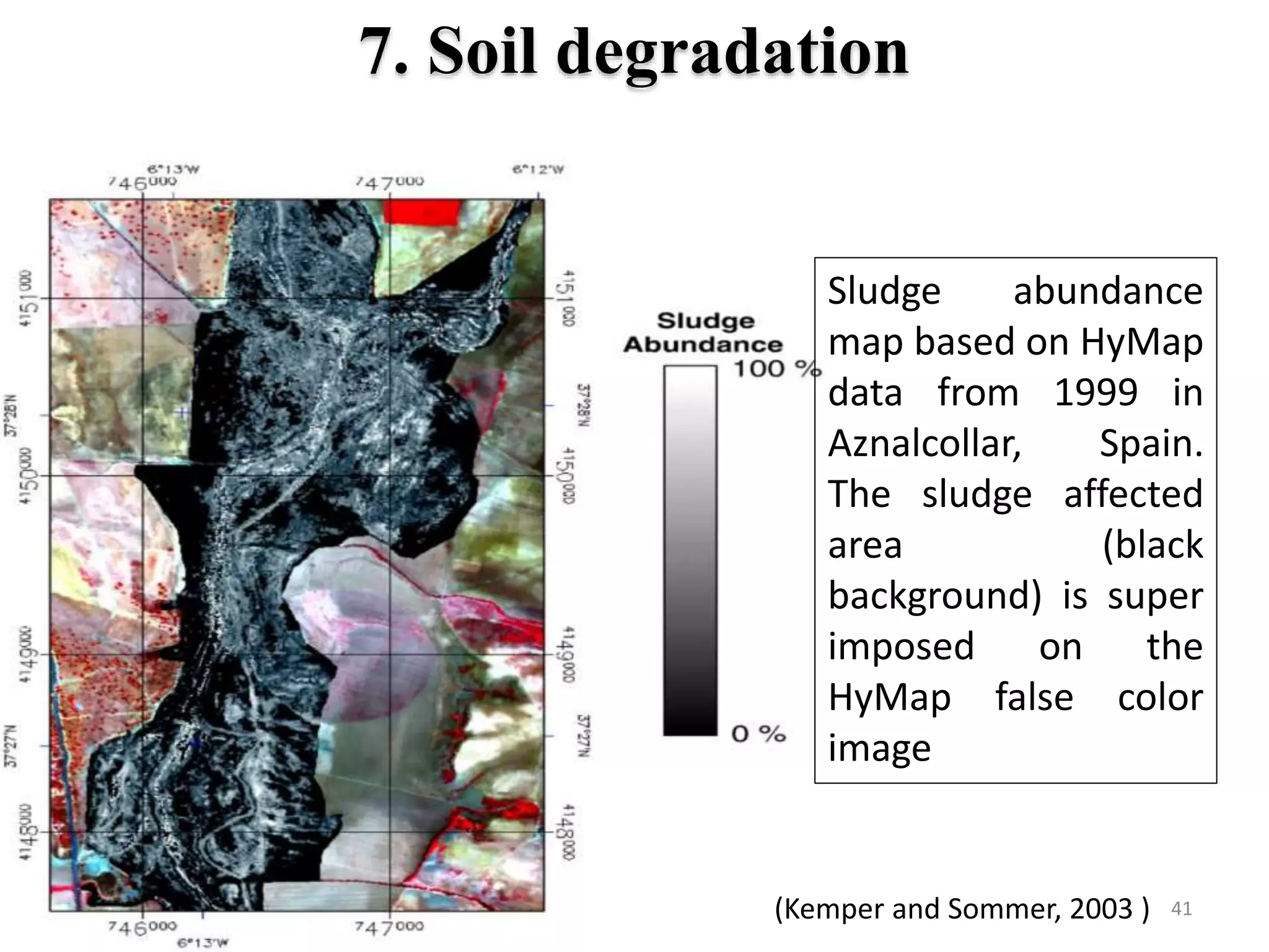
The document discusses the role of remote sensing in land evaluation and soil mapping, emphasizing techniques like digital soil mapping and the use of spectral signatures to identify various soil attributes. It details different remote sensing technologies, such as passive and active sensors, and their applications in monitoring soil conditions like moisture, salinity, and organic content. Ongoing and future satellite missions are highlighted for their potential in enhancing soil and environmental monitoring globally.


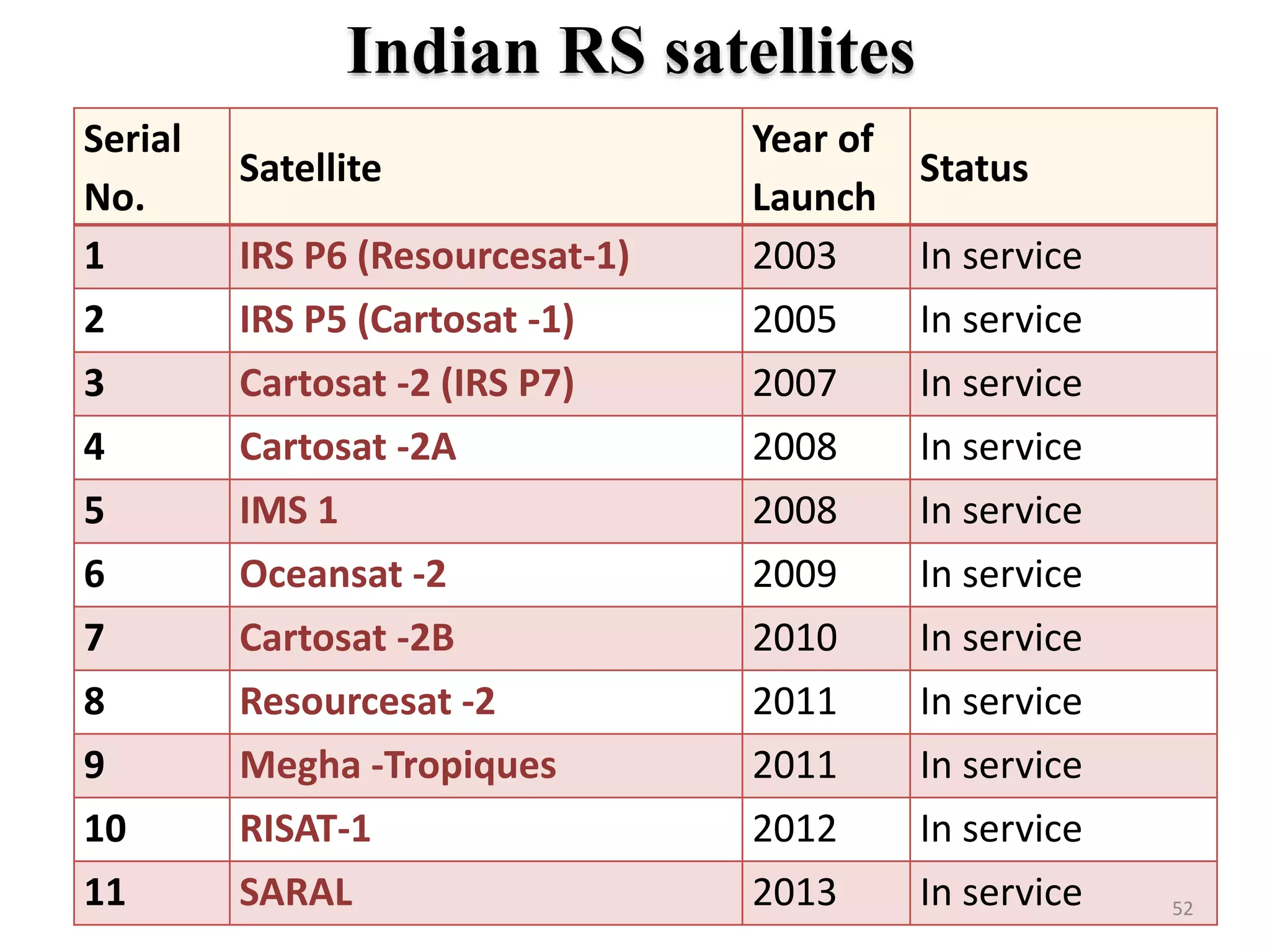
![RS-techs for soil attribute retrieval
Soil attributes RADAR LIDAR Optical Relevant
spectra
regionActive Passive MS HS
Minerology -- -- -- 3 4 VNIR-TIR
Soil texture -- 3 -- 3 3 SWIR-TIR
Iron content -- -- -- 1 3 VNIR
SOC -- -- -- 1 5 VIS-SWIR
Soil moisture 4 4 -- 3 2 MW
Salinity -- -- -- 2 3 VIS-FIR
Carbonates -- -- -- 2 2 VIS
Vegetation patterns -- -- -- 5 5 NIR
Land cover -- 2 -- 4 5 VIS-NIR
Numbers (1–5) indicate the feasibility to determine attributes with RS. The feasibility represents
the weighted average of scores based on studies reported, dataset quality, obtained result and
applicability to field surveys. 1=low, 2=low-medium, 3=medium, 4=medium-high and 5=high
[Mulder et al., 2011].
42](https://image.slidesharecdn.com/myppt-copy7-161126165114/75/Soil-separability-through-remote-sensing-for-land-evaluation-42-2048.jpg)
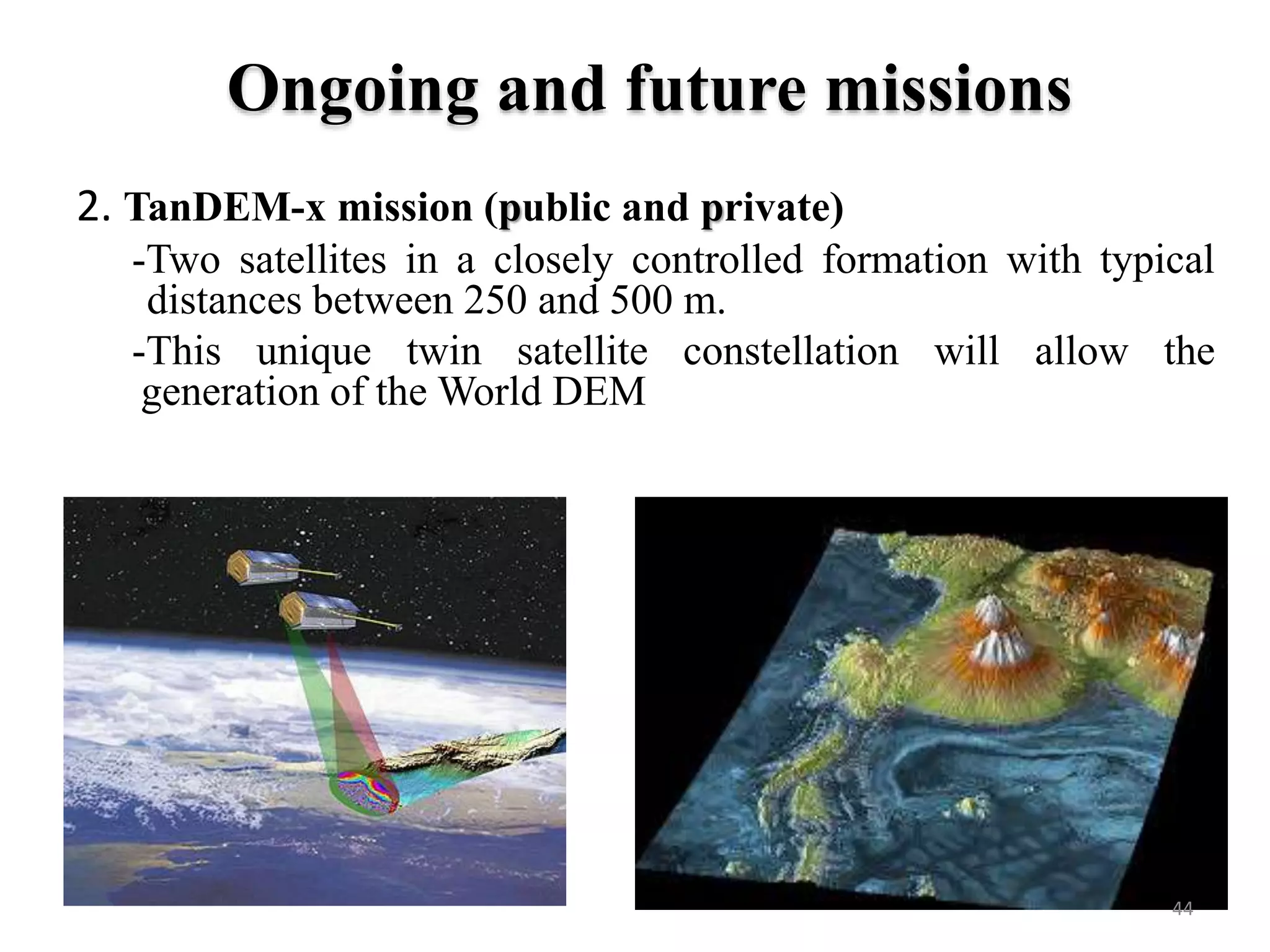
![Ongoing and future missions
1. Global Soil Map ( A consortium)
Soil depth, water storage, texture, fertility and carbon at fine
spatial resolution (~100 m).
Interpretation and functionality options for a range of global
issues such as food production, climate change, and environmental.
Freely available, web-accessible
[Arrouays et al., 2014].
43](https://image.slidesharecdn.com/myppt-copy7-161126165114/75/Soil-separability-through-remote-sensing-for-land-evaluation-43-2048.jpg)