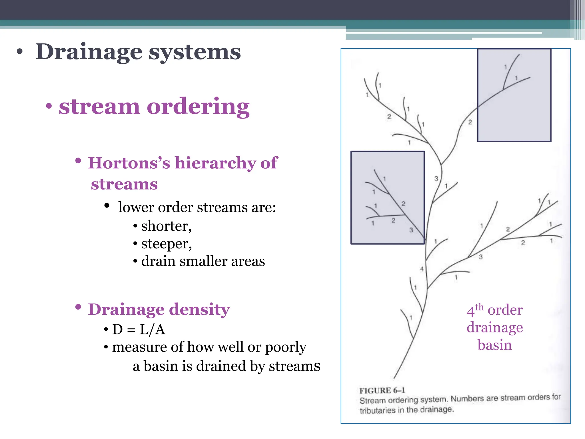
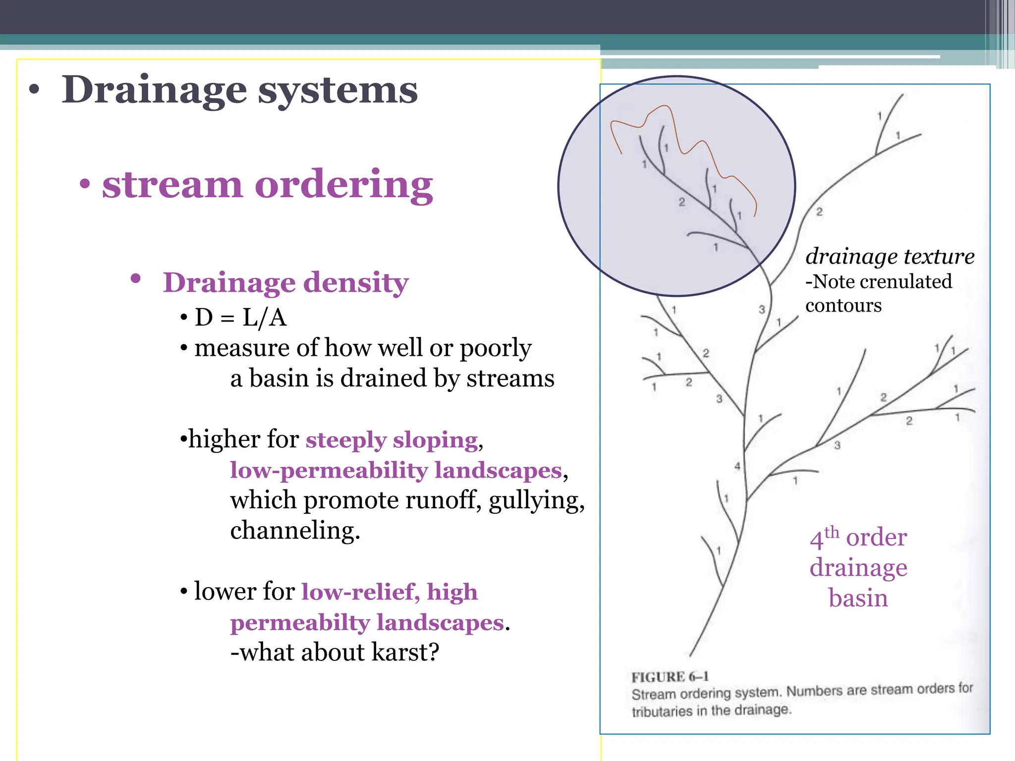
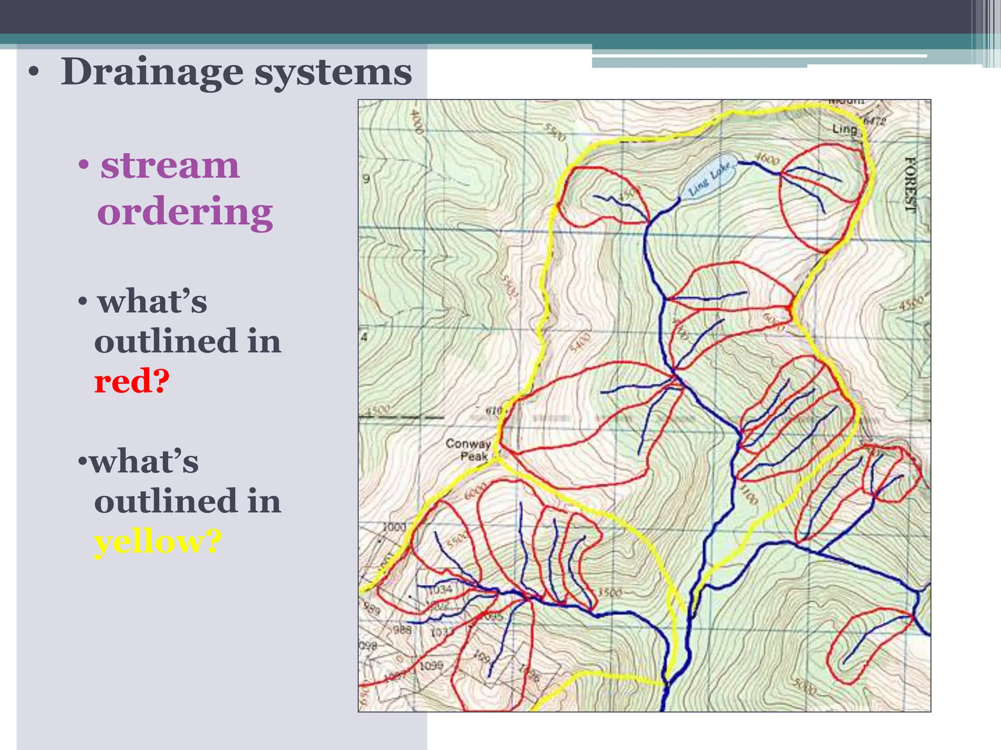
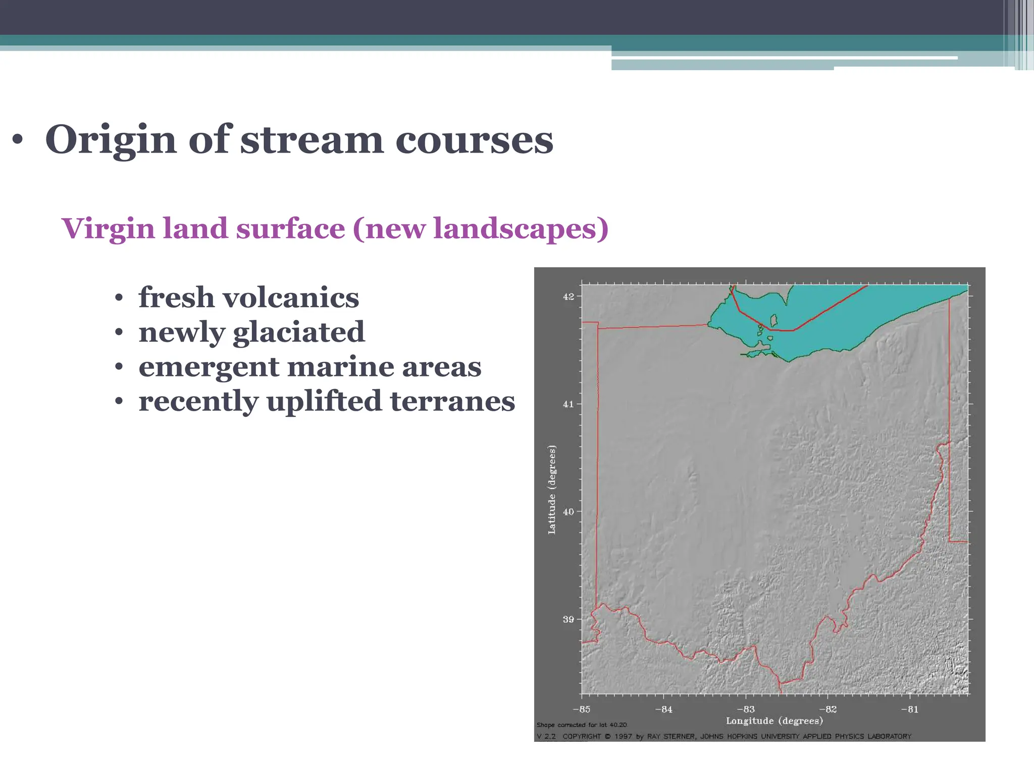
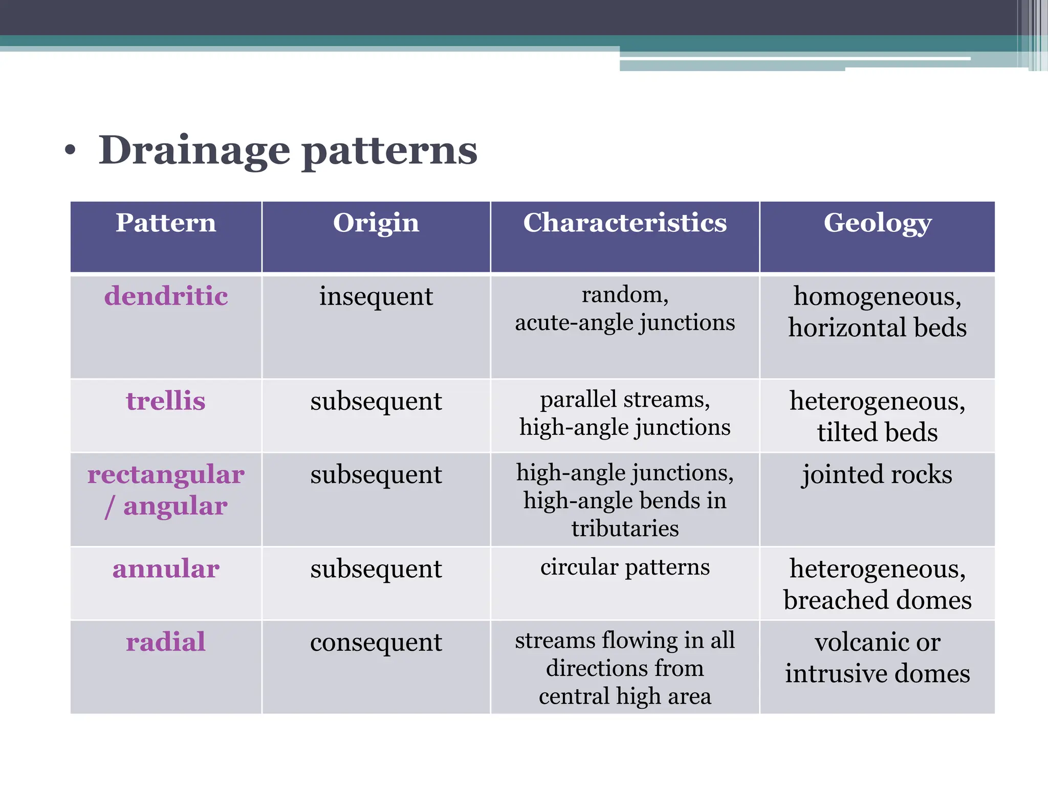
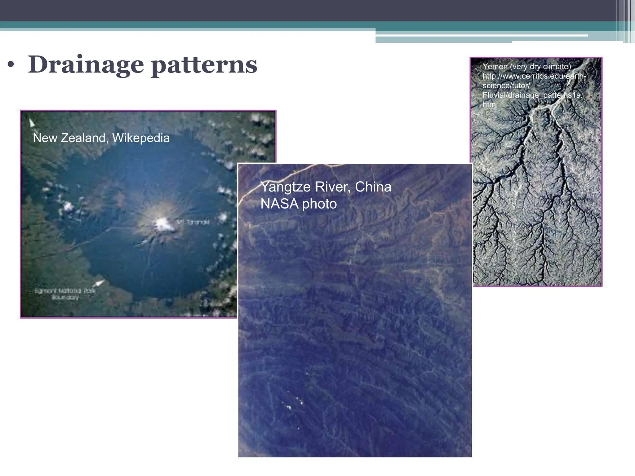
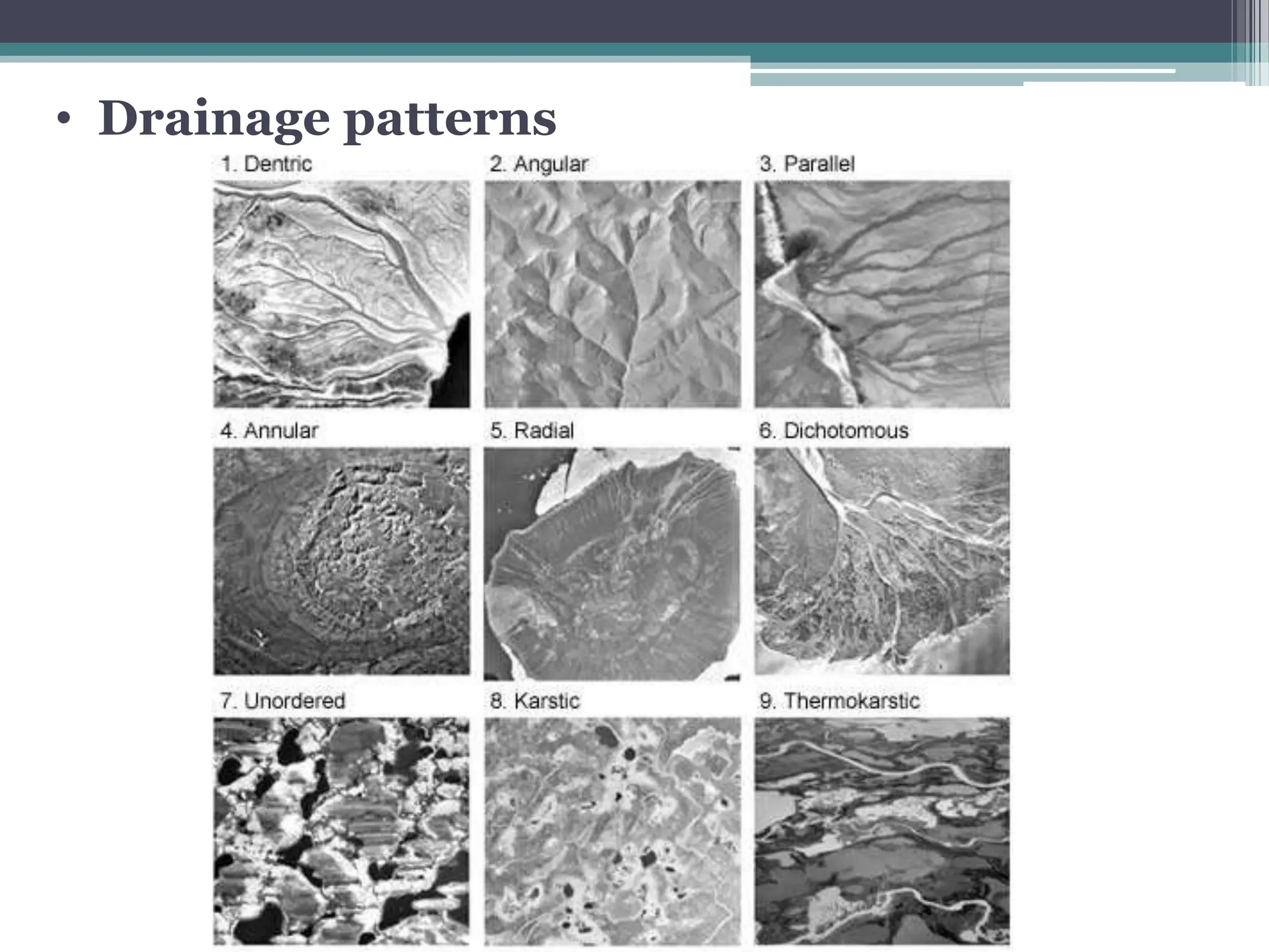
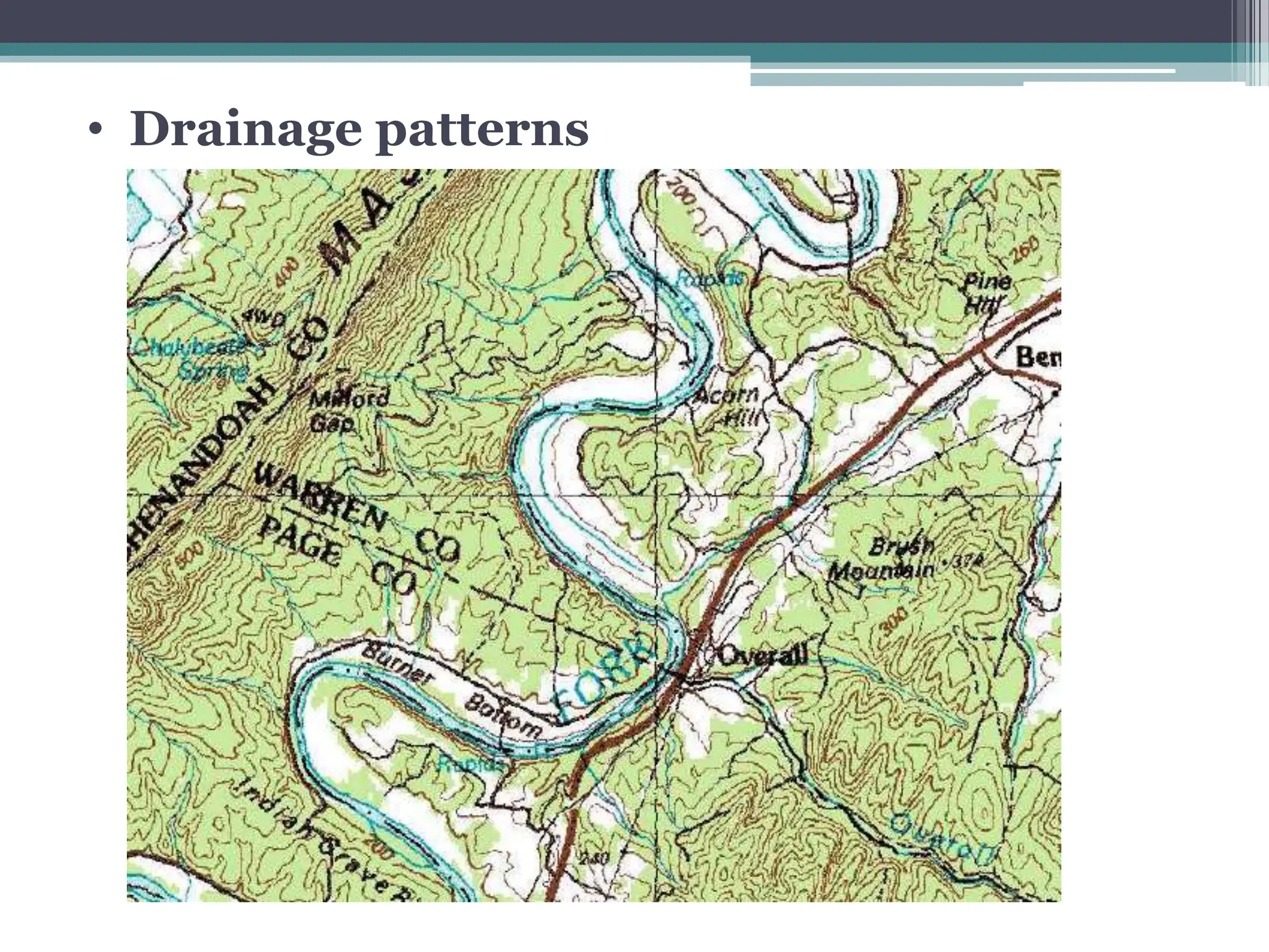
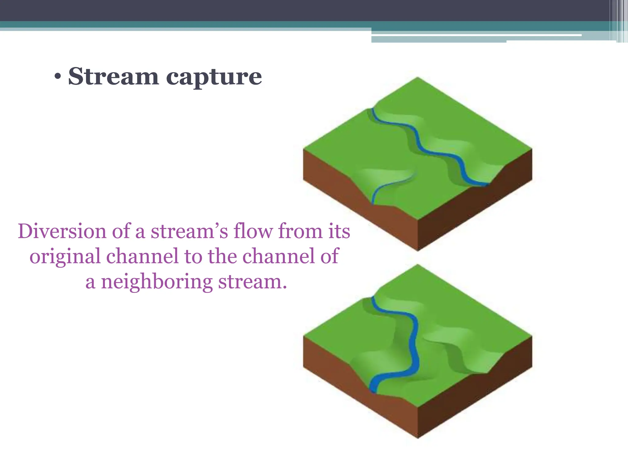
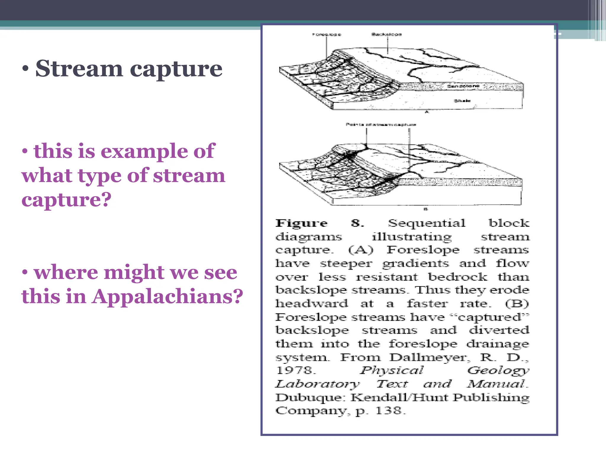
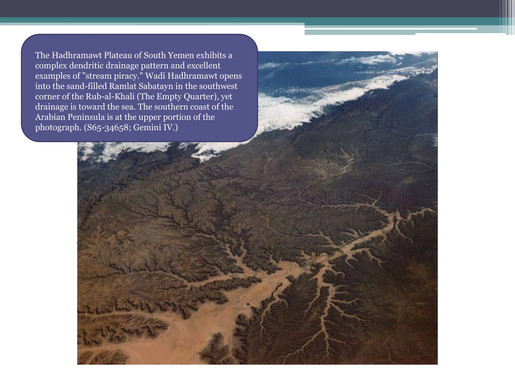
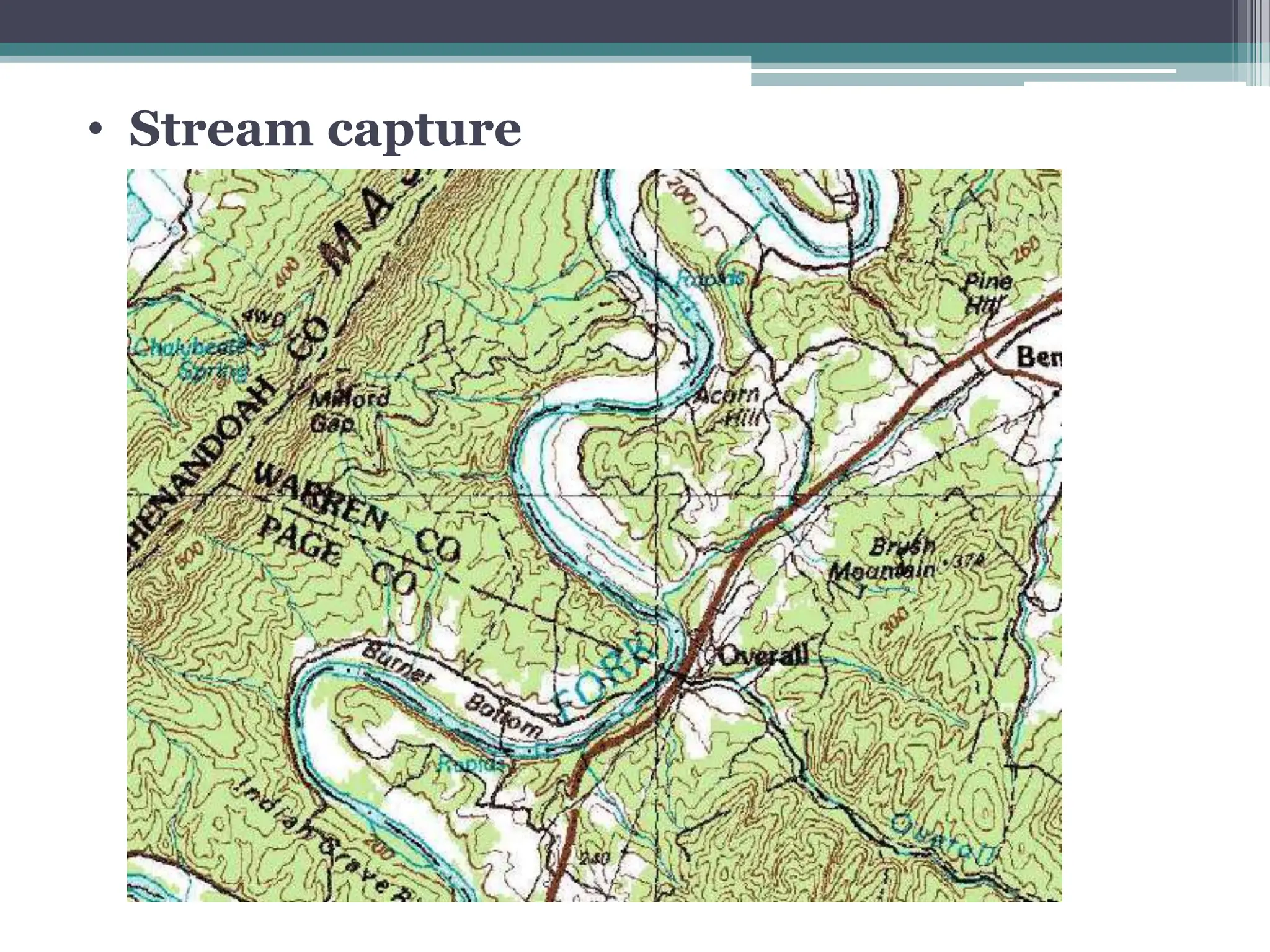
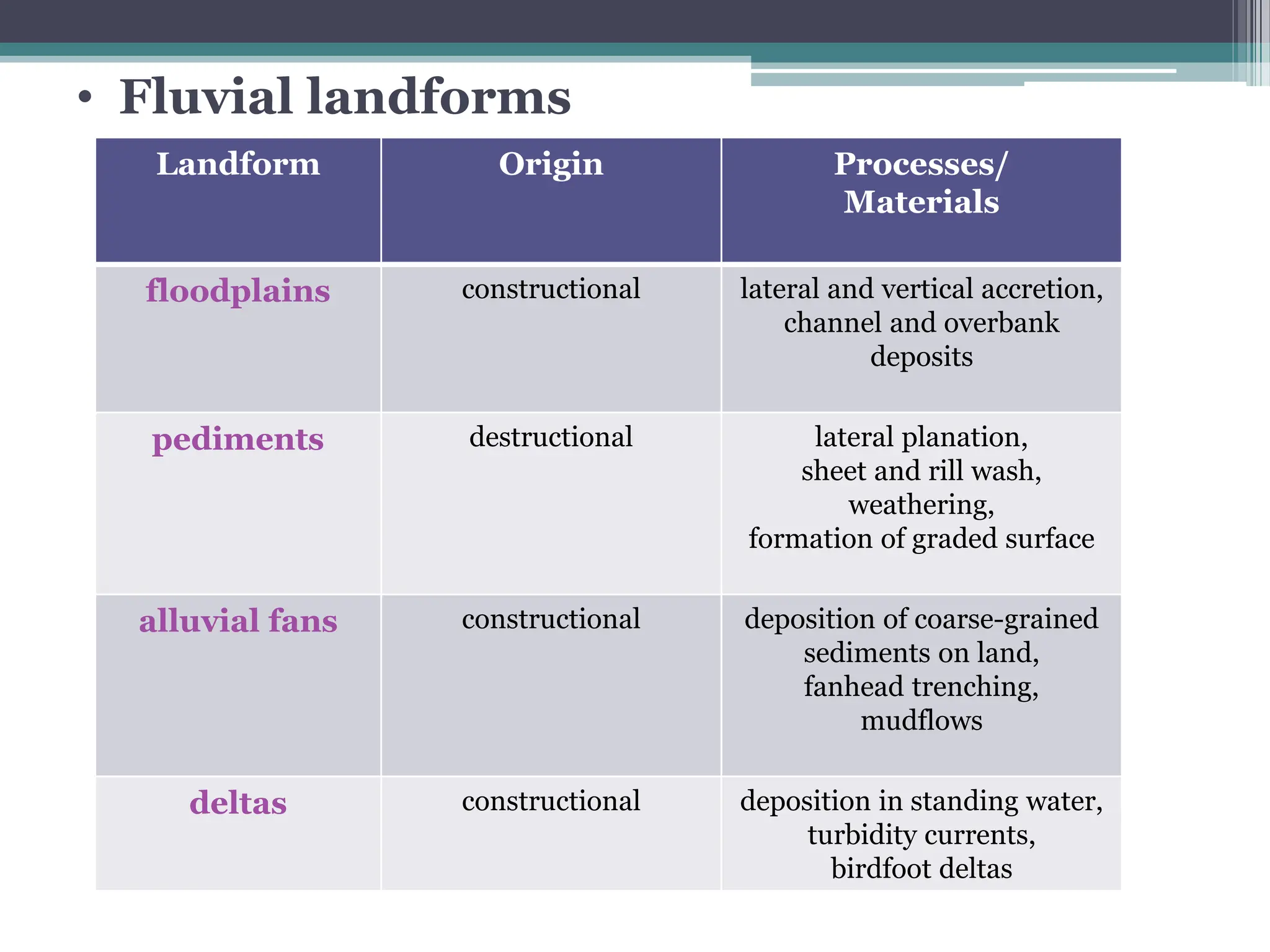
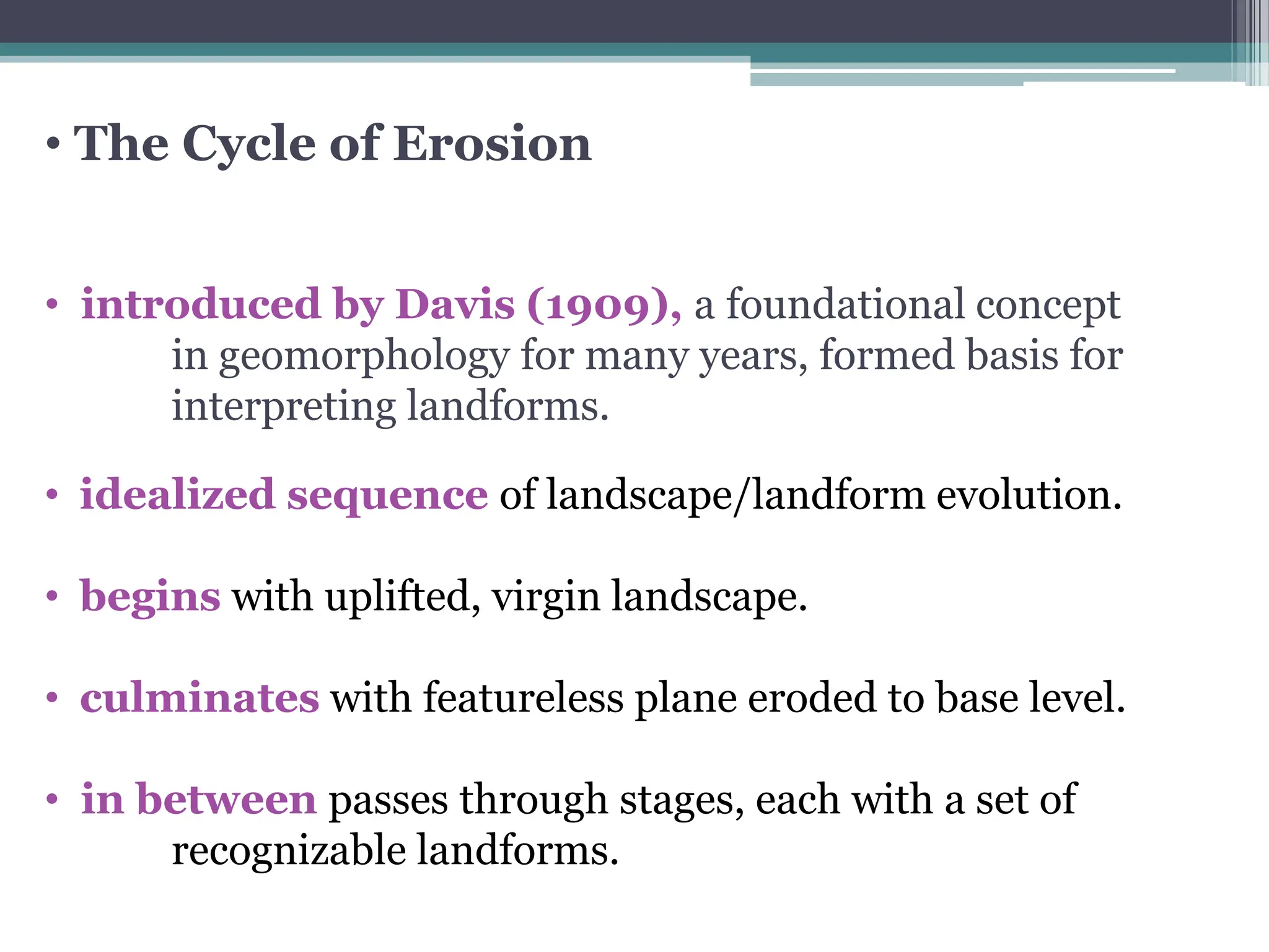
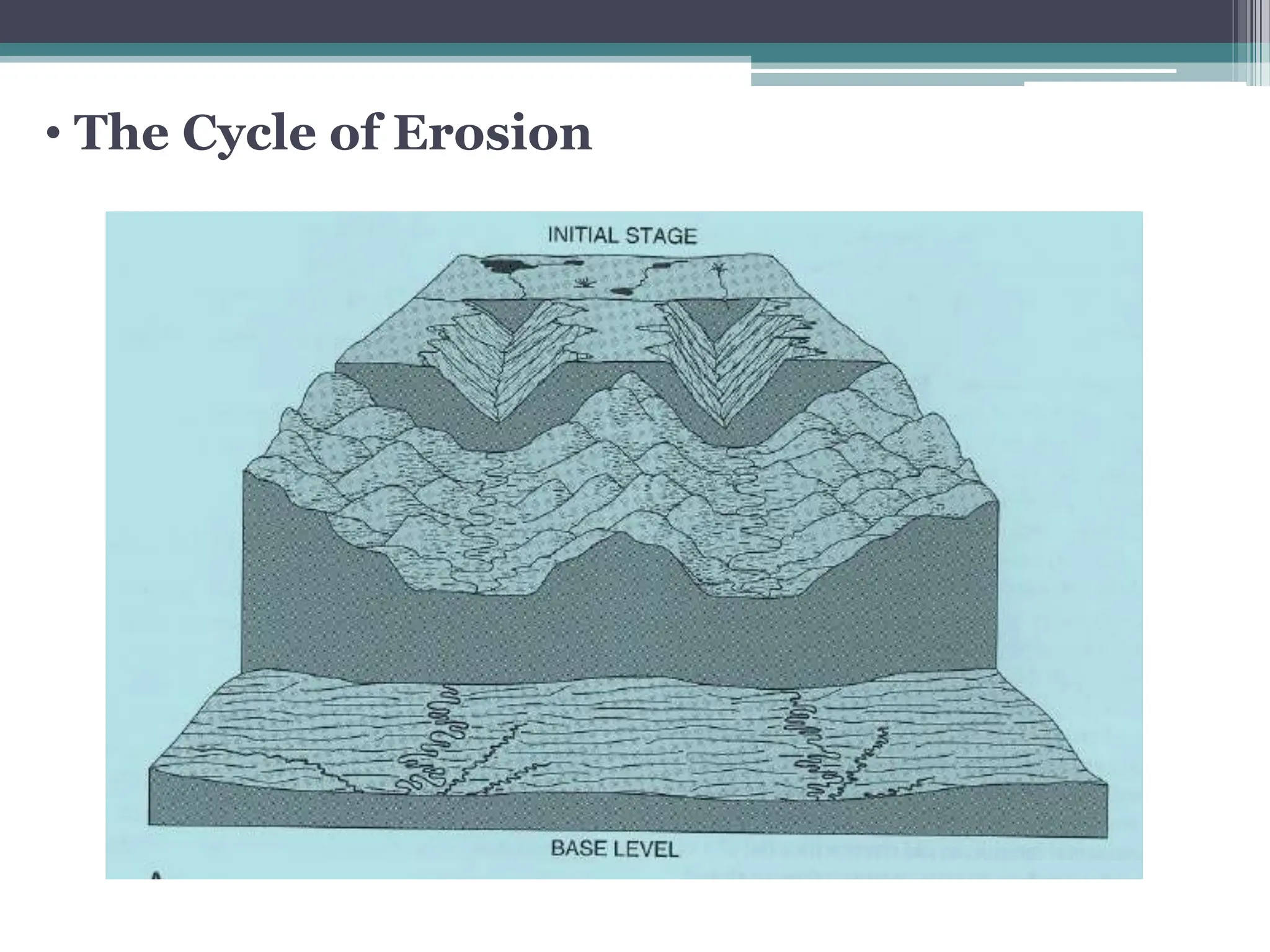
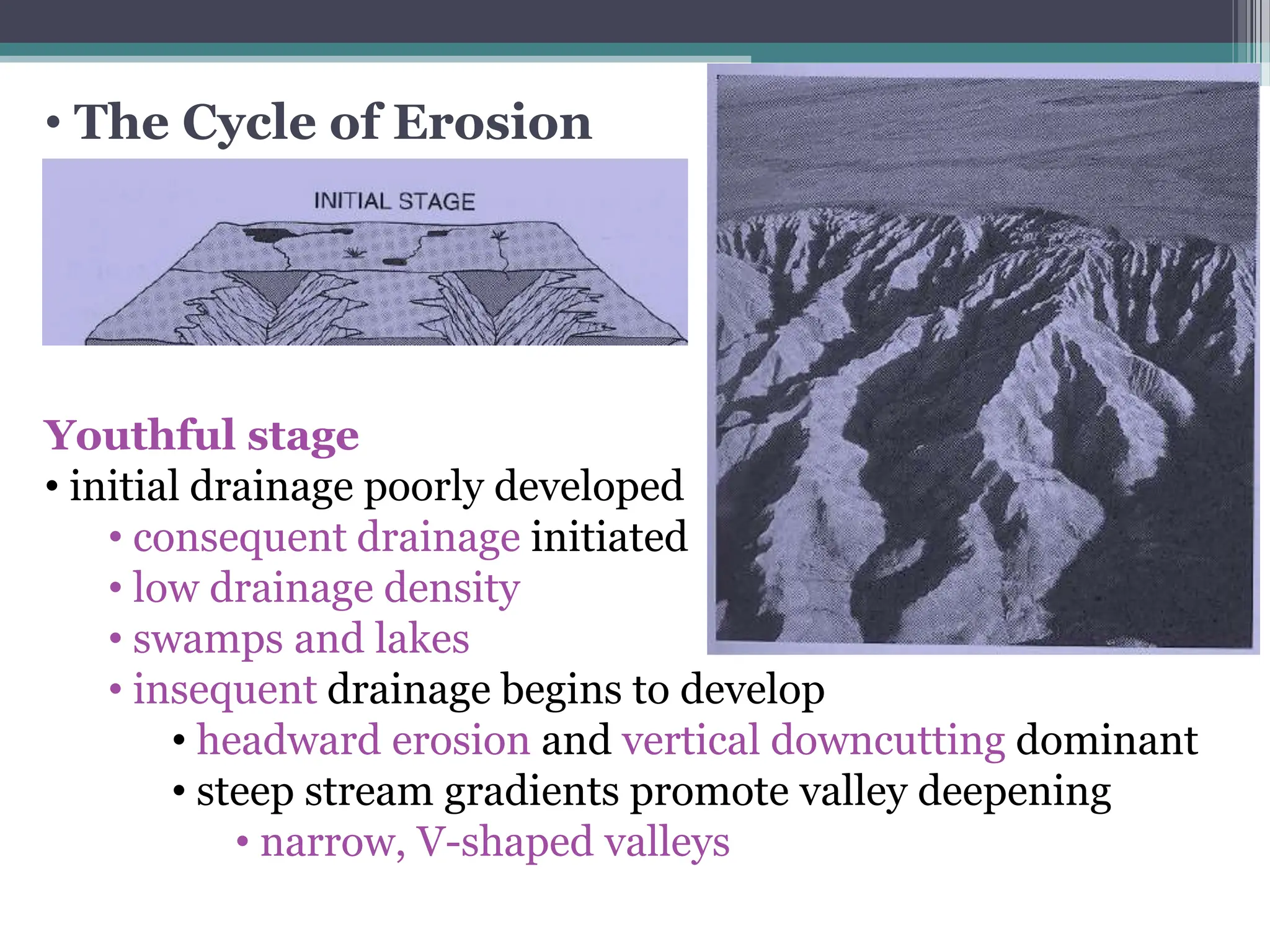
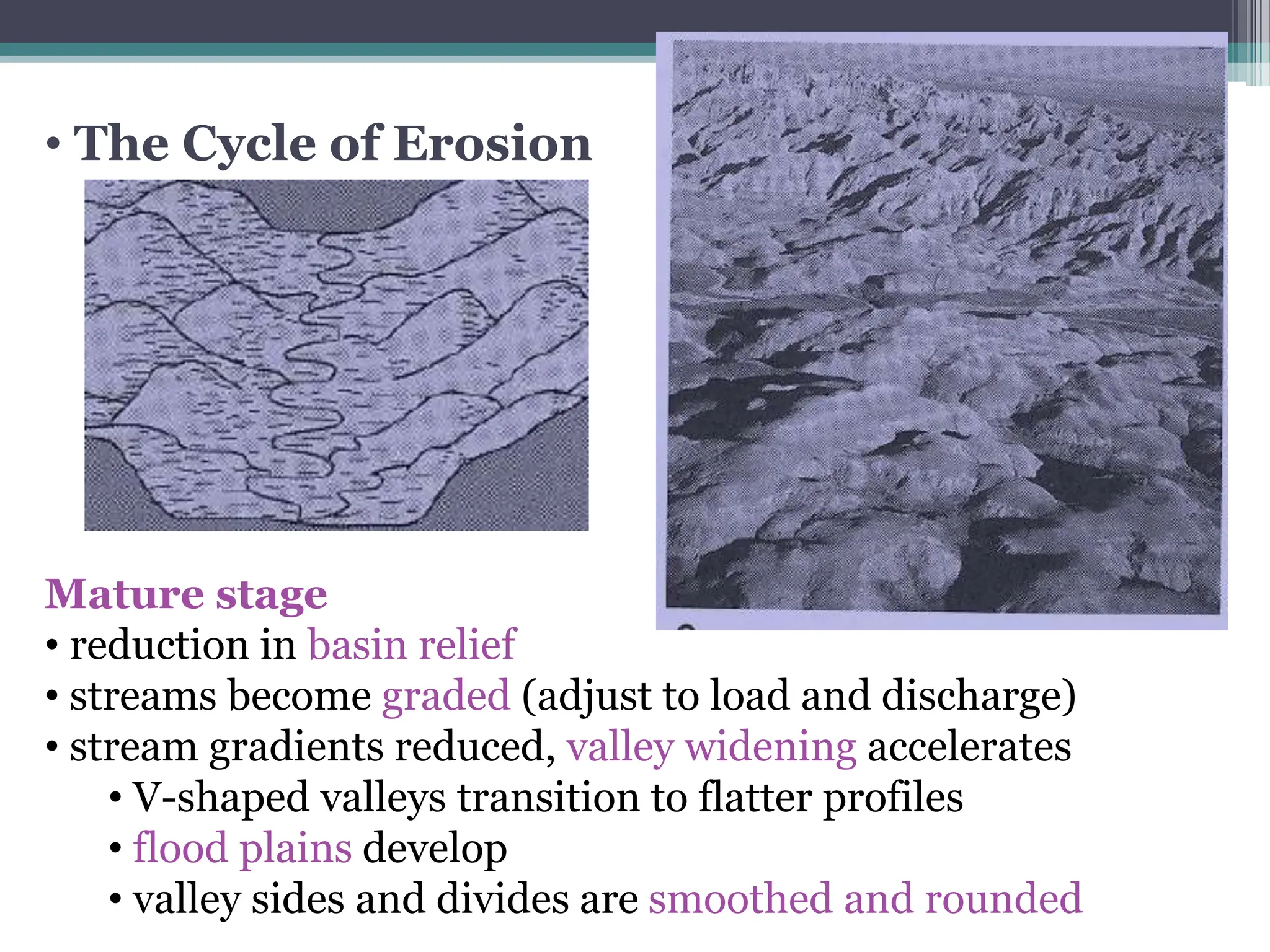
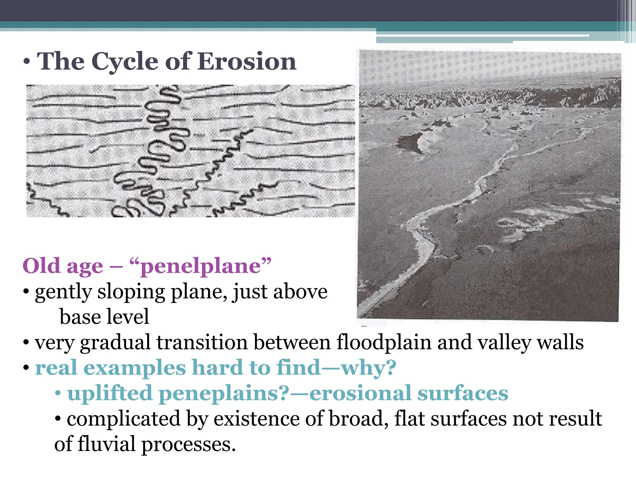
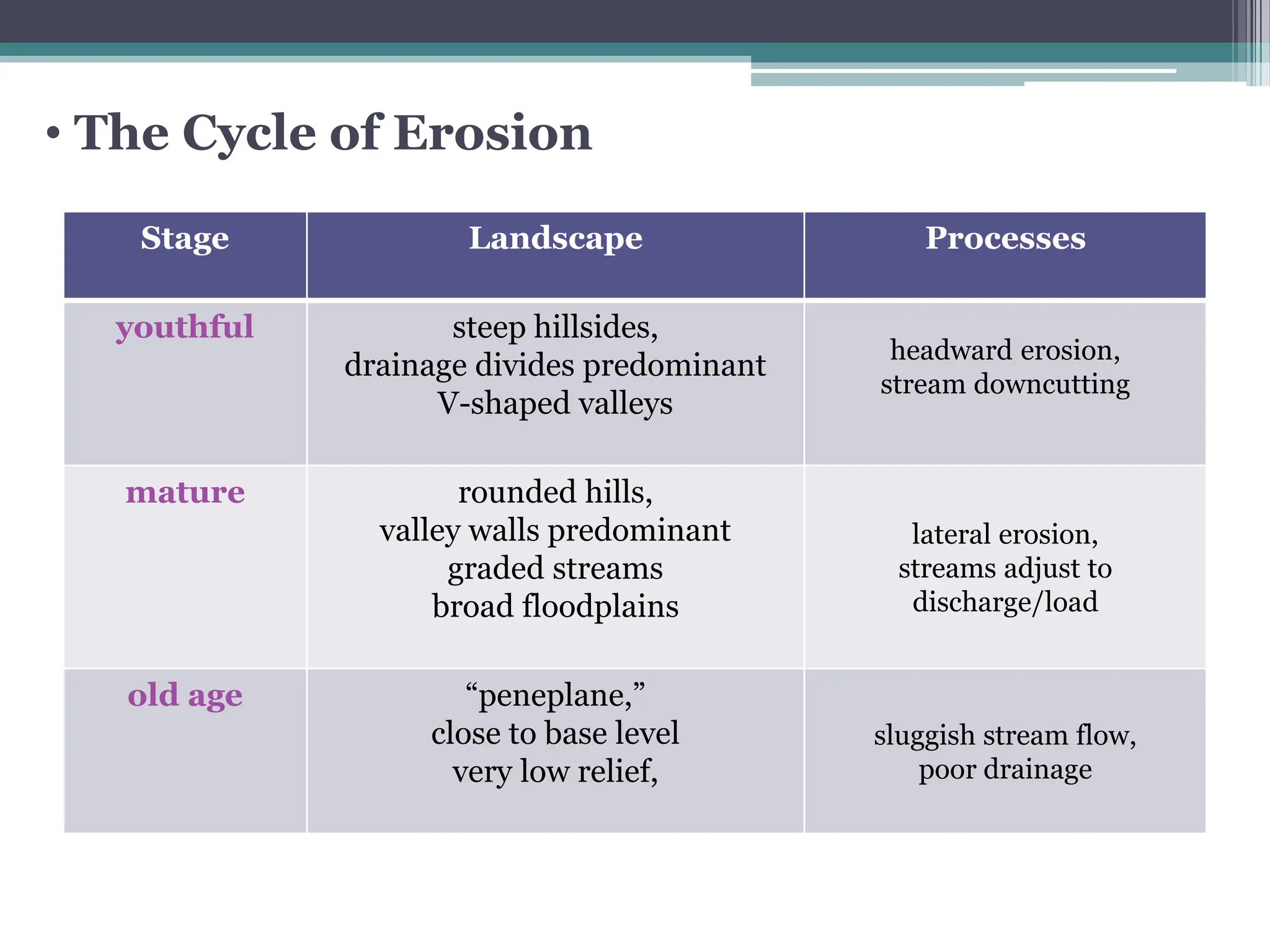
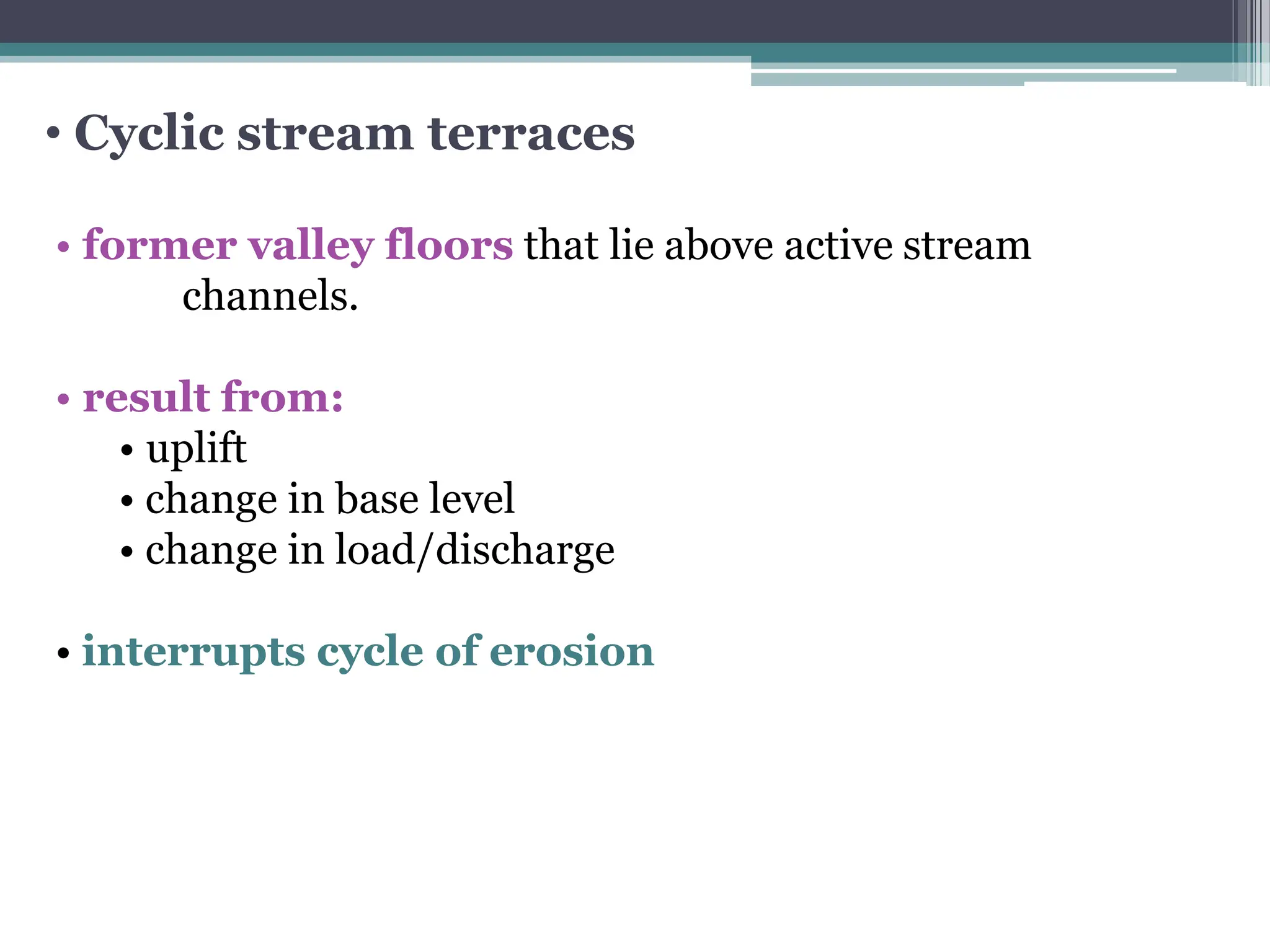
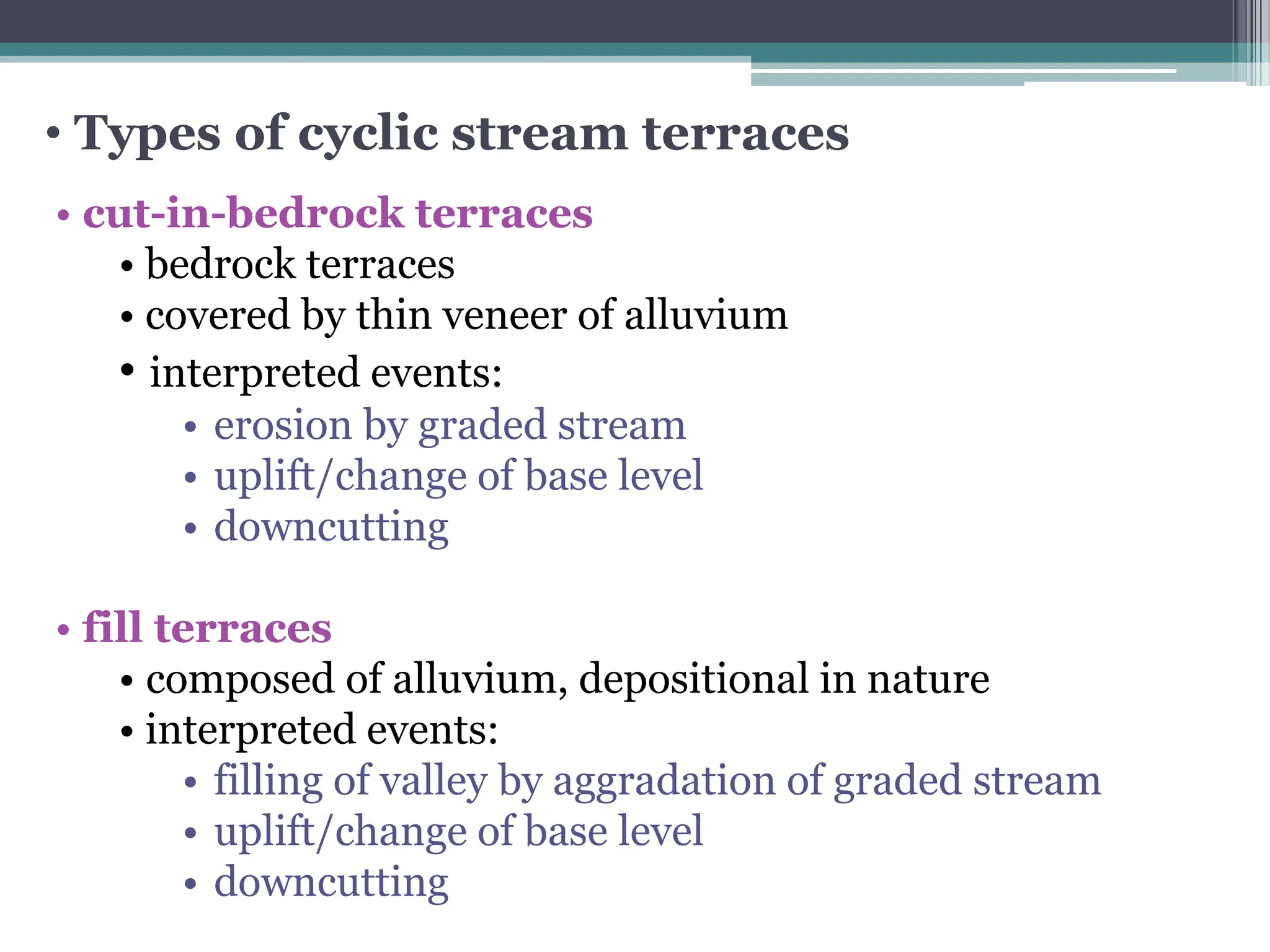
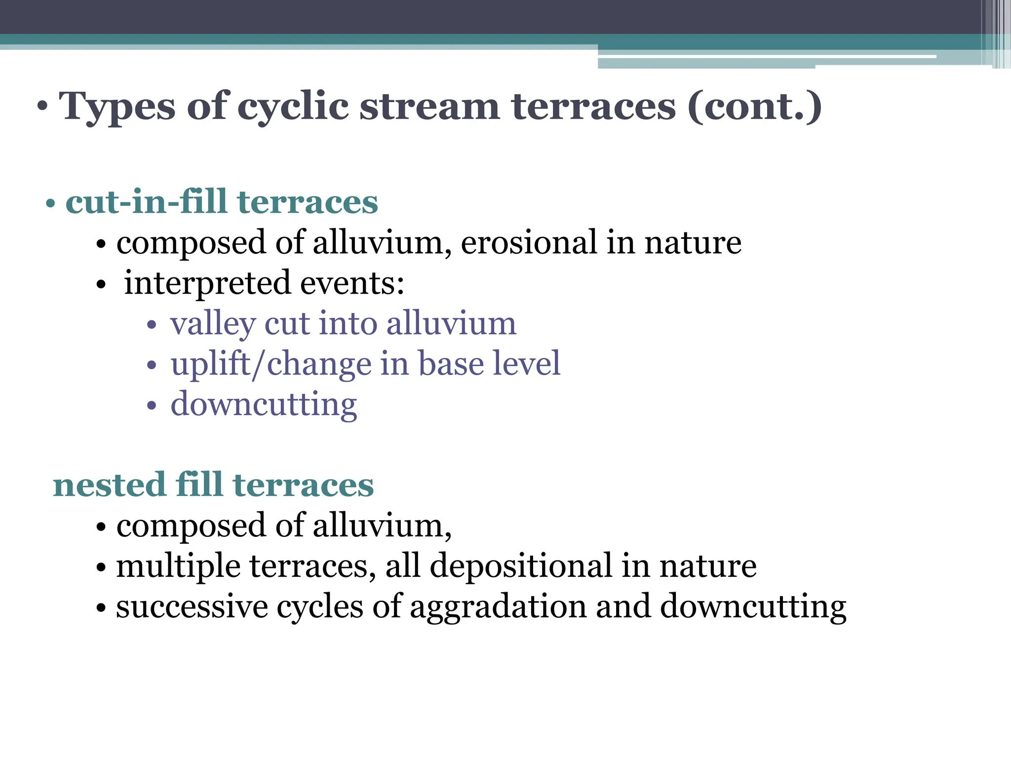
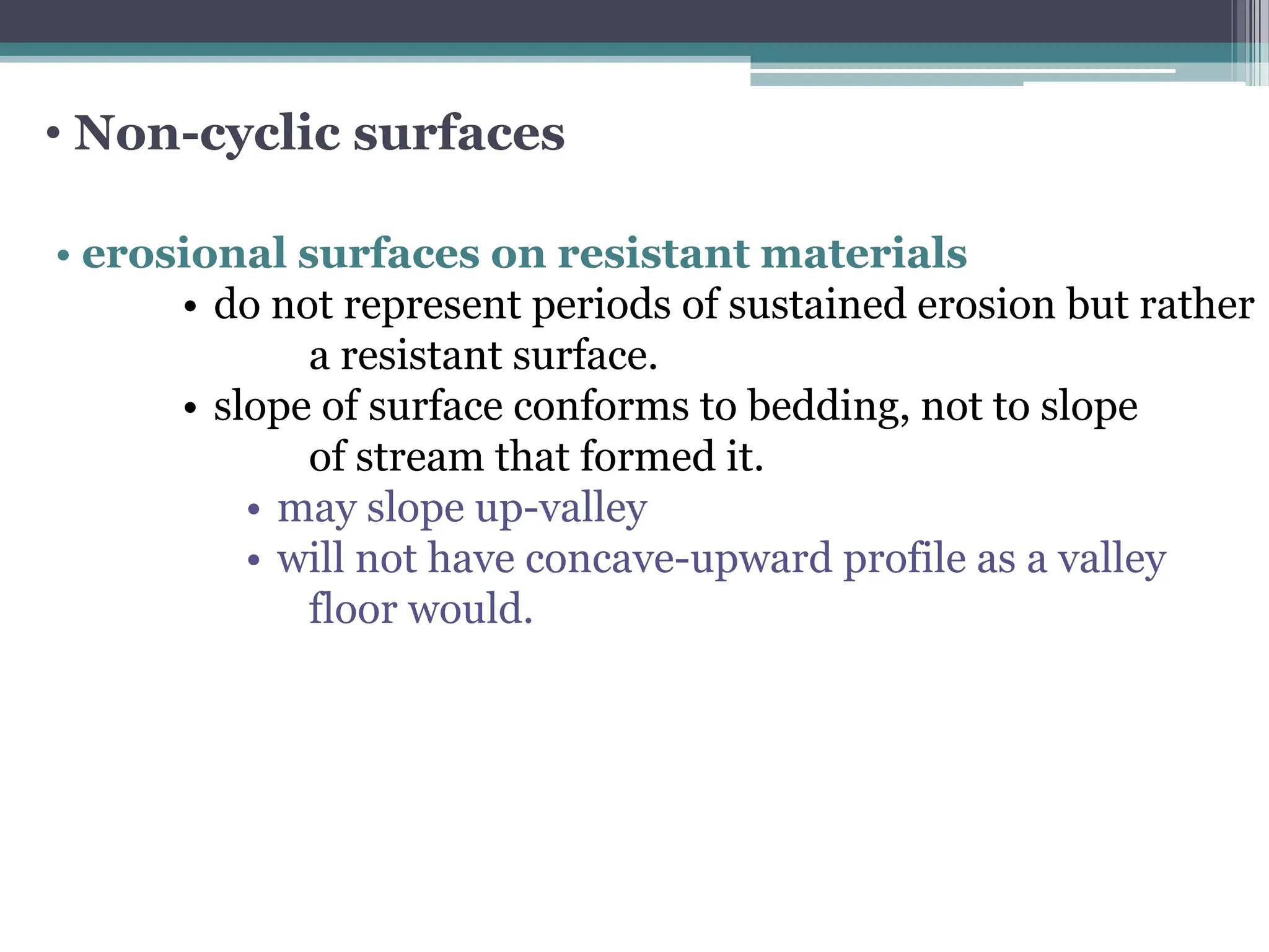
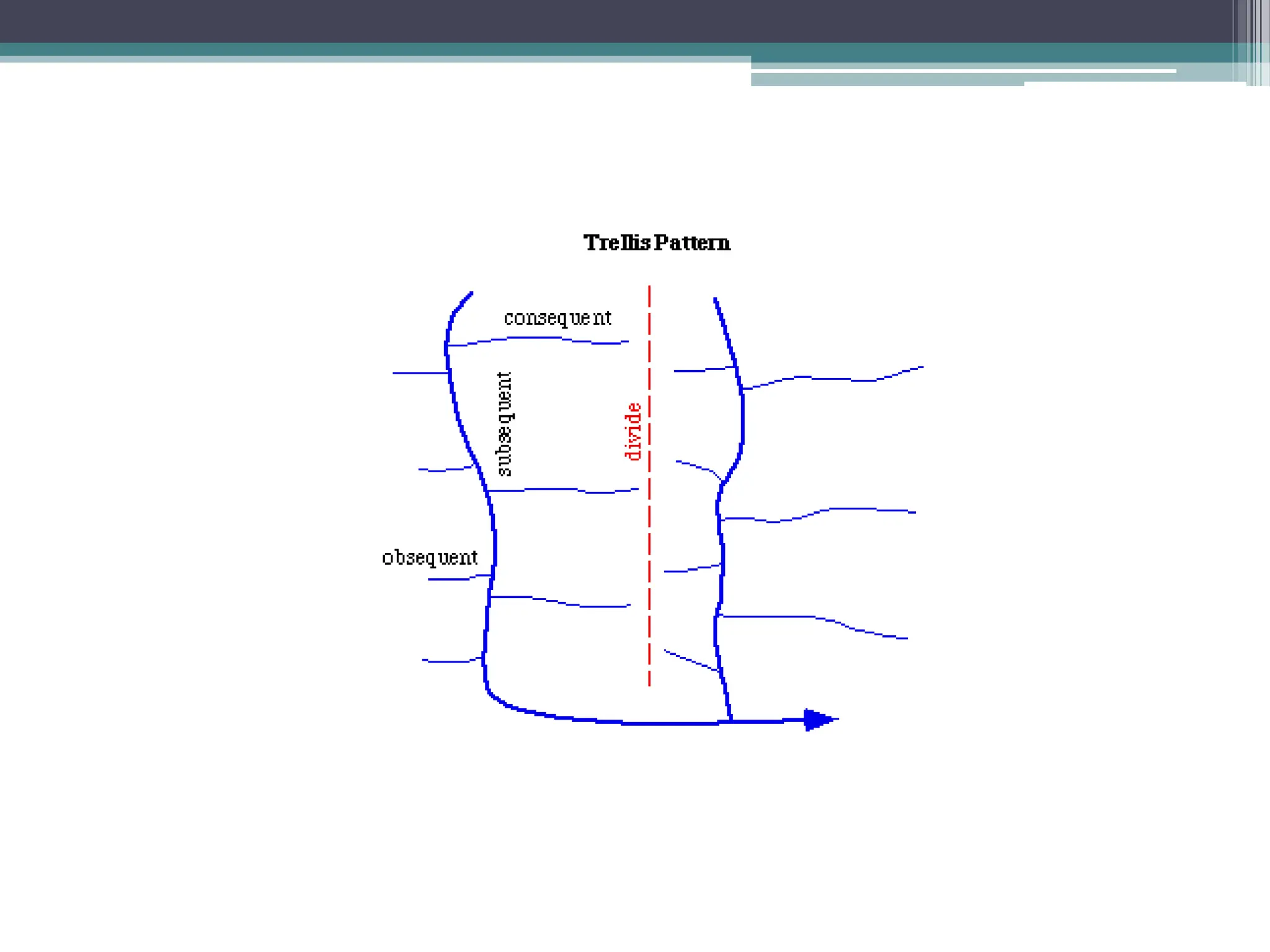
3. • Drainage systems
• stream ordering
• Hortons’s hierarchy of
streams
• lower order streams are:
• shorter,
• steeper,
• drain smaller areas
• Drainage density
• D = L/A
• measure of how well or poorly
a basin is drained by streams
4th order
drainage
basin
4. • Drainage systems
• stream ordering
• Drainage density
• D = L/A
• measure of how well or poorly
a basin is drained by streams
•higher for steeply sloping,
low-permeability landscapes,
which promote runoff, gullying,
channeling.
• lower for low-relief, high
permeabilty landscapes.
-what about karst?
4th order
drainage
basin
drainage texture
-Note crenulated
contours
5. • Drainage systems
• stream
ordering
• what’s
outlined in
red?
•what’s
outlined in
yellow?
6. • Origin of stream courses
Virgin land surface (new landscapes)
• fresh volcanics
• newly glaciated
• emergent marine areas
• recently uplifted terranes
7. • Origin of stream courses
• What determines the path taken by a stream on a
virgin land surface (new landscapes)?
• slope of ground
consequent streams
• random headward erosion
• homogeneous materials
insequent streams
• selective headward erosion
• materials of varying resistance
subsequent streams
8. • Drainage patterns
Pattern Origin Characteristics Geology
dendritic insequent random,
acute-angle junctions
homogeneous,
horizontal beds
trellis subsequent parallel streams,
high-angle junctions
heterogeneous,
tilted beds
rectangular
/ angular
subsequent high-angle junctions,
high-angle bends in
tributaries
jointed rocks
annular subsequent circular patterns heterogeneous,
breached domes
radial consequent streams flowing in all
directions from
central high area
volcanic or
intrusive domes
9. Yemen (very dry climate)
http://www.cerritos.edu/earth-
science/tutor/
Fluvial/drainage_patterns1a.
htm
New Zealand, Wikepedia
• Drainage patterns
Yangtze River, China
NASA photo
12. • Stream capture
Diversion of a stream’s flow from its
original channel to the channel of
a neighboring stream.
13. • Stream capture
Two types:
• abstraction– faster rate of headward erosion on one side of drainage
divide because of steeper gradient or less resistant rocks.
• intercession – lateral movement of meander bend intersects meander
bend of another stream.
14. • Stream capture
• this is example of
what type of stream
capture?
• where might we see
this in Appalachians?
15. The Hadhramawt Plateau of South Yemen exhibits a
complex dendritic drainage pattern and excellent
examples of "stream piracy." Wadi Hadhramawt opens
into the sand-filled Ramlat Sabatayn in the southwest
corner of the Rub-al-Khali (The Empty Quarter), yet
drainage is toward the sea. The southern coast of the
Arabian Peninsula is at the upper portion of the
photograph. (S65-34658; Gemini IV.)
18. Landform Origin Processes/
Materials
floodplains constructional lateral and vertical accretion,
channel and overbank
deposits
pediments destructional lateral planation,
sheet and rill wash,
weathering,
formation of graded surface
alluvial fans constructional deposition of coarse-grained
sediments on land,
fanhead trenching,
mudflows
deltas constructional deposition in standing water,
turbidity currents,
birdfoot deltas
• Fluvial landforms
19.
20.
21. • The Cycle of Erosion
• introduced by Davis (1909), a foundational concept
in geomorphology for many years, formed basis for
interpreting landforms.
• idealized sequence of landscape/landform evolution.
• begins with uplifted, virgin landscape.
• culminates with featureless plane eroded to base level.
• in between passes through stages, each with a set of
recognizable landforms.
23. • The Cycle of Erosion
• sequence of forms: 1) youth 2) maturity 3) old age
24. • The Cycle of Erosion
Youthful stage
• initial drainage poorly developed
• consequent drainage initiated
• low drainage density
• swamps and lakes
• insequent drainage begins to develop
• headward erosion and vertical downcutting dominant
• steep stream gradients promote valley deepening
• narrow, V-shaped valleys
25. • The Cycle of Erosion
Mature stage
• reduction in basin relief
• streams become graded (adjust to load and discharge)
• stream gradients reduced, valley widening accelerates
• V-shaped valleys transition to flatter profiles
• flood plains develop
• valley sides and divides are smoothed and rounded
26. • The Cycle of Erosion
Old age – “penelplane”
• gently sloping plane, just above
base level
• very gradual transition between floodplain and valley walls
• real examples hard to find—why?
• uplifted peneplains?—erosional surfaces
• complicated by existence of broad, flat surfaces not result
of fluvial processes.
27. Stage Landscape Processes
youthful steep hillsides,
drainage divides predominant
V-shaped valleys
headward erosion,
stream downcutting
mature rounded hills,
valley walls predominant
graded streams
broad floodplains
lateral erosion,
streams adjust to
discharge/load
old age “peneplane,”
close to base level
very low relief,
sluggish stream flow,
poor drainage
• The Cycle of Erosion
28.
29. • Cyclic stream terraces
• former valley floors that lie above active stream
channels.
• result from:
• uplift
• change in base level
• change in load/discharge
• interrupts cycle of erosion
30. • Types of cyclic stream terraces
• cut-in-bedrock terraces
• bedrock terraces
• covered by thin veneer of alluvium
• interpreted events:
• erosion by graded stream
• uplift/change of base level
• downcutting
• fill terraces
• composed of alluvium, depositional in nature
• interpreted events:
• filling of valley by aggradation of graded stream
• uplift/change of base level
• downcutting
31. • Types of cyclic stream terraces (cont.)
• cut-in-fill terraces
• composed of alluvium, erosional in nature
• interpreted events:
• valley cut into alluvium
• uplift/change in base level
• downcutting
nested fill terraces
• composed of alluvium,
• multiple terraces, all depositional in nature
• successive cycles of aggradation and downcutting
32.
33.
34. • Non-cyclic surfaces
• erosional surfaces on resistant materials
• do not represent periods of sustained erosion but rather
a resistant surface.
• slope of surface conforms to bedding, not to slope
of stream that formed it.
• may slope up-valley
• will not have concave-upward profile as a valley
floor would.