Downloaded 205 times
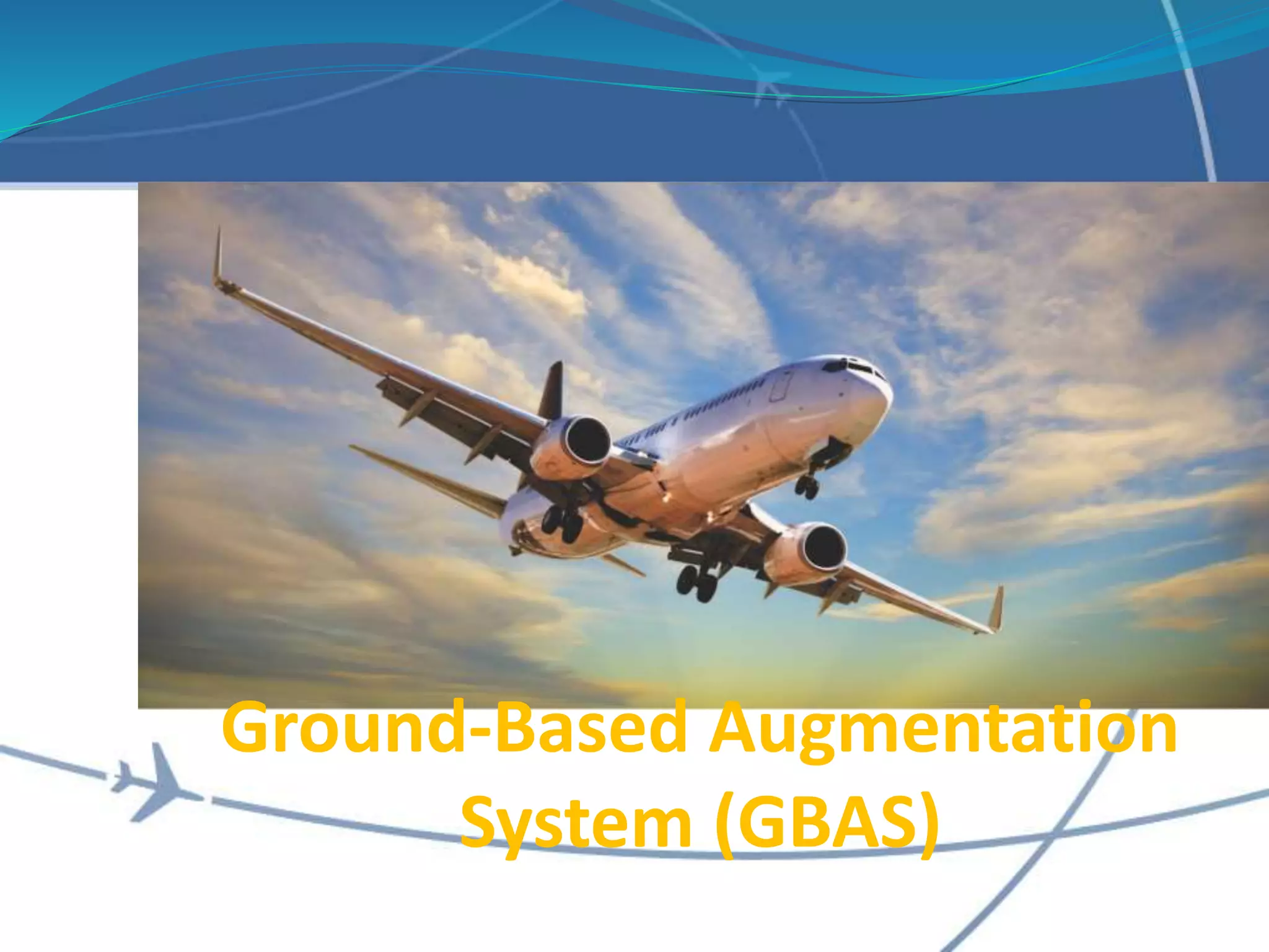
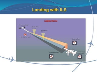
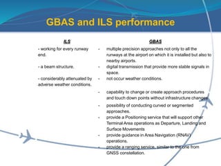
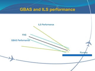
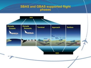
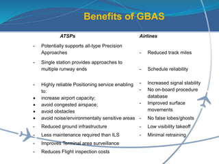
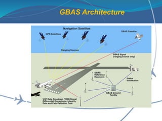
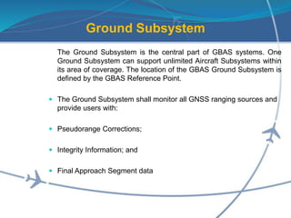


The document discusses Ground-Based Augmentation System (GBAS) and how it compares to the Instrument Landing System (ILS). GBAS provides precision approaches for all runways at an airport, supports curved and segmented approaches, and can change procedures without infrastructure changes. It also enables Category I through III precision approaches with minima down to no decision height or visibility required. GBAS signals are more stable than ILS in adverse weather. The document outlines the benefits of GBAS for airlines, airports, and air navigation service providers, such as reduced track miles, increased airport capacity and flexibility in procedure design.


