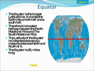
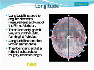
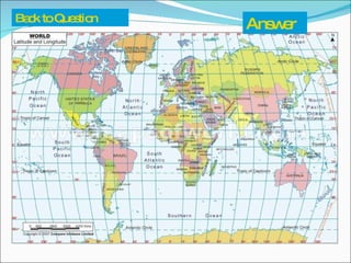
The document discusses the Earth's grid system of latitude and longitude which is used to locate positions on the planet. Latitude lines run parallel to the equator and indicate distances north and south, while longitude lines run perpendicular and indicate distances east and west from the prime meridian. Key lines include the equator at 0 degrees latitude, and the prime meridian and international date line which delineate the eastern and western hemispheres. Several examples are provided to illustrate how the grid system can be used to determine locations.


![Latitudes and Longitudes [Autosaved].pptx](https://cdn.slidesharecdn.com/ss_thumbnails/latitudesandlongitudesautosaved-221031193426-8f2f0591-thumbnail.jpg?width=640&height=640&fit=bounds)


