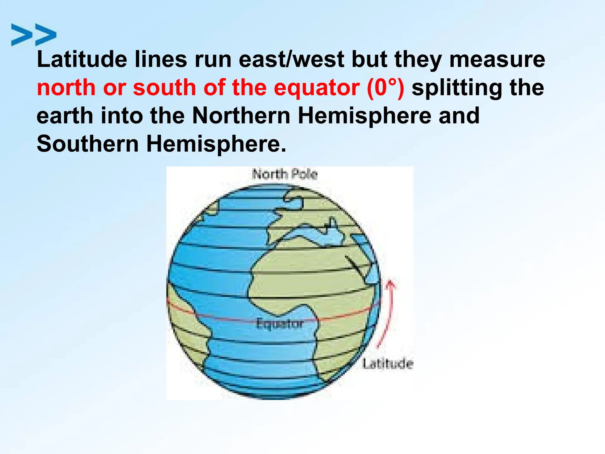
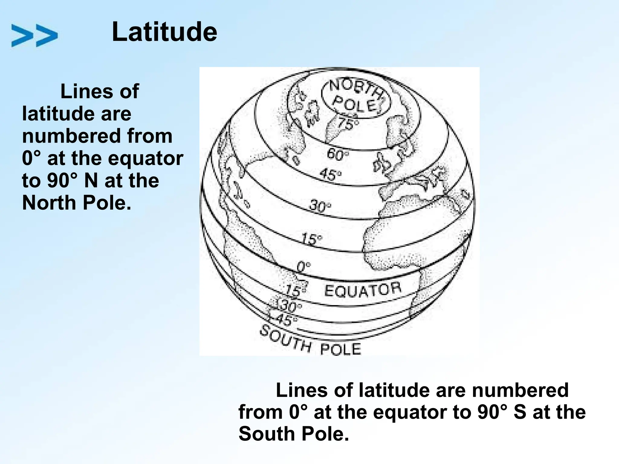
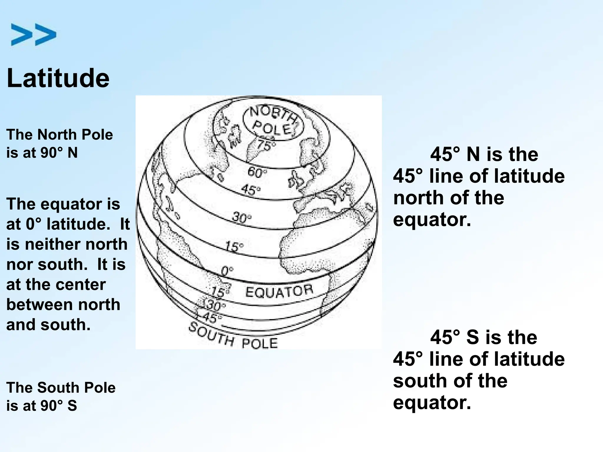
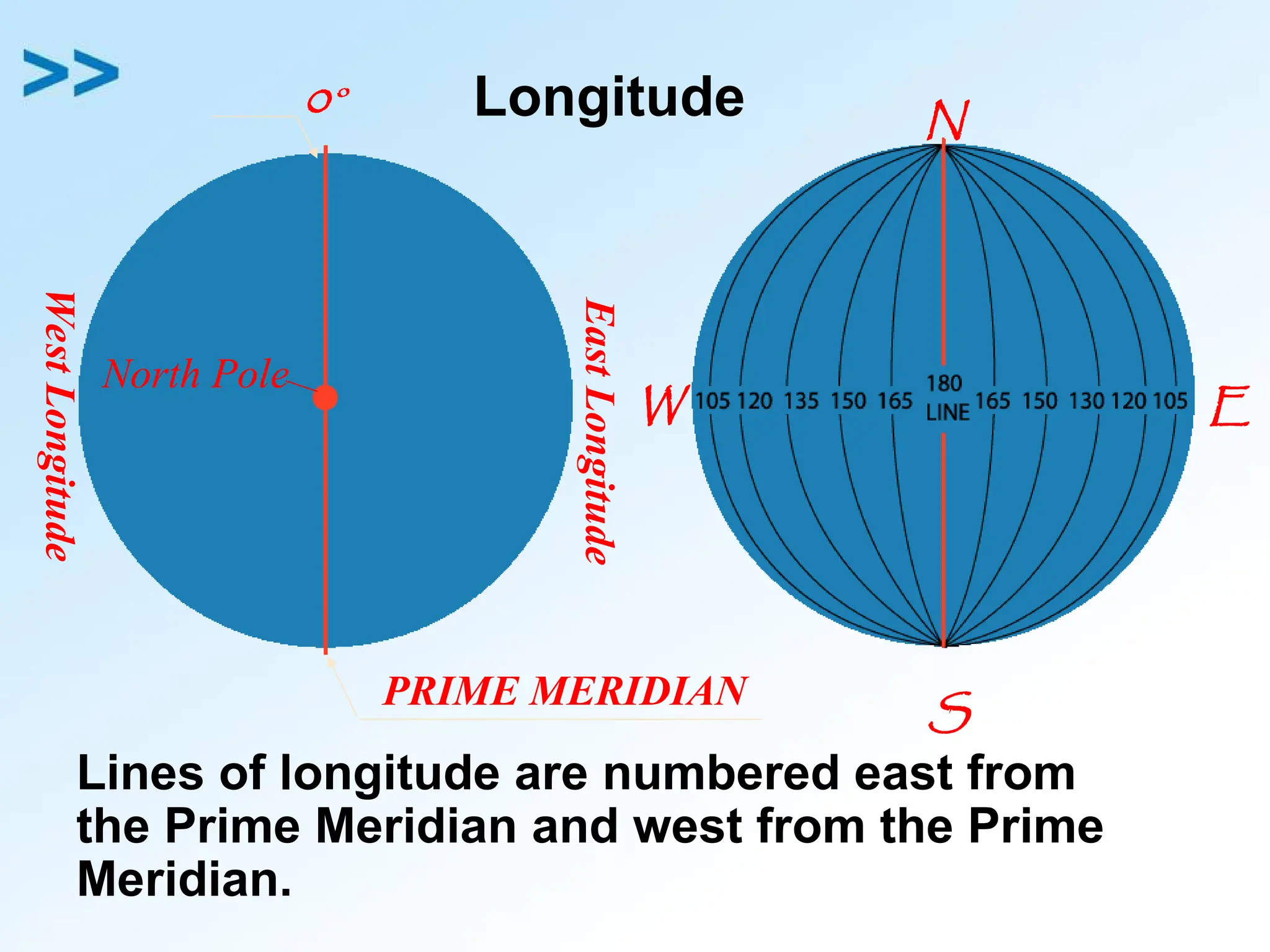
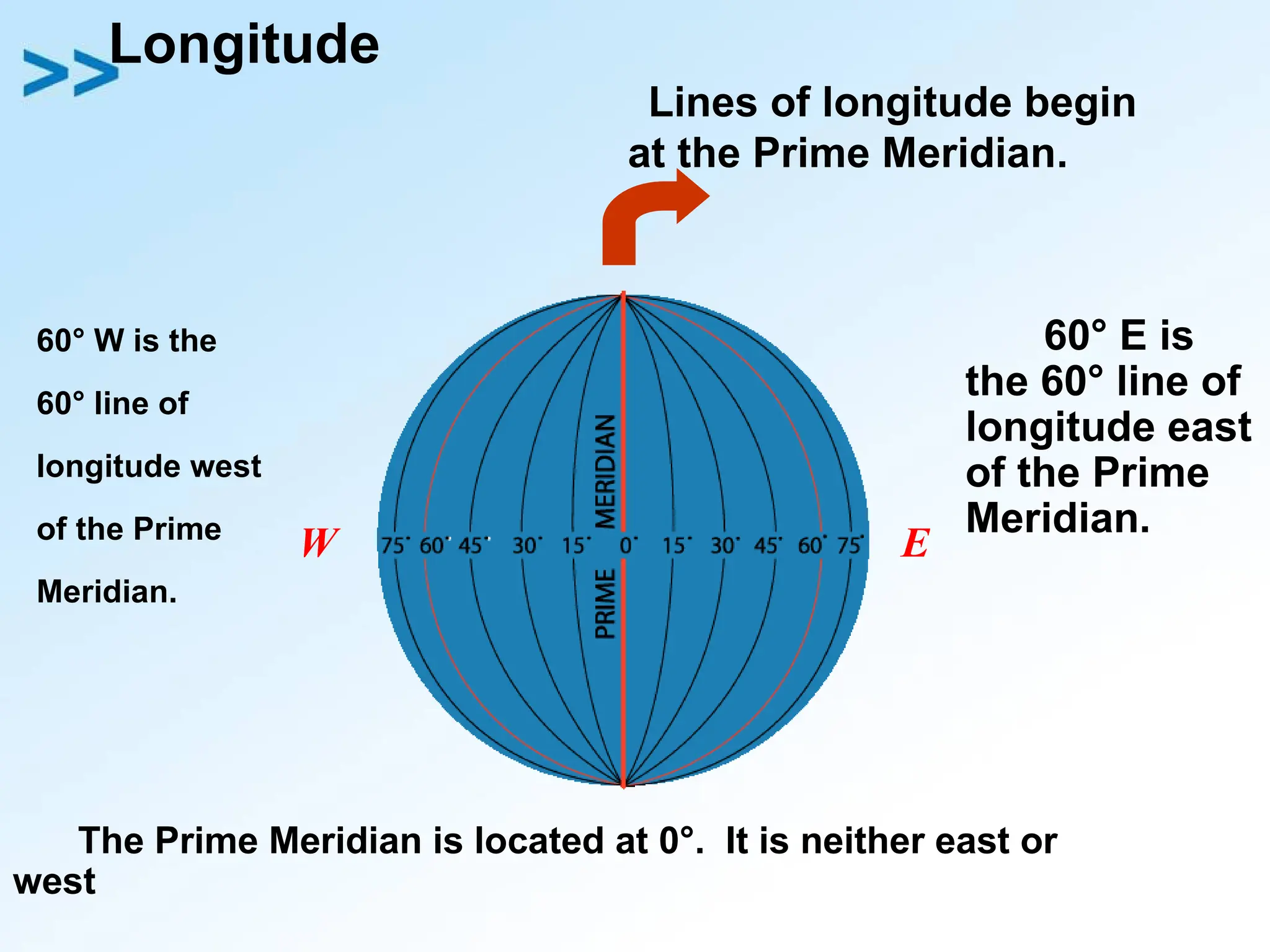
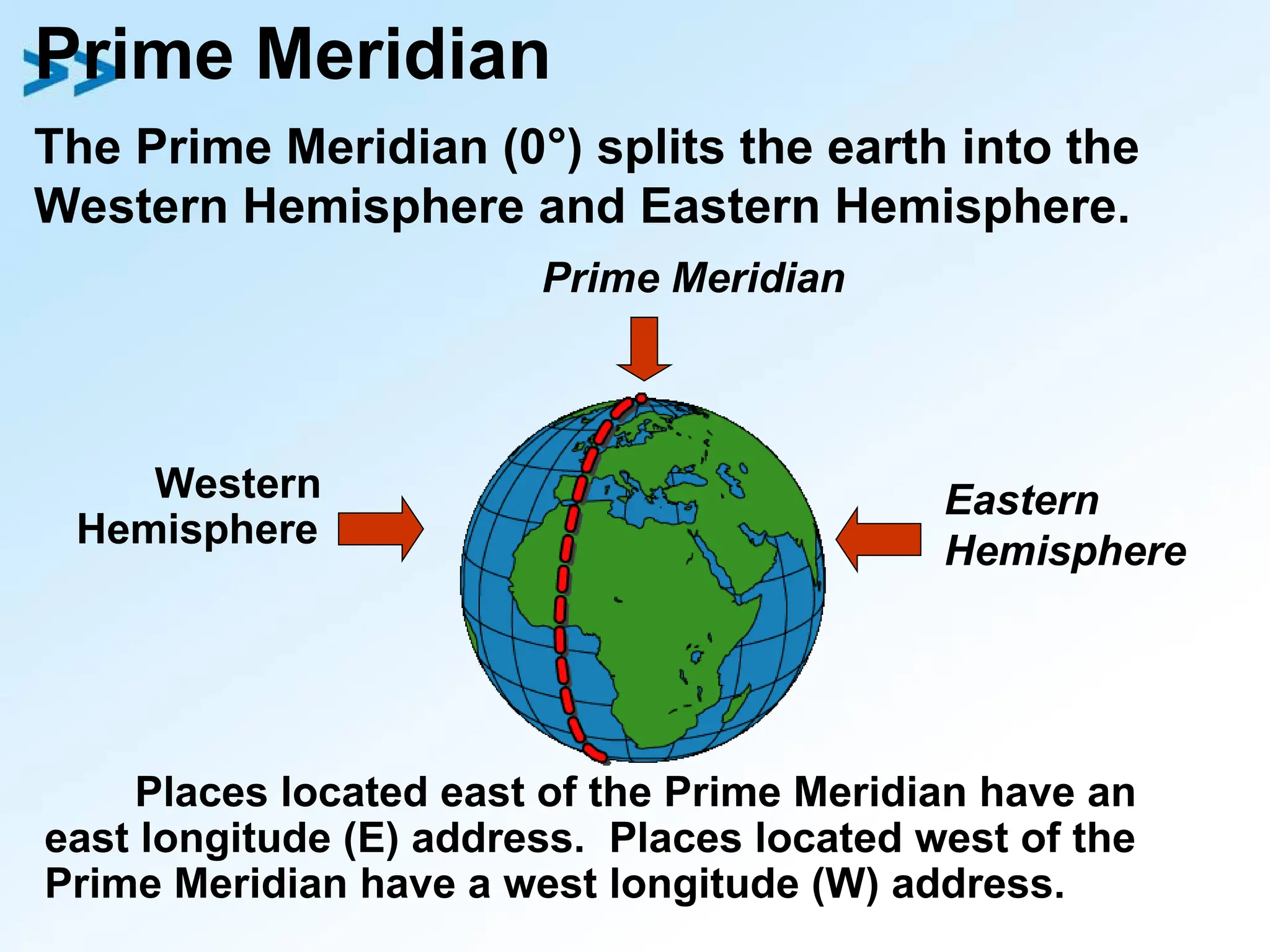
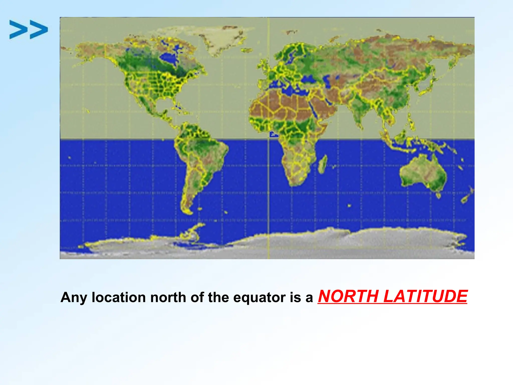
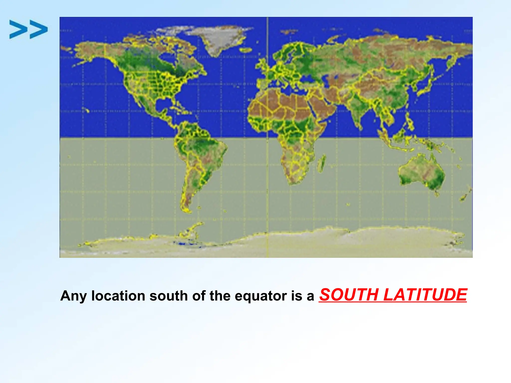
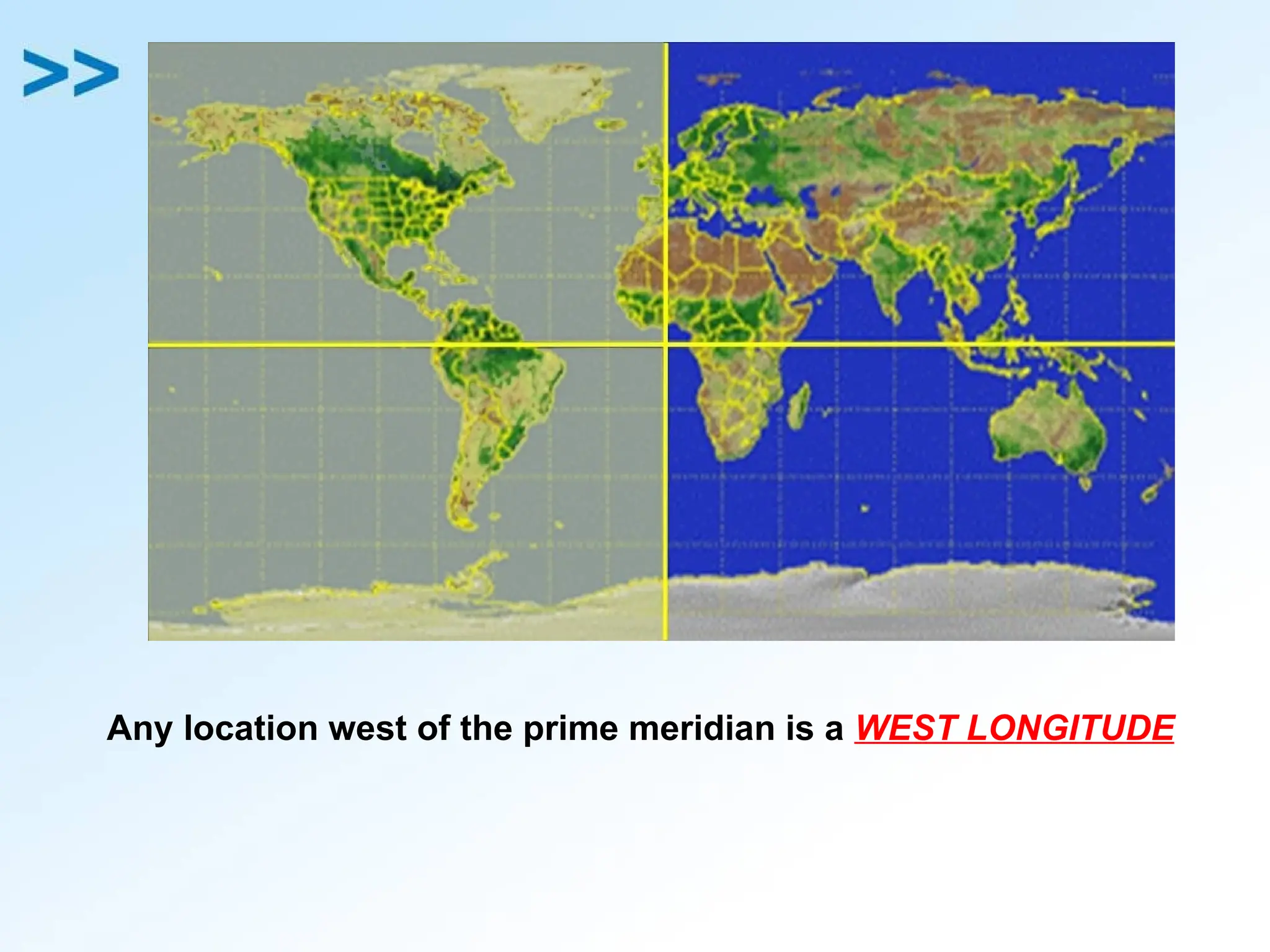
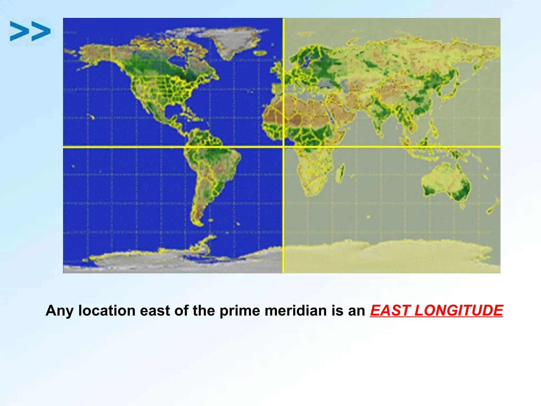
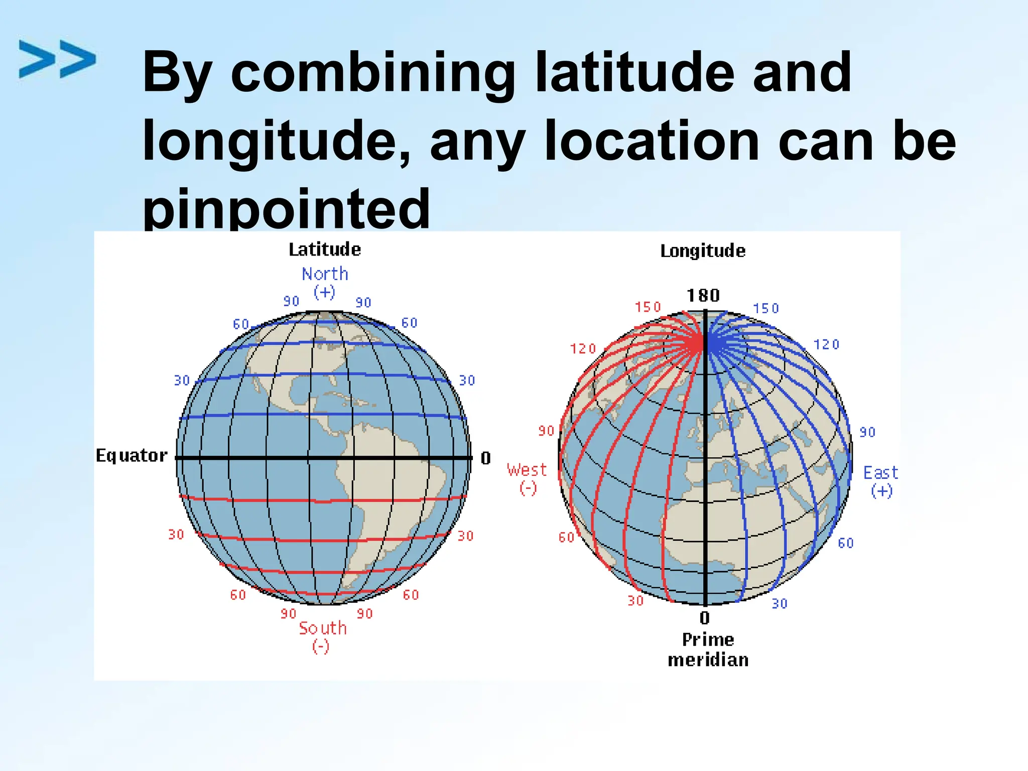
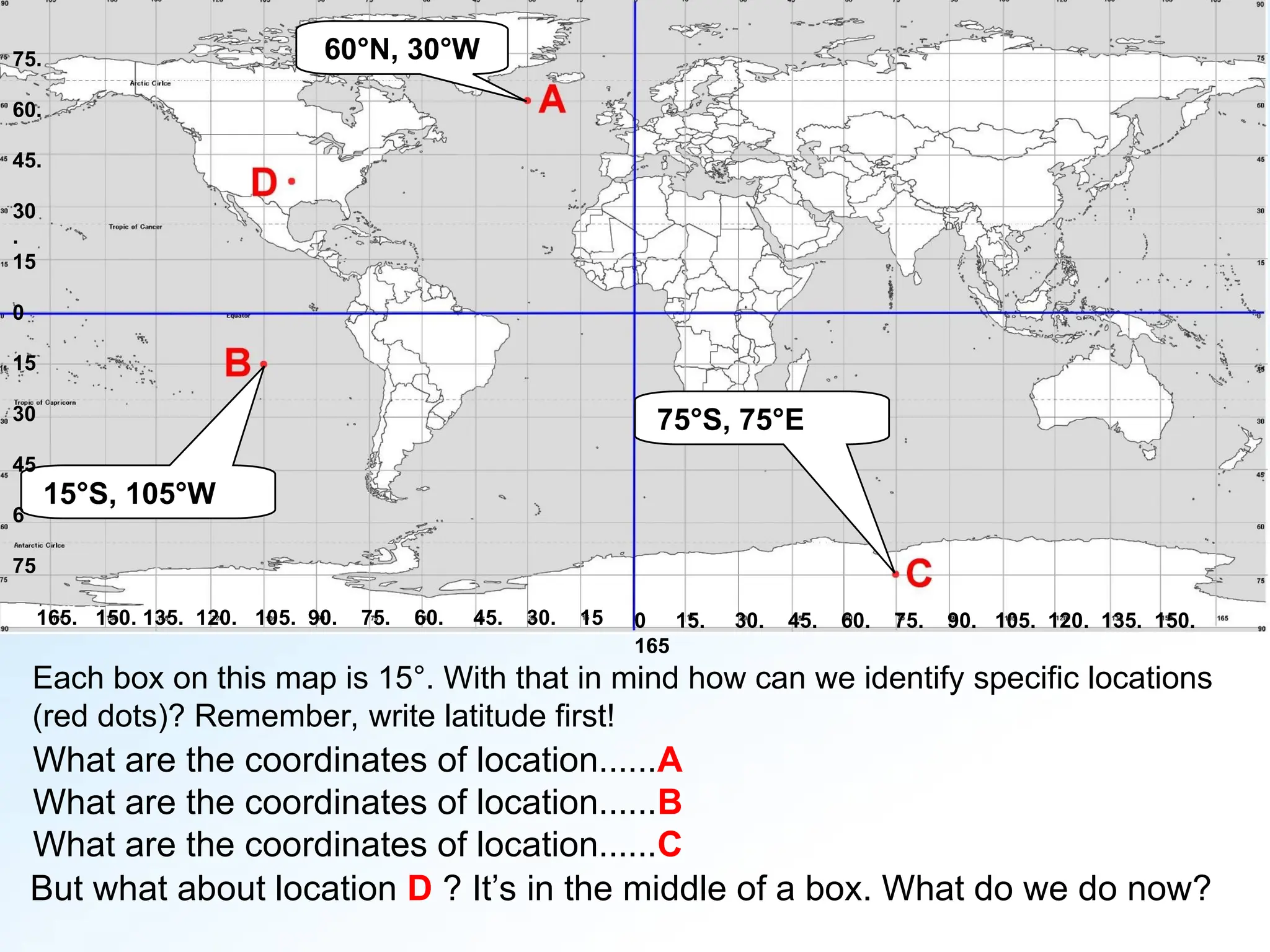
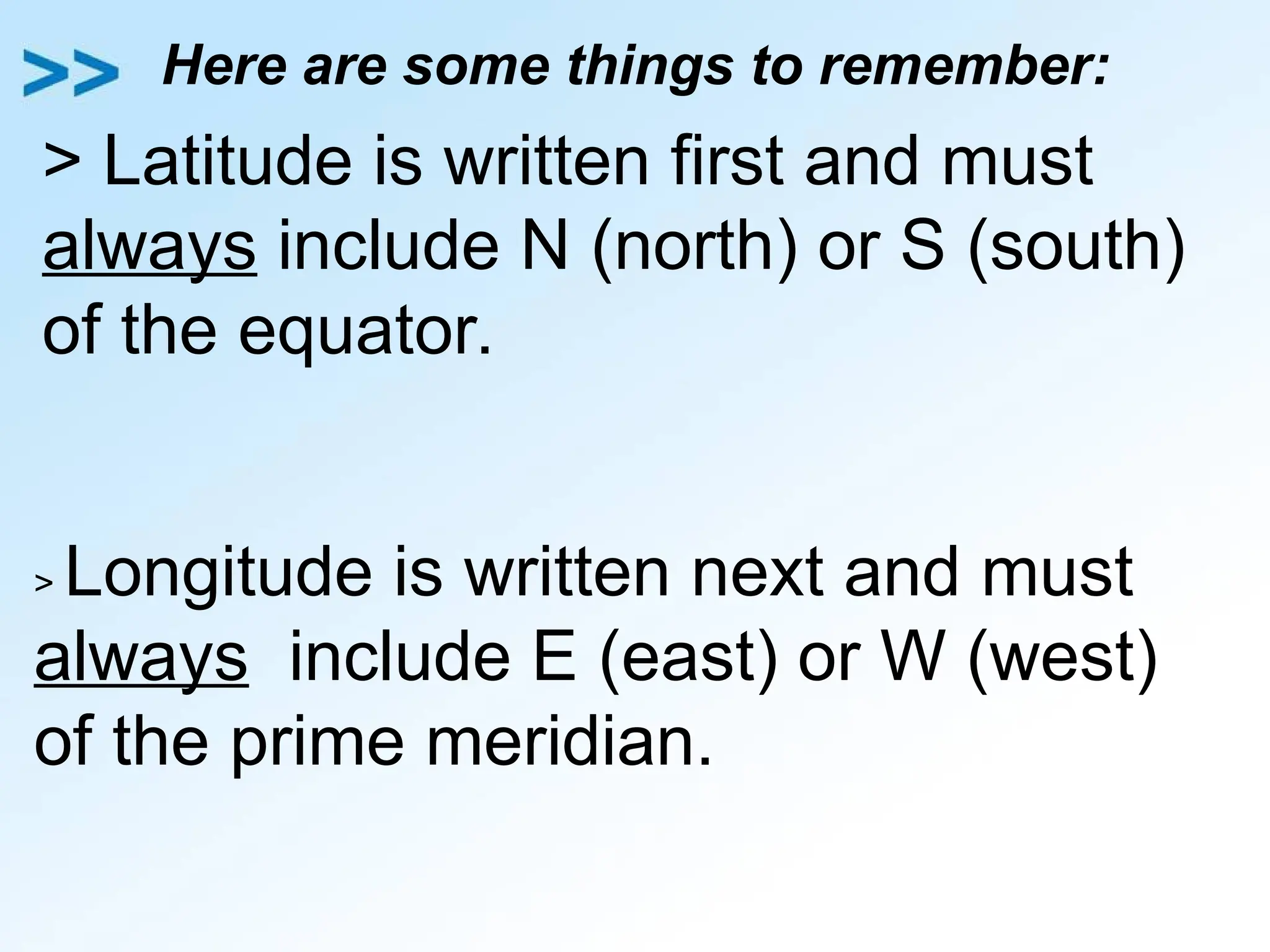
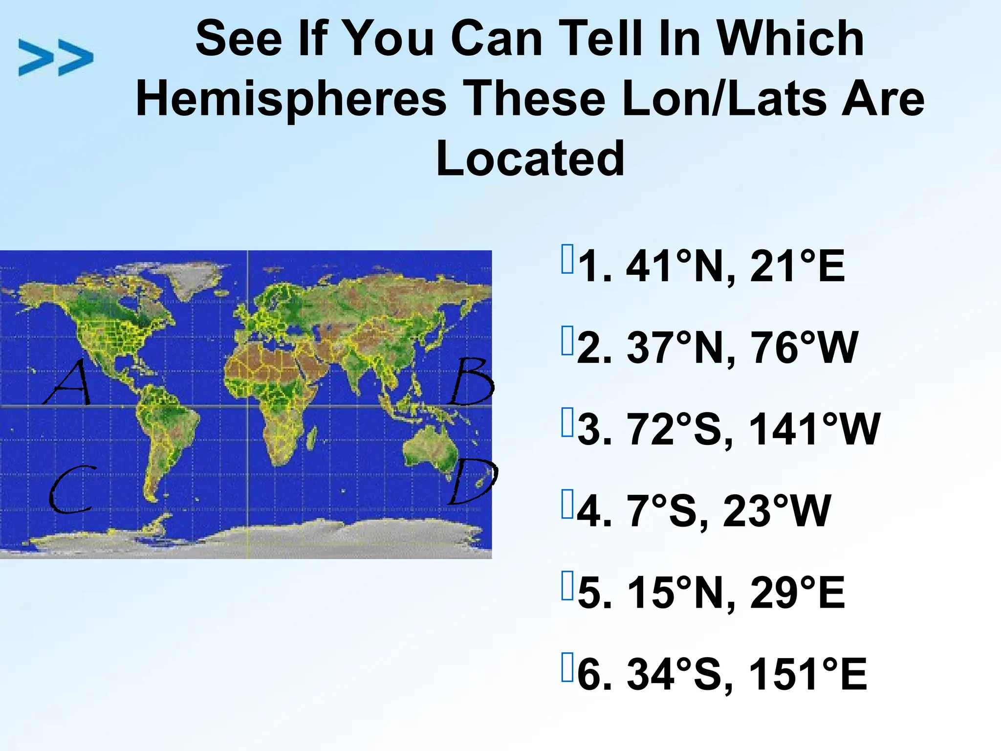
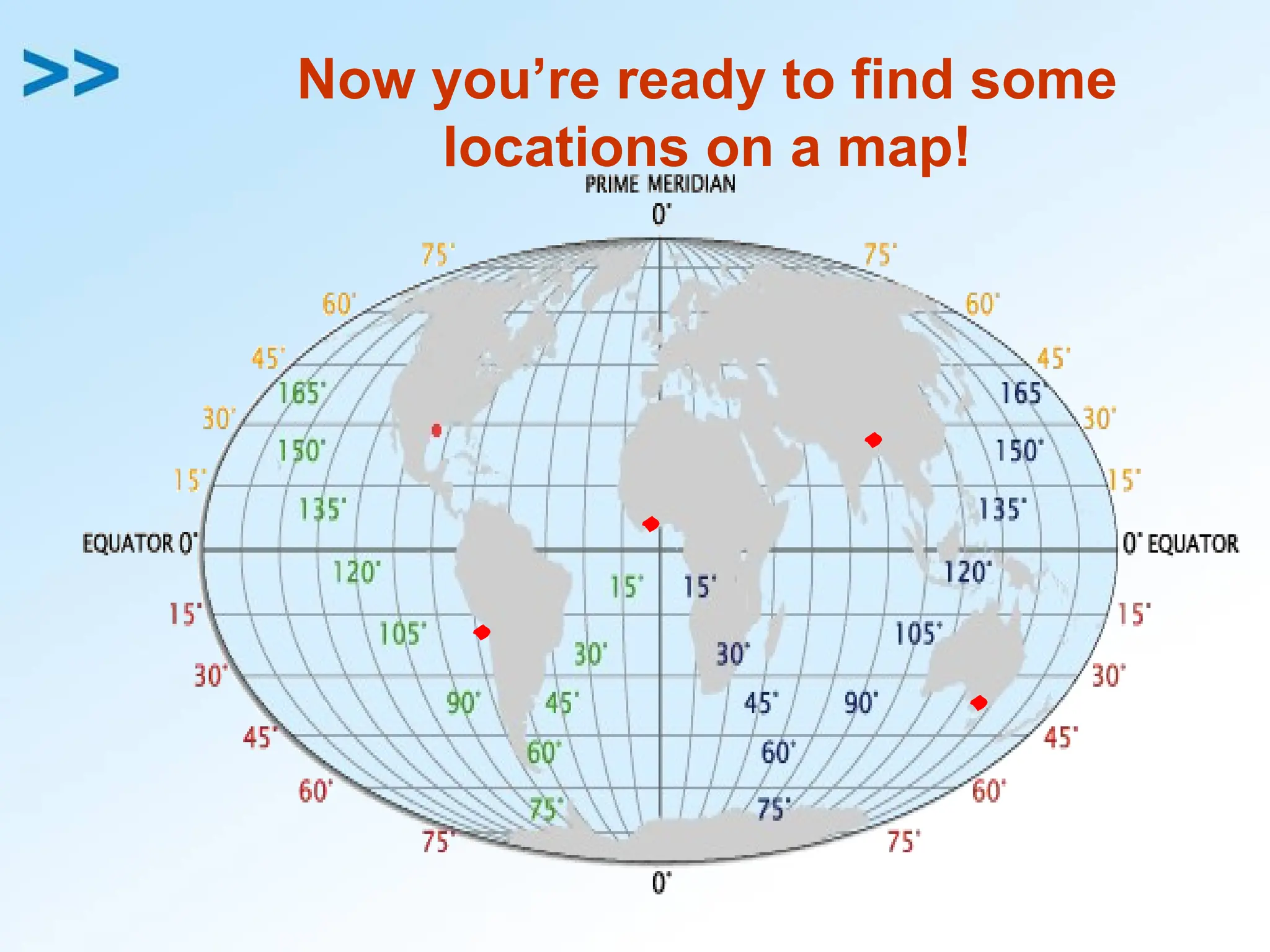
The document explains how to identify locations on Earth using latitude and longitude. Latitude lines measure north or south of the equator, ranging from 0° at the equator to 90° at the poles, while longitude lines measure east or west from the prime meridian at 0°. By combining these coordinates, specific locations can be pinpointed on a map.


![Latitudes and Longitudes [Autosaved].pptx](https://cdn.slidesharecdn.com/ss_thumbnails/latitudesandlongitudesautosaved-221031193426-8f2f0591-thumbnail.jpg?width=640&height=640&fit=bounds)


