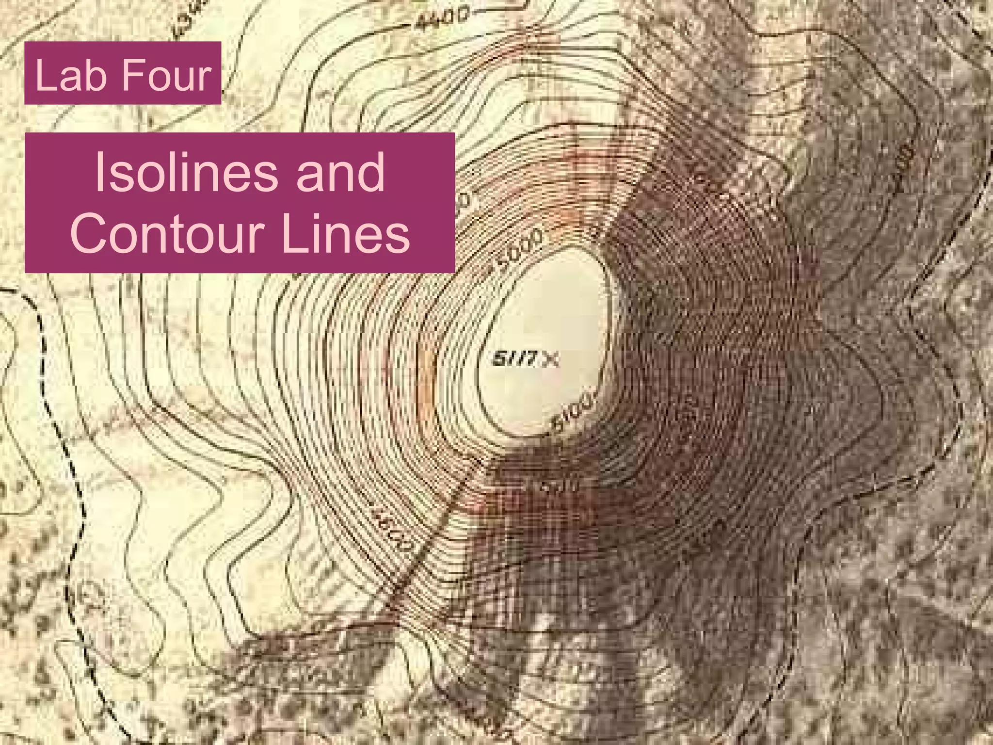
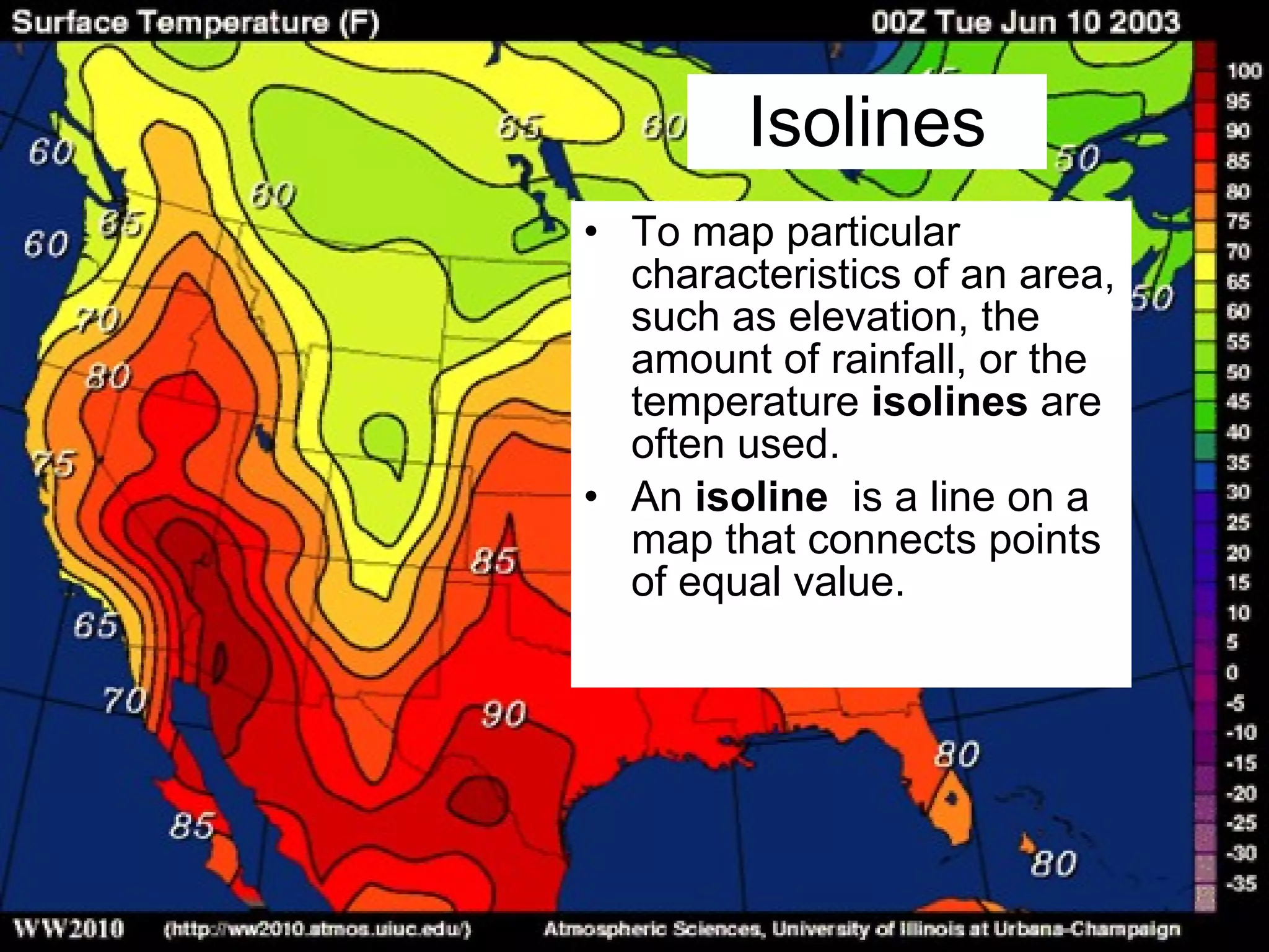
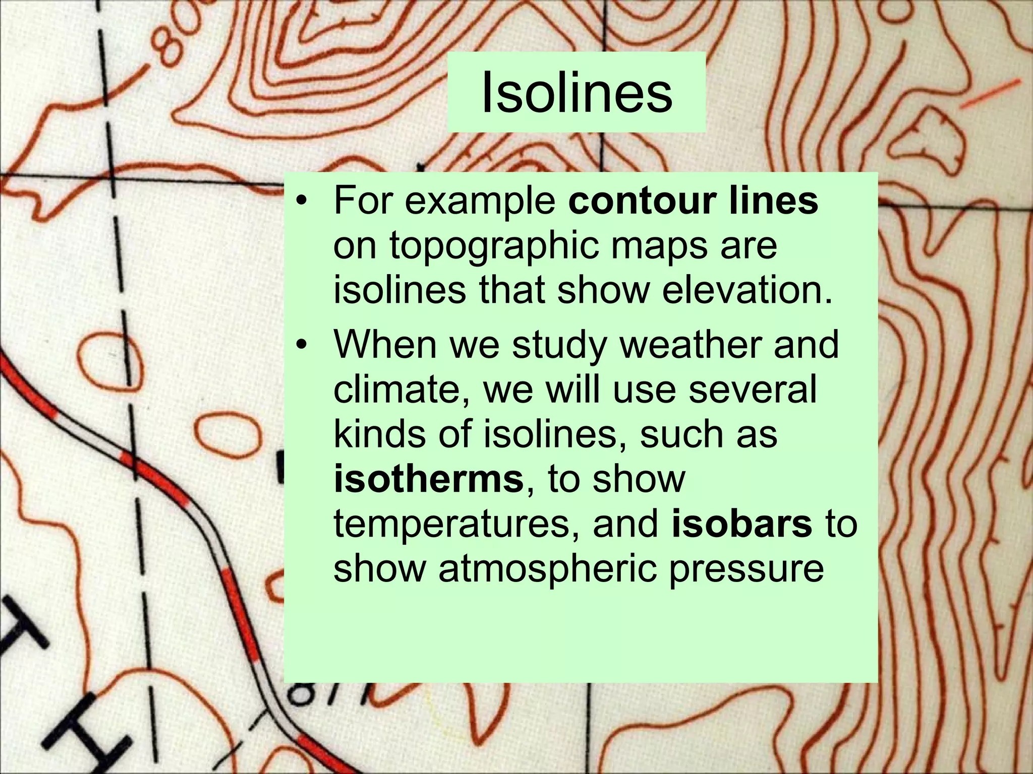
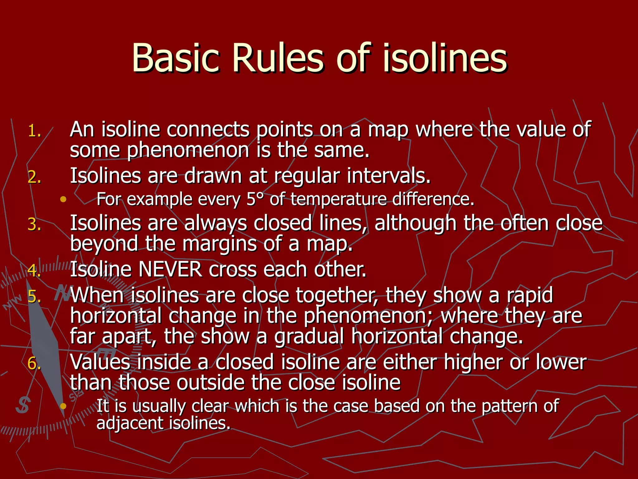
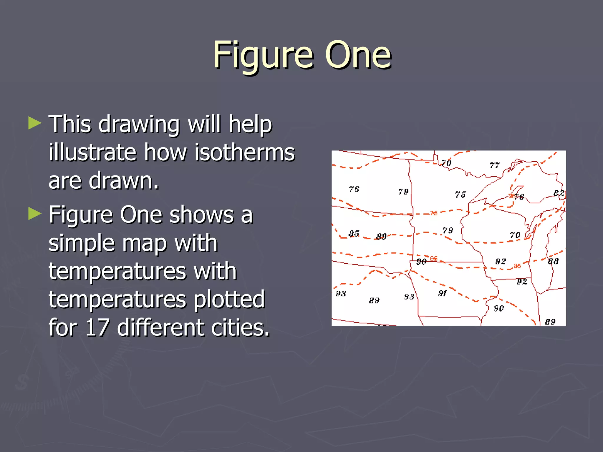
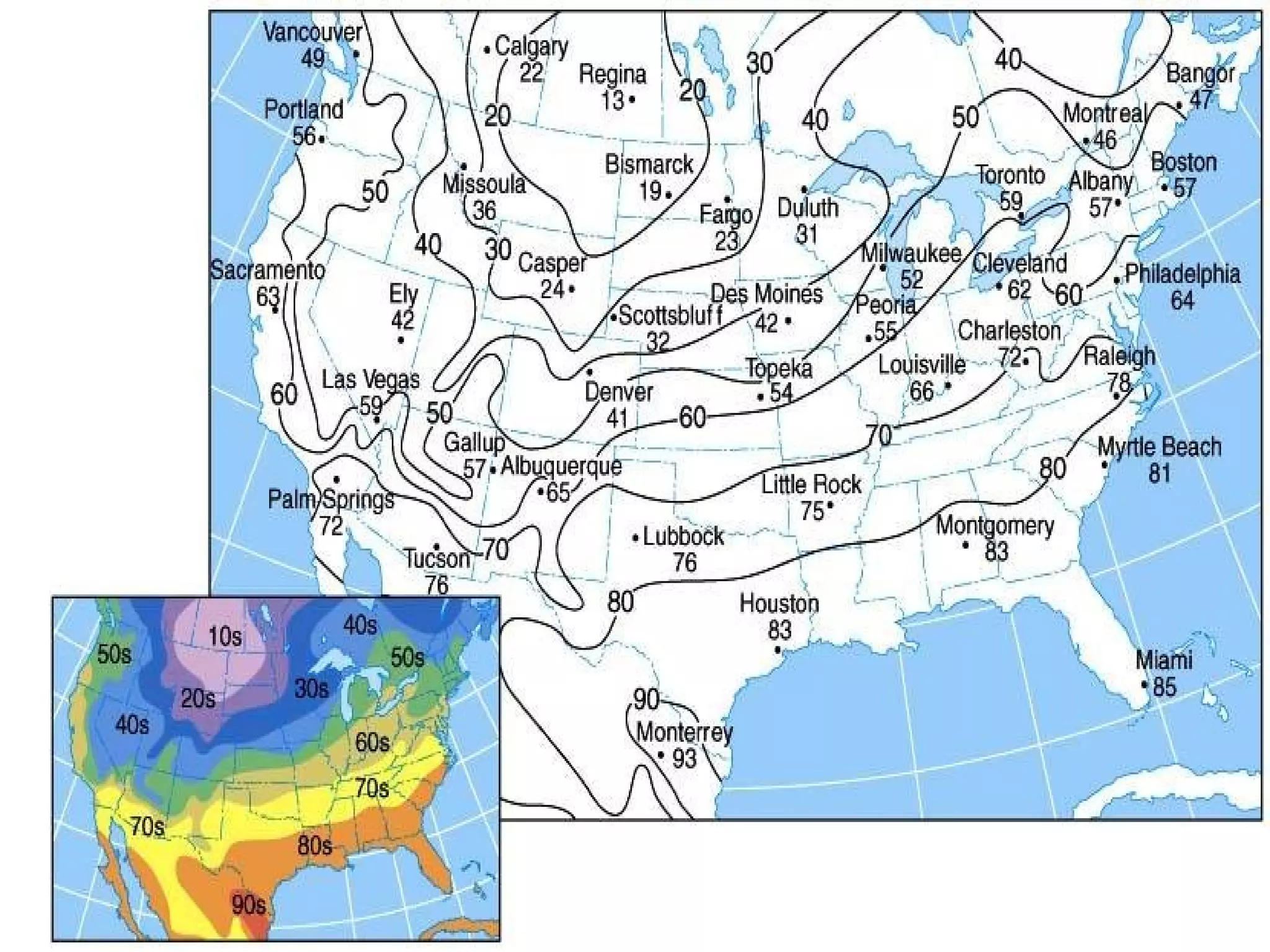
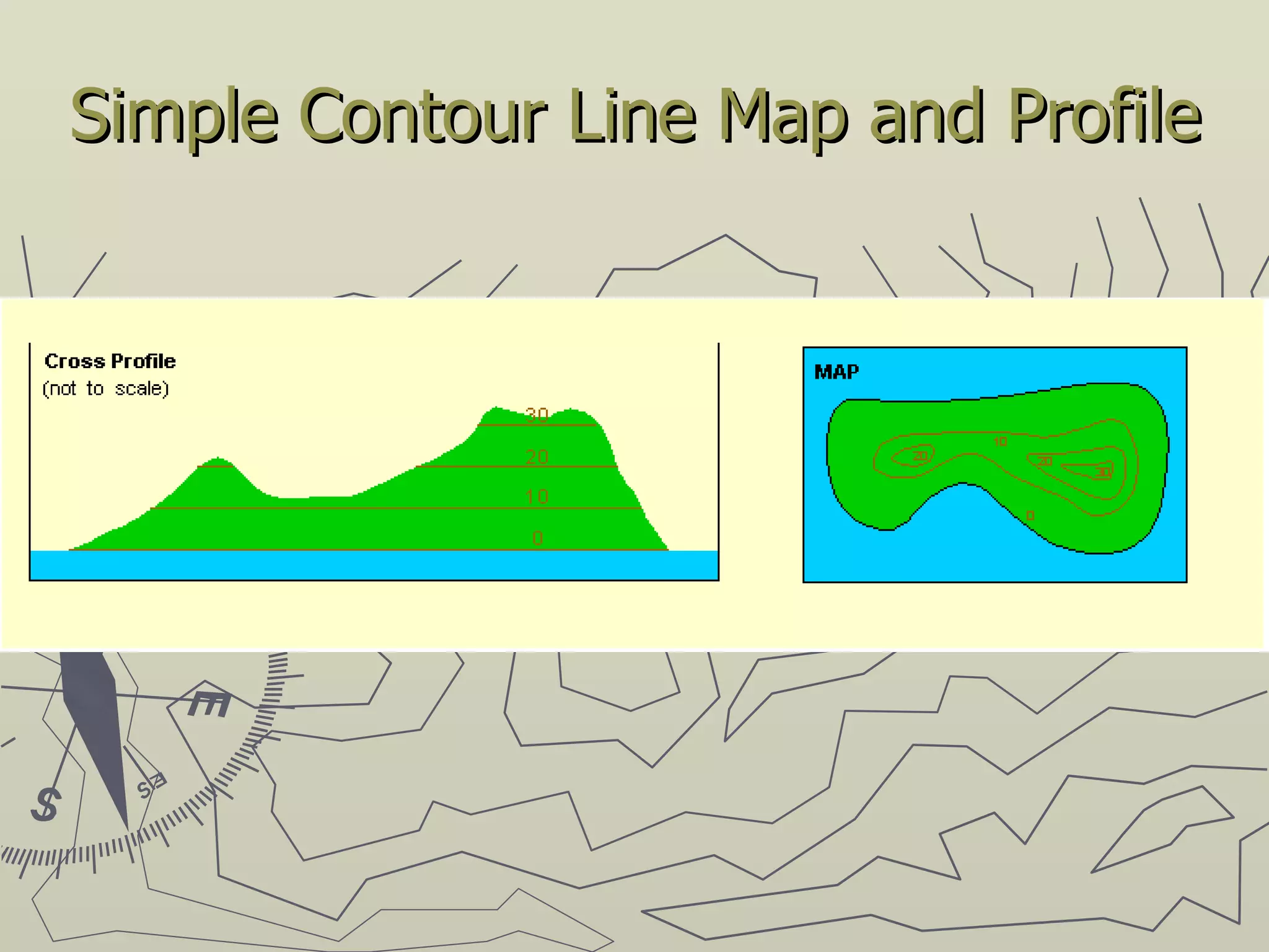
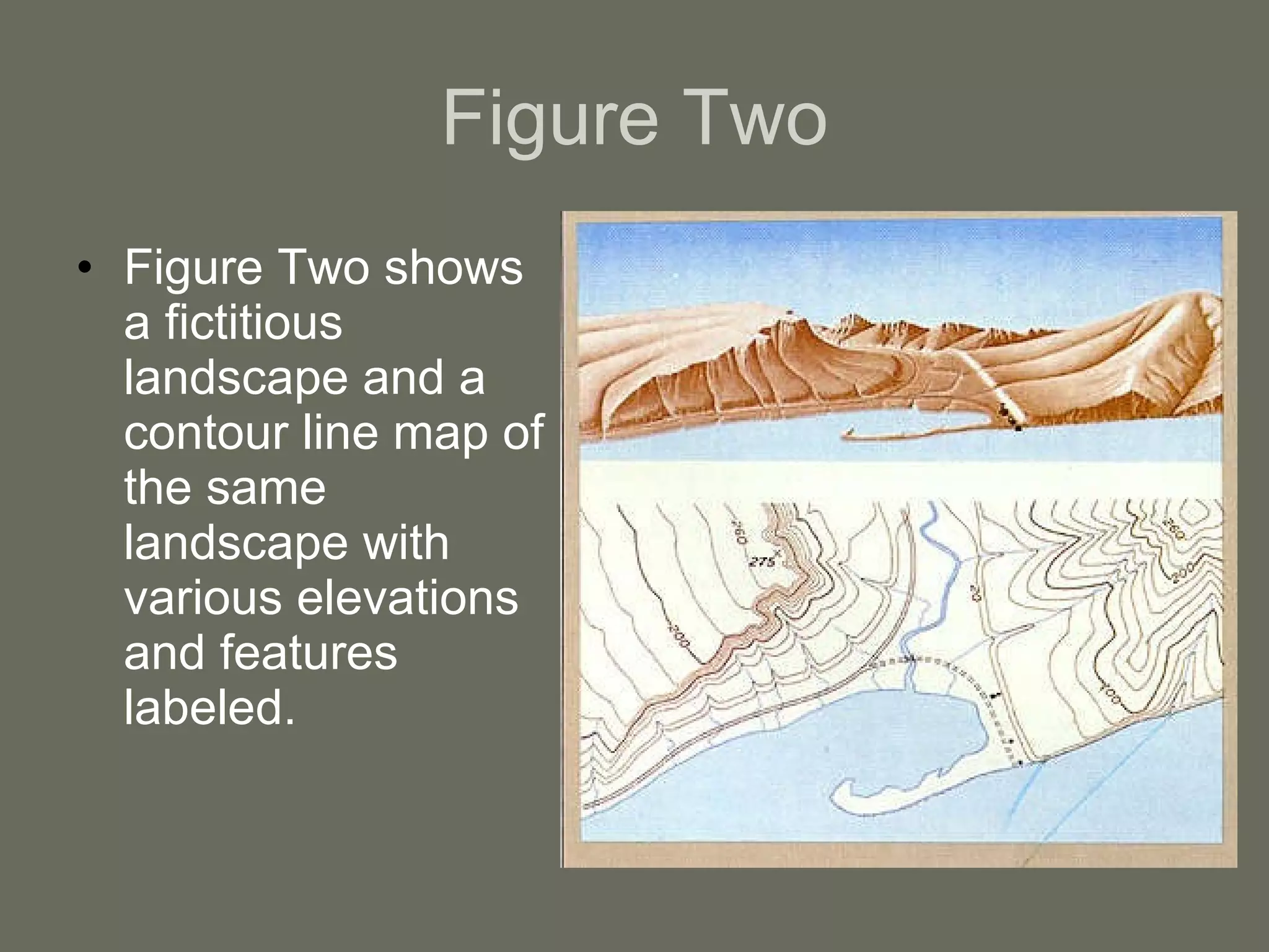
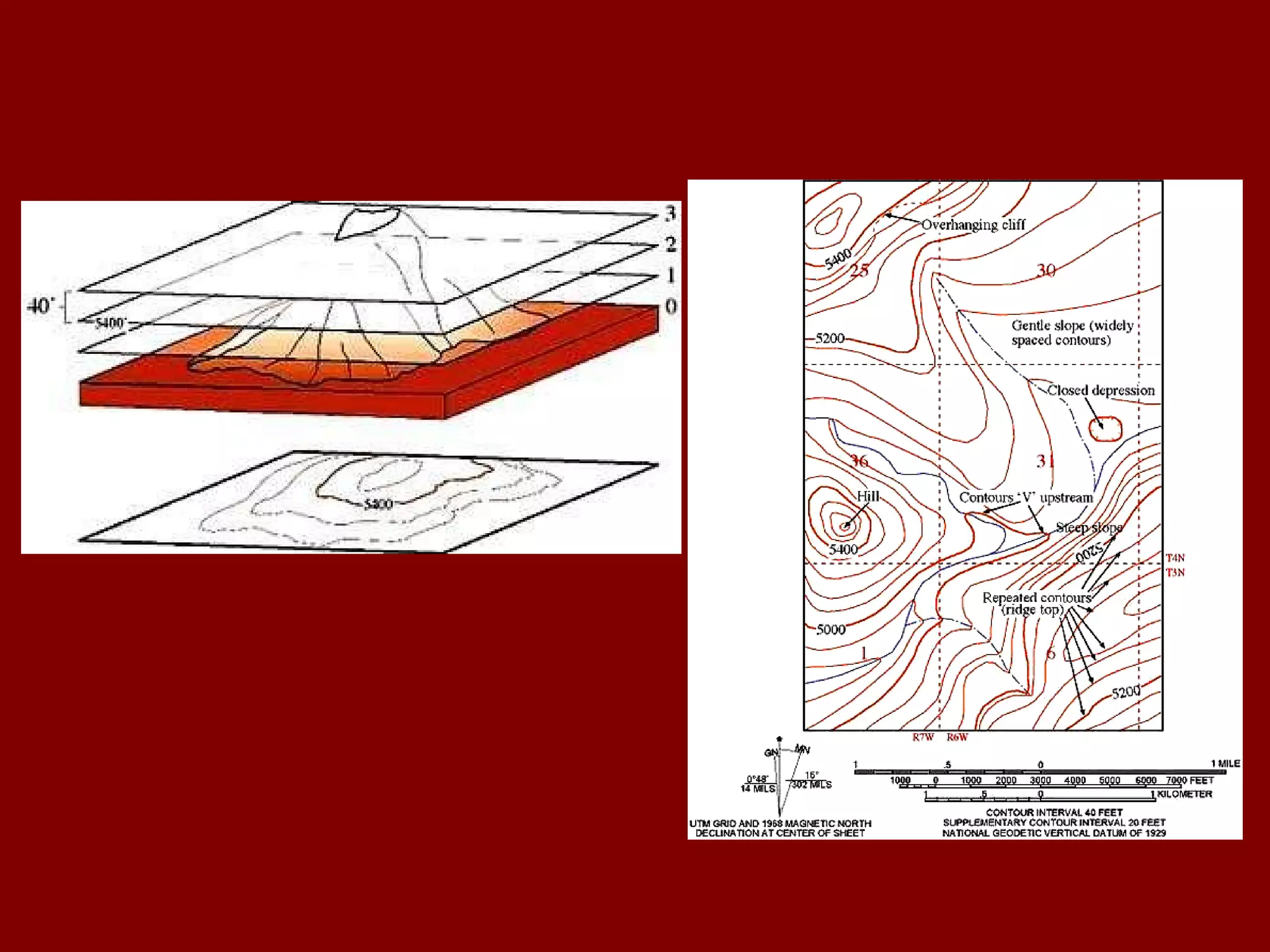
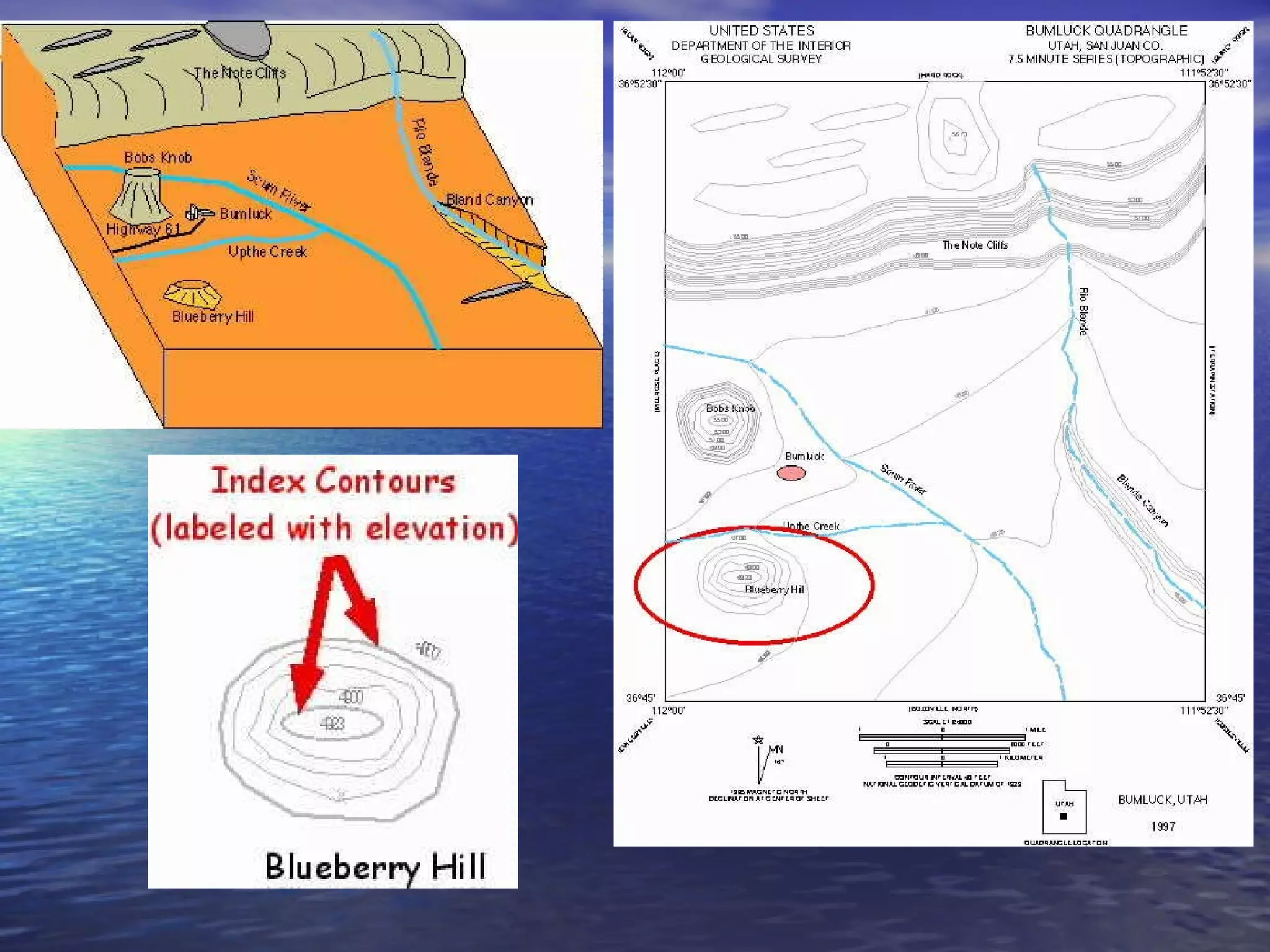
Isolines, also known as contour lines, connect points of equal value on a map. They show characteristics such as elevation, temperature, rainfall, and pressure. Isolines are always closed, do not cross, and indicate a rapid change where spaced closely and a gradual change where spaced far apart. Different types of isolines include isobars for pressure, isotherms for temperature, and contour lines for elevation shown on topographic maps.


![[Quick guide]sataid for-wis](https://cdn.slidesharecdn.com/ss_thumbnails/quick-guidesataidforwis-150707021921-lva1-app6891-thumbnail.jpg?width=640&height=640&fit=bounds)