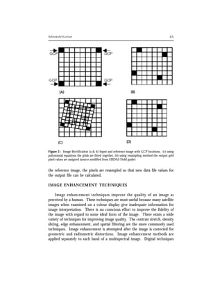
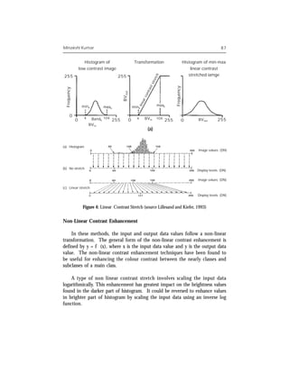
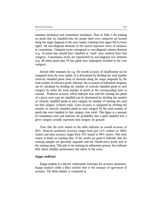
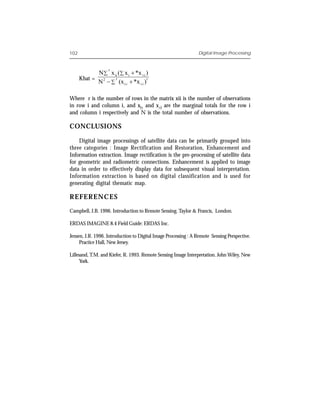
This document discusses digital image processing of satellite images. It describes how satellite images are represented digitally as pixels with brightness values. It explains that digital image processing involves three main categories: image rectification and restoration to correct geometric distortions; enhancement to improve visual interpretation; and information extraction to automate feature identification. It provides details on image rectification, color composites, and basic image enhancement techniques for satellite images.