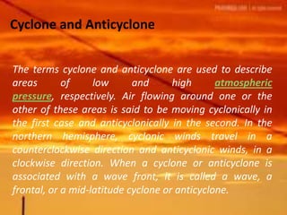
Cyclones and anticyclones are areas of low and high atmospheric pressure respectively. Air flows cyclonically (counterclockwise in northern hemisphere) around low pressure systems and anticyclonically (clockwise) around high pressure systems. Cyclones are associated with rising air and rain while anticyclones see sinking air and fair weather. Irregularities in jet streams can contribute to the formation and movement of cyclonic and anticyclonic weather systems.
introduction of precipitation , process of introduction , form of precipitation ,types of precipitation , conclusion ,reference
according to Agro -metrology
Water is hydrosphere is made up of all the water on Earth. This includes all of the rivers, lakes, streams, oceans, groundwater, polar ice caps, glaciers and moisture in the air (like rain and snow). The hydrosphere is found on the surface of Earth, but also extends down several miles below, as well as several miles up into the atmosphere. So, there is a need for study of water as a scarce resource.
WHAT IS HYDROLOGICAL CYCLE
SYSTEM APPROACH IN HYDROLOGY
HYDROLOGIC INPUT & OUTPUT
VARIATION IN HYDROLOGICAL CYCLE
COMPONENTS
EVAPORATION
EVAPOTRANSPIRATION
PRECIPITATION
INTERCEPTION
INFILTRATION
GROUND WATER
RUN-OFF
HUMAN IMPACT
EARTH SURFACE
CLIMATE CHANGE
ATMOSPHERIC POLLUTION
MULTI PURPOSE PROJECTS
WATER WITHDRAWAL
MANAGEMENT AND CONTROL
Horizontal Distribution & Differences of Temperature
If the Earth was a homogeneous body without the present land/ocean distribution, its temperature distribution would be strictly latitudinal. However, the Earth is more complex than this, being composed of a mosaic of land and water. This mosaic causes latitudinal (horizontal) zonation of temperature to be disrupted spatially.
LGF 1013-Kumpulan Hujan, Jenis-jenis Awan, dan Faktor Cuaca dan IklimStanley James
Proses utama yang membentuk 3 kumpulan utama hujan melalui proses pemeluwapan, perbezaan awan secara vertikal, proses pengangkatan (uplifting) dalam membentuk awan dan faktor2 yang memberi kesan kpd cuaca dan iklim sepanjang tahun.
this is a presentation of cyclone.in this ppt, various types of cyclones are given.its effects, formation, different names, types, emergency response on cyclone is given
Tropical deforestation, global climate change, ENSO and possible feedback amp...Paul Pittman
Essay derived from compilation of sveral journal articles. Duscusses rainforest loss and its effects on global climate, especially ENSO (El-Nino Southern Oscillation). Reveals possible feedback amplification between tropical African and Amazonian deforestation.
This is abaout tropical strom. my teacher gave the task to make a presentation explaining natural disasters. I and my group explain about tropical storm.
Understanding Cyclones. Cyclone Freddy being of interestPeter Maphalla
These was an assignment that we were required to complete with the topic being the understanding of tropical cyclones. But the main focus of these research was on cyclone freddy which was the longest living cyclone in history. I hope you enjoy my work
Generative AI Deep Dive: Advancing from Proof of Concept to ProductionAggregage
Join Maher Hanafi, VP of Engineering at Betterworks, in this new session where he'll share a practical framework to transform Gen AI prototypes into impactful products! He'll delve into the complexities of data collection and management, model selection and optimization, and ensuring security, scalability, and responsible use.
GDG Cloud Southlake #33: Boule & Rebala: Effective AppSec in SDLC using Deplo...James Anderson
Effective Application Security in Software Delivery lifecycle using Deployment Firewall and DBOM
The modern software delivery process (or the CI/CD process) includes many tools, distributed teams, open-source code, and cloud platforms. Constant focus on speed to release software to market, along with the traditional slow and manual security checks has caused gaps in continuous security as an important piece in the software supply chain. Today organizations feel more susceptible to external and internal cyber threats due to the vast attack surface in their applications supply chain and the lack of end-to-end governance and risk management.
The software team must secure its software delivery process to avoid vulnerability and security breaches. This needs to be achieved with existing tool chains and without extensive rework of the delivery processes. This talk will present strategies and techniques for providing visibility into the true risk of the existing vulnerabilities, preventing the introduction of security issues in the software, resolving vulnerabilities in production environments quickly, and capturing the deployment bill of materials (DBOM).
Speakers:
Bob Boule
Robert Boule is a technology enthusiast with PASSION for technology and making things work along with a knack for helping others understand how things work. He comes with around 20 years of solution engineering experience in application security, software continuous delivery, and SaaS platforms. He is known for his dynamic presentations in CI/CD and application security integrated in software delivery lifecycle.
Gopinath Rebala
Gopinath Rebala is the CTO of OpsMx, where he has overall responsibility for the machine learning and data processing architectures for Secure Software Delivery. Gopi also has a strong connection with our customers, leading design and architecture for strategic implementations. Gopi is a frequent speaker and well-known leader in continuous delivery and integrating security into software delivery.
Elevating Tactical DDD Patterns Through Object CalisthenicsDorra BARTAGUIZ
After immersing yourself in the blue book and its red counterpart, attending DDD-focused conferences, and applying tactical patterns, you're left with a crucial question: How do I ensure my design is effective? Tactical patterns within Domain-Driven Design (DDD) serve as guiding principles for creating clear and manageable domain models. However, achieving success with these patterns requires additional guidance. Interestingly, we've observed that a set of constraints initially designed for training purposes remarkably aligns with effective pattern implementation, offering a more ‘mechanical’ approach. Let's explore together how Object Calisthenics can elevate the design of your tactical DDD patterns, offering concrete help for those venturing into DDD for the first time!
Dr. Sean Tan, Head of Data Science, Changi Airport Group
Discover how Changi Airport Group (CAG) leverages graph technologies and generative AI to revolutionize their search capabilities. This session delves into the unique search needs of CAG’s diverse passengers and customers, showcasing how graph data structures enhance the accuracy and relevance of AI-generated search results, mitigating the risk of “hallucinations” and improving the overall customer journey.
Sudheer Mechineni, Head of Application Frameworks, Standard Chartered Bank
Discover how Standard Chartered Bank harnessed the power of Neo4j to transform complex data access challenges into a dynamic, scalable graph database solution. This keynote will cover their journey from initial adoption to deploying a fully automated, enterprise-grade causal cluster, highlighting key strategies for modelling organisational changes and ensuring robust disaster recovery. Learn how these innovations have not only enhanced Standard Chartered Bank’s data infrastructure but also positioned them as pioneers in the banking sector’s adoption of graph technology.
GridMate - End to end testing is a critical piece to ensure quality and avoid...ThomasParaiso2
End to end testing is a critical piece to ensure quality and avoid regressions. In this session, we share our journey building an E2E testing pipeline for GridMate components (LWC and Aura) using Cypress, JSForce, FakerJS…
Climate Impact of Software Testing at Nordic Testing DaysKari Kakkonen
My slides at Nordic Testing Days 6.6.2024
Climate impact / sustainability of software testing discussed on the talk. ICT and testing must carry their part of global responsibility to help with the climat warming. We can minimize the carbon footprint but we can also have a carbon handprint, a positive impact on the climate. Quality characteristics can be added with sustainability, and then measured continuously. Test environments can be used less, and in smaller scale and on demand. Test techniques can be used in optimizing or minimizing number of tests. Test automation can be used to speed up testing.
GraphRAG is All You need? LLM & Knowledge GraphGuy Korland
Guy Korland, CEO and Co-founder of FalkorDB, will review two articles on the integration of language models with knowledge graphs.
1. Unifying Large Language Models and Knowledge Graphs: A Roadmap.
https://arxiv.org/abs/2306.08302
2. Microsoft Research's GraphRAG paper and a review paper on various uses of knowledge graphs:
https://www.microsoft.com/en-us/research/blog/graphrag-unlocking-llm-discovery-on-narrative-private-data/
A tale of scale & speed: How the US Navy is enabling software delivery from l...sonjaschweigert1
Rapid and secure feature delivery is a goal across every application team and every branch of the DoD. The Navy’s DevSecOps platform, Party Barge, has achieved:
- Reduction in onboarding time from 5 weeks to 1 day
- Improved developer experience and productivity through actionable findings and reduction of false positives
- Maintenance of superior security standards and inherent policy enforcement with Authorization to Operate (ATO)
Development teams can ship efficiently and ensure applications are cyber ready for Navy Authorizing Officials (AOs). In this webinar, Sigma Defense and Anchore will give attendees a look behind the scenes and demo secure pipeline automation and security artifacts that speed up application ATO and time to production.
We will cover:
- How to remove silos in DevSecOps
- How to build efficient development pipeline roles and component templates
- How to deliver security artifacts that matter for ATO’s (SBOMs, vulnerability reports, and policy evidence)
- How to streamline operations with automated policy checks on container images
DevOps and Testing slides at DASA ConnectKari Kakkonen
My and Rik Marselis slides at 30.5.2024 DASA Connect conference. We discuss about what is testing, then what is agile testing and finally what is Testing in DevOps. Finally we had lovely workshop with the participants trying to find out different ways to think about quality and testing in different parts of the DevOps infinity loop.
UiPath Test Automation using UiPath Test Suite series, part 5DianaGray10
Welcome to UiPath Test Automation using UiPath Test Suite series part 5. In this session, we will cover CI/CD with devops.
Topics covered:
CI/CD with in UiPath
End-to-end overview of CI/CD pipeline with Azure devops
Speaker:
Lyndsey Byblow, Test Suite Sales Engineer @ UiPath, Inc.
2. cyclone The term ‘cyclone’ refers to large-scale rotating
weather systems which rotate with positive vorticity.
Two major types of cyclones are tropical cyclones and
extra- tropical cyclones. The latter are also known as
depressions. The mechanisms of formation and the
structures of these two forms are so different that they
should be considered separately.
3. Tropical cyclones are also known as
hurricanes and typhoons. They develop over
tropical oceans and can produce extremely
heavy rainfall and devastating winds with
sustained wind speeds sometimes in excess
of 100 metres per second (m s−1). Satellite
pictures (Fig. 1) reveal a striking circular
symmetry in tropical cyclones with a small
(50 km diameter) cloud-free ‘eye’. The
preferred regions for hurricane development
are oceans where the winds are light, the
humidity is high, and the surface water
temperature is high (usually over 26 °C) over
4. Since these conditions exist in some
places for only part of unfortunate that
they share the same nameThe conditions
required for tropical cyclones are also
suitable conditions for
thunderstorms, deep convective clouds
with strong updraughts. Thunderstorms
can be organized into a tropical cyclone in
the presence of low-level convergence.
The winds converging in one particular
region increase the large-scale rotation in
an anti clockwise sense in the northern
5. Because this rotation is an important factor
in the development of tropical cyclones,
and because no rotation is imparted at the
Equator, no development of tropical
cyclones is found within about 5 degrees of
the Equator. As the air converges, the
thunderstorms become more organized
and closer together. Huge amounts of
water evaporating from the warm ocean
surface are carried aloft in the bands of
thunderstorms. As the air rises it cools, and
the water condenses releasing latent heat.
6. The latent heat released greatly enhances the
buoyancy of the air, producing even stronger
updraughts, which in turn draw in more
converging air at the base. There is positive
feedback as more warm moist air being drawn
into the base of the clouds produces even
stronger updraughts. At the tropopause the air
spreads out in bands moving away from the
centre of the cyclone. When this divergence of air
at high levels exceeds the convergence of air at
low levels, the surface pressure drops, forming a
low-pressure centre around which the air
circulates and converges, bringing in even more
warm moist air to feed the cyclone. Extra-tropical
cyclones.
7. Extra-tropical cyclones are the middle
latitude tropospheric circulation systems
also known as depressions. The life
cycle of a depression is often described
by the polar front approach, in which the
depression is seen as a disturbance
which grows and modifies the front as it
develops. Another approach is used
here to illustrate the three-dimensional
structure and the development
mechanism by which an extra-tropical
cyclone develops.
8. Fig.2 shows a wave depression at its
most vigorous stage of development.
The surface weather map shows an
open warm sector with a deepening
low-pressure centre. The low-pressure
centre is situated below a region in the
upper troposphere where a wave or
trough of low pressure is lying slightly
behind the surface low. This is exactly
the configuration required to enable a
low-pressure centre to deepen. The
circulation of the wave depression is in
9. . (In the southern hemisphere the
circulation would be clockwise, but the
cold air would be to the south and so the
mechanism would be the same.) The
warm air at low levels in the warm sector
is lifted above the warm front. This applies
not only to air at the surface, but to all the
air through a substantial depth. At the
same time the cold air moving southwards
behind the low-pressure centre is losing
height. The net effect of warm air rising
and cold air sinking is to decrease the
‘centre of gravity’ of the system because
10. By lowering the centre of gravity, some
potential energy is removed from the system
and converted to kinetic energy—the energy
of motion. (When we release an object from a
height and let it fall, we are converting
potential energy into kinetic energy). In the
wave depression the kinetic energy is
manifested by the strength of the winds in the
circulating system. Because it is these winds
that are moving the warm air upwards and
the cold air downwards, the process
accelerates and feeds on itself. This unstable
situation, known as baroclinic instability,
continues until the warm air is lifted from the
surface into the upper troposphere.
11. By moving warm, less dense, air into the
column ahead of the upper trough the
pressure ahead of the upper trough is
reduced. Conversely, the cold air introduced
behind the trough increases the pressure: so
the trough minimum is moved from east to
west. This means that the region of
divergence is now no longer above the centre
of low pressure at the surface. In fact, there is
neither divergence nor convergence at upper
levels, but convergence remains at the
surface. The effect is thus to increase the
surface pressure and complete the last phase
12. Cyclone and Anticyclone
The terms cyclone and anticyclone are used to describe
areas of low and high atmospheric
pressure, respectively. Air flowing around one or the
other of these areas is said to be moving cyclonically in
the first case and anticyclonically in the second. In the
northern hemisphere, cyclonic winds travel in a
counterclockwise direction and anticyclonic winds, in a
clockwise direction. When a cyclone or anticyclone is
associated with a wave front, it is called a wave, a
frontal, or a mid-latitude cyclone or anticyclone.
13. Vertical air movements are
associated with both cyclones
and anticyclones. In the former
case, air close to the ground is
forced inward, toward the center
of a cyclone, where pressure is
lowest, and then begins to rise
upward. At some height, the rising
air begins to diverge outward
away from the cyclone center.
14. In an anticyclone, the situation is reversed.
Air at the center of an anticyclone is forced
away from the high pressure that occurs
there and is replaced by a downward draft
of air from higher altitudes. That air is
replaced, in turn, by a convergence of air
from higher altitudes moving into the upper
region of the anticyclone.
Distinctive weather patterns tend to be associated with
both cyclones and anticyclones. Cyclones and low
pressure systems are generally harbingers of rain,
clouds, and other forms of bad weather, while
anticyclones and high pressure systems are predictors
of fair weather.
15. One factor in the formation of cyclones
and anticyclones may be the
development of irregularities in a jet
stream. When streams of air in the
upper atmosphere begin to meander
back and forth along an east-west axis,
they may add to cyclonic or
anticyclonic systems that already exist
in the lower troposphere. As a result,
relatively stable cyclones (or
anticyclones) or families of cyclones (or
anticyclones) may develop and travel
16. On relatively rare occasions, such
storms may pick up enough
energy to be destructive of
property and human life.
Tornadoes and possibly
hurricanes are examples of such
extreme conditions.