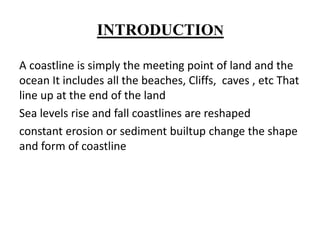
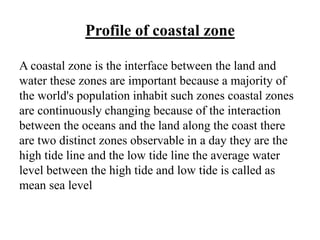
INTRODUCTION
A coastline is simply the meeting point of land and the
ocean It includes all the beaches, Cliffs, caves , etc That
line up at the end of the land
Sea levels rise and fall coastlines are reshaped
constant erosion or sediment builtup change the shape
and form of coastline
Coastlines changes with time when sea level rises and
fall coastline are reshaped Constant erosion or sediment
build-up also change the shape and form of coastlines
New features such as stacks and caves are formed and
older features also breakup
Coastlines are formed in many ways The deposit of
sediments carried by ocean,currents and river entering
the seas and also by erosion by waves .Rocky coastlines
are usually formed by erosion while Sandy beaches,
sedimentary and Shallow coastlines are usually those
formed from sedimentary deposits.earth or tectonic
movements can also pushup new landforms or spill out
new Lava from nearby mountains creating new coastal
features
Profile of coastal zone
A coastal zone is the interface between the land and
water these zones are important because a majority of
the world's population inhabit such zones coastal zones
are continuously changing because of the interaction
between the oceans and the land along the coast there
are two distinct zones observable in a day they are the
high tide line and the low tide line the average water
level between the high tide and low tide is called as
mean sea level
Coastal belt
Coastal belts are divided into three divisions Bakshore
region ,Foreshore region, Offshore region
Backshore region
The area of a shore that lies between the average high
tide mark and the average low tide mark
Foreshore region
The zone of the shore or beach above the high water
line
Offshore region
At a distance from the Shore
Waves Tides and currents
When we go to the coastal region we hear the
continuous sound of waves. waves are formed by
periodic changes in the water surface height caused by
the wind. waves are capable of doing both constructive
and destructive processes.waves get the energy from the
wind as the wind blows over the surface of the sea it
create friction this fictional drugs causes wave particle
to rotate and their energy is transferred in the form of
wave
The movement of particles
towards the coastal area is
called swash
when it is moving back it is
called backswash
Based on actions two main
types of waves have been
recognised
They are
constructive wave
Destructive wave
Constructive wave
They are low energy waves that tend to arrive at a rate
of less than 8 waves per minute. constructive wave are
small in height. They have strong swashand weak
backswash
Destructive waves
Destructive wave have higher energy and tend to arrive
at the coast at a rate of more than 8 per minute. They are
much larger in height then constructive waves often
have been caused by strong winds. Destructive waves
have a weak swash but a strong backswash
Process of coastal erosion
The combined effect of waves currents and Tides result
in the variety of gradiational processes acting in the
coastal zone coastal erosion happens in the form of
hydraulic action, corrosion, attrition, solution
Hydraulic action
Hydraulic action occurs when the
motion of water against a rock
surface produces mechanical
weathering
The abrasion of a river is
when the rocks,sand and
pebbles erode the river bed
Abrasion
Attrition
Attrition is the erosion of the river bed
solution
The solution of a river is the
final result of the erosion of
the rocks that are in the river
Landforms of coastal
regions are classified into
two major groups
Erosional landforms
Depositional landforms
Erosional landforms
The notable erosional landforms of the coasts are
sea cliffs
sea caves
sea arches
sea stacks
Depositional landforms
Depositional landforms are the visible evidence of
processes that have deposited sediments or rocks after
they were transported by flowing Ice or water, wind or
Gravity
Tides
Tides are the Rise and fall of sea levels caused by the
combined effect of gravitational forces exerted by the
moon and the sun and the rotation of the earth
The notable depositional coastal
landform are
Beaches
Tombolo
Barrier islands
Mudflats
Beaches
A beach is a landform alongside a body of water which
consists of loose particles the particles composing a
beach are typically made from Rock such as sand,
gravel ,shingle pebbles
Barrier spits and Islands
It is away from main beach area and it stands isolated in
Island
Tombolo
Tombolo is a kind of tide Island.It acts as a connecting
link between land and Island and it is called as Tombolo
Mudflats
Mudflats are formed due to the action of tidal currents
they contain silt and clay
Conclusion
THANK YOU

Costal landforms

  • 1.
    INTRODUCTION A coastline issimply the meeting point of land and the ocean It includes all the beaches, Cliffs, caves , etc That line up at the end of the land Sea levels rise and fall coastlines are reshaped constant erosion or sediment builtup change the shape and form of coastline
  • 2.
    Coastlines changes withtime when sea level rises and fall coastline are reshaped Constant erosion or sediment build-up also change the shape and form of coastlines New features such as stacks and caves are formed and older features also breakup
  • 3.
    Coastlines are formedin many ways The deposit of sediments carried by ocean,currents and river entering the seas and also by erosion by waves .Rocky coastlines are usually formed by erosion while Sandy beaches, sedimentary and Shallow coastlines are usually those formed from sedimentary deposits.earth or tectonic movements can also pushup new landforms or spill out new Lava from nearby mountains creating new coastal features
  • 4.
    Profile of coastalzone A coastal zone is the interface between the land and water these zones are important because a majority of the world's population inhabit such zones coastal zones are continuously changing because of the interaction between the oceans and the land along the coast there are two distinct zones observable in a day they are the high tide line and the low tide line the average water level between the high tide and low tide is called as mean sea level
  • 5.
    Coastal belt Coastal beltsare divided into three divisions Bakshore region ,Foreshore region, Offshore region Backshore region The area of a shore that lies between the average high tide mark and the average low tide mark
  • 6.
    Foreshore region The zoneof the shore or beach above the high water line Offshore region At a distance from the Shore
  • 7.
    Waves Tides andcurrents When we go to the coastal region we hear the continuous sound of waves. waves are formed by periodic changes in the water surface height caused by the wind. waves are capable of doing both constructive and destructive processes.waves get the energy from the wind as the wind blows over the surface of the sea it create friction this fictional drugs causes wave particle to rotate and their energy is transferred in the form of wave
  • 8.
    The movement ofparticles towards the coastal area is called swash when it is moving back it is called backswash Based on actions two main types of waves have been recognised They are constructive wave Destructive wave
  • 9.
    Constructive wave They arelow energy waves that tend to arrive at a rate of less than 8 waves per minute. constructive wave are small in height. They have strong swashand weak backswash
  • 10.
    Destructive waves Destructive wavehave higher energy and tend to arrive at the coast at a rate of more than 8 per minute. They are much larger in height then constructive waves often have been caused by strong winds. Destructive waves have a weak swash but a strong backswash
  • 11.
    Process of coastalerosion The combined effect of waves currents and Tides result in the variety of gradiational processes acting in the coastal zone coastal erosion happens in the form of hydraulic action, corrosion, attrition, solution
  • 12.
    Hydraulic action Hydraulic actionoccurs when the motion of water against a rock surface produces mechanical weathering The abrasion of a river is when the rocks,sand and pebbles erode the river bed Abrasion
  • 13.
    Attrition Attrition is theerosion of the river bed solution The solution of a river is the final result of the erosion of the rocks that are in the river
  • 14.
    Landforms of coastal regionsare classified into two major groups Erosional landforms Depositional landforms
  • 15.
    Erosional landforms The notableerosional landforms of the coasts are sea cliffs sea caves sea arches sea stacks
  • 16.
    Depositional landforms Depositional landformsare the visible evidence of processes that have deposited sediments or rocks after they were transported by flowing Ice or water, wind or Gravity
  • 17.
    Tides Tides are theRise and fall of sea levels caused by the combined effect of gravitational forces exerted by the moon and the sun and the rotation of the earth
  • 18.
    The notable depositionalcoastal landform are Beaches Tombolo Barrier islands Mudflats
  • 19.
    Beaches A beach isa landform alongside a body of water which consists of loose particles the particles composing a beach are typically made from Rock such as sand, gravel ,shingle pebbles
  • 20.
    Barrier spits andIslands It is away from main beach area and it stands isolated in Island
  • 21.
    Tombolo Tombolo is akind of tide Island.It acts as a connecting link between land and Island and it is called as Tombolo
  • 22.
    Mudflats Mudflats are formeddue to the action of tidal currents they contain silt and clay
  • 23.
  • 24.