Downloaded 81 times
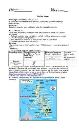


This document provides instructions for locating the epicenter of an earthquake using triangulation from seismic station data. The procedure involves using the time difference between P and S wave arrivals at three stations to calculate the distance from each station to the epicenter. Circles are drawn on a map using these distances to find the point where all three intersect, which identifies the epicenter. Determining the epicenter is important for understanding the earthquake's location and effects.


![Earth and Space W2 D2 - 3 [Autosaved].pptx](https://cdn.slidesharecdn.com/ss_thumbnails/earthandspacew2d2-3autosaved-250710040541-de452520-thumbnail.jpg?width=640&height=640&fit=bounds)


