The document summarizes key aspects of the hydrologic cycle and Earth's water systems. It describes the hydrologic cycle as a series of interconnected water storage areas and transfer processes. It discusses the oceans, which contain over 97% of Earth's water, and how ocean waters vary in salinity, temperature, and density around the world. It also outlines various freshwater storage areas like lakes, rivers, groundwater, and glaciers, and how humans have impacted some of these systems through activities like irrigation and groundwater extraction.
Geomorphology at a glance: Major landformsP.K. Mani
Geomorphology, Major landforms, Genetic landform classifications, Volcanic landforms, River Systems and Fluvial Landforms, Aeolian Landforms, Glacial Landforms
Physical Geography Lecture 09 - Water Resources (Ground water and ice) 110716angelaorr
Movement and locations of water. Underground water. Soil water belt, subsurface flow. Percolation. Porosity and Permeability. Hydrologic Zones. Zone of aeration, zone of saturation, water table, effluent and influent condition. Zone of confined water, aquaclude, aquifer, artesian well. Waterless zone. Groundwater management. Groundwater management issues. Aquifer recharge, cone of depression, subsidence, groundwater contamination. The case of Venice Italy. Hydrothermal activity. Hot springs, geysers, fumaroles. Permafrost, melting permafrost. Glaciers, alpine and continental glaciers. Melting glaciers. Lakes. Destruction of the Aral Sea. Swamps and marshes. Streams.
Wind has the ability to shape the surface of the Earth. Wind is one of the greatest agents of land erosion and transportation. The action of wind is very significant in arid and semi-arid regions. Due to profound wetness, wind cannot act in humid regions. Wind is capable of eroding, transporting and depositing the surface materials, in drylands. The landforms created by wind action are called as Aeolian landforms. The word “Aeolian” is derived from the Greek word “Aeolus”, meaning, the god of the winds.
Geological work of the wind, deflation, wind abrasion, desert pavement,
ventifacts, desert dunes and sand sheets, sand seas or ergs, loess, coastal dunes, sand hills and
sabkhas, loess and evolution of deserts: Wind action and desert landscape
This is our group work in our science subject. We are assigned to make a power point presentation in order for us to understand and share our knowledge in the given chapter. We hope that you learned from the presentation the we have presented, thank you and good luck!
This power point presentation is all about water resources and its characteristics.It is presented by Ram Angeles and Frank Gutierrez of section 11- San Juan from Rizal Technological University
This document covers rivers from the CSEC Geography syllabus. It covers the water cycle, drainage basin, drainage density, drainage patterns, river processes, characteristics of rivers and river landforms
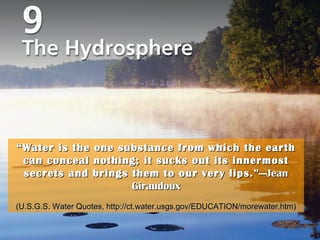
1. Title Page Photo “ Water is the one substance from which the earth can conceal nothing; it sucks out its innermost secrets and brings them to our very lips. ”—Jean Giraudoux (U.S.G.S. Water Quotes, http://ct.water.usgs.gov/EDUCATION/morewater.htm)
2. Vocabulary thermohaline circulation (p. 269) tidal bore (p. 268) tidal range (p. 267) tides (p. 267) waterless zone (p. 283) water table (p. 281) zone of aeration (p. 281) zone of confined water (p. 282) zone of saturation (p. 281) lake (p. 273) marsh (p. 278) permafrost (p. 273) permeability (p. 280) porosity (p. 280) runoff (p. 263) salinity (p. 266) subartesian (well) (p. 283) swamp (p. 278) aquifers (p. 281) artesian well (p. 283) global conveyer-belt circulation (p. 269) groundwater (p. 281) hydrologic cycle (p. 261) iceberg (p. 271) ice floe (p. 271) ice pack (p. 271) ice shelf (p. 271)
Figure: 09-12PE-B Title: Mean annual ground temperatures at Bonanza Creek, Fairbanks, Alaska from 1930 to 2003. Caption: (NOAA/Vladimir E. Romanovsky, University of Alaska, Fairbanks) Keywords: ice, permafrost, global warming, climates, greenhouse gases
Figure: 09-25PE-E Title: Subsidence around Las Vegas. Caption: InSAR-derived maps showing ground subsidence due to groundwater pumping in the Las Vegas Valley between April 1992 and December 1997. (From USGS Fact Sheet 165-00, Land Subsidence in the United States, 2000.) Keywords: groundwater, aquifers, water tables