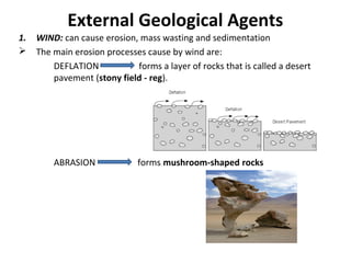
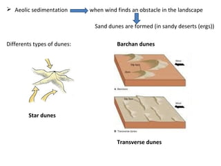
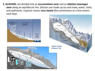
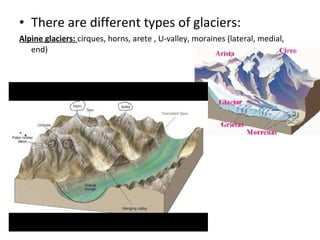
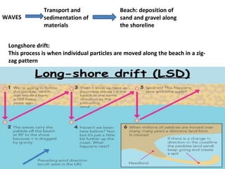
1. External geological agents such as wind, glaciers, water and sea water can cause erosion and sedimentation processes that shape the Earth's surface over time. Wind forms desert pavements and mushroom rocks through deflation and abrasion, and causes aeolian sedimentation forming dune types like barchan and star dunes. Glaciers erode and transport material, forming landforms like moraines.
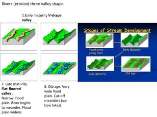
2. Water agents like rivers and streams erode through processes like mass wasting. Rivers progress through stages from youth to maturity that change their valleys and floodplains. Groundwater is stored in aquifers and can dissolve carbonate rock to form karst landscapes with sinkholes and caves.