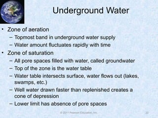
© 2011 Pearson Education, Inc.
Chapter 9: The Hydrosphere
McKnight’s Physical Geography:
A Landscape Appreciation,
Tenth Edition, Hess
© 2011 Pearson Education, Inc.
The Hydrosphere
• The Hydrologic Cycle
• The Oceans
• Movements of Ocean Waters
• Permanent Ice—The Crysophere
• Surface Waters
• Underground Water
2
© 2011 Pearson Education, Inc.
The Hydrologic Cycle
• Bulk of Earth’s moisture
(99%) is in storage in oceans,
lakes, rivers, glacial ice, or
rocks beneath the surface
• Remaining fraction involved in
a continuous sequence of
movement and change
• Movement is the hydrologic
cycle
3
Figure 9-1
© 2011 Pearson Education, Inc.
The Hydrologic Cycle
• Three primary movement
types
– Surface to air
• Ocean evaporation
• Vapor remains in air for a
short time
– Air to surface
• Precipitation—78% falls on
oceans and 22% on land
• Precipitation is the same as
evaporation over long time
scales
4
Figure 9-2
© 2011 Pearson Education, Inc.
The Hydrologic Cycle
• Three primary movement
types (cont.)
– Movement beneath the
surface—runoff
• Water collects in lakes and
rivers and either penetrates
ground or runs off if sloped
• Becomes part of underground
water supply
• Reemerges as springs or
becomes part of rivers and
streams
• Residence times
5
Figure 9-3
© 2011 Pearson Education, Inc.
The Oceans
• Vast majority of surface is
oceans
• Number of oceans
– Four principal parts
• Pacific—largest, occupies
1/3 of total Earth surface area
• Atlantic—less than half the size
of the Pacific
• Indian—slightly smaller than
Atlantic
• Arctic—small and shallow
• Smaller bodies—seas, gulfs,
and bays
6
Figure 9-4
© 2011 Pearson Education, Inc.
The Oceans
• Characteristics of ocean
waters
– Chemical composition
• Sodium and chlorine
• Salinity
– Increasing acidity
• Carbon dioxide absorbed by
ocean water creates carbonic
acid
• Affects the ability of microscopic
creatures to build shells and
exoskeletons
7
Figure 9-6
© 2011 Pearson Education, Inc.
The Oceans
• Characteristics of ocean waters (cont.)
– Temperature
• Decreases with increasing latitude
• Ranges from near 80 °F to near 28 °F
– Density
• High temperature means low density
• High salinity means high density
8
© 2011 Pearson Education, Inc.
Movement of Ocean Waters
• Three primary groupings: tides, currents, and waves
• Tides
– Bulges in sea surface in some places that are
compensated by sinks in the surface at other places
– Significant in shallow water areas for horizontal
placement of water
9
© 2011 Pearson Education, Inc.
Movement of Ocean Waters
• Causes of tides
– Gravitational attraction of
Moon (lunar tides) and Sun
(solar tides)
– More gravitational force on
the side of Earth facing the
Moon
– More centripetal force on
opposite side to keep Earth in
orbit
– Two bulges form on opposite
sides of planet
10
Figure 9-7a
© 2011 Pearson Education, Inc.
Movement of Ocean Waters
• Causes of tides (cont.)
– Two tidal cycles in 25 hours
– Flood tide and high tide
– Ebb tide and low tide
• Monthly tidal cycles
– Tidal range—difference in
high and low tides
– spring tides
– neap tides
• Global range of tides
11
Figure 9-7b and c
© 2011 Pearson Education, Inc.
Movement of Ocean Waters
• Currents
– Subtropical gyres develop from surface wind patterns
– Deep ocean circulations
• Result from differences in salinity and temperature in deep ocean
water
• Thermohaline circulation
• Water in northern latitudes is colder and higher salinity, so it sinks
– Global conveyer-belt circulation
• Waves
– Disturbances to the sea surface
– Little forward progress is observed
– Wave breaking can result in shifting of water
12
© 2011 Pearson Education, Inc.
Movement of Ocean Waters
13
Figure 9-10
© 2011 Pearson Education, Inc.
Permanent Ice – The Cryosphere
• Cryosphere
– Second greatest storage
of Earth’s water
– Two groups; ice on land
and ice in water
– Approximately 10% of
Earth’s surface is ice
– Different names
• Ice pack
• Ice shelf
• Ice floe
• Iceberg
14
Figure 9-12
© 2011 Pearson Education, Inc.
Permanent Ice – The Cryosphere
• Cryosphere (cont.)
– Largest ice pack covers
most of the Arctic ocean
surface
– Several large ice shelves
attached to Antarctica
– Large ice floes form off of
Antarctica
• Permafrost
– Permanently frozen
ground ice
15
Figure 9-13
© 2011 Pearson Education, Inc.
Surface Waters
• Represent only 0.02% of
the world’s total moisture
• Numerous surface water
types
• Lakes—bodies of water
surrounded by land
– Small lakes are called
ponds
– Lake Baykal in Siberia is
largest lake by volume
16
Figure 9-17
© 2011 Pearson Education, Inc.
Surface Waters
• Lakes (cont.)
– Saline versus freshwater lakes
– Ephemeral lakes (only contain water sporadically)
– Two conditions required for lake formation
• Natural basin with restricted outlet
• Sufficient water to keep basin filled
– Most are relatively short-lived
17
© 2011 Pearson Education, Inc.
Surface Waters
• Human alteration of natural
lakes
– Irrigation
– Water diversion projects
– Reservoirs
• Artificial lakes used for
hydroelectric power,
municipal water, and stable
agriculture
18
Modification of the Aral Sea
Figure 9-19a
© 2011 Pearson Education, Inc.
Surface Waters
• Swamps and Marshes
– Flattish places that are
periodically submerged
and shallow enough to
permit plant growth
– Swamps grow trees
– Marshes grow grasses
and rushes
19
Figure 9-23
© 2011 Pearson Education, Inc.
Surface Waters
• Rivers and Streams
– Streams smaller than
rivers
– Geographers call all
running water streams
– Allow for drainage of
land surface water
towards oceans
– Drainage basins
20
Figure 9-24
© 2011 Pearson Education, Inc.
Underground Water
• Water beneath land
surface worldwide
• More than half found
within 800 meters of the
surface
• Precipitation or water
basins are the sources
• Quantity held depends on
– Porosity
– Permeability
• Aquifers and aquicludes
21
Figure 9-25
© 2011 Pearson Education, Inc.
Underground Water
• Zone of aeration
– Topmost band in underground water supply
– Water amount fluctuates rapidly with time
• Zone of saturation
– All pore spaces filled with water, called groundwater
– Top of the zone is the water table
– Water table intersects surface, water flows out (lakes,
swamps, etc.)
– Well water drawn faster than replenished creates a
cone of depression
– Lower limit has absence of pore spaces
22
© 2011 Pearson Education, Inc.
Underground Water
• Zone of confined water
– Zone that exists in some
regions that is below the
region of impermeable
rock below the zone of
saturation
– Pressure at the great
depth of the water will
cause water to rise to
piezometric surface
– Artesian well versus sub-
artesian
23
Figure 9-27
© 2011 Pearson Education, Inc.
Underground Water
• Waterless zone
– Pressure too great to
sustain water
• Groundwater mining
– Accumulation of
groundwater is slow, but
human use is rapid
– The Ogallala Aquifer
• Water table drops with
increased use
• Numerous wells tapped
• Unsustainable situation
24
Figure 9-30
© 2011 Pearson Education, Inc.
Summary
• Most of the water on the planet exists in the oceans
• The hydrologic cycle describes the transition of water
from land to sea to air
• Ocean water has numerous defining characteristics
• Ocean water movement is affected by gravitational
pull from celestial objects (tides)
• Ocean water moves through currents based on
salinity and temperature
• Winds and ocean surface disturbances result in
waves on the ocean surface
25
© 2011 Pearson Education, Inc.
Summary
• The cryosphere holds a large percentage of the
Earth’s water content
• The ice in the cryosphere contains no salt
• Permafrost is permanently frozen landscape
• Surface water represents a very small fraction of the
total Earth water content
• Surface water processes constitute an important part
of the hydrologic cycle
• Lakes are bodies of water surrounded by land
26
© 2011 Pearson Education, Inc.
Summary
• Swamps and marshes exist in areas that are shallow
and can support plant life
• Rivers and streams help distribute water back to the
oceans and replenish lakes
• Underground water exists due to water basin seeping
or precipitation
• Human interactions in above ground and below
ground water areas have drastically altered the
hydrosphere
27

Ch09

  • 1.
    © 2011 PearsonEducation, Inc. Chapter 9: The Hydrosphere McKnight’s Physical Geography: A Landscape Appreciation, Tenth Edition, Hess
  • 2.
    © 2011 PearsonEducation, Inc. The Hydrosphere • The Hydrologic Cycle • The Oceans • Movements of Ocean Waters • Permanent Ice—The Crysophere • Surface Waters • Underground Water 2
  • 3.
    © 2011 PearsonEducation, Inc. The Hydrologic Cycle • Bulk of Earth’s moisture (99%) is in storage in oceans, lakes, rivers, glacial ice, or rocks beneath the surface • Remaining fraction involved in a continuous sequence of movement and change • Movement is the hydrologic cycle 3 Figure 9-1
  • 4.
    © 2011 PearsonEducation, Inc. The Hydrologic Cycle • Three primary movement types – Surface to air • Ocean evaporation • Vapor remains in air for a short time – Air to surface • Precipitation—78% falls on oceans and 22% on land • Precipitation is the same as evaporation over long time scales 4 Figure 9-2
  • 5.
    © 2011 PearsonEducation, Inc. The Hydrologic Cycle • Three primary movement types (cont.) – Movement beneath the surface—runoff • Water collects in lakes and rivers and either penetrates ground or runs off if sloped • Becomes part of underground water supply • Reemerges as springs or becomes part of rivers and streams • Residence times 5 Figure 9-3
  • 6.
    © 2011 PearsonEducation, Inc. The Oceans • Vast majority of surface is oceans • Number of oceans – Four principal parts • Pacific—largest, occupies 1/3 of total Earth surface area • Atlantic—less than half the size of the Pacific • Indian—slightly smaller than Atlantic • Arctic—small and shallow • Smaller bodies—seas, gulfs, and bays 6 Figure 9-4
  • 7.
    © 2011 PearsonEducation, Inc. The Oceans • Characteristics of ocean waters – Chemical composition • Sodium and chlorine • Salinity – Increasing acidity • Carbon dioxide absorbed by ocean water creates carbonic acid • Affects the ability of microscopic creatures to build shells and exoskeletons 7 Figure 9-6
  • 8.
    © 2011 PearsonEducation, Inc. The Oceans • Characteristics of ocean waters (cont.) – Temperature • Decreases with increasing latitude • Ranges from near 80 °F to near 28 °F – Density • High temperature means low density • High salinity means high density 8
  • 9.
    © 2011 PearsonEducation, Inc. Movement of Ocean Waters • Three primary groupings: tides, currents, and waves • Tides – Bulges in sea surface in some places that are compensated by sinks in the surface at other places – Significant in shallow water areas for horizontal placement of water 9
  • 10.
    © 2011 PearsonEducation, Inc. Movement of Ocean Waters • Causes of tides – Gravitational attraction of Moon (lunar tides) and Sun (solar tides) – More gravitational force on the side of Earth facing the Moon – More centripetal force on opposite side to keep Earth in orbit – Two bulges form on opposite sides of planet 10 Figure 9-7a
  • 11.
    © 2011 PearsonEducation, Inc. Movement of Ocean Waters • Causes of tides (cont.) – Two tidal cycles in 25 hours – Flood tide and high tide – Ebb tide and low tide • Monthly tidal cycles – Tidal range—difference in high and low tides – spring tides – neap tides • Global range of tides 11 Figure 9-7b and c
  • 12.
    © 2011 PearsonEducation, Inc. Movement of Ocean Waters • Currents – Subtropical gyres develop from surface wind patterns – Deep ocean circulations • Result from differences in salinity and temperature in deep ocean water • Thermohaline circulation • Water in northern latitudes is colder and higher salinity, so it sinks – Global conveyer-belt circulation • Waves – Disturbances to the sea surface – Little forward progress is observed – Wave breaking can result in shifting of water 12
  • 13.
    © 2011 PearsonEducation, Inc. Movement of Ocean Waters 13 Figure 9-10
  • 14.
    © 2011 PearsonEducation, Inc. Permanent Ice – The Cryosphere • Cryosphere – Second greatest storage of Earth’s water – Two groups; ice on land and ice in water – Approximately 10% of Earth’s surface is ice – Different names • Ice pack • Ice shelf • Ice floe • Iceberg 14 Figure 9-12
  • 15.
    © 2011 PearsonEducation, Inc. Permanent Ice – The Cryosphere • Cryosphere (cont.) – Largest ice pack covers most of the Arctic ocean surface – Several large ice shelves attached to Antarctica – Large ice floes form off of Antarctica • Permafrost – Permanently frozen ground ice 15 Figure 9-13
  • 16.
    © 2011 PearsonEducation, Inc. Surface Waters • Represent only 0.02% of the world’s total moisture • Numerous surface water types • Lakes—bodies of water surrounded by land – Small lakes are called ponds – Lake Baykal in Siberia is largest lake by volume 16 Figure 9-17
  • 17.
    © 2011 PearsonEducation, Inc. Surface Waters • Lakes (cont.) – Saline versus freshwater lakes – Ephemeral lakes (only contain water sporadically) – Two conditions required for lake formation • Natural basin with restricted outlet • Sufficient water to keep basin filled – Most are relatively short-lived 17
  • 18.
    © 2011 PearsonEducation, Inc. Surface Waters • Human alteration of natural lakes – Irrigation – Water diversion projects – Reservoirs • Artificial lakes used for hydroelectric power, municipal water, and stable agriculture 18 Modification of the Aral Sea Figure 9-19a
  • 19.
    © 2011 PearsonEducation, Inc. Surface Waters • Swamps and Marshes – Flattish places that are periodically submerged and shallow enough to permit plant growth – Swamps grow trees – Marshes grow grasses and rushes 19 Figure 9-23
  • 20.
    © 2011 PearsonEducation, Inc. Surface Waters • Rivers and Streams – Streams smaller than rivers – Geographers call all running water streams – Allow for drainage of land surface water towards oceans – Drainage basins 20 Figure 9-24
  • 21.
    © 2011 PearsonEducation, Inc. Underground Water • Water beneath land surface worldwide • More than half found within 800 meters of the surface • Precipitation or water basins are the sources • Quantity held depends on – Porosity – Permeability • Aquifers and aquicludes 21 Figure 9-25
  • 22.
    © 2011 PearsonEducation, Inc. Underground Water • Zone of aeration – Topmost band in underground water supply – Water amount fluctuates rapidly with time • Zone of saturation – All pore spaces filled with water, called groundwater – Top of the zone is the water table – Water table intersects surface, water flows out (lakes, swamps, etc.) – Well water drawn faster than replenished creates a cone of depression – Lower limit has absence of pore spaces 22
  • 23.
    © 2011 PearsonEducation, Inc. Underground Water • Zone of confined water – Zone that exists in some regions that is below the region of impermeable rock below the zone of saturation – Pressure at the great depth of the water will cause water to rise to piezometric surface – Artesian well versus sub- artesian 23 Figure 9-27
  • 24.
    © 2011 PearsonEducation, Inc. Underground Water • Waterless zone – Pressure too great to sustain water • Groundwater mining – Accumulation of groundwater is slow, but human use is rapid – The Ogallala Aquifer • Water table drops with increased use • Numerous wells tapped • Unsustainable situation 24 Figure 9-30
  • 25.
    © 2011 PearsonEducation, Inc. Summary • Most of the water on the planet exists in the oceans • The hydrologic cycle describes the transition of water from land to sea to air • Ocean water has numerous defining characteristics • Ocean water movement is affected by gravitational pull from celestial objects (tides) • Ocean water moves through currents based on salinity and temperature • Winds and ocean surface disturbances result in waves on the ocean surface 25
  • 26.
    © 2011 PearsonEducation, Inc. Summary • The cryosphere holds a large percentage of the Earth’s water content • The ice in the cryosphere contains no salt • Permafrost is permanently frozen landscape • Surface water represents a very small fraction of the total Earth water content • Surface water processes constitute an important part of the hydrologic cycle • Lakes are bodies of water surrounded by land 26
  • 27.
    © 2011 PearsonEducation, Inc. Summary • Swamps and marshes exist in areas that are shallow and can support plant life • Rivers and streams help distribute water back to the oceans and replenish lakes • Underground water exists due to water basin seeping or precipitation • Human interactions in above ground and below ground water areas have drastically altered the hydrosphere 27