
Recommended
More Related Content
What's hot
What's hot (20)
Similar to 2. Representing the Earth's area
Similar to 2. Representing the Earth's area (20)
More from alnugar
More from alnugar (20)
Recently uploaded
Recently uploaded (20)
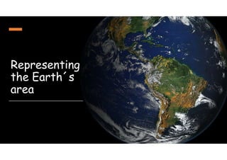
2. Representing the Earth's area
- 2. In order to represent the Earth, we use simplified representations of the Earth: maps. Although the Earth is a sphere (well, nearly a sphere, it’s not a perfect sphere, it’s a geoid), Geographers represent the Earth on a flat surface: a map. That´s not so easy! The most common way to represent the Earth is the cylindrical projection. This type of representation is not perfect.
- 3. We can also represent the Earth with a globe
- 5. 1. Physical (or topographic) maps. They represent natural features: mountains, rivers, islands, lakes, etc. The different colours represent the altitude Green: low altitude Yellow: high altitude Brown and white: very high altitude
- 6. 2. Political maps: they represent cities, countries, villages, etc. Borders separate countries. Borders can be physical (a river, a mountain…) or imaginary
- 7. 3. Climate and weather maps: they represent climates, precipitation or temperatures on planet Earth This is a map of the weather Climate map: we represent the different climates with different colours
- 8. 4. Population maps Map key. It helps us to understand the map The darker the color, the more people live in an area of the world.
- 9. 5. Vegetation maps Map key
- 10. 6. Roadmaps
- 11. Now imagine you have a yatch. You are in the middle of the Atlantic ocean. But you have run out of petrol! You need help! Heeelp!!!Sorry captain, we have run out of petrol!!!
- 12. It is a modern yatch, and you have a radio! We need help! We are here, in the middle of the Atlantic ocean! Ok. We will help you. Where exactly are you? The Atlantic ocean is huge!
- 13. We need to know your geographical coordinates!
- 14. No problem! I can do that! This is a modern yatch! Latitude: 30º North Longitude: 60º West We´ll be there ASAP
- 15. In order to locate any point on the Earth´s surface, we use lines called parallels and meridians. These lines are not real: they are imaginary lines.
- 16. The Equator is parallel 0º (zero degrees) The Equator divides the Earth in two hemispheres: Northern and Southern
- 17. A parallel is an imaginary line running from East to West, and parallel to the Equator There are 90 parallels between the Equator and each pole.
- 18. Other important parallels are the Tropic of Cancer and the Tropic of Capricorn Tropic of Cancer: 23º 27’ North Tropic of Capricorn: 23º 27’ South
- 19. Also, the Artic circle and the Antartic circle Artic circle: 66º 33’ North Antartic circle: 66º 33’ South
- 20. Meridians are imaginary lines running from the North pole to the South pole. The Prime Meridian (0º) or Greenwich meridian crosses the Observatory at Greenwich near London. It also crosses Spain! The Prime Meridian also divides our planet in two hemispheres: Western Hemisphere, and Eastern Hemisphere. There are 180 main meridians in each hemisphere
- 21. Parallels and meridians cross and form a grid. I am here!, in this GEOGRAPHICAL COORDINATE
- 22. What is latitude? - Latitude is the distance of any point on the Earth to the Equator. That is: the distance from a parallel to the Equator. - Latitude can be North or South. - Latitude goes from 0º (the Equator) to 90º (the North and the South poles). North South
- 23. What is longitude? Longitude is the distance from any meridian on the Earth to the Prime Meridian (=Meridian 0º or Greenwich meridian). Longitude can be West or East. Longitude can go from 0º to 180º
- 25. So where exactly is Madrid?
- 26. Latitude: 40°25′ North of the Equator Longitude: 3°41′ West of the Prime Meridan These are the geographical coordinates of the city of Madrid
- 28. In order to represent on a map the real world, we need a scale. A scale is the relationship between a distance measured on the map, and the real distance on Earth. There are two types: graphical and numerical scales. Graphical scale: each rectangle represents 1,000 meters in reality Numerical scale
- 29. Example: the distance between Torrejón de Ardoz and Alcalá de Henares on a map is 5 cm. The scale is 1:250,000. What is the distance between these two cities in the real world in kilometers? Calculations: 5 cm x 250,000 = 1,250,000 cm 1 m = 100 cm 1,250,000 / 100 = 12,500 m 1 km = 1000 m 12,500 / 1000 = 12.5 km The distance between Torrejón de Ardoz and Alcalá de Henares is 12.5 km