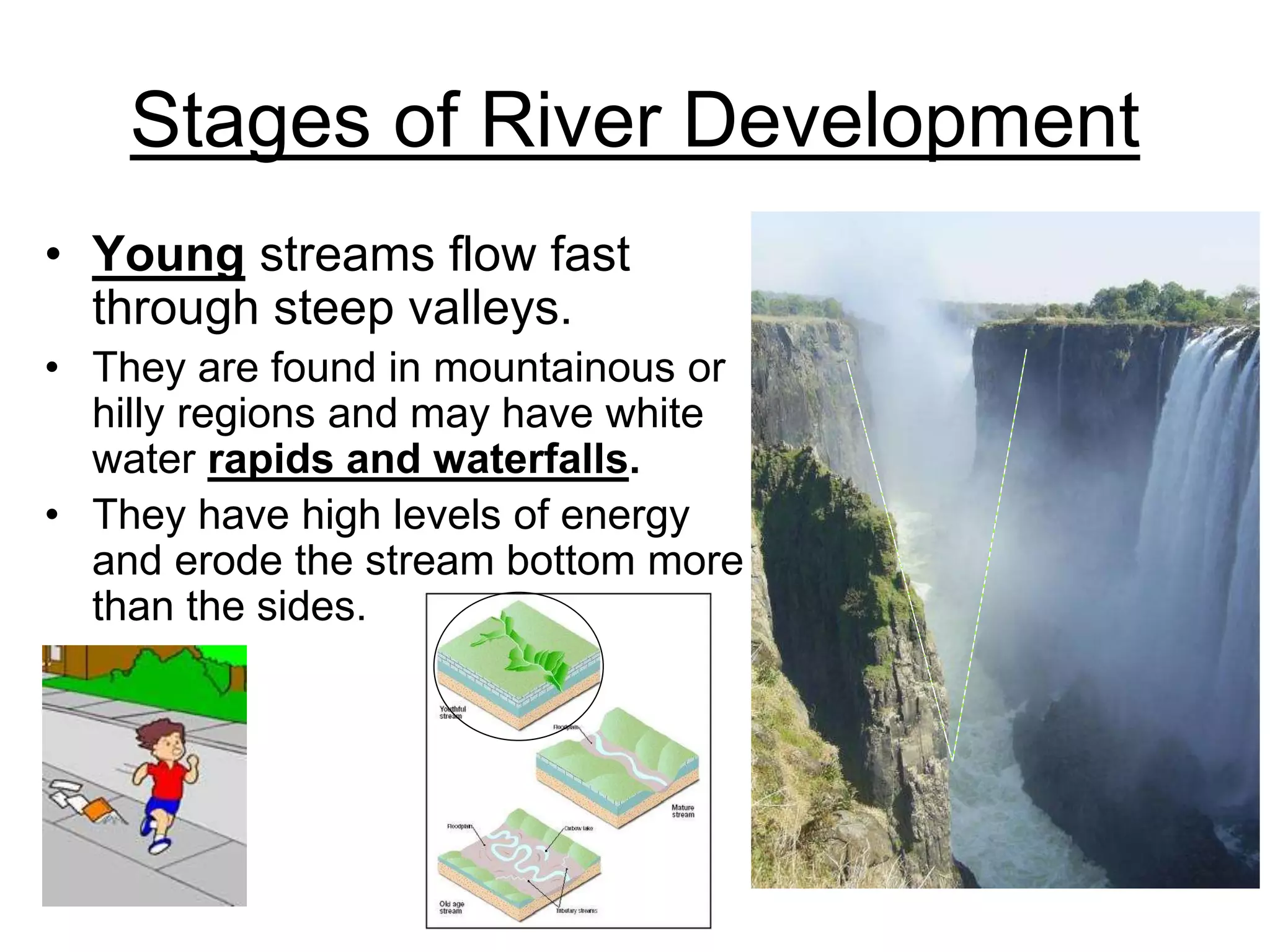
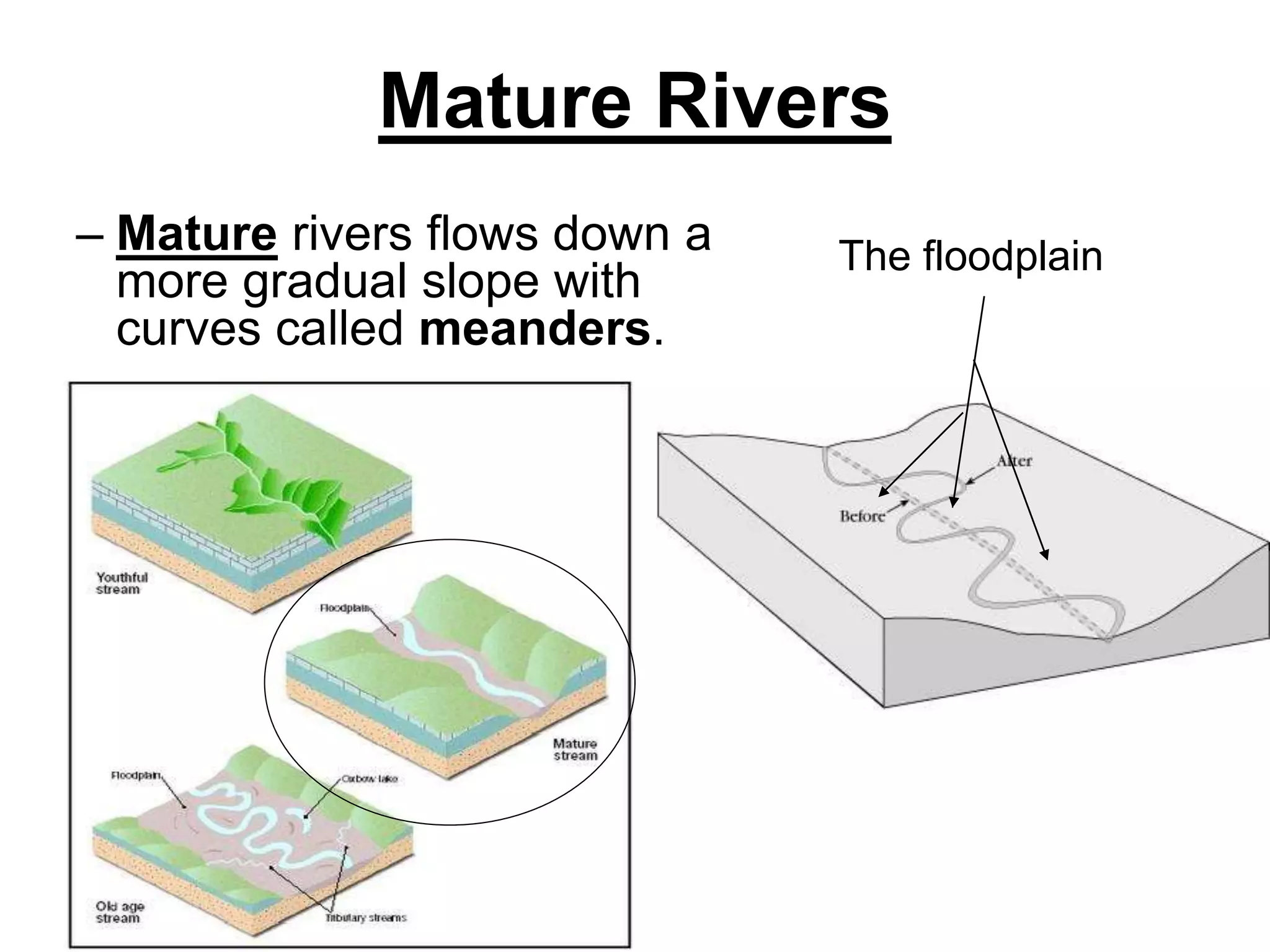
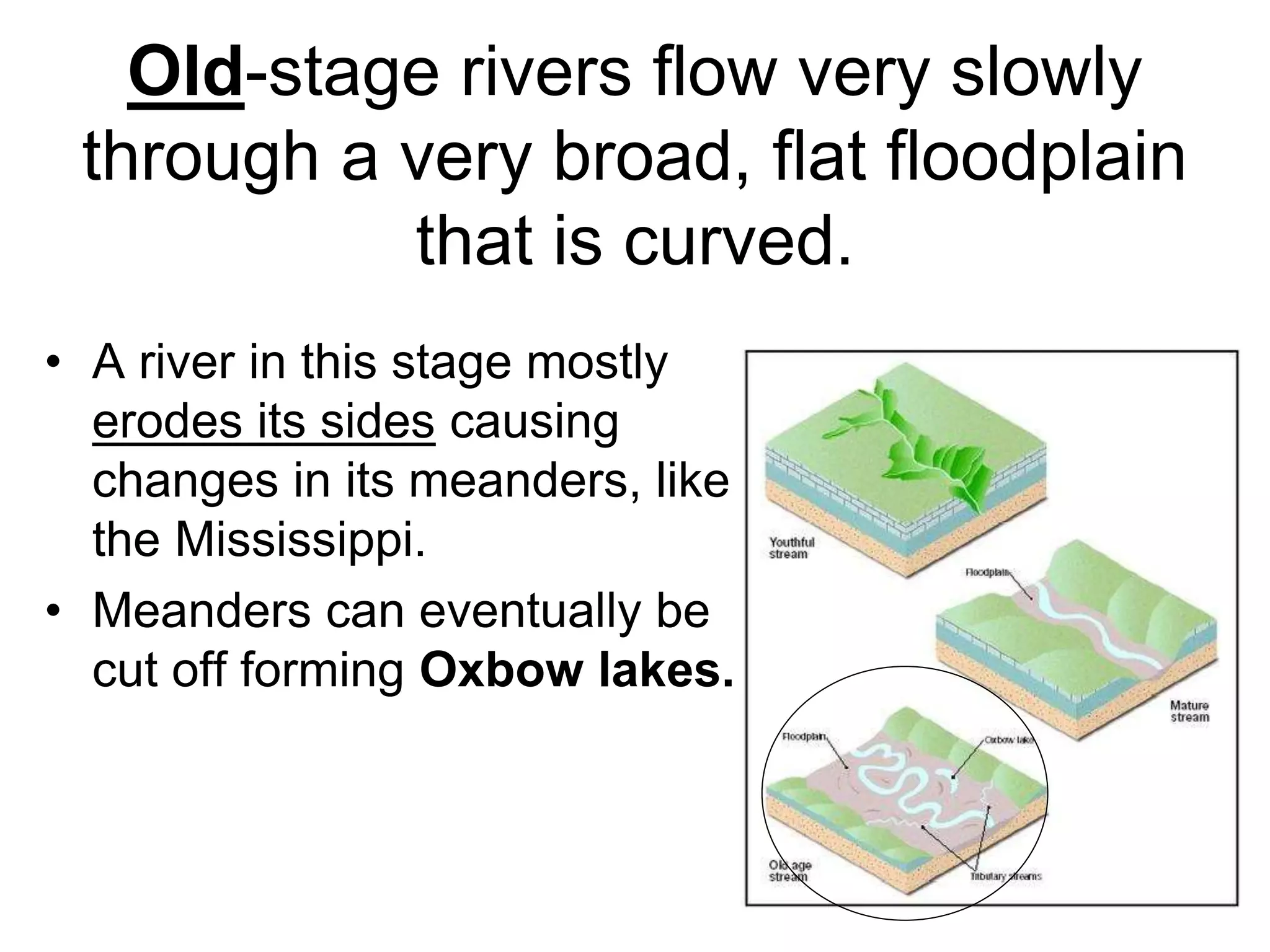
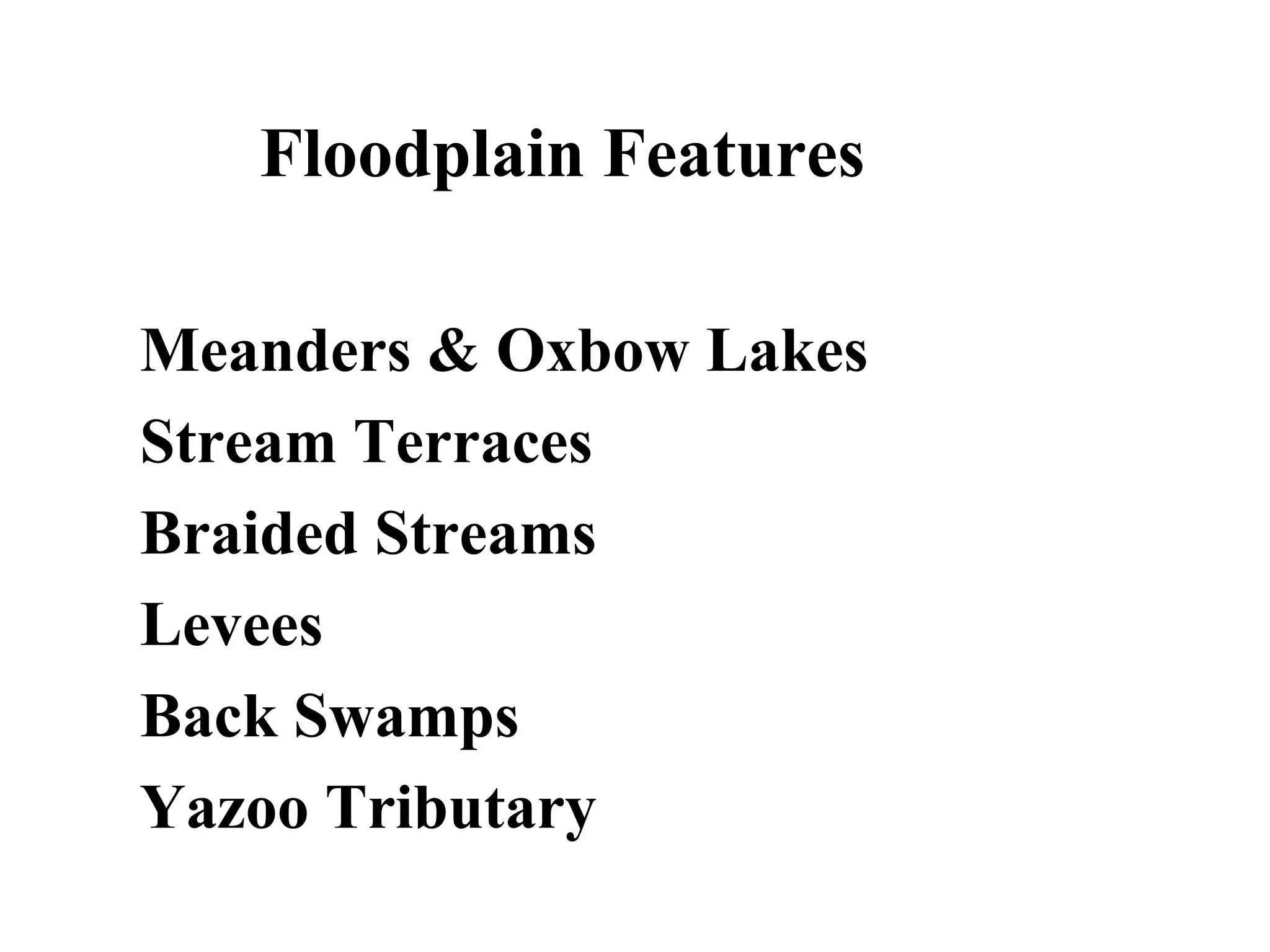
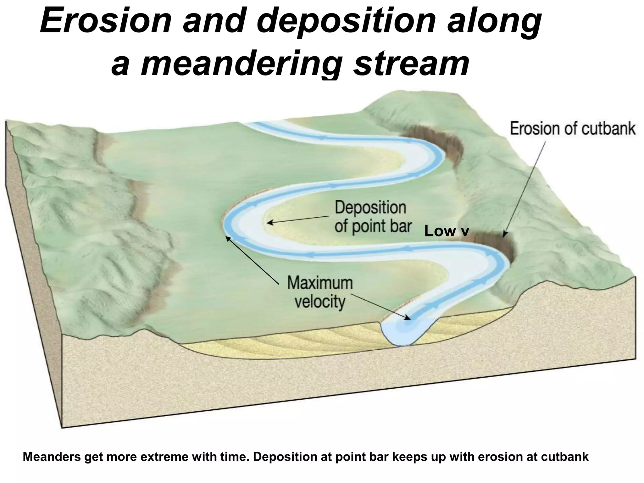
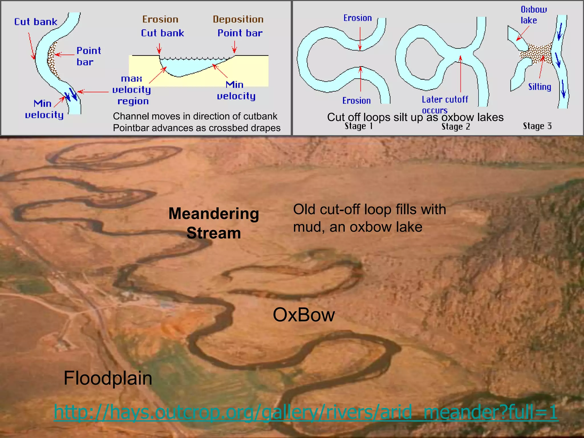
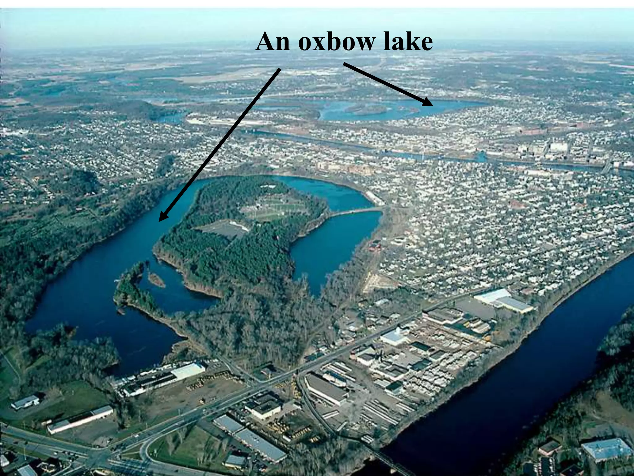
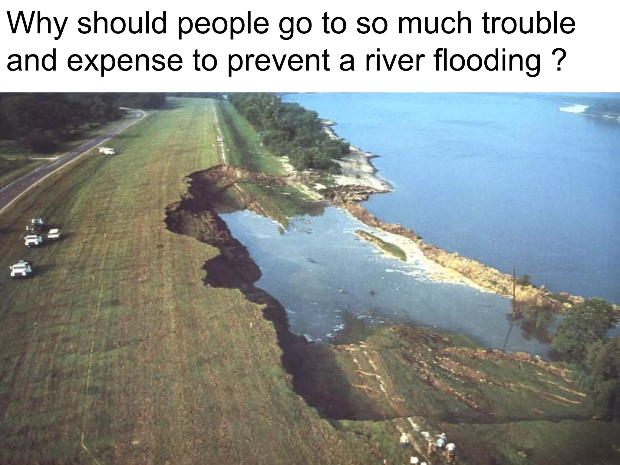
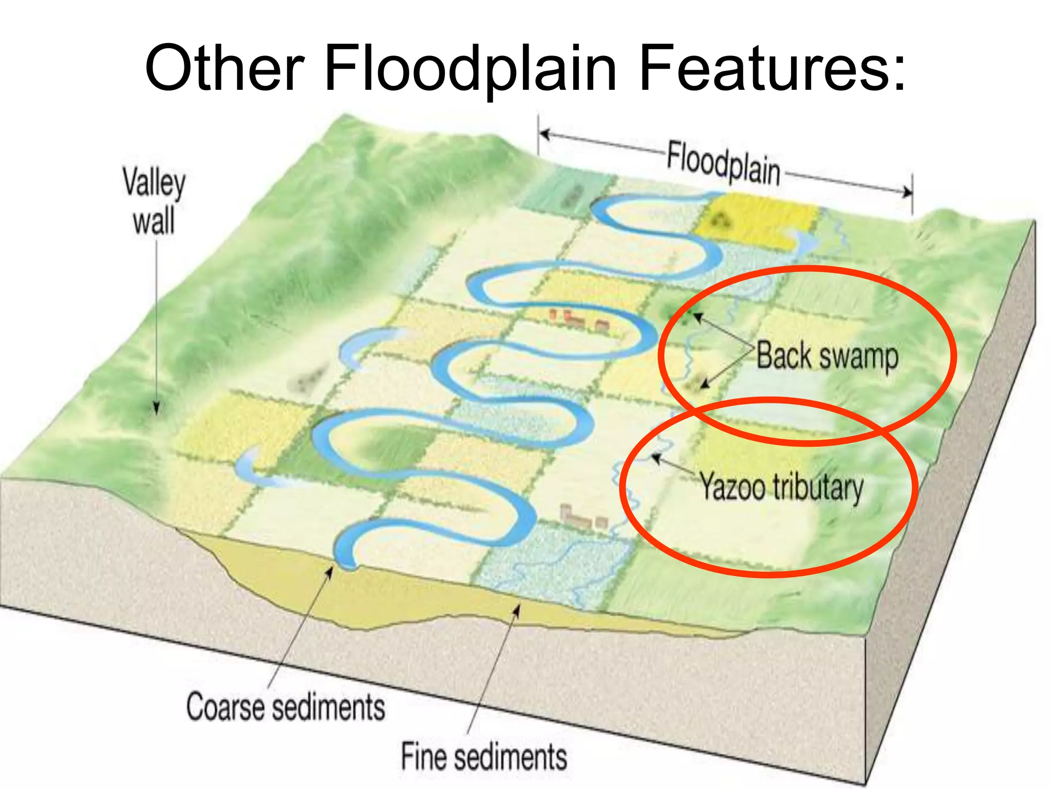
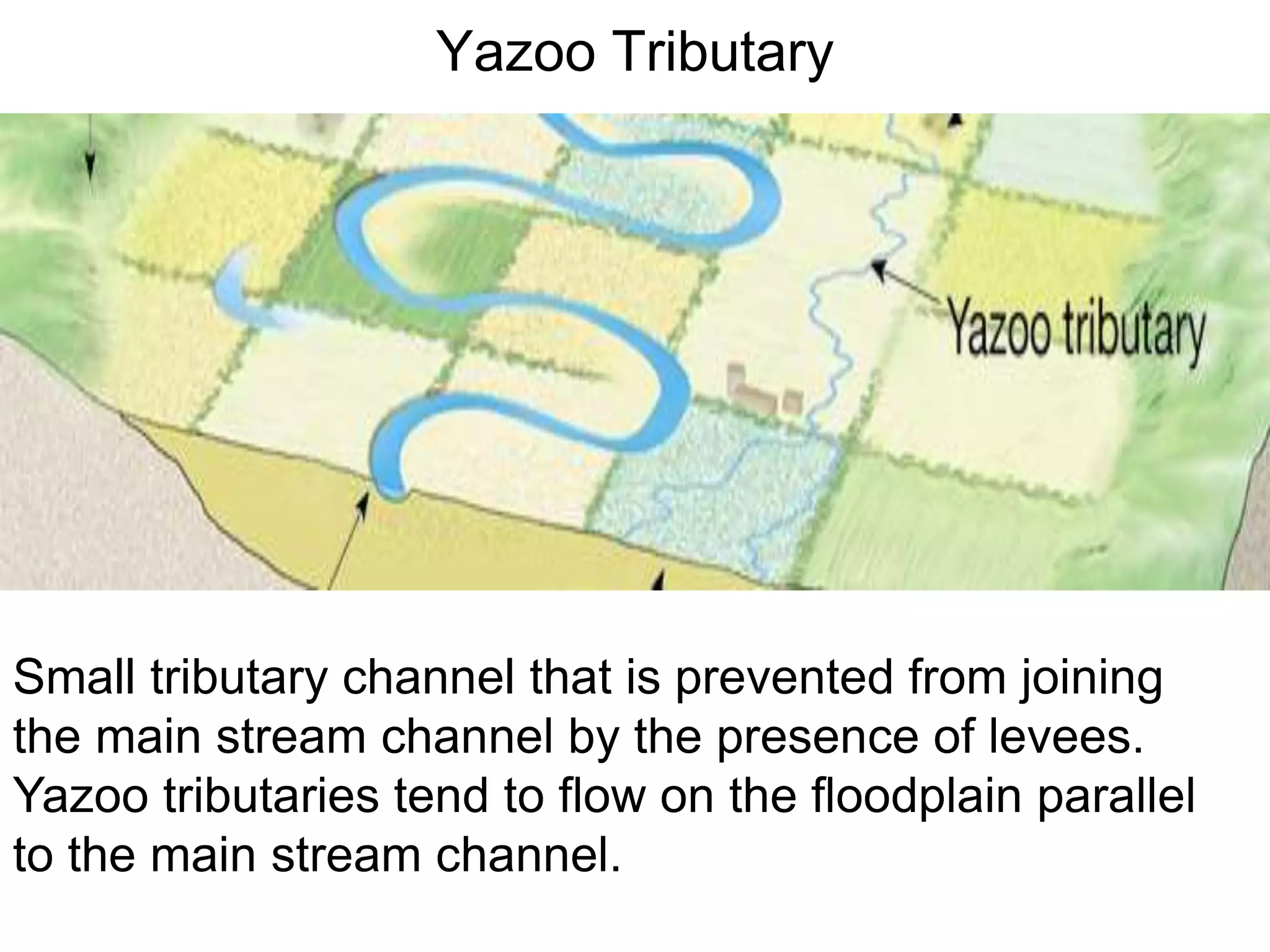
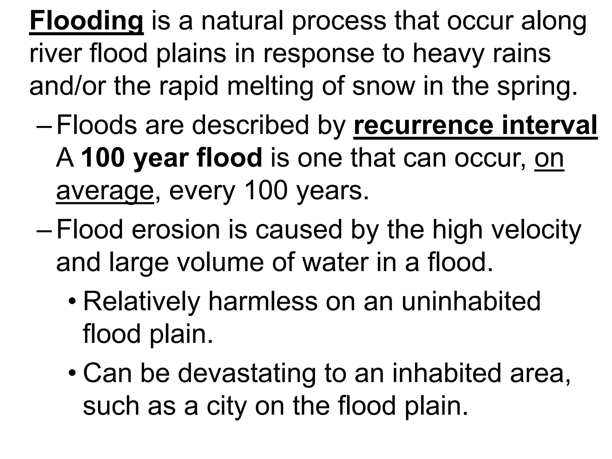
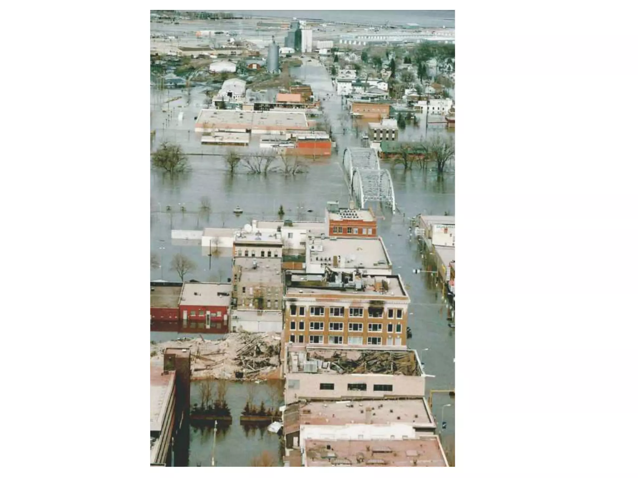
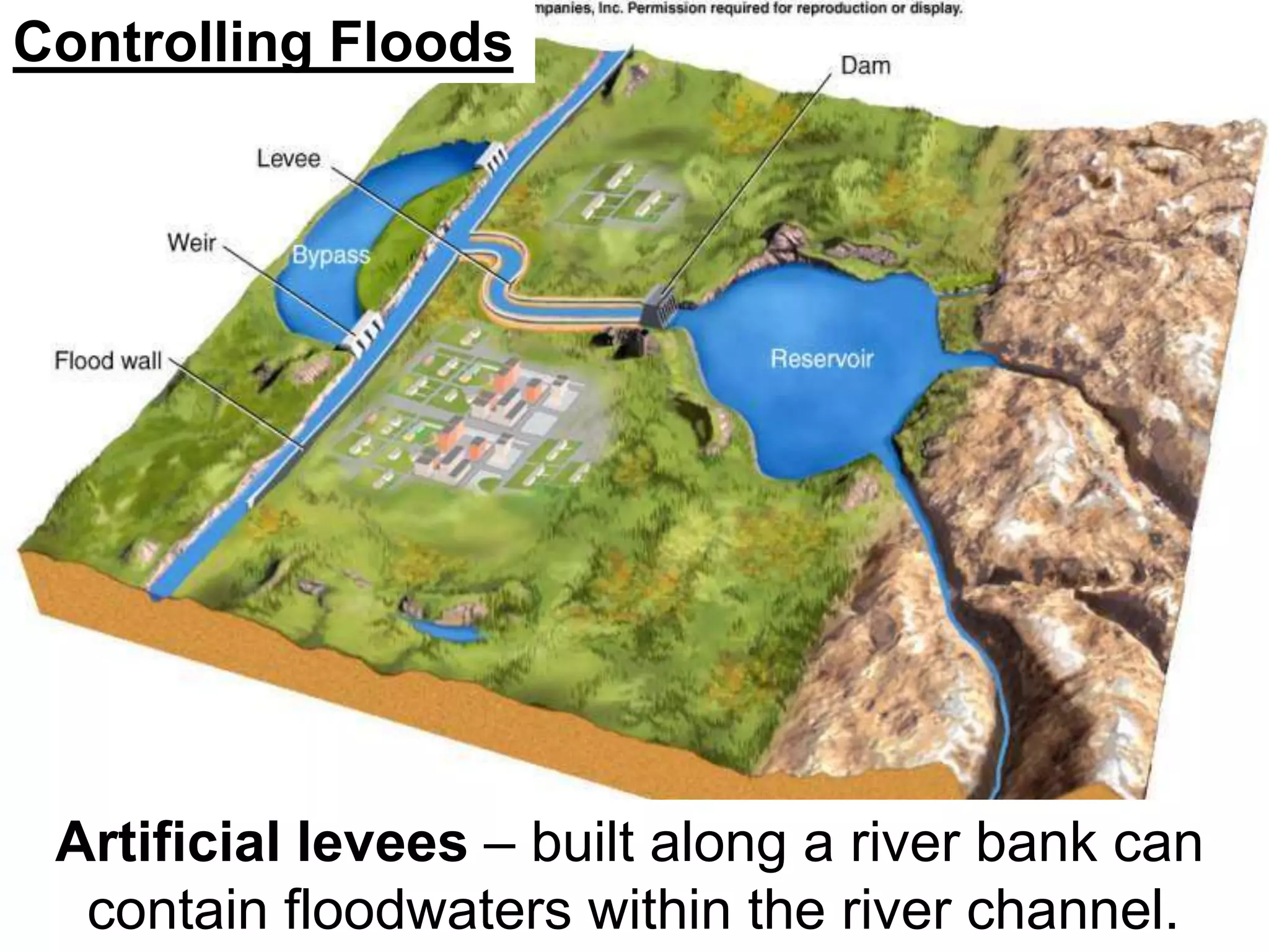
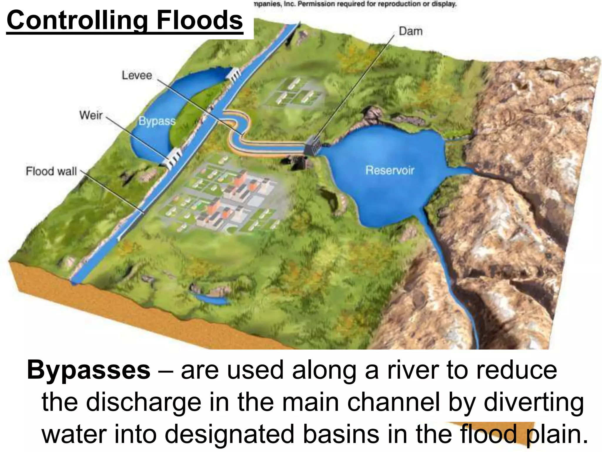
13.4 - Floodplains & Floods
http://www.dkimages.com/discover/previews/774/206778.JPG
Stages
of
Stream/River
Development
Stages of River Development
• Young streams flow fast
through steep valleys.
• They are found in mountainous or
hilly regions and may have white
water rapids and waterfalls.
• They have high levels of energy
and erode the stream bottom more
than the sides.
Mature Rivers
– Mature rivers flows down a
more gradual slope with
curves called meanders.
The floodplain
Old-stage rivers flow very slowly
through a very broad, flat floodplain
that is curved.
• A river in this stage mostly
erodes its sides causing
changes in its meanders, like
the Mississippi.
• Meanders can eventually be
cut off forming Oxbow lakes.
Meanders
What can cause the banks of the Colorado
River to be so steep?
A
B
Drawing B
shows that the
ground has
actually uplifted
and the river is
trying to
maintain its
original level
relative to base
level.
River Rejuvenation
A fall in sea level or a rise in the level of the
land can have a dramatic effect on a river's
journey to the sea. The old age stage of the
river becomes perched above the sea and
therefore the river, with new-found energy, has
to erode through the already deposited material
to create a new route to the sea. The features
formed as a result of this rejuvenation will
deepen and straighten the river, have more
youthful features.
Causes of Rejuvenation
• Climatic change: Glaciations and
changes in rainfall.
• Tectonic change: Where land is uplifted
after plate movement or volcanic activity.
Changes can be positive sea level rises
in relation to the land, or negative sea
level fall in relation to the land.
Features of a Floodplain
Wide valleys often include
–Floodplains
»Erosional floodplains
»Depositional floodplains
–Meanders
»Cut bank and point bar
»Cutoffs and oxbow lakes
Floodplain Features
Meanders & Oxbow Lakes
Stream Terraces
Braided Streams
Levees
Back Swamps
Yazoo Tributary
Flood Plains
“Click to view animation”
Flood Plains
Flood Plain – is a broad strip of land built up by sedimentation on either side of a
stream channel.
– During floods, flood plains may be covered with water carrying suspended silt and clay.
– When the flood water recedes, these fine-grained sediments are left behind as a horizontal
deposit.
– The sudden decrease in velocity
of water leaving the channel
causes the river to deposit most
of its sediment near the main
channel.
• Progressively less sediment is
deposited away from the
channel.
• A series of floods may build up
natural levees – low ridges of
flood-deposited sediment that
form on either side of a stream
channel.
“Click to view animation”
Formation of natural levees by flooding
Flood over banks, sediment carrying water into wide area, greater drag, lower velocity, load drops
Meandering Stream
Erosion and deposition along
a meandering stream
Meanders get more extreme with time. Deposition at point bar keeps up with erosion at cutbank
Low v
Floodplain
Meandering
Stream
OxBow
http://hays.outcrop.org/gallery/rivers/arid_meander?full=1
Channel moves in direction of cutbank
Pointbar advances as crossbed drapes
Cut off loops silt up as oxbow lakes
Old cut-off loop fills with
mud, an oxbow lake
Evolution of a Meander to Oxbow:
These are bends
(loops) in the
river with lateral
(sideways)
erosion of the
river channel
results in the river
forming a winding
pattern.
Where is
cutoff
likely to
occur
here?
An oxbow lake
Stream Terraces
•Remnants of former
floodplain
•River adjusts to drop in base
level by down cutting
River meanders across
floodplain
Base level drops,
or region uplifts.
Terrace forms in floodplain
Further incision cuts a new
terrace
Why? Steeper gradient
causes cuttoffs, stream
straighter, cuts down
narrower area.
A flight of river terraces
Braided Streams
• Occur where bed (sediment) load is very
high. Often big boulders in the stream.
• Many channels because mid-channel bars
split the stream
• Adjacent to mountains in high rainfall
areas
A braided river in Alaska
braiding
description - This is where the river channel is broken
up into a number of distributaries.
Braiding
Explanation:
As a river slowly
meanders across its
flood plain, it often
deposits material in
the 'middle' of its
channel. Sand and
shingle banks often
form small islands in
this way.
Formation of a Levee
New Orleans Levee - Before Katrina
New Orleans Levee Breaks - After Katrina
Natural Levee
Definition: These are mounds of alluvium (material
deposited by running water) piled up along the river's
edge, each time the river floods.
Natural Levee
Man-Made Levee
A man-made levee reinforces the bank and helps prevent
flooding. By confining the flow, levees can also increase
the speed of the water.
The simplest is just a mound of dirt bulldozed up when
there is an advancing flood. These levees are not very
good and can be breached by the power of the water.
Properly designed levees (that may include specially
compacted earthen mounds, reinforced concrete walls
or other methods of solid construction) provide
protection from river flooding to areas behind them.
However all levees are at risk of failure from overtopping
or breaching if the flood is bigger than what the levee
was designed for or if the levee hasn't been properly
maintained.
Why should people go to so much trouble
and expense to prevent a river flooding ?
Other
Floodplain
Features:
Other Floodplain Features:
Back Swamps & Floodplain
On a flood plain, a marshy area where floodwater
may be confined between the valley walls.
Back Swamp - poorly drained oval-shaped
depressions located between the natural levees
and the edge of the floodplain.
Yazoo Tributary
Small tributary channel that is prevented from joining
the main stream channel by the presence of levees.
Yazoo tributaries tend to flow on the floodplain parallel
to the main stream channel.
Flooding is a natural process that occur along
river flood plains in response to heavy rains
and/or the rapid melting of snow in the spring.
–Floods are described by recurrence interval
A 100 year flood is one that can occur, on
average, every 100 years.
–Flood erosion is caused by the high velocity
and large volume of water in a flood.
• Relatively harmless on an uninhabited
flood plain.
• Can be devastating to an inhabited area,
such as a city on the flood plain.
Flooding
Flash Floods – are local, sudden floods of
large volume and short duration, often
triggered by heavy thunderstorms.
Controlling Floods
–Man-made structures can mitigate the
dangers of floodwaters and sedimentation to
river cities.
Controlling
Floods
Controlling Floods
Upstream dams – can trap water from a
drainage basin and release it slowly after the
storm.
Controlling Floods
Artificial levees – built along a river bank can
contain floodwaters within the river channel.
Controlling Floods
Flood walls – may be used to protect cities
from flooding.
Controlling Floods
Bypasses – are used along a river to reduce
the discharge in the main channel by diverting
water into designated basins in the flood plain.

13.4 Stages of a River.ppt

  • 1.
  • 2.
  • 3.
    Stages of RiverDevelopment • Young streams flow fast through steep valleys. • They are found in mountainous or hilly regions and may have white water rapids and waterfalls. • They have high levels of energy and erode the stream bottom more than the sides.
  • 5.
    Mature Rivers – Maturerivers flows down a more gradual slope with curves called meanders. The floodplain
  • 6.
    Old-stage rivers flowvery slowly through a very broad, flat floodplain that is curved. • A river in this stage mostly erodes its sides causing changes in its meanders, like the Mississippi. • Meanders can eventually be cut off forming Oxbow lakes.
  • 7.
  • 8.
    What can causethe banks of the Colorado River to be so steep? A B Drawing B shows that the ground has actually uplifted and the river is trying to maintain its original level relative to base level.
  • 9.
    River Rejuvenation A fallin sea level or a rise in the level of the land can have a dramatic effect on a river's journey to the sea. The old age stage of the river becomes perched above the sea and therefore the river, with new-found energy, has to erode through the already deposited material to create a new route to the sea. The features formed as a result of this rejuvenation will deepen and straighten the river, have more youthful features.
  • 10.
    Causes of Rejuvenation •Climatic change: Glaciations and changes in rainfall. • Tectonic change: Where land is uplifted after plate movement or volcanic activity. Changes can be positive sea level rises in relation to the land, or negative sea level fall in relation to the land.
  • 11.
    Features of aFloodplain Wide valleys often include –Floodplains »Erosional floodplains »Depositional floodplains –Meanders »Cut bank and point bar »Cutoffs and oxbow lakes
  • 12.
    Floodplain Features Meanders &Oxbow Lakes Stream Terraces Braided Streams Levees Back Swamps Yazoo Tributary
  • 13.
    Flood Plains “Click toview animation”
  • 14.
    Flood Plains Flood Plain– is a broad strip of land built up by sedimentation on either side of a stream channel. – During floods, flood plains may be covered with water carrying suspended silt and clay. – When the flood water recedes, these fine-grained sediments are left behind as a horizontal deposit. – The sudden decrease in velocity of water leaving the channel causes the river to deposit most of its sediment near the main channel. • Progressively less sediment is deposited away from the channel. • A series of floods may build up natural levees – low ridges of flood-deposited sediment that form on either side of a stream channel. “Click to view animation”
  • 15.
    Formation of naturallevees by flooding Flood over banks, sediment carrying water into wide area, greater drag, lower velocity, load drops Meandering Stream
  • 16.
    Erosion and depositionalong a meandering stream Meanders get more extreme with time. Deposition at point bar keeps up with erosion at cutbank Low v
  • 17.
    Floodplain Meandering Stream OxBow http://hays.outcrop.org/gallery/rivers/arid_meander?full=1 Channel moves indirection of cutbank Pointbar advances as crossbed drapes Cut off loops silt up as oxbow lakes Old cut-off loop fills with mud, an oxbow lake
  • 18.
    Evolution of aMeander to Oxbow: These are bends (loops) in the river with lateral (sideways) erosion of the river channel results in the river forming a winding pattern.
  • 19.
  • 20.
  • 21.
    Stream Terraces •Remnants offormer floodplain •River adjusts to drop in base level by down cutting
  • 22.
    River meanders across floodplain Baselevel drops, or region uplifts. Terrace forms in floodplain Further incision cuts a new terrace Why? Steeper gradient causes cuttoffs, stream straighter, cuts down narrower area.
  • 23.
    A flight ofriver terraces
  • 24.
    Braided Streams • Occurwhere bed (sediment) load is very high. Often big boulders in the stream. • Many channels because mid-channel bars split the stream • Adjacent to mountains in high rainfall areas
  • 25.
    A braided riverin Alaska
  • 26.
    braiding description - Thisis where the river channel is broken up into a number of distributaries.
  • 27.
    Braiding Explanation: As a riverslowly meanders across its flood plain, it often deposits material in the 'middle' of its channel. Sand and shingle banks often form small islands in this way.
  • 28.
  • 29.
    New Orleans Levee- Before Katrina
  • 30.
    New Orleans LeveeBreaks - After Katrina
  • 31.
    Natural Levee Definition: Theseare mounds of alluvium (material deposited by running water) piled up along the river's edge, each time the river floods.
  • 32.
  • 33.
    Man-Made Levee A man-madelevee reinforces the bank and helps prevent flooding. By confining the flow, levees can also increase the speed of the water. The simplest is just a mound of dirt bulldozed up when there is an advancing flood. These levees are not very good and can be breached by the power of the water. Properly designed levees (that may include specially compacted earthen mounds, reinforced concrete walls or other methods of solid construction) provide protection from river flooding to areas behind them. However all levees are at risk of failure from overtopping or breaching if the flood is bigger than what the levee was designed for or if the levee hasn't been properly maintained.
  • 34.
    Why should peoplego to so much trouble and expense to prevent a river flooding ?
  • 35.
  • 36.
  • 37.
    Back Swamps &Floodplain On a flood plain, a marshy area where floodwater may be confined between the valley walls. Back Swamp - poorly drained oval-shaped depressions located between the natural levees and the edge of the floodplain.
  • 38.
    Yazoo Tributary Small tributarychannel that is prevented from joining the main stream channel by the presence of levees. Yazoo tributaries tend to flow on the floodplain parallel to the main stream channel.
  • 39.
    Flooding is anatural process that occur along river flood plains in response to heavy rains and/or the rapid melting of snow in the spring. –Floods are described by recurrence interval A 100 year flood is one that can occur, on average, every 100 years. –Flood erosion is caused by the high velocity and large volume of water in a flood. • Relatively harmless on an uninhabited flood plain. • Can be devastating to an inhabited area, such as a city on the flood plain.
  • 42.
    Flooding Flash Floods –are local, sudden floods of large volume and short duration, often triggered by heavy thunderstorms. Controlling Floods –Man-made structures can mitigate the dangers of floodwaters and sedimentation to river cities.
  • 43.
  • 44.
    Controlling Floods Upstream dams– can trap water from a drainage basin and release it slowly after the storm.
  • 45.
    Controlling Floods Artificial levees– built along a river bank can contain floodwaters within the river channel.
  • 46.
    Controlling Floods Flood walls– may be used to protect cities from flooding.
  • 47.
    Controlling Floods Bypasses –are used along a river to reduce the discharge in the main channel by diverting water into designated basins in the flood plain.