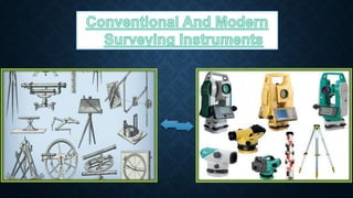
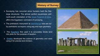
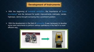
Instruments have a major importance in the field of survey. There are numerous instruments which are used in surveying.With the passage of time instruments have been modified and more accurate.
The science of today is the technology of tomorrow.
2. Contents To be Discussed
History Of Survey
Development of Instruments
Stretched Rope
Gunter’s Chain
Measuring Tape
Perambulator
Electron Distance Measurement
Inclinometer
Abney Level
Theodolite
Auto Level
Total Station
Global Positioning System(GPS)
Conclusion
3. What are Instruments ?
Instruments are the tools or devices which are used to
carry out various jobs in a field.
In every field, you need some tools (some devices) to
perform different operations. Without proper
instruments one cannot perform his job accurately and
efficiently.
4. Why do we need Instruments In Surveying ?
Instruments are used in surveying for different purposes.
The main key points for which we use instruments in survey are:
For Finding Distances
For Finding Angles
For Knowing Elevations
To Find Unknown Coordinates
For Finding Inaccessible Heights
For Setting out of Curves
Making Contour Maps
Marking National Boundaries
Area and Volume Computation
5. History of Survey
Surveying has occurred since humans built the first
large structures. The almost perfect squareness and
north-south orientation of the Great Pyramid of Giza,
affirm the Egyptians' command of surveying.
The prehistoric monument at Stonehenge was set out
by prehistoric surveyors using peg and rope geometry.
The Egyptians first used it to accurately divide land
into plots for the purpose of taxation.
Greeks developed the science of geometry and were
using it for precise land division.
6. Development of Instruments
With the beginning of Industrial revolution, the importance of "exact
boundaries" and the demand for public improvements (railroads, canals,
highways, dams) brought surveying into a prominent position.
With the development in the field of surveying, it was necessary to develop
some new instruments to perform various operations in the field in a more
efficient way.
7.
8. Stretched Rope
Initially a stretched rope was used to measure distances between two
places or points. But it was not an accurate method as it contained a
lot of error and also it was a very slow process.
As the rope contained a lot of sags, so the distance was not measured
accurately.
Moreover, due to the short length of the rope it was very difficult to
measure a long distance in a single span.
To overcome this problem, a chain was developed to measure the
distances between two points. This chain was known as Gunter’s
chain.
9. Gunter’s Chain
Gunter's chain a distance measuring device used for surveying.
It was designed and introduced in 1620 by Edmund Gunter. It
enabled plots of land to be accurately surveyed and plotted, for
legal and commercial purposes.
The 66-feet chain is divided into 100 links. Each link is thus
7.92 inches long ( 0.66 feet ).
Although Gunter's chain was later superseded by the steel tape.
Because the chain was to heavy to carry and also it contained a
lot of sags due to its heavy load while taking measurements.
So, a great care was to be taken while taking measurements
with Gunter’s chain.
10. Measuring Tape
As the Gunter’s chain had a number of limitations. To overcome
these difficulties, measuring tape was developed.
Measuring tape is a flexible ruler used to measure distances.
It consists of a ribbon of cloth, plastic, fibre glass, or metal strip
with linear-measurement markings.
Tapes come in a variety of lengths and materials. For engineering
work the lengths are generally 10m, 30m, 50m and 100m.
11. Perambulator
It is also another distance measuring device. Also known as
surveyor’s wheel.
They are often used by road maintenance or underground utility
workers and by farmers for fast measures over distances.
It is wheeled along the line whose length is desired. The distance
traversed is automatically registered in terms of miles, furlongs, and
yards to the nearest yard on the dial.
As the wheel turns during measurement, it is seen that the wheel
sweeps out at an angle of ⅜𝜋 radians which is equal to 135
degrees.
Surveyor's wheels are used primarily for lower accuracy surveys.
12. Electron Distance Measurement
EDM stands for Electronic Distance Measurement.
EDM is a surveying instrument used for measuring distance electronically
between two points through electromagnetic waves.
The distance measured by EDM is more precise than measured with chain or
tape. The wave emitted from the EDM reaches the reflector and return back to
the EDM. Then the distance is measured with the help of time taken for the
above process – time taken by the wave for the emission and return.
The following equation is used to measure the distance.
Distance = Velocity X time
13. Graphometer
The graphometer or semi-circumferentor is a surveying instrument
used for angle measurements.
It consists of a semicircular limb divided into 180 degrees and
sometimes subdivided into minutes.
The form was introduced in Philippe Danfrie's, (Paris, 1597).
The limb is subtended by the diameter with two sights at its ends. In the
middle of the diameter a "box and needle" (compass) is fixed.
14. Inclinometer
An inclinometer or clinometer is an instrument used for
measuring angles of slope, elevation, or depression of an
object with respect to gravity's direction.
It is also known as a tilt indicator, tilt sensor, gradient meter
and pitch & roll indicator. Clinometers measure both inclines
and declines
Uses
In land surveying and mapping, a clinometer can provide a
rapid measurement of the slope of a geographic feature, or
used for cave survey.
In prospecting for minerals, clinometers are used to measure
the strike and dip of geologic formations.
In forestry, tree height measurement can be done with a
clinometer using standardized methods.
Major artillery guns may have an associated clinometer used
to facilitate aiming of shells over long distances.
15. Abney Level
The Abney Level is an engineering instrument which can be
used to determine height.
It is moderately expensive and of medium size and weight.
Abney levels are made with square tubular bodies so that they
may also be used to directly measure the slopes of plane
surfaces by simply placing the body of the level on the surface,
adjusting the level, and then reading the angle off of the scale.
16. Common Uses
In topographic surveying, to place high precision
surveying equipment, particularly in rough terrain.
In forestry, for tree height measurement.
In mining and mine safety inspection, to measure the
grades of haulage roads.
In geology, in measurements of rock outcrops and fault
scarps
17. Auto Level
A level an optical instrument used to establish or verify points in
the same horizontal plane in a process known as levelling.
It is used in conjunction with a levelling staff to establish the
relative heights levels of objects or marks.
It is widely used in surveying and construction to measure height
differences and to transfer, measure, and set heights of known
objects or marks.
The complete unit is normally mounted on a tripod, and the
telescope can freely rotate 360° in a horizontal plane.
It is also known as a Surveyors level, Builders level,
Dumpy level.
18. Applications of Auto level
To measure height differences
Used in a Road Profile
For excavation of canals, roads, pipelines, railroads
etc
Setting height of known objects
Finding height and horizontal angle between different
objects
Helps in making contour maps, contour lines etc.
19. Theodolite
Joshua Habermel created a theodolite with a compass and tripod in
1576.
It is an instrument for measuring angles in the horizontal and vertical
planes.
Initially the theodolite had a number of limitations and could not measure
angle with great accuracy and precision.
With the advancement in the field of technology, scientists made a number
of modifications in older theodolites for measuring angles with great
accuracy and precision.
Modern theodolites are designed in such a way to perform all the
necessary angular and distance calculations and to read the measurement
upto seconds of levels.
20. Applications of Theodolite
Measuring horizontal and Vertical
angles
Locating points on a line
Difference of level
Setting out of Curves
Measurement of Bearings
Setting out of Grades(Slopes)
21. Total Station
Initially theodolites were used to measure angles. Distances were
measured either with the tapes or chains.
With the advancement in technology, EDM (Electron Distance
Measurement) was mounted on theodolites. Total stations became
combination of theodolite, level and measuring tape.
It is equally good in measuring horizontal and vertical angles, sloping
distances and three dimensional coordinate’s computation.
Data collected from total station can be downloaded into
computer/laptops for further processing of information.
22. Applications of Total Station
Used for topographic, Hydrographic, cadastral, project and
construction surveys.
Computing coordinates of survey points from horizontal angle
and horizontal distance.
Area calculations
Volume Calculations
Stake out Coordinates
Setting out Curves
Remote distance measurement (RDM) or Missing line
measurement (MLM)
23. Uses of Total Station
The uses of Total Station are as follows:
Mine Survey
Cadastral Survey
Engineering Survey
Large Scale Survey
Road / Rail / Canal
Survey
24. GPS (Global Positioning System)
As the technology is advancing day by day, several new methods
are introduced by developers to help the surveyors in performing
different operations in field more accurately and precisely.
Initially GPS was developed for military use but there is a wide
variety of equipment and techniques that can be used for
surveying.
GPS was rapidly adapted for surveying, as it can give a position
(Latitude, Longitude and Height) directly, without the need to
measure angles and distances between intermediate points.
Survey control points could now be established almost anywhere
and it is only necessary to have a clear view of the sky so the
signal from the GPS satellites could be received clearly.
25. Applications and Benefits
GPS provides surveying and mapping data of the highest accuracy.
GPS is especially useful in surveying coasts and waterways, where
there are few land-based reference points.
Bridge builders and offshore oil rigs also depend on GPS for
accurate hydrographic surveys.
Significant productivity gains in terms of time, equipment, and labor
required.
Fewer operational limitations compared to conventional techniques.
Accurate positioning of physical features that can be used in maps
and models.
Faster delivery of geographic information needed by decision makers.
27. Conclusion
The field of surveying started a long time ago, but as the time passed and
with the advancement in the field of technology, new methods and new
instruments were developed to carry out the experiments more accurately
and taking the readings more efficiently.
Every scientist is striving hard to develop such instruments which can give
more precise and accurate readings than the previous one to help the
society managing in a better way.
The main purpose is to give the surveyors such instruments and techniques
by which they can give better results with less efforts.