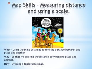
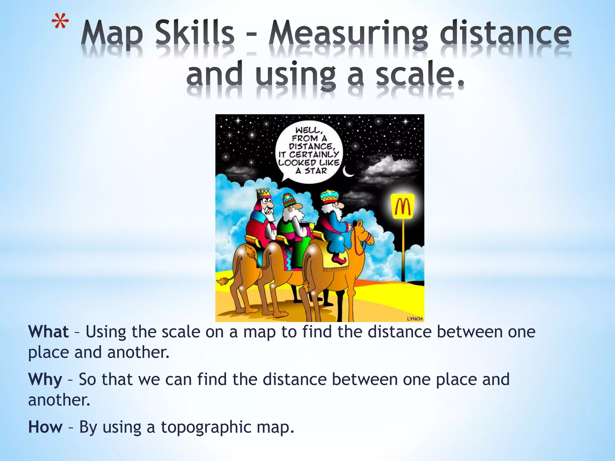
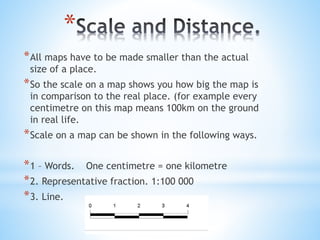
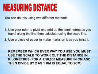
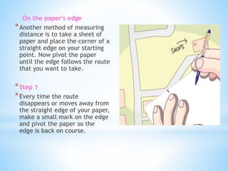
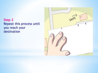
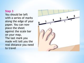
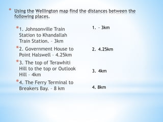
* 
What – Using the scale on a map to find the distance between one 
place and another. 
Why – So that we can find the distance between one place and 
another. 
How – By using a topographic map.
* 
*All maps have to be made smaller than the actual 
size of a place. 
*So the scale on a map shows you how big the map is 
in comparison to the real place. (for example every 
centimetre on this map means 100km on the ground 
in real life. 
*Scale on a map can be shown in the following ways. 
*1 – Words. One centimetre = one kilometre 
*2. Representative fraction. 1:100 000 
*3. Line.
* 
*1cm on the map represents 2km in real life so the scale will be 
written as = _____________ 
1 : 200’000 
*3 : 100’000 
3cm represents 1km so the scale as a ratio = _______________ 
*5cm represents 100m so the scale as a ratio = ______________ 
5: 10’000 
*0.5cm represents 1m so the scale as a ratio = ______________ 
1 : 200
You can do this using two different methods. 
1. Use your ruler to pivot and add up the centimetres as you 
travel along the line then calculate using the scale line. 
2. Use a piece of paper to make marks on it as you twist it. 
REMEMBER WHICH EVER WAY YOU USE YOU MUST 
USE THE SCALE TO WORK OUT THE DISTANCE IN 
KILOMETRES (FOR A 1:50,000 MEASURE IN CM AND 
THEN DIVIDE BY 2 AS 1 KM IS EQUAL TO 2CM)
On the paper's edge 
*Another method of measuring 
distance is to take a sheet of 
paper and place the corner of a 
straight edge on your starting 
point. Now pivot the paper 
until the edge follows the route 
that you want to take. 
*Step 1 
*Every time the route 
disappears or moves away from 
the straight edge of your paper, 
make a small mark on the edge 
and pivot the paper so the 
edge is back on course.
Step 2 
Repeat this process until 
you reach your 
destination
Step 3 
You should be left 
with a series of marks 
along the edge of your 
paper. You can now 
place the sheet 
against the scale bar 
on your map. 
The last mark you 
made will tell you the 
real distance you need 
to travel
* 
*1. Johnsonville Train 
Station to Khandallah 
Train Station. – 3km 
*2. Government House to 
Point Halswell – 4.25km 
*3. The top of Terawhiti 
Hill to the top or Outlook 
Hill – 4km 
*4. The Ferry Terminal to 
Breakers Bay. – 8 km 
1. – 3km 
2. 4.25km 
3. 4km 
4. 8km
*

Map skills – measuring distance and using a

  • 1.
    * What –Using the scale on a map to find the distance between one place and another. Why – So that we can find the distance between one place and another. How – By using a topographic map.
  • 2.
    * *All mapshave to be made smaller than the actual size of a place. *So the scale on a map shows you how big the map is in comparison to the real place. (for example every centimetre on this map means 100km on the ground in real life. *Scale on a map can be shown in the following ways. *1 – Words. One centimetre = one kilometre *2. Representative fraction. 1:100 000 *3. Line.
  • 3.
    * *1cm onthe map represents 2km in real life so the scale will be written as = _____________ 1 : 200’000 *3 : 100’000 3cm represents 1km so the scale as a ratio = _______________ *5cm represents 100m so the scale as a ratio = ______________ 5: 10’000 *0.5cm represents 1m so the scale as a ratio = ______________ 1 : 200
  • 4.
    You can dothis using two different methods. 1. Use your ruler to pivot and add up the centimetres as you travel along the line then calculate using the scale line. 2. Use a piece of paper to make marks on it as you twist it. REMEMBER WHICH EVER WAY YOU USE YOU MUST USE THE SCALE TO WORK OUT THE DISTANCE IN KILOMETRES (FOR A 1:50,000 MEASURE IN CM AND THEN DIVIDE BY 2 AS 1 KM IS EQUAL TO 2CM)
  • 5.
    On the paper'sedge *Another method of measuring distance is to take a sheet of paper and place the corner of a straight edge on your starting point. Now pivot the paper until the edge follows the route that you want to take. *Step 1 *Every time the route disappears or moves away from the straight edge of your paper, make a small mark on the edge and pivot the paper so the edge is back on course.
  • 6.
    Step 2 Repeatthis process until you reach your destination
  • 7.
    Step 3 Youshould be left with a series of marks along the edge of your paper. You can now place the sheet against the scale bar on your map. The last mark you made will tell you the real distance you need to travel
  • 8.
    * *1. JohnsonvilleTrain Station to Khandallah Train Station. – 3km *2. Government House to Point Halswell – 4.25km *3. The top of Terawhiti Hill to the top or Outlook Hill – 4km *4. The Ferry Terminal to Breakers Bay. – 8 km 1. – 3km 2. 4.25km 3. 4km 4. 8km
  • 9.