Download as PDF, PPTX


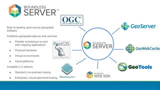
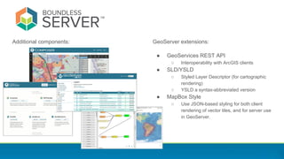

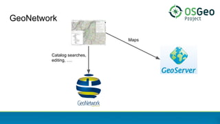

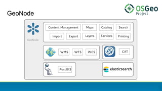

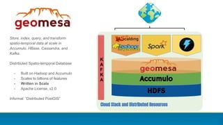
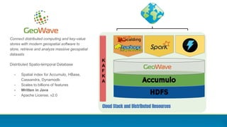


This document discusses the GeoServer ecosystem and integrations. GeoServer is an open source geospatial data server that can publish data using open standards. It is used by many organizations to serve maps and geospatial data on the web. The document highlights several integrations and uses of GeoServer including by government agencies to serve satellite imagery, cadastral data, and more. It also discusses commercial support from Boundless and how GeoServer can be deployed in cloud environments and integrated with other open source geospatial tools like GeoNetwork, GeoNode, and World Wind Server.


![20260201 [FOSDEM] gomodjail - library sandboxing for Go modules.pdf](https://cdn.slidesharecdn.com/ss_thumbnails/20260201fosdemgomodjail-librarysandboxingforgomodules-260201225659-76609ec4-thumbnail.jpg?width=640&height=640&fit=bounds)


