Downloaded 93 times
![Spatiotemporal Raster Management
Add REST support to expose a image mosaic internal structure
Dimensions
Granules
Dimensions: list, edit, create, remove
/workspaces/<ws>/coveragestores/<cs>/coverages/<mosaic>/dimensions
/workspaces/<ws>/coveragestores/<cs>/coverages/<mosaic>/dimensions/<dimension>[.format]
TODO paging and query of dimension domain
Granules: list, edit, create, remove
/workspaces/<ws>/coveragestores/<cs>/coverages/<mosaic>/index
/workspaces/<ws>/coveragestores/<cs>/coverages/<mosaic>/index/pageN
/workspaces/<ws>/coveragestores/<cs>/coverages/<mosaic>/index/pageN/granuleM
GFOSS Day 2013, Bologna
October 11th, 2013](https://image.slidesharecdn.com/geoserveraaimegfoss2013-131015030029-phpapp01/75/GeoServer-The-Open-Source-Solution-for-the-interoperable-management-of-geospatial-data-GFOSS-Day-2013-34-2048.jpg)


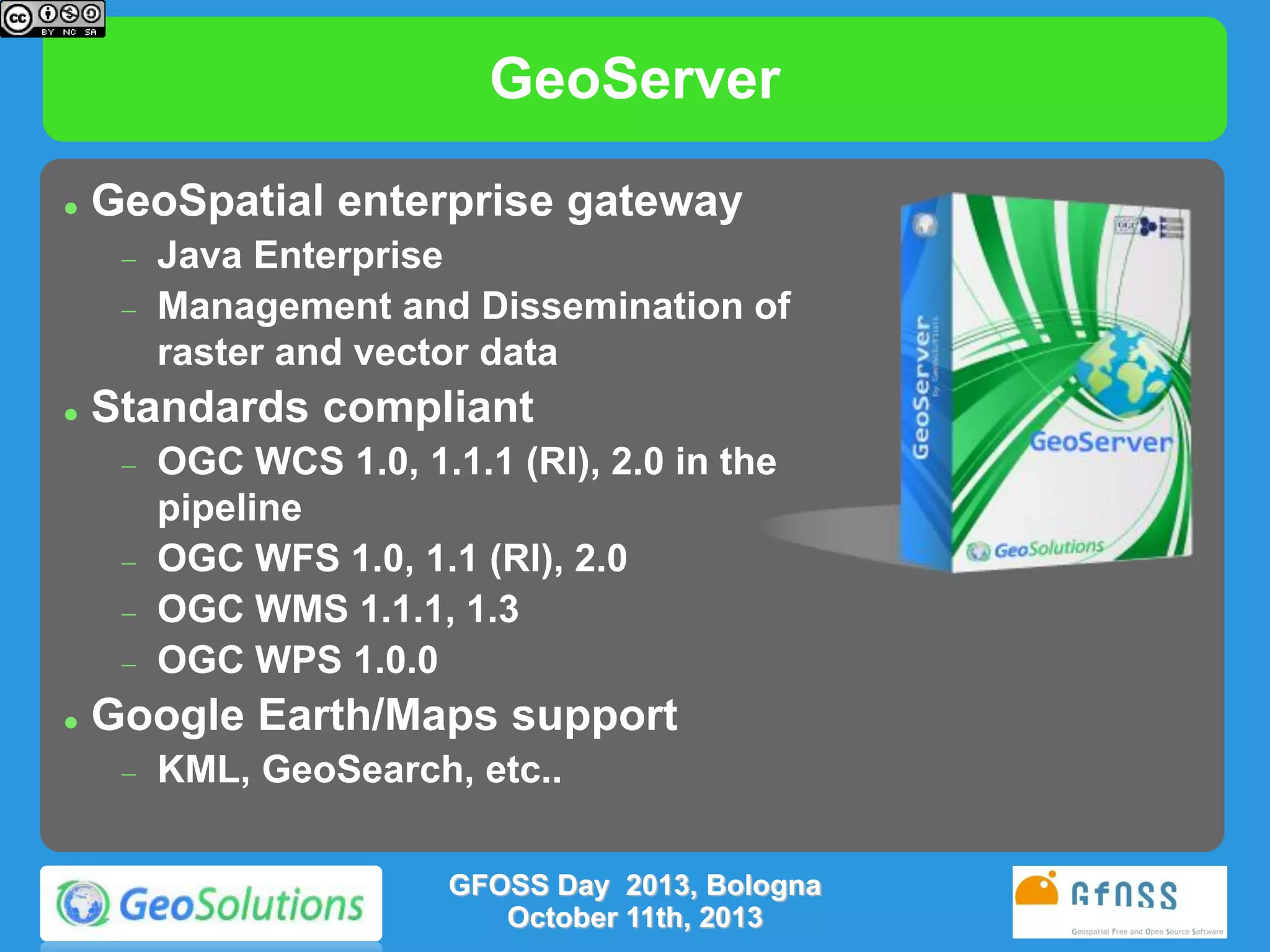
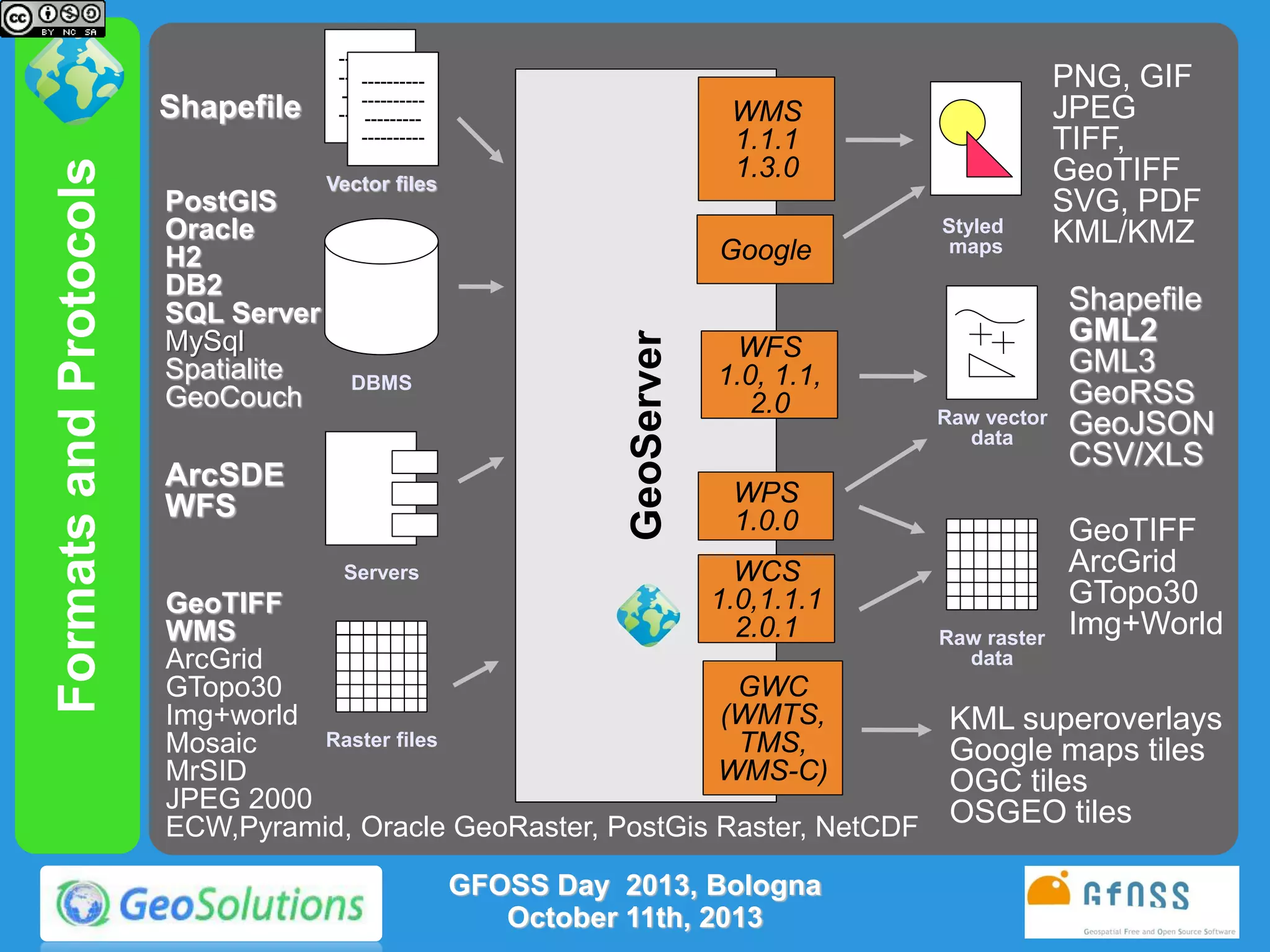
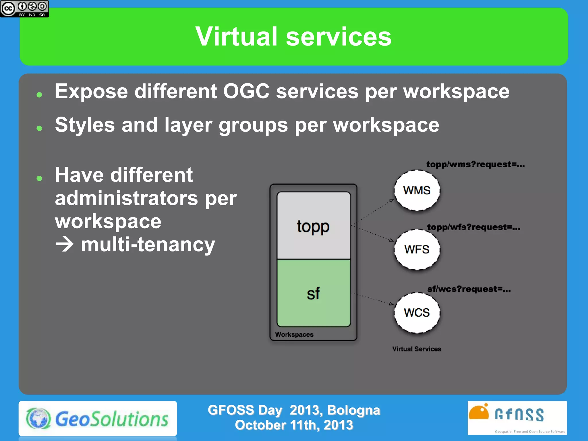
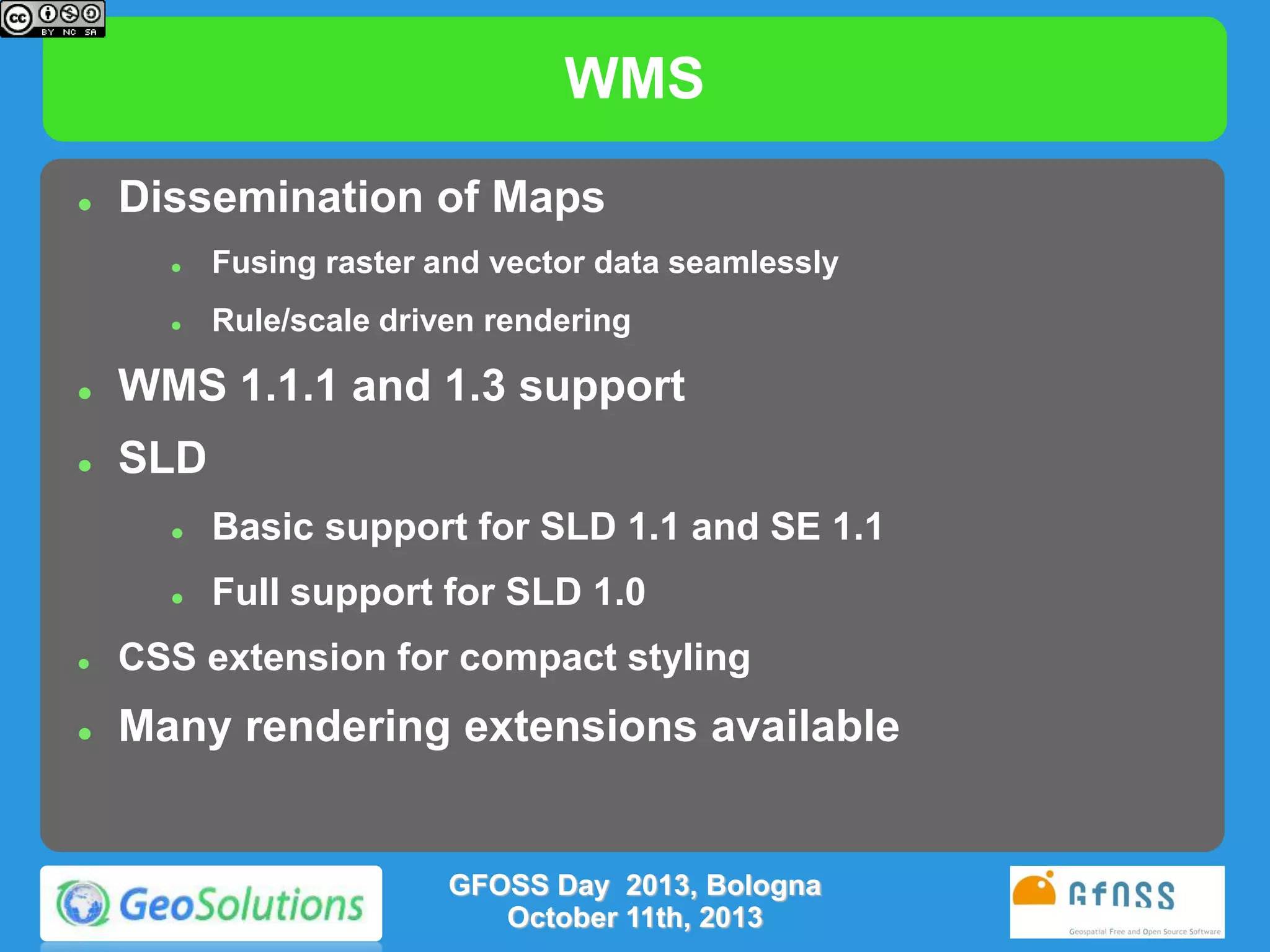
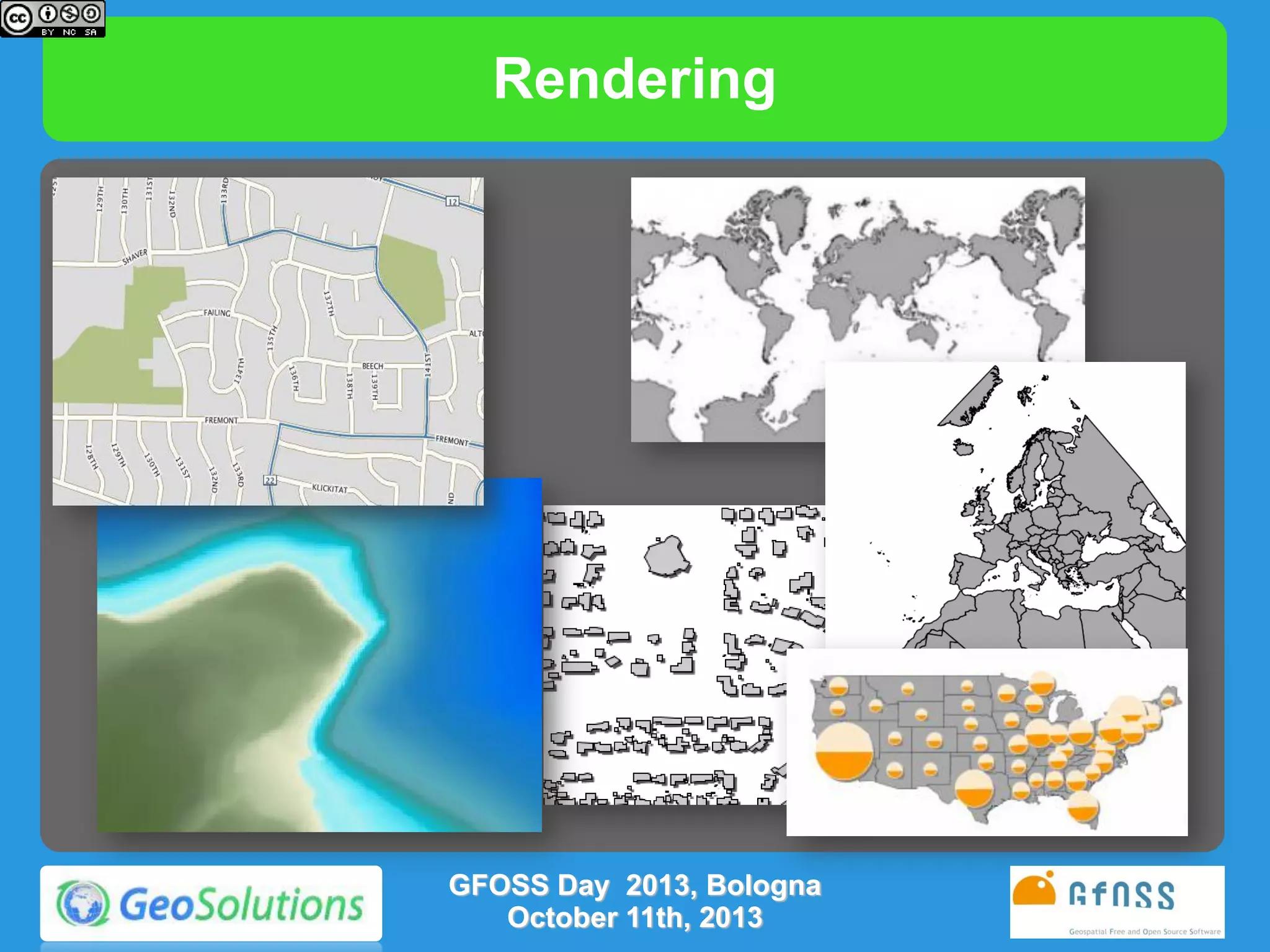
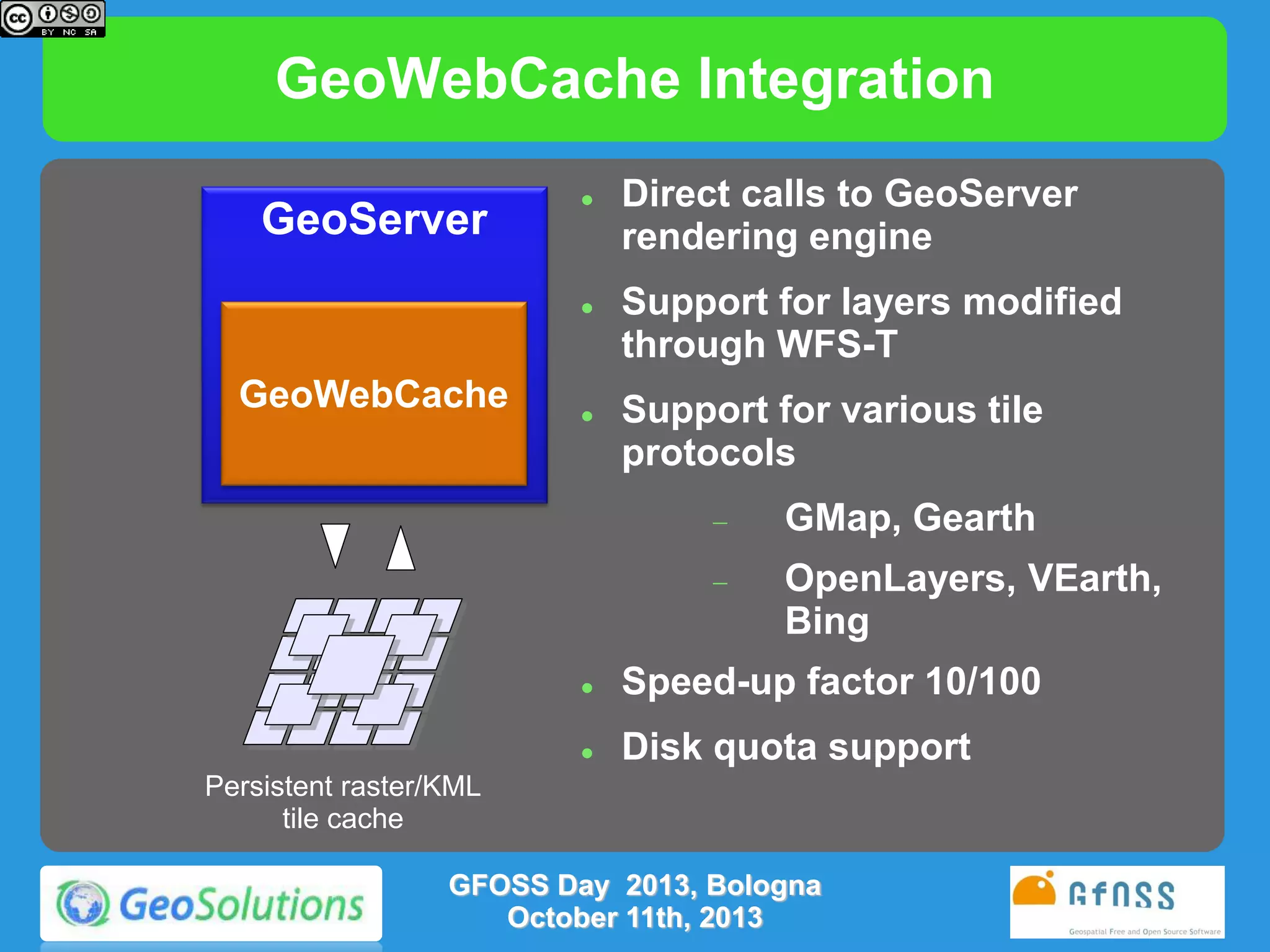
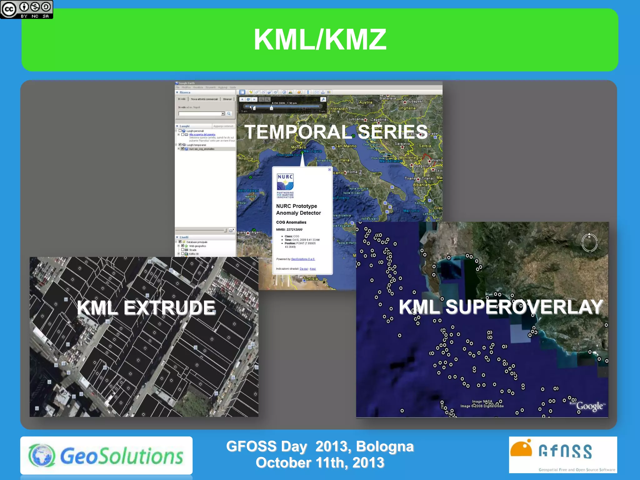
The document provides an extensive overview of GeoServer, an open source solution for managing geospatial data, detailing its features, standards compliance, and updates across different versions. It highlights the capabilities for handling raster and vector data, different service integrations, and administrative tools, along with insights into upcoming enhancements in future releases. Key topics include new functionalities in data dissemination, improved rendering, and the introduction of CSS for styling.


![[FOSS4G 2017 Boston]Development of an extension of Geoserver for handling 3D ...](https://cdn.slidesharecdn.com/ss_thumbnails/v2oglr9ztj6rozsfllyr-signature-7a758961d3f50ce339111f96a982ffa97fdeafa443a72eaf3f00f44b1d62f961-poli-170822063420-thumbnail.jpg?width=640&height=640&fit=bounds)


![[BDD 2025 - Full-Stack Development] Agentic AI Architecture: Redefining Syste...](https://cdn.slidesharecdn.com/ss_thumbnails/fs-agenticaiarchitectureredefiningsystemcommunication-251124030838-e6c70cc2-thumbnail.jpg?width=640&height=640&fit=bounds)


