Downloaded 107 times


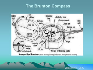
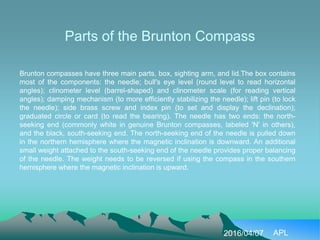
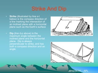
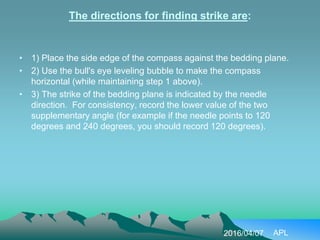
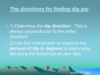
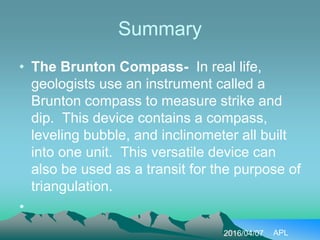


The document discusses how to measure strike and dip using a Brunton compass. It describes the main parts of the Brunton compass, including the box, sighting arm, needle, levels, and scales. It explains how to determine magnetic declination from maps or by setting it on the compass. The directions for finding strike involve placing the compass against the bedding plane and recording the needle direction. Finding dip involves first determining the dip direction, which is perpendicular to strike, and then using the inclinometer to measure the angle of dip. In summary, the Brunton compass is a versatile tool that geologists use to measure the strike and dip of geological features through its integrated compass, levels, and inclinometer


