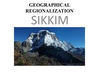
Geographical background
•Download as PPT, PDF•
0 likes•278 views

For 6th sem SU students

Recommended
More Related Content
What's hot
What's hot (20)
Similar to Geographical background
Similar to Geographical background (20)
More from Government Pharmacy College Sajong, Government of Sikkim
More from Government Pharmacy College Sajong, Government of Sikkim (20)
Recently uploaded
Recently uploaded (20)
Geographical background
- 2. INTRODUCTION • Country : India • Neighbouring State : West Bengal • Neighbouring Countries : Nepal ,China, Bhutan • Location : 27° 04’ – 28° 7’ North latitude 88° 00’ 58’’ – 88° 55’ 25’’ East longitude • Area : 7096 km2 • Capital : Gangtok
- 3. • Sikkim : derived from Tibetian name “DENJONG, DEMOJONG AND DEMO SHONG” meaning “THE COUNTRY OF VALLEY OF RICE” • Lepchas- this was "Nye-mae-el" (Paradise), • Tsong's word "Sukhim" meaning (New or Happy Home) . • Essentially mountainous with no flat piece of land • Merged as 22nd Indian state since 1975 • No. of Districts : 4 (East, North , South & West) (Gangtok, Mangan, Namchi, Geyzing) • No. of Villages : 450 • No. of Towns : 09 ( Namchi, Geyzing, Mangan, Jelep La, Pemayangtse, Lachen, Yunthang, Tashiding, Rumtek )
- 5. • Elevation range : 280m – 8,585m (920 ft – 28,000 ft) • North – South Stretch : 112.70 km • East – West Stretch : 64.40 km
- 7. • NORTH – Tibetan plateau • SOUTH – Darjeeling ridge, Teesta valley • Mountain range between Sikkim and Bhutan-Pangola range. • NORTH-WEST - Singalila Range and chewabhanzang– Sikkim-Nepal border; includes highest Sikkimese Summit, The KANCHENZUNGA- 8,586 m (28,150 ft.) • NORTH EAST - Donkhya Range – NE Sikkim- Tibet border • The Dongkya Range forms the tri-junction of the Bhutan-Sikkim-Tibet border • EAST – Chola range/ridge & Chumbi valley of Tibet & Bhutan
- 9. PHYSIOGRAPHY •GLACIAL ZONE: North and North-West (Zemu glaciar and Kanchanjunga) •HIGH MOUNTAIN AREA: - ridges run from North-South (Singalila & Chola) -Neinam ridge ( seperates Rangeet from Tista valley) -North –south ridge caused by southern slope of Himalayas
- 11. • Main physiographic of East Sikkim is culminating in Donkoya peak (6870m) • Eastern sikkim –Jela peak (4350m) • Distinct characteristic of Eastern Sikkim is NATHULA (4335m) AND TANGKARLA peak (4800m)
- 12. Assignment • 28 mountain peaks • 80 glaciers • 227 high altitude lakes • 5 major hot springs • > 100 rivers & streams • 8 mountain passes
- 13. KANCHENGZONGA
- 14. • Mt. Kanchenzunga- is the third highest mountains in the world and an elevation of 8,586m (28,169 feet). • The name itself literally means “The Five Treasures of Snow” in Tibetan language, owing to the five major peaks in the region. • The center, main and south peaks are situated in Taplejung, Nepal while the north peak lies in Sikkim- India. • A large portion of the mountain is covered with snow glaciers feeding through a large network of rivers in both Nepal and India side. • The major rivers are the Sapta Koshi River in Nepal and Teesta River in India.
- 16. Conti.. • However, major climbing peak routes and best trekking trails including the Kanchenjunga trekking lies on Nepal’s side. • Make a note on climbing history of Mt. Kanchendzonga
- 17. GEO-MORPHOLOGY
- 18. • Sikkim encompasses or surrounded by the lesser Himalaya, Central Himalaya, and the Tethys Himalaya. • A mountainous state without flat piece of land of any extent any where. The mountains rise in elevation northward. • The northern portion of the state is deeply cut into steep escarpments (a long, steep slope), and except in the Lachen and Lachung valleys, is not populated. • Southern Sikkim is lower, more open, and fairly well cultivated. This configuration of the State is partly due to the direction of the main drainage facilities in southern..
- 19. • The physical configuration of Sikkim is also partly due to geological structure. Major portion old state is covered by Precambrian rock and is much younger in age. • The Northern, Eastern and Western portion of the state are constituted of hard massive gneissose rocks capable of resisting denudation. • The central and southern portion is formed of comparatively soft, thin and half-schist ore rocks which denudes very easily.
- 20. Gneissose and half-schistose rocks, producing generally poor and shallow brown clay soils. Large concentrations of iron oxide; neutral to acidic & is poor in organic and mineral nutrients. Precambrian rock, which is much younger in age than the hills. The rock consists of phyllites (foliated metamorphic rock) and schists (medium-grade metamorphic rock), is highly susceptible to weathering and erosion.
- 21. GNEISS
- 22. SCHISTS
- 23. SOIL • North – mountainous skeletal soil • Foothills – Gravelly, Sandy soil • Lower areas - Clayey soil • River beds – Alluvial soil • Zone of tropical forest – leached, but rich in humus
- 25. CLIMATE • Warmer and more humid than western Himalayas • Most humid place in Himalayas because of proximity to Bay of Bengal and its exposure to moisture bearing south western monsoon winds • 1. Topical • 2. Temperate • 3. Alpine
- 27. • Tundra region is clad with snow for four months every year, and the temperature drops below 0 °C (32 °F) almost every night • Most of the inhabited regions of Sikkim, however, experience a temperate climate, with the temperatures seldom exceeding 28 °C (82 °F) in summer or dropping below 0 °C (32 °F) in winter; the mean monthly summer temperature is 18 °C.
- 29. • Five seasons: winter, summer, spring, autumn, and a monsoon season. • The average annual temperature for most of Sikkim is around 18 °C (64 °F). • During the monsoon, heavy rains (500 cm average) increase the risk of landslides. The record for the longest period of continuous rain in Sikkim is 11 days
- 30. DRAINAGE • The Sikkim basin is drained by the TEESTA RIVER & it’s tributaries (a river or stream flowing into a larger river or lake), such as Rangit, Lhonak, Talung, & Lachung. • Other tributaries - Lachen, Zeum, Rongni, Rungpo-chu • Teesta river originates from Zemu glacier in the NE, near Tibetan border (Tso Lhamu lake) • Teesta river descends steeply, dropping about 15,700 ft (4800 m) to Rangpo • Cuts a gorge through Darjeeling ridge, before emerging onto the Indo-Gangetic plain.
- 31. TEESTA- RANGEET
- 32. River Rangeet • The Rangeet or Rangit is a tributary of the Teesta river, which is the largest river in the Indian state of Sikkim. The Rangeet river originates in the Himalayan mountains in West Sikkim district. The river also forms the boundary between Sikkim and Darjeeling district. The river flows past the towns of Jorethang, Pelling and Legship. During its final few kilometres, it joins the Teesta River at a confluence known as Tribeni, which is a popular picnic spot. The Rangeet river has an NHPC hydropower plant with a capacity of 60 megawatts (80,000 hp) capacity in Sikkim.
- 33. Teesta - Rangeet
- 34. BIODIVERSITY & BIORESOURCES • Sikkim has around 5,000 flowering plants, 515 rare orchids, 60 primula species (herbaceous flowering plants in the family Primulaceae), 36 rhododendron species, 11 oak varieties, 23 bamboo varieties, 16 conifer species, 362 types of ferns and ferns allies, 8 tree ferns, and over 424 medicinal plants. • A variant of the Poinsettia, locally known as "Christmas Flower", can be found in abundance in the mountainous state. • The orchid Dendrobium nobile is the official flower of Sikkim, while the rhododendron is the state tree, (Rhododendron niveum).
- 35. State flower -Dendrobium nobile
- 37. Flora of Sikkim may be divide into three zones: 1. Tropical zone- ranging from lowest level upto 1500m 2. Temperate zone- from 1500-3900m 3. Alpine zone – till 4800m
- 38. • Orchids, figs, Bay laurel, bananas, sal trees, bamboo, and firs are grow in the Himalayan tropical & subtropical broadleaf forests of the lower elevation (altitudes) of Sikkim (up to 1500m). • In the temperate elevations above 1,500 metres (4,900 ft) there are Eastern Himalayan broadleaf forests, where oaks, chestnuts, maples, and magnolia grow in large numbers, as well as Himalayan subtropical pine forests, dominated by Chir pine. • The alpine-type vegetation is typically found between an altitude of 3,500 to 5,000 metres (11,500 to 16,000 ft). and rhododendrons from the Eastern Himalayan sub-alpine conifer forests. Higher up are Eastern Himalayan alpine shrub and meadows, home to a broad variety of rhododendrons and wildflowers.
- 41. • THE FAUNA include the snow leopard, the musk deer, the Himalayan Tahr, the RED PANDA (Ailurus fulgens) (State animal), the Himalayan marmot, the serow, the goral, the barking deer, the common langur, the Himalayan Black Bear, the clouded leopard, leopard cat, the wild dog, the Tibetan wolf, the hog badger, the binturong, the jungle cat and the civet cat. Among the animals more commonly found in the alpine zone are yaks, mainly reared for their milk, meat, and as a beast of burden.
- 42. State Animal- RED PANDA
- 45. • THE AVIFAUNA of Sikkim include of the Impeyan pheasant, the crimson horned pheasant, the snow partridge, the snow cock, the lammergeier and griffon vultures, as well as golden eagles, quail, plovers, woodcock, sandpipers, pigeons, Old World flycatchers, babblers and robins. • Sikkim has more than 550 species of birds, some of which have been declared endangered. • State Bird – Blood pheasant (Ithaginis cruentus)
- 46. State Bird – Blood Pheasant
- 49. • Sikkim also has a rich diversity of arthropods, many of which remain unstudied. As with the rest of India, the most studied group is that of the butterflies. Of approximately 1,438 butterfly species found in the Indian subcontinent, 695 have been recorded from Sikkim. These include the endangered Kaiser-i- hind, Yellow Gorgon and the Bhutan Glory.
- 53. GLACIERS IN SIKKIM A slowly moving mass or river of ice formed by the accumulation and compaction of snow on mountains or near the poles. There are more than 80 glaciers in Sikkim, some important are listed below. • Zemu glacier, • Rathong glacier, • Lonak glacier, • Zemathang glacier • Taluk glacier, • Tista khangse glacier, • Hidden glacier
- 54. • ZEMU GLACIER – largest & most famous in eastern himalayas • 26 km in length • Situated in U- Shaped valley at base of Kanchendzonga • Origin of TEESTA river
- 55. ZEMU GLACIER
- 56. • RATHONG GLACIER – West district of Sikkim • Total length and average width of about 4 km and 800 m • Origin of RANGIT river • Chaurikhang falls • LONAK GLACIER – at an altitude of about 4720 m in North Sikkim. • Zemu glacier in the North, Mt. Lama-ongden in the East, Mt. Narsing & Mt. Damdin in South, & Kanchenjungha in West.
- 58. ZEMATHANG GLACIER Zemathang glacier, near Kangchenjunga mountain range.
- 59. LAKES IN SIKKIM • Khecheopalri lake • Gurudongmar lake • Tsongmo lake • Tso Lhamu lake • Menmecho lake • Green lake • Karthok lake
- 60. • Khecheopalri lake – West sikkim, 25 kms from Pelling. Sacred lake both for Buddhists & Hindus. • Gurudongmar lake – North Sikkim, at 17,800 ft North East of Kanchenzunga. One portion of the lake never freezes in winter
- 62. GURUDONGMAR LAKE
- 63. • Tso Lhamo lake or Chho Lhamo or Cholamu lake is one of the highest lakes in the world, located approximately at an altitude of 17,100 ft (5,210 m). It is situated in North Sikkim- India, only some 4 km (2.5 miles) south-west of Chinese border. • This is a glacial, fresh-water lake is located north-east of the Kangchenjunga range in a high plateau area connected with the Tibetan Plateau.
- 65. • Tsomgo lake – 12,400 ft. (East Sikkim) • “source of the lake” • 1km long,15 mts deep, oval in shape
- 66. TSOMGO LAKE
- 67. HOT SPRINGS • A hot spring is a spring that is produced by the emergence of geo-thermally heated groundwater from the Earth's crust. • Phurchachu • Yunthang • Borang • Ralang • Yumey Sandong High in sulphur content – medicinal value – average temperature of water is 50°C and Some emit hydrogen.
- 68. PURCHACHU HOT SPRING – situated on the bank of River Rangeet south village of tikutam near Reshi. The water of these springs has medicinal value as it contains sulphur and can cure some skin diseases.
- 69. YUMTHANG HOT SPRING • Yumthang is situated about 135 kms from Gangtok in North Sikkim . It is well known for its hot springs. The route to Yumthang from Lachung has a very picturesque landscape and is lined with Rhododendrons. Yumthang falls in the restricted area.
- 70. Borong and Ralong Hot Springs • Situated near Ravangla in South Sikkim, the Borong and Ralong hot springs are located within a radius of 7 KM from each other. It takes close to an hour-long trek to arrive at Ralong Tsachu from the famed Ralong Monastery at Ravangla. • Borong Tsachu has a relatively less difficult access as the first 7 KM has motorable roads. After the initial drive, it takes a further 40 minutes' downhill walk to reach at Borong.
- 72. YUME SAMDONG HOT SPRING Yume samdong is the end of Yumthang Valley. It is situated close to China border and can be visited by Indian tourists only. Its often referred as the Zero Point or Yume samdong - Zero Point Sikkim. Situated at 15,500 feets altitude in the North East state of Sikkim (India).It is very close to the Chinese border. An hours drive beyond Yumthang (26 kms).