Downloaded 140 times
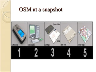
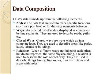

OpenStreetMap (OSM) is a collaborative project to create a free editable map of the world. It was founded in 2004 and now has over 500,000 registered users. Data is collected through GPS, local knowledge, and correcting existing maps. The map can be edited online or through applications like JOSM and uploaded. OSM data includes nodes, ways, closed ways, and relations. Rendering transforms the vector data into a more artistic map. OSM has benefits like aiding disaster relief and is compatible with platforms like Ushahidi.


