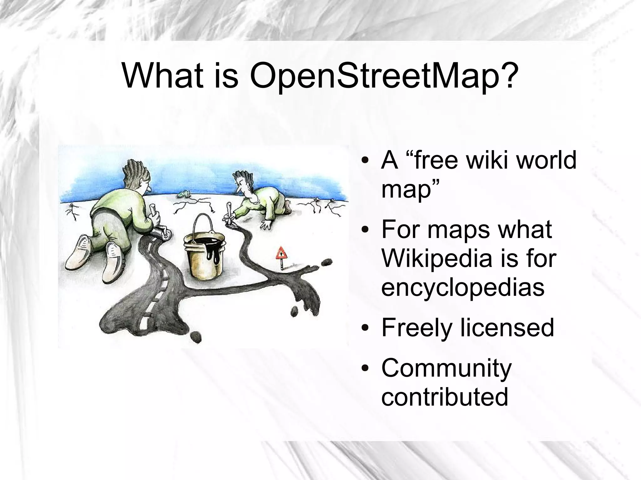
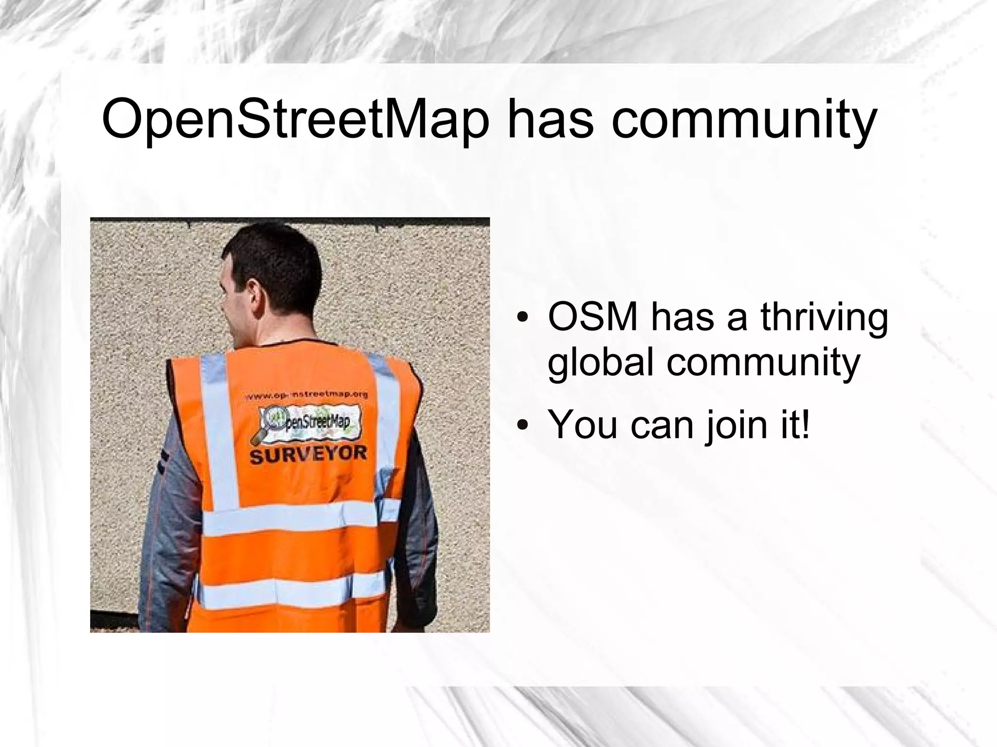
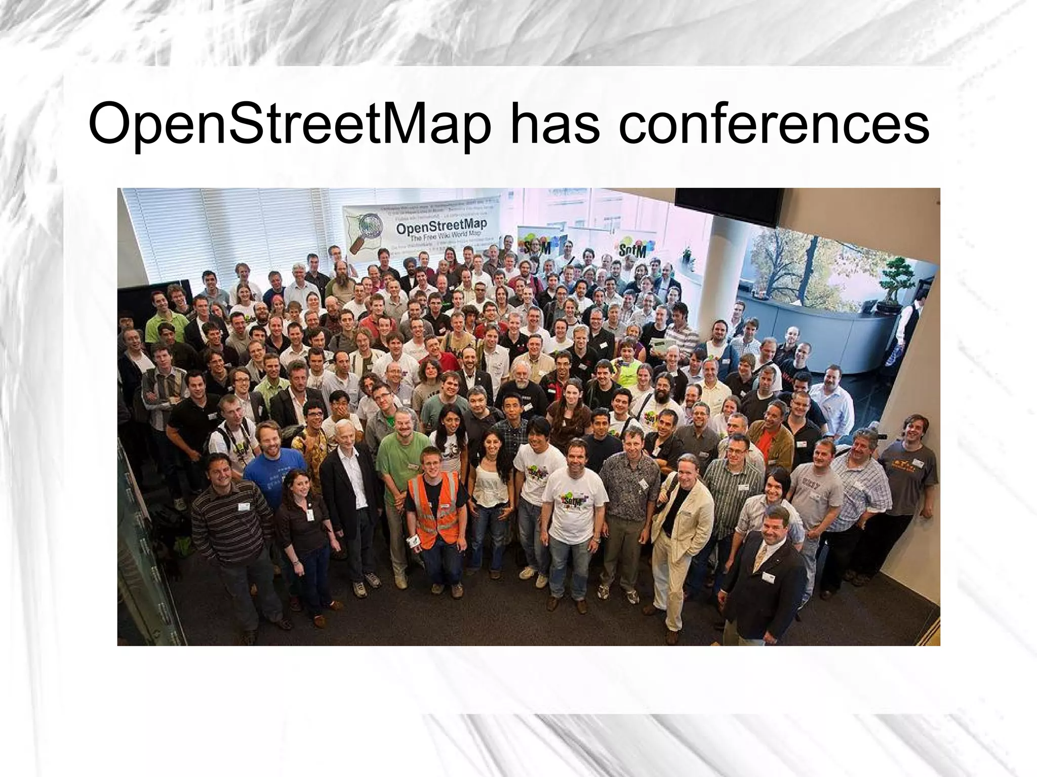
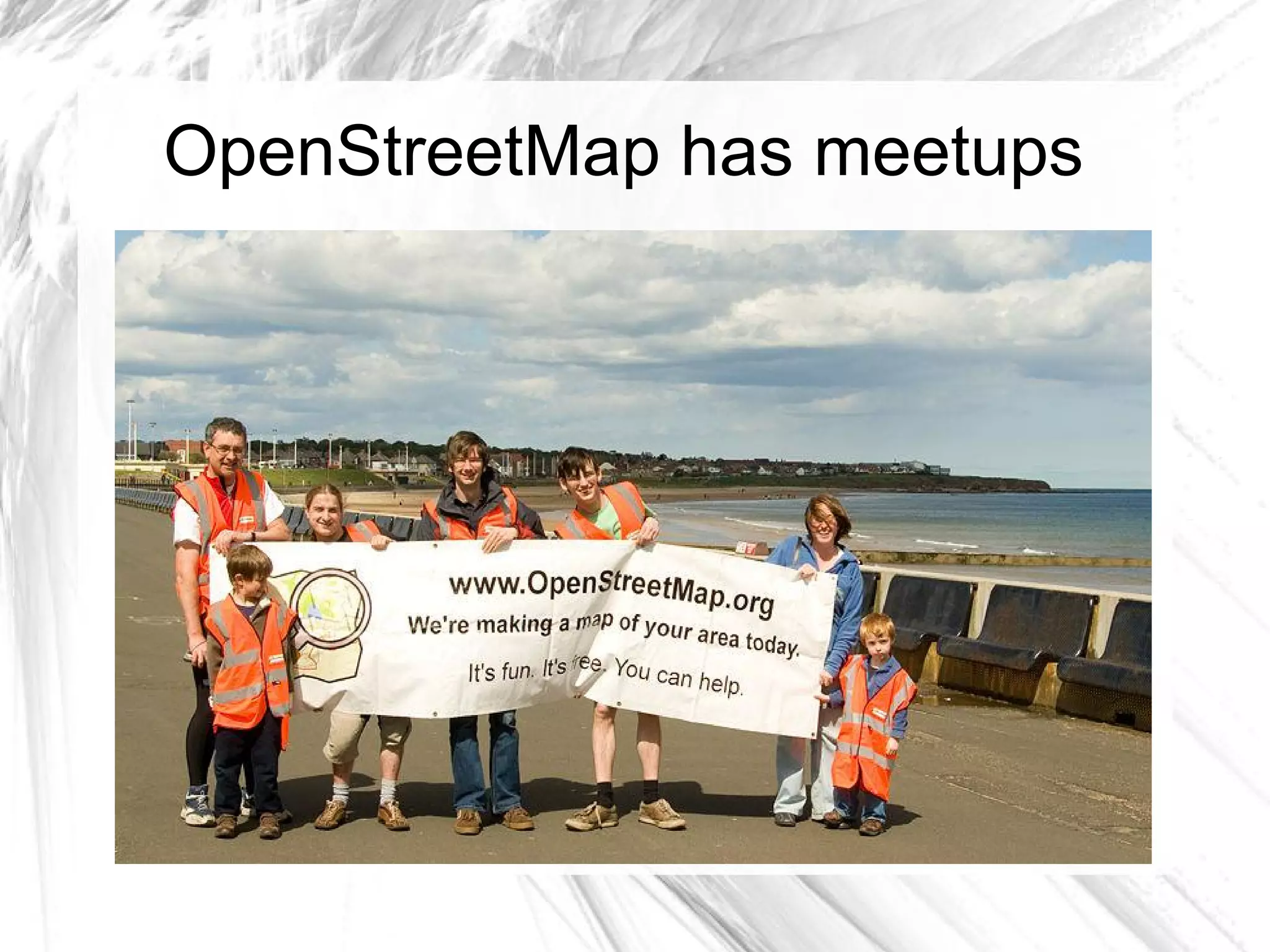
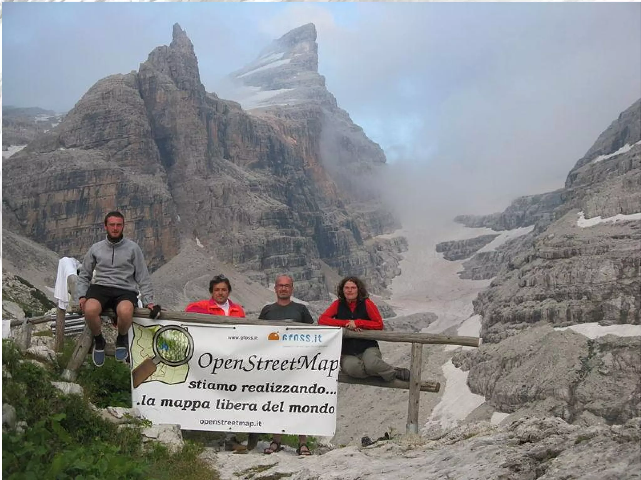
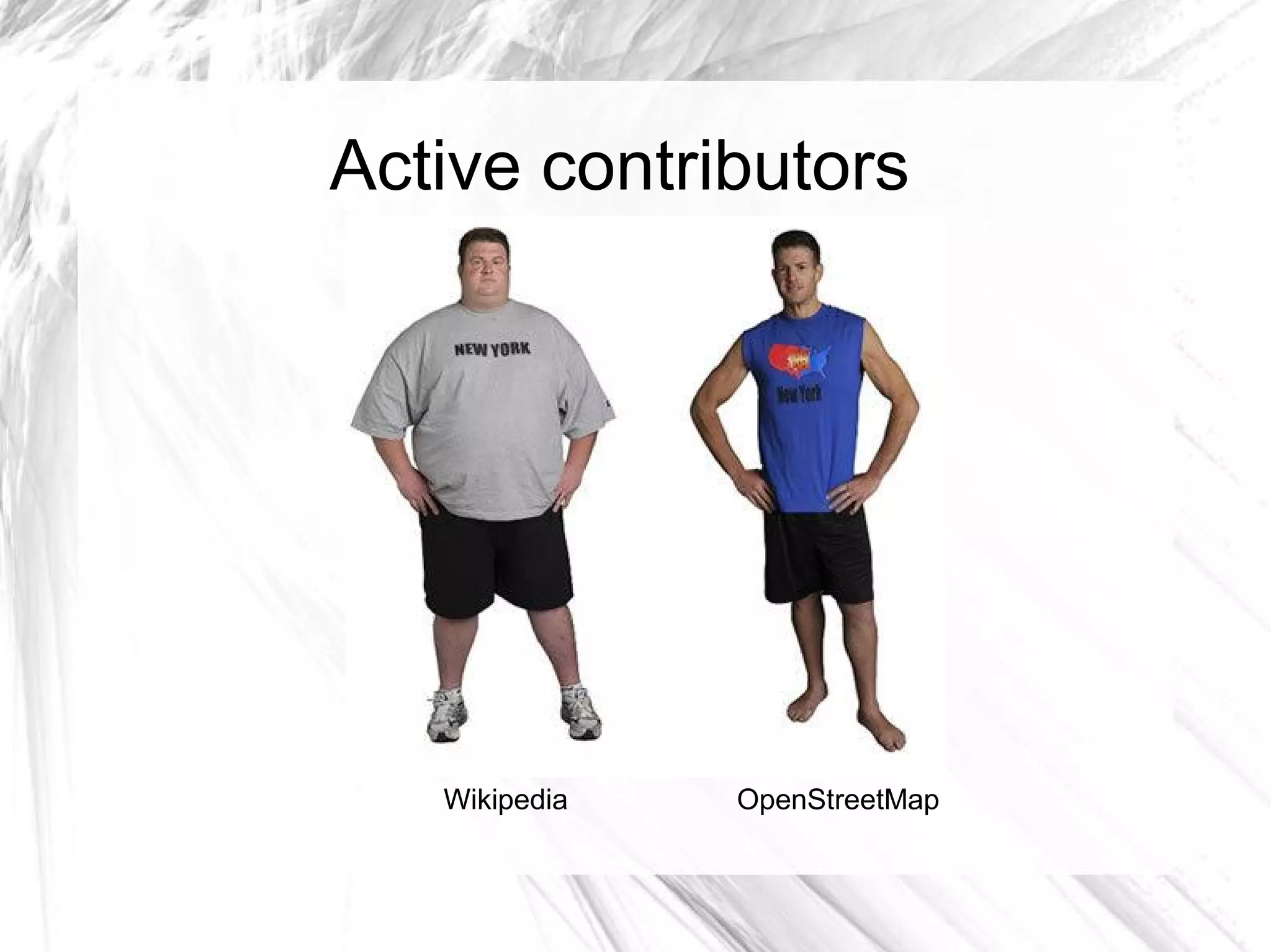
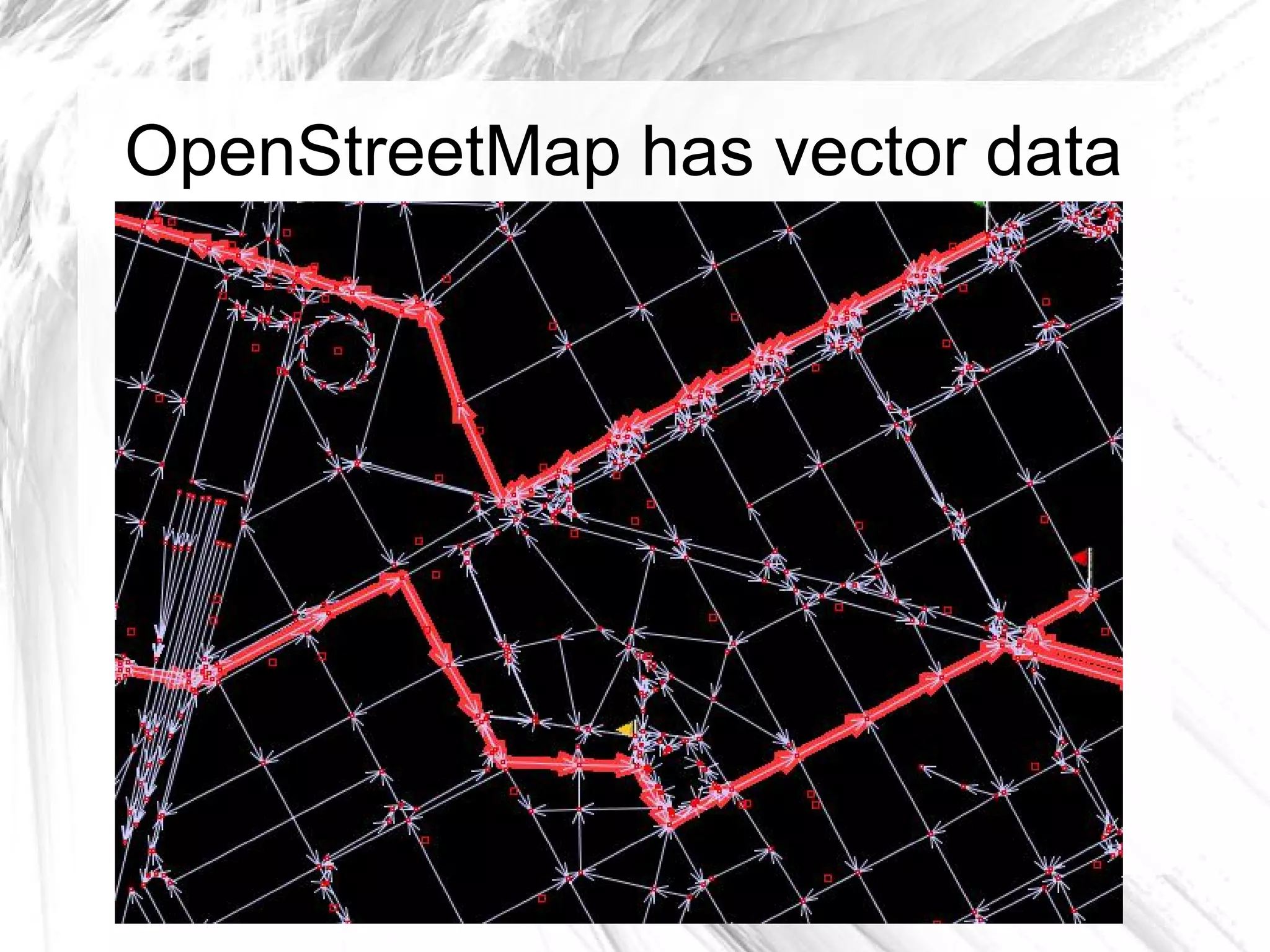
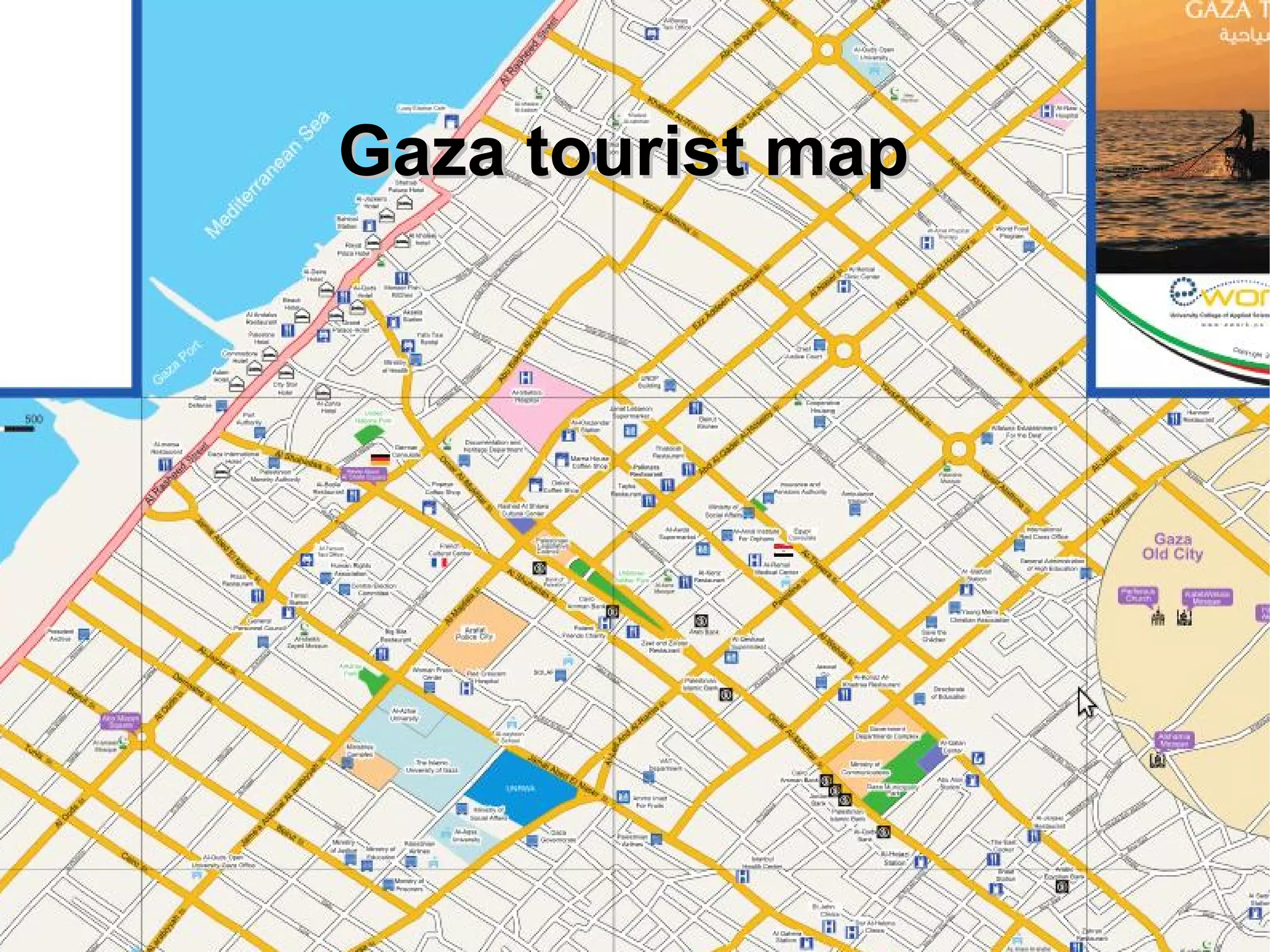
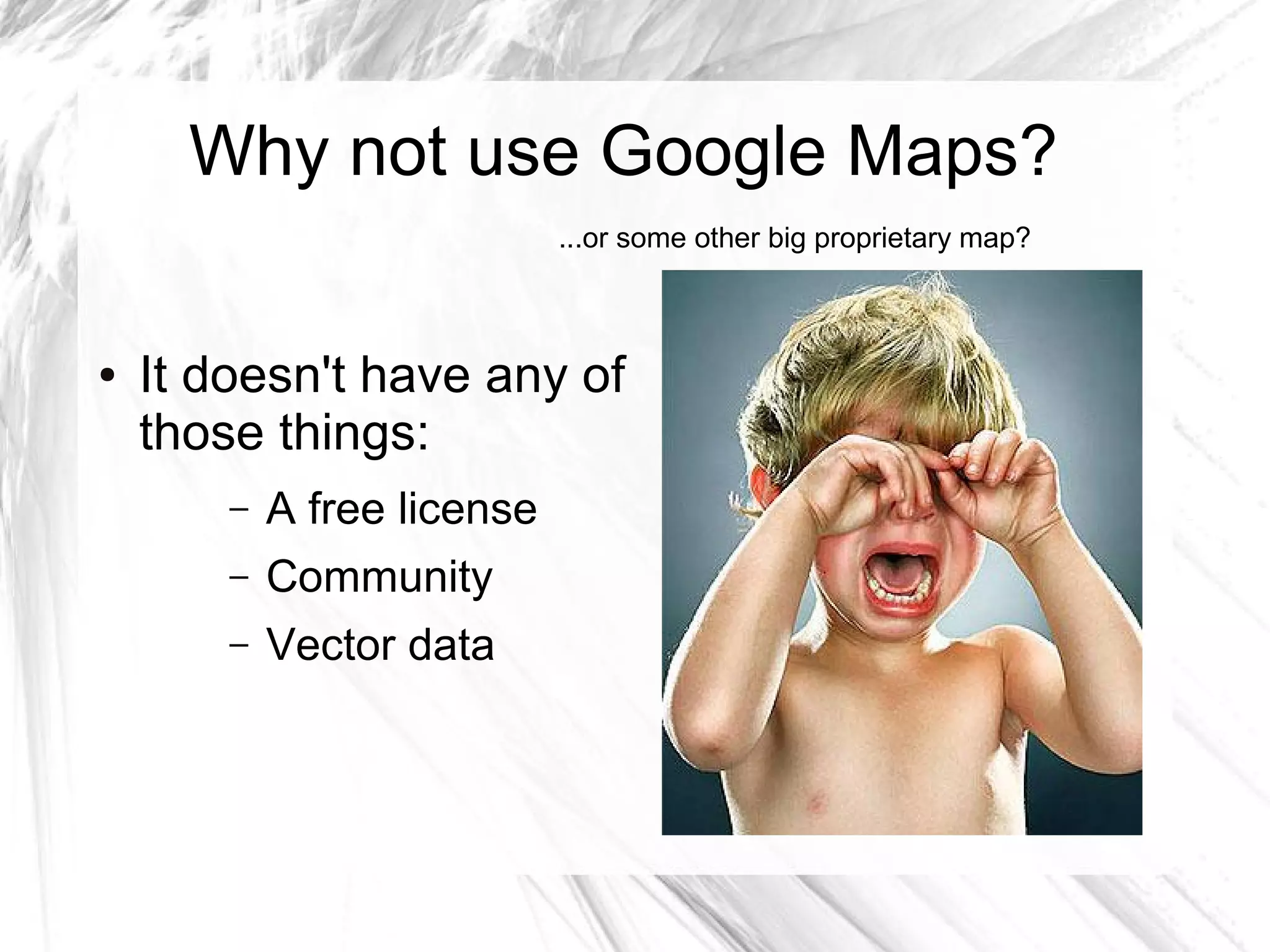
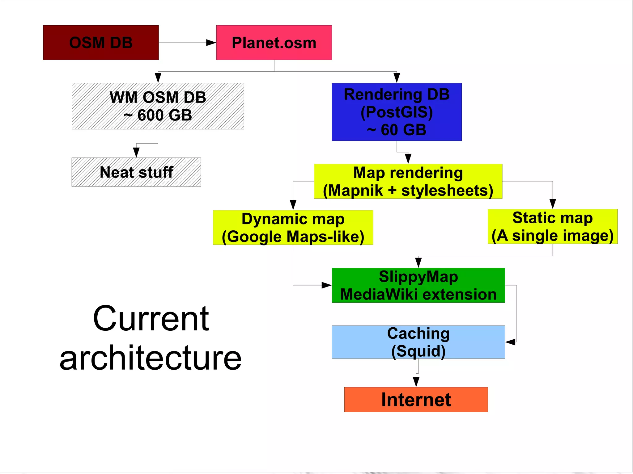
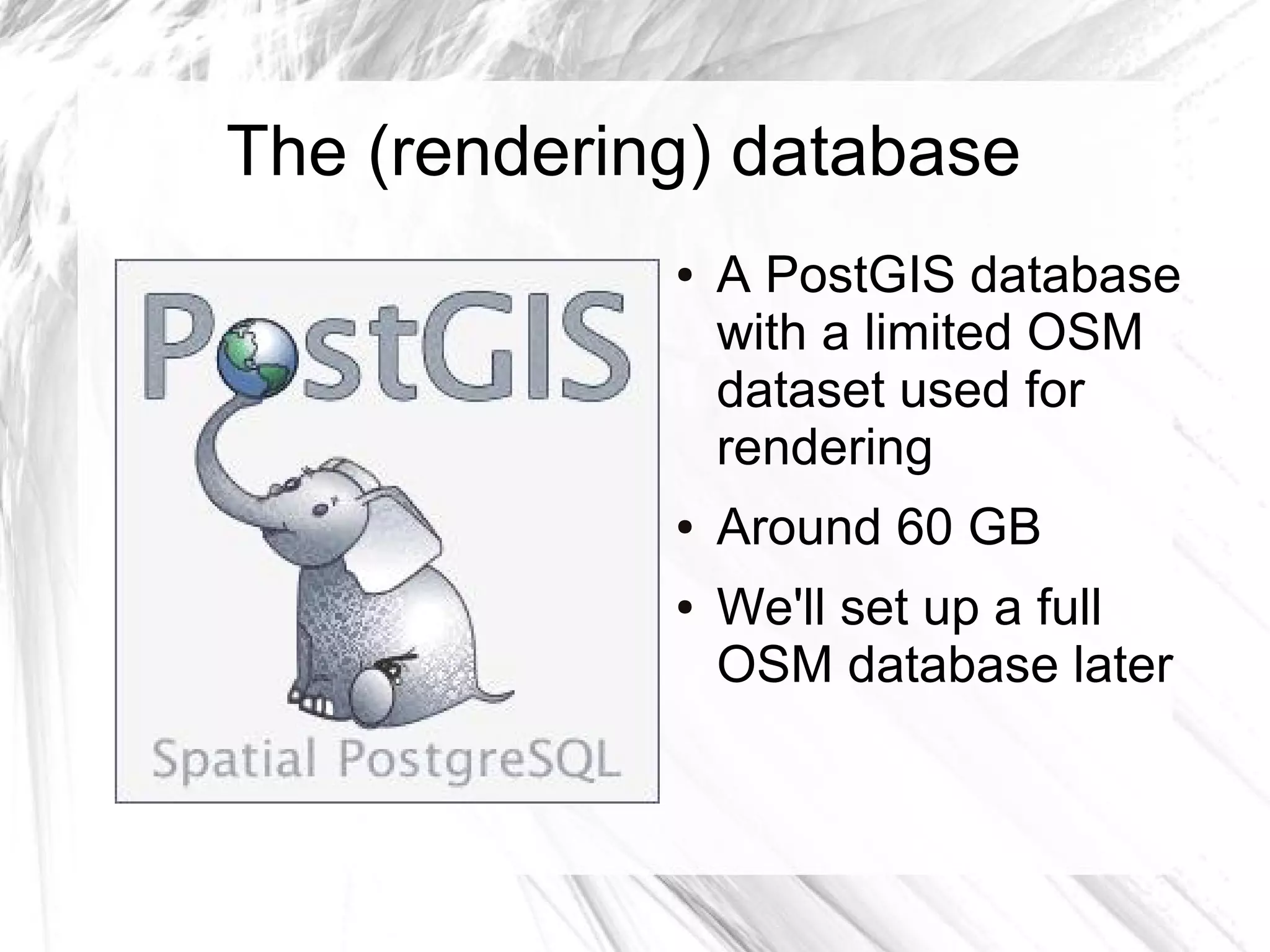
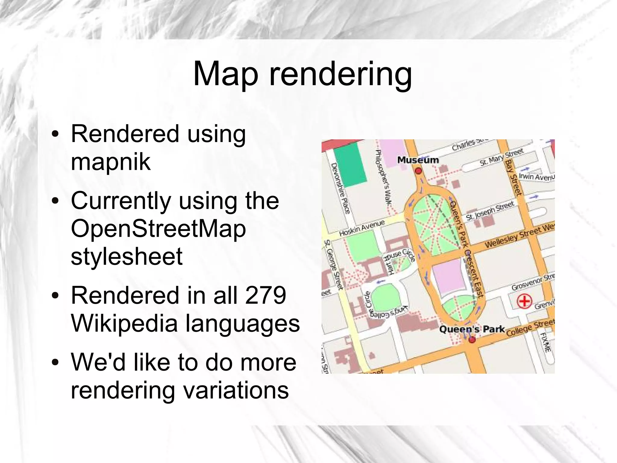
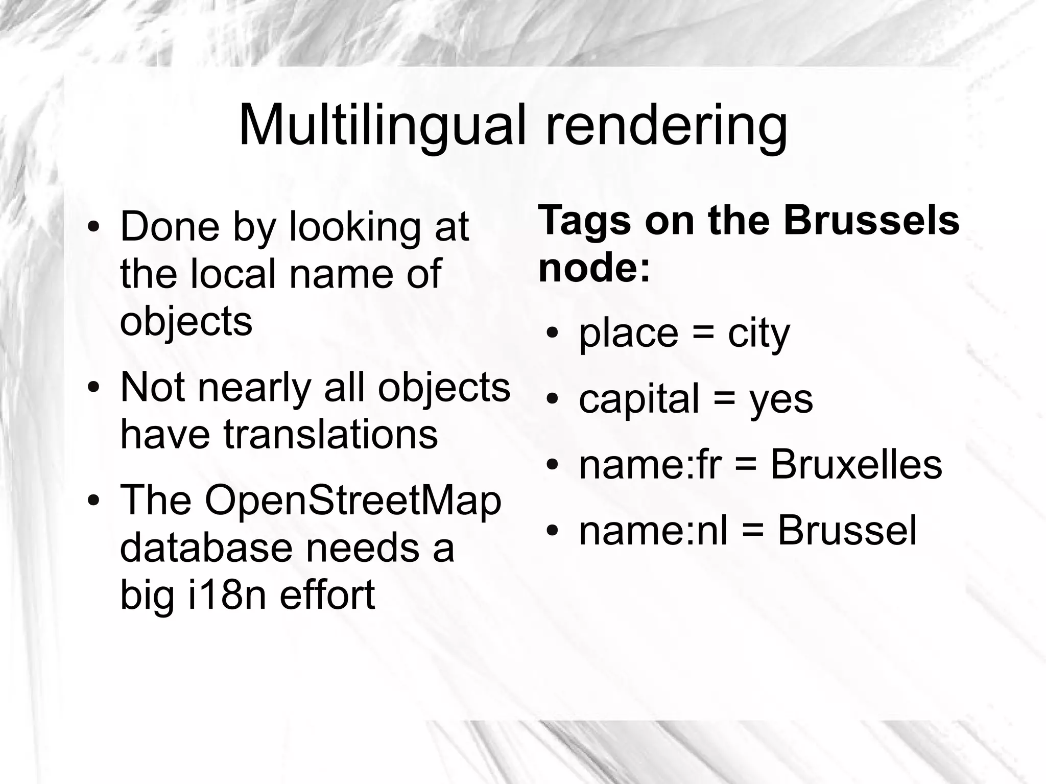
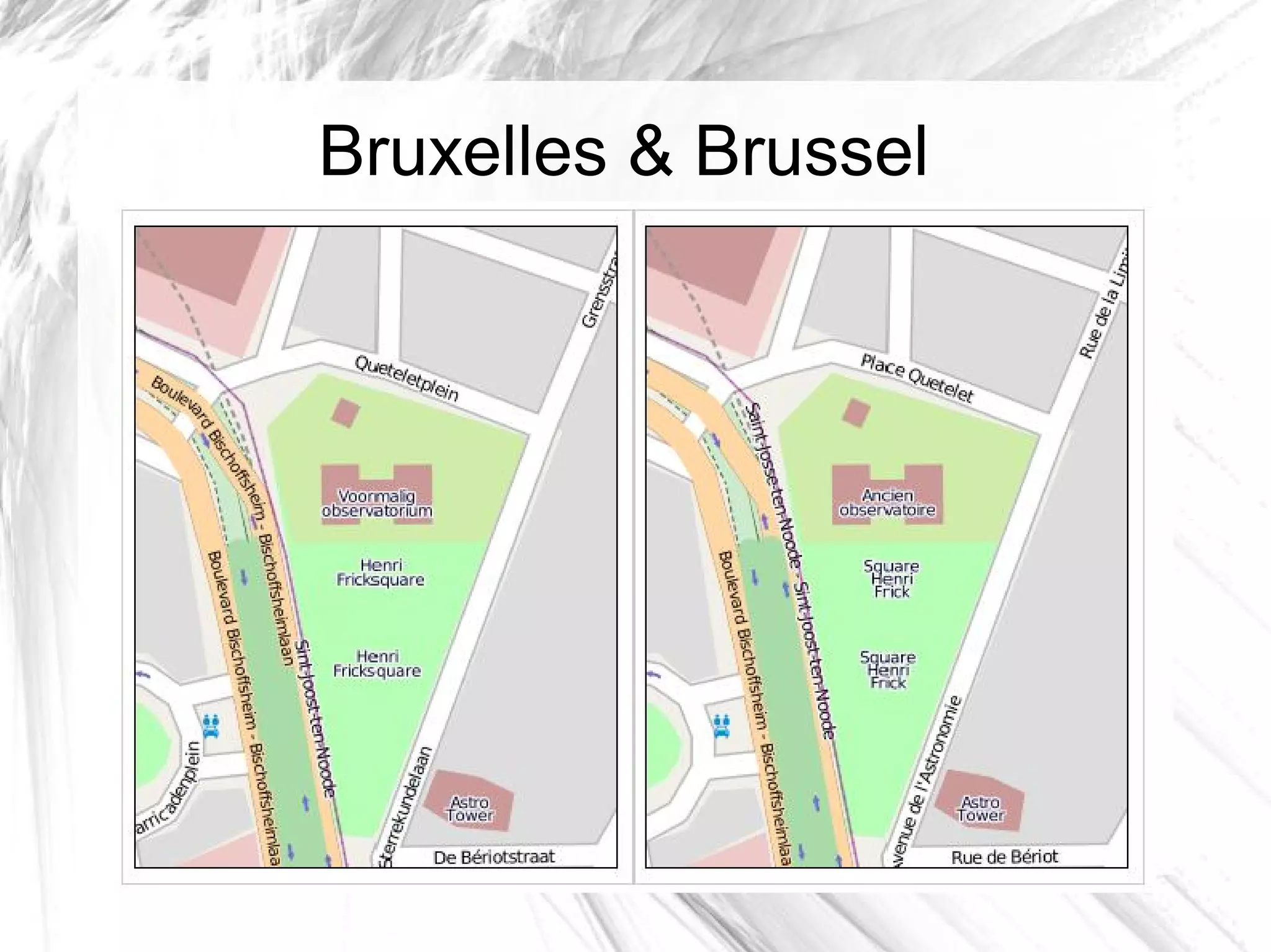
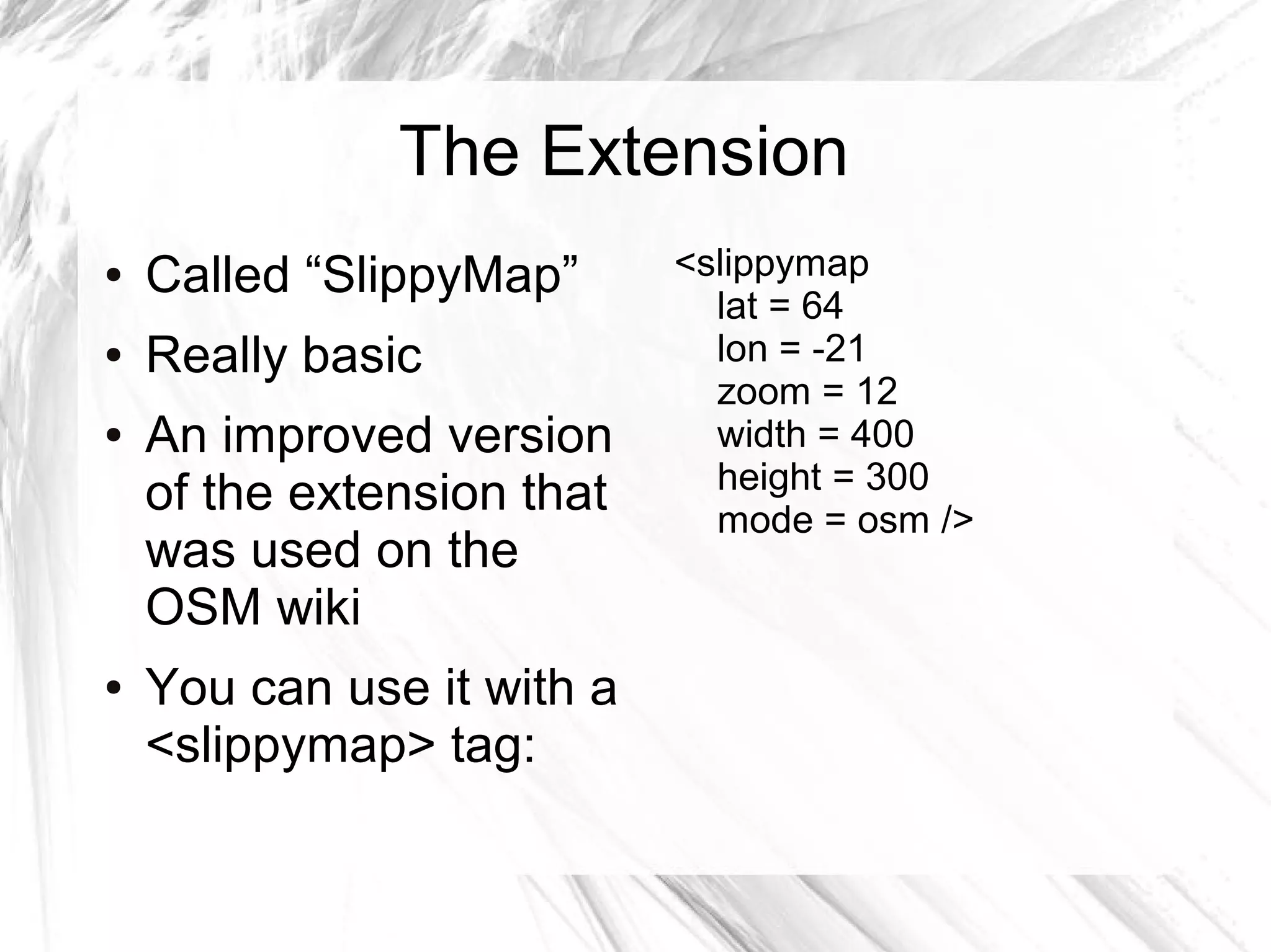
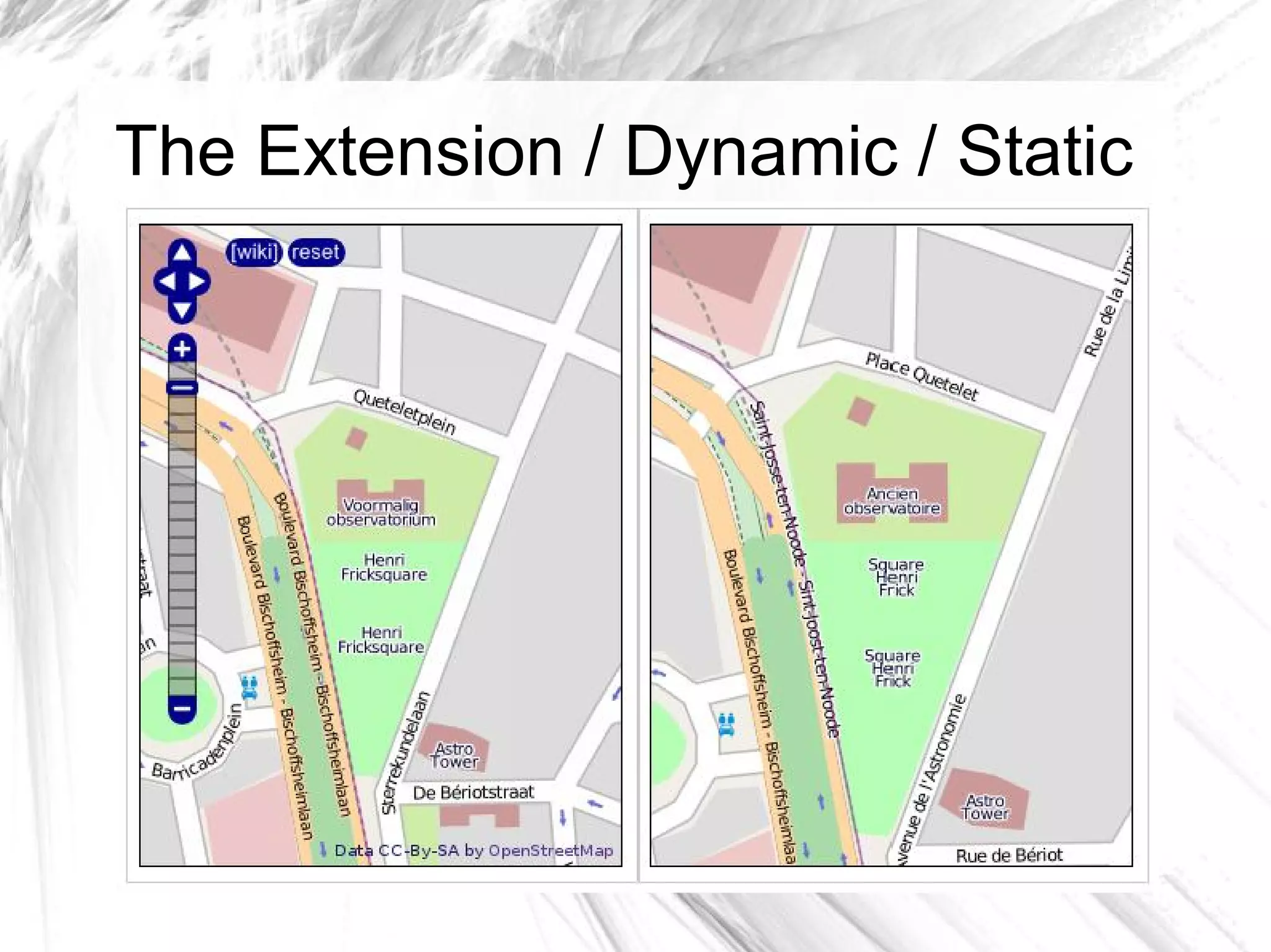
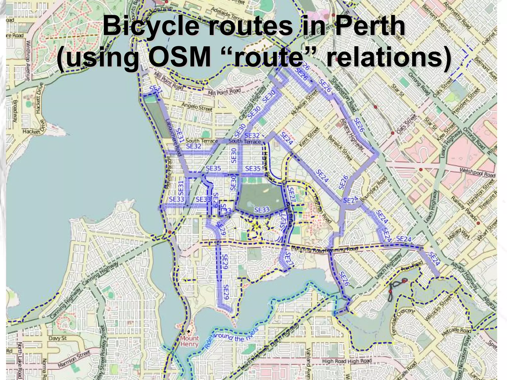
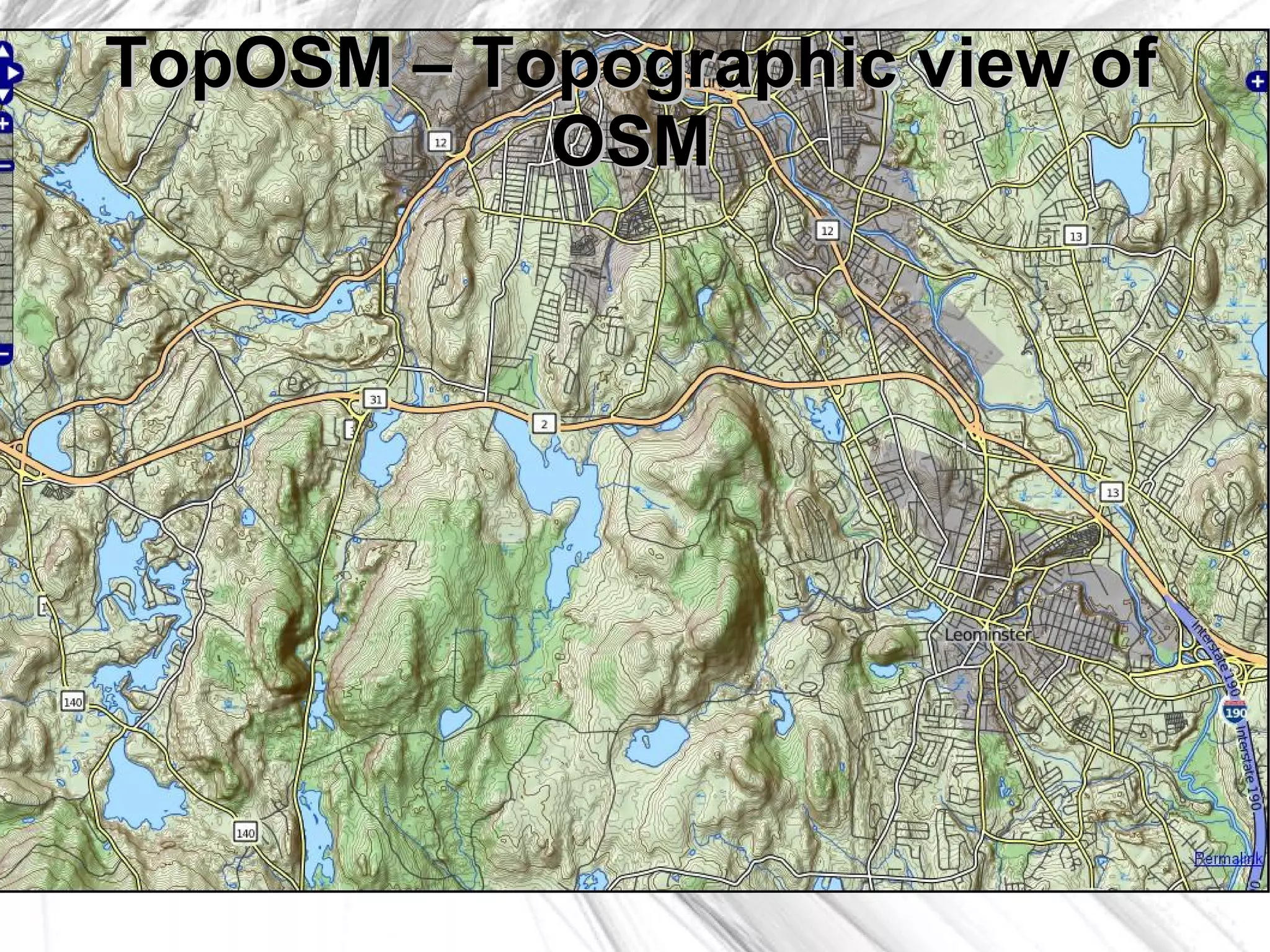
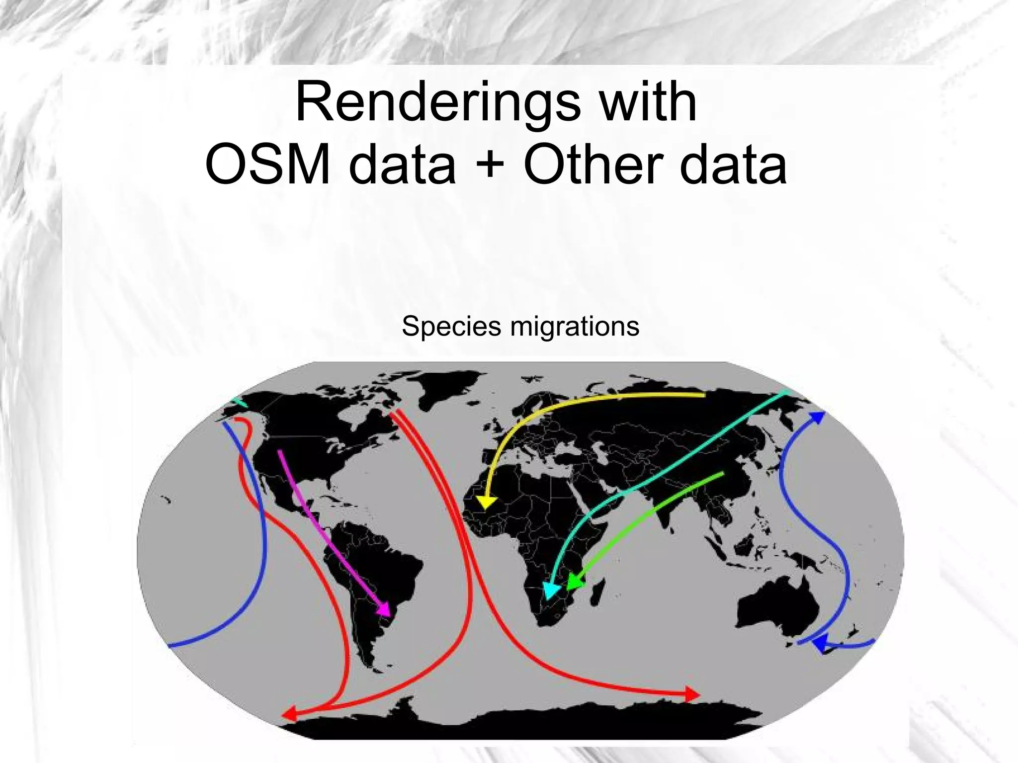
OpenStreetMap integration into
      Wikimedia projects
   A progress report on getting OpenStreetMap
        integrated into Wikimedia projects


Ævar Arnfjörð Bjarmason        Wikimania 2009
          avar                August 26-28, 2009
  avarab@gmail.com              Buenos Aires
Who am I?
     ●   A (inactive)
         MediaWiki
         developer
     ●   A Wikipedia and
         OpenStreetMap
         contributor
     ●   Someone who
         wants to increase
         collaboration
         between these
         projects
What is OpenStreetMap?

             ●   A “free wiki world
                 map”
             ●   For maps what
                 Wikipedia is for
                 encyclopedias
             ●   Freely licensed
             ●   Community
                 contributed
There's a lot of similarities
between OSM and Wikipedia
OpenStreetMap has community


              ●   OSM has a thriving
                  global community
              ●   You can join it!
OpenStreetMap has conferences
OpenStreetMap has meetups
Active contributors


   Wikipedia   OpenStreetMap
But most importantly...
OpenStreetMap has vector data
Which gives us all sorts of neat stuff
Gaza tourist map
Tactile maps for the blind
London postcodes
Why not use Google Maps?
                             ...or some other big proprietary map?


●   It doesn't have any of
    those things:
        –   A free license
        –   Community
        –   Vector data
So let's do it!
Developer meet-up 2009
●   Held in Berlin by
    Wikimedia Germany
●   A bunch of people
    interested in OSM ↔
    WM integration were
    there
●   Plans were made on
    how to accomplish
    this
“OpenStreetMap maps will be
    added to Wikimedia projects”
●   Wikimedia will set up a database to mirror the
    OSM data (Planet.osm)
●   Wikimedia will set up its own rendering
    infrastructure for rendering tiles & other maps
    from the OSM data
●   The existing MediaWiki extensions for
    displaying OSM data in a MediaWiki article will
    be improved to work acceptably in production
    on Wikimedia servers
Design goals
●   The maps should also work for non-JavaScript
    enabled browsers
●   The tools have to be stable & deployable on
    Wikimedia servers
●   Everything we're generating has to be
    cachable so we can throw it at the squids
We've done that...


   And this is what we have now
OSM DB          Planet.osm


   WM OSM DB                   Rendering DB
    ~ 600 GB                     (PostGIS)
                                  ~ 60 GB

  Neat stuff                    Map rendering
                             (Mapnik + stylesheets)
                 Dynamic map                         Static map
               (Google Maps-like)                 (A single image)

                                   SlippyMap
                               MediaWiki extension
  Current                            Caching
architecture                         (Squid)


                                    Internet
The (rendering) database
             ●   A PostGIS database
                 with a limited OSM
                 dataset used for
                 rendering
             ●   Around 60 GB
             ●   We'll set up a full
                 OSM database later
Map rendering
●   Rendered using
    mapnik
●   Currently using the
    OpenStreetMap
    stylesheet
●   Rendered in all 279
    Wikipedia languages
●   We'd like to do more
    rendering variations
Multilingual rendering
●   Done by looking at       Tags on the Brussels
    the local name of        node:
    objects                  ●   place = city
●   Not nearly all objects   ●   capital = yes
    have translations
                             ●   name:fr = Bruxelles
●   The OpenStreetMap
    database needs a
                             ●   name:nl = Brussel
    big i18n effort
Bruxelles & Brussel
The Extension
●   Called “SlippyMap”      <slippymap
                              lat = 64
●   Really basic              lon = -21
                              zoom = 12
●   An improved version       width = 400
                              height = 300
    of the extension that     mode = osm />
    was used on the
    OSM wiki
●   You can use it with a
    <slippymap> tag:
The Extension / Dynamic / Static
What comes next?
●   Getting what we have ready for production
       –   Fixing bugs
       –   Testing the stack under load
       –   Rolling it out on some wiki (German?) for
           testing
       –   Global deployment
       –   Adding more exciting features
Want to help?
●   Finding out what needs doing:
    –   A maps-l mailing list on lists.wikimedia.org
    –   The Maps component in MediaZilla
●   Programming to be done in C/C+
    +/Python/JavaScript/PHP
●   UI testing: http://xrl.us/osmwm
●   Other interesting projects
Neat stuff we can (hopefully) do in the future...
Bicycle routes in Perth
(using OSM “route” relations)
TopOSM – Topographic view of
           OSM
Renderings with
OSM data + Other data

       Species migrations
Coolserver tools
             Multilingular Country-List


http://cassini.toolserver.org/~mazder/multilingual-country-list/
Thanks!
     ●   To Wikimedia for
         sponsoring me to
         come here
     ●   To Wikimedia
         Germany for
         sponsoring me to
         their hackathon
Questions?

OpenStreetMap integration into Wikimedia projects

  • 1.
    OpenStreetMap integration into Wikimedia projects A progress report on getting OpenStreetMap integrated into Wikimedia projects Ævar Arnfjörð Bjarmason Wikimania 2009 avar August 26-28, 2009 avarab@gmail.com Buenos Aires
  • 2.
    Who am I? ● A (inactive) MediaWiki developer ● A Wikipedia and OpenStreetMap contributor ● Someone who wants to increase collaboration between these projects
  • 3.
  • 4.
    What is OpenStreetMap? ● A “free wiki world map” ● For maps what Wikipedia is for encyclopedias ● Freely licensed ● Community contributed
  • 5.
    There's a lotof similarities between OSM and Wikipedia
  • 6.
    OpenStreetMap has community ● OSM has a thriving global community ● You can join it!
  • 7.
  • 8.
  • 10.
    Active contributors Wikipedia OpenStreetMap
  • 11.
  • 12.
  • 13.
    Which gives usall sorts of neat stuff
  • 14.
  • 15.
  • 16.
  • 17.
    Why not useGoogle Maps? ...or some other big proprietary map? ● It doesn't have any of those things: – A free license – Community – Vector data
  • 18.
  • 19.
    Developer meet-up 2009 ● Held in Berlin by Wikimedia Germany ● A bunch of people interested in OSM ↔ WM integration were there ● Plans were made on how to accomplish this
  • 20.
    “OpenStreetMap maps willbe added to Wikimedia projects” ● Wikimedia will set up a database to mirror the OSM data (Planet.osm) ● Wikimedia will set up its own rendering infrastructure for rendering tiles & other maps from the OSM data ● The existing MediaWiki extensions for displaying OSM data in a MediaWiki article will be improved to work acceptably in production on Wikimedia servers
  • 21.
    Design goals ● The maps should also work for non-JavaScript enabled browsers ● The tools have to be stable & deployable on Wikimedia servers ● Everything we're generating has to be cachable so we can throw it at the squids
  • 22.
    We've done that... And this is what we have now
  • 23.
    OSM DB Planet.osm WM OSM DB Rendering DB ~ 600 GB (PostGIS) ~ 60 GB Neat stuff Map rendering (Mapnik + stylesheets) Dynamic map Static map (Google Maps-like) (A single image) SlippyMap MediaWiki extension Current Caching architecture (Squid) Internet
  • 24.
    The (rendering) database ● A PostGIS database with a limited OSM dataset used for rendering ● Around 60 GB ● We'll set up a full OSM database later
  • 25.
    Map rendering ● Rendered using mapnik ● Currently using the OpenStreetMap stylesheet ● Rendered in all 279 Wikipedia languages ● We'd like to do more rendering variations
  • 26.
    Multilingual rendering ● Done by looking at Tags on the Brussels the local name of node: objects ● place = city ● Not nearly all objects ● capital = yes have translations ● name:fr = Bruxelles ● The OpenStreetMap database needs a ● name:nl = Brussel big i18n effort
  • 27.
  • 28.
    The Extension ● Called “SlippyMap” <slippymap lat = 64 ● Really basic lon = -21 zoom = 12 ● An improved version width = 400 height = 300 of the extension that mode = osm /> was used on the OSM wiki ● You can use it with a <slippymap> tag:
  • 29.
    The Extension /Dynamic / Static
  • 30.
    What comes next? ● Getting what we have ready for production – Fixing bugs – Testing the stack under load – Rolling it out on some wiki (German?) for testing – Global deployment – Adding more exciting features
  • 31.
    Want to help? ● Finding out what needs doing: – A maps-l mailing list on lists.wikimedia.org – The Maps component in MediaZilla ● Programming to be done in C/C+ +/Python/JavaScript/PHP ● UI testing: http://xrl.us/osmwm ● Other interesting projects
  • 32.
    Neat stuff wecan (hopefully) do in the future...
  • 33.
    Bicycle routes inPerth (using OSM “route” relations)
  • 34.
  • 35.
    Renderings with OSM data+ Other data Species migrations
  • 36.
    Coolserver tools Multilingular Country-List http://cassini.toolserver.org/~mazder/multilingual-country-list/
  • 37.
    Thanks! ● To Wikimedia for sponsoring me to come here ● To Wikimedia Germany for sponsoring me to their hackathon
  • 38.