Downloaded 423 times
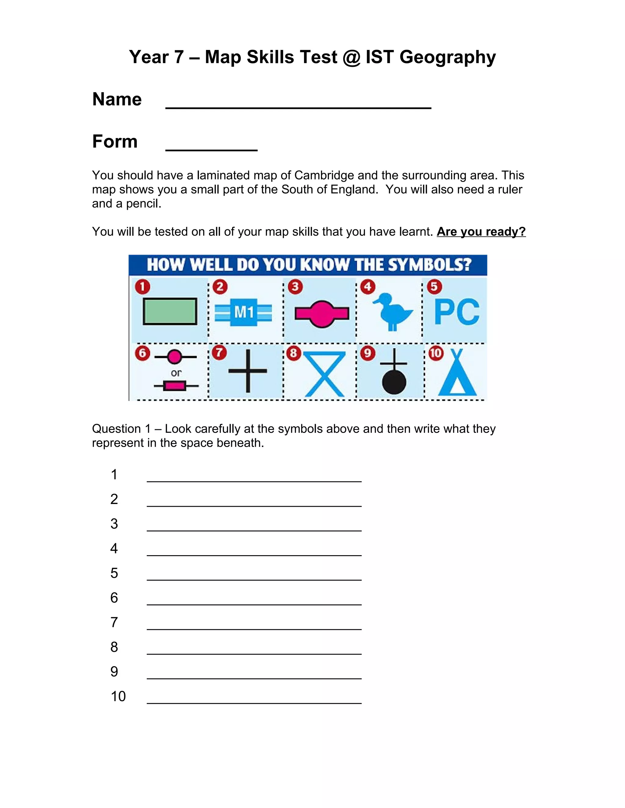

The document appears to be a geography test on map skills for students in Year 7 at the International School of Toulouse. It contains 35 multiple choice and short answer questions testing students' abilities to interpret map symbols, use scales, calculate distances, find grid references, identify locations, and describe terrain features using contour lines. Students are instructed to refer to a laminated map of Cambridge and surrounding areas as they complete the test.