GEOGRAPHY IGCSE: ALTERNATIVE PAPER 4 - INVESTIGATINGGeorge Dumitrache
GEOGRAPHY IGCSE: ALTERNATIVE PAPER 4 - INVESTIGATING. It contains: formulating aims and hypotheses, enquiry skills to collect data, questionnaires, observation, counts, measurements, river measurement and beach studies, data presentation techniques, analysis, formation of conclusions.
GEOGRAPHY IGCSE: WEATHER MEASUREMENTS. It contains: difference between weather and climate, measuring the weather, what do we measure, temperature, precipitation, wind direction, Beaufort scale, cloud cover, air pressure, glossary.
CAMBRIDGE GEOGRAPHY A2 REVISION - ENVIRONMENTAL MANAGEMENT: SUSTAINABLE ENERGY SUPPLIES. Presentation suitable for Cambridge A2 level students. It contains: key terms and definitions, topic summary, additional works and suggested websites.
GEOGRAPHY IGCSE: TROPICAL RAINFORESTS. DEFORESTATION ON THE AMAZONGeorge Dumitrache
GEOGRAPHY IGCSE: TROPICAL RAINFORESTS. DEFORESTATION ON THE AMAZON. It contains: tropical rainforests, average rainfall in Brazil, rainforest ecosystems, disadvantages of human intervention, rainforest water cycle, rainforest nutrient cycle, rainforest soils, vegetation layers, fan palms, buttress roots, lianas, strangler figs, case study, humans and the Amazon.
CAMBRIDGE GEOGRAPHY AS ULTRA REVISION TEST 2 ATMOSPHERE AND WEATHERGeorge Dumitrache
Cambridge Geography AS Ultra Revision Test 2, with questions and answers for chapter 2 Atmosphere and Weather. This is a test with 30 questions, 2 minutes each.
AS Level Human Geography - Population DynamicsArm Punyathorn
In this chapter, you will learn about how the human population change over the centuries and why those changes occur. You will also discuss the arguments regarding population and resources - the ideas of Thomas Malthus and Ester Boserup.
CAMBRIDGE AS GEOGRAPHY REVISION: HYDROLOGY AND FLUVIAL GEOMORPHOLOGY - 1.2 RA...George Dumitrache
A presentation of the second subchapter (Rainfall Discharge Relationships) from the first chapter (Fluvial Geomorphology) of Revision for Geography AS Cambridge exams.
CAMBRIDGE AS GEOGRAPHY REVISION: HYDROLOGY AND FLUVIAL GEOMORPHOLOGY - 1.3 RI...George Dumitrache
A presentation of the third subchapter (River Channel Processes) from the first chapter (Hydrology and Fluvial Geomorphology) of Revision for Geography AS Cambridge exam.
AS Level Physical Geography - Rocks and WeatheringArm Punyathorn
The earth's surface is an ever-changing entity. With the forces of weather and climate and tectonic variability, the rocks and minerals that make up the earth are always changing in size, shape and forms - a fascinating, ancient, never-ending process.
CAMBRIDGE AS GEOGRAPHY REVISION: HYDROLOGY AND FLUVIAL GEOMORPHOLOGY - 1.1 DR...George Dumitrache
A presentation of the first subchapter (Drainage Basin Systems) from the first chapter (Hydrology and Fluvial Geomorphology) of Revision for Geography AS Cambridge exam.
A2 CAMBRIDGE GEOGRAPHY: COASTAL ENVIRONMENTS - CORAL REEFS. It contains: what are coral reefs, the development of corals, growth rates, polyps and algae, reef formation, fringing reefs, barrier reefs, atolls, threats to coral.
GEOGRAPHY IGCSE: TOURISM - TRENDS. It contains: trends in tourism, the growth of tourism, trends, infrastructure, reasons behind the trends in tourism.
Methods of Shore Observations for Horizontal position FixingNzar Braim
This report is about the methods of observations of the shore for fixing the horizontal
control position, I will try to explain the hydrographic engineering science within its
advantages and applications and the most common methods used in hydrography
briefly.
We knew that the depths of the water bodies at various points and will be changed
and unstable so Depths are determined by making sounding which is determining the
depth of water from the stationary boat and the positions of sounding can be determined
either from the boat from shore or both of them.
If we want to make a survey Project or let's say if a surveyor wants to make a survey
project for hydrographic surveying and observation for this project so he needs
many processes many preparations many techniques many tools equipment and
So For establishing horizontal control and vertical control points, we have many
methods either offshore or onshore or both I mean from a boat or shore or both
consequently, I wrote a report about this important t subject and In this report I
mention all methods and explain the three applicable and using methods that have
been used in hydrographic surveying and also mention which method is good or
better than the other and the advantages and disadvantages of these methods.At the end
my aim for preparing this report is to show the importance of hydrographic surveying
and how these methods can be used and all require and need for these methods and
also mention all steps, all equations that must be used for these methods.
Finally most important point I should mention it is a co-ordinated system or finding the
coordinates .the surveyor deals with the coordinates, so we make all these processes,
learning all methods, equations, formulas, steps, establishing control points, all above
just for one purpose which is finding the or calculating coordinate, and the most
the important thing in coordinate is accuracy, avoiding errors and uncertainty.
Room Enough for Everyone? Understanding Human Uses & Interactions in RI Coast...riseagrant
Dennis Nixon (Facilitator)
Associate Dean for Research & Administration, URI GSO
Robert Thompson
Associate Professor & Chair, URI Marine Affairs
Tracey Dalton
Associate Professor, URI Marine Affairs
Reconnaissance for Hydrographic Surveying ProjectNzar Braim
Reconnaissance for Hydrographic
Surveying Project
This report talks about how the reconnaissance will be and it is effectively important the place that we survey and observation so the surveyor should prepare himself or herself for the project visiting site and site survey and planning and so on.
Observer visiting the site many times daily to see what is the situation and the condition and booking his or her notes recording them such as is the site ready to start the observation? Or is the site has safety to start? I mean replace safety conditions and also must have collected all this information and choose which instrument this site or this project and many other conditions should be considered after all above that I have mentioned he or she decides to start and beginning Project and surveying or not. This is the idea or this the outline recognizes.
Week 2 Environmental Monitoring_Sampling & Data Quality Objectives.pptxSansenHandagJr
The basic principles of monitoring and characterization are described
for different environments, considering their most relevant processes. Initially, sampling protocols are described,
followed by documentation of quality control issues and
statistical methods for data analysis. Methods for making
field measurements in soil, vadose zone, water, and atmospheric environments are described. This includes
real-time monitoring, temporal and spatial issues, and
the issues of scale of measurement.
The Digital Science Labratory - using new technologies to improve trahing and learning in Secondary Science
Ed Walsh, Science Adviser, Cornwall Learning.
http://cornwalllearning.org
Acetabularia Information For Class 9 .docxvaibhavrinwa19
Acetabularia acetabulum is a single-celled green alga that in its vegetative state is morphologically differentiated into a basal rhizoid and an axially elongated stalk, which bears whorls of branching hairs. The single diploid nucleus resides in the rhizoid.
Model Attribute Check Company Auto PropertyCeline George
In Odoo, the multi-company feature allows you to manage multiple companies within a single Odoo database instance. Each company can have its own configurations while still sharing common resources such as products, customers, and suppliers.
Francesca Gottschalk - How can education support child empowerment.pptxEduSkills OECD
Francesca Gottschalk from the OECD’s Centre for Educational Research and Innovation presents at the Ask an Expert Webinar: How can education support child empowerment?
Embracing GenAI - A Strategic ImperativePeter Windle
Artificial Intelligence (AI) technologies such as Generative AI, Image Generators and Large Language Models have had a dramatic impact on teaching, learning and assessment over the past 18 months. The most immediate threat AI posed was to Academic Integrity with Higher Education Institutes (HEIs) focusing their efforts on combating the use of GenAI in assessment. Guidelines were developed for staff and students, policies put in place too. Innovative educators have forged paths in the use of Generative AI for teaching, learning and assessments leading to pockets of transformation springing up across HEIs, often with little or no top-down guidance, support or direction.
This Gasta posits a strategic approach to integrating AI into HEIs to prepare staff, students and the curriculum for an evolving world and workplace. We will highlight the advantages of working with these technologies beyond the realm of teaching, learning and assessment by considering prompt engineering skills, industry impact, curriculum changes, and the need for staff upskilling. In contrast, not engaging strategically with Generative AI poses risks, including falling behind peers, missed opportunities and failing to ensure our graduates remain employable. The rapid evolution of AI technologies necessitates a proactive and strategic approach if we are to remain relevant.
The French Revolution, which began in 1789, was a period of radical social and political upheaval in France. It marked the decline of absolute monarchies, the rise of secular and democratic republics, and the eventual rise of Napoleon Bonaparte. This revolutionary period is crucial in understanding the transition from feudalism to modernity in Europe.
For more information, visit-www.vavaclasses.com
Synthetic Fiber Construction in lab .pptxPavel ( NSTU)
Synthetic fiber production is a fascinating and complex field that blends chemistry, engineering, and environmental science. By understanding these aspects, students can gain a comprehensive view of synthetic fiber production, its impact on society and the environment, and the potential for future innovations. Synthetic fibers play a crucial role in modern society, impacting various aspects of daily life, industry, and the environment. ynthetic fibers are integral to modern life, offering a range of benefits from cost-effectiveness and versatility to innovative applications and performance characteristics. While they pose environmental challenges, ongoing research and development aim to create more sustainable and eco-friendly alternatives. Understanding the importance of synthetic fibers helps in appreciating their role in the economy, industry, and daily life, while also emphasizing the need for sustainable practices and innovation.
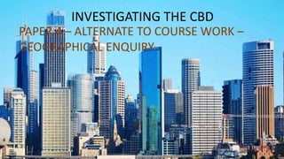
2. Geographical enquiry within the CBD could be used to
answer a lot of questions
EXAMPLES
1.how does traffic flow vary during different times of
the day at major intersections in Yantai?
2.What is the maximum range of Joy city?
3.What is the size of the sphere of influence of Sunyi
Plaza?
4.What are the different orders of services in Kai fa qu?
3. STEPS TO FOLLOW WHEN CARRYING OUT AN ENQUIRY
1.ENQUIRY QUESTION/ HYPOTHESIS
2.EQUIPMENT NEEDED
3.METHOD
4.SAFETY
4. Investigations within a CBD are generally carried out by conducting surveys:
In the exam a question that appears quiet frequently is how can a survey be
improved.
• Do the counts more regularly ( e.g. when carrying out a traffic survey maybe
count the cars more frequently
• Carry out the survey at more than one location (e.g. when trying to
determine the range of Joy city, try to survey many areas who go to Joy city
to shop
• Do the survey or counts on different days of the week including weekends
to get a more varied sample
• Get two groups surveying the same area so that you can compare statistics
and get the averages.
5. Surveys are carried out using questionnaire
It is very important to use the right structure and layout when designing a questionnaire.
• Questions should be set out in a logical manner
• A good questionnaire will include both open ended and close ended questions
Open ended questions ask for the persons opinion
Closed ended questions requires the person to just tick the correct answer
• It is more difficult to display data when the questionnaire is made up of to many open
ended questions
HOMEWORK
Research what makes a good questionnaire and design a
questionnaire that will help you conduct a population census
in your area (maximum 10 questions)
7. Geographical enquiry about coastlines could be used to answer
many questions
EXAMPLES
1. How does vegetation change with distance from the
coastline?
2. What is the structure and elevation of the coast compared to
other coastlines?
3. What is the Fetch of the waves along the coastline
4. How do the type of dunes change with distance from the
beach?
8. There a various instruments that are used when carrying out a Geographical enquiry along the coastline
CLINOMETER – USED
TO MEASURE THE
ANGLE OF ELEVATION
9. RANGING POLES/RODS- USED TO MEASURE THE
SLOPE ANGLE – NB. THE SAMPLING POINTS MUST BE AT
IDENTICAL HEIGHTS ON BOTH POLES AND THE POLES MUST BE
VERTICAL
TAPE MEASURE – used to measure the distance
between the two sampling points.
Using the angle of elevation and the distance, the gradient of the
slope can be calculated
10. Calipers– used to measure the length of
pebbles along its longest axis
Power scale of roundness – used to measure
the degree of roundness of the pebbles.
11. Spring balance – used to measure the mass
of the pebbles along the beach or river
Quadrat– is a square divided into many smaller
squares and is used to measuring vegetation cover or is
used for selecting samples along a beach or river
12. How to measure longshore drift
• A tape measure is laid out close to the water to mark start and finish points of the investigation
• A float is placed in the water at the start mark
• Direction and time of movement of the float is observed and recorded along the present distance
How to measure beach profile
• Appropriate sampling points are selected across the width of the beach at the break of slopes (change in gradient)
• For each section between two sampling points, a clinometer and ranging rod are used to measure the slope angle
• The distance between each section is measured using a tape measure and the gradient is calculated
• This is best done at low tide and during stable weather conditions to ensure the safety of the surveyors.
13. Students at a school in Scotland did fieldwork on a river in the Lammermuir Hills.
The students chose ten sites, approximately 1 kilometre apart downstream, along the river. The students agreed
to investigate the following hypotheses:
Hypothesis 1: The gradient of the river bed becomes steeper as distance downstream increases.
Hypothesis 2: River velocity becomes faster as distance downstream increases.
Before they went on their fieldtrip the students did a pilot study at three sites on a local stream.
Suggest two advantages of doing a pilot study.
14. ANSWER
Practise fieldwork / learn how to do tasks / agree method / know what to do
Find out what doesn’t work / change it / correct mistakes
Test equipment / check how equipment works / learn how to use equipment / check have right eqiuipment
Experience of working as a team / team organization
Find out how long to allocate each task
Suggests outcome of real study / gives an idea of what results might be
15. To test Hypothesis 1 the students measured the gradient of the river bed. Describe
how they would use the equipment shown in Fig. 1 (Insert) to measure the gradient.
16. Use tape measure to measure certain distance / 10 m (more than 5 m)
Students hold / put (ranging) poles at either end of measured distance
Put two (ranging) poles vertically on river bed
Students hold clinometer / measuring gun next to top / at certain height on (ranging) pole Lines up identified position
/ top on other pole
Student uses clinometer to measure angle / read off angle / read off degrees
No credit just for naming equipment but need to name tape measure and ranging poles. No need to name clinometer
[4]
17. a) The students made four measurements of gradient at each site. Suggest two reasons why they did
this.
b) Another way to measure the velocity of a river is to use a digital flowmeter (velocity meter) like the one shown in
Photograph A (Insert).
Give one advantage and one disadvantage of using a digital flowmeter to measure velocity.
18. More reliable / fair test
Avoid error / wrong result /anomaly Can calculate average
Advantage–accurate/precise reading/quick/instant/no calculation needed
Disadvantage – inaccurate in low flow conditions / battery may go flat / may break / easily damaged / needs calibrating
19. Some students did fieldwork in a small river drainage basin in south west England. The students
chose four sites which are shown on Fig. 1 (Insert).
(a) Which two features of the drainage basin are labelled A and B on Fig. 1?
20. In order to calculate river discharge the students had to measure river velocity and channel width and depth.
First they measured velocity once at each site using floats, a tape measure and a stopwatch. Describe how they measured
velocity.
When the students returned to school they discussed with their teacher possible
weaknesses of their method for measuring velocity. Give two weaknesses of the method.
21. ANSWERS
(a) A: Confluence
(b) B: Watershed
Measure set/certain/specific/fixed distance / 5-15 m (No need for equipment (1) Put/place/throw float/example
or type of float at start of measured distance (1) Start stopwatch when float is put in (1)
Measure time it takes to travel the measured distance / stop stopwatch or timer when float reaches end of
measured distance (1)
Only measuring surface velocity / different velocities at different points (1) Floats get stuck on vegetation / rocks /
obstacles (1)
Strong wind may interfere with movement of float / float too light (1)
Only measuring once at each site /didn’t repeat / may create anomaly (1) Measurement will depend on where float is
put into river (1)
Start/finish points not clear (1)
Student error with reason e.g. inaccurate timing (1)
23. In terms of weather most questions in past paper ask how the weather instruments work or where they should be sited
placed.
24.
25. 1.How do you read a hygrometer?
2.Where is the best place to put a rain gauge
3.Diagram of a rain gauge showing all the components
26.
27.
28. Quick / saves time / easy to read / instant measurement
Gives exact / precise reading / accurate / reliable
Less / no chance of human error
No need to take measurements manually during night / don’t have to be there
29. Fig. 2.1 (Insert) shows a weather instrument. How does this instrument measure wind direction?
30. In the box below draw and label a traditional rain gauge.
Describe and explain a good position to put a rain gauge to make sure that the data collected will be accurate.
Students at two schools in South Africa planned an investigation using weather stations. The two
schools are in Pretoria and Cape Town which are located on Fig. 1 (Insert).
The students in Pretoria used a Stevenson Screen in their weather station. Photograph A (Insert) shows a
Stevenson Screen.
Describe three features of a Stevenson Screen and explain why each is important.
31. Which one of the following measuring instruments would the students put inside a Stevenson Screen?
Circle your answer. [1]
Anemometer Rain gauge Thermometer Wind vane
Students in Pretoria collected data on the following weather elements:
maximum temperature, minimum temperature, precipitation, relative humidity, atmospheric pressure.
Name one other weather element the students could have measured.
Study Figs 2 and 3 (Insert), which show a maximum-minimum thermometer and a rain gauge.
Explain how the thermometer is used to measure maximum and minimum temperatures.
Explain how rainfall is measured using the rain gauge shown in Fig. 3.
32.
33. Away from people / animals (D); so that rain gauge is not interfered with (E) 4 Away from trees / clear of
buildings / away from shelter / on open ground (D)
so that there is no interception of rainfall / so trees / buildings don’t block rain /
to avoid drips from leaves (E)
On grass / above ground level (D); so that rain doesn’t splash into funnel (E) Accessible location (D) ; so
measurements can be obtained (E)
On flat / level ground (D) so won’t fall over (E)
2 marks for description & 2 marks for explanation
Wind pushes the arrow or pointer / wind makes arrow or pointer spin / rotate / 2 turn
Arrow points to / shows the direction the wind is coming from
N, E, S, W points allow direction to be worked out / show compass direction /
compass points are fixed / don’t move
ANSWERS
34. Screen is painted white...so that it reflects heat or sunlight / reduces direct heating by the sun / does not absorb sunlight
Sides are made of slats / louvres / have spaces / gaps / not solid...so that air can circulate
Screen / box is made of wood...so that heat is not conducted into it
Roof is made of a double layer of wood...so that airspace provides insulation
Screen stands more than 1 m / raised on legs above the ground...so that instruments are not affected by heat from the
ground
Wet and dry bulb thermometer / hygrometer Barometer / barograph
Readevery24hours/fixed period of time
Indices (markers) left at / show the minimum and maximum temperatures Read off the bottom of the index
Read at eye level
Magnet to reset / button to reset
Gauge stood firmly / dug in ground
Funnel and jar placed in casing / gauge
Rain enters gauge / jar through funnel / collects in jar / collects in rain gauge Noting / recording water level in jar / water
poured into measuring cylinder Reading taken every day / at same time reach day / fixed time period
Empty jar after measuring
42. Steps to follow when carrying out a Geographical inquiry about tourism
1. identify an issue/question or problem
2. Collect data – primary data
- secondary data
3. Decide on the best sampling method to collect your data
4. Recording and presentation of data
5. Analysis and interpretation of your results
6. conclusions/ solutions
43. Example of an inquiry question related to Tourism
Is tourism killing Venice?
How will you go about collecting data to answer this question?
45. RANDOM SAMPLING
• When a large survey population is available
for study.
• Each sample is randomly selected and
entirely by chance,
• such that each sample has the same
probability of being chosen.
• Reduce human biases.
• Simple to use.
• Short time in the field.
46. SYSTEMATIC SAMPLING
• When a homogenous population is available
for study.
• Each sample is selected with regular intervals
in between e.g. every nth person/pebble.
• Reduce human biases.
• Simple to use.
• Short time in the field.
47. STRATIFIED SAMPLING
• When there are subgroups in the survey
population.
• Stratification is the process of dividing members
of the population into homogeneous subgroups
before sampling.
• Random sampling or systematic sampling can be
applied to each subgroup before sampling.
• Ensures equal representation across subgroups.
• Hard to use.
• May create classification errors.
• Requires more planning and time in the field.