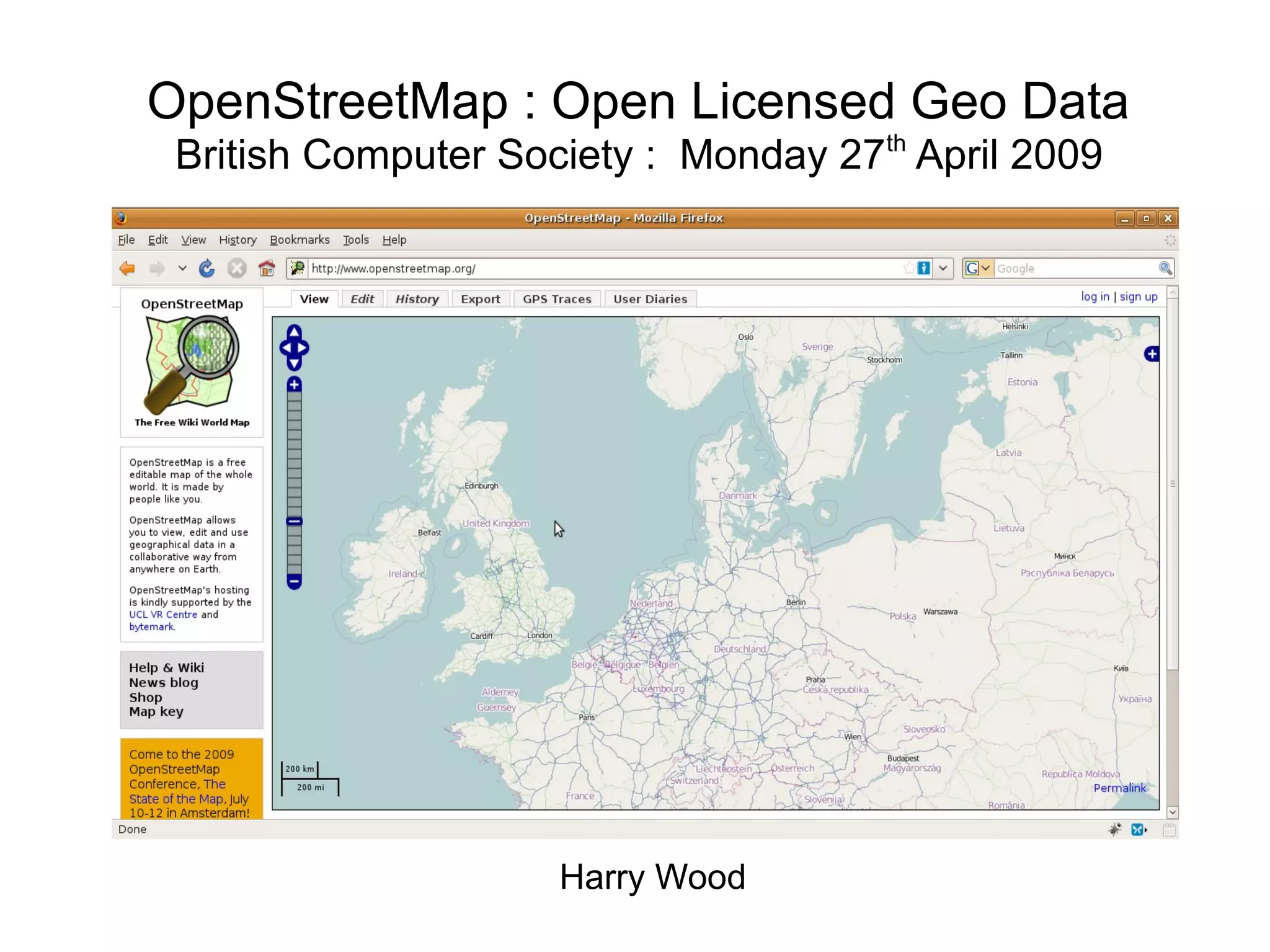
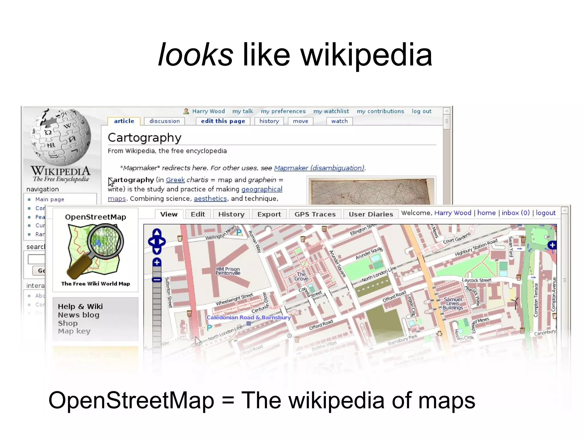
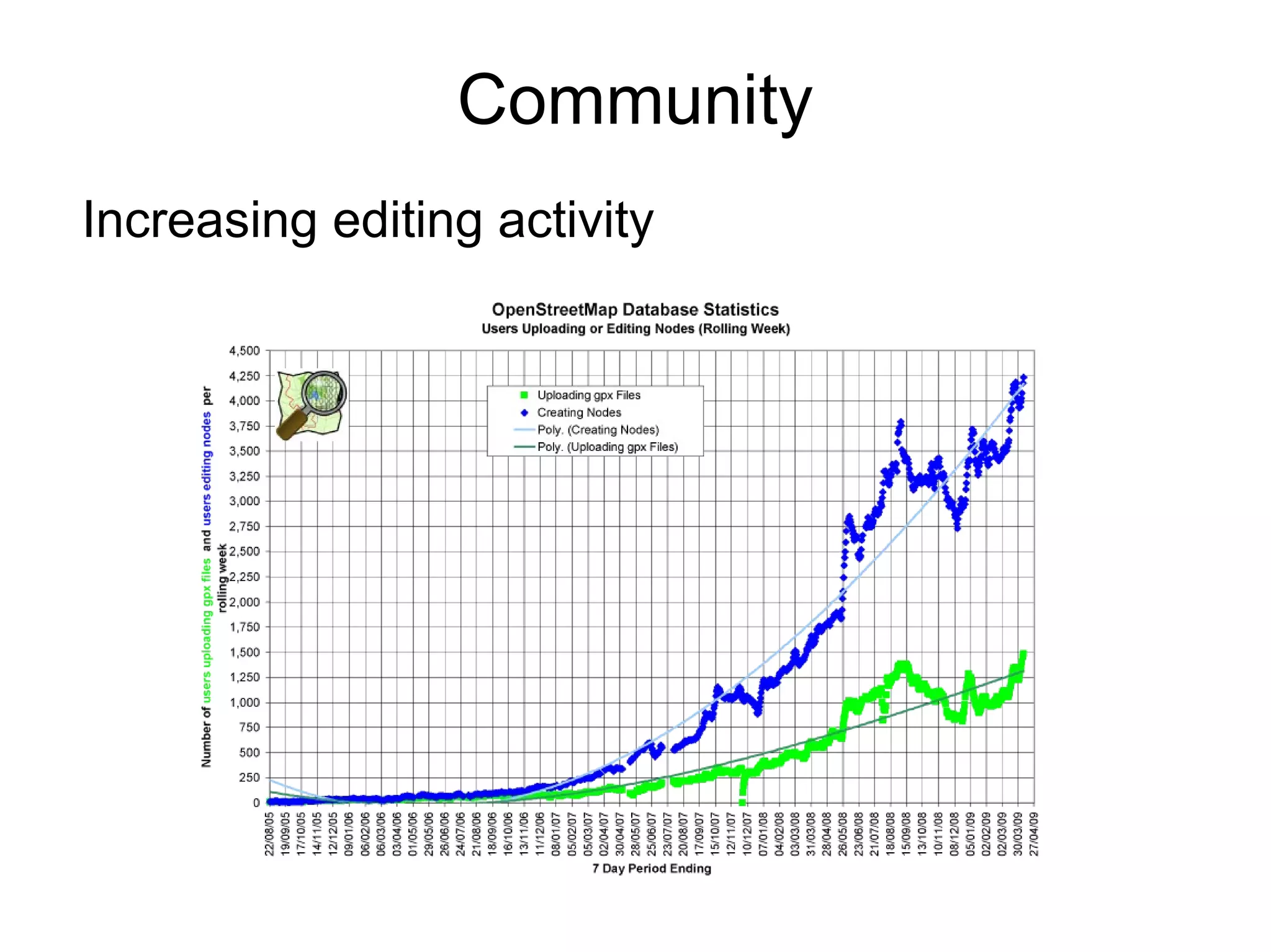
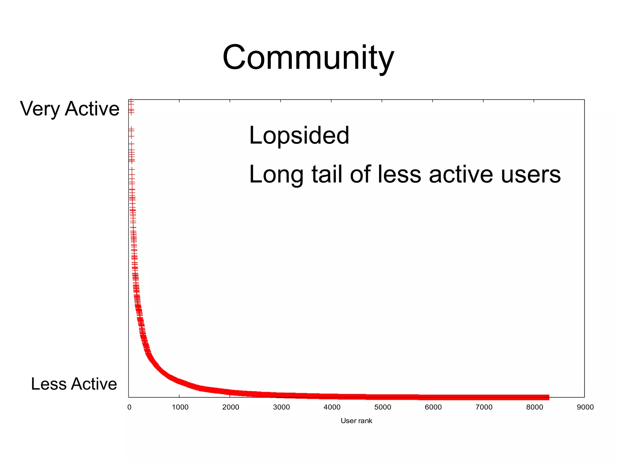
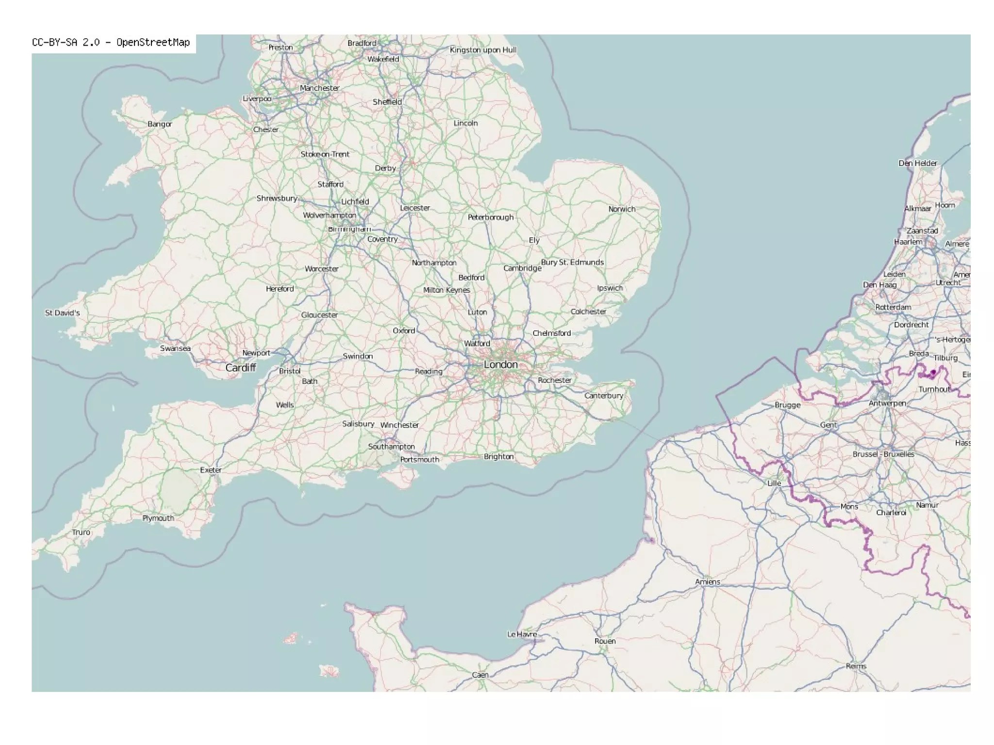
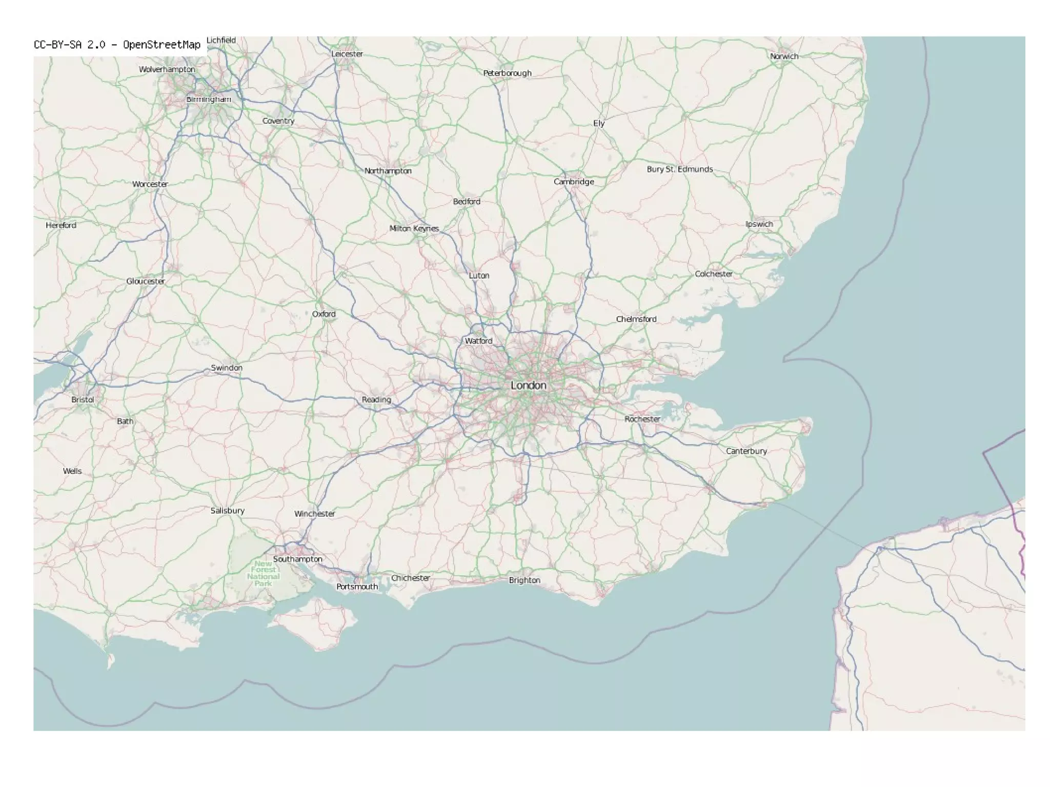
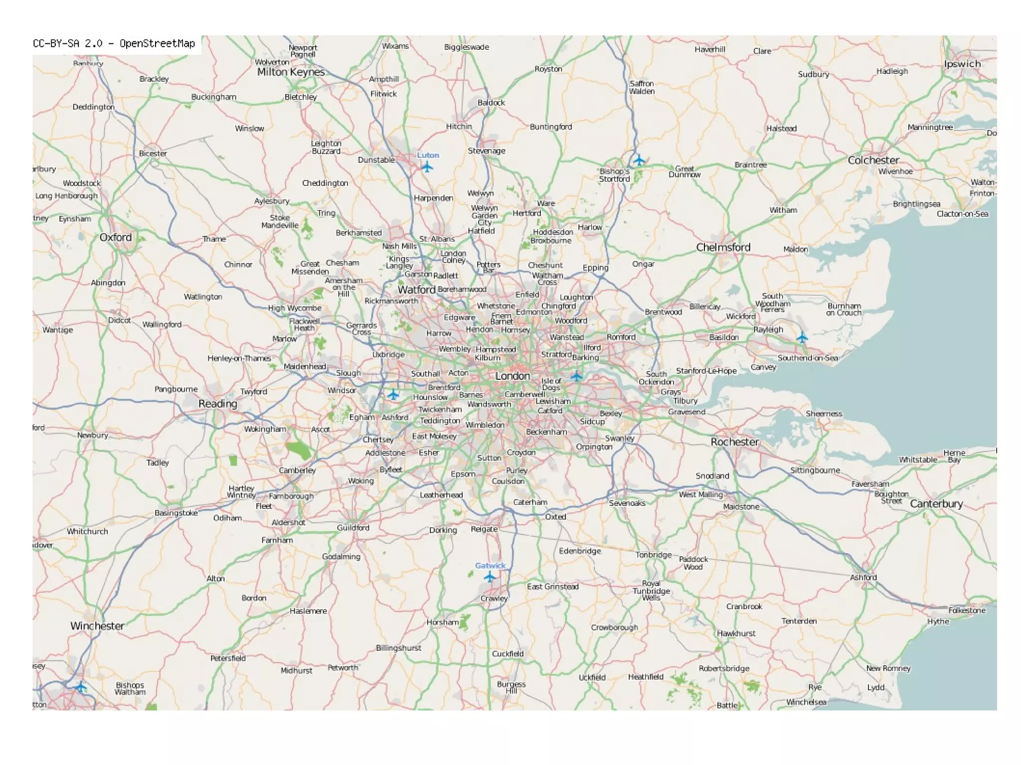
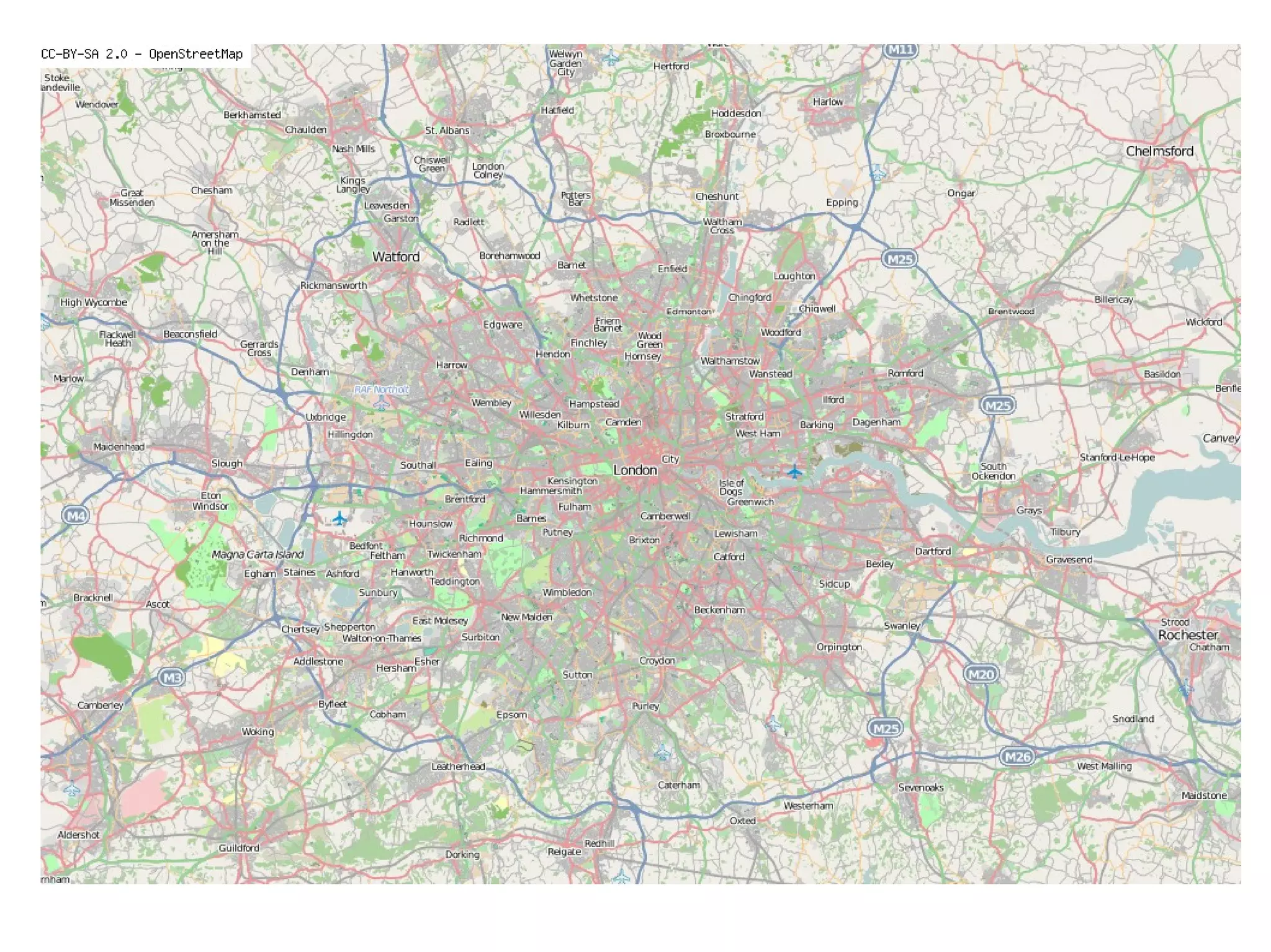
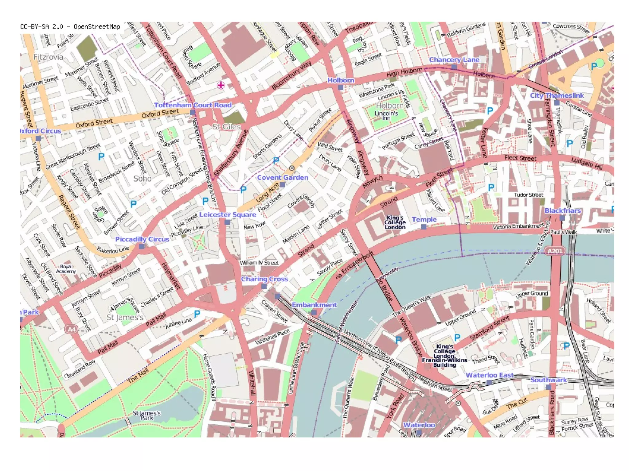
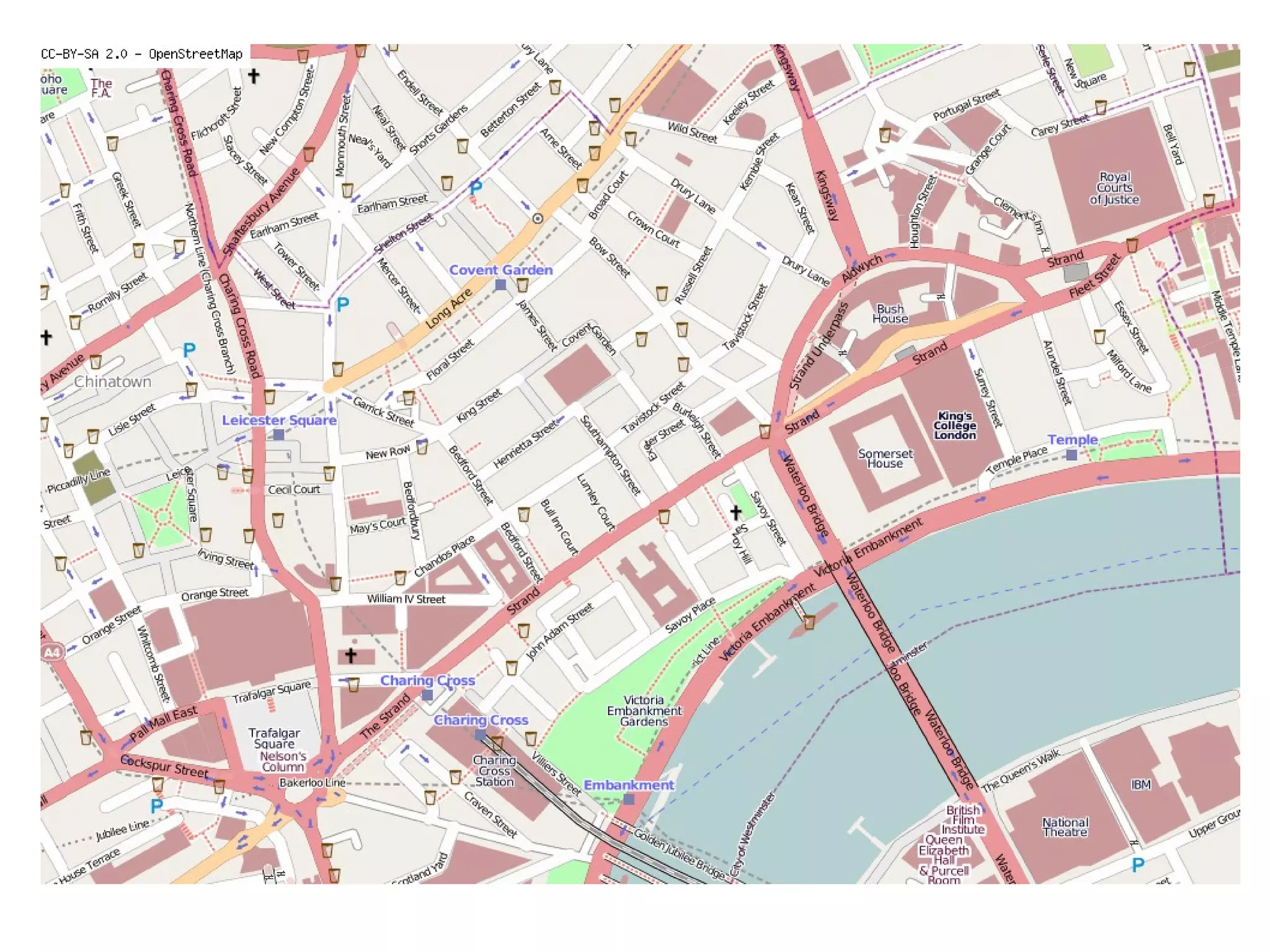
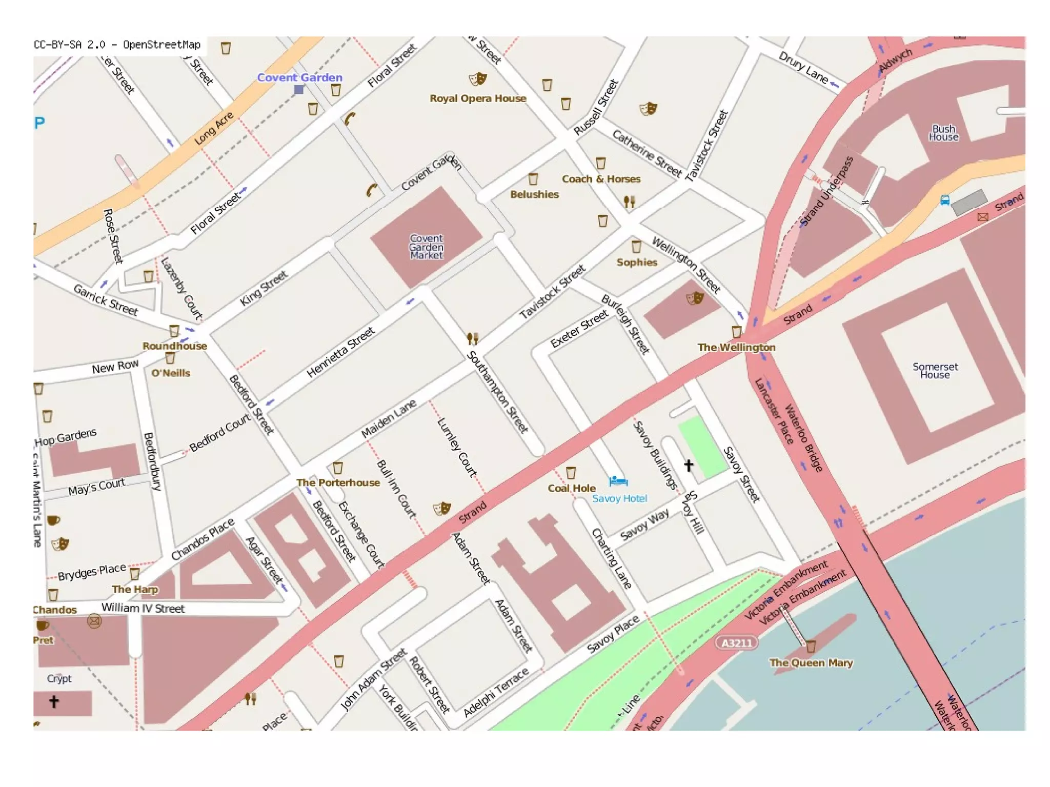
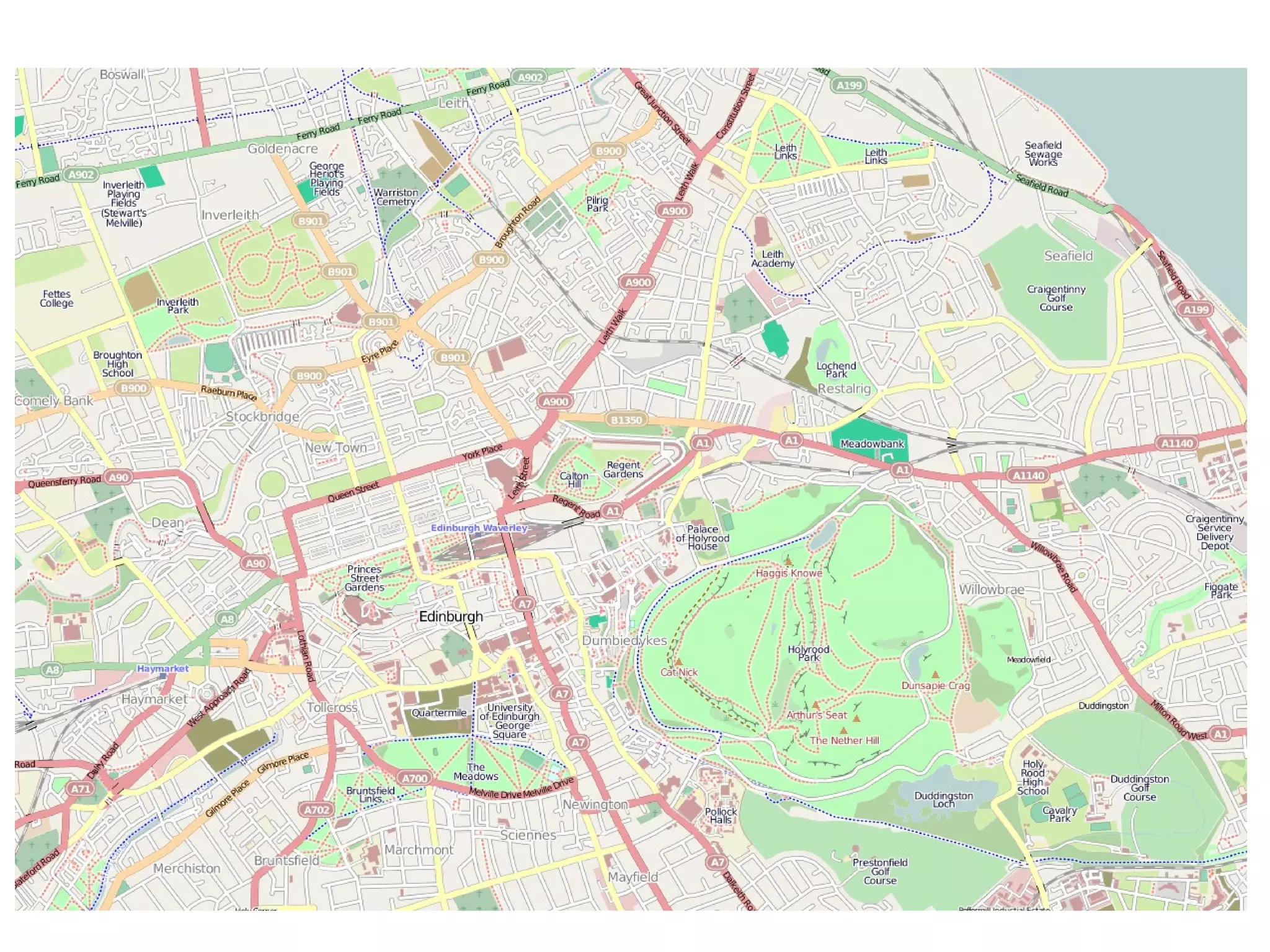
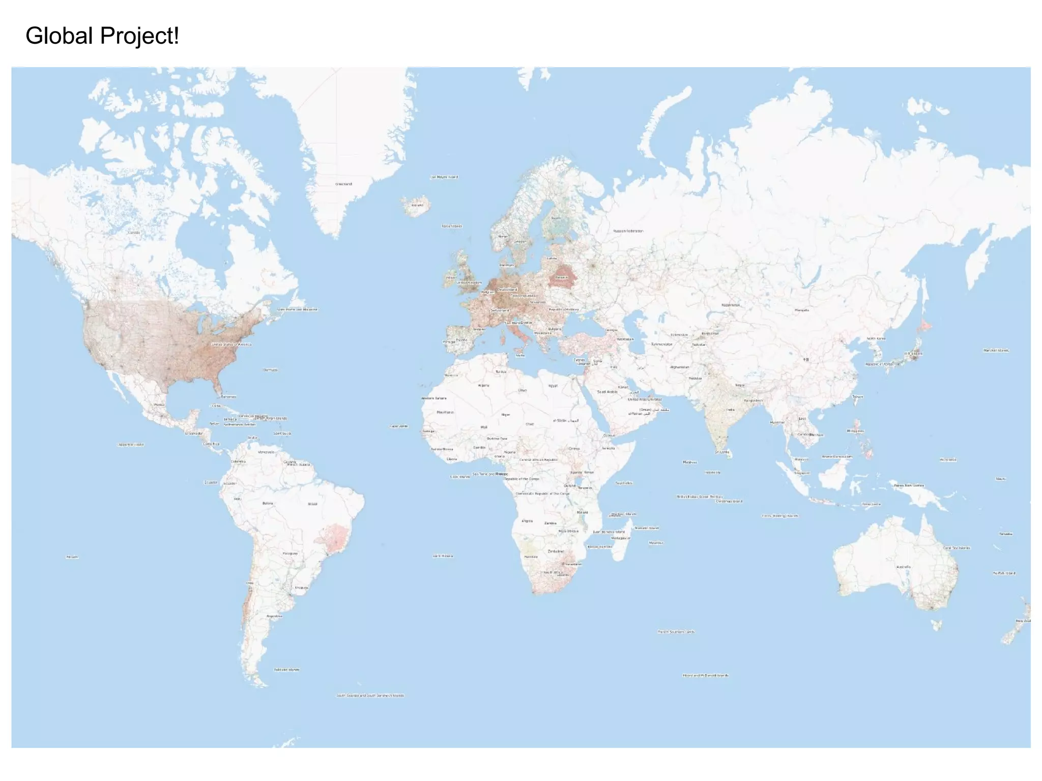
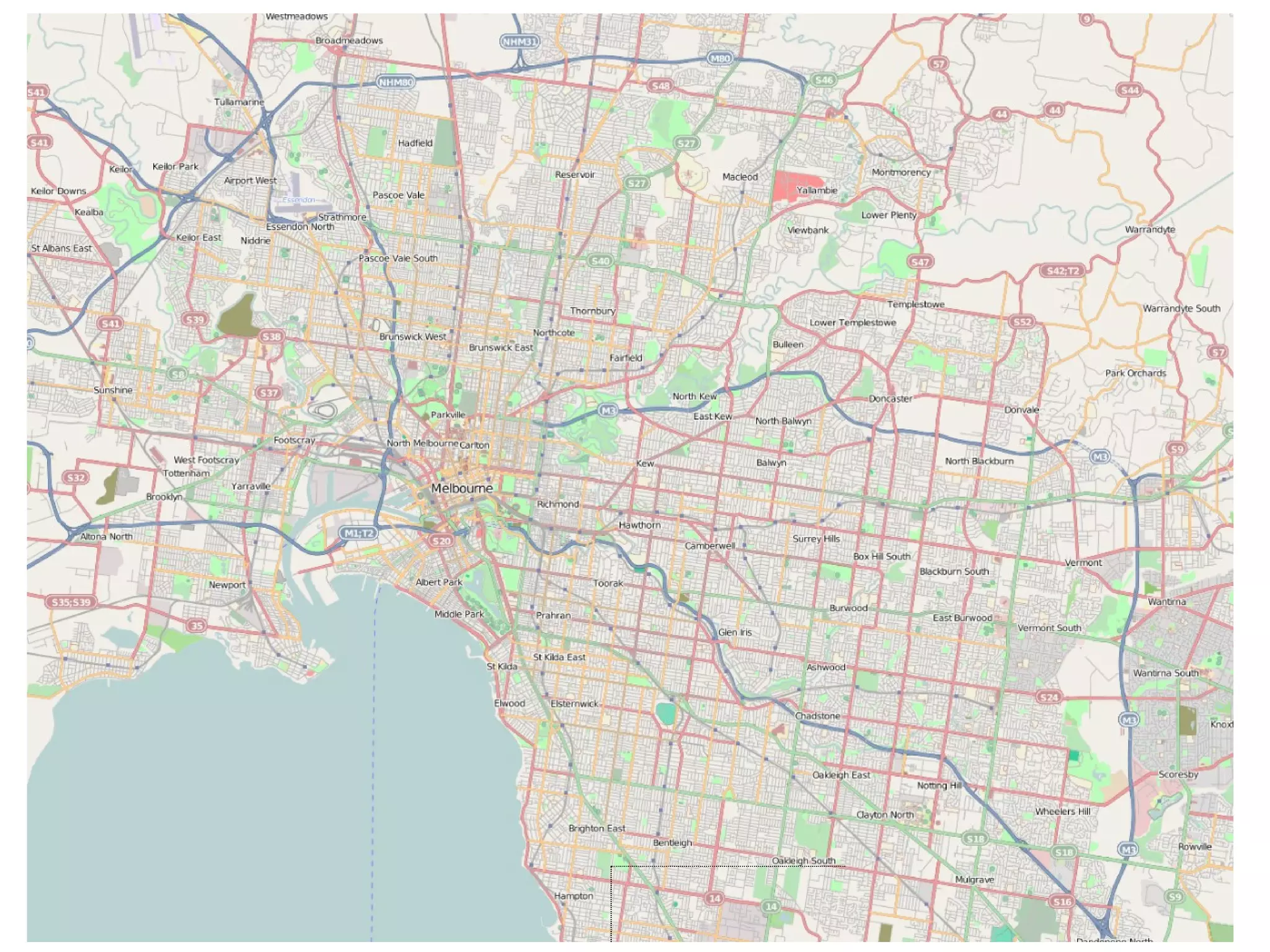
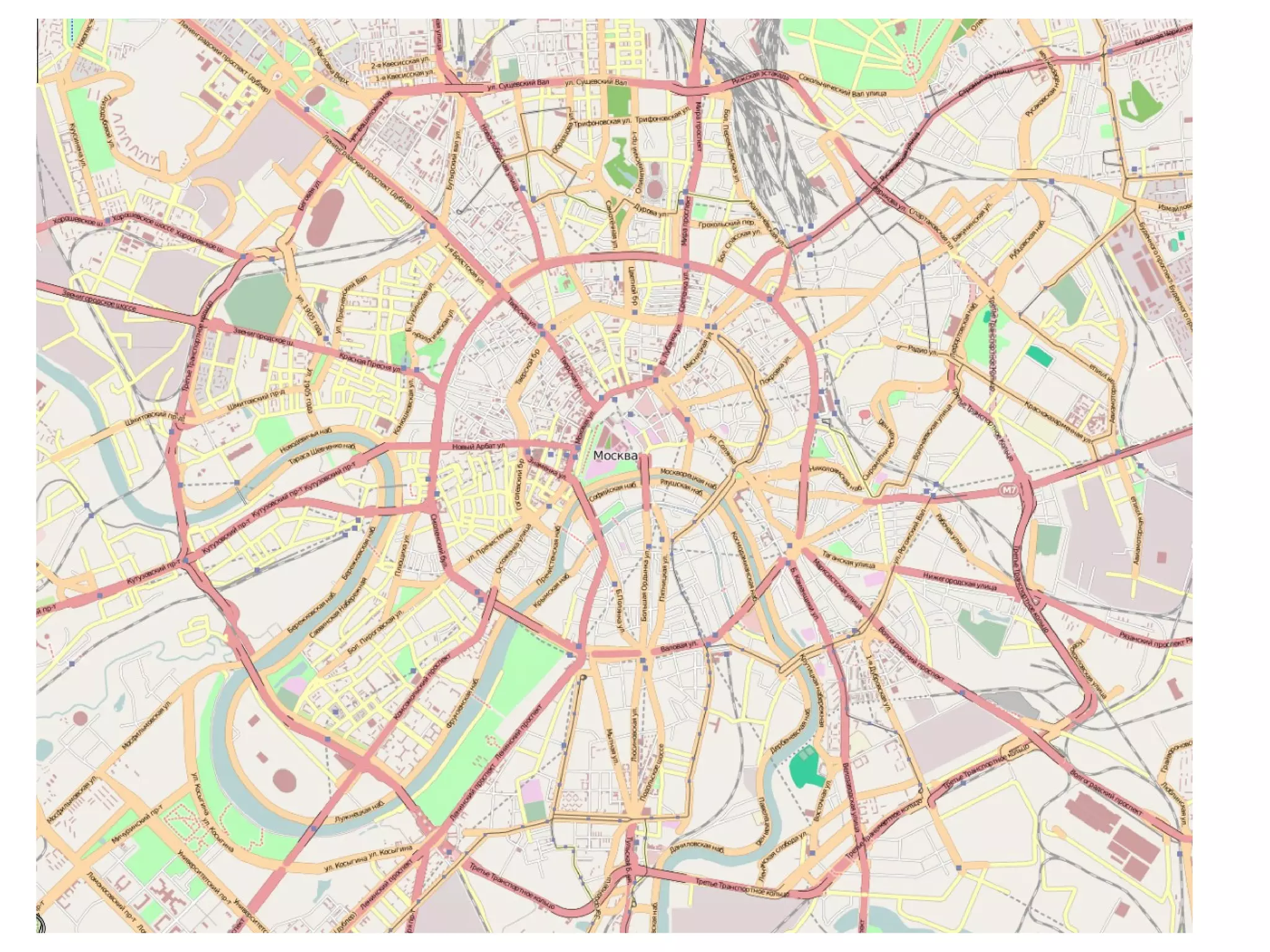
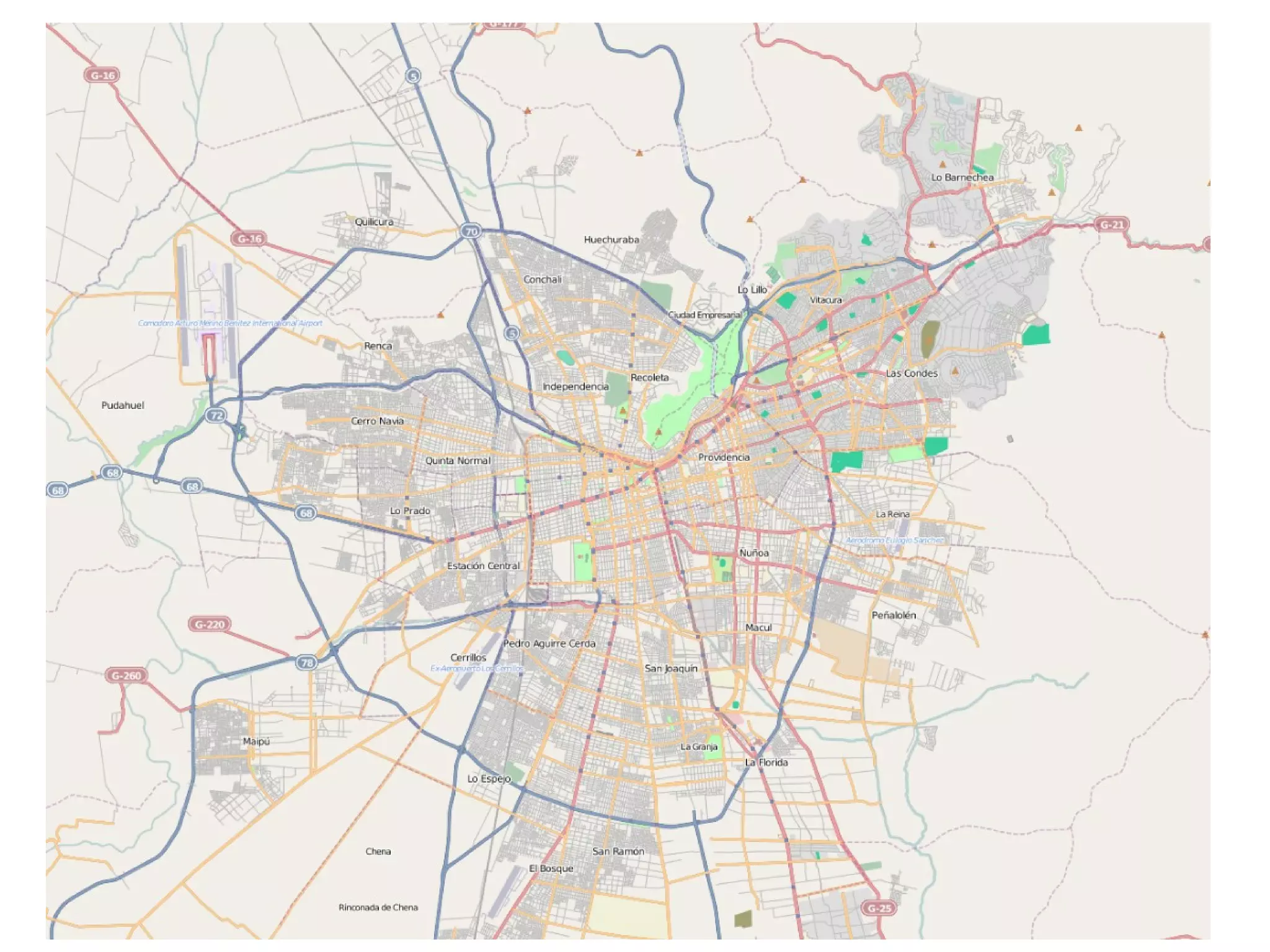
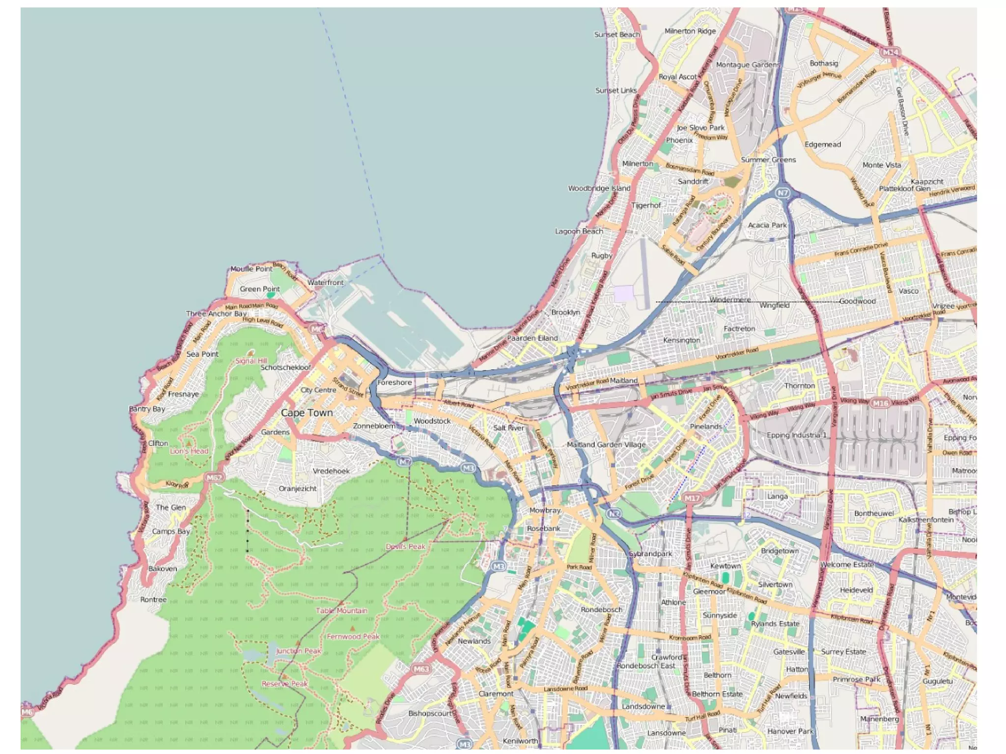
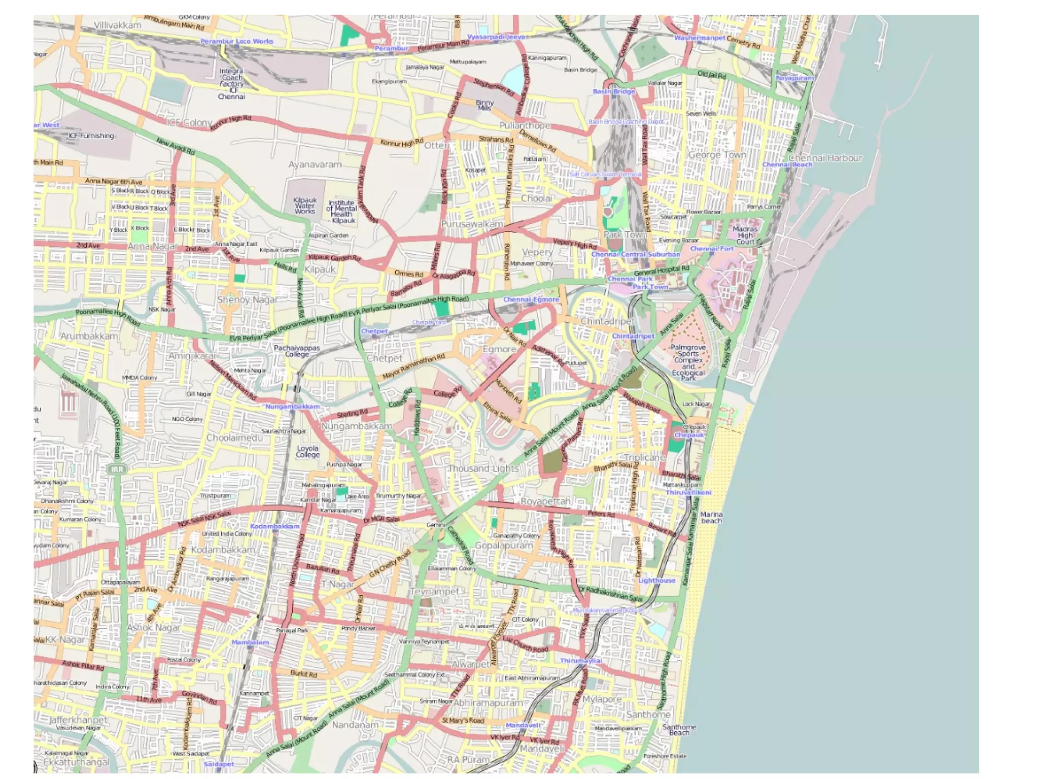
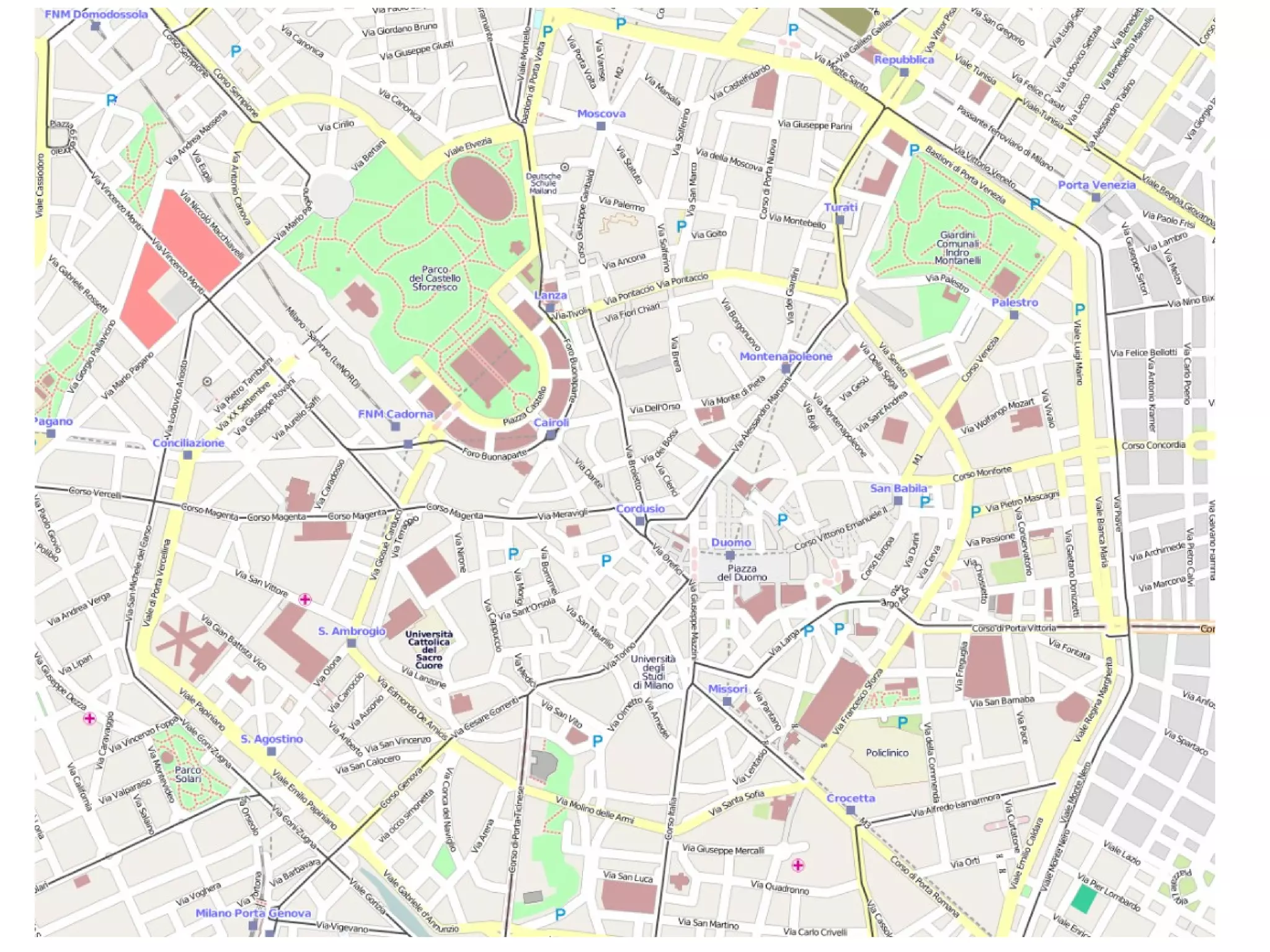
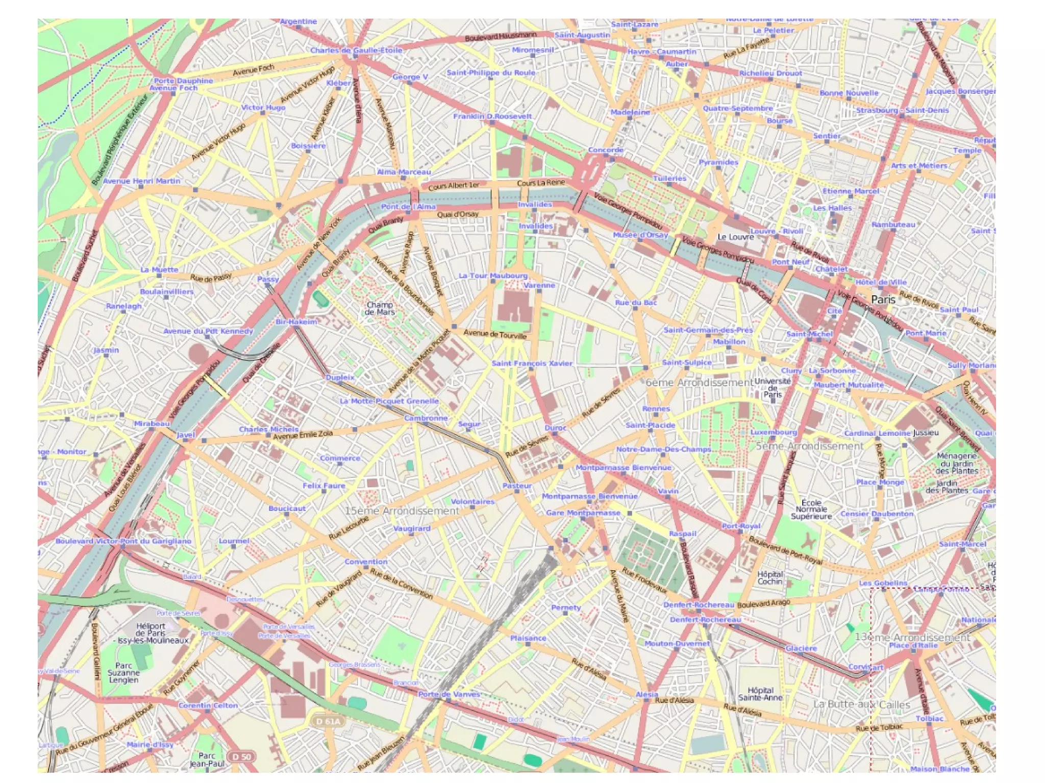
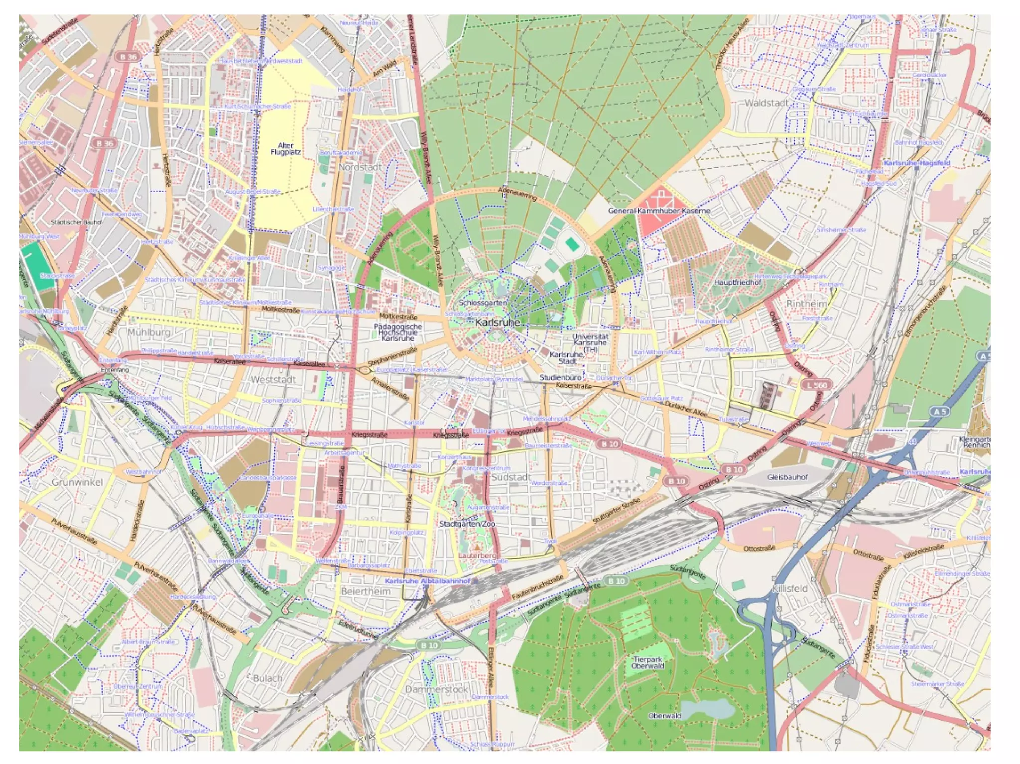
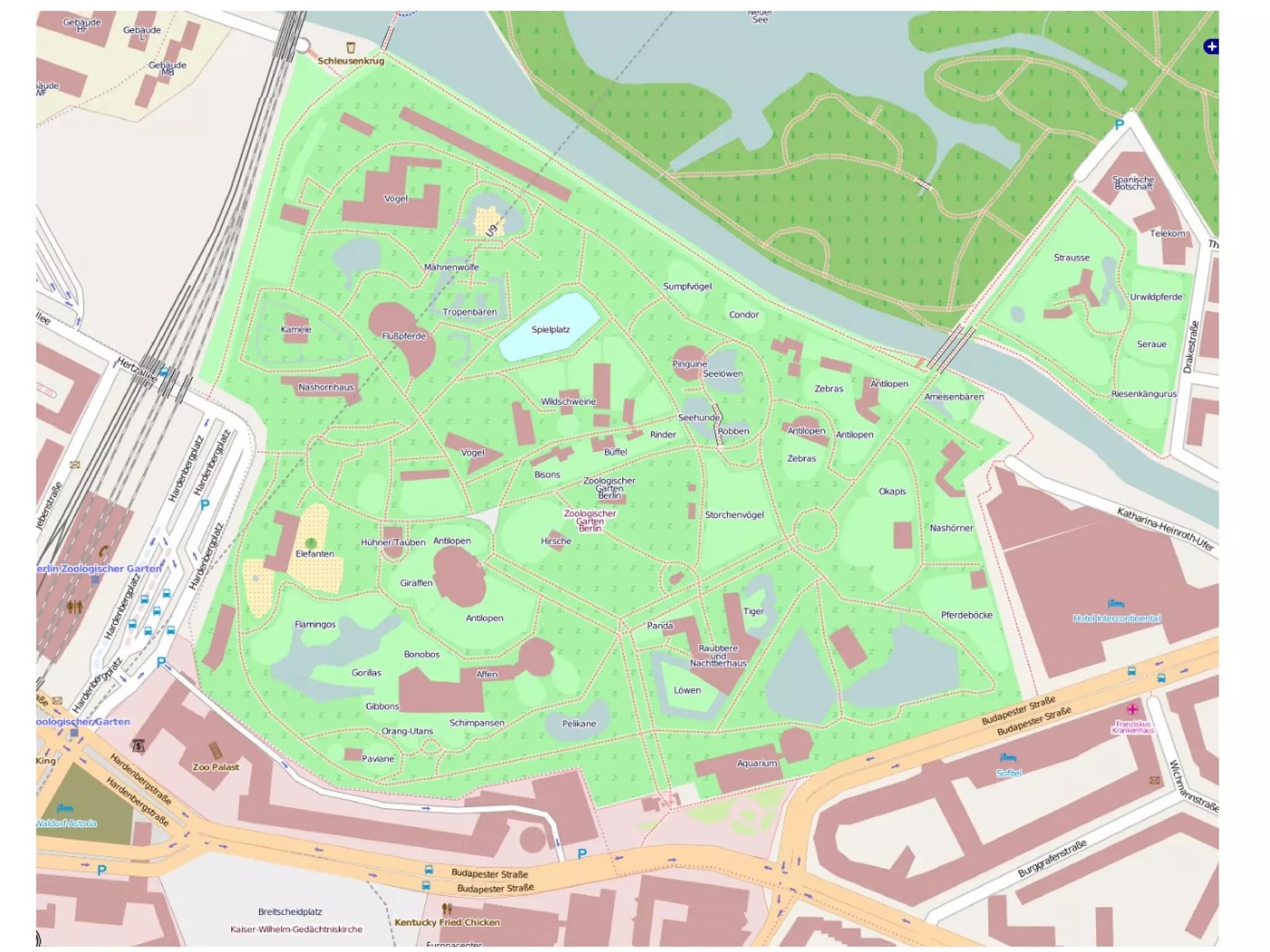
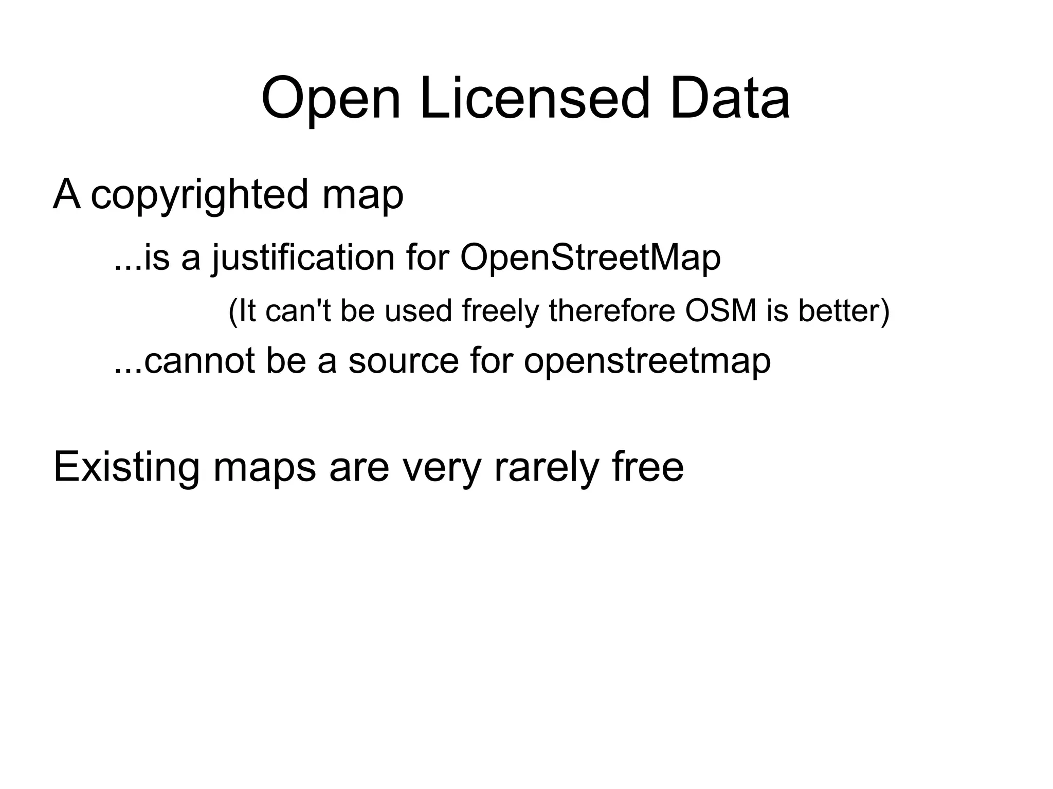
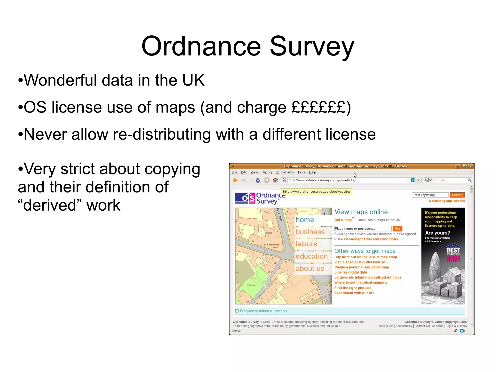
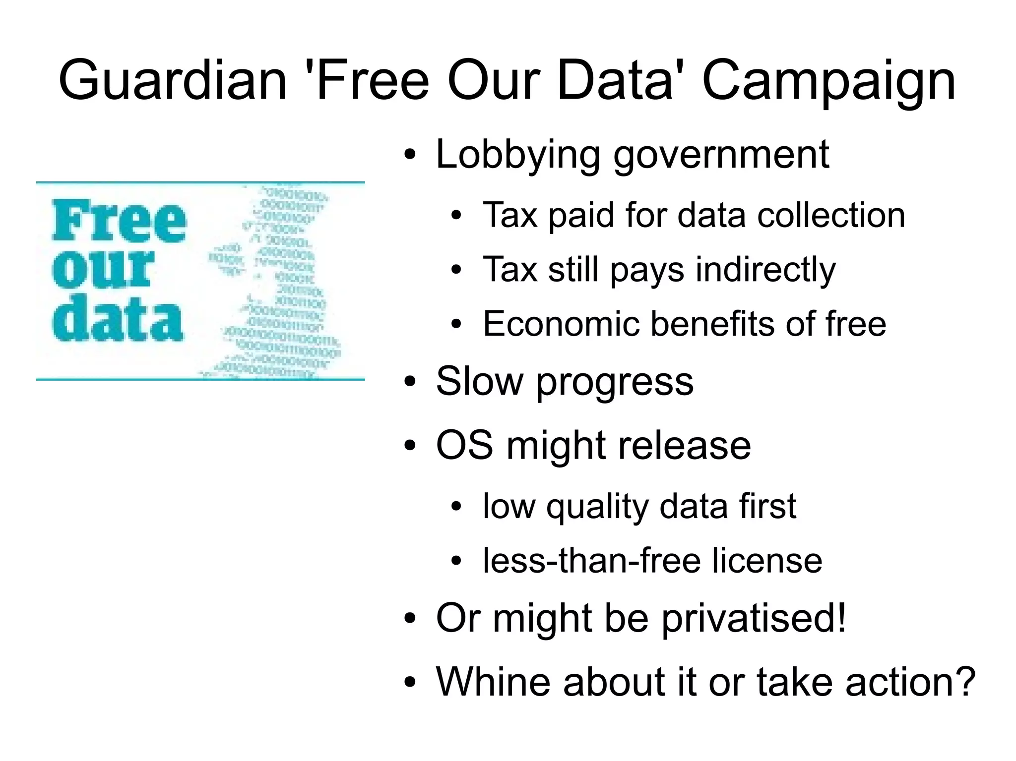
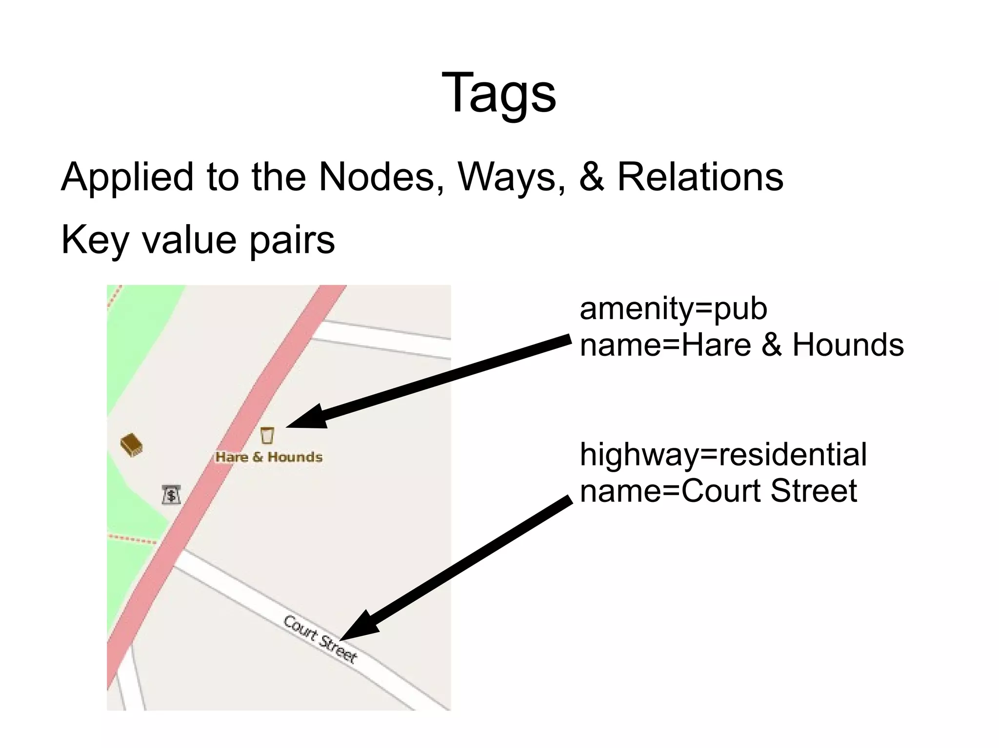
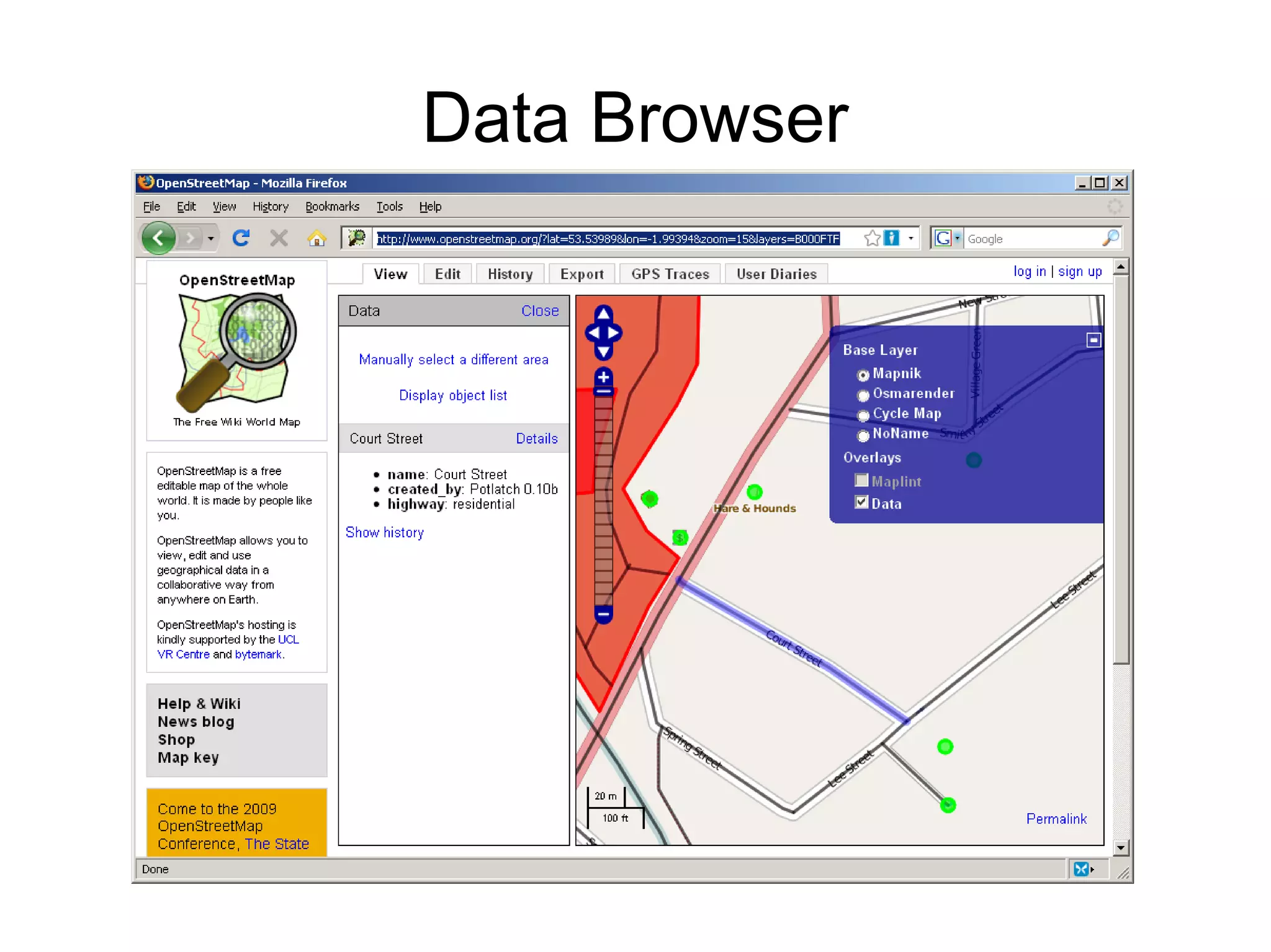
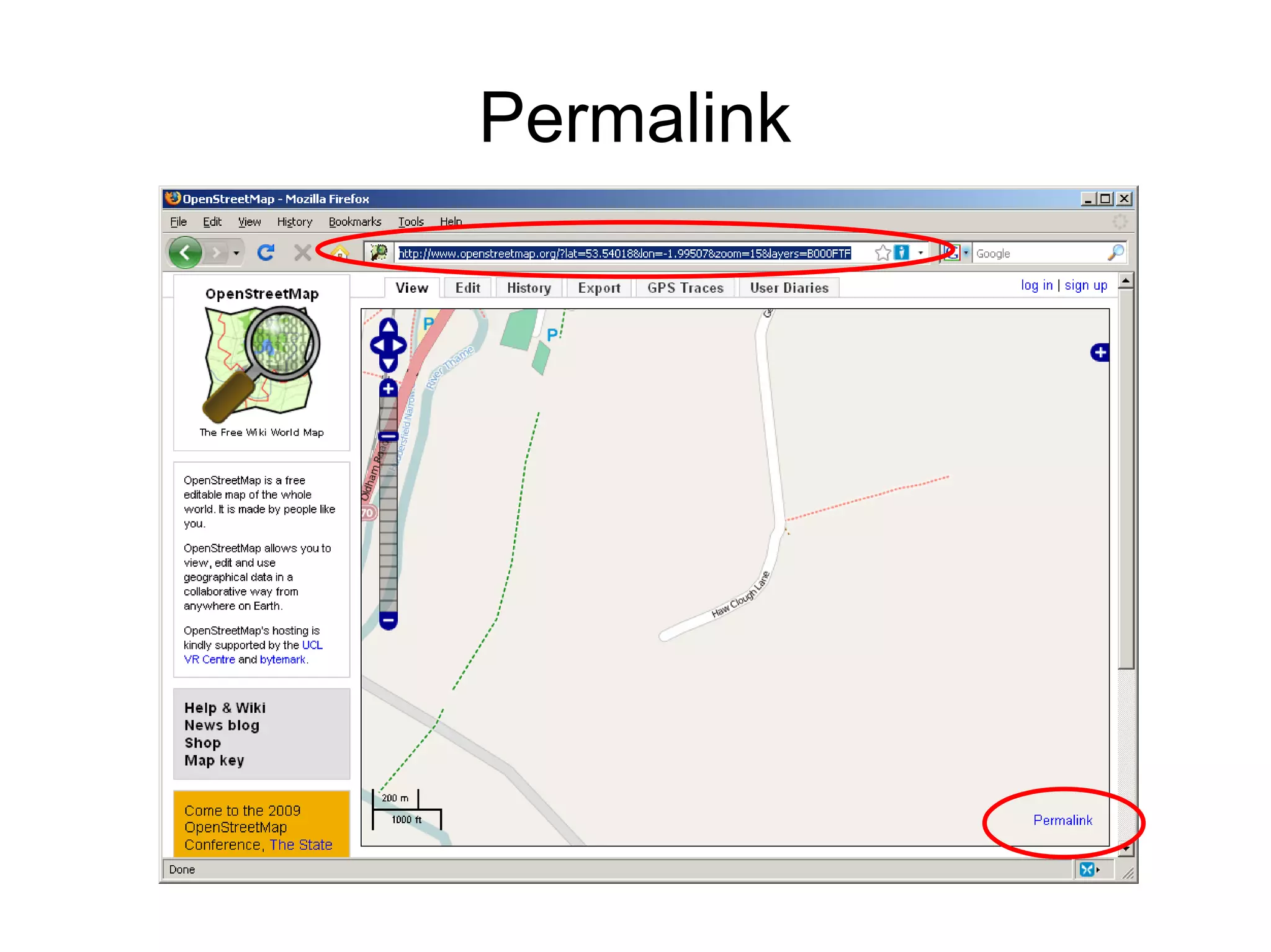
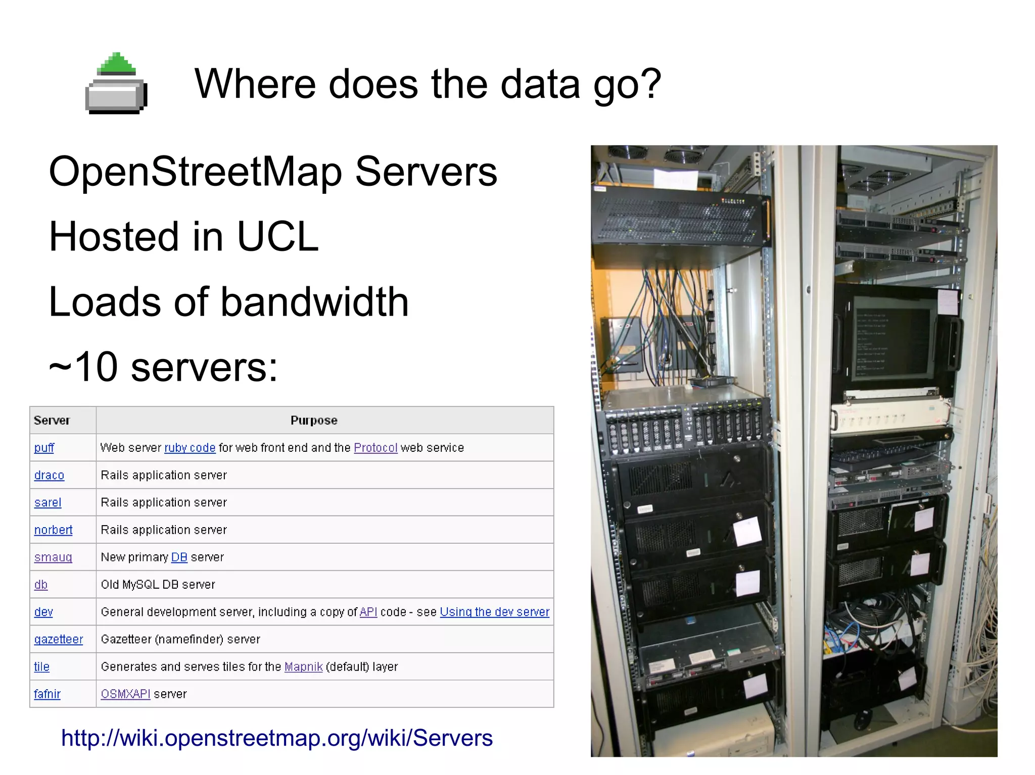
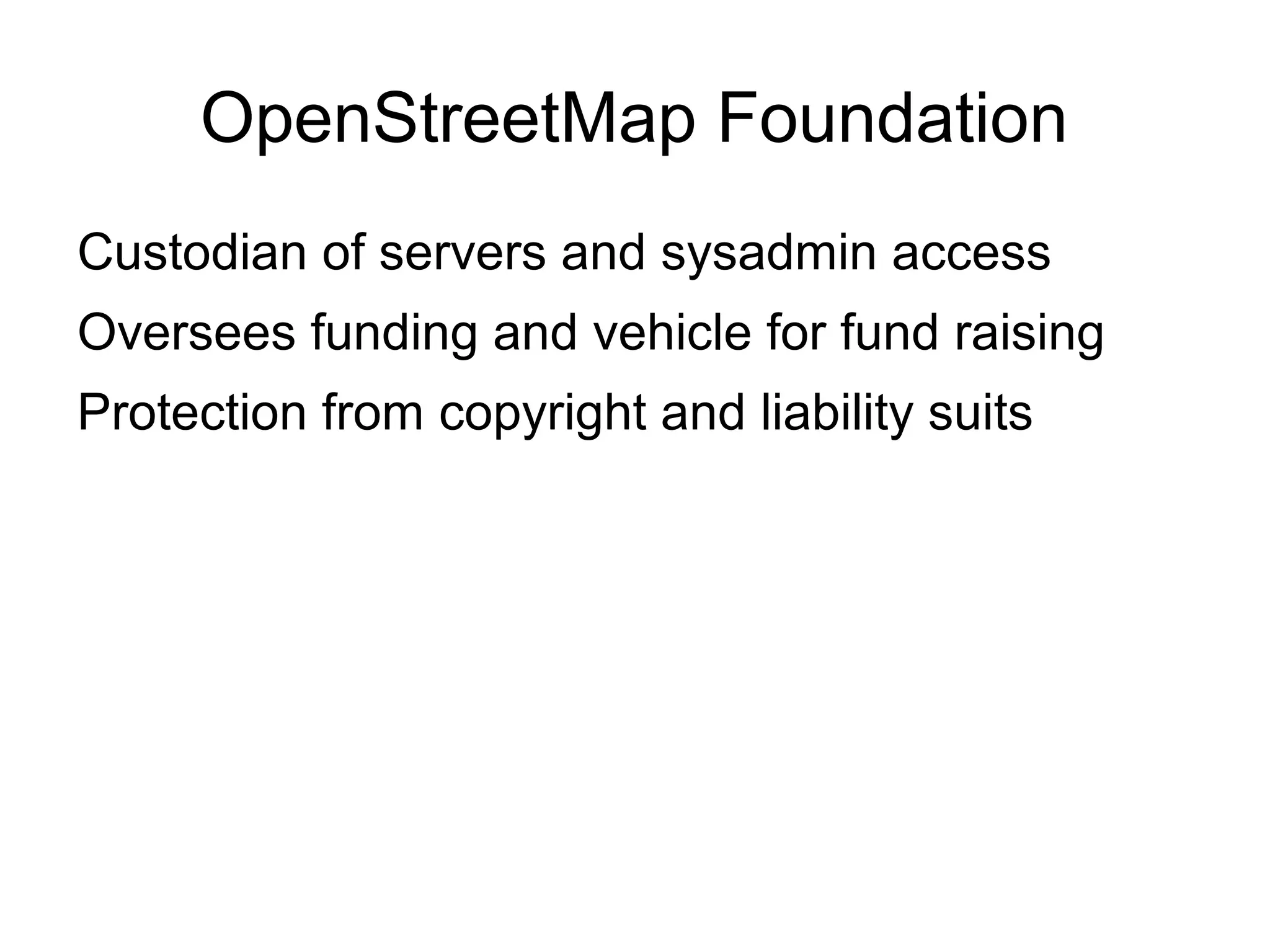
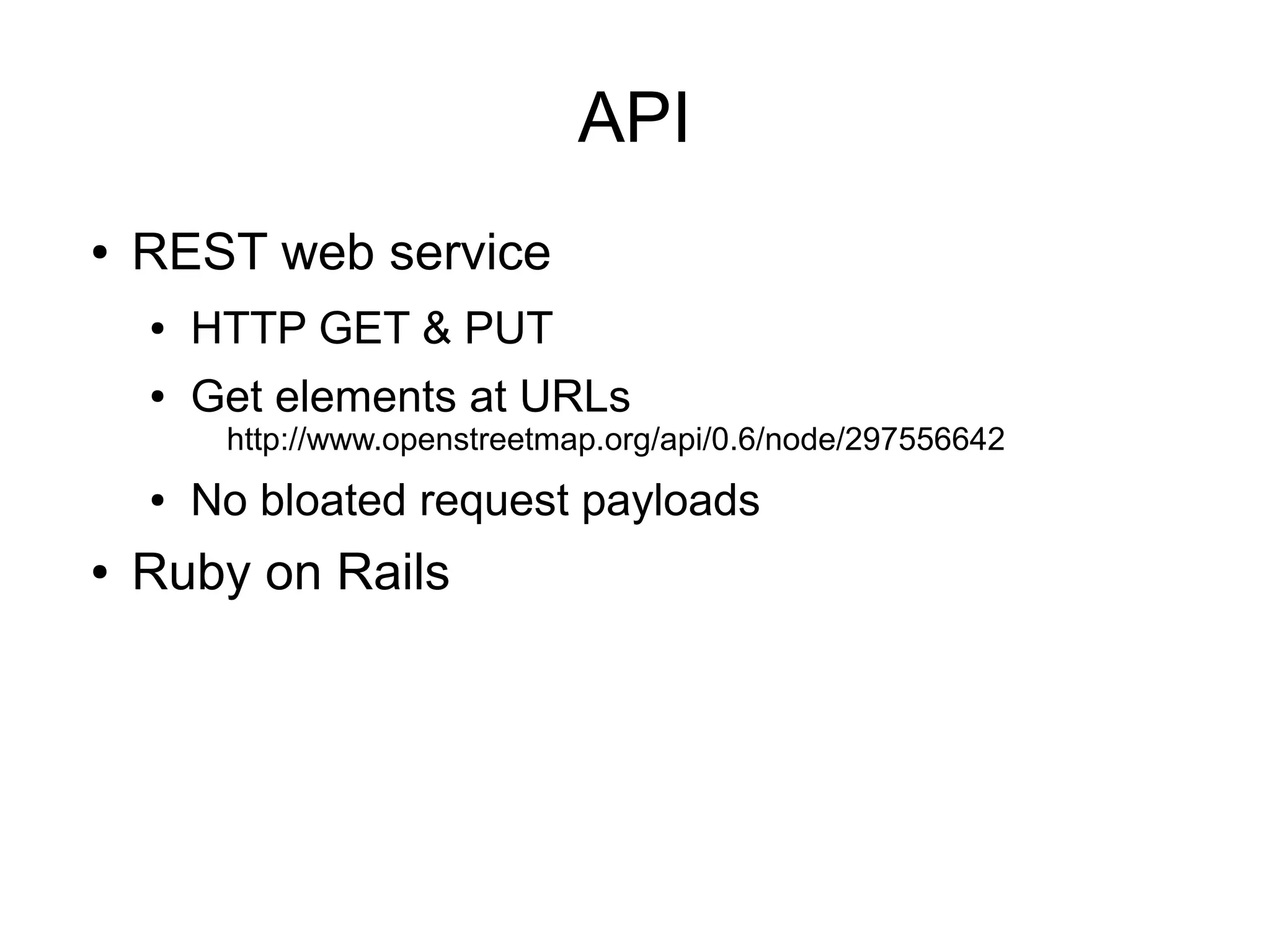
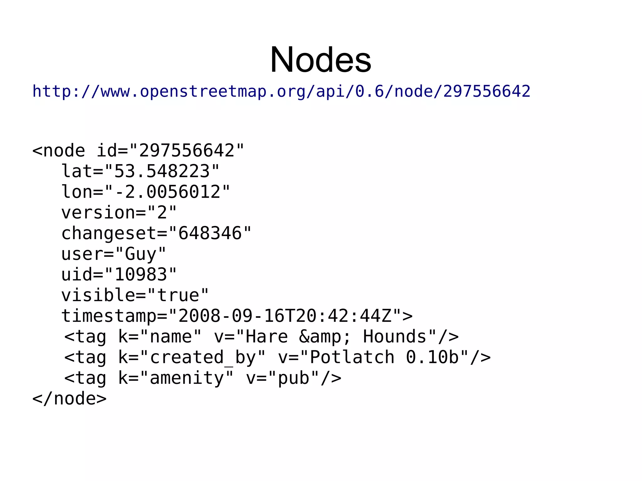
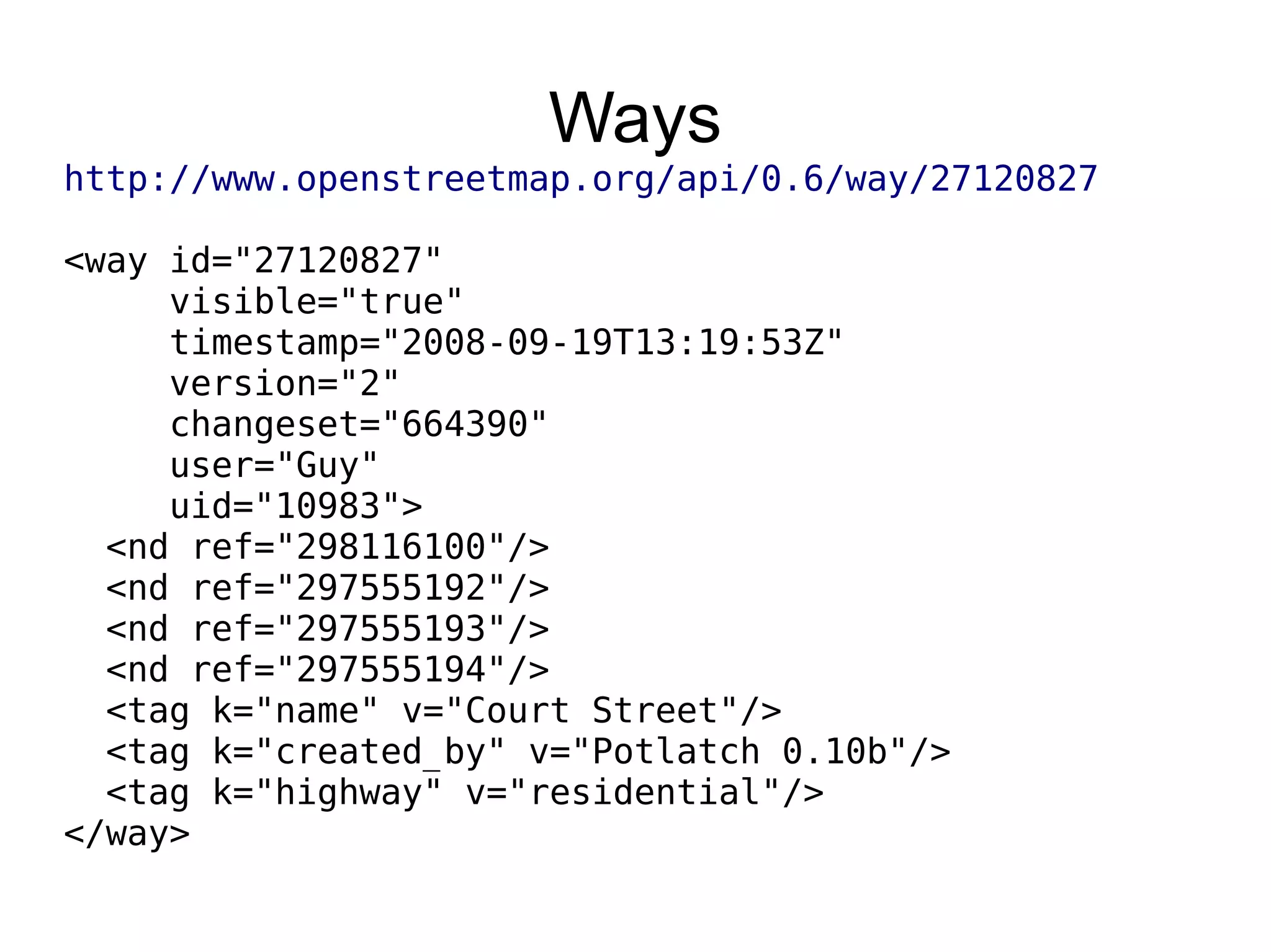
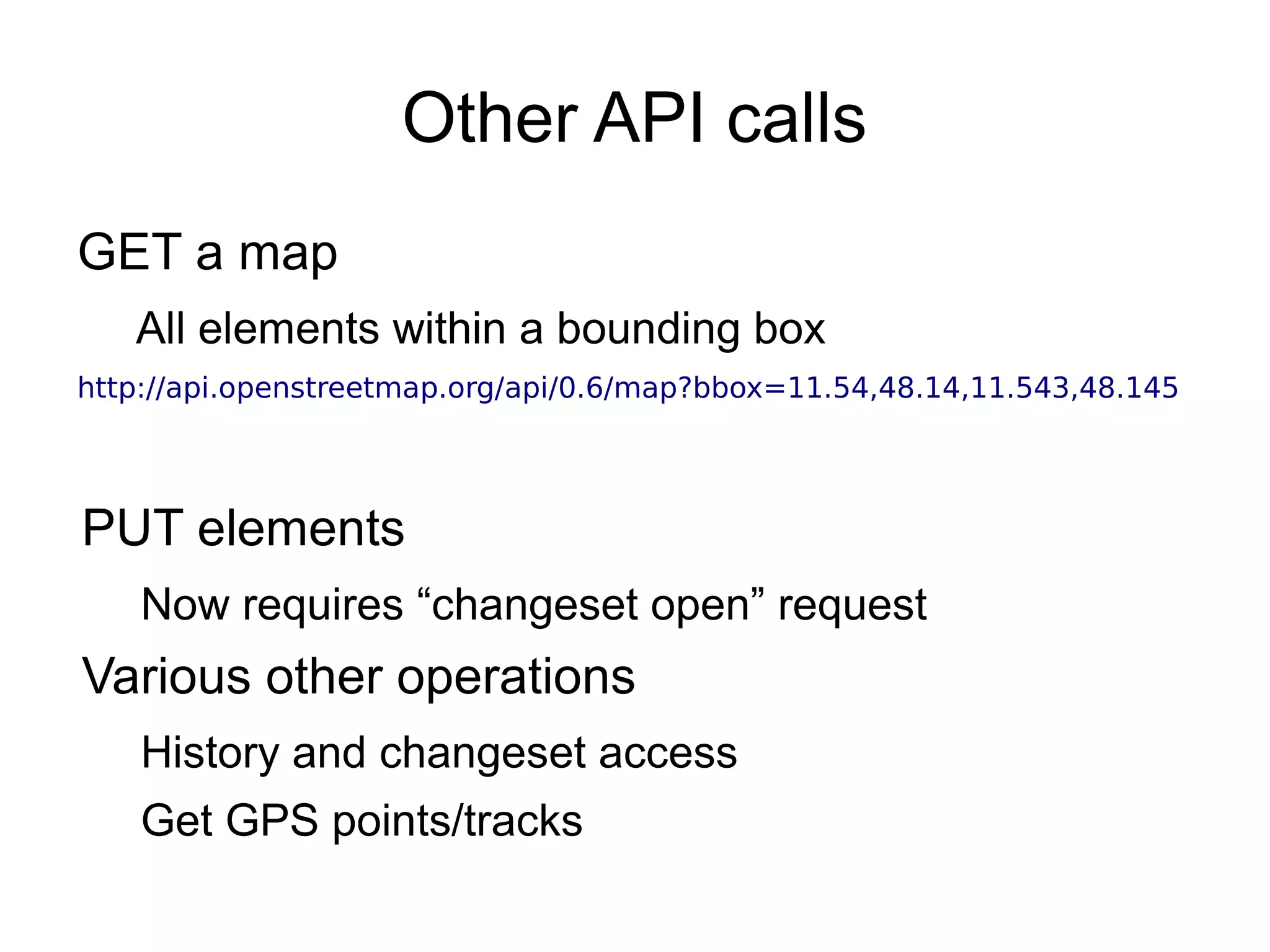
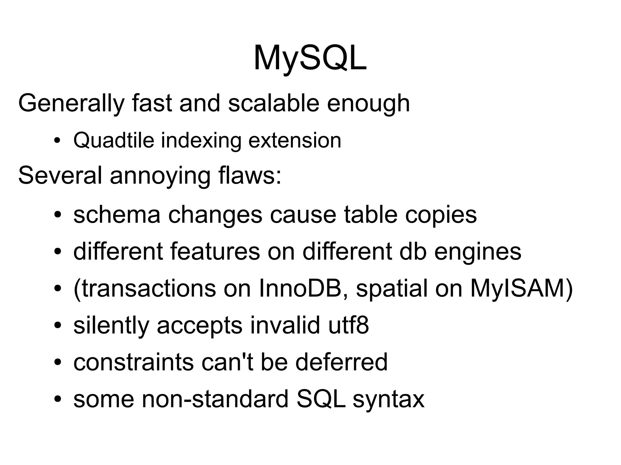
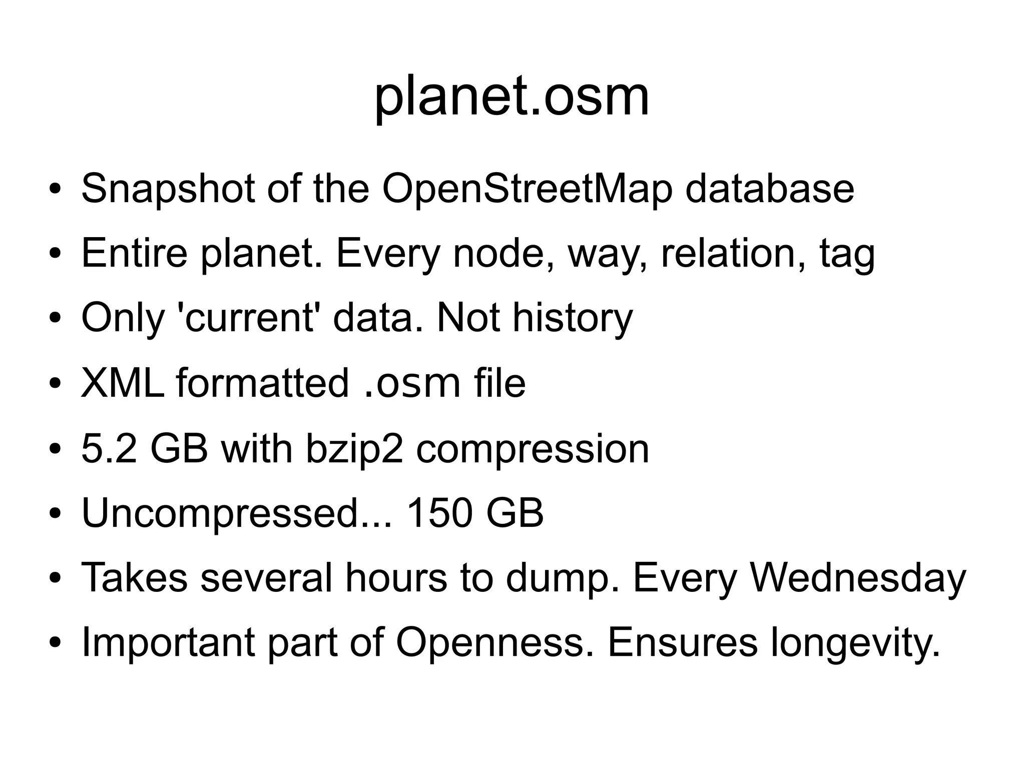
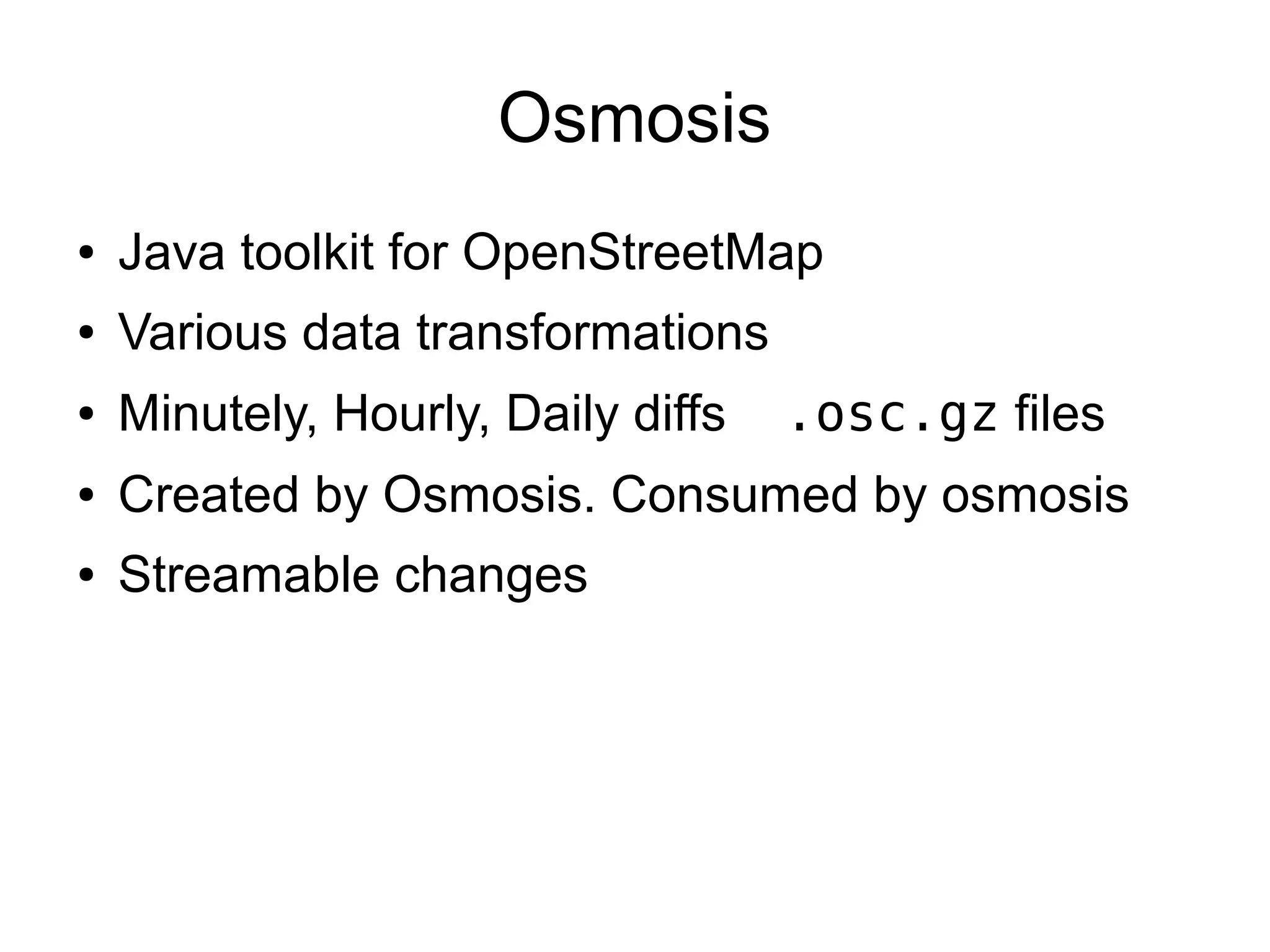
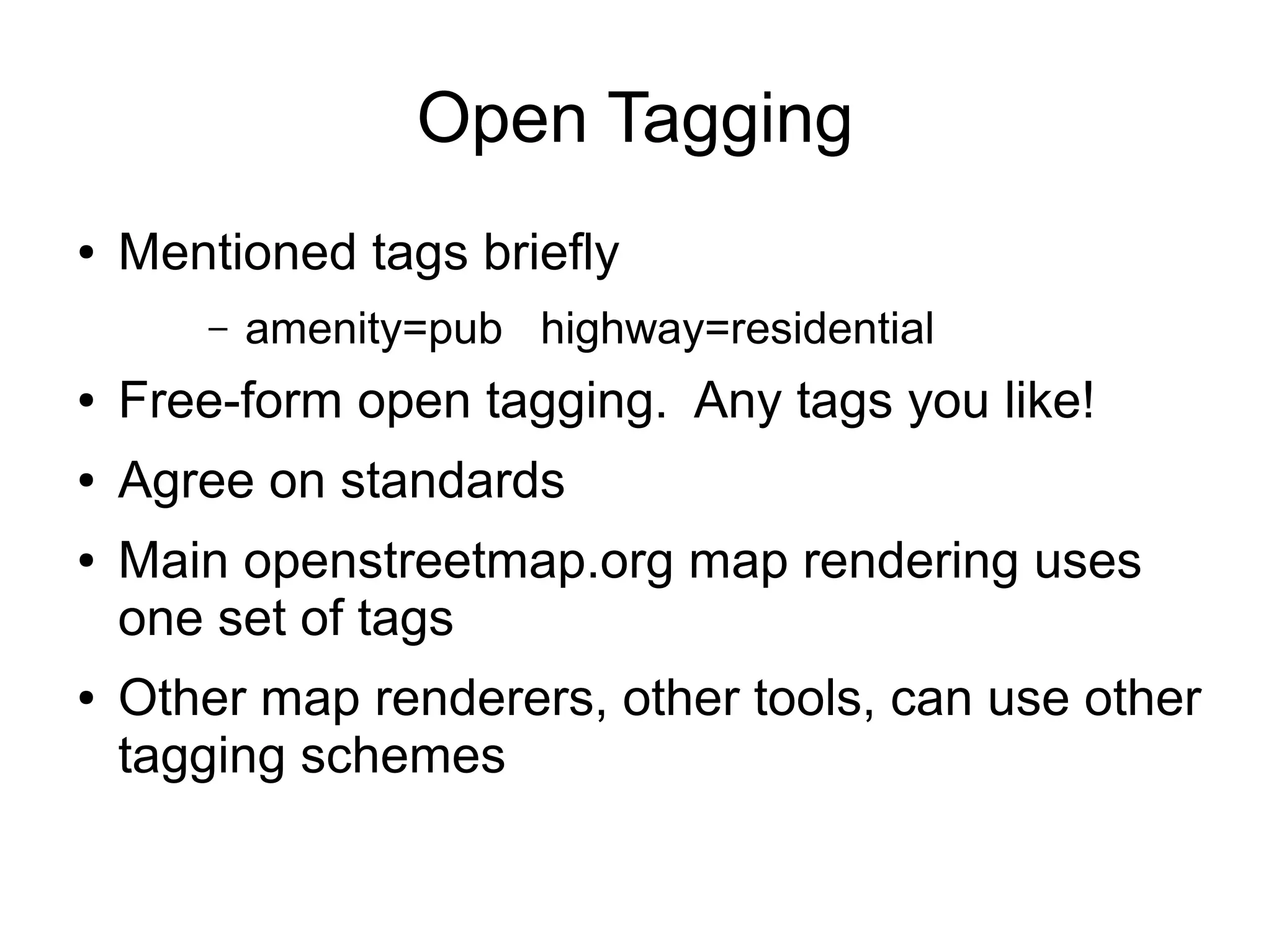
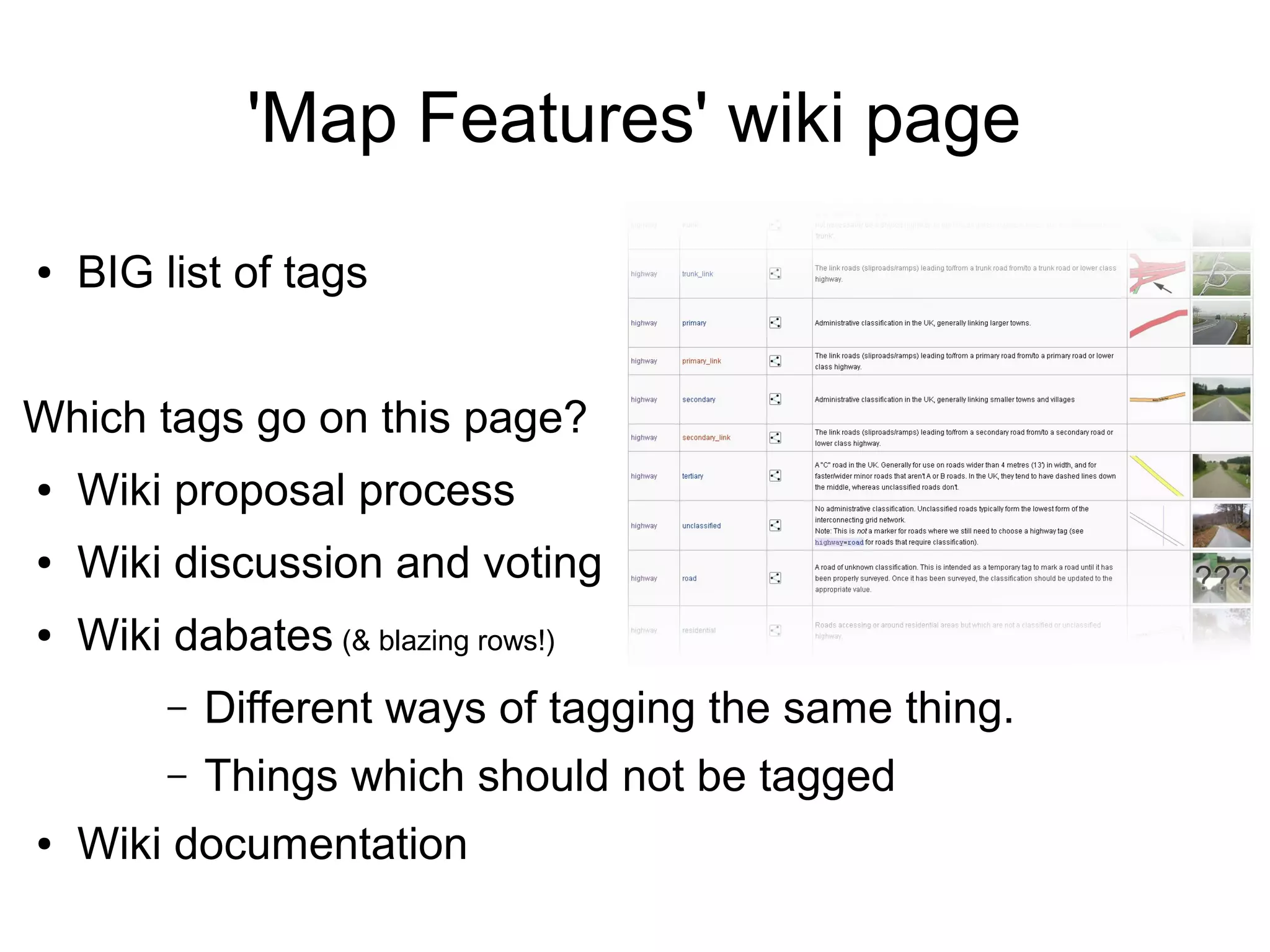
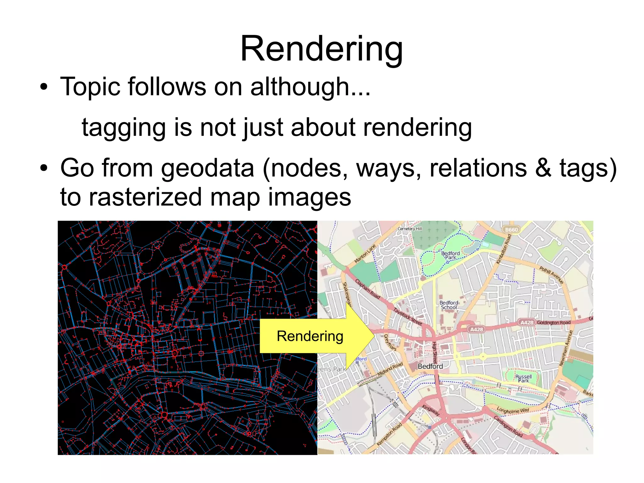
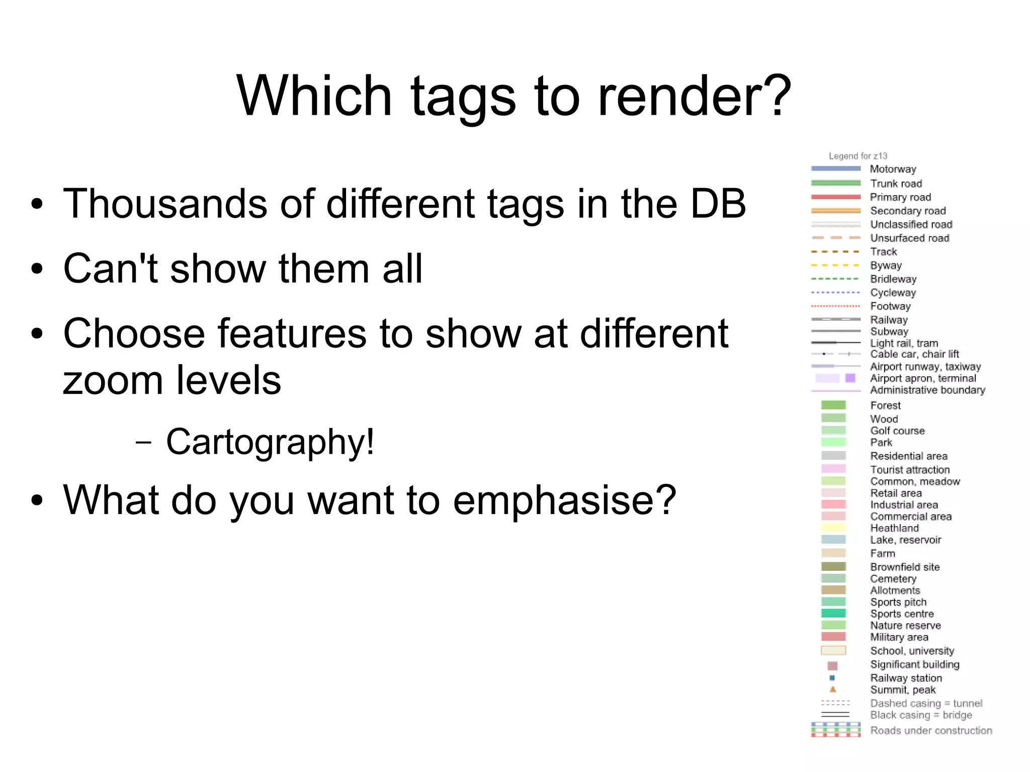
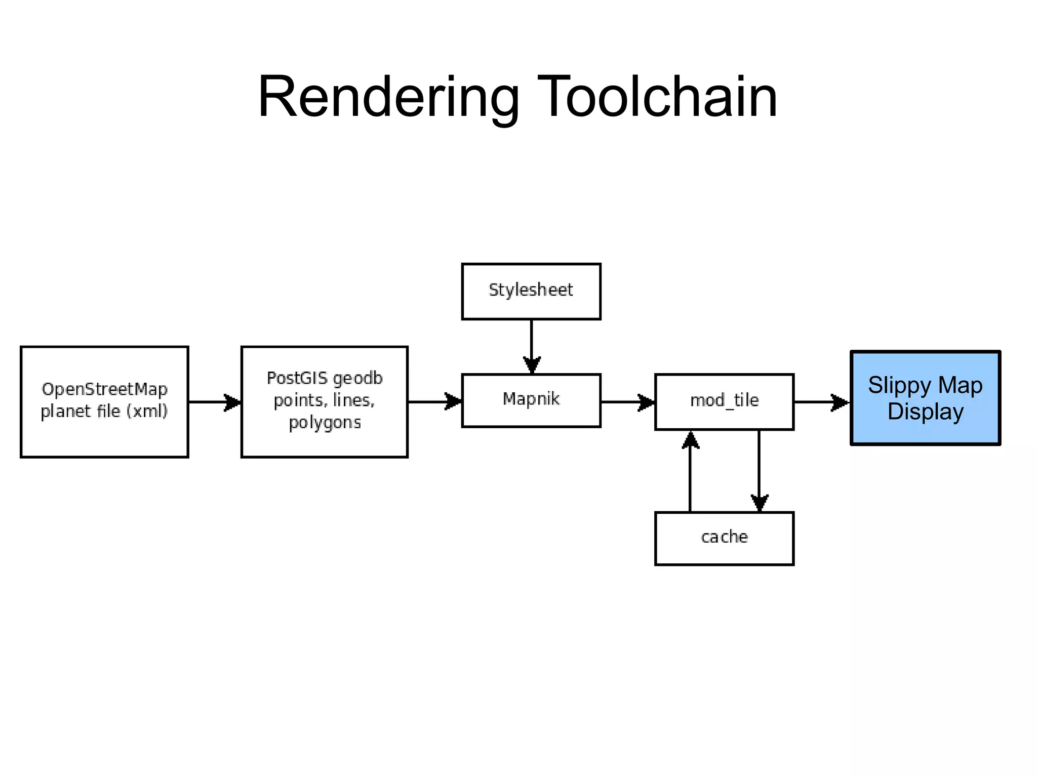
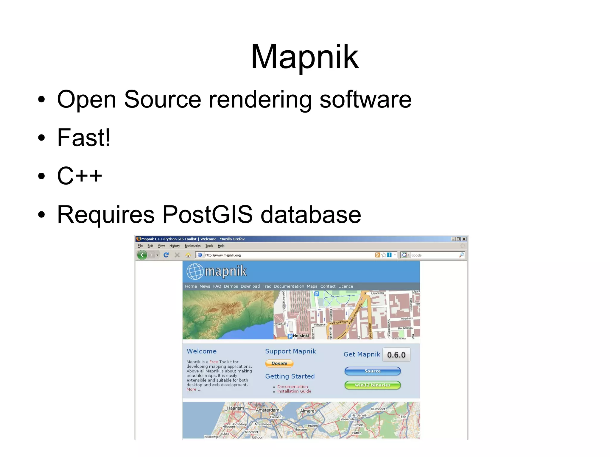
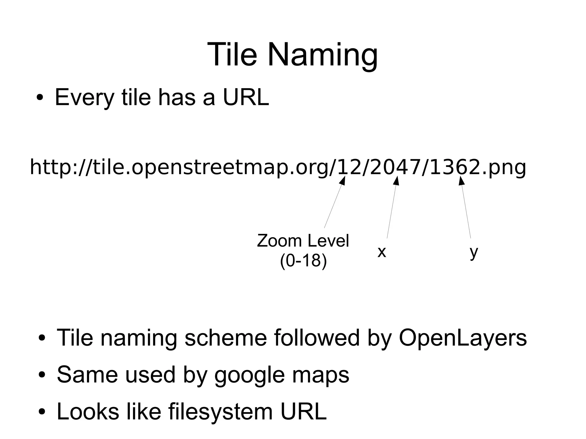
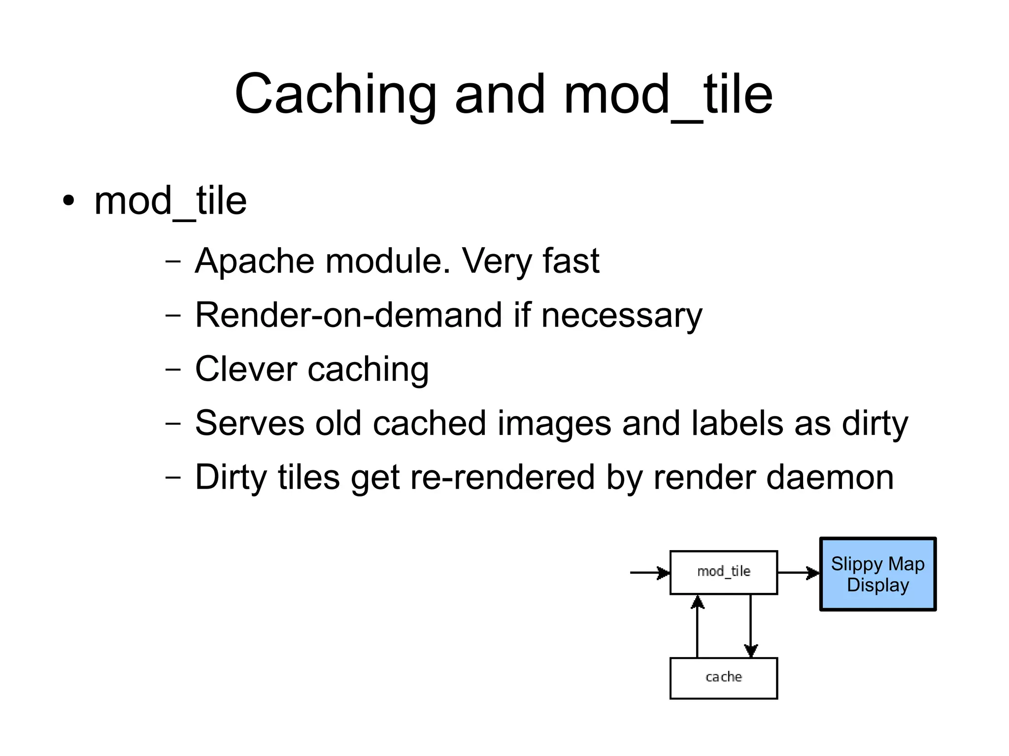
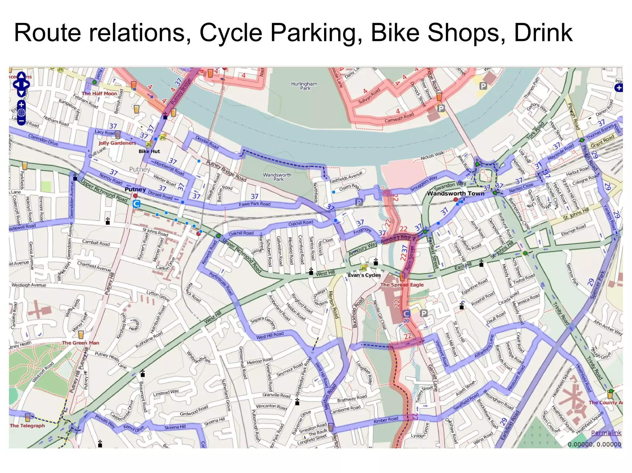
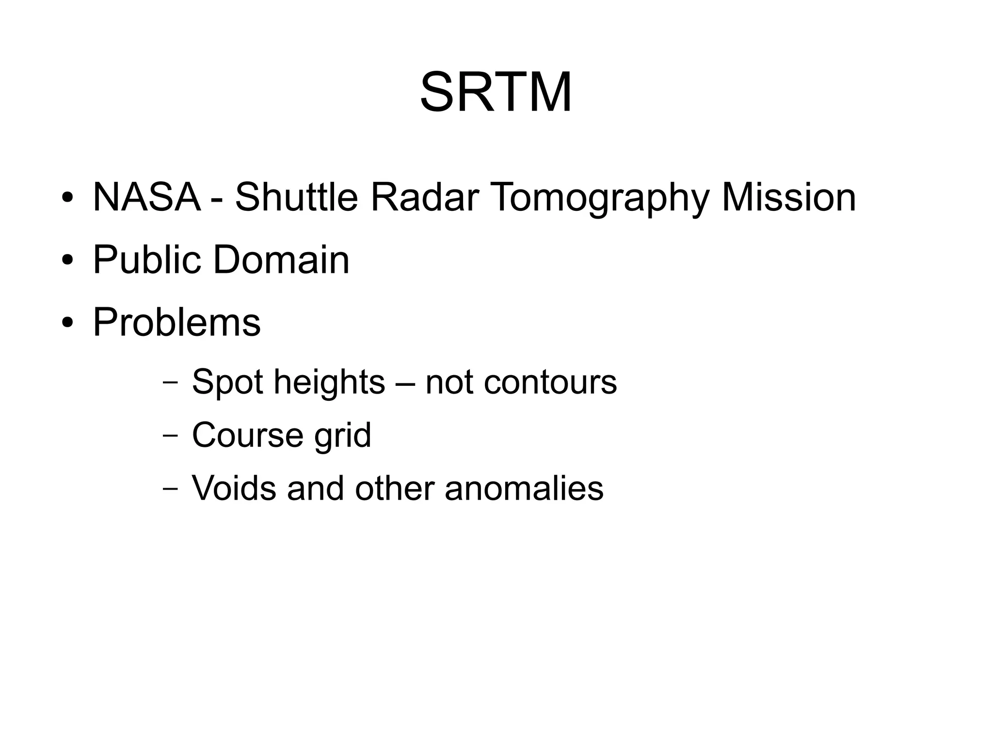
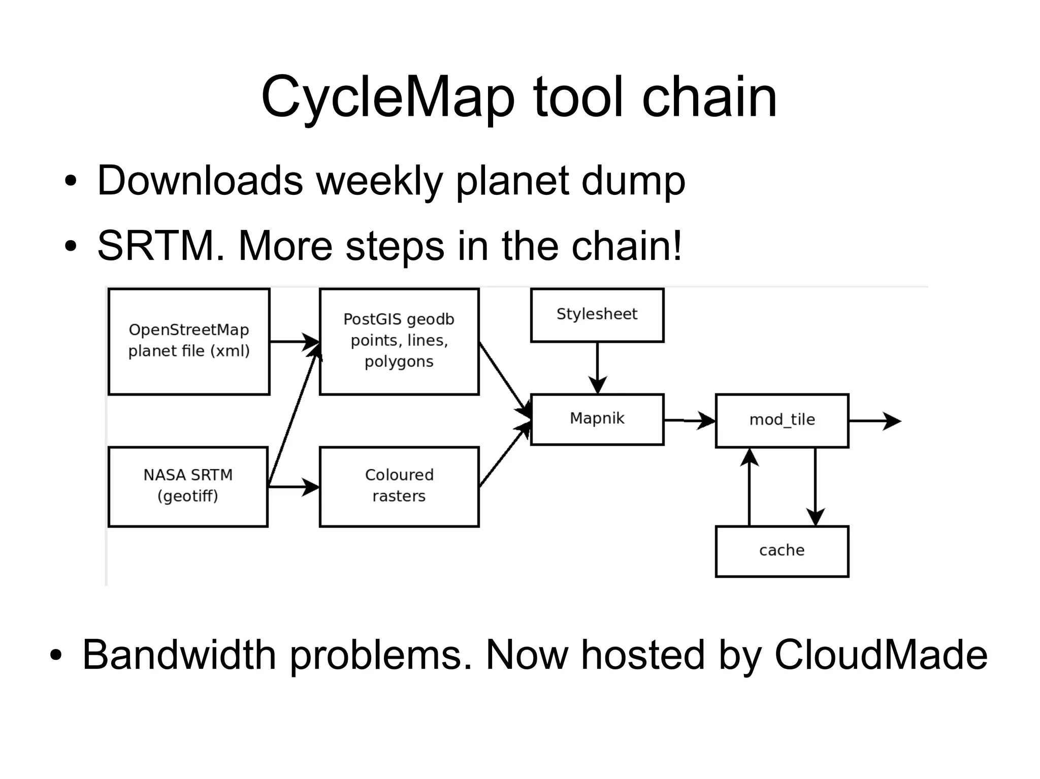
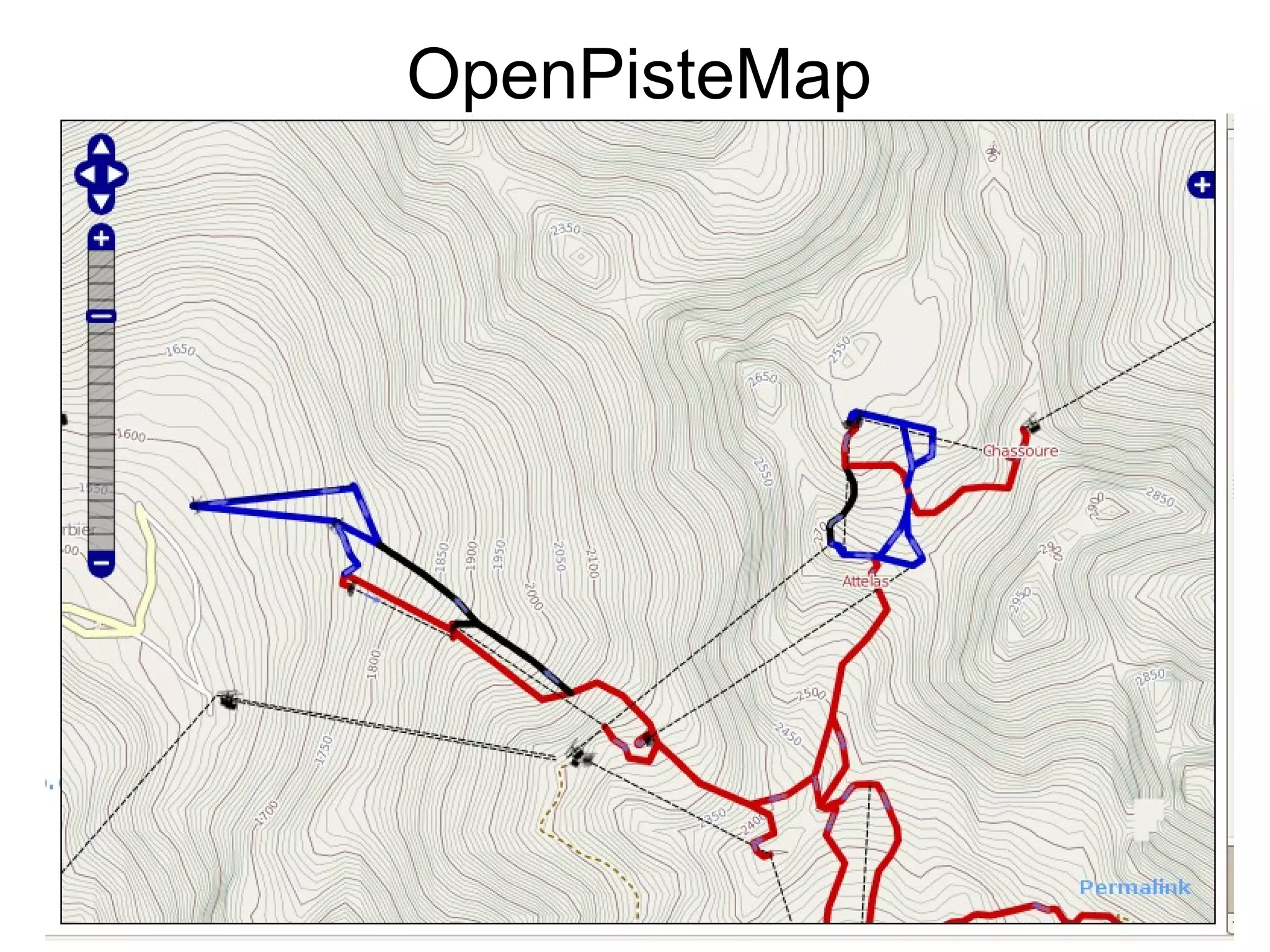
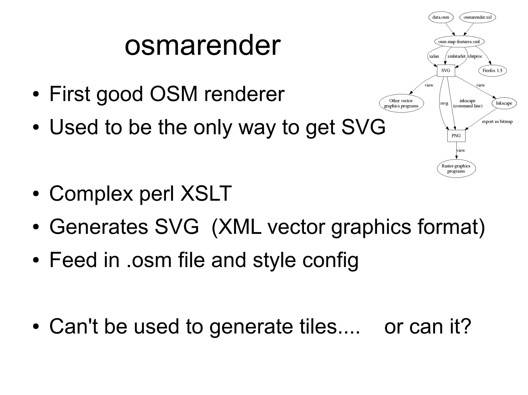
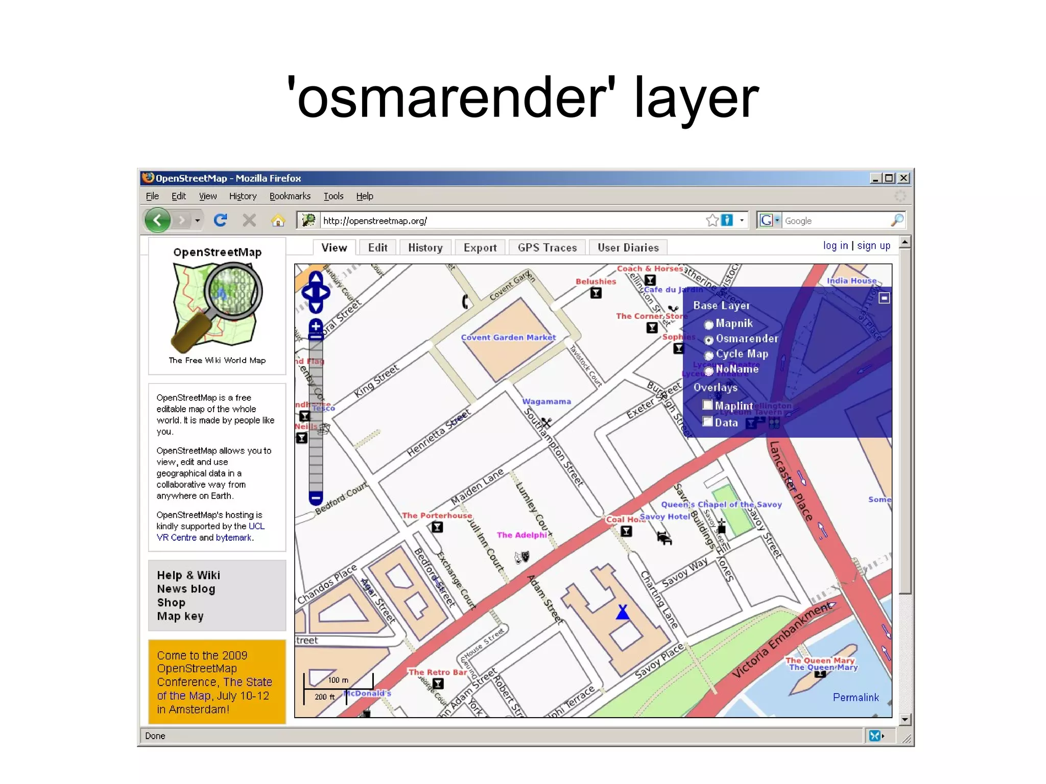
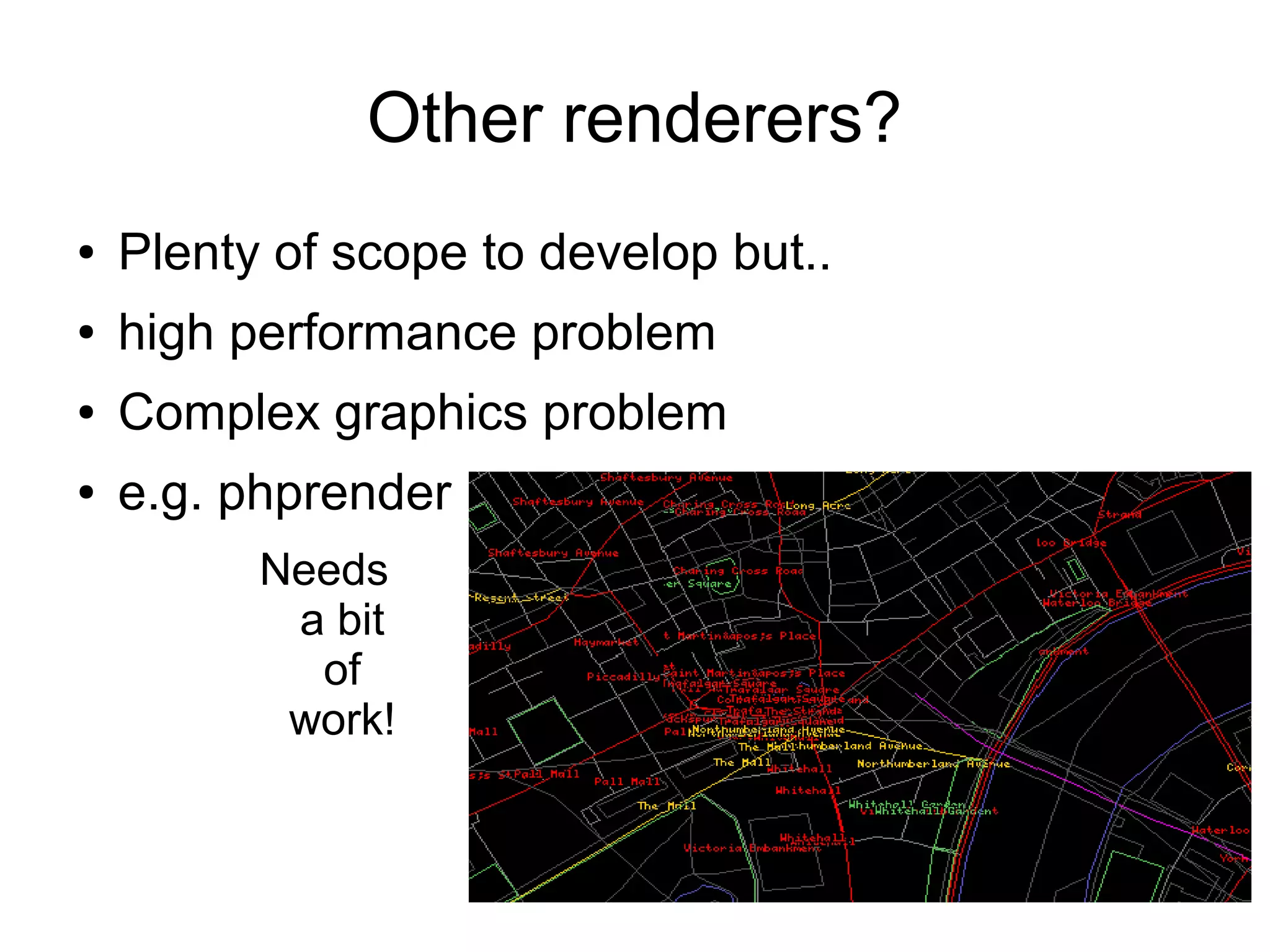
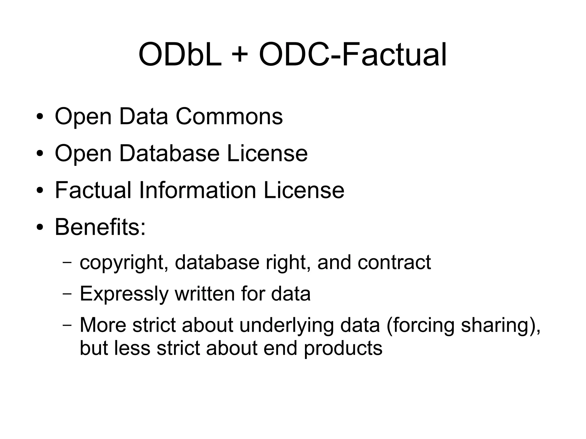
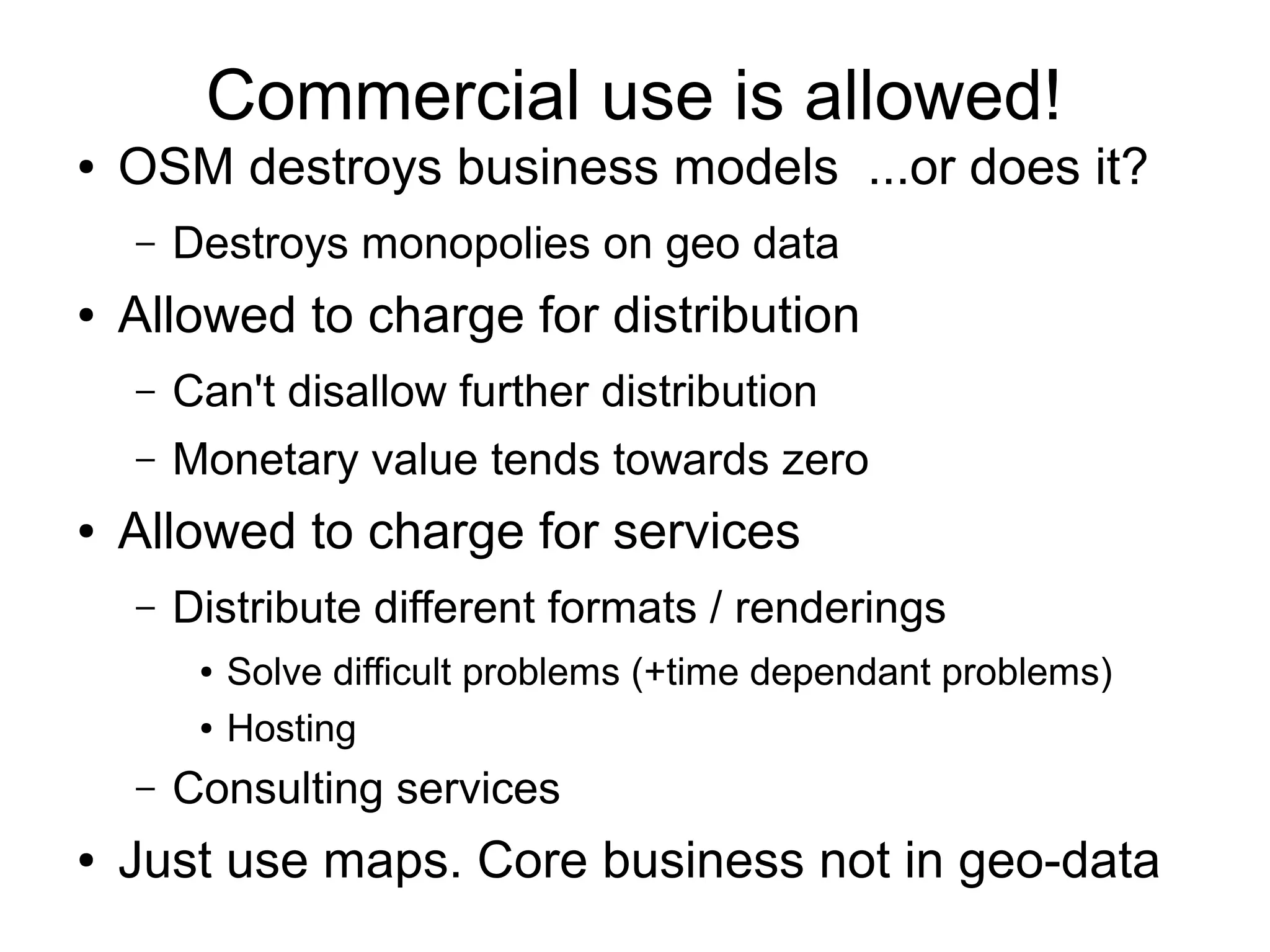
Harry Wood
OpenStreetMap : Open Licensed Geo Data
British Computer Society : Monday 27th
April 2009
Topics
●OpenStreetMap purpose and premise
●Data structures: Nodes, Ways ,Tags etc
●Editor demo
●OpenStreetMap servers and architecture
●Rendering and map displays
●The license
●CloudMade products and services
●Imports and other mapping techniques
●Getting Involved
NOTE:
Ran out of time for
these topics on the day.
The slides for these
have also been
removed from this deck.
Could present them on
another occasion!
Free as in Freedom
●Open license:
–Creative Commons Attribution Share-alike
●“Open Content” like “Open Source”
●Contributors retain ownership of copyright
●People and commercial companies can use the
maps for free under this license.
–Details of license requirements?... coming up
Getting an Open Licensed Map
●Can't copy copyrighted maps
● Not allowed to import copyrighted data
● Not allowed to copy from copyrighted maps
● Not allowed to trace over copyrighted maps
● Not allowed to “derive”
●Can copy some maps, but only...
● Public domain. Unrestricted (incl. relicensing)
● Get permission to release with an open license (big ask)
●Can create maps completely from scratch
● crazy idea?
GPS traces
● How it started. Gadgets!
● Cheap consumer GPS
units or location-aware
mobiles
● Record a line of dots
Record many lines of dots....
Looks like a street map. Kind of
Recording data
Names of streets
Types of streets (trunk, residential, motorway)
One-way restrictions
Footpaths, tracks, pedestrian, rivers, railways
Parks, woodland, industrial areas, cemeteries
POI (pubs, cash machines, post offices, post
boxes, bus stops, toilets, supermarkets, restaurants,
kebab shops, monuments, hotels, picnic sites, barriers, light
houses, piers, sports centres, petrol stations, playgrounds,
cinemas, car parks, universities, bicycle parking, tourist information, etc
etc etc
Mapping Techniques
●Photo Mapping (geo-located photos)
●Audio mapping
●Taking notes
●
●Ditch the GPS
● Taking notes
● Local knowledge!
● Yahoo Aerial Imagery
Mapping: A lot of effort
●Gather data
● GPS traces and other information
●Input data
● using OSM “editor” software
●Requires a lot of effort
● Requires a lot of people!
Community Contribution
●Built by a large online community
●Many hands make light work
●Openly editable (and easy)
●Poor quality contributions?
● Gradual refinement
● Assume good faith
● Monitoring and correction
....Remarkably it works!
Sounds familiar?
Wikipedia
●Large community coming together to build
something great!
●Wikipedia Principles
● Openly editable
● Open content license
● Gradual refinement
● Assume good faith
● “Soft Security” Monitoring and correction
looks like wikipedia
OpenStreetMap = The wikipedia of maps
Community
It's big. 100,000 registered users
Community
Increasing editing activity
Community
Very Active
0 1000 2000 3000 4000 5000 6000 7000 8000 9000
User rank
Less Active
Lopsided
Long tail of less active users
Cambridge
Global Project!
Open Licensed Data
A copyrighted map
...is a justification for OpenStreetMap
(It can't be used freely therefore OSM is better)
...cannot be a source for openstreetmap
Existing maps are very rarely free
Ordnance Survey
●Wonderful data in the UK
●OS license use of maps (and charge ££££££)
●Never allow re-distributing with a different license
●Very strict about copying
and their definition of
“derived” work
Guardian 'Free Our Data' Campaign
● Lobbying government
● Tax paid for data collection
● Tax still pays indirectly
● Economic benefits of free
● Slow progress
● OS might release
● low quality data first
● less-than-free license
● Or might be privatised!
● Whine about it or take action?
OSM and Ordnance Survey
£many
£0
Low quality High quality
OS
OSM
● We can't can't use google maps
● License their data from teleatlas
● ...who license data from Navteq / Teleatlas
● ...Ordnance Survey!
● No access to underlying data
● Google terms & conditions
● Don't allow deriving data from their maps
● Don't allow copying & re-distributing with a different license
● Wonderful hi-res aerial imagery
● T&Cs do not allow deriving maps (tracing)
● Bought in (licensed) from multiple suppliers
Google Maps
Why not use Google Maps?
Wonderful “free” (beer) mash-up API but...
●Errors and omissions
●Car centric. Footpaths and other details
●Cycle routes and Pistes
●Colours / branding - Google maps fatigue
●SVG export. Custom cartography
●Underlying data access!
● Details of OSM map access coming up
●Help OpenStreetMap!
Oxford University Website
OSM has better
maps of Oxford
Encourages the
OSM
community
Other uses
coming up...
Nodes, Ways, Relations
Node
Has latitude and longitude
Can stand alone, or form part of a way
Way
Joins together several nodes
Direction sometimes matters
Can form a 'closed way' (area)
Relation
For complex things such as routes
Tags
Applied to the Nodes, Ways, & Relations
Key value pairs
amenity=pub
name=Hare & Hounds
highway=residential
name=Court Street
http://www.openstreetmap.org/?lat=53.548078&lon=-2.004771&zoom=18
Data Browser demo
Data Browser
Permalink
JOSM demo
JOSM demo
OpenStreetMap Servers
Hosted in UCL
Loads of bandwidth
~10 servers:
Where does the data go?
http://wiki.openstreetmap.org/wiki/Servers
OpenStreetMap Foundation
Custodian of servers and sysadmin access
Oversees funding and vehicle for fund raising
Protection from copyright and liability suits
Database Server
Motherboard Supermicro X7DWN+ motherboard with Intel 5400 (Seaburg) Chipset
CPU 2x Intel Xeon Processor E5420 Quad Core 2.5Ghz
Memory 32GB DDR2 667 ECC
Disk 2x 73GB (3.5) SAS 15K
10x 450GB (3.5) SAS 15K
donate.openstreetmap.org
Raised £10,000 in 2 days
API
● REST web service
● HTTP GET & PUT
● Get elements at URLs
http://www.openstreetmap.org/api/0.6/node/297556642
● No bloated request payloads
● Ruby on Rails
Ruby on Rails
● It's easy. Web + REST
● Fashionable. Developers like it
● Developers are our most limited resource.
● It's what SteveC used
● Problems?
● Can't stream data from db
● Memory hungry and leaks somewhere
● Maybe use something else for core API
Nodes
http://www.openstreetmap.org/api/0.6/node/297556642
<node id="297556642"
lat="53.548223"
lon="-2.0056012"
version="2"
changeset="648346"
user="Guy"
uid="10983"
visible="true"
timestamp="2008-09-16T20:42:44Z">
<tag k="name" v="Hare &amp; Hounds"/>
<tag k="created_by" v="Potlatch 0.10b"/>
<tag k="amenity" v="pub"/>
</node>
Ways
http://www.openstreetmap.org/api/0.6/way/27120827
<way id="27120827"
visible="true"
timestamp="2008-09-19T13:19:53Z"
version="2"
changeset="664390"
user="Guy"
uid="10983">
<nd ref="298116100"/>
<nd ref="297555192"/>
<nd ref="297555193"/>
<nd ref="297555194"/>
<tag k="name" v="Court Street"/>
<tag k="created_by" v="Potlatch 0.10b"/>
<tag k="highway" v="residential"/>
</way>
Other API calls
GET a map
All elements within a bounding box
http://api.openstreetmap.org/api/0.6/map?bbox=11.54,48.14,11.543,48.145
PUT elements
Now requires “changeset open” request
Various other operations
History and changeset access
Get GPS points/tracks
Some database details
Switched from MySQL to Postgres last weekend!
Rails migrations in theory
In practice. C++ scripts running all weekend
Why the switch?
Lots of other planned restructuring
including new DB hardware
Good time to do it
MySQL
Generally fast and scalable enough
● Quadtile indexing extension
Several annoying flaws:
● schema changes cause table copies
● different features on different db engines
● (transactions on InnoDB, spatial on MyISAM)
● silently accepts invalid utf8
● constraints can't be deferred
● some non-standard SQL syntax
Postgres
● Addresses a lot of MySQL flaws:
● Faster schema changes
● Better support for transactions, utf8, etc
● Personal preference of our sysops
Full Revision History
Store a full history edits to elements
Essential wiki-like feature
Ideally provide simple roll-back
Access old versions of an element
Difficult to reconstruct old version of a map
Changesets
● Brand new feature
● Every edit belongs in a change set
● Every numbered version of every object
belongs in one particular changeset
● Changesets have comments
● Great for monitoring
Changeset Displays
http://www.openstreetmap.org/browse/changesets
Changeset revert?
● Reverting is still a difficult problem
● Changesets are not atomic
● Changeset 1 User:Sam Node 12345 v1
● Changeset 2 User:SallyNode 12345 v2
● Changeset 3 User:Sid Node 12345 v3
● Changeset 4 User:SallyNode 12345 v3
● Changeset 1 User:Sam Node 12345 v4
● Changeset 1 User:Sam Node 12345 v5
● Many interlinked elements
Conflicts
● Two users editing the same element
– Rarely happens actually
● Version mismatch now reported
– “Optimistic locking”
● Editors (should) do CVS style conflict resolution
● Download reveals conflict
● Upload not allowed until resolved
(Watch nice video)
OSM 2008: A Year of Edits
http://vimeo.com/2598878
planet.osm
● Snapshot of the OpenStreetMap database
● Entire planet. Every node, way, relation, tag
● Only 'current' data. Not history
● XML formatted .osm file
● 5.2 GB with bzip2 compression
● Uncompressed... 150 GB
● Takes several hours to dump. Every Wednesday
● Important part of Openness. Ensures longevity.
Osmosis
● Java toolkit for OpenStreetMap
● Various data transformations
● Minutely, Hourly, Daily diffs .osc.gz files
● Created by Osmosis. Consumed by osmosis
● Streamable changes
Open Tagging
● Mentioned tags briefly
– amenity=pub highway=residential
● Free-form open tagging. Any tags you like!
● Agree on standards
● Main openstreetmap.org map rendering uses
one set of tags
● Other map renderers, other tools, can use other
tagging schemes
'Map Features' wiki page
● BIG list of tags
Which tags go on this page?
● Wiki proposal process
● Wiki discussion and voting
● Wiki dabates (& blazing rows!)
– Different ways of tagging the same thing.
– Things which should not be tagged
● Wiki documentation
Smoothness Debate
● Vehement Objections
– Too subjective
– Verifiability
– Poor english
● Disruption
– Disregarding vote
– Wiki fiddlers
vs Mappers
– Wiki edit wars
– New process?
● Lock down?
The wrong way to think about tags
● Come up with lots of ideas for new tags
● Submit proposals, organise votes, generally
fiddle with the OSM wiki a lot
● Pester people to use tags in map renderings
...oh and maybe do a bit of actual mapping
The right way to think about tags
● Do mapping!
● Found something without a documented tag?
– Search thoroughly (in mailing list too)
– Use a less specific tag and qualify with type=
– Use a note= tag
– Just invent a tag
● Do more mapping!
● Discuss politely. Improve existing docs.
● maybe... possibly.... do a proposal
● Focus on mapping. Don't worry about rendering
TagWatch
● Tag usage stats
● Split by country
● Tags used in
conjunction
Rendering
● Topic follows on although...
tagging is not just about rendering
● Go from geodata (nodes, ways, relations & tags)
to rasterized map images
Rendering
Which tags to render?
● Thousands of different tags in the DB
● Can't show them all
● Choose features to show at different
zoom levels
– Cartography!
● What do you want to emphasise?
Rendering Toolchain
Slippy Map
Display
Mapnik
● Open Source rendering software
● Fast!
● C++
● Requires PostGIS database
Mapnik Stylesheet
● XML format
● 'styles', 'filters' and 'rules'
● >7000 lines long
● Pre-processing steps
– Cascadenik
– and also...
osm2pgsql
● Step before using Mapnik (& stylesheet)
● load OSM data into a Postgres database
● Lossy conversion. Only take tags of interest
● nodes and ways → linestrings and polygons
Slippy Map
Display
● Open Source JavaScript library
● Dynamic slippy map on your website
● WMS layers
● Tile based map layers
● Transparent overlay layers
● Markers, Boxes, Polygons, Click events
In the end we want a map display...
Tiles
● Small map images
● Cacheable
● Fast loading
● Sized to optimize speed
– Too big. Unneeded map area
– Too small. Too many requests
– 256x256pixels
Tile Naming
● Slice the world into tiles at each zoom level
● Tiles are always 256x256 pixels
● Represent different sized area of the world at
different zoom levels
Tile Naming
Zoom level 0 has only one tile (whole world):
Tile Naming
Zoom level 1 has 2x2 tiles
Tile Naming
● Zoom level 2 has 4x4 tiles
● Zoom level 3 has 8x8 tiles
● Zoom level 4 has 16x16 tiles
...
●
Zoom level n has 2n
x2n
tiles
...
● Zoom level 18 has
262144 x 262144 tiles
Tile Naming
● Every tile has a URL
http://tile.openstreetmap.org/12/2047/1362.png
y
Zoom Level
(0-18)
x
● Tile naming scheme followed by OpenLayers
● Same used by google maps
● Looks like filesystem URL
Tiles =High Performance Computing
262144 x 262144 = 68,719,476,736 tiles
inode problem!
5 kB each = 320 terabytes
But then there's zoom 17.... another 80 terabytes
etc...
Tiles =High Performance Computing
OpenStreetMap updates?
● Apply diffs
● Re-render tile images!
● CPU problem!
Caching and mod_tile
● mod_tile
– Apache module. Very fast
– Render-on-demand if necessary
– Clever caching
– Serves old cached images and labels as dirty
– Dirty tiles get re-rendered by render daemon
Slippy Map
Display
Bandwidth
● Serving terrabytes of tile data. High bandwidth
● UCL
OpenCycleMap.org
● Using OpenStreetMap
– Presenting special interest map
– Same data. Different cartographic choices
● Toolchain running on another server
– Updates fed in
– Passionate sub-set of the OSM community
Route relations, Cycle Parking, Bike Shops, Drink
Relief maps!
SRTM
● NASA - Shuttle Radar Tomography Mission
● Public Domain
● Problems
– Spot heights – not contours
– Course grid
– Voids and other anomalies
CycleMap tool chain
● Downloads weekly planet dump
● SRTM. More steps in the chain!
● Bandwidth problems. Now hosted by CloudMade
OpenPisteMap
Hiking Map
Whitewater Map
Bus map
Kosmos
● .NET (windows only)
● Desktop app
● Can generate tiles
● wiki based
style config
osmarender
● First good OSM renderer
● Used to be the only way to get SVG
● Complex perl XSLT
● Generates SVG (XML vector graphics format)
● Feed in .osm file and style config
● Can't be used to generate tiles.... or can it?
'osmarender' layer
tiles@home
● Distributed tile rendering
– Instructions dished out from tiles@home server
– Many clients download via API and upload
images
● 'osmarender' layer
– Used to provide the fastest updates
● XSLT transforms & inkscape SVG rendering
– Eats massive amounts of CPU
– Mapnik more sensible. ...no need to distribute
Other renderers?
● Plenty of scope to develop but..
● high performance problem
● Complex graphics problem
● e.g. phprender
Needs
a bit
of
work!
We want people to be free to use our maps!
OSM License Requirements
● Free to bring maps into “collective” works
– Must give “attribution”
● Free to create “derivative” works
– must share-alike
● Awkward complications:
– What exactly counts as “derivative work”?
– How do you give credit to the “authors”?
ODbL + ODC-Factual
● Open Data Commons
● Open Database License
● Factual Information License
● Benefits:
– copyright, database right, and contract
– Expressly written for data
– More strict about underlying data (forcing sharing),
but less strict about end products
Commercial use is allowed!
● OSM destroys business models ...or does it?
– Destroys monopolies on geo data
● Allowed to charge for distribution
– Can't disallow further distribution
– Monetary value tends towards zero
● Allowed to charge for services
– Distribute different formats / renderings
● Solve difficult problems (+time dependant problems)
● Hosting
– Consulting services
● Just use maps. Core business not in geo-data
Flickr
Nestoria
'Trails' iPhone app
Get Involved!
http://wiki.openstreetmap.org/
http://lists.openstreetmap.org/
irc://irc.oftc.net #osm
http://trac.openstreetmap.org
Harry Wood worked as an enterprise integration
consultant for 8 years, but led a secret double-life as
addicted contributor to wikipedia and other collaborative
open content projects. He got involved in
OpenStreetMap three years ago, as a mapper, wiki
gardener, and developer. Since January this year (2009)
he has worked for CloudMade, as a full time
OpenStreetMap developer
CloudMade is a company providing products and
services around OpenStreetMap.
More information at http://cloudmade.com
These slides are (of course) freely re-usable under the
Creative Commons Attribution-ShareAlike 2.0 License

OpenStreetMap : Open Licensed GeoData

  • 1.
    Harry Wood OpenStreetMap :Open Licensed Geo Data British Computer Society : Monday 27th April 2009
  • 2.
    Topics ●OpenStreetMap purpose andpremise ●Data structures: Nodes, Ways ,Tags etc ●Editor demo ●OpenStreetMap servers and architecture ●Rendering and map displays ●The license ●CloudMade products and services ●Imports and other mapping techniques ●Getting Involved NOTE: Ran out of time for these topics on the day. The slides for these have also been removed from this deck. Could present them on another occasion!
  • 3.
    Free as inFreedom ●Open license: –Creative Commons Attribution Share-alike ●“Open Content” like “Open Source” ●Contributors retain ownership of copyright ●People and commercial companies can use the maps for free under this license. –Details of license requirements?... coming up
  • 4.
    Getting an OpenLicensed Map ●Can't copy copyrighted maps ● Not allowed to import copyrighted data ● Not allowed to copy from copyrighted maps ● Not allowed to trace over copyrighted maps ● Not allowed to “derive” ●Can copy some maps, but only... ● Public domain. Unrestricted (incl. relicensing) ● Get permission to release with an open license (big ask) ●Can create maps completely from scratch ● crazy idea?
  • 5.
    GPS traces ● Howit started. Gadgets! ● Cheap consumer GPS units or location-aware mobiles ● Record a line of dots
  • 6.
    Record many linesof dots.... Looks like a street map. Kind of
  • 7.
    Recording data Names ofstreets Types of streets (trunk, residential, motorway) One-way restrictions Footpaths, tracks, pedestrian, rivers, railways Parks, woodland, industrial areas, cemeteries POI (pubs, cash machines, post offices, post boxes, bus stops, toilets, supermarkets, restaurants, kebab shops, monuments, hotels, picnic sites, barriers, light houses, piers, sports centres, petrol stations, playgrounds, cinemas, car parks, universities, bicycle parking, tourist information, etc etc etc
  • 8.
    Mapping Techniques ●Photo Mapping(geo-located photos) ●Audio mapping ●Taking notes ● ●Ditch the GPS ● Taking notes ● Local knowledge! ● Yahoo Aerial Imagery
  • 9.
    Mapping: A lotof effort ●Gather data ● GPS traces and other information ●Input data ● using OSM “editor” software ●Requires a lot of effort ● Requires a lot of people!
  • 10.
    Community Contribution ●Built bya large online community ●Many hands make light work ●Openly editable (and easy) ●Poor quality contributions? ● Gradual refinement ● Assume good faith ● Monitoring and correction ....Remarkably it works! Sounds familiar?
  • 11.
    Wikipedia ●Large community comingtogether to build something great! ●Wikipedia Principles ● Openly editable ● Open content license ● Gradual refinement ● Assume good faith ● “Soft Security” Monitoring and correction
  • 12.
    looks like wikipedia OpenStreetMap= The wikipedia of maps
  • 13.
  • 14.
  • 15.
    Community Very Active 0 10002000 3000 4000 5000 6000 7000 8000 9000 User rank Less Active Lopsided Long tail of less active users
  • 30.
  • 33.
  • 43.
    Open Licensed Data Acopyrighted map ...is a justification for OpenStreetMap (It can't be used freely therefore OSM is better) ...cannot be a source for openstreetmap Existing maps are very rarely free
  • 44.
    Ordnance Survey ●Wonderful datain the UK ●OS license use of maps (and charge ££££££) ●Never allow re-distributing with a different license ●Very strict about copying and their definition of “derived” work
  • 45.
    Guardian 'Free OurData' Campaign ● Lobbying government ● Tax paid for data collection ● Tax still pays indirectly ● Economic benefits of free ● Slow progress ● OS might release ● low quality data first ● less-than-free license ● Or might be privatised! ● Whine about it or take action?
  • 46.
    OSM and OrdnanceSurvey £many £0 Low quality High quality OS OSM
  • 47.
    ● We can'tcan't use google maps ● License their data from teleatlas ● ...who license data from Navteq / Teleatlas ● ...Ordnance Survey! ● No access to underlying data ● Google terms & conditions ● Don't allow deriving data from their maps ● Don't allow copying & re-distributing with a different license ● Wonderful hi-res aerial imagery ● T&Cs do not allow deriving maps (tracing) ● Bought in (licensed) from multiple suppliers Google Maps
  • 48.
    Why not useGoogle Maps? Wonderful “free” (beer) mash-up API but... ●Errors and omissions ●Car centric. Footpaths and other details ●Cycle routes and Pistes ●Colours / branding - Google maps fatigue ●SVG export. Custom cartography ●Underlying data access! ● Details of OSM map access coming up ●Help OpenStreetMap!
  • 49.
    Oxford University Website OSMhas better maps of Oxford Encourages the OSM community Other uses coming up...
  • 50.
    Nodes, Ways, Relations Node Haslatitude and longitude Can stand alone, or form part of a way Way Joins together several nodes Direction sometimes matters Can form a 'closed way' (area) Relation For complex things such as routes
  • 51.
    Tags Applied to theNodes, Ways, & Relations Key value pairs amenity=pub name=Hare & Hounds highway=residential name=Court Street
  • 52.
  • 53.
  • 54.
  • 55.
  • 56.
  • 57.
    OpenStreetMap Servers Hosted inUCL Loads of bandwidth ~10 servers: Where does the data go? http://wiki.openstreetmap.org/wiki/Servers
  • 58.
    OpenStreetMap Foundation Custodian ofservers and sysadmin access Oversees funding and vehicle for fund raising Protection from copyright and liability suits
  • 59.
    Database Server Motherboard SupermicroX7DWN+ motherboard with Intel 5400 (Seaburg) Chipset CPU 2x Intel Xeon Processor E5420 Quad Core 2.5Ghz Memory 32GB DDR2 667 ECC Disk 2x 73GB (3.5) SAS 15K 10x 450GB (3.5) SAS 15K donate.openstreetmap.org Raised £10,000 in 2 days
  • 61.
    API ● REST webservice ● HTTP GET & PUT ● Get elements at URLs http://www.openstreetmap.org/api/0.6/node/297556642 ● No bloated request payloads ● Ruby on Rails
  • 62.
    Ruby on Rails ●It's easy. Web + REST ● Fashionable. Developers like it ● Developers are our most limited resource. ● It's what SteveC used ● Problems? ● Can't stream data from db ● Memory hungry and leaks somewhere ● Maybe use something else for core API
  • 63.
  • 64.
    Ways http://www.openstreetmap.org/api/0.6/way/27120827 <way id="27120827" visible="true" timestamp="2008-09-19T13:19:53Z" version="2" changeset="664390" user="Guy" uid="10983"> <nd ref="298116100"/> <ndref="297555192"/> <nd ref="297555193"/> <nd ref="297555194"/> <tag k="name" v="Court Street"/> <tag k="created_by" v="Potlatch 0.10b"/> <tag k="highway" v="residential"/> </way>
  • 65.
    Other API calls GETa map All elements within a bounding box http://api.openstreetmap.org/api/0.6/map?bbox=11.54,48.14,11.543,48.145 PUT elements Now requires “changeset open” request Various other operations History and changeset access Get GPS points/tracks
  • 66.
    Some database details Switchedfrom MySQL to Postgres last weekend! Rails migrations in theory In practice. C++ scripts running all weekend Why the switch? Lots of other planned restructuring including new DB hardware Good time to do it
  • 67.
    MySQL Generally fast andscalable enough ● Quadtile indexing extension Several annoying flaws: ● schema changes cause table copies ● different features on different db engines ● (transactions on InnoDB, spatial on MyISAM) ● silently accepts invalid utf8 ● constraints can't be deferred ● some non-standard SQL syntax
  • 68.
    Postgres ● Addresses alot of MySQL flaws: ● Faster schema changes ● Better support for transactions, utf8, etc ● Personal preference of our sysops
  • 69.
    Full Revision History Storea full history edits to elements Essential wiki-like feature Ideally provide simple roll-back Access old versions of an element Difficult to reconstruct old version of a map
  • 70.
    Changesets ● Brand newfeature ● Every edit belongs in a change set ● Every numbered version of every object belongs in one particular changeset ● Changesets have comments ● Great for monitoring
  • 71.
  • 72.
    Changeset revert? ● Revertingis still a difficult problem ● Changesets are not atomic ● Changeset 1 User:Sam Node 12345 v1 ● Changeset 2 User:SallyNode 12345 v2 ● Changeset 3 User:Sid Node 12345 v3 ● Changeset 4 User:SallyNode 12345 v3 ● Changeset 1 User:Sam Node 12345 v4 ● Changeset 1 User:Sam Node 12345 v5 ● Many interlinked elements
  • 73.
    Conflicts ● Two usersediting the same element – Rarely happens actually ● Version mismatch now reported – “Optimistic locking” ● Editors (should) do CVS style conflict resolution ● Download reveals conflict ● Upload not allowed until resolved
  • 74.
    (Watch nice video) OSM2008: A Year of Edits http://vimeo.com/2598878
  • 75.
    planet.osm ● Snapshot ofthe OpenStreetMap database ● Entire planet. Every node, way, relation, tag ● Only 'current' data. Not history ● XML formatted .osm file ● 5.2 GB with bzip2 compression ● Uncompressed... 150 GB ● Takes several hours to dump. Every Wednesday ● Important part of Openness. Ensures longevity.
  • 76.
    Osmosis ● Java toolkitfor OpenStreetMap ● Various data transformations ● Minutely, Hourly, Daily diffs .osc.gz files ● Created by Osmosis. Consumed by osmosis ● Streamable changes
  • 77.
    Open Tagging ● Mentionedtags briefly – amenity=pub highway=residential ● Free-form open tagging. Any tags you like! ● Agree on standards ● Main openstreetmap.org map rendering uses one set of tags ● Other map renderers, other tools, can use other tagging schemes
  • 78.
    'Map Features' wikipage ● BIG list of tags Which tags go on this page? ● Wiki proposal process ● Wiki discussion and voting ● Wiki dabates (& blazing rows!) – Different ways of tagging the same thing. – Things which should not be tagged ● Wiki documentation
  • 79.
    Smoothness Debate ● VehementObjections – Too subjective – Verifiability – Poor english ● Disruption – Disregarding vote – Wiki fiddlers vs Mappers – Wiki edit wars – New process? ● Lock down?
  • 80.
    The wrong wayto think about tags ● Come up with lots of ideas for new tags ● Submit proposals, organise votes, generally fiddle with the OSM wiki a lot ● Pester people to use tags in map renderings ...oh and maybe do a bit of actual mapping
  • 81.
    The right wayto think about tags ● Do mapping! ● Found something without a documented tag? – Search thoroughly (in mailing list too) – Use a less specific tag and qualify with type= – Use a note= tag – Just invent a tag ● Do more mapping! ● Discuss politely. Improve existing docs. ● maybe... possibly.... do a proposal ● Focus on mapping. Don't worry about rendering
  • 82.
    TagWatch ● Tag usagestats ● Split by country ● Tags used in conjunction
  • 83.
    Rendering ● Topic followson although... tagging is not just about rendering ● Go from geodata (nodes, ways, relations & tags) to rasterized map images Rendering
  • 84.
    Which tags torender? ● Thousands of different tags in the DB ● Can't show them all ● Choose features to show at different zoom levels – Cartography! ● What do you want to emphasise?
  • 85.
  • 86.
    Mapnik ● Open Sourcerendering software ● Fast! ● C++ ● Requires PostGIS database
  • 87.
    Mapnik Stylesheet ● XMLformat ● 'styles', 'filters' and 'rules' ● >7000 lines long ● Pre-processing steps – Cascadenik – and also...
  • 88.
    osm2pgsql ● Step beforeusing Mapnik (& stylesheet) ● load OSM data into a Postgres database ● Lossy conversion. Only take tags of interest ● nodes and ways → linestrings and polygons Slippy Map Display
  • 89.
    ● Open SourceJavaScript library ● Dynamic slippy map on your website ● WMS layers ● Tile based map layers ● Transparent overlay layers ● Markers, Boxes, Polygons, Click events In the end we want a map display...
  • 90.
    Tiles ● Small mapimages ● Cacheable ● Fast loading ● Sized to optimize speed – Too big. Unneeded map area – Too small. Too many requests – 256x256pixels
  • 91.
    Tile Naming ● Slicethe world into tiles at each zoom level ● Tiles are always 256x256 pixels ● Represent different sized area of the world at different zoom levels
  • 92.
    Tile Naming Zoom level0 has only one tile (whole world):
  • 93.
    Tile Naming Zoom level1 has 2x2 tiles
  • 94.
    Tile Naming ● Zoomlevel 2 has 4x4 tiles ● Zoom level 3 has 8x8 tiles ● Zoom level 4 has 16x16 tiles ... ● Zoom level n has 2n x2n tiles ... ● Zoom level 18 has 262144 x 262144 tiles
  • 95.
    Tile Naming ● Everytile has a URL http://tile.openstreetmap.org/12/2047/1362.png y Zoom Level (0-18) x ● Tile naming scheme followed by OpenLayers ● Same used by google maps ● Looks like filesystem URL
  • 96.
    Tiles =High PerformanceComputing 262144 x 262144 = 68,719,476,736 tiles inode problem! 5 kB each = 320 terabytes But then there's zoom 17.... another 80 terabytes etc...
  • 97.
    Tiles =High PerformanceComputing OpenStreetMap updates? ● Apply diffs ● Re-render tile images! ● CPU problem!
  • 98.
    Caching and mod_tile ●mod_tile – Apache module. Very fast – Render-on-demand if necessary – Clever caching – Serves old cached images and labels as dirty – Dirty tiles get re-rendered by render daemon Slippy Map Display
  • 99.
    Bandwidth ● Serving terrabytesof tile data. High bandwidth ● UCL
  • 100.
    OpenCycleMap.org ● Using OpenStreetMap –Presenting special interest map – Same data. Different cartographic choices ● Toolchain running on another server – Updates fed in – Passionate sub-set of the OSM community
  • 101.
    Route relations, CycleParking, Bike Shops, Drink
  • 102.
  • 103.
    SRTM ● NASA -Shuttle Radar Tomography Mission ● Public Domain ● Problems – Spot heights – not contours – Course grid – Voids and other anomalies
  • 104.
    CycleMap tool chain ●Downloads weekly planet dump ● SRTM. More steps in the chain! ● Bandwidth problems. Now hosted by CloudMade
  • 105.
  • 106.
  • 107.
  • 108.
  • 109.
    Kosmos ● .NET (windowsonly) ● Desktop app ● Can generate tiles ● wiki based style config
  • 110.
    osmarender ● First goodOSM renderer ● Used to be the only way to get SVG ● Complex perl XSLT ● Generates SVG (XML vector graphics format) ● Feed in .osm file and style config ● Can't be used to generate tiles.... or can it?
  • 111.
  • 112.
    tiles@home ● Distributed tilerendering – Instructions dished out from tiles@home server – Many clients download via API and upload images ● 'osmarender' layer – Used to provide the fastest updates ● XSLT transforms & inkscape SVG rendering – Eats massive amounts of CPU – Mapnik more sensible. ...no need to distribute
  • 113.
    Other renderers? ● Plentyof scope to develop but.. ● high performance problem ● Complex graphics problem ● e.g. phprender Needs a bit of work!
  • 114.
    We want peopleto be free to use our maps! OSM License Requirements ● Free to bring maps into “collective” works – Must give “attribution” ● Free to create “derivative” works – must share-alike ● Awkward complications: – What exactly counts as “derivative work”? – How do you give credit to the “authors”?
  • 115.
    ODbL + ODC-Factual ●Open Data Commons ● Open Database License ● Factual Information License ● Benefits: – copyright, database right, and contract – Expressly written for data – More strict about underlying data (forcing sharing), but less strict about end products
  • 116.
    Commercial use isallowed! ● OSM destroys business models ...or does it? – Destroys monopolies on geo data ● Allowed to charge for distribution – Can't disallow further distribution – Monetary value tends towards zero ● Allowed to charge for services – Distribute different formats / renderings ● Solve difficult problems (+time dependant problems) ● Hosting – Consulting services ● Just use maps. Core business not in geo-data
  • 117.
  • 118.
  • 119.
  • 120.
  • 121.
    Harry Wood workedas an enterprise integration consultant for 8 years, but led a secret double-life as addicted contributor to wikipedia and other collaborative open content projects. He got involved in OpenStreetMap three years ago, as a mapper, wiki gardener, and developer. Since January this year (2009) he has worked for CloudMade, as a full time OpenStreetMap developer CloudMade is a company providing products and services around OpenStreetMap. More information at http://cloudmade.com These slides are (of course) freely re-usable under the Creative Commons Attribution-ShareAlike 2.0 License

Editor's Notes

  • #53 http://www.openstreetmap.org/?lat=53.54599&amp;lon=-2.00424&amp;zoom=16&amp;layers=B000FTTTT