OpenStreetMap (OSM) is a collaborative project to create a free and editable map of the world. The document discusses using OSM for community mapping in Malawi to improve flood preparedness. It describes training local mappers on collecting geospatial data using tools like Field Papers. The goal is to involve government, universities, and NGOs to build mapping capacity and make the data accessible on the Malawi Open Spatial Data Portal for contingency planning using the InaSAFE tool.
Maps from the Crowd in Crisis context / OpenStreetMap Response to humanitaria...Pierre Béland
Maps from the Crowd in Crisis context
OpenStreetMap Response to humanitarian crisis
Haiyan Typhoon / 2013 and Ebola Epidemic / 2014 Cases
Pierre Béland Humanitarian OpenStreetMap Team
IHTC 2014, Montréal, 2014-06-01
OpenStreetMap (OSM): Mapping from the crowd and on the field open data prepa...Severin Menard
Presentation made at Crossroads Hotel, Lilongwe, Malawi, as part of the UN-SPIDER Technical Advisory Mission, Workshop Programme: Use of Space Technology in Disaster Risk Management, 10/18/2013
Introduction to OpenStreetMap, its extracts, and relation to Project NOAHErvin Malicdem
An introduction to the basics of editing in OpenStreetMap, extracts, Schadow1 Expeditions GPS map of the Philippines and its importance to the development of risk analysis map by Project NOAH (Nationwide Operational Assessment of Hazards) and its ISAIAH component (Integrated Scenario-based Assessment of Impacts and Hazards.
How OpenStreetMap responds to Disaster Crisis : Digital Revolutions Workshop ...Pierre Béland
Digital Revolutions: New Information Technology
Tools in 21st Century Politics
How OpenStreetMap respond to Disaster Crisis
Pierre Béland, Humanitarian OpenStreetMap Team Volunteer
Norvegian Center for Humanitarian Studies (CMI), Bergen, Norway, 2015-11-02
Humanitarian OpenStreetMap Team at UNGIWG 10
Presentation compiled by Nicolas Chavent
Presentation presented by Sandra Sudhoff
(many thanks Nicolas and Sandra!)
Introduction to OpenStreetMap and Humanitarian OSM Team for Plan Internationa...chippy
Presentation about OSM for Humanitarian use at Plan International Mapping Workshop, Woking, Nov. 2012.
Getting started with OSM: http://learnosm.org
About HOT: http://hot.openstreetmap.org/
Current HOT projects: http://hot.openstreetmap.org/projects
DSD-INT 2016 A crowd-sourced spatial database can change the way we work - Va...Deltares
Presentation by Ben van Kester (Deltares) at Earth Observation and Data Science Symposium, during Delft Software Days 2016. Monday 24 October 2016, Delft.
Presentation introducing and giving details of the Digital Earth workshop at the GA 2015 conference in Manchester, UK, organised as part of the School in the Cloud network project.
Workshops links are provided on the presentation. Subscription to the Digital Earth e-newsletter is available.
Utilization of OpenAerialMap for Mapping in OSM Ervin Malicdem
How Openstreetmap contributors can utilize OpenAerialMap for mapping in OpenStreetMap and how Schadow1 Expeditions compiles the data for offline GPS navigation. For relief and rescue operations and tourism.
Marks Sattin Accounting Sector Market Research Presentation - Sydneyieuan84
Marks Sattin recently surveyed 1586 Finance professionals. This presentation reveals key findings within the Accounting Sector in Sydney and includes research on:
Feelings on the current market and the potential impact
Job seeking behaviour
Job satisfaction
Unique Concept of cold press juices just wash fruits & vegetables and directly put in whole slow juicer without use of knife,, peeler, deseeded etc. The taste of juice made of this juicer is unmatched
While extracting juice 95% nutrient value is retained
Enzymes , vitamins and Minerals are not killed as this juicer is blade free and works on cold press masticating technology. No heat is generated during the process of juicing
Technical Bulletin 0714 Elastomeric insulation versus polyisocyanurate in low...Dyplast Products
PURPOSE
Several of Dyplast’s prior Technical Bulletins have provided in-depth comparisons of various insulants, including polyisocyanurate (polyiso or PIR), polyurethane (PUR), phenolic, polystyrene (expanded EPS and extruded XPS), cellular glass, and fiberglass - - as well as less-than-comprehensive comparisons with elastomeric and aerogel. Now with somewhat more information becoming available from elastomeric manufacturers and the aggressive marketing from elastomeric suppliers for colder applications it is appropriate to dedicate a Technical Bulletin to elastomeric insulants as compared to polyisocyanurate - - and to a much lesser extent phenolic, and cellular glass.
Harry Mahardhika, HOT Indonesia, OSM for Disaster Management, Harry Mahardhik...Kathmandu Living Labs
State of the Map Asia (SotM-Asia) is the annual regional conference of OpenStreetMap (OSM) organized by OSM communities in Asia. First SotM-Asia was organized in Jakarta, Indonesia in 2015, and the second was organized in Manila, Philippines in 2016. This year’s conference, third in the series, was organized in Kathmandu, Nepal on September 23 – 24, 2017 at Park Village Resort, Budhanilkantha, Kathmandu, Nepal.
We brought nearly 200 Open Mapping enthusiasts from Asia and beyond to this year’s SotM-Asia. The event provided an opportunity to share knowledge and experience among mappers; expand their network; and generate ideas to expand map coverage and effective use of OSM data in Asian continent. We chose ‘from creation to use of OSM data’ as the theme of this year’s conference, emphasizing on the effective use of OSM data. We also brought together a government panel from four different countries in this year’s SotM-Asia. We believe this event will deepen the bond and enhance collaboration among OSM communities across Asia.
More information about the conference can be found on: http://stateofthemap.asia.
This toolkit provides the methodology for focusing the data-gathering power of existing communities, increasing their capacity to work together and building awareness of the potential of the data created by this work. It aims to help citizens identify and articulate their own problems using the supplementing data in their communities.
Crowdsourced mapping for open collaboration: A story of Taiwan so farDongpo Deng
The slides presented in State of the Map Japan 2014 mainly introduced the development status of the OSM Taiwan community, and the idea of community mapping is implemented in Taiwan.
An Introduction to OpenStreetMap and Paper Mapping (2011 Software Freedom Day)Yuwei Lin
The slides were prepared for the mini mapping weekend that took place at MadLab / Northern Quarter at Manchester (UK) over the weekend 17-18 September 2011, as a gesture of celebrating 2011 Software Freedom Day. For more info please see http://wiki.openstreetmap.org/wiki/Mapping_Weekend and http://hiyashi.wordpress.com/
2019 09 - drr and geographic information - wikimedia italia presentationAle ZenaIT
Recap the trainings and the discussion on OpenStreetMap and Remote Volunteering during the Progetto V-IOLA's final exercitation in Finale Emilia on 2019-09-19. For further information http://violaproject.eu/ https://eacea.ec.europa.eu/sites/eacea-site/files/compendium_euaid_cb_2017.pdf (at page 17)
OneMap project works with government, civil society, ethnic groups and communities, to produce, enhance, and share high quality and accuracy data on land and other natural resources.
The open-access, online OneMap spatial data platform democratizes access to multi-sectoral data. It aims to function as an effective basis for transparent and accountable land governance and development planning by government and citizens.
By supporting government and civil society alike, OneMap provides space for multi-stakeholders based production and verification of key datasets, and thereby allows different perspectives on land to be equally represented.
Présentation du projet OpenStreetMap, ses avantages, son utilisation dans le champ humanitaire, les moyens de contribution et de réutilisation (MAJ 2019)
Cartographie systématique dans OSM avec un référentiel routierSeverin Menard
Une méthodologie de cartographie systématique dans OpenStreetMap avec le HOT Tasking Manager utilisant un référentiel routier, afin d'en finir avec l'aspect patchwork de la couverture d'OSM
GIS based flood risk assessment exercise in Phalombe and Zomba districts: 19t...Severin Menard
This document is a report related to a field visit and data collection made by the Humanitarian OpenStreetMap Team Interns in Malawi in areas hit by floods in January 2015, with the support of the national Department of Disaster Management Affairs.
OSM Présentation Summerlab Casablance 2014Severin Menard
Présentation en boucle réalisée pour le stand OpenStreetMap lors du Summerlab 2014 à Casablanca, où une présentation rapide et de petits ateliers thématiques étaient réalisés, axés sur les centres d'intérêt des visiteurs : https://www.facebook.com/events/1459819300967730/?ref=2&ref_dashboard_filter=upcoming
OSM et trois échelles de référence pour la cartographieSeverin Menard
Pour améliorer la carte OSM, il convient de ne pas se focaliser uniquement sur la cartographie à très grande échelle, quartier par quartier, mais raisonner aussi à des échelles plus petites, celle d; une ville ou d'une région ou d'un pays entier.
Presentation OSM dans le contexte de l'Afrique de l'OuestSeverin Menard
Présentation faite à l'IRD de Bobo-Dioulasso le 2 juin 2014, dans le cadre d'une mission de sensibilisation et de formation financée par la Direction de la Fraocphonie Numérique - OIF
OpenStreetMap : um mapa wiki mondial livre. Seu uso nas situações de crise ...Severin Menard
09/07/2013
Universidade Federal da Bahia, Salvador, Brasil
Severin Menard, Humanitarian OpenStreetMap Team (AKA H.O.T.)
Edit: Nova versão corrigida por Wille Marcel, muito obrigado cara !
Présentée lors de la cérémonie de graduation clôturant le projet CAP103, le 28 juin 2013, dans le grand Auditorium de l'Université Henri Christophe de Limonade en Haïti
PHP Frameworks: I want to break free (IPC Berlin 2024)Ralf Eggert
In this presentation, we examine the challenges and limitations of relying too heavily on PHP frameworks in web development. We discuss the history of PHP and its frameworks to understand how this dependence has evolved. The focus will be on providing concrete tips and strategies to reduce reliance on these frameworks, based on real-world examples and practical considerations. The goal is to equip developers with the skills and knowledge to create more flexible and future-proof web applications. We'll explore the importance of maintaining autonomy in a rapidly changing tech landscape and how to make informed decisions in PHP development.
This talk is aimed at encouraging a more independent approach to using PHP frameworks, moving towards a more flexible and future-proof approach to PHP development.
Essentials of Automations: Optimizing FME Workflows with ParametersSafe Software
Are you looking to streamline your workflows and boost your projects’ efficiency? Do you find yourself searching for ways to add flexibility and control over your FME workflows? If so, you’re in the right place.
Join us for an insightful dive into the world of FME parameters, a critical element in optimizing workflow efficiency. This webinar marks the beginning of our three-part “Essentials of Automation” series. This first webinar is designed to equip you with the knowledge and skills to utilize parameters effectively: enhancing the flexibility, maintainability, and user control of your FME projects.
Here’s what you’ll gain:
- Essentials of FME Parameters: Understand the pivotal role of parameters, including Reader/Writer, Transformer, User, and FME Flow categories. Discover how they are the key to unlocking automation and optimization within your workflows.
- Practical Applications in FME Form: Delve into key user parameter types including choice, connections, and file URLs. Allow users to control how a workflow runs, making your workflows more reusable. Learn to import values and deliver the best user experience for your workflows while enhancing accuracy.
- Optimization Strategies in FME Flow: Explore the creation and strategic deployment of parameters in FME Flow, including the use of deployment and geometry parameters, to maximize workflow efficiency.
- Pro Tips for Success: Gain insights on parameterizing connections and leveraging new features like Conditional Visibility for clarity and simplicity.
We’ll wrap up with a glimpse into future webinars, followed by a Q&A session to address your specific questions surrounding this topic.
Don’t miss this opportunity to elevate your FME expertise and drive your projects to new heights of efficiency.
GDG Cloud Southlake #33: Boule & Rebala: Effective AppSec in SDLC using Deplo...James Anderson
Effective Application Security in Software Delivery lifecycle using Deployment Firewall and DBOM
The modern software delivery process (or the CI/CD process) includes many tools, distributed teams, open-source code, and cloud platforms. Constant focus on speed to release software to market, along with the traditional slow and manual security checks has caused gaps in continuous security as an important piece in the software supply chain. Today organizations feel more susceptible to external and internal cyber threats due to the vast attack surface in their applications supply chain and the lack of end-to-end governance and risk management.
The software team must secure its software delivery process to avoid vulnerability and security breaches. This needs to be achieved with existing tool chains and without extensive rework of the delivery processes. This talk will present strategies and techniques for providing visibility into the true risk of the existing vulnerabilities, preventing the introduction of security issues in the software, resolving vulnerabilities in production environments quickly, and capturing the deployment bill of materials (DBOM).
Speakers:
Bob Boule
Robert Boule is a technology enthusiast with PASSION for technology and making things work along with a knack for helping others understand how things work. He comes with around 20 years of solution engineering experience in application security, software continuous delivery, and SaaS platforms. He is known for his dynamic presentations in CI/CD and application security integrated in software delivery lifecycle.
Gopinath Rebala
Gopinath Rebala is the CTO of OpsMx, where he has overall responsibility for the machine learning and data processing architectures for Secure Software Delivery. Gopi also has a strong connection with our customers, leading design and architecture for strategic implementations. Gopi is a frequent speaker and well-known leader in continuous delivery and integrating security into software delivery.
Smart TV Buyer Insights Survey 2024 by 91mobiles.pdf91mobiles
91mobiles recently conducted a Smart TV Buyer Insights Survey in which we asked over 3,000 respondents about the TV they own, aspects they look at on a new TV, and their TV buying preferences.
Let's dive deeper into the world of ODC! Ricardo Alves (OutSystems) will join us to tell all about the new Data Fabric. After that, Sezen de Bruijn (OutSystems) will get into the details on how to best design a sturdy architecture within ODC.
JMeter webinar - integration with InfluxDB and GrafanaRTTS
Watch this recorded webinar about real-time monitoring of application performance. See how to integrate Apache JMeter, the open-source leader in performance testing, with InfluxDB, the open-source time-series database, and Grafana, the open-source analytics and visualization application.
In this webinar, we will review the benefits of leveraging InfluxDB and Grafana when executing load tests and demonstrate how these tools are used to visualize performance metrics.
Length: 30 minutes
Session Overview
-------------------------------------------
During this webinar, we will cover the following topics while demonstrating the integrations of JMeter, InfluxDB and Grafana:
- What out-of-the-box solutions are available for real-time monitoring JMeter tests?
- What are the benefits of integrating InfluxDB and Grafana into the load testing stack?
- Which features are provided by Grafana?
- Demonstration of InfluxDB and Grafana using a practice web application
To view the webinar recording, go to:
https://www.rttsweb.com/jmeter-integration-webinar
LF Energy Webinar: Electrical Grid Modelling and Simulation Through PowSyBl -...DanBrown980551
Do you want to learn how to model and simulate an electrical network from scratch in under an hour?
Then welcome to this PowSyBl workshop, hosted by Rte, the French Transmission System Operator (TSO)!
During the webinar, you will discover the PowSyBl ecosystem as well as handle and study an electrical network through an interactive Python notebook.
PowSyBl is an open source project hosted by LF Energy, which offers a comprehensive set of features for electrical grid modelling and simulation. Among other advanced features, PowSyBl provides:
- A fully editable and extendable library for grid component modelling;
- Visualization tools to display your network;
- Grid simulation tools, such as power flows, security analyses (with or without remedial actions) and sensitivity analyses;
The framework is mostly written in Java, with a Python binding so that Python developers can access PowSyBl functionalities as well.
What you will learn during the webinar:
- For beginners: discover PowSyBl's functionalities through a quick general presentation and the notebook, without needing any expert coding skills;
- For advanced developers: master the skills to efficiently apply PowSyBl functionalities to your real-world scenarios.
Kubernetes & AI - Beauty and the Beast !?! @KCD Istanbul 2024Tobias Schneck
As AI technology is pushing into IT I was wondering myself, as an “infrastructure container kubernetes guy”, how get this fancy AI technology get managed from an infrastructure operational view? Is it possible to apply our lovely cloud native principals as well? What benefit’s both technologies could bring to each other?
Let me take this questions and provide you a short journey through existing deployment models and use cases for AI software. On practical examples, we discuss what cloud/on-premise strategy we may need for applying it to our own infrastructure to get it to work from an enterprise perspective. I want to give an overview about infrastructure requirements and technologies, what could be beneficial or limiting your AI use cases in an enterprise environment. An interactive Demo will give you some insides, what approaches I got already working for real.
Kubernetes & AI - Beauty and the Beast !?! @KCD Istanbul 2024
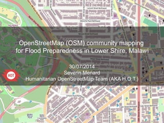
HOT OSM Community mapping in Lower Shire, Malawi
1. OpenStreetMap (OSM) community mapping
for Flood Preparedness in Lower Shire, Malawi
30/07/2014
Severin Menard
Humanitarian OpenStreetMap Team (AKA H.O.T.)
2. 1
OpenStreetMap is a web project aiming at creating a map of the entire world,
accessible, free and downloadable for anyone.
It has been started in 2004 by a student from UK.
= +
What is OpenStreetMap?
www.osm.org
It is based on the joint action of thousands of contributors working voluntarily.
Anyone can participate. +150,000 users created more than 2 billion nodes as of today.
The ongoing OSM contributions can be followed on http://live.openstreetmap.fr/
3. OSM focuses on all the visible, physical objects
like: roads, buildings, land uses, facilities (health,
education..) shops, industries, water and
sanitation, natural spaces... but also not visible
like administrative boundaries or transportation
lines.
OSM does not store information about
populations or sensitive data.
1
Mapping any feature existing in the field,
visible or not
4. 1
OSM is a free map,
not submitted to political constraints
Example in China where OSM has no random offset
5. 1
“Legal” Details
Was Licensed CC-BY-SA 2.0
Moved towards ODbL
Kate Chapman's article about OdbL:
http://www.maploser.com/2012/03/03/odbl-what-the-heck-can-you-do-with-it/
6. 1
OSM governance
The ecosystem of the OSM community
Citizens
Associations
Local governments (ex: BNPB, the National Disaster Management Agency in
Indonesia)
NGOs
International Organizations (UN, WB, USAID, AUSAid)
Academia
Private actors:
•
Microsoft, Foursquare
•
Cloudmade, Geofabrik, Camptocamp, MapBox
The growth of the OSM project is fostered by
•
OpenStreetMap Foundation & local Chapters
•
Humanitarian OpenStreetMap Team for Humanitarian/Development contexts
9. 1
La cartographie Collaborative
Idea (same as Wikipedia): A large
number of individuals contributing
together will tend to create high
quality data.
Free mapping and quality
● Validation tools within editor
Different kind of practises and
tools strengthen this:
● Quality control tools over an area
● Easy access to each step of the
history of every object
● Easy access to all the
contributions of every mapper
● Possibility to revert any bad
contribution
15. 1
OpenStreetMap and humanitarian data:
since the Haiti Earthquake in 2010
Port-au-Prince on OSM,
January 12, 2010
Port-au-Prince on OSM,
28 days later
Within a few days, the response of the OSM community to map the affected areas has
been intensive, as seen in this video.
16. 1
A new interest from the humanitarian
organizations to work with the virtual, technical
communities
18. 1
Free mapping and open data, a new
humanitarian field
Humanitarian/
Development
organizations
A NGO has been created in August 2010 to create a bridge between the
community of OSM contributors and the humanitarian and development
stakeholders.
An organization working to promote the use of open data and volunteered
geographic information within the humanitarian and development contexts
The Humanitarian OpenStreetMap Team activate a response to quickly provide
baseline data to the humanitarian stakeholders.
The Humanitarian OpenStreetMap Team also works or worked on field projects
in Indonesia (AusAID), Haiti (USAID), Senegal (IOF), Burundi, CAR, Chad,
Kenya (DG ECHO), in order to both create baseline data and build up local
capacities by training future trainers to OSM techniques.
19. 1
OSM Community Mapping in the Lower Shire
http://hot.openstreetmap.org/projects/osm_community_mapping_for_flood_preparedness_in_
From late July to late September, a team of 3 HOT contractors will carry out a project in
Malawi whose main aim is to achieve a Community Mapping Exercise for the Lower Shire,
tin the two flood-prone districts, Chikwawa and Nsanje. The objectives are as follow:
●
Hold a series of meetings and training sessions on open data and community mapping,
engaging government Departements, university students (especially from the Polytechnic
School in Blantyre), NGOs and civil society
● Apply the training by collecting geospatial data in the field in the two most flood prone
districts of Malawi (Chikhwawa and Nsanje), edit and upload it in partnership with the OSM
worldwide community that has already shown it huge impact when mapping on imagery or
editing field collected data with Field Papers
● Explain how to host the data on the Malawi Open Spatial Data Portal (MASDAP) and use it
effectively, especially by holding a training on the INASAFE tool to perform contingency
planning with the OSM data, as already made elsewhere, especially in Indonesia
● Identify and support community mobilizers to ensure sustainability of the outcomes, and
make the community autonomous, able to update and enhance the OSM data, use it when
crisis arises, and link with the local disaster management authorities and the OSM
worldwide community.
20. 1
OSM Community Mapping in the Lower Shire
http://hot.openstreetmap.org/projects/osm_community_mapping_for_flood_preparedness_in_
The time frame is as follows:
●
Week 1 (starting July 29): meetings with stakeholders in Lilongwe
● Week 2 (starting August 4): OSM training and MASDAP/OSM sessions in Lilongwe
● Week 3 (starting August 11): OSM training in Blantyre, Polytechnic School
● Weeks 4 and 5 (starting August 18): OSM field community mapping in Chikwawa district
● Weeks 6 and 7 (starting September 1): OSM field community mapping in Nsanje district
● Week 8 (starting September 15): InaSafe training in Lilongwe
35. 1
Tools to contribute in OSM:
Walking of Field Papers
http://walking-papers.org/ or http://fieldpapers.org/
Printable Map
Collect Data by Writing
Scan and Upload
Edit for OpenStreetMap
36. 1
Tools to contribute in OSM:
Survey forms fitting humanitarian
data models (ex: UNDIT for roads)
37. 1
Tools to contribute in OSM:
Editors for smartphones
OsmTracker
- Routing
- Pedestrian
- Edits/Bugs
- Edits/Bugs
& transports
Vespucci
- light online editor
- online
- Edits/Bugs
47. 1
A documented, reviewed process
http://wiki.openstreetmap.org/wiki/Import
An official agreement
signed by the owner
A documented import process
monitored by a skilled Import
Working Group
60. 1
HOT Export job covering all Malawi
http://export.hotosm.org/en/jobs/4843
61. InaSAFE Introduction
InaSAFE is a free software that produces realistic natural hazard impact
scenarios for better planning, preparedness and response activities.
64. Sourcing hazard information
Communities
frequent
events only
Communities
frequent
events only
Previous
Hazard
footprint
Previous
Hazard
footprint
UniversityUniversity Local
Government
Local
Government
National
science
agency
National
science
agency
Hazard in InaSAFE refers to a single disaster scenario
Conceptually InaSAFE combines one exposure layer such as buildings with one hazard scenario such as flooding and returns an impact layer along with textual statically summary
Conceptually InaSAFE combines one exposure layer such as buildings with one hazard scenario such as flooding and returns an impact layer along with textual statically summary
Conceptually InaSAFE combines one exposure layer such as buildings with one hazard scenario such as flooding and returns an impact layer along with textual statically summary