Downloaded 40 times
![Lasma Sietinsone [email_address] Getting started with PostGIS geographic database](https://image.slidesharecdn.com/pgintro-110831140839-phpapp02/85/Getting-Started-with-PostGIS-geographic-database-Lasma-Sietinsone-EDINA-1-320.jpg)
![Lasma Sietinsone [email_address] Getting started with PostGIS geographic database](https://image.slidesharecdn.com/pgintro-110831140839-phpapp02/75/Getting-Started-with-PostGIS-geographic-database-Lasma-Sietinsone-EDINA-1-2048.jpg)
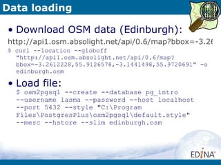
![Data Loading Standard formats: CSV, TEXT $ psql --help $ psql –h [host] –p [port] –U [user] –c “COPY [tablename] FROM [filename] WITH CSV DELIMITER ‘,’” [database] Utilities: shp2pgsql, shp2pgsql-gui: load SHP, DBF files $ shp2pgsql --help $ shp2pgsql [options] [shapefile schema.table | psql –h [host] –p [port] –U [user] [database] osm2pgsql : load OSM data $ osm2pgsql --help $ osm2pgsql [options] planet.osm $ osm2pgsql [options] planet.osm.{gz,bz2} $ osm2pgsql [options] file1.osm file2.osm file3.osm](https://image.slidesharecdn.com/pgintro-110831140839-phpapp02/85/Getting-Started-with-PostGIS-geographic-database-Lasma-Sietinsone-EDINA-11-320.jpg)
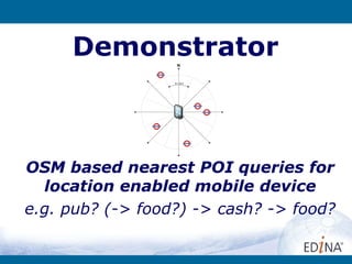

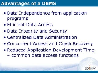
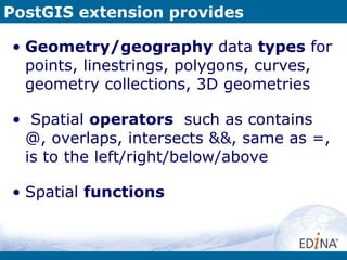
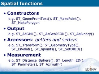
The document discusses PostGIS, a spatial extension to PostgreSQL that allows for geographic data types and functions. It provides an overview of PostGIS features like geometry types and spatial functions, and describes common workflows for loading and querying spatial data using PostGIS. The document also outlines steps for installing PostgreSQL, PostGIS and osm2pgsql to load OpenStreetMap data and perform location-based queries on amenities data.