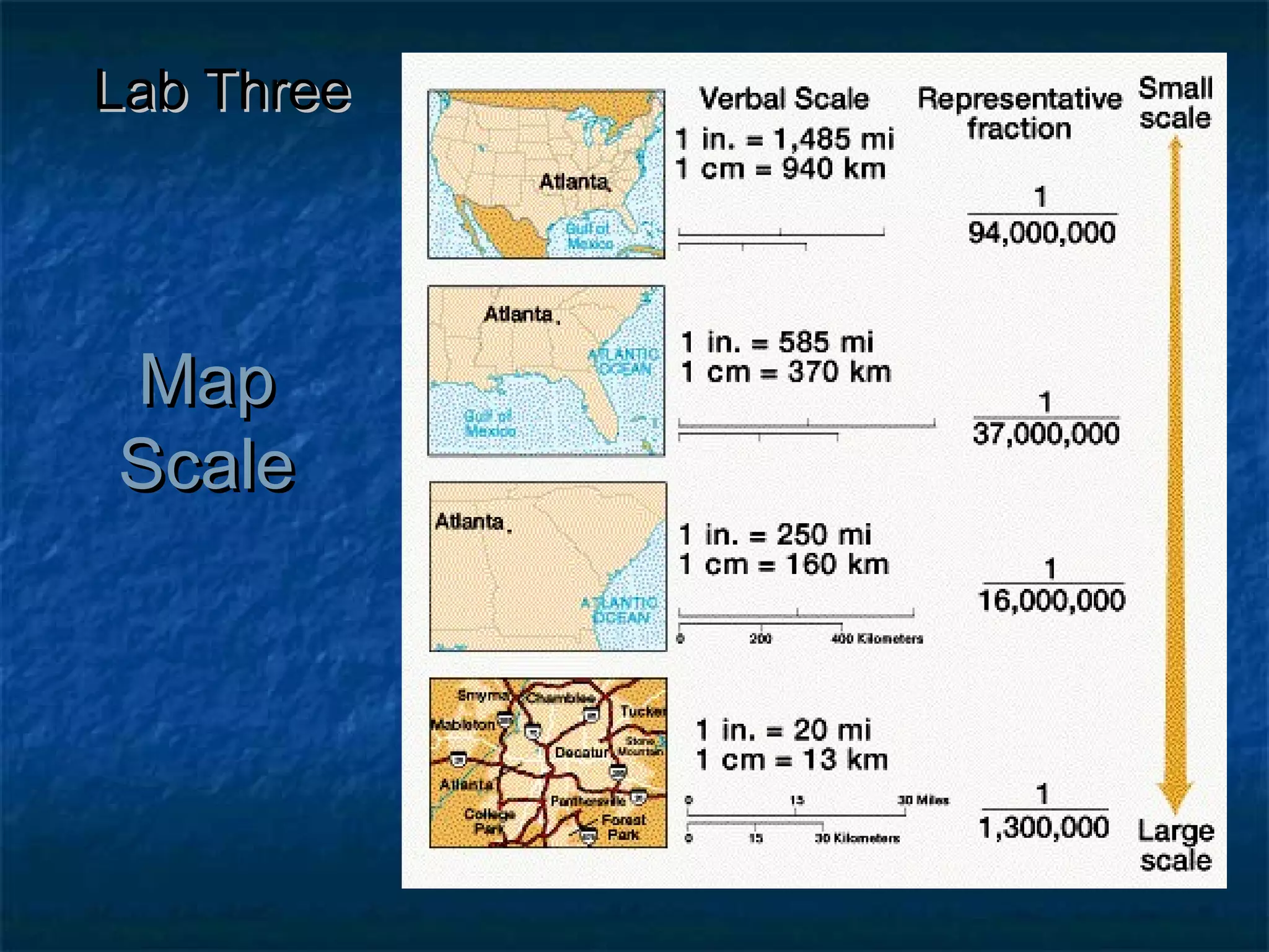
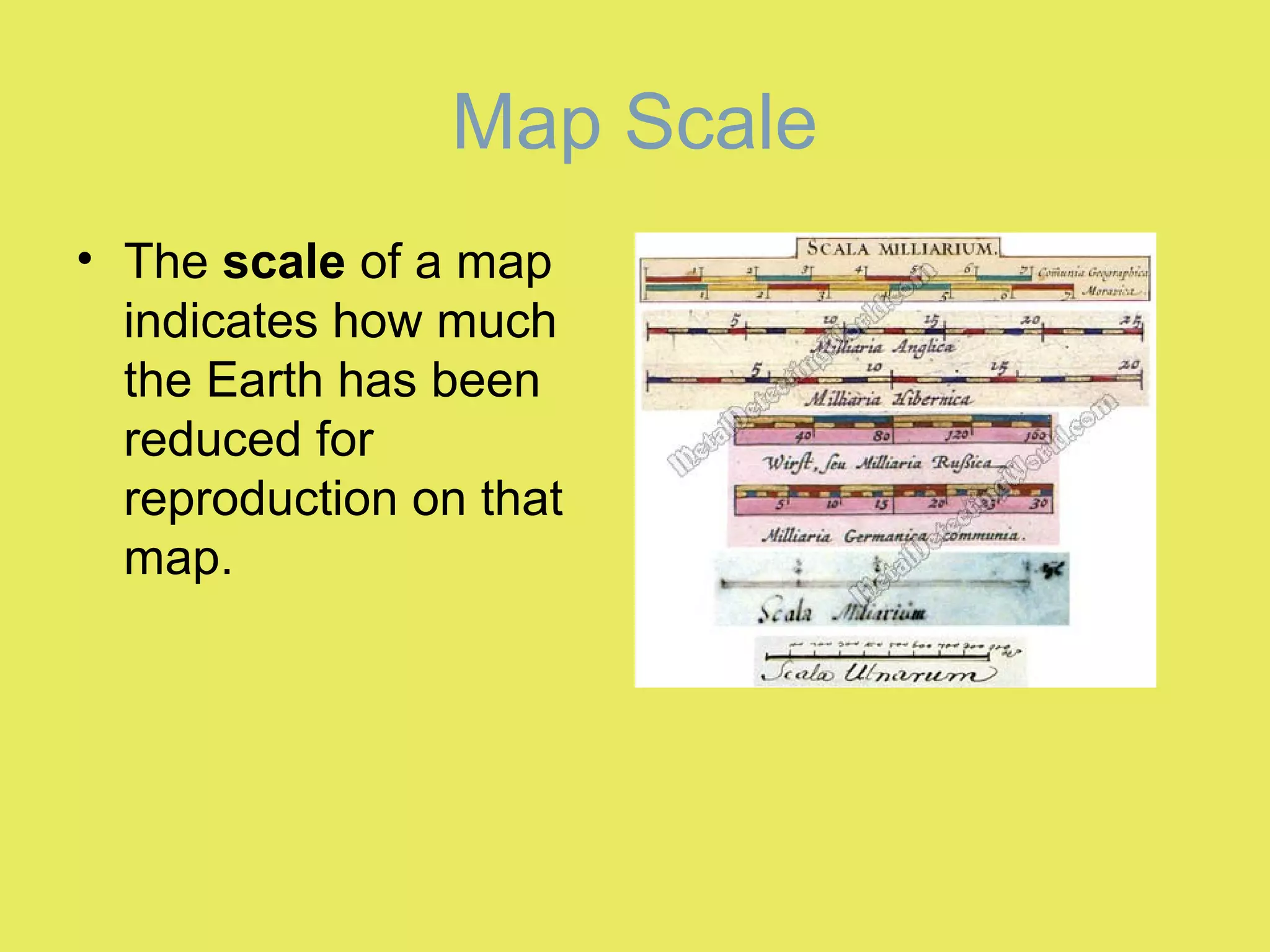
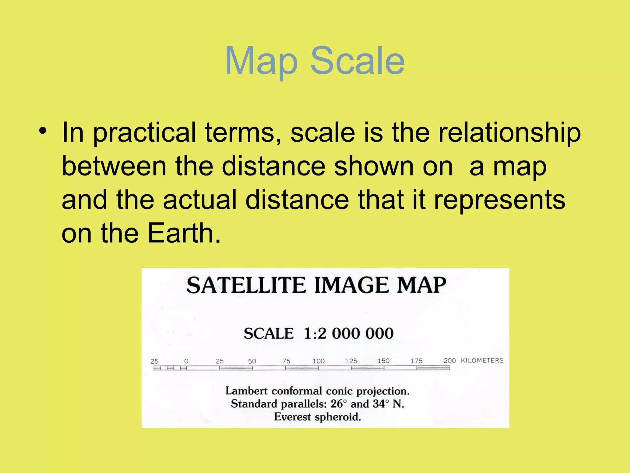
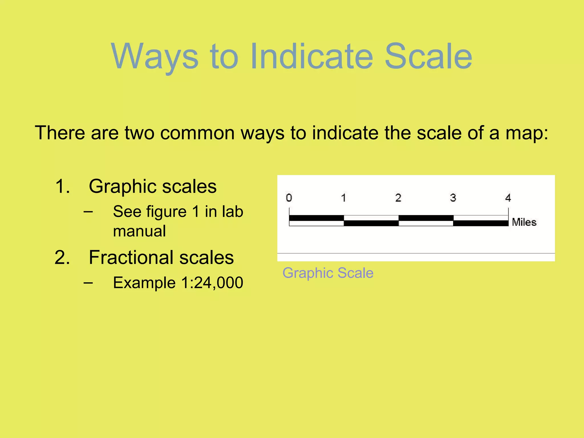
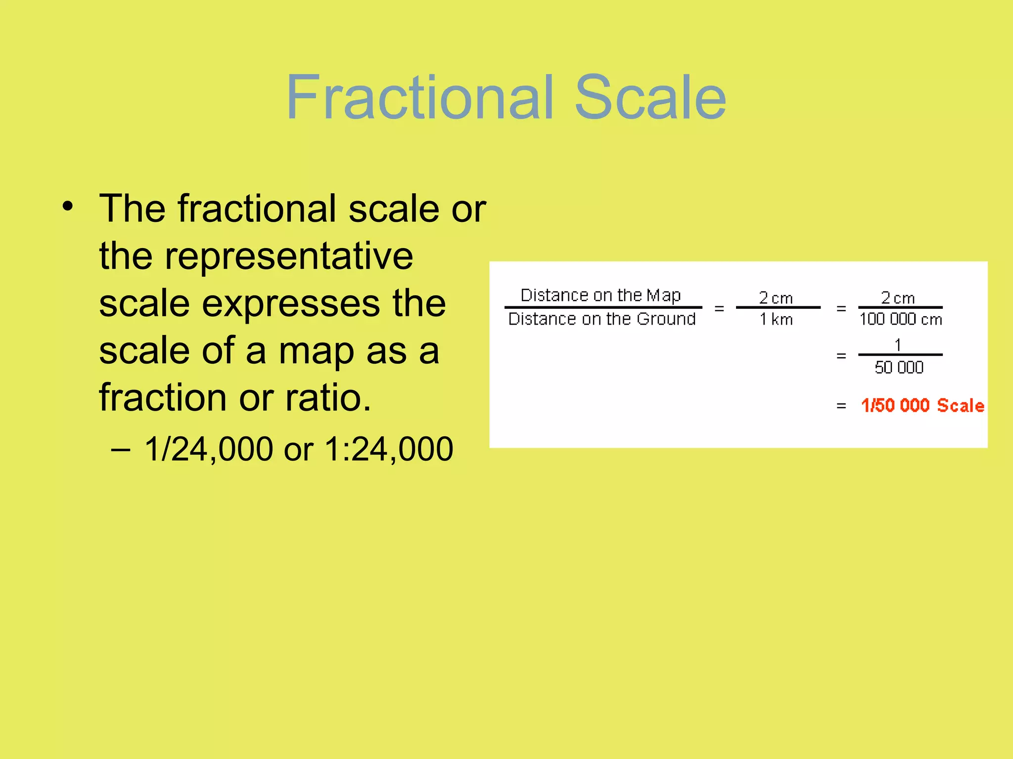
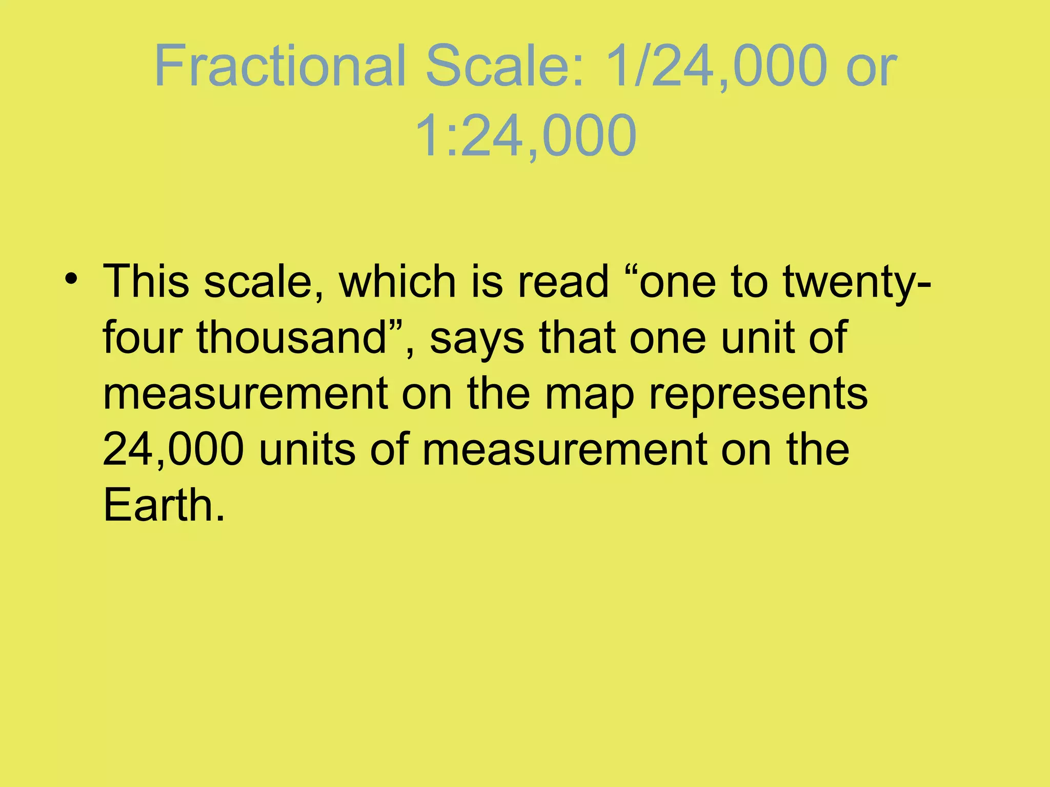
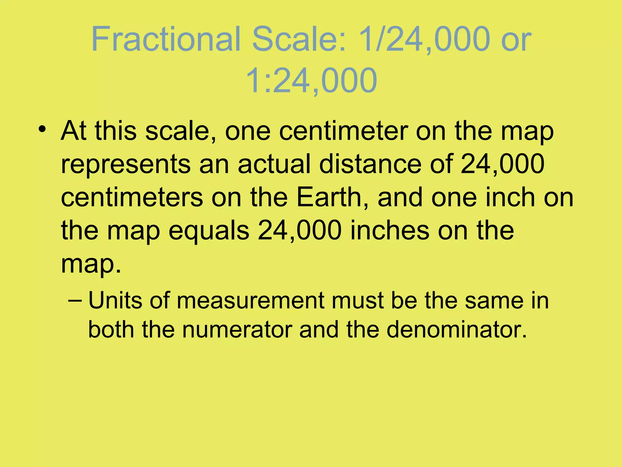
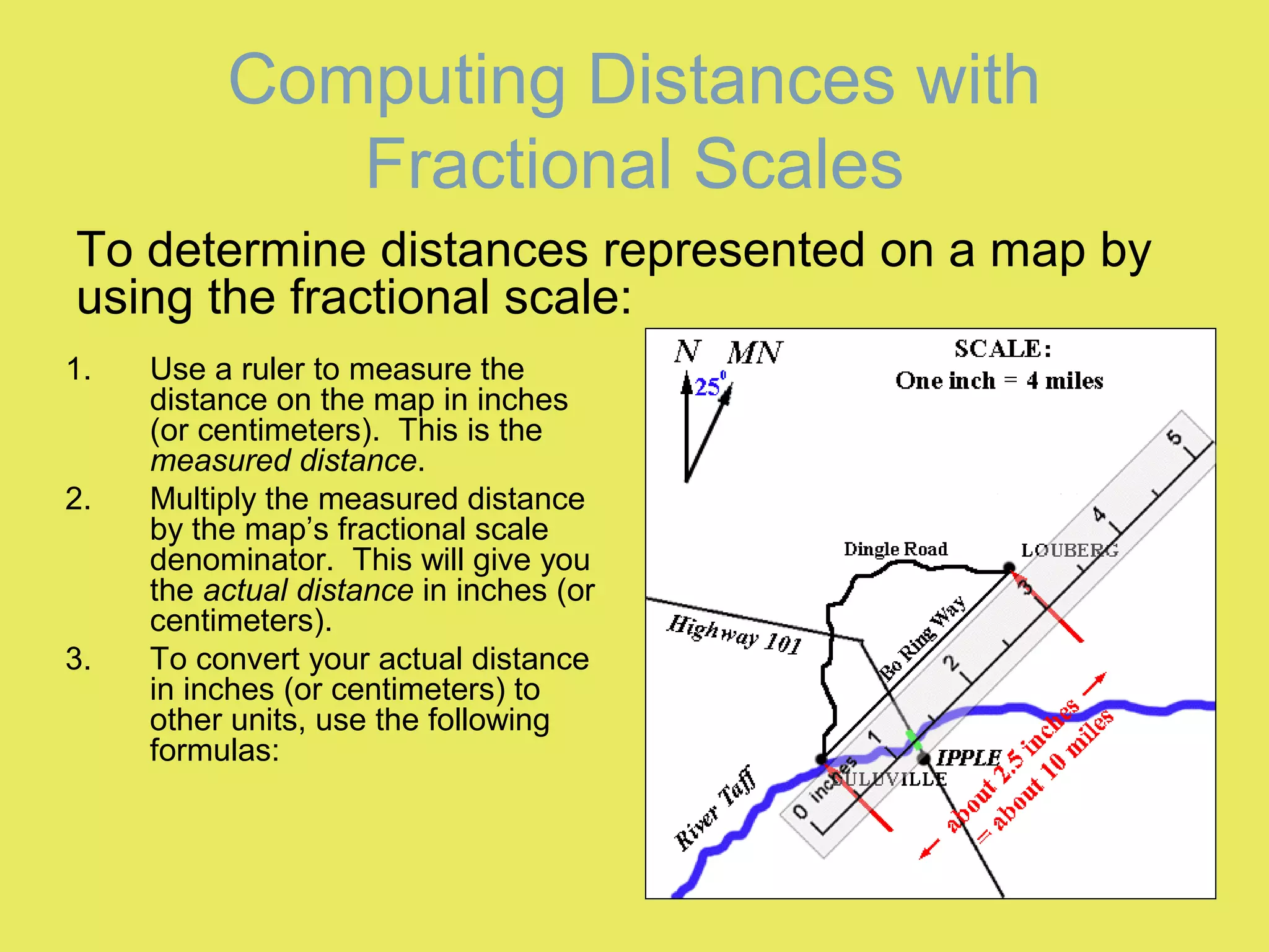
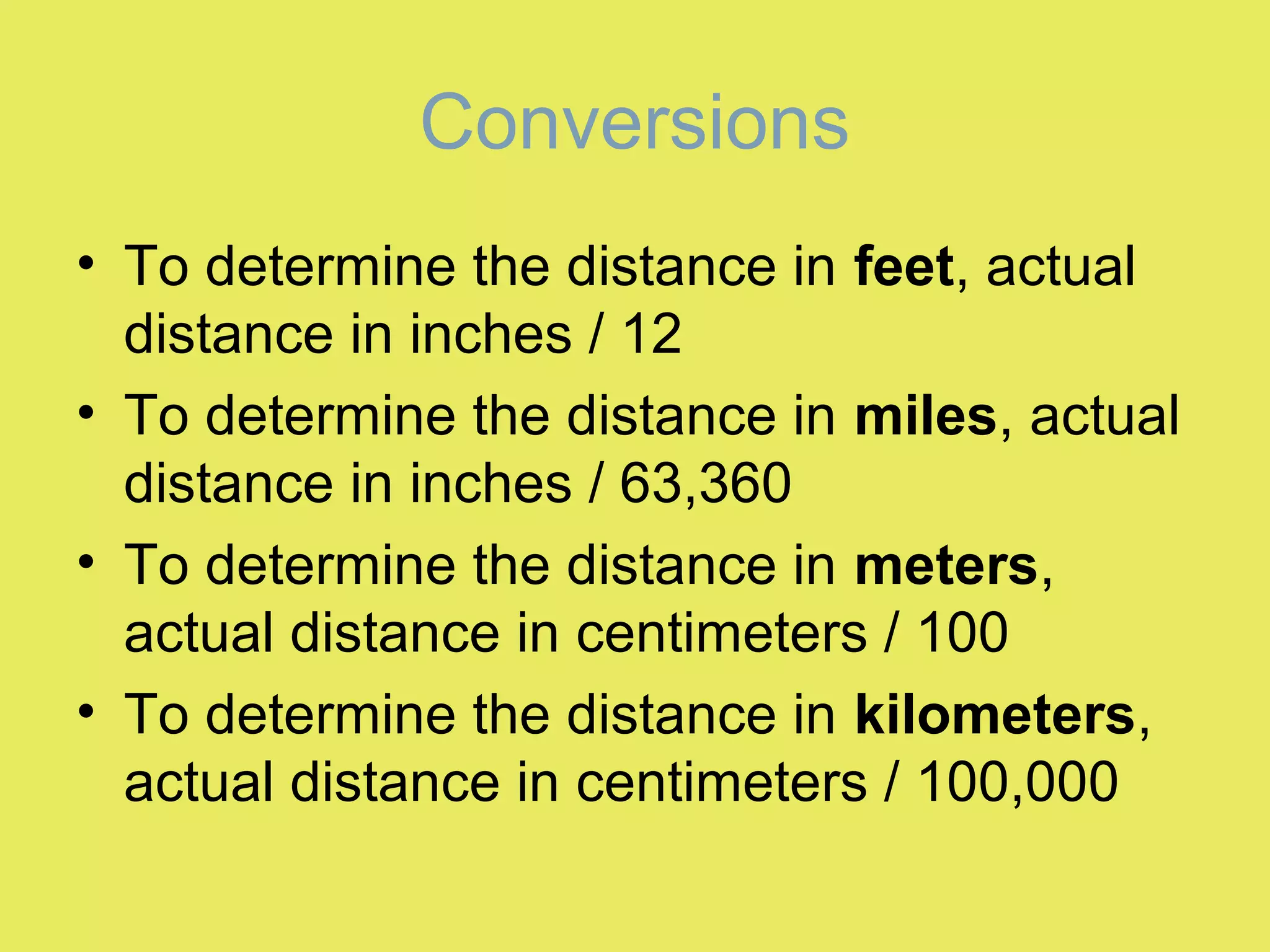
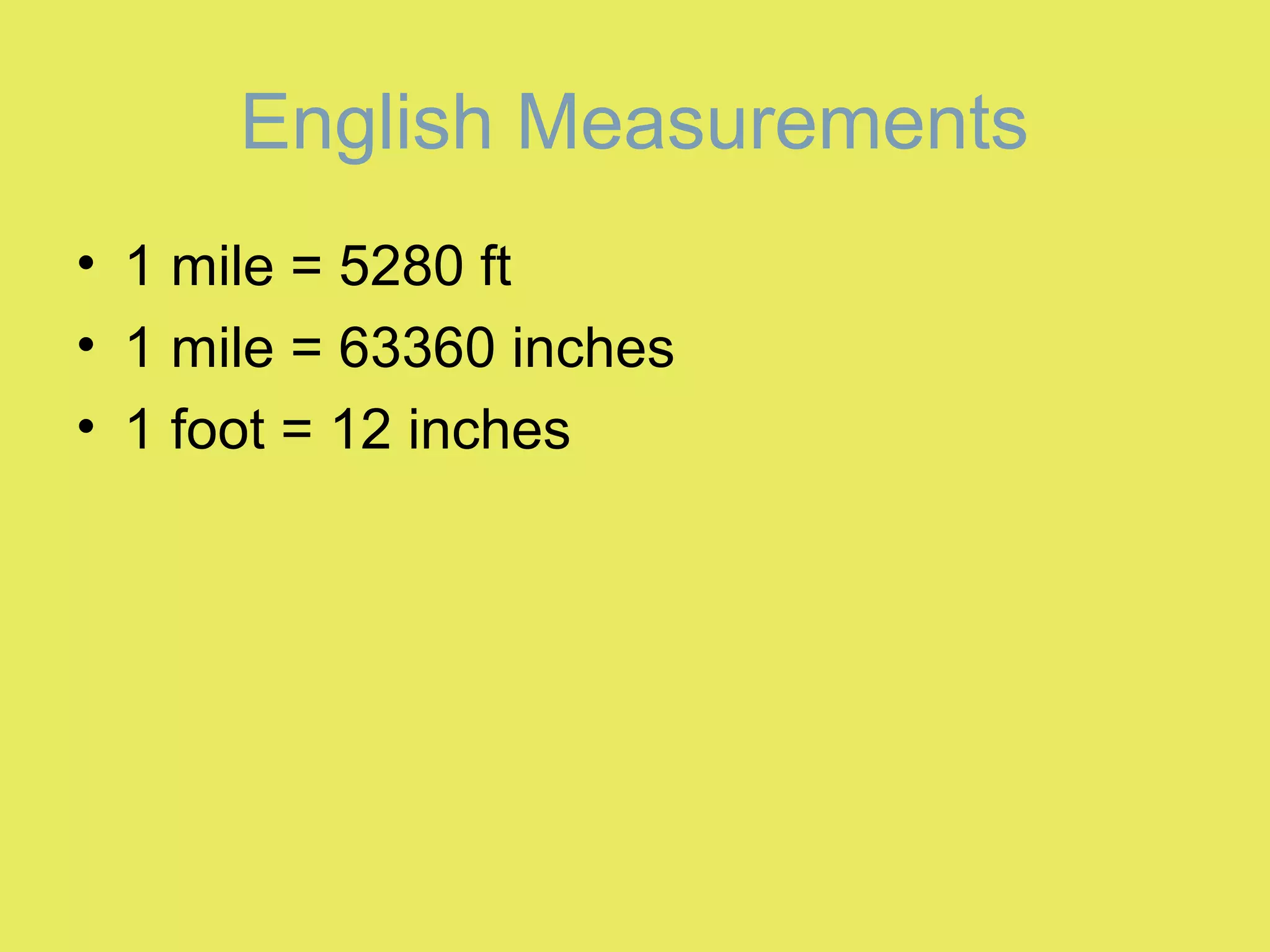
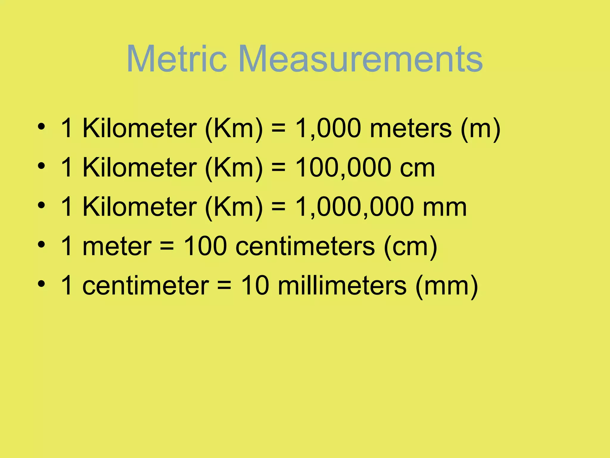
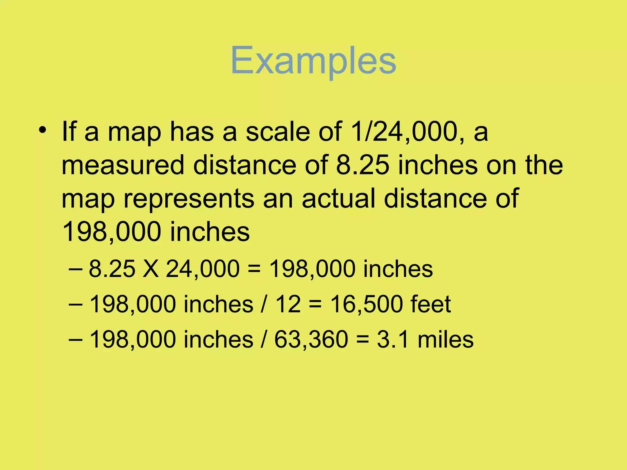
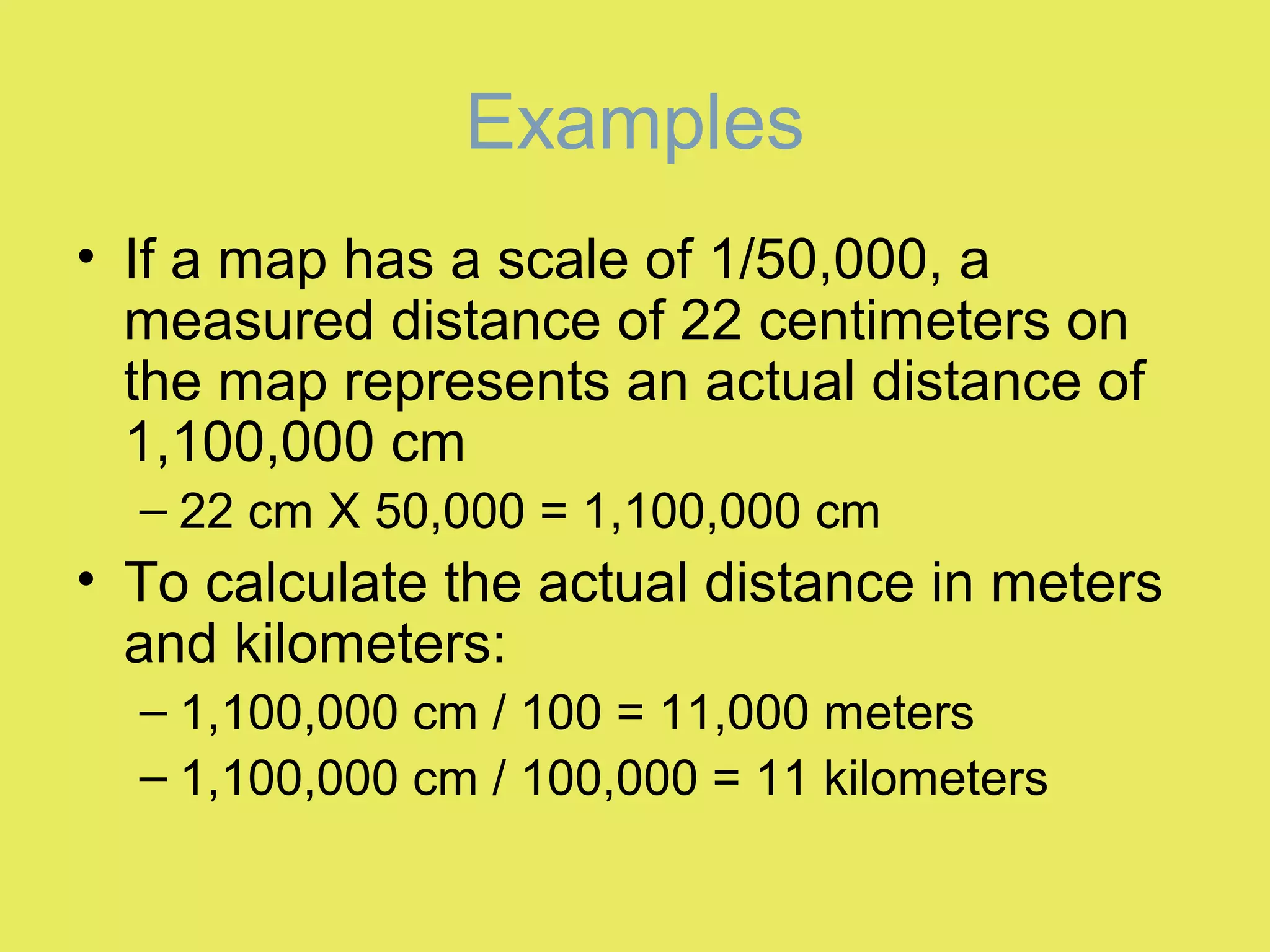
MapMap
ScaleScale
Lab ThreeLab Three
Map Scale
• The scale of a map
indicates how much
the Earth has been
reduced for
reproduction on that
map.
• In practical terms, scale is the relationship
between the distance shown on a map
and the actual distance that it represents
on the Earth.
Map Scale
Ways to Indicate Scale
1. Graphic scales
– See figure 1 in lab
manual
2. Fractional scales
– Example 1:24,000
Graphic Scale
There are two common ways to indicate the scale of a map:
Graphic Scales
• The graphic scale of a
map is a bar graph
graduates by
distance.
– Figure one in the lab
manual shows the
graphic map scale
from a U.S. Geological
Survey topographic
map.
• To use a graphic scale, simply measure a
distance on the map (or mark off the
distance on the edge of a piece of paper),
then compare the measured distance to
the bar graph to determine the actual
distance represented.
Graphic Scales
On some graphic scales, “zero” is not at the far left, this
is to make it easier to read fractions.
Graphic Scales
• Graphic scales are useful since they
remain accurate even if the map is
enlarged or reduced.
Graphic Scales
Fractional Scale
• The fractional scale or
the representative
scale expresses the
scale of a map as a
fraction or ratio.
– 1/24,000 or 1:24,000
Fractional Scale: 1/24,000 or
1:24,000
• This scale, which is read “one to twenty-
four thousand”, says that one unit of
measurement on the map represents
24,000 units of measurement on the
Earth.
• At this scale, one centimeter on the map
represents an actual distance of 24,000
centimeters on the Earth, and one inch on
the map equals 24,000 inches on the
map.
– Units of measurement must be the same in
both the numerator and the denominator.
Fractional Scale: 1/24,000 or
1:24,000
Computing Distances with
Fractional Scales
1. Use a ruler to measure the
distance on the map in inches
(or centimeters). This is the
measured distance.
2. Multiply the measured distance
by the map’s fractional scale
denominator. This will give you
the actual distance in inches (or
centimeters).
3. To convert your actual distance
in inches (or centimeters) to
other units, use the following
formulas:
To determine distances represented on a map by
using the fractional scale:
Conversions
• To determine the distance in feet, actual
distance in inches / 12
• To determine the distance in miles, actual
distance in inches / 63,360
• To determine the distance in meters,
actual distance in centimeters / 100
• To determine the distance in kilometers,
actual distance in centimeters / 100,000
English Measurements
• 1 mile = 5280 ft
• 1 mile = 63360 inches
• 1 foot = 12 inches
Metric Measurements
• 1 Kilometer (Km) = 1,000 meters (m)
• 1 Kilometer (Km) = 100,000 cm
• 1 Kilometer (Km) = 1,000,000 mm
• 1 meter = 100 centimeters (cm)
• 1 centimeter = 10 millimeters (mm)
Examples
• If a map has a scale of 1/24,000, a
measured distance of 8.25 inches on the
map represents an actual distance of
198,000 inches
– 8.25 X 24,000 = 198,000 inches
– 198,000 inches / 12 = 16,500 feet
– 198,000 inches / 63,360 = 3.1 miles
Examples
• If a map has a scale of 1/50,000, a
measured distance of 22 centimeters on
the map represents an actual distance of
1,100,000 cm
– 22 cm X 50,000 = 1,100,000 cm
• To calculate the actual distance in meters
and kilometers:
– 1,100,000 cm / 100 = 11,000 meters
– 1,100,000 cm / 100,000 = 11 kilometers
Large Versus Small Scale Maps
• Large scale maps refer to maps with a relatively large
representative fraction such as 1/10,000.
– Large scale maps show a small area of the Earth in great detail.
• Small scale maps refer to maps with a relatively small
representative fraction like 1/1,000,000.
– Small scale maps show large areas in less detail.
Small Scale Medium Scale Large Scale

Lab three map scale

  • 1.
  • 2.
    Map Scale • Thescale of a map indicates how much the Earth has been reduced for reproduction on that map.
  • 3.
    • In practicalterms, scale is the relationship between the distance shown on a map and the actual distance that it represents on the Earth. Map Scale
  • 4.
    Ways to IndicateScale 1. Graphic scales – See figure 1 in lab manual 2. Fractional scales – Example 1:24,000 Graphic Scale There are two common ways to indicate the scale of a map:
  • 5.
    Graphic Scales • Thegraphic scale of a map is a bar graph graduates by distance. – Figure one in the lab manual shows the graphic map scale from a U.S. Geological Survey topographic map.
  • 6.
    • To usea graphic scale, simply measure a distance on the map (or mark off the distance on the edge of a piece of paper), then compare the measured distance to the bar graph to determine the actual distance represented. Graphic Scales
  • 7.
    On some graphicscales, “zero” is not at the far left, this is to make it easier to read fractions. Graphic Scales
  • 8.
    • Graphic scalesare useful since they remain accurate even if the map is enlarged or reduced. Graphic Scales
  • 9.
    Fractional Scale • Thefractional scale or the representative scale expresses the scale of a map as a fraction or ratio. – 1/24,000 or 1:24,000
  • 10.
    Fractional Scale: 1/24,000or 1:24,000 • This scale, which is read “one to twenty- four thousand”, says that one unit of measurement on the map represents 24,000 units of measurement on the Earth.
  • 11.
    • At thisscale, one centimeter on the map represents an actual distance of 24,000 centimeters on the Earth, and one inch on the map equals 24,000 inches on the map. – Units of measurement must be the same in both the numerator and the denominator. Fractional Scale: 1/24,000 or 1:24,000
  • 12.
    Computing Distances with FractionalScales 1. Use a ruler to measure the distance on the map in inches (or centimeters). This is the measured distance. 2. Multiply the measured distance by the map’s fractional scale denominator. This will give you the actual distance in inches (or centimeters). 3. To convert your actual distance in inches (or centimeters) to other units, use the following formulas: To determine distances represented on a map by using the fractional scale:
  • 13.
    Conversions • To determinethe distance in feet, actual distance in inches / 12 • To determine the distance in miles, actual distance in inches / 63,360 • To determine the distance in meters, actual distance in centimeters / 100 • To determine the distance in kilometers, actual distance in centimeters / 100,000
  • 14.
    English Measurements • 1mile = 5280 ft • 1 mile = 63360 inches • 1 foot = 12 inches
  • 15.
    Metric Measurements • 1Kilometer (Km) = 1,000 meters (m) • 1 Kilometer (Km) = 100,000 cm • 1 Kilometer (Km) = 1,000,000 mm • 1 meter = 100 centimeters (cm) • 1 centimeter = 10 millimeters (mm)
  • 16.
    Examples • If amap has a scale of 1/24,000, a measured distance of 8.25 inches on the map represents an actual distance of 198,000 inches – 8.25 X 24,000 = 198,000 inches – 198,000 inches / 12 = 16,500 feet – 198,000 inches / 63,360 = 3.1 miles
  • 17.
    Examples • If amap has a scale of 1/50,000, a measured distance of 22 centimeters on the map represents an actual distance of 1,100,000 cm – 22 cm X 50,000 = 1,100,000 cm • To calculate the actual distance in meters and kilometers: – 1,100,000 cm / 100 = 11,000 meters – 1,100,000 cm / 100,000 = 11 kilometers
  • 18.
    Large Versus SmallScale Maps • Large scale maps refer to maps with a relatively large representative fraction such as 1/10,000. – Large scale maps show a small area of the Earth in great detail. • Small scale maps refer to maps with a relatively small representative fraction like 1/1,000,000. – Small scale maps show large areas in less detail. Small Scale Medium Scale Large Scale