Download as PDF, PPTX
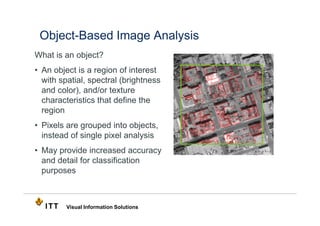


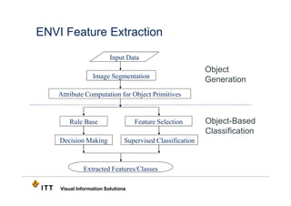
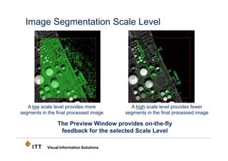
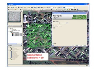


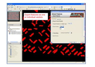


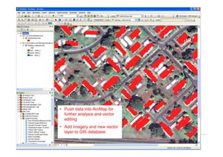


Object-based image analysis (OBIA) groups pixels into objects and then classifies those objects rather than individual pixels. It uses both spectral and spatial/textural attributes of pixels within objects to improve accuracy over traditional pixel-based classification. ENVI software provides a tool for OBIA that allows image segmentation, attribute computation, rule-based or supervised classification of objects, and export of classified vectors.