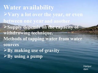
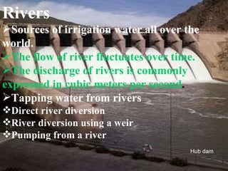
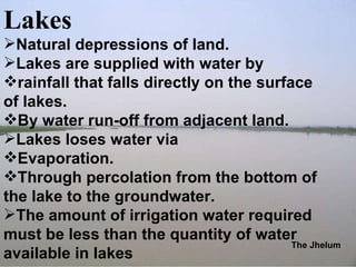
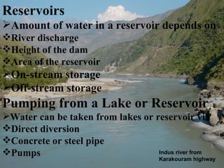
WELCOME TO WATER SOURCES
Ravi Introduction Water covers 71% of the earth’s surface Water moves continually through a cycle of evaporation, precipitation and runoff Essential for all forms of life.
Water sources Sources from which water is available for water supply schemes are called water sources. The most common sources of water for irrigation includes: Surface Water (Rivers, Reservoirs and Lakes). Ground water. the chanab
Surface water Water in a river, lake or fresh water wetland. Naturally replenished by precipitation, lost through discharge to the oceans, evaporation, and subsurface seepage. The total quantity of water in a system may depends on Storage capacity Permeability Runoff Precipitation and evaporation rate Human activities can have large and devastating impact on these factor by increase storage capacity by Constructing dam Decrease it by draining wetlands
Total quantity of available water depends on seasons like Winter Summer Humans can cause surface water to be “lost” (i.e. become unusable) through pollution. Desalination Artificial process by which Saline water is converted into fresh water Distillation and reverse osmosis Expensive process
Water availability Vary a lot over the year, or even between one year   and another Supply depends on the capacity of withdrawing technique. Methods of tapping water from water sources By making use of gravity By using a pump Haripur dam
Rivers Sources of irrigation water all over the world. The flow of river fluctuates over time. The discharge of rivers is commonly expressed in cubic meters per second . Tapping water from rivers Direct river diversion River diversion using a weir Pumping from a river Hub dam
Lakes Natural depressions of land. Lakes are supplied with water by rainfall that falls directly on the surface of lakes. By water run-off from adjacent land. Lakes loses water via  Evaporation. Through percolation from the bottom of the lake to the groundwater. The amount of irrigation water required must be less than the quantity of water available in lakes The Jhelum
Reservoirs Amount of water in a reservoir depends on River discharge  Height of the dam Area of the reservoir On-stream storage Off-stream storage Pumping from a Lake or Reservoir Water can be taken from lakes or reservoir via Direct diversion Concrete or steel pipe Pumps Indus river from Karakouram highway
Groundwater An important source of irrigation water Groundwater may be found close to the surface or at profound depth In coastal plains the groundwater is often brackish or saline due to the proximity of the sea Inland groundwater may also be brackish in places where the soil contains many soluble salts Pumping from wells To tap groundwater a well must be dig deeper than the groundwater level. Shallow groundwater Deep groundwater Kabul attock
Surface water of Pakistan The Ravi
Dams Before Partition:   Khushdil Khan Dam (1890). Spin Karaiz (1945). Namal Dam (1913). After Partition: Mangla Dam. Tarbela Dam . Mangla dam
Rivers Water Sources measurement at Rim Station. Rim Station Indus Rivers Brings 154 MAF of Water annually (144.91 MAF from Western Rivers and 9.14 MAF from Eastern River). 104.73 MAF used for irrigation. 39.4 MAF flows to sea. 9.9 MAF is consumed by the system losses. s Sutlej river
It comprises of  Major reservoirs : 3 Barrages : 16 Head Works : 2 Siphons : 2  Inter river link canals : 12 Canal system : 44  Punjab : 23 Sindh : 14 NWFP : 5 Balochistan : 2 Watercourses : 107,000 Aggregate length of canals is about 56,073 km. Watercourses, Form Channels and Field Ditches, covers 1.6 million km. Tube wells : 500,000 The chanab
Ground Water  Sindh  and Balochistan : 40 ft depth. Rachna Doab : 100 ft  . 1950’s SCARP introduced deep tube wells to control salinity and water logging.  Within 30 years 13,500 tube wells were installed (9300 in Punjab). Now about 41.6 MAF water supply is from 500,000 tube wells . In Punjab 79%, in Sindh 28% of the area is underline by freshwater. Ground water become a major supplement of canal supplies  in last 25-30 years. Tarbela spillway
Quality of ground water. Fresh (salinity less than 1000 mg / l TDS). Saline (salinity less than 3000 mg / l TDS). Punjab 79% fresh water. 9.78 million acres are underline with ground water of less than 1000 mg/ l TDS. 3 million acres with salinity ranging from 1000-3000 mg / l  TDS.  3.26 million acres with salinity more than 3000 mg / l TDS. Saline water in central Doab area. Brackish water in Cholistan area. Ground water with high fluoride contents in Kasur, Mianwali and Bhawalpur Rawal dam
Sindh 28 % fresh groundwater. Found at depth of 20-25 m. Large area with groundwater of poor quality. Thar, Nara and Kohistan with non-portable, highly brackish water. Tharparker and Umerkot with high fluoride contents in ground water . NWFP In  NWFP, certain areas such as Karak, Kohat , Bannu and D.I. khan has lowered the water table and resulted in contamination. Balochistan Makran coastal zone with highly brackish groundwater. Local communities use groundwater with TDS as high as 3000 mg / l for drinking purposes.  Mastung Valley, Makran Coast and Kharan with high flouride contents in groundwater. Lahore canal
THANK YOU

Water sources

  • 1.
  • 2.
    Ravi Introduction Watercovers 71% of the earth’s surface Water moves continually through a cycle of evaporation, precipitation and runoff Essential for all forms of life.
  • 3.
    Water sources Sourcesfrom which water is available for water supply schemes are called water sources. The most common sources of water for irrigation includes: Surface Water (Rivers, Reservoirs and Lakes). Ground water. the chanab
  • 4.
    Surface water Waterin a river, lake or fresh water wetland. Naturally replenished by precipitation, lost through discharge to the oceans, evaporation, and subsurface seepage. The total quantity of water in a system may depends on Storage capacity Permeability Runoff Precipitation and evaporation rate Human activities can have large and devastating impact on these factor by increase storage capacity by Constructing dam Decrease it by draining wetlands
  • 5.
    Total quantity ofavailable water depends on seasons like Winter Summer Humans can cause surface water to be “lost” (i.e. become unusable) through pollution. Desalination Artificial process by which Saline water is converted into fresh water Distillation and reverse osmosis Expensive process
  • 6.
    Water availability Varya lot over the year, or even between one year and another Supply depends on the capacity of withdrawing technique. Methods of tapping water from water sources By making use of gravity By using a pump Haripur dam
  • 7.
    Rivers Sources ofirrigation water all over the world. The flow of river fluctuates over time. The discharge of rivers is commonly expressed in cubic meters per second . Tapping water from rivers Direct river diversion River diversion using a weir Pumping from a river Hub dam
  • 8.
    Lakes Natural depressionsof land. Lakes are supplied with water by rainfall that falls directly on the surface of lakes. By water run-off from adjacent land. Lakes loses water via Evaporation. Through percolation from the bottom of the lake to the groundwater. The amount of irrigation water required must be less than the quantity of water available in lakes The Jhelum
  • 9.
    Reservoirs Amount ofwater in a reservoir depends on River discharge Height of the dam Area of the reservoir On-stream storage Off-stream storage Pumping from a Lake or Reservoir Water can be taken from lakes or reservoir via Direct diversion Concrete or steel pipe Pumps Indus river from Karakouram highway
  • 10.
    Groundwater An importantsource of irrigation water Groundwater may be found close to the surface or at profound depth In coastal plains the groundwater is often brackish or saline due to the proximity of the sea Inland groundwater may also be brackish in places where the soil contains many soluble salts Pumping from wells To tap groundwater a well must be dig deeper than the groundwater level. Shallow groundwater Deep groundwater Kabul attock
  • 11.
    Surface water ofPakistan The Ravi
  • 12.
    Dams Before Partition: Khushdil Khan Dam (1890). Spin Karaiz (1945). Namal Dam (1913). After Partition: Mangla Dam. Tarbela Dam . Mangla dam
  • 13.
    Rivers Water Sourcesmeasurement at Rim Station. Rim Station Indus Rivers Brings 154 MAF of Water annually (144.91 MAF from Western Rivers and 9.14 MAF from Eastern River). 104.73 MAF used for irrigation. 39.4 MAF flows to sea. 9.9 MAF is consumed by the system losses. s Sutlej river
  • 14.
    It comprises of Major reservoirs : 3 Barrages : 16 Head Works : 2 Siphons : 2 Inter river link canals : 12 Canal system : 44 Punjab : 23 Sindh : 14 NWFP : 5 Balochistan : 2 Watercourses : 107,000 Aggregate length of canals is about 56,073 km. Watercourses, Form Channels and Field Ditches, covers 1.6 million km. Tube wells : 500,000 The chanab
  • 15.
    Ground Water Sindh and Balochistan : 40 ft depth. Rachna Doab : 100 ft . 1950’s SCARP introduced deep tube wells to control salinity and water logging. Within 30 years 13,500 tube wells were installed (9300 in Punjab). Now about 41.6 MAF water supply is from 500,000 tube wells . In Punjab 79%, in Sindh 28% of the area is underline by freshwater. Ground water become a major supplement of canal supplies in last 25-30 years. Tarbela spillway
  • 16.
    Quality of groundwater. Fresh (salinity less than 1000 mg / l TDS). Saline (salinity less than 3000 mg / l TDS). Punjab 79% fresh water. 9.78 million acres are underline with ground water of less than 1000 mg/ l TDS. 3 million acres with salinity ranging from 1000-3000 mg / l TDS. 3.26 million acres with salinity more than 3000 mg / l TDS. Saline water in central Doab area. Brackish water in Cholistan area. Ground water with high fluoride contents in Kasur, Mianwali and Bhawalpur Rawal dam
  • 17.
    Sindh 28 %fresh groundwater. Found at depth of 20-25 m. Large area with groundwater of poor quality. Thar, Nara and Kohistan with non-portable, highly brackish water. Tharparker and Umerkot with high fluoride contents in ground water . NWFP In NWFP, certain areas such as Karak, Kohat , Bannu and D.I. khan has lowered the water table and resulted in contamination. Balochistan Makran coastal zone with highly brackish groundwater. Local communities use groundwater with TDS as high as 3000 mg / l for drinking purposes. Mastung Valley, Makran Coast and Kharan with high flouride contents in groundwater. Lahore canal
  • 18.