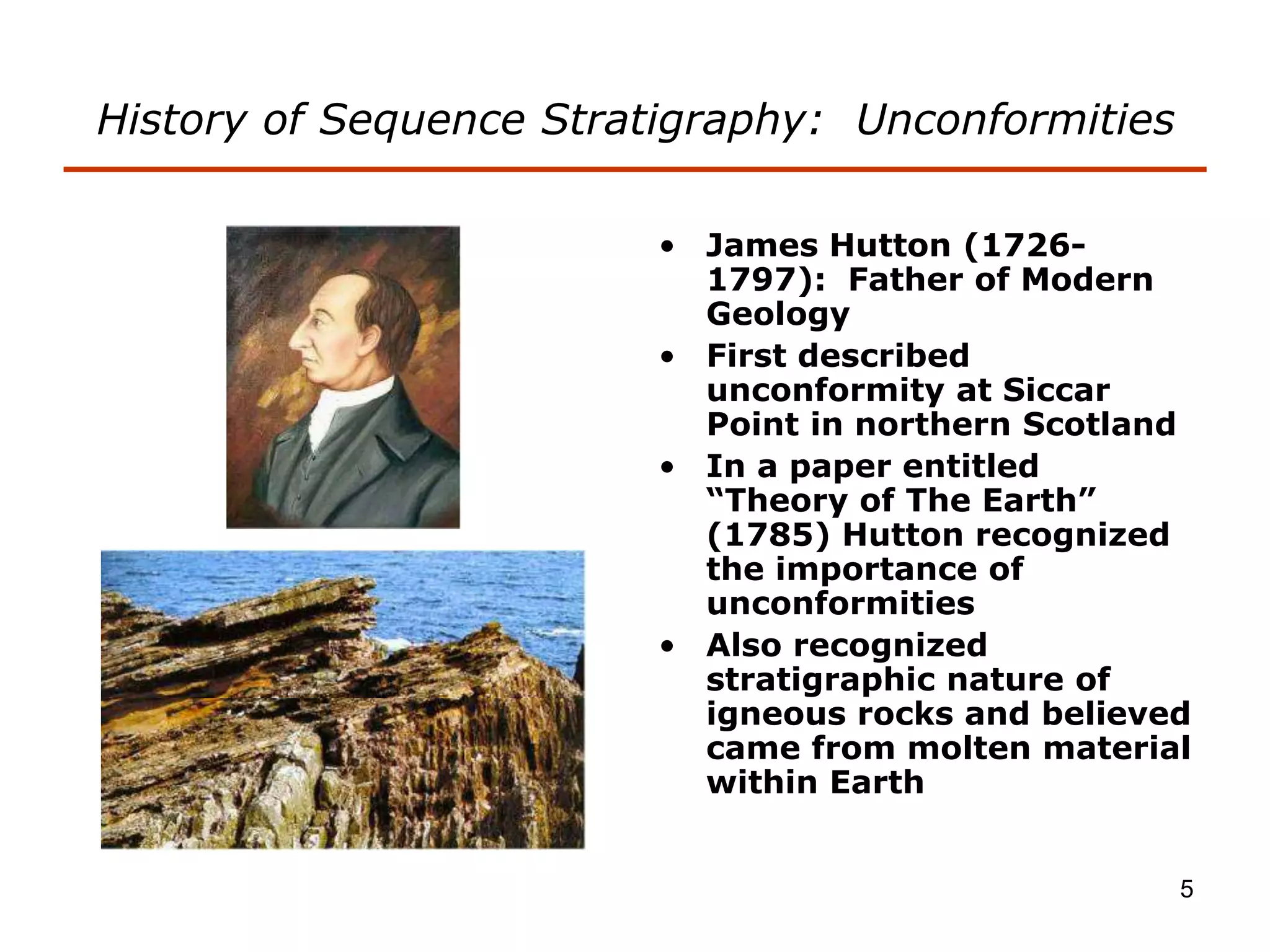
Stratigraphic principles and sequence stratigraphy are methods used to analyze sedimentary rock layers and impose a temporal dimension. Key concepts include:
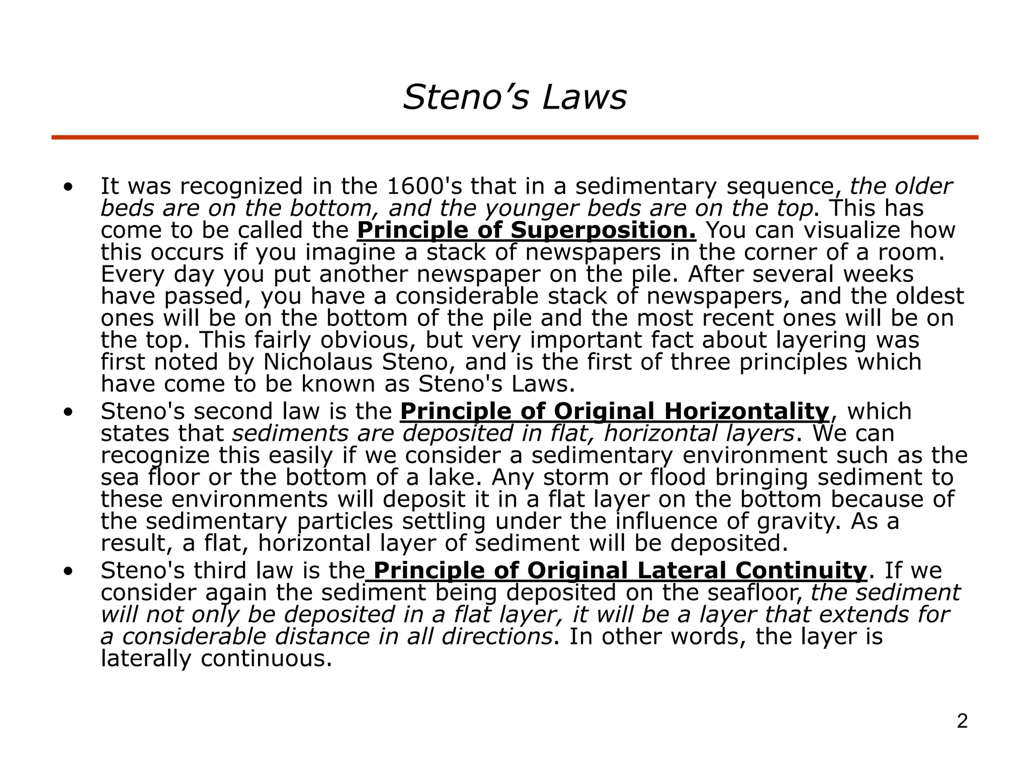
- Steno's laws of superposition, original horizontality, and lateral continuity which describe how sedimentary layers are deposited.
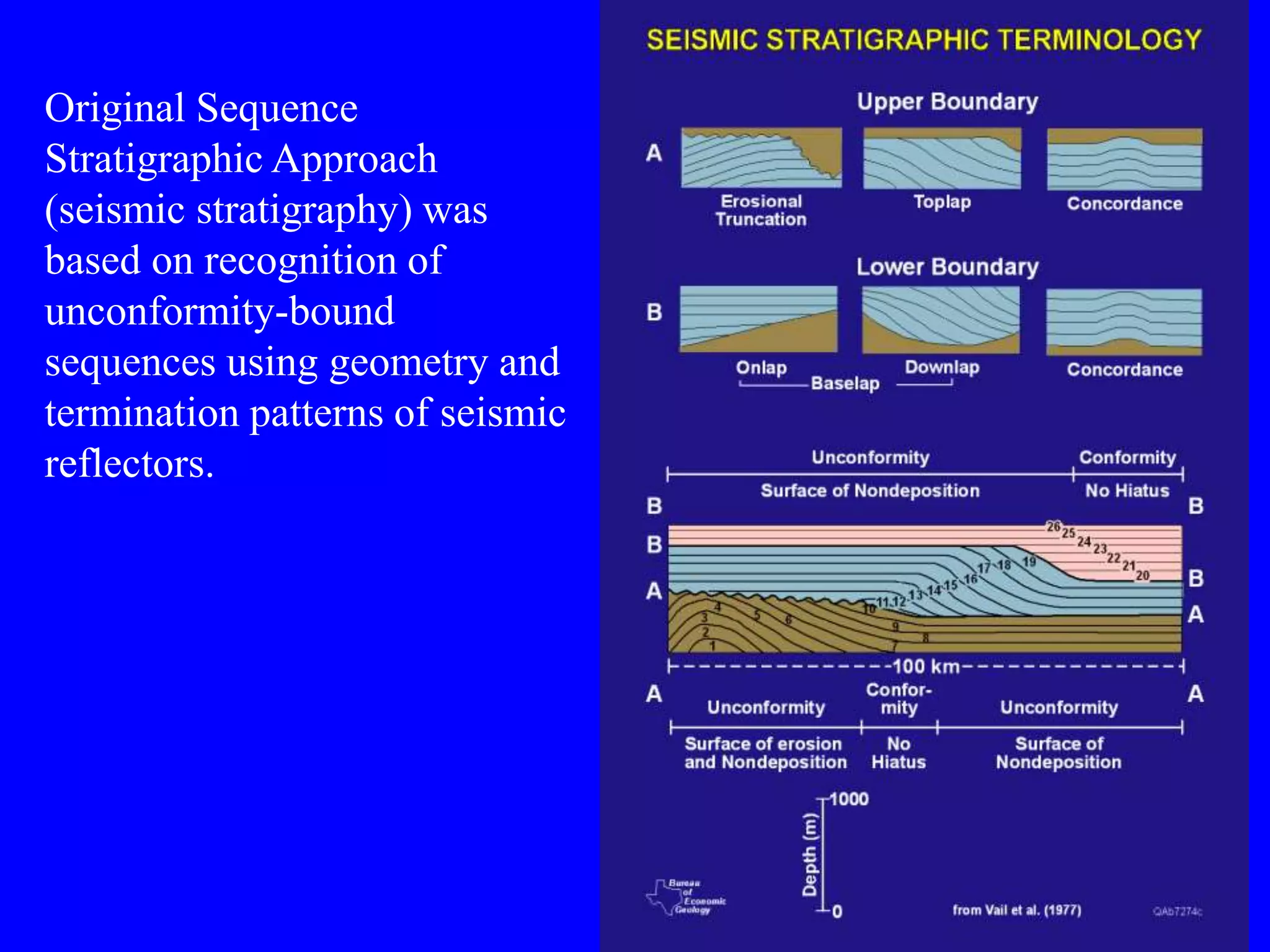
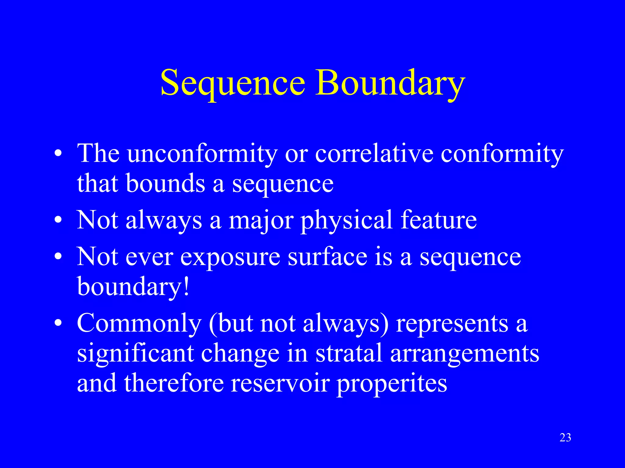
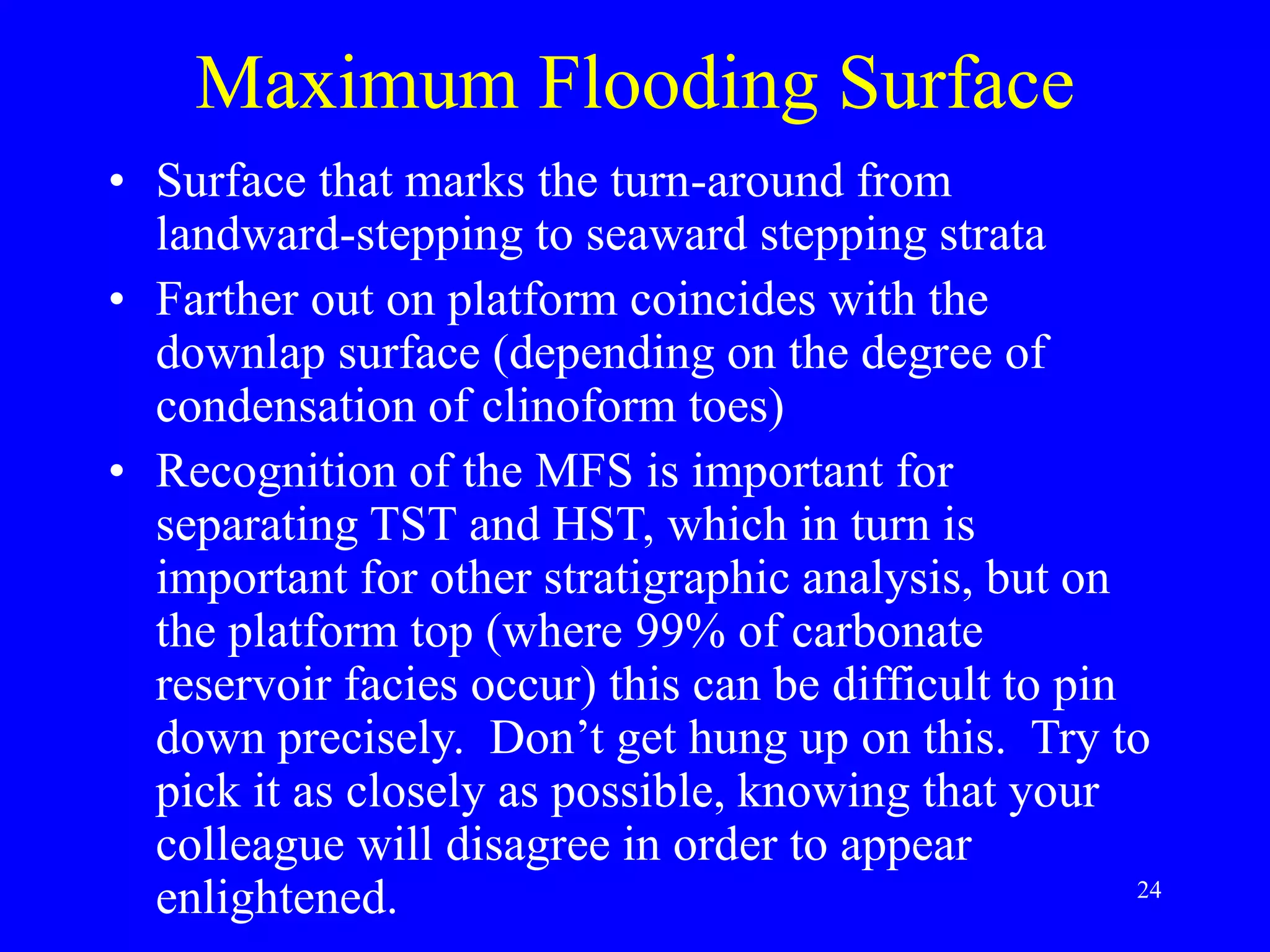
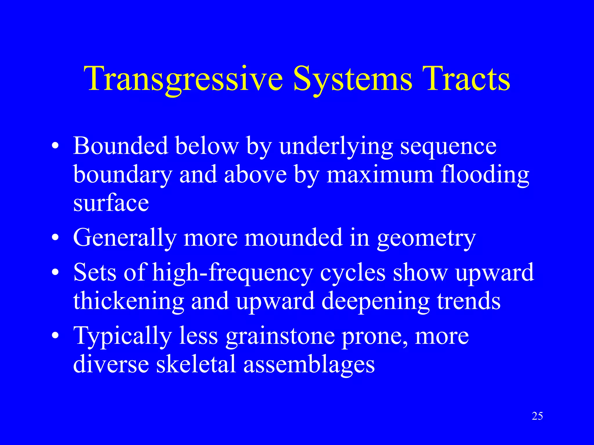
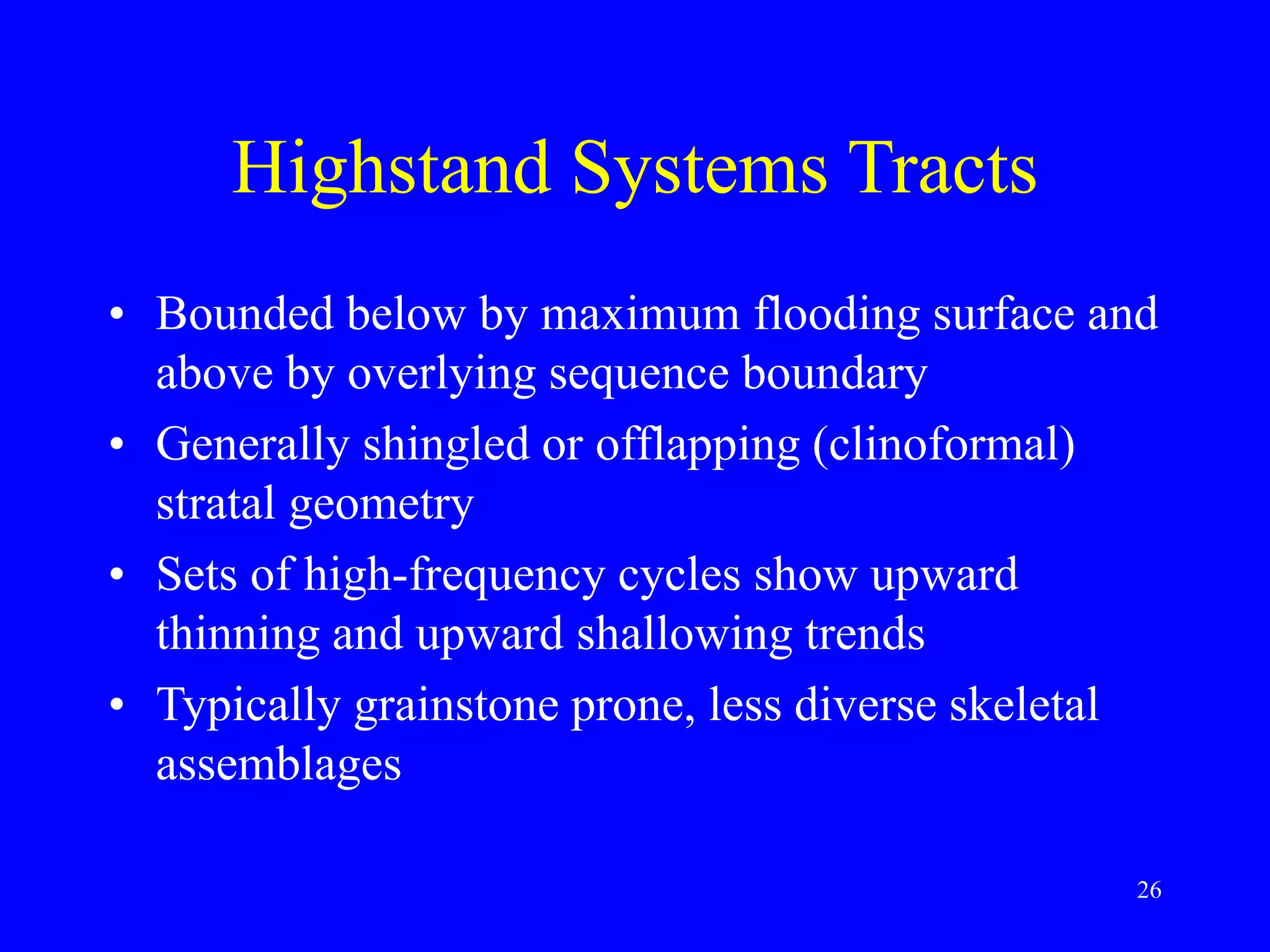
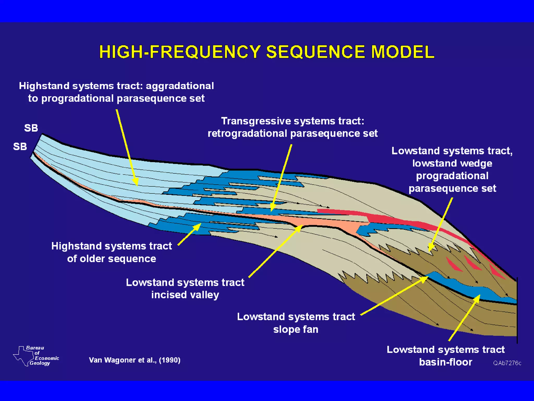
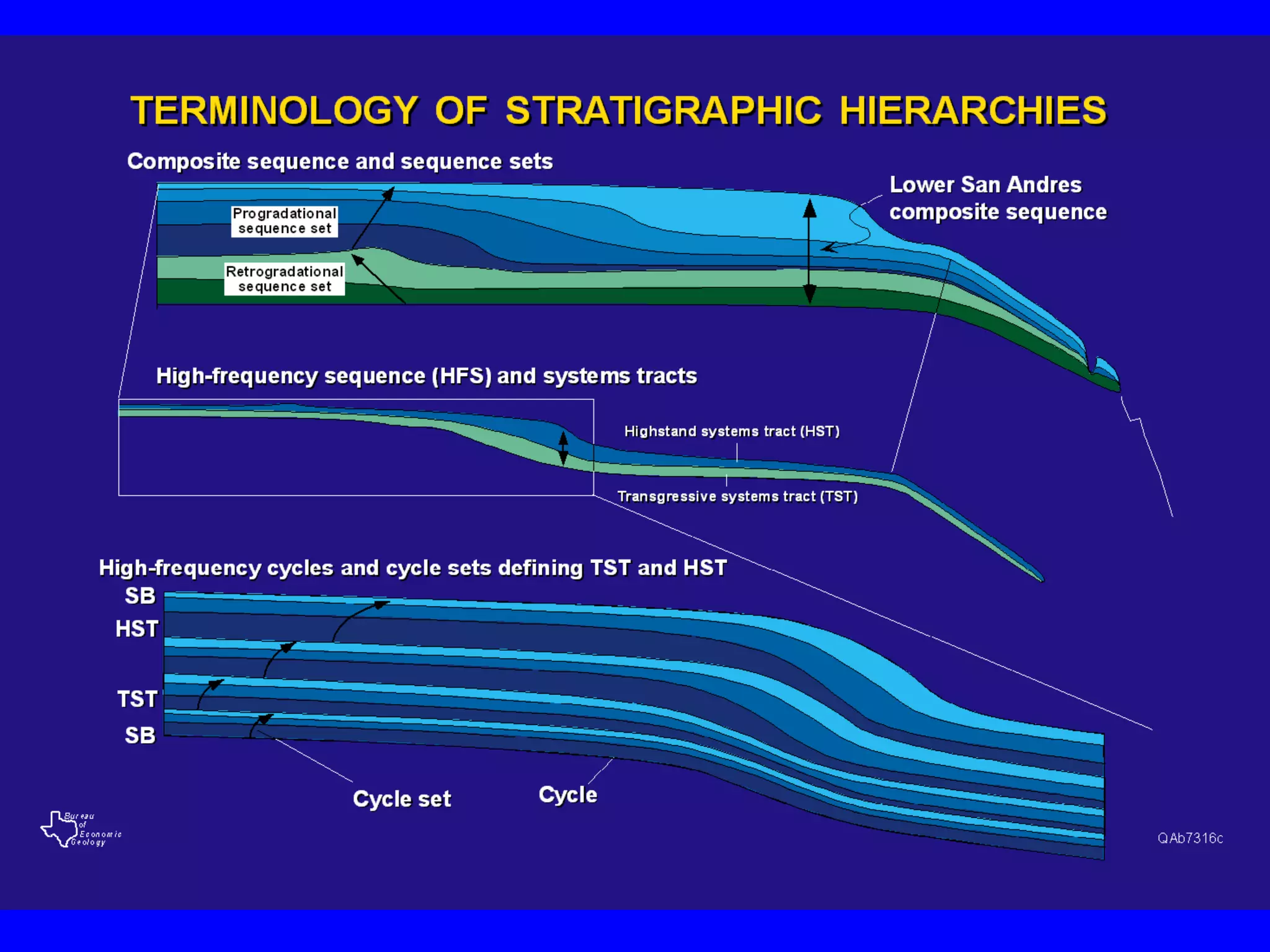
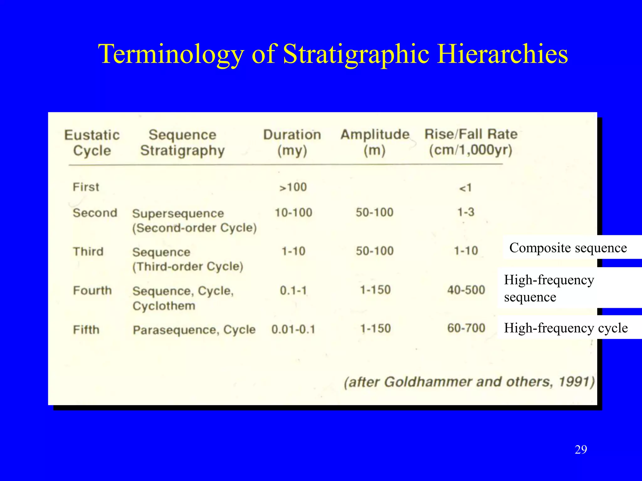
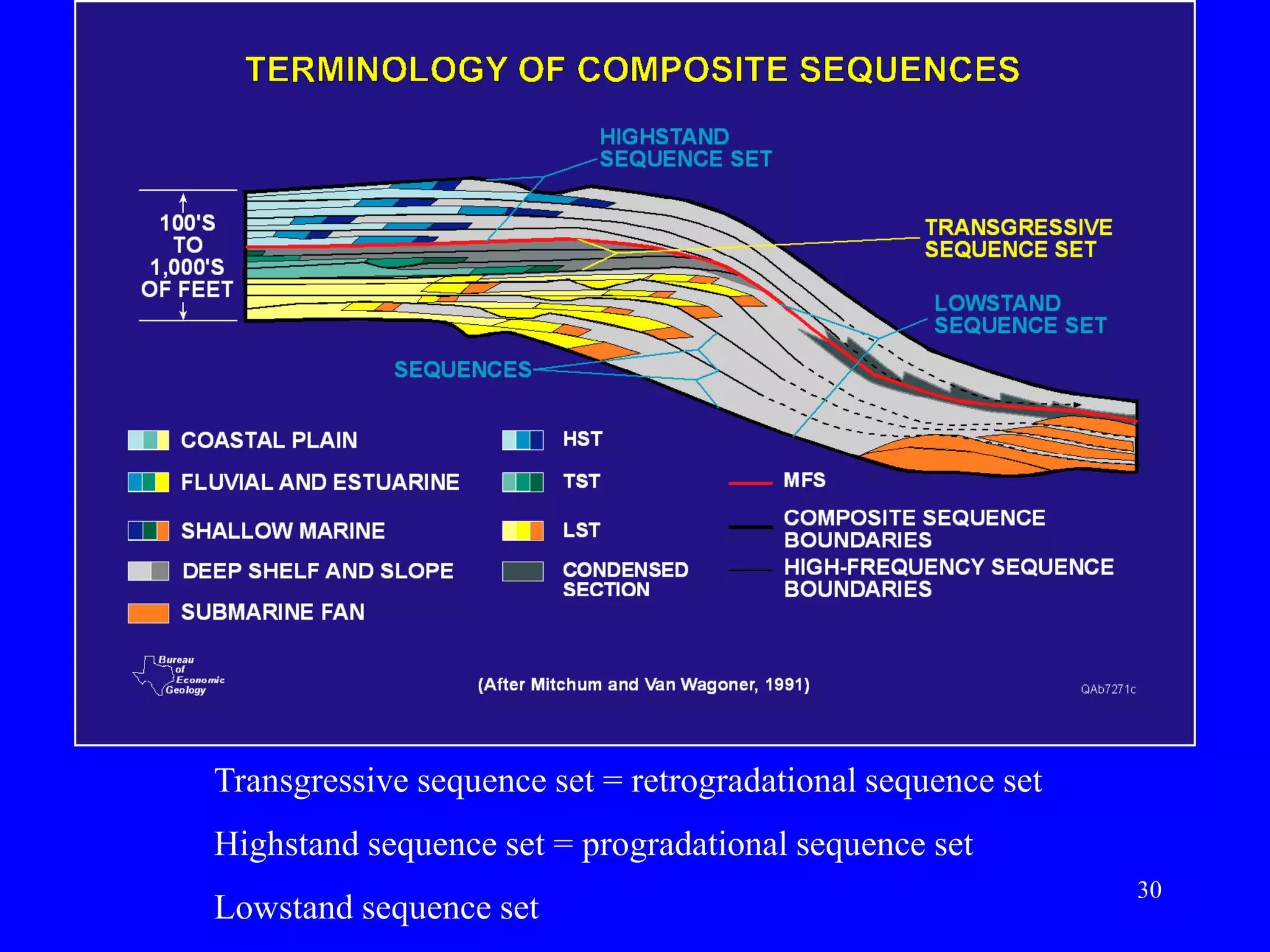
- Sequence stratigraphy subdivides strata using surfaces that represent changes in relative sea level, including sequence boundaries, maximum flooding surfaces, and systems tracts like transgressive and highstand.
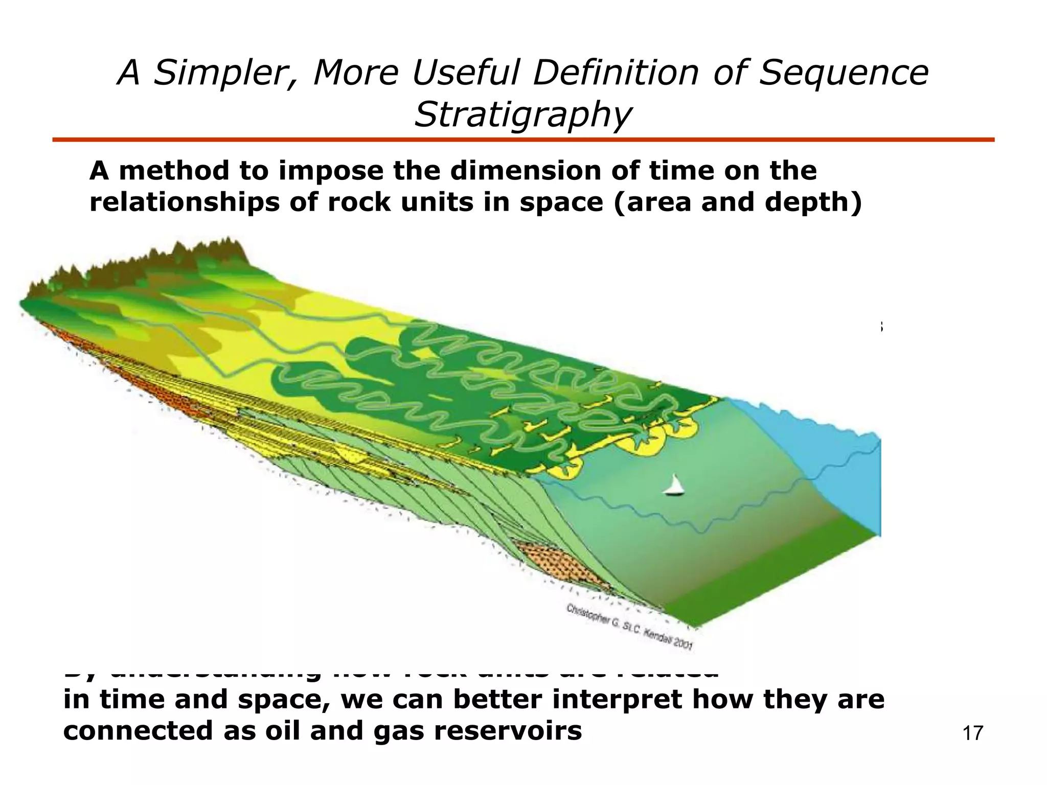
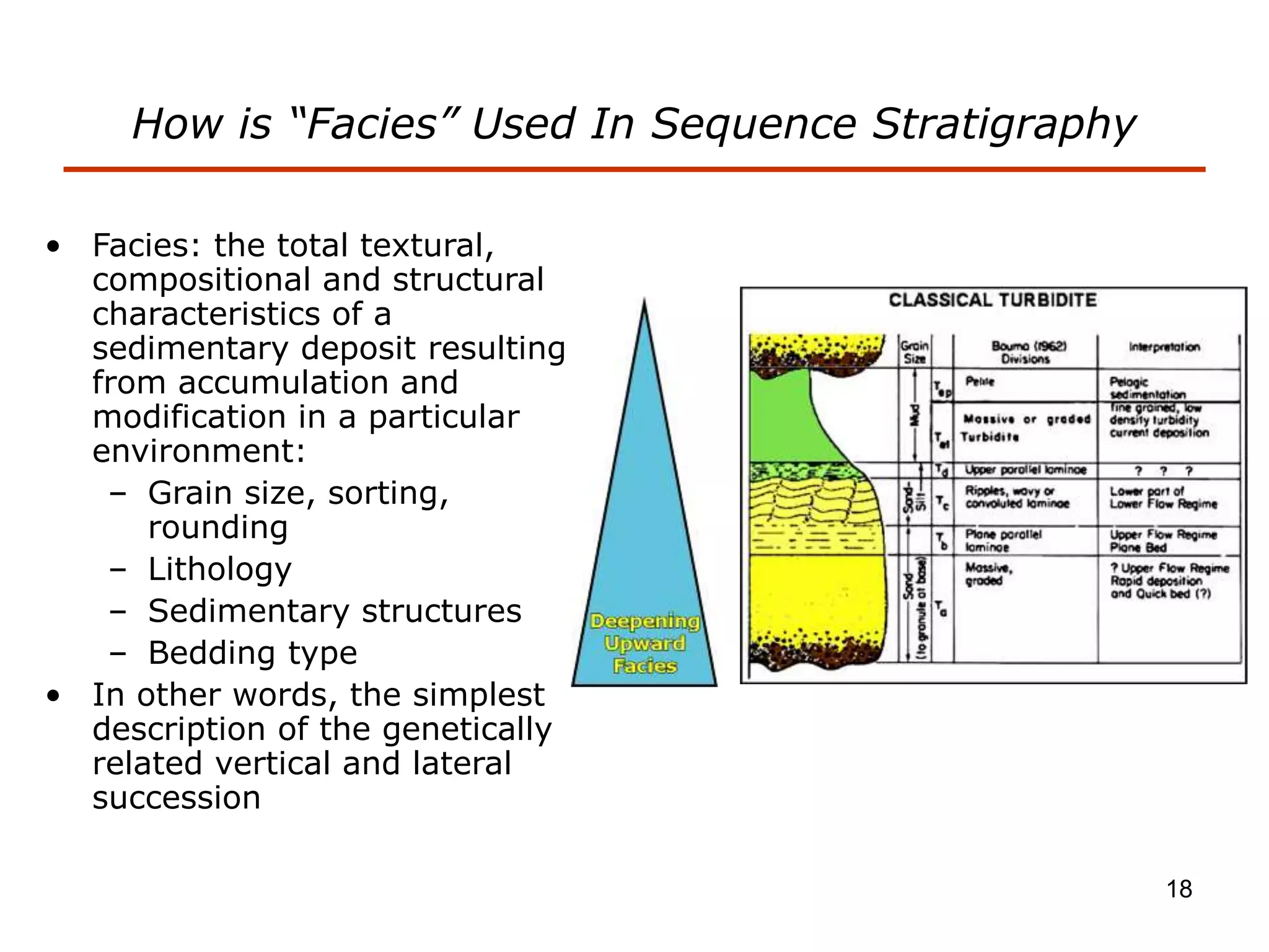
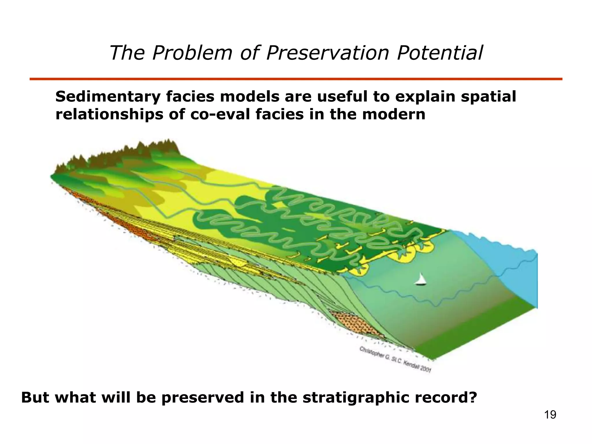
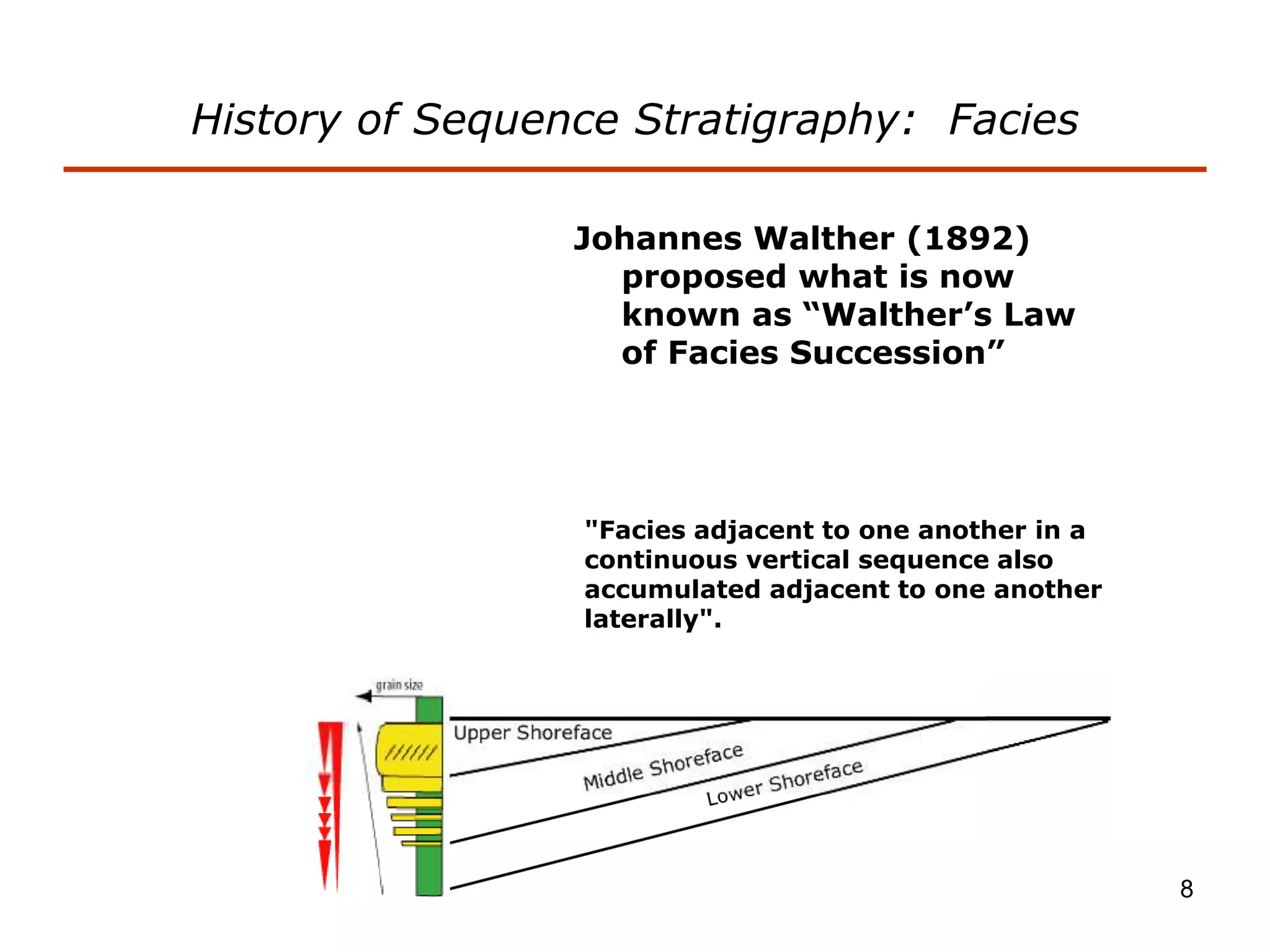
- Facies describe the characteristics of sediment deposited in different environments, and sequence stratigraphy studies the geometric relationships between facies belts to interpret depositional history.
Introduction
Stratigraphy is the study of strata (sedimentary layers) in the Earth's crust, it is the relationship between rocks and time.
Stratigrapher are concerned with the observation, description and interpretation of direct and tangible evidence in rocks to determine the history of the Earth.
The combination of sedimentology and stratigraphy allows us to build up pictures of the Earth’s surface at different times in different places and relate them to each other through the relative ages of rocks
A more modern way of stating the same principle is that the laws of nature (laws of chemistry and physics) that have operated in the same way since the beginning of time.
And thus if we understand the physical and chemical principles by which nature operates, we can assume that nature operated the same way in the past.
Basic principles of stratigraphy
Principle of Uniformitarianism
Principle of Lateral Horizontality
Principle of Superposition
Principle of Cross-cutting Relations
Principle of Inclusions
Principle of Chilled Margins
Correlation
Rigid Earth Theory. Plasticity. Isostacy. Alfred Wegener and Continental Drift. Wegener's lines of evidence. Harry Hess and more evidence. Power source = convection currents in the mantle. Theory of Plate Tectonics. Plate boundaries: Divergent (spreading centers), Convergent (subduction zones), Lateral (transform faults). Three types of subduction zones. Hot spots. Accreted Terranes. Cratons. Continental Shields. Topography. (maps for lab)
Tectonic Basin and its classification:
Dickinson's Classification
Kingston Classification
Ingersoll's Classification
Bally and Snelson's Classification
Deadline is on Tuesday ,September 16 th2014I would like to .docxtheodorelove43763
Deadline is on Tuesday ,September 16 th/2014
I would like to have a design of the four broadcast protocols using a written description with the graphic representation showing how the design looks like and how information/communication happen between nodes beside the details explanation using scenarios to estimate the complexity.
Each of the designs should have an evaluation of the efficiency in the context of message complexity and round complexity.
The design should be based on a cube system with 8 nodes using
1. message-passing model
2. shared-memory model
3. mobile agent communication model
So the final work will have a total of 4 graphic designs with use case scenarios for each design to explain and calculate the complexity and efficiently of each design. The efficiency would be calculated for each design in term of message complexity and round complexity. Then decide on the best protocol among the proposed designs based on the efficiency.
geology2.pdf
geology1.pdf
1
Plate Tectonics Name: ________________
INTRODUCTION
Plate tectonics is a well established theory that unifies and provides a framework for
all geologic observations. Most geologic phenomenon observed near the Earth’s
surface are linked in some way to plate tectonic processes. The theory states that the
outer 60-100 km of the Earth is divided into slabs of rigid rock (the lithosphere). These
slabs (the plates) rest upon a semi-viscous layer of easily deformable rock (the
asthenosphere). Thermal convection within the asthenosphere pushes the plates in
horizontal directions at rates ranging from 1 cm to 12 cm/year. This causes the plates
to move in relation to one another. Boundaries between the 8 principle plates and
several smaller plates are zones of rock deformation, earthquakes and volcanism.
This lab utilizes real data that demonstrates and/or validates the theory of Plate
Tectonics. Four exercises, modified from Jones and Jones (2003), follow.
o Part A examines global maps of tectonic plate boundaries and earthquake data
to identify plate boundary locations and assess relative motion between the
plates.
o Part B uses maps of the ocean floor to calculate spreading rates across a mid-
oceanic ridge in the South Pacific.
o Part C interprets maps and utilizes geologic ages for Hawaiian Islands to better
understand movement of the underlying Pacific plate over a “hot spot”.
o Part D examines a geologic map along a portion of the San Andreas Fault to
evaluate the direction and rate of plate movement.
OBJECTIVES
Upon completion of this exercise, you will be able to understand:
1. basic differences between major types of plate boundaries.
2. magnetic stripping and use it to calculate spreading rates
3. the concept of “hot spots” and use this understanding to determine the speed
and direction of movement of plates
4. how to interpret a geological map of the San Andreas Fault and calculate the
rate of movement al.
Journal Petroleum Geology. Northern and Central North Sea Aptian sands, lowstand systems tract. Sequence stratigraphy development, Logs and micropapaeontology. prospectivity
A Simple Presentation depicting the concepts os Stratigraphy. The Stratigraphy is a branch of geology concerned with the study of rock layers and layering .
Short course discussing a practical approach to Sequence Stratigraphy and attempting to clarify some of the terminological muddle that has accumulated over the past few decades.
Note: Originally presented as in-house short course for Pioneer Natural Resources Company. All material is public domain and/or original sketches/figures by author.
CFD Simulation of By-pass Flow in a HRSG module by R&R Consult.pptxR&R Consult
CFD analysis is incredibly effective at solving mysteries and improving the performance of complex systems!
Here's a great example: At a large natural gas-fired power plant, where they use waste heat to generate steam and energy, they were puzzled that their boiler wasn't producing as much steam as expected.
R&R and Tetra Engineering Group Inc. were asked to solve the issue with reduced steam production.
An inspection had shown that a significant amount of hot flue gas was bypassing the boiler tubes, where the heat was supposed to be transferred.
R&R Consult conducted a CFD analysis, which revealed that 6.3% of the flue gas was bypassing the boiler tubes without transferring heat. The analysis also showed that the flue gas was instead being directed along the sides of the boiler and between the modules that were supposed to capture the heat. This was the cause of the reduced performance.
Based on our results, Tetra Engineering installed covering plates to reduce the bypass flow. This improved the boiler's performance and increased electricity production.
It is always satisfying when we can help solve complex challenges like this. Do your systems also need a check-up or optimization? Give us a call!
Work done in cooperation with James Malloy and David Moelling from Tetra Engineering.
More examples of our work https://www.r-r-consult.dk/en/cases-en/
Final project report on grocery store management system..pdfKamal Acharya
In today’s fast-changing business environment, it’s extremely important to be able to respond to client needs in the most effective and timely manner. If your customers wish to see your business online and have instant access to your products or services.
Online Grocery Store is an e-commerce website, which retails various grocery products. This project allows viewing various products available enables registered users to purchase desired products instantly using Paytm, UPI payment processor (Instant Pay) and also can place order by using Cash on Delivery (Pay Later) option. This project provides an easy access to Administrators and Managers to view orders placed using Pay Later and Instant Pay options.
In order to develop an e-commerce website, a number of Technologies must be studied and understood. These include multi-tiered architecture, server and client-side scripting techniques, implementation technologies, programming language (such as PHP, HTML, CSS, JavaScript) and MySQL relational databases. This is a project with the objective to develop a basic website where a consumer is provided with a shopping cart website and also to know about the technologies used to develop such a website.
This document will discuss each of the underlying technologies to create and implement an e- commerce website.
Water scarcity is the lack of fresh water resources to meet the standard water demand. There are two type of water scarcity. One is physical. The other is economic water scarcity.
NO1 Uk best vashikaran specialist in delhi vashikaran baba near me online vas...Amil Baba Dawood bangali
Contact with Dawood Bhai Just call on +92322-6382012 and we'll help you. We'll solve all your problems within 12 to 24 hours and with 101% guarantee and with astrology systematic. If you want to take any personal or professional advice then also you can call us on +92322-6382012 , ONLINE LOVE PROBLEM & Other all types of Daily Life Problem's.Then CALL or WHATSAPP us on +92322-6382012 and Get all these problems solutions here by Amil Baba DAWOOD BANGALI
#vashikaranspecialist #astrologer #palmistry #amliyaat #taweez #manpasandshadi #horoscope #spiritual #lovelife #lovespell #marriagespell#aamilbabainpakistan #amilbabainkarachi #powerfullblackmagicspell #kalajadumantarspecialist #realamilbaba #AmilbabainPakistan #astrologerincanada #astrologerindubai #lovespellsmaster #kalajaduspecialist #lovespellsthatwork #aamilbabainlahore#blackmagicformarriage #aamilbaba #kalajadu #kalailam #taweez #wazifaexpert #jadumantar #vashikaranspecialist #astrologer #palmistry #amliyaat #taweez #manpasandshadi #horoscope #spiritual #lovelife #lovespell #marriagespell#aamilbabainpakistan #amilbabainkarachi #powerfullblackmagicspell #kalajadumantarspecialist #realamilbaba #AmilbabainPakistan #astrologerincanada #astrologerindubai #lovespellsmaster #kalajaduspecialist #lovespellsthatwork #aamilbabainlahore #blackmagicforlove #blackmagicformarriage #aamilbaba #kalajadu #kalailam #taweez #wazifaexpert #jadumantar #vashikaranspecialist #astrologer #palmistry #amliyaat #taweez #manpasandshadi #horoscope #spiritual #lovelife #lovespell #marriagespell#aamilbabainpakistan #amilbabainkarachi #powerfullblackmagicspell #kalajadumantarspecialist #realamilbaba #AmilbabainPakistan #astrologerincanada #astrologerindubai #lovespellsmaster #kalajaduspecialist #lovespellsthatwork #aamilbabainlahore #Amilbabainuk #amilbabainspain #amilbabaindubai #Amilbabainnorway #amilbabainkrachi #amilbabainlahore #amilbabaingujranwalan #amilbabainislamabad
Hybrid optimization of pumped hydro system and solar- Engr. Abdul-Azeez.pdffxintegritypublishin
Advancements in technology unveil a myriad of electrical and electronic breakthroughs geared towards efficiently harnessing limited resources to meet human energy demands. The optimization of hybrid solar PV panels and pumped hydro energy supply systems plays a pivotal role in utilizing natural resources effectively. This initiative not only benefits humanity but also fosters environmental sustainability. The study investigated the design optimization of these hybrid systems, focusing on understanding solar radiation patterns, identifying geographical influences on solar radiation, formulating a mathematical model for system optimization, and determining the optimal configuration of PV panels and pumped hydro storage. Through a comparative analysis approach and eight weeks of data collection, the study addressed key research questions related to solar radiation patterns and optimal system design. The findings highlighted regions with heightened solar radiation levels, showcasing substantial potential for power generation and emphasizing the system's efficiency. Optimizing system design significantly boosted power generation, promoted renewable energy utilization, and enhanced energy storage capacity. The study underscored the benefits of optimizing hybrid solar PV panels and pumped hydro energy supply systems for sustainable energy usage. Optimizing the design of solar PV panels and pumped hydro energy supply systems as examined across diverse climatic conditions in a developing country, not only enhances power generation but also improves the integration of renewable energy sources and boosts energy storage capacities, particularly beneficial for less economically prosperous regions. Additionally, the study provides valuable insights for advancing energy research in economically viable areas. Recommendations included conducting site-specific assessments, utilizing advanced modeling tools, implementing regular maintenance protocols, and enhancing communication among system components.
Saudi Arabia stands as a titan in the global energy landscape, renowned for its abundant oil and gas resources. It's the largest exporter of petroleum and holds some of the world's most significant reserves. Let's delve into the top 10 oil and gas projects shaping Saudi Arabia's energy future in 2024.
1. 1
Stratigraphic Principles
• Types of Stratigraphy
• Focus on Modern Stratigraphy is Sequence-based
• History of Sequence Stratigraphy
• Terminology of Sequence Stratigraphy
• Examples from Permian Basin
2. 2
Steno’s Laws
• It was recognized in the 1600's that in a sedimentary sequence, the older
beds are on the bottom, and the younger beds are on the top. This has
come to be called the Principle of Superposition. You can visualize how
this occurs if you imagine a stack of newspapers in the corner of a room.
Every day you put another newspaper on the pile. After several weeks
have passed, you have a considerable stack of newspapers, and the oldest
ones will be on the bottom of the pile and the most recent ones will be on
the top. This fairly obvious, but very important fact about layering was
first noted by Nicholaus Steno, and is the first of three principles which
have come to be known as Steno's Laws.
• Steno's second law is the Principle of Original Horizontality, which
states that sediments are deposited in flat, horizontal layers. We can
recognize this easily if we consider a sedimentary environment such as the
sea floor or the bottom of a lake. Any storm or flood bringing sediment to
these environments will deposit it in a flat layer on the bottom because of
the sedimentary particles settling under the influence of gravity. As a
result, a flat, horizontal layer of sediment will be deposited.
• Steno's third law is the Principle of Original Lateral Continuity. If we
consider again the sediment being deposited on the seafloor, the sediment
will not only be deposited in a flat layer, it will be a layer that extends for
a considerable distance in all directions. In other words, the layer is
laterally continuous.
4. 4
Terminology of Lithostratigraphic Units
• Supergroup
– Group
• Formation
– Member
» Bedset
» Bed
• Types of unconformities
– Angular unconformity
– Disconformity
– Paraconformity
– Nonconformity
– hiatus
5. 5
History of Sequence Stratigraphy: Unconformities
• James Hutton (1726-
1797): Father of Modern
Geology
• First described
unconformity at Siccar
Point in northern Scotland
• In a paper entitled
“Theory of The Earth”
(1785) Hutton recognized
the importance of
unconformities
• Also recognized
stratigraphic nature of
igneous rocks and believed
came from molten material
within Earth
7. 7
History of Sequence Stratigraphy
William Smith measured and
described outcrop stratigraphy
during excavation of transport
canals in England beginning in 1791
8. 8
History of Sequence Stratigraphy: Facies
Johannes Walther (1892)
proposed what is now
known as “Walther’s Law
of Facies Succession”
"Facies adjacent to one another in a
continuous vertical sequence also
accumulated adjacent to one another
laterally".
9. 9
History of Sequence Stratigraphy: Time-significant
surfaces
1909: Eliot Blackwelder published use
of unconformities as time markers;
introduced concept of time
represented by surfaces (erosional
removal and sedimentary hiatus)
10. 10
1916: Amadeus Grabau proposed
the pulsation theory.
History of Sequence Stratigraphy: Cyclicity
11. 11
1917: Joseph Barrell stated the
most fundamental events in
geologic history--the time-space
distribution of deposition and non-
deposition: the alternating rise
and fall of Base-level.
History of Sequence Stratigraphy: Base Level
12. 12
What Really Happened: New Concepts from New
Technology
1951 John L. Rich proposes the
concept of clinoforms…
…recognition of seismic
reflection geometries
13. 13
History of Sequence Stratigraphy: Time Stratigraphy
1958 Harry Wheeler produced first chronostratigraphic chart
14. 14
History of Sequence Stratigraphy: Time Stratigraphy
1963 Lawrence Sloss recognized 6 major sequences in
North America controlled by eustatic sea level changes
15. 15
1977 Peter Vail and Robert Mitchum co-
ordinated the publishing of AAPG Memoir
#26 based on the assumption that a
seismic relection surface represents a time
line
Official Birth of Sequence Stratigraphy
16. 16
•A framework of genetically related stratigraphic facies
geometries and their bounding surfaces used to determine
depositional setting
•Subdivision & interpretation of sedimentary record using a
framework surfaces seen in outcrops, well logs, & 2-D and
3-D seismic.
•Include: Surfaces of erosion & non-deposition (sequence
boundaries), systems tracts
•Flooding (trangressive surfaces [TS] &/or maximum
flooding surfaces [mfs]); require that relative sea-level is
known
•This framework used to predict the extent of sedimentary
facies geometry, lithologic character, grain size, sorting &
reservoir quality
A Definition of Sequence Stratigraphy
17. 17
A Simpler, More Useful Definition of Sequence
Stratigraphy
A method to impose the dimension of time on the
relationships of rock units in space (area and depth)
To do this we first describe
facies…
…Then we observe the
geometric relationships
among facies
By understanding how rock units are related
in time and space, we can better interpret how they are
connected as oil and gas reservoirs
18. 18
• Facies: the total textural,
compositional and structural
characteristics of a
sedimentary deposit resulting
from accumulation and
modification in a particular
environment:
– Grain size, sorting,
rounding
– Lithology
– Sedimentary structures
– Bedding type
• In other words, the simplest
description of the genetically
related vertical and lateral
succession
How is “Facies” Used In Sequence Stratigraphy
19. 19
The Problem of Preservation Potential
Sedimentary facies models are useful to explain spatial
relationships of co-eval facies in the modern
But what will be preserved in the stratigraphic record?
21. 21
A critical assumption of the
seismic stratigraphic approach,
illustrated in this diagram
from Vail et al (1977), is that
seismic reflectors follow time
surfaces rather than facies
impedance boundaries.
Note the regional scale of this
illustration.
22. 22
The Classic Slug Exxon Model
SB – sequence boundary
LST – lowstand systems tract
TST – transgressive systems tract
HST – highstand systems tract
SMW – shelf-margin wedge
Mfs – maximum flooding surface
Lsw – lowstand wedge
Sf – slope fan
Bf – basin-floor fan
23. 23
Sequence Boundary
• The unconformity or correlative conformity
that bounds a sequence
• Not always a major physical feature
• Not ever exposure surface is a sequence
boundary!
• Commonly (but not always) represents a
significant change in stratal arrangements
and therefore reservoir properites
24. 24
Maximum Flooding Surface
• Surface that marks the turn-around from
landward-stepping to seaward stepping strata
• Farther out on platform coincides with the
downlap surface (depending on the degree of
condensation of clinoform toes)
• Recognition of the MFS is important for
separating TST and HST, which in turn is
important for other stratigraphic analysis, but on
the platform top (where 99% of carbonate
reservoir facies occur) this can be difficult to pin
down precisely. Don’t get hung up on this. Try to
pick it as closely as possible, knowing that your
colleague will disagree in order to appear
enlightened.
25. 25
Transgressive Systems Tracts
• Bounded below by underlying sequence
boundary and above by maximum flooding
surface
• Generally more mounded in geometry
• Sets of high-frequency cycles show upward
thickening and upward deepening trends
• Typically less grainstone prone, more
diverse skeletal assemblages
26. 26
Highstand Systems Tracts
• Bounded below by maximum flooding surface and
above by overlying sequence boundary
• Generally shingled or offlapping (clinoformal)
stratal geometry
• Sets of high-frequency cycles show upward
thinning and upward shallowing trends
• Typically grainstone prone, less diverse skeletal
assemblages