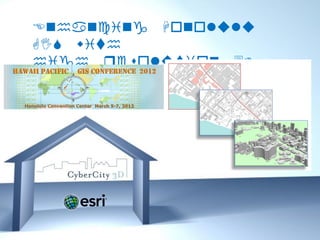
Hawaii Pacific GIS Conference 2012: 3D GIS - True 3D GIS Buildings: Honolulu Area 3D Buildings Created with 4-inch Accuracy and Roof Details including Superstructures for 3D Analysis, Visualation, 3D Editing and Planning
•
1 like•651 views

The document summarizes a 3D city model of Honolulu, Hawaii created by CyberCity 3D, Inc. using photogrammetry from high resolution aerial images. The model contains over 6,000 buildings with roof details and other structures. It includes 14 feature classes stored in a geodatabase that can be used for applications like solar potential analysis. The data is now available for public and private use to help agencies with planning, engineering, and emergency services.
Report
Share
Report
Share
Download to read offline

Recommended
Introduction to Esri CityEngine
Esri CityEngine is a 3D modeling software that transforms 2D GIS data into 3D city models through a procedural modeling workflow. It allows users to quickly create 3D models of urban environments using real-world 2D data. The software extrudes 2D features like building footprints, roads, and terrain to generate initial 3D geometry which is then refined using procedural rules to add detail before exporting the finished 3D city model. CityEngine models can be shared online and updated directly within a GIS database.
Shannon Park Redevelopment Plan Remodeling with Esri CityEngine
The project aims at transferring a community redevelopment plan as done by the student in 2010, including its general layout, transportation system, dwelling types, and spatial organization, into a 3D simulation model within Esri CityEngine. The project has a two-fold goal: 1) to explore 3D GIS application in urban planning and community design, and 2) to explore Esri CityEngine as a powerful tool of building 3D communities.
How 3D GIS connects the real world with virtual worlds
GIS is a system of record and as such incredably valuable basis for design. In the Geodesign process, (3D) GIS technology is incredably powerful for visualizing and analyzing urban designs. Procedural modellng in CityEngine allows city planners and designers generate flexible designs that allow for manipulation of all design parameters. 3D GIS technology connects the real world as it is stored in a realistic model with the virtual worlds of the future designed with procedural modelling.
State of mago3D, An Open Source Based Digital Twin Platform
I gave this talk at the FOSS4G Thailand 2019 which was held at Chulalongkorn University, Bangkok on 4th Nov 2019. I talked about the recent achievements and improvements of mago3D project, an open source based Digital Twin platform. mago3D(http mago3d.com) is relatively new project first released in July 2017. The ultimate goal of mago3D is developing an open source based digital twin platform that can replicate and simulate the real world objects, processes, and phenomena on web environment. mago3D has been used in various industry sectors including ship building, urban management, indoor data management, and national defense. In this talk I showcased several real projects that used the mago3D and shared what I learnt from these projects. Also I introduced new features and future plan of mago3D.
mago3D, A Brand-New Web Based Open Source GeoBIM Platform
This is an introduction to mago3D, a web based open source GeoBIM platform developed by Gaia3D, Inc. This presentation was given at Geo Business event on 22nd, May. For details about mago3D, please visit http://mago3d.com
Introduction to OpenIndoorMap
This talk was given at the FOSS4G Asia 2021 held at Kathmandu, Nepal.
Have you ever heard about Open Indoor Map project? No? Don't worry about that you don't know the OIM(Open Indoor Map) project, because OIM is quite new project and not publicly well-known. OIM project got many inspiration from Open Street Map. OIM is a project to let users upload & share their indoor related data. Users can upload their IFC, CityGML, IndoorGML, 3DS data that represent indoor space to the OIM server and OIM server service those data through web in 3D. OIM project makes use of many open source project including mago3D, Assimp, and others. I expect OIM project could expand crowd-sourced map to indoor space as well by complementing Open Street Map.
Esri CityEngine & Minecraft: Engaging Citizens in 3D City Planning
Researchers at VU, Amsterdam are leveraging Esri CityEngine and Minecraft to increase citizen engagement in neighborhood design & planning. Inspired by UN-Habitat’s Block by Block, the project combines 2D & 3D datasets to create a 3D model in CityEngine. This GIS output becomes a canvas of the city in Minecraft, offering a gaming-style geodesign tool that citizens and their children can interact with. This presentation will explore how 2D data can be leveraged in 3D with Esri CityEngine.
Master Planning Cities (with the help of CityEngine) (Elliot Hartley, Garsdal...
Master Planning Cities (with the help of CityEngine) (Elliot Hartley, Garsdal...Association for Geographic Information (AGI)
Audio Recorded Live at the AGI Showcase Event in York.
For details of more AGI Events, visit our website: www.agi.org.ukRecommended
Introduction to Esri CityEngine
Esri CityEngine is a 3D modeling software that transforms 2D GIS data into 3D city models through a procedural modeling workflow. It allows users to quickly create 3D models of urban environments using real-world 2D data. The software extrudes 2D features like building footprints, roads, and terrain to generate initial 3D geometry which is then refined using procedural rules to add detail before exporting the finished 3D city model. CityEngine models can be shared online and updated directly within a GIS database.
Shannon Park Redevelopment Plan Remodeling with Esri CityEngine
The project aims at transferring a community redevelopment plan as done by the student in 2010, including its general layout, transportation system, dwelling types, and spatial organization, into a 3D simulation model within Esri CityEngine. The project has a two-fold goal: 1) to explore 3D GIS application in urban planning and community design, and 2) to explore Esri CityEngine as a powerful tool of building 3D communities.
How 3D GIS connects the real world with virtual worlds
GIS is a system of record and as such incredably valuable basis for design. In the Geodesign process, (3D) GIS technology is incredably powerful for visualizing and analyzing urban designs. Procedural modellng in CityEngine allows city planners and designers generate flexible designs that allow for manipulation of all design parameters. 3D GIS technology connects the real world as it is stored in a realistic model with the virtual worlds of the future designed with procedural modelling.
State of mago3D, An Open Source Based Digital Twin Platform
I gave this talk at the FOSS4G Thailand 2019 which was held at Chulalongkorn University, Bangkok on 4th Nov 2019. I talked about the recent achievements and improvements of mago3D project, an open source based Digital Twin platform. mago3D(http mago3d.com) is relatively new project first released in July 2017. The ultimate goal of mago3D is developing an open source based digital twin platform that can replicate and simulate the real world objects, processes, and phenomena on web environment. mago3D has been used in various industry sectors including ship building, urban management, indoor data management, and national defense. In this talk I showcased several real projects that used the mago3D and shared what I learnt from these projects. Also I introduced new features and future plan of mago3D.
mago3D, A Brand-New Web Based Open Source GeoBIM Platform
This is an introduction to mago3D, a web based open source GeoBIM platform developed by Gaia3D, Inc. This presentation was given at Geo Business event on 22nd, May. For details about mago3D, please visit http://mago3d.com
Introduction to OpenIndoorMap
This talk was given at the FOSS4G Asia 2021 held at Kathmandu, Nepal.
Have you ever heard about Open Indoor Map project? No? Don't worry about that you don't know the OIM(Open Indoor Map) project, because OIM is quite new project and not publicly well-known. OIM project got many inspiration from Open Street Map. OIM is a project to let users upload & share their indoor related data. Users can upload their IFC, CityGML, IndoorGML, 3DS data that represent indoor space to the OIM server and OIM server service those data through web in 3D. OIM project makes use of many open source project including mago3D, Assimp, and others. I expect OIM project could expand crowd-sourced map to indoor space as well by complementing Open Street Map.
Esri CityEngine & Minecraft: Engaging Citizens in 3D City Planning
Researchers at VU, Amsterdam are leveraging Esri CityEngine and Minecraft to increase citizen engagement in neighborhood design & planning. Inspired by UN-Habitat’s Block by Block, the project combines 2D & 3D datasets to create a 3D model in CityEngine. This GIS output becomes a canvas of the city in Minecraft, offering a gaming-style geodesign tool that citizens and their children can interact with. This presentation will explore how 2D data can be leveraged in 3D with Esri CityEngine.
Master Planning Cities (with the help of CityEngine) (Elliot Hartley, Garsdal...
Master Planning Cities (with the help of CityEngine) (Elliot Hartley, Garsdal...Association for Geographic Information (AGI)
Audio Recorded Live at the AGI Showcase Event in York.
For details of more AGI Events, visit our website: www.agi.org.uk6 Stories of Maps and FOSS4G Korea
The document summarizes 6 stories about maps from around the world:
1) South Korea's national mapping agency will provide 50,000 free digital maps to the public, continuing a trend of maps becoming free and commoditized.
2) Pokémon Go players in South Korea were able to play in Sokcho due to a mapping glitch, reminding people how important maps are.
3) OpenStreetMap was founded in 2004 to allow anyone to collaboratively map the world for free in response to limitations of government and commercial maps. It now has over 2 million mappers.
4) The Humanitarian OpenStreetMap Team maps disaster-stricken areas like the Philippines quickly to provide relief organizations with up
3D Digital Cities: The Convergence of CAD, GIS and BIM
The document discusses the emergence of 3D digital cities as a convergence of building information modeling (BIM), computer-aided design (CAD), and geographic information systems (GIS). 3D digital cities combine mapping, building, civil, and utility data into accurate 3D models that can be visualized, analyzed, and shared. They are part of municipal sustainability initiatives and help analyze projects, visualize designs, and simulate city planning initiatives. The trend is moving towards more detailed real-time navigation and analysis of intelligent 3D city models.
3D Modeling by GIS
- The document discusses providing 3D modeling and GIS services for existing facility data management in Iraq, including collecting accurate survey data, developing 3D models and geodatabases, and training local teams.
- A balanced approach of high-accuracy data collection using GNSS and processing in GIS and CAD software will enable developing detailed 3D models and rich geodatabases.
- The services include field data collection, 3D modeling, developing site plans, training local staff, and establishing a framework to support future projects.
How to Create GIS and BIM Interoperability
Discover how to solve the most common problems with BIM and GIS integration. See how to easily move data between IFC, Autodesk Revit, SketchUp 2015, Esri ArcGIS, AutoCAD, and more. You'll also learn how to use automated techniques to get simplified BIM geometries into GIS, combine attribute or tabular data with existing models, perform space extraction, QC data, and much more.
Smart city and gis
Smart City is an trending Project in todays world. This document provides you an platform of using GIS software in these kind of project.
Crowdsourcing and storytelling by gamification
Crowdsourcing and storytelling by gamification. The document discusses how crowdsourcing can be used to collect geospatial data as data is increasingly abundant. It proposes using games as a platform to visualize crowdsourced data and tell stories with maps to gain insights. Examples mentioned include using games to collect data on issues like haze and an interactive 3D cholera map that helped prove John Snow's theory on how cholera spreads through water contamination.
Overview of 3D GIS Capabilties
This poster presents an overview of 3D GIS Capabilities. It can be used for discussions about 3D GIS workflows (from 3D data acquisition to 3D object creation to 3D analysis, modeling and visualization), and the possible applications of 3D GIS in urban and landscape environments
The future of GIS as we know it
Presentation 'about the (very nearby) future of GIS' for GeoScience students, Universiteit Utrecht. I had a few recommended skill and recommendations as well, will blog about that later.
Hardik_Final_CV
Hardik Tuvar is a senior GIS executive with over 3.9 years of experience in the GIS industry. He has extensive experience developing GIS systems for municipalities and private sector clients. Some of his project experience includes developing web-based GIS applications for Surat Municipal Corporation and cadastral mapping projects. He is proficient in various GIS, remote sensing, and CAD software. Hardik holds a post-graduation degree in Remote Sensing and GIS from Gujarat University.
DRCOG Keynote on GIS, BIM, CAD Convergence and 3D Cities
The document discusses the convergence of GIS, CAD, and BIM technologies and how they promise new insights. It outlines how these integrated modeling approaches allow for improved coordination, clash detection, conceptual design, analysis of impacts, and navigation of virtual environments. Examples are given of toolmaker approaches integrating these technologies for applications like land use planning, infrastructure modeling, and 3D city modeling. Challenges faced by cities are also discussed like efficient urban planning, aging infrastructure, and adapting to climate change. Thought leaders and global examples pursuing smart, sustainable cities through these converging technologies are provided.
Geo spatial analytics using Microsoft BI
The document summarizes a presentation on geospatial analytics using Microsoft BI tools. It provides an agenda for the presentation including an overview of why geospatial analytics is useful and a demo of tools like Power View, GeoFlow, and SQL Server Reporting Services. It discusses how each tool can be used for interactive data visualization and exploration of geographic data on maps and globes. The presentation aims to illustrate which Microsoft BI tools are best suited for different types of geospatial analysis and when to use each tool.
StevesDWESlide_exported
The document discusses how ArcGIS software has evolved to support 3D capabilities that allow users to process drone imagery into 3D models and point clouds, manage large volumes of imagery and 3D data from multiple sources, and share 3D content and services. Challenges of 3D imagery such as file sizes, projections, and accuracy are addressed with tools in ArcGIS like Drone2Map and new 3D scene layer formats that facilitate the creation and use of 3D content across industries.
3D CITY MODELS
The document discusses 3D city models (3DCM), which are digital representations of urban areas like cities and buildings. 3DCM have various applications in fields like urban planning and engineering. The document reviews literature on 3DCM projects, including cases modeling the cities of Hamburg, Germany and Fez, Morocco. It also describes two case studies modeling the cities of Vadaj, India and parts of Mumbai, India using software like ArcGIS. The 3DCM allow for better visualization and analysis of spatial properties, land use, and infrastructure to inform decision making.
스마트시티 공간정보 서비스 지원을 위한 BIM-GIS 객체 맵핑 표준
This document discusses BIM-GIS integration standards and technologies. It provides an overview of a BIM-GIS integration project conducted from 2013-2016 that developed integrated operation technologies based on a BIM/GIS interoperability platform. The project developed applications, an interoperability platform, standard file formats, and conducted various validations and improvements. It discusses key issues in mapping between BIM and GIS standards and provides examples of element and LOD mapping approaches defined in ISO 19166.
Infrastruktur Informasi Geospasial untuk Big Data dan 3D Geoinformasi
1) Spatial data is a form of big data that is proliferating from a variety of sources such as social media, games, and crowdsourcing.
2) 3D spatial data is being used to create "digital twins" that replicate real world places and infrastructure through point clouds, 3D models, and sensor data.
3) Standards are important for spatial big data and 3D geoinformation in order to integrate this data and take advantage of the opportunities it presents while also addressing challenges around data volume and variety.
Integrating BIM & GIS - Closing the Data Loop, September 2019
The integration of BIM and GIS enables users to unlock the value in diverse data sets to enable applications including citizen engagement, sustainability analysis, disaster preparedness and much more operational and management uses. Esri Ireland and Pentagon Solutions are partnering to showcase the power of the BIM and GIS integration at a series of events, the first ones which took place in Dublin and Belfast from September 24th - 25th 2019.
This first of a kind collaboration demonstrated the workflows between ArcGIS and BIM technology for planning, design and asset ownership of digital projects. Both Esri Ireland and Pentagon Solutions believe that the integration of these game changing technologies, will prove beneficial for many.
If this is an area that is of interest to you or your organisation, you can get in touch with us via mapsmakesense@esri-ireland.ie.
Future of GIS, Moving to the Enterprise Platform
The document discusses how utilities are moving towards enterprise GIS platforms to better integrate and analyze spatial and asset data across their organizations. It provides examples of how Memphis Light Gas & Water and Middle Tennessee Electric Membership Corporation leveraged ArcGIS Online and mobile data collection to improve their asset management and field operations by exposing new types of data to field crews and collecting additional information. The key is for utilities to focus on exposing new data sources, collecting data from the field, and empowering operations through spatial analysis, systems integration and workflows.
Smart City with GIS
GIS is indispensable for smart cities as it allows stakeholders to visualize and communicate complex concepts. Some key uses of GIS for smart cities include:
1) Determining rooftop solar potential by calculating how much solar radiation reaches rooftops using location data, elevation models, and sun path calculations. This can also calculate carbon footprint reductions.
2) Asset management by mapping assets, tracking maintenance, and planning development digitally. This allows creating dashboards to perform spatial queries and allow residents to map issues.
3) Rainwater management by using GIS site selection models and elevation data to identify locations where stormwater can be naturally collected with minimal intervention.
4) Calculating drive/walk times to
A Research on EIA(Environmental Impact Assessment) Data Visualization Technol...
This talk was given at the FOSS4G Buenos Aires 2021.
This research is about the development of an EIA(Environmental Impact Assessment) decision support system that effectively integrates and visualizes the results of the EIA review process and related information such as BIM/GIS, modeling data, and sensor data. The final goal is to improve the EIA process so that not only experts but also non-experts can participate in the EIA process and easily understand the EIA statements using innovative technologies such as 3D GIS and Easy Finger real-time simulation. The final system will be developed and opened as an open source. This research is 5 years long project funded by Ministry of Environment, South Korea. This talk will focus on the 1st year's research outcome and future plans.
Esri CityEngine
Esri CityEngine software allows users to quickly build 3D city models by aggregating geospatial data and procedurally generating buildings and other structures. It provides tools for importing GIS data, designing street networks, modeling buildings and vegetation, and visualizing and analyzing urban planning projects in 3D. CityEngine outputs can be shared online or exported to common 3D formats for use in simulation, gaming, and film production.
Introduction to mago3D, an Open Source Based Digital Twin Platform
This talk was given at the Busan Eco Delta City(Korea National Pilot Smart City) technical workshop held on 18th July. I talked about introduction and history of mago3D, some core technologies, real cases, and lessons learnt in this workshop.
Design and Development of BIM on GIS Interoperability Open Platform
ecently, Construction data has evolved from CAD to BIM and BIM becomes more important data used in various fields like facility management and 3D GIS construction, so there is an increasing need for developing technologies that can be effectively used in post-construction steps. There are lots of trials to model and service not only geographical terrain and outdoor but also indoor space. From this perspective, establishment of BIM and GIS interoperable method and development of service platform became the most important core technology. On this research, spatial data linkage model has been devised to smoothly implement the interoperability between two different kinds of data - BIM data and GIS data.
The platform basically displays BIM data based on 3D GIS such as WorldWind Java developed by NASA and Google Earth. It is also possible to interactively move in and out the buildings and also to see the outside of the building when a user is inside the building and inside of the building while a user is outside the building. Besides, the platform makes users look up the objects of buildings and properties of objects one by one, floor by floor, by similar properties, or all. Users can also edit the properties of objects and do spatial queries for analysis of the data.
This project is co research project of KICT(Korea Institute of Construction Technology) and Gaia3D and working closely together to develop BIM and GIS Interoperability Open-Platform for the integration of BIM and GIS data since 2012 and have developed the system for smooth operation of big size 3D BIM data and GIS data about plenty of buildings in areas or cities, not just one building. Now, core technologies to integrate BIM into GIS are successfully developed and we will keep improving the system step by step. KICT and Gaia3D together have designed and developed BIM and GIS interoperability open-platform based on the spatial data linkage model. Links between BIM data and GIS data enables efficient and seamless management of indoor and outdoor information at the same time and it also could be used for various services such as real estates and AR (Augmented Reality) services. Gaia3D develops 3D facility management system for Antarctic King Sejong science station to efficiently manage the facilities and publicly promote the station using BIM on GIS system with open source GIS software.
More Related Content
What's hot
6 Stories of Maps and FOSS4G Korea
The document summarizes 6 stories about maps from around the world:
1) South Korea's national mapping agency will provide 50,000 free digital maps to the public, continuing a trend of maps becoming free and commoditized.
2) Pokémon Go players in South Korea were able to play in Sokcho due to a mapping glitch, reminding people how important maps are.
3) OpenStreetMap was founded in 2004 to allow anyone to collaboratively map the world for free in response to limitations of government and commercial maps. It now has over 2 million mappers.
4) The Humanitarian OpenStreetMap Team maps disaster-stricken areas like the Philippines quickly to provide relief organizations with up
3D Digital Cities: The Convergence of CAD, GIS and BIM
The document discusses the emergence of 3D digital cities as a convergence of building information modeling (BIM), computer-aided design (CAD), and geographic information systems (GIS). 3D digital cities combine mapping, building, civil, and utility data into accurate 3D models that can be visualized, analyzed, and shared. They are part of municipal sustainability initiatives and help analyze projects, visualize designs, and simulate city planning initiatives. The trend is moving towards more detailed real-time navigation and analysis of intelligent 3D city models.
3D Modeling by GIS
- The document discusses providing 3D modeling and GIS services for existing facility data management in Iraq, including collecting accurate survey data, developing 3D models and geodatabases, and training local teams.
- A balanced approach of high-accuracy data collection using GNSS and processing in GIS and CAD software will enable developing detailed 3D models and rich geodatabases.
- The services include field data collection, 3D modeling, developing site plans, training local staff, and establishing a framework to support future projects.
How to Create GIS and BIM Interoperability
Discover how to solve the most common problems with BIM and GIS integration. See how to easily move data between IFC, Autodesk Revit, SketchUp 2015, Esri ArcGIS, AutoCAD, and more. You'll also learn how to use automated techniques to get simplified BIM geometries into GIS, combine attribute or tabular data with existing models, perform space extraction, QC data, and much more.
Smart city and gis
Smart City is an trending Project in todays world. This document provides you an platform of using GIS software in these kind of project.
Crowdsourcing and storytelling by gamification
Crowdsourcing and storytelling by gamification. The document discusses how crowdsourcing can be used to collect geospatial data as data is increasingly abundant. It proposes using games as a platform to visualize crowdsourced data and tell stories with maps to gain insights. Examples mentioned include using games to collect data on issues like haze and an interactive 3D cholera map that helped prove John Snow's theory on how cholera spreads through water contamination.
Overview of 3D GIS Capabilties
This poster presents an overview of 3D GIS Capabilities. It can be used for discussions about 3D GIS workflows (from 3D data acquisition to 3D object creation to 3D analysis, modeling and visualization), and the possible applications of 3D GIS in urban and landscape environments
The future of GIS as we know it
Presentation 'about the (very nearby) future of GIS' for GeoScience students, Universiteit Utrecht. I had a few recommended skill and recommendations as well, will blog about that later.
Hardik_Final_CV
Hardik Tuvar is a senior GIS executive with over 3.9 years of experience in the GIS industry. He has extensive experience developing GIS systems for municipalities and private sector clients. Some of his project experience includes developing web-based GIS applications for Surat Municipal Corporation and cadastral mapping projects. He is proficient in various GIS, remote sensing, and CAD software. Hardik holds a post-graduation degree in Remote Sensing and GIS from Gujarat University.
DRCOG Keynote on GIS, BIM, CAD Convergence and 3D Cities
The document discusses the convergence of GIS, CAD, and BIM technologies and how they promise new insights. It outlines how these integrated modeling approaches allow for improved coordination, clash detection, conceptual design, analysis of impacts, and navigation of virtual environments. Examples are given of toolmaker approaches integrating these technologies for applications like land use planning, infrastructure modeling, and 3D city modeling. Challenges faced by cities are also discussed like efficient urban planning, aging infrastructure, and adapting to climate change. Thought leaders and global examples pursuing smart, sustainable cities through these converging technologies are provided.
Geo spatial analytics using Microsoft BI
The document summarizes a presentation on geospatial analytics using Microsoft BI tools. It provides an agenda for the presentation including an overview of why geospatial analytics is useful and a demo of tools like Power View, GeoFlow, and SQL Server Reporting Services. It discusses how each tool can be used for interactive data visualization and exploration of geographic data on maps and globes. The presentation aims to illustrate which Microsoft BI tools are best suited for different types of geospatial analysis and when to use each tool.
StevesDWESlide_exported
The document discusses how ArcGIS software has evolved to support 3D capabilities that allow users to process drone imagery into 3D models and point clouds, manage large volumes of imagery and 3D data from multiple sources, and share 3D content and services. Challenges of 3D imagery such as file sizes, projections, and accuracy are addressed with tools in ArcGIS like Drone2Map and new 3D scene layer formats that facilitate the creation and use of 3D content across industries.
3D CITY MODELS
The document discusses 3D city models (3DCM), which are digital representations of urban areas like cities and buildings. 3DCM have various applications in fields like urban planning and engineering. The document reviews literature on 3DCM projects, including cases modeling the cities of Hamburg, Germany and Fez, Morocco. It also describes two case studies modeling the cities of Vadaj, India and parts of Mumbai, India using software like ArcGIS. The 3DCM allow for better visualization and analysis of spatial properties, land use, and infrastructure to inform decision making.
스마트시티 공간정보 서비스 지원을 위한 BIM-GIS 객체 맵핑 표준
This document discusses BIM-GIS integration standards and technologies. It provides an overview of a BIM-GIS integration project conducted from 2013-2016 that developed integrated operation technologies based on a BIM/GIS interoperability platform. The project developed applications, an interoperability platform, standard file formats, and conducted various validations and improvements. It discusses key issues in mapping between BIM and GIS standards and provides examples of element and LOD mapping approaches defined in ISO 19166.
Infrastruktur Informasi Geospasial untuk Big Data dan 3D Geoinformasi
1) Spatial data is a form of big data that is proliferating from a variety of sources such as social media, games, and crowdsourcing.
2) 3D spatial data is being used to create "digital twins" that replicate real world places and infrastructure through point clouds, 3D models, and sensor data.
3) Standards are important for spatial big data and 3D geoinformation in order to integrate this data and take advantage of the opportunities it presents while also addressing challenges around data volume and variety.
Integrating BIM & GIS - Closing the Data Loop, September 2019
The integration of BIM and GIS enables users to unlock the value in diverse data sets to enable applications including citizen engagement, sustainability analysis, disaster preparedness and much more operational and management uses. Esri Ireland and Pentagon Solutions are partnering to showcase the power of the BIM and GIS integration at a series of events, the first ones which took place in Dublin and Belfast from September 24th - 25th 2019.
This first of a kind collaboration demonstrated the workflows between ArcGIS and BIM technology for planning, design and asset ownership of digital projects. Both Esri Ireland and Pentagon Solutions believe that the integration of these game changing technologies, will prove beneficial for many.
If this is an area that is of interest to you or your organisation, you can get in touch with us via mapsmakesense@esri-ireland.ie.
Future of GIS, Moving to the Enterprise Platform
The document discusses how utilities are moving towards enterprise GIS platforms to better integrate and analyze spatial and asset data across their organizations. It provides examples of how Memphis Light Gas & Water and Middle Tennessee Electric Membership Corporation leveraged ArcGIS Online and mobile data collection to improve their asset management and field operations by exposing new types of data to field crews and collecting additional information. The key is for utilities to focus on exposing new data sources, collecting data from the field, and empowering operations through spatial analysis, systems integration and workflows.
Smart City with GIS
GIS is indispensable for smart cities as it allows stakeholders to visualize and communicate complex concepts. Some key uses of GIS for smart cities include:
1) Determining rooftop solar potential by calculating how much solar radiation reaches rooftops using location data, elevation models, and sun path calculations. This can also calculate carbon footprint reductions.
2) Asset management by mapping assets, tracking maintenance, and planning development digitally. This allows creating dashboards to perform spatial queries and allow residents to map issues.
3) Rainwater management by using GIS site selection models and elevation data to identify locations where stormwater can be naturally collected with minimal intervention.
4) Calculating drive/walk times to
A Research on EIA(Environmental Impact Assessment) Data Visualization Technol...
This talk was given at the FOSS4G Buenos Aires 2021.
This research is about the development of an EIA(Environmental Impact Assessment) decision support system that effectively integrates and visualizes the results of the EIA review process and related information such as BIM/GIS, modeling data, and sensor data. The final goal is to improve the EIA process so that not only experts but also non-experts can participate in the EIA process and easily understand the EIA statements using innovative technologies such as 3D GIS and Easy Finger real-time simulation. The final system will be developed and opened as an open source. This research is 5 years long project funded by Ministry of Environment, South Korea. This talk will focus on the 1st year's research outcome and future plans.
Esri CityEngine
Esri CityEngine software allows users to quickly build 3D city models by aggregating geospatial data and procedurally generating buildings and other structures. It provides tools for importing GIS data, designing street networks, modeling buildings and vegetation, and visualizing and analyzing urban planning projects in 3D. CityEngine outputs can be shared online or exported to common 3D formats for use in simulation, gaming, and film production.
What's hot (20)
3D Digital Cities: The Convergence of CAD, GIS and BIM
3D Digital Cities: The Convergence of CAD, GIS and BIM
DRCOG Keynote on GIS, BIM, CAD Convergence and 3D Cities
DRCOG Keynote on GIS, BIM, CAD Convergence and 3D Cities
Infrastruktur Informasi Geospasial untuk Big Data dan 3D Geoinformasi
Infrastruktur Informasi Geospasial untuk Big Data dan 3D Geoinformasi
Integrating BIM & GIS - Closing the Data Loop, September 2019
Integrating BIM & GIS - Closing the Data Loop, September 2019
A Research on EIA(Environmental Impact Assessment) Data Visualization Technol...
A Research on EIA(Environmental Impact Assessment) Data Visualization Technol...
Similar to Hawaii Pacific GIS Conference 2012: 3D GIS - True 3D GIS Buildings: Honolulu Area 3D Buildings Created with 4-inch Accuracy and Roof Details including Superstructures for 3D Analysis, Visualation, 3D Editing and Planning
Introduction to mago3D, an Open Source Based Digital Twin Platform
This talk was given at the Busan Eco Delta City(Korea National Pilot Smart City) technical workshop held on 18th July. I talked about introduction and history of mago3D, some core technologies, real cases, and lessons learnt in this workshop.
Design and Development of BIM on GIS Interoperability Open Platform
ecently, Construction data has evolved from CAD to BIM and BIM becomes more important data used in various fields like facility management and 3D GIS construction, so there is an increasing need for developing technologies that can be effectively used in post-construction steps. There are lots of trials to model and service not only geographical terrain and outdoor but also indoor space. From this perspective, establishment of BIM and GIS interoperable method and development of service platform became the most important core technology. On this research, spatial data linkage model has been devised to smoothly implement the interoperability between two different kinds of data - BIM data and GIS data.
The platform basically displays BIM data based on 3D GIS such as WorldWind Java developed by NASA and Google Earth. It is also possible to interactively move in and out the buildings and also to see the outside of the building when a user is inside the building and inside of the building while a user is outside the building. Besides, the platform makes users look up the objects of buildings and properties of objects one by one, floor by floor, by similar properties, or all. Users can also edit the properties of objects and do spatial queries for analysis of the data.
This project is co research project of KICT(Korea Institute of Construction Technology) and Gaia3D and working closely together to develop BIM and GIS Interoperability Open-Platform for the integration of BIM and GIS data since 2012 and have developed the system for smooth operation of big size 3D BIM data and GIS data about plenty of buildings in areas or cities, not just one building. Now, core technologies to integrate BIM into GIS are successfully developed and we will keep improving the system step by step. KICT and Gaia3D together have designed and developed BIM and GIS interoperability open-platform based on the spatial data linkage model. Links between BIM data and GIS data enables efficient and seamless management of indoor and outdoor information at the same time and it also could be used for various services such as real estates and AR (Augmented Reality) services. Gaia3D develops 3D facility management system for Antarctic King Sejong science station to efficiently manage the facilities and publicly promote the station using BIM on GIS system with open source GIS software.
Case Study about BIM on GIS platform development project with the standard model
To realize BIM on GIS technology for productivity of AEC industry, we should have some questions like these.
Questions
• What is the benefit from the fusion
between BIM and GIS as the viewpoint of
the public sector
• What do we should do first?
• What is the barrier to realize it?
• How to develop it?
Research and try to
• find the useful use-cases
• define the technology and the organization
including people etc
• survey the issues and define the considerations
• collaborate and research it with the institutes and
the industries
- 2013.5
Mago3D - An innovative AEC/GIS integration platform that can service millions...
This talk was given at the Geospatial World Forum 2018.
This slides introduce a brand new live 3D geo-platform called mago3D that can integrate BIM/AEC(Architecture, Engineering, Construction) and 3D GIS in a web browser. mago3D can manage and visualize millions of 3D objects from different sources in a web browser without installing any plugin or ActiveX. 2 main cores of mago3D are mago3D.js and F4D format. mago3D.js is a set of JavaScript that expands existing WebGL Globe's functionality and usability. mago3D.js increases rendering quality and speed. mago3D.js runs on top of AGI's Cesium.js and NASA Web World Wind at the moment. One of big hurdle to integrate AEC and 3D GIS simultaneously is handling and visualizing the massive 3D objects. To overcome this hurdle, new format called F4D has been devised. F4D is a sort of 3D service format that contains LOD, pre-processed occlusion culling information, and visibility indexes. Currently industry standard IFC(Industry Foundation Classes), JT(Jupiter Tessellation), and popular 3D formats such as OBJ, 3DS, COLLADA DAE can be converted to F4D format. mago3D has been successfully used in several industries including ship building, FM(Facility Management), constructions so far. Real success story of mago3D will be presented during the talk.
Current State of mago3D, an Open Source Based Digital Twin Platform
I gave this talk at the FOSS4G 2019 Bucharest. I talked about the recent achievements and improvements of mago3D project, an open source based Digital Twin platform. mago3D(http mago3d.com) is relatively new project first released in July 2017. The ultimate goal of mago3D is developing an open source based digital twin platform that can replicate and simulate the real world objects, processes, and phenomena on web environment. mago3D is on its way to achieve this goal now. mago3D has been used in various industry sectors including ship building, urban management, indoor data management, and national defense. In this talk I showcased several real projects that employed the mago3D and shared what I learnt from these projects.
Unleashing the Power of Data Interoperability - UMass Amherst
Discover how UMass Amherst improved facilities and campus planning efforts using leading data interoperability technology, FME.
도시건축설계와 오픈소스 기반 GIS
도시건축설계와 오픈소스 기반 GIS에 대한 프리젠테이션입니다. 아래 내용을 포함합니다.
1. 도시건축설계에서 GIS의 의미와 활용
2. 도시건축설계의 GIS 활용사례
3. GIS 함수
4. 오픈소스기반 GIS
5. BIM연계
6. 비지니스 기회와 향후 발전 방향
도시 설계와 GIS 기술의 관계
This document introduces Tae Wook Kang, a senior researcher at KICT whose interests include BIM, GIS, interoperability, and related fields. It provides an overview of GIS, describing its uses in applications like crime mapping, landscape analysis, civil engineering, and more. It also discusses the relationships between GIS and urban design, covering topics like data collection and management, spatial queries, tools like QGIS and ArcGIS, and coordinate systems.
BIM Conversion & Analysis Workshop: Story of the I-35W Bridge Collapse
The document discusses capabilities of the FME software for working with 3D geospatial data and CityGML models. It provides examples of workflows for converting BIM and CAD files to CityGML and analyzing 3D city models. Specifically, it describes how FME was used to convert a Revit model of the collapsed I-35W bridge in Minneapolis to a CityGML model and link bridge components to external semantic data about the bridge failure for analysis.
Introduction of super map gis 10i bitcc technology jayson
SuperMap GIS 10i is SuperMap's latest GIS software release. It features cloud native GIS, cross-platform GIS, new 3D GIS capabilities, big data GIS, and AI GIS technologies. SuperMap has over 4,000 employees and 700 partners worldwide, with annual revenues growing from $72.9 million in 2015 to $221 million in 2018.
UrbanIT Partner Presentation
This document provides an overview of the UrbanIT project, which aims to develop an urban information modeling framework to support integrated metropolitan planning. It discusses the development of an urban information model for the Green Square area in Sydney, based on building information modeling (BIM) standards. The framework uses ontologies and open standards to integrate diverse planning, social and spatial data sources. Example applications include context analysis, compliance checking and BASIX energy assessment. The project demonstrates how an urban information model can help decision-making and management of large-scale urban development projects.
What we've done so far with mago3D, an open source based 'Digital Twin' platf...
mago3D = {Indoor, Outdoor} + {Overground, Underground} + {Objects, Phenomena} + {Static, Dynamic}
It would be awesome if you can have a virtual replica of real world that you can play with and do the simulation to see what would happen. That is 'Digital Twin', the ultimate goal of mago3D!
At the FOSS4G NA 2019, I talked about the recent achievements and improvements of mago3D project, an open source based 'Digital Twin' platform. mago3D(http://mago3d.com) is relatively new project that was first released in July 2017. The ultimate goal of mago3D project is developing an open source based digital twin platform that can replicate and simulate the real world objects, processes, and phenomena on web environment. mago3D is on its way to achieve this goal now. Currently mago3D more focuses on managing and visualization of various types of 3D data ranging from simple box style extrusion model, point clouds, realistic mesh, to complex BIM(Building Information Modeling), AEC(Architecture, Engineering, Construction) data. mago3D supports industry standards 3D formats such as IFC, CityGML, IndoorGML, 3DS, Collada DAE, OBJ, LAS, JT, and so on. mago3D has been used in various industry sectors including ship building, urban management, indoor data management, and national defense. In this talk I showcased several real projects that had employed the mago3D and talked about what I'd learned during this projects. I also talked more about the future plan of mago3D towards visualizing/simulating of {static and dynamic data}, {underground and overground features}, {indoor and outdoor spaces}, {objects and phenomena} at the same time on web browser.
As a tech-savvy country, there're lots of discussions and activities around digital twin in Korea. I also shared my real experiences on this in this talk.
A Bumpy Road to Digital Twin
I gave this talk at the ITEA3 Smart City Business Event. In this talk, I introduced mago3D project, an open source based digital twin platform first. And then shared the real cases that I and my company have carried out in various industries. I concluded the talk with what I've learnt from these real projects. Some food for thoughts around digital twin were provided for further discussion.
Hawaii Pacific GIS Conference 2012: 3D GIS - Has GIS Become 3D Yet?
Hawaii Pacific GIS Conference 2012: 3D GIS - Has GIS Become 3D Yet?Hawaii Geographic Information Coordinating Council
This document discusses 3D GIS capabilities and lidar data analysis. It covers new sensor and software developments, how 3D analysis differs from 2D, visualizing and updating lidar data in GIS, and sharing lidar data through image services. Examples of 3D modeling software like Esri CityEngine are provided, showing how procedural rules can be used to generate 3D urban environments from GIS data.Esri cityengine
Esri CityEngine software allows users to quickly build 3D city models by aggregating geospatial data and procedurally generating buildings and other structures. It provides tools for importing GIS data, designing street networks, modeling buildings and vegetation, and visualizing and analyzing urban planning projects in 3D. CityEngine outputs can be shared online or exported to common 3D formats for use in simulation, gaming, and film production.
Digital Twin and Smart Spaces
I gave this talk at the 'Digital Twin Conference' hosted by LH Corp at COEX, Seoul on August 8th, 2019.
Abstract: 'Digital Twin' is a digital replication of real world objects, processes, phenomena that can be used for various purposes. Digital twin concept backs to manufacturing industry in early 2000s for the PLM (Product Lifecycle Management) purposes. It is based on the idea that a digital informational construct about a physical system could be created as an entity on its own. Definitions of digital twin emphasize the three important levels or characteristics. At first, there should be connection between real physical world and corresponding virtual world. To do this, Level 1 digital twin provides virtual 3D models. Secondly, this connection between real world and virtual world is established by generating (near) real time data using sensors or IoT. This is called Level 2 digital twin. Thirdly, Level 3 digital twin carries out certain analyses, predictions, and simulations using virtual 3D and (near) real time data. ‘Smart Spaces’ are interactive environments where humans and technology can openly communicate with each other in a physical or digital setting. Examples of smart spaces include smart cities, smart factories, and smart homes. ‘Smart Spaces’ is one of Garner’s Top 10 Tech Trends for 2019. As spaces are going through digital transformation with 4th industrial revolution, there are many attempts to apply digital twin technology to manage urban, spatial, and industrial issues around the world. Those attempts look set to play an increasingly important role in the creation of smart cities, smart factories, and smart homes. Bringing the virtual and real worlds together in this way can help to give better analysis, visualization, and simulation to the decision-making process. This will be a multi-way process with iterative feedback among stakeholders.
In this talk, I'll share my real experiences in carrying out digital twin and smart space projects. Also I’ll talk about what I’ve learnt from these projects.
Introduction of super map gis 10i(2020) (1)
SuperMap Software Co., Ltd provides distributed, cross-platform, 3D, and big data GIS solutions. Their flagship product is SuperMap GIS 10i, which offers more effective, elastic, stable and real-time functionality. The solution includes cloud, edge, and terminal components that allow for distributed processing and analysis of vector, raster, imagery and other geospatial data across multiple platforms including web, mobile, and desktop.
Presentation dr abeermoh_bahrain_gbforum2012kuwait
The document discusses the role of urban planning and design techniques in developing green building typologies. It proposes using 3D modeling to better represent urban spatial relationships and environmental problems. Specifically, it outlines a process to generate a rough 3D roof-footprint model from 2D GIS data as an initial representation for urban modeling projects. For more detailed studies, it recommends combining the model with a digital terrain model and texturizing mapping images for improved visualization.
09165566d individual
The document discusses the validity of the argument that off-the-shelf 3D GIS software cannot model Hong Kong's complex 3D cityscape. It outlines Hong Kong's dense, irregular urban form with tall, uniquely shaped buildings. It also describes 3D modeling and visualization processes, including data acquisition methods like LIDAR, and capabilities of various 3D GIS software packages. While software allows complex 3D modeling, limitations include inability to access interiors and fully represent Hong Kong's unique urban landscape.
Super map solution for mobile surveying and 3d cadastre vella
This document discusses SuperMap's mobile surveying and 3D cadastre solutions. It provides an overview of their mobile surveying app for collecting field data offline and online. It also describes their 3D cadastre system which integrates business and spatial data, digitizes architecture plans, models buildings in 3D, and allows for 3D visualization, querying, and legality checks of cadastral information. The goal is to provide an integrated, efficient, effective and flexible system to support modern 3D cadastre needs.
Similar to Hawaii Pacific GIS Conference 2012: 3D GIS - True 3D GIS Buildings: Honolulu Area 3D Buildings Created with 4-inch Accuracy and Roof Details including Superstructures for 3D Analysis, Visualation, 3D Editing and Planning (20)
Introduction to mago3D, an Open Source Based Digital Twin Platform
Introduction to mago3D, an Open Source Based Digital Twin Platform
Design and Development of BIM on GIS Interoperability Open Platform
Design and Development of BIM on GIS Interoperability Open Platform
Case Study about BIM on GIS platform development project with the standard model
Case Study about BIM on GIS platform development project with the standard model
Mago3D - An innovative AEC/GIS integration platform that can service millions...
Mago3D - An innovative AEC/GIS integration platform that can service millions...
Current State of mago3D, an Open Source Based Digital Twin Platform
Current State of mago3D, an Open Source Based Digital Twin Platform
Unleashing the Power of Data Interoperability - UMass Amherst
Unleashing the Power of Data Interoperability - UMass Amherst
BIM Conversion & Analysis Workshop: Story of the I-35W Bridge Collapse
BIM Conversion & Analysis Workshop: Story of the I-35W Bridge Collapse
Introduction of super map gis 10i bitcc technology jayson
Introduction of super map gis 10i bitcc technology jayson
What we've done so far with mago3D, an open source based 'Digital Twin' platf...
What we've done so far with mago3D, an open source based 'Digital Twin' platf...
Hawaii Pacific GIS Conference 2012: 3D GIS - Has GIS Become 3D Yet?
Hawaii Pacific GIS Conference 2012: 3D GIS - Has GIS Become 3D Yet?
Presentation dr abeermoh_bahrain_gbforum2012kuwait
Presentation dr abeermoh_bahrain_gbforum2012kuwait
Super map solution for mobile surveying and 3d cadastre vella
Super map solution for mobile surveying and 3d cadastre vella
More from Hawaii Geographic Information Coordinating Council
Taking 3D to the next Level with 3D Streaming Maps
Taking 3D to the next Level with 3D Streaming MapsHawaii Geographic Information Coordinating Council
This document discusses streaming 3D maps as a high return, low risk investment for cities. Streaming 3D maps are 100% web-based solutions that enable maximum communication and awareness. They have benefits such as being browser-based so no additional software is needed, turnkey assembly of content is available, and superior 3D technologies can be used in an open architecture with minimal costs, training needs, and risks.US Army Real Estate Holdings in Hawaii
The document discusses the U.S. Army Military Land Tract Project to convert paper records of Army real estate holdings into a digital database and GIS system. It provides an overview of the project objectives and tasks. As a case study, it summarizes the history of land holdings at Fort Shafter in Hawaii from 1899 to present day, showing how the single tract has been subdivided over time into 50 active tracts today. Maps of Army sites on Oahu and Hawaii islands are also presented.
NOAA's Coastal Change Analysis Program
NOAA's Coastal Change Analysis Program provides nationally standardized data on land cover and land use collected every five years. It includes high resolution data for several Pacific islands at 2.4m resolution. This level of detail is useful for small-scale analysis, extracting specific land cover components, and site-specific studies. The high resolution data has been used for applications like vulnerability assessments, studying climate change impacts, and modeling sediment erosion. It is made more useful through data products like the Land Cover Atlas, sea level rise viewer, and other tools to analyze and understand the land cover data.
Hawaii and US Pacific Basin Orthoimagery Update
This document summarizes the status of orthoimagery for Hawaii and the US Pacific Basin. It discusses the various satellite sensors used to acquire the imagery, including WorldView-2 and WorldView-3. It provides timelines of imagery acquisition for different islands from 1997 to 2015. It also describes how the imagery data is distributed and the costs associated with acquiring the imagery from 2013 to 2015.
The ArcGIS Platform: Appyling Geography Everywhere
The ArcGIS Platform: Appyling Geography EverywhereHawaii Geographic Information Coordinating Council
The document discusses the ArcGIS platform which enables employees to easily discover, use, make and share maps from any device. It provides mapping, analysis, data management and collaboration capabilities through an integrated web GIS platform including ArcGIS Desktop, ArcGIS Online and Portal for ArcGIS. The ArcGIS platform supports embedding web maps across various business systems and on any device through web browsers and applications.Web based Data and Tools for Coastal Management
The document discusses NOAA's Digital Coast website and tools for coastal management. Digital Coast provides data like LiDAR, land cover maps, historical imagery, and ocean use maps for several Pacific islands. It also offers tools like a tsunami information tool, land cover atlas, sea level rise viewer, and economic data. Training is provided through various methods. The goal is to bring geospatial and coastal management communities together on an integrated platform to support coastal resource management.
Ecosystem Vulnerability and Cumulative Impacts on th eOceans of hawaii
Ecosystem Vulnerability and Cumulative Impacts on th eOceans of hawaiiHawaii Geographic Information Coordinating Council
This document discusses key threats to Hawaiian reefs from various human activities and natural stressors. It provides details on potential data sources that could be used to map the spatial distribution and intensity of each threat, such as sediment export models, land use maps, commercial fishing records, buoy locations, and satellite sea surface temperature data. The goal is to develop comprehensive spatial datasets characterizing multiple threats to better understand their combined impacts and inform management decisions.Using GIS to Connect Communities
The document discusses how The Trust for Public Land uses geographic information systems (GIS) to connect communities through conservation planning. It explains that TPL works with communities to create "Greenprints", which are plans that identify local conservation priorities through public engagement and GIS modeling. Greenprints incorporate weighted criteria like recreation, habitat protection, and water quality to create composite maps of conservation value. These maps guide land prioritization and stakeholder action planning. The document provides examples of TPL's Greenprinting work in Hawaii and its Climate Smart Cities initiative, which uses GIS to help communities increase greenspace and mitigate climate impacts.
Assessing Reef Health Using a Low Altitude Sensing Platform
Assessing Reef Health Using a Low Altitude Sensing PlatformHawaii Geographic Information Coordinating Council
This document discusses using low-altitude aerial surveys with unmanned aerial vehicles to assess coral reef health in Kaneohe Bay, Hawaii. The goals are to develop a cheap, fast, and spatially accurate technique to survey entire reef areas at a high resolution. Test flights with a DJI Phantom 2 drone captured imagery over 1500 square meters that was processed into orthomosaics and used texture/color models to classify and map coral species, bleaching, and health. This could create a reef atlas for Kaneohe Bay, inform management, and increase understanding of reef dynamics by providing long-term monitoring at various spatial scales.Hawaii DOT Monitoring Stations Versus National Performance Measurement Resear...
Hawaii DOT Monitoring Stations Versus National Performance Measurement Resear...Hawaii Geographic Information Coordinating Council
This presentation compares speed data from Hawaii DOT monitoring stations to the National Performance Measurement Research Data Set (NPMRDS) probe data. It finds that the two data sources match fairly well overall but that finer-grained Hawaii DOT data is needed for detailed analysis. The presentation demonstrates how to link NPMRDS travel time data to road network maps using open-source tools and provides examples of mapping and animating travel times using this data to estimate the impacts of traffic events. It concludes that the NPMRDS and Hawaii DOT data can both be used to analyze traffic conditions when combined with open-source spatial analysis tools.Use of GIS Technology to Inform Planning Efforts Through Visualization of Com...
Use of GIS Technology to Inform Planning Efforts Through Visualization of Com...Hawaii Geographic Information Coordinating Council
This document summarizes Donald Hayes' presentation on the use of geographic information systems (GIS) technology and community level data visualization to inform planning efforts in Hawaii. Some key points:
- The Hawaii Department of Health uses a variety of health and socioeconomic datasets to identify needs, support grant applications, research, legislation and program evaluation.
- Data is compiled into a Primary Care Data Book which provides indicators by community on health outcomes, risk factors and socioeconomics using data sources like the census and vital records.
- The Data Book is used to assess primary care needs, highlight differences between communities, and facilitate data-driven decision making. It has supported funding and policy decisions and is utilized by various organizations.Expanding GIS Access to Technical and Non-Technical Users to Enhance Project ...
Expanding GIS Access to Technical and Non-Technical Users to Enhance Project ...Hawaii Geographic Information Coordinating Council
The document discusses how GIS was used to enhance collaboration and decision making for the Honolulu Rail Transit Project. GIS provided a platform for HART, HDOH, and contractors to easily share and access environmental, planning, and construction data. Task-based apps within the GIS system allowed non-technical and technical users to efficiently view relevant project information. Organizing data within the GIS cloud-based system reduced data management costs and improved access to real-time project data compared to traditional approaches. Overall, the use of GIS created a powerful collaborative decision making tool that improved project planning, oversight and efficiency.STEMworks: K12 Education in Hawaii in Science Technology Engineering and Math
STEMworks: K12 Education in Hawaii in Science Technology Engineering and MathHawaii Geographic Information Coordinating Council
The Women in Technology project in Hawaii aims to encourage girls, women, Native Hawaiians, and other underrepresented groups to pursue STEM education and careers. It works to build a homegrown technical workforce through various initiatives like STEMWorks, which partners students with industry mentors on projects that address community needs. Key elements of STEMWorks include service-learning courses, promoting equity and cultural understanding, and facilitating self-directed learning through critical thinking and teamwork skills. The program also offers teacher professional development, student internships, and GIS training and workshops across various Hawaiian islands.Planning for Technological Change
Zachary Smith outlines a plan to upgrade the organizational GIS system at the Office of Hawaiian Affairs. The current system uses outdated software and individual project files stored on a network drive. The upgrade will implement an enterprise GIS by moving all data and maps to a centralized geodatabase on a SQL Server, publishing feature services, and hosting web applications on ArcGIS Online. This will allow for better sharing of maps and data across the organization and with the public. The implementation will involve contracting a developer, upgrading servers and software, and publishing all assets as web services on the new system.
Now & the Future of geodesy in Hawaii for the GIS Users
Now & the Future of geodesy in Hawaii for the GIS UsersHawaii Geographic Information Coordinating Council
Geodesy is the science of measuring and monitoring the shape and size of the Earth. It provides the foundation for geospatial data through establishing accurate coordinate systems. The National Geodetic Survey is working to modernize and improve the National Spatial Reference System through new geometric and vertical datums by 2022, which will change coordinates by up to a few meters. Users should adopt the latest realizations of NAD 83 to prepare for these changes and ensure accurate positioning into the future.314 woods- uav mapping history
This document summarizes the capabilities of aerial cameras used for unmanned aerial vehicle (UAV) imaging and mapping. It provides details on fixed-wing and rotary-wing UAVs, including payload, flight time, and advantages. The document discusses historical map-making techniques like plane table surveying and photogrammetry. It also demonstrates the high quality data and 3D models that can be generated from UAV imagery, including orthomosaics, point clouds, digital surface models, and meshes. Accuracy is assessed by comparison to lidar elevation data. The document shows examples of UAV products like 3D meshes of structures.
314 smith 2015 higicc-final
The document discusses preparations for the 2020 Census and Geographic Partnerships. It provides updates on the 2020 Census program, the Geographic Support System Initiative (GSS-I), the Local Update of Census Addresses Program (LUCA), and the Redistricting Data Program (RDP). It summarizes various census tests conducted in 2015, 2016, and future tests planned for 2017 and 2018. The goals are to test new address canvassing methods, self-response optimization, use of administrative records, and field operations to improve the 2020 Census.
Real Time Corrections for GNSS Receivers
This document discusses real-time GNSS correction sources and their applications and accuracy levels. It describes satellite-based augmentation systems (SBAS), Omnistar satellite differential corrections, Trimble RTX internet and satellite corrections, single base radio/internet corrections, and real-time networks. Accuracies range from 10-15 meters for autonomous GNSS to 1-3 centimeters for fixed baseline survey systems using corrections. The document provides an overview of correction options for different uses like survey, mapping, and their availability in Hawaii.
Honolulu Board of Water Supply: Enterprise GIS
The Honolulu Board of Water Supply (BWS) uses geographic information systems (GIS) to manage its water infrastructure data and provide services to over 500 employees. BWS' GIS program started in 1989 and maintains spatial data for over 160,000 service connections and 2,100 miles of pipelines. Key GIS applications include HONU for web mapping, MANO for mobile workforce management, and GISMO for work order integration. BWS shares data with the City/County and other agencies and is developing live data feeds. The GIS program supports asset management, field data collection, and enterprise mapping, analysis, and collaboration tools.
State of Hawaii Digital Leveling Project
The document outlines Hawaii's plans for height modernization from 2015 to 2026. Digital leveling of Oahu is underway from 2015 to 2016. Maui plans to issue an RFP for leveling consultants. Leveling of the Big Island and Kauai is planned from around 2018 to 2022. Lidar data collection for the islands is planned to begin in 2025. A new geoid model for Hawaii incorporating the leveling and lidar data is planned for 2026. The effort aims to benefit the private sector, government, and public utilities through improved vertical accuracy and control across the state.
More from Hawaii Geographic Information Coordinating Council (20)
Taking 3D to the next Level with 3D Streaming Maps
Taking 3D to the next Level with 3D Streaming Maps
The ArcGIS Platform: Appyling Geography Everywhere
The ArcGIS Platform: Appyling Geography Everywhere
Ecosystem Vulnerability and Cumulative Impacts on th eOceans of hawaii
Ecosystem Vulnerability and Cumulative Impacts on th eOceans of hawaii
Assessing Reef Health Using a Low Altitude Sensing Platform
Assessing Reef Health Using a Low Altitude Sensing Platform
Hawaii DOT Monitoring Stations Versus National Performance Measurement Resear...
Hawaii DOT Monitoring Stations Versus National Performance Measurement Resear...
Use of GIS Technology to Inform Planning Efforts Through Visualization of Com...
Use of GIS Technology to Inform Planning Efforts Through Visualization of Com...
Expanding GIS Access to Technical and Non-Technical Users to Enhance Project ...
Expanding GIS Access to Technical and Non-Technical Users to Enhance Project ...
STEMworks: K12 Education in Hawaii in Science Technology Engineering and Math
STEMworks: K12 Education in Hawaii in Science Technology Engineering and Math
Now & the Future of geodesy in Hawaii for the GIS Users
Now & the Future of geodesy in Hawaii for the GIS Users
Recently uploaded
GNSS spoofing via SDR (Criptored Talks 2024)
In the realm of cybersecurity, offensive security practices act as a critical shield. By simulating real-world attacks in a controlled environment, these techniques expose vulnerabilities before malicious actors can exploit them. This proactive approach allows manufacturers to identify and fix weaknesses, significantly enhancing system security.
This presentation delves into the development of a system designed to mimic Galileo's Open Service signal using software-defined radio (SDR) technology. We'll begin with a foundational overview of both Global Navigation Satellite Systems (GNSS) and the intricacies of digital signal processing.
The presentation culminates in a live demonstration. We'll showcase the manipulation of Galileo's Open Service pilot signal, simulating an attack on various software and hardware systems. This practical demonstration serves to highlight the potential consequences of unaddressed vulnerabilities, emphasizing the importance of offensive security practices in safeguarding critical infrastructure.
A Deep Dive into ScyllaDB's Architecture
This talk will cover ScyllaDB Architecture from the cluster-level view and zoom in on data distribution and internal node architecture. In the process, we will learn the secret sauce used to get ScyllaDB's high availability and superior performance. We will also touch on the upcoming changes to ScyllaDB architecture, moving to strongly consistent metadata and tablets.
What is an RPA CoE? Session 1 – CoE Vision
In the first session, we will review the organization's vision and how this has an impact on the COE Structure.
Topics covered:
• The role of a steering committee
• How do the organization’s priorities determine CoE Structure?
Speaker:
Chris Bolin, Senior Intelligent Automation Architect Anika Systems
"$10 thousand per minute of downtime: architecture, queues, streaming and fin...
Direct losses from downtime in 1 minute = $5-$10 thousand dollars. Reputation is priceless.
As part of the talk, we will consider the architectural strategies necessary for the development of highly loaded fintech solutions. We will focus on using queues and streaming to efficiently work and manage large amounts of data in real-time and to minimize latency.
We will focus special attention on the architectural patterns used in the design of the fintech system, microservices and event-driven architecture, which ensure scalability, fault tolerance, and consistency of the entire system.
Introduction of Cybersecurity with OSS at Code Europe 2024
I develop the Ruby programming language, RubyGems, and Bundler, which are package managers for Ruby. Today, I will introduce how to enhance the security of your application using open-source software (OSS) examples from Ruby and RubyGems.
The first topic is CVE (Common Vulnerabilities and Exposures). I have published CVEs many times. But what exactly is a CVE? I'll provide a basic understanding of CVEs and explain how to detect and handle vulnerabilities in OSS.
Next, let's discuss package managers. Package managers play a critical role in the OSS ecosystem. I'll explain how to manage library dependencies in your application.
I'll share insights into how the Ruby and RubyGems core team works to keep our ecosystem safe. By the end of this talk, you'll have a better understanding of how to safeguard your code.
Freshworks Rethinks NoSQL for Rapid Scaling & Cost-Efficiency
Freshworks creates AI-boosted business software that helps employees work more efficiently and effectively. Managing data across multiple RDBMS and NoSQL databases was already a challenge at their current scale. To prepare for 10X growth, they knew it was time to rethink their database strategy. Learn how they architected a solution that would simplify scaling while keeping costs under control.
Northern Engraving | Nameplate Manufacturing Process - 2024
Manufacturing custom quality metal nameplates and badges involves several standard operations. Processes include sheet prep, lithography, screening, coating, punch press and inspection. All decoration is completed in the flat sheet with adhesive and tooling operations following. The possibilities for creating unique durable nameplates are endless. How will you create your brand identity? We can help!
Taking AI to the Next Level in Manufacturing.pdf
Read Taking AI to the Next Level in Manufacturing to gain insights on AI adoption in the manufacturing industry, such as:
1. How quickly AI is being implemented in manufacturing.
2. Which barriers stand in the way of AI adoption.
3. How data quality and governance form the backbone of AI.
4. Organizational processes and structures that may inhibit effective AI adoption.
6. Ideas and approaches to help build your organization's AI strategy.
[OReilly Superstream] Occupy the Space: A grassroots guide to engineering (an...
The typical problem in product engineering is not bad strategy, so much as “no strategy”. This leads to confusion, lack of motivation, and incoherent action. The next time you look for a strategy and find an empty space, instead of waiting for it to be filled, I will show you how to fill it in yourself. If you’re wrong, it forces a correction. If you’re right, it helps create focus. I’ll share how I’ve approached this in the past, both what works and lessons for what didn’t work so well.
Mutation Testing for Task-Oriented Chatbots
Conversational agents, or chatbots, are increasingly used to access all sorts of services using natural language. While open-domain chatbots - like ChatGPT - can converse on any topic, task-oriented chatbots - the focus of this paper - are designed for specific tasks, like booking a flight, obtaining customer support, or setting an appointment. Like any other software, task-oriented chatbots need to be properly tested, usually by defining and executing test scenarios (i.e., sequences of user-chatbot interactions). However, there is currently a lack of methods to quantify the completeness and strength of such test scenarios, which can lead to low-quality tests, and hence to buggy chatbots.
To fill this gap, we propose adapting mutation testing (MuT) for task-oriented chatbots. To this end, we introduce a set of mutation operators that emulate faults in chatbot designs, an architecture that enables MuT on chatbots built using heterogeneous technologies, and a practical realisation as an Eclipse plugin. Moreover, we evaluate the applicability, effectiveness and efficiency of our approach on open-source chatbots, with promising results.
“Temporal Event Neural Networks: A More Efficient Alternative to the Transfor...
“Temporal Event Neural Networks: A More Efficient Alternative to the Transfor...Edge AI and Vision Alliance
For the full video of this presentation, please visit: https://www.edge-ai-vision.com/2024/06/temporal-event-neural-networks-a-more-efficient-alternative-to-the-transformer-a-presentation-from-brainchip/
Chris Jones, Director of Product Management at BrainChip , presents the “Temporal Event Neural Networks: A More Efficient Alternative to the Transformer” tutorial at the May 2024 Embedded Vision Summit.
The expansion of AI services necessitates enhanced computational capabilities on edge devices. Temporal Event Neural Networks (TENNs), developed by BrainChip, represent a novel and highly efficient state-space network. TENNs demonstrate exceptional proficiency in handling multi-dimensional streaming data, facilitating advancements in object detection, action recognition, speech enhancement and language model/sequence generation. Through the utilization of polynomial-based continuous convolutions, TENNs streamline models, expedite training processes and significantly diminish memory requirements, achieving notable reductions of up to 50x in parameters and 5,000x in energy consumption compared to prevailing methodologies like transformers.
Integration with BrainChip’s Akida neuromorphic hardware IP further enhances TENNs’ capabilities, enabling the realization of highly capable, portable and passively cooled edge devices. This presentation delves into the technical innovations underlying TENNs, presents real-world benchmarks, and elucidates how this cutting-edge approach is positioned to revolutionize edge AI across diverse applications.Monitoring and Managing Anomaly Detection on OpenShift.pdf
Monitoring and Managing Anomaly Detection on OpenShift
Overview
Dive into the world of anomaly detection on edge devices with our comprehensive hands-on tutorial. This SlideShare presentation will guide you through the entire process, from data collection and model training to edge deployment and real-time monitoring. Perfect for those looking to implement robust anomaly detection systems on resource-constrained IoT/edge devices.
Key Topics Covered
1. Introduction to Anomaly Detection
- Understand the fundamentals of anomaly detection and its importance in identifying unusual behavior or failures in systems.
2. Understanding Edge (IoT)
- Learn about edge computing and IoT, and how they enable real-time data processing and decision-making at the source.
3. What is ArgoCD?
- Discover ArgoCD, a declarative, GitOps continuous delivery tool for Kubernetes, and its role in deploying applications on edge devices.
4. Deployment Using ArgoCD for Edge Devices
- Step-by-step guide on deploying anomaly detection models on edge devices using ArgoCD.
5. Introduction to Apache Kafka and S3
- Explore Apache Kafka for real-time data streaming and Amazon S3 for scalable storage solutions.
6. Viewing Kafka Messages in the Data Lake
- Learn how to view and analyze Kafka messages stored in a data lake for better insights.
7. What is Prometheus?
- Get to know Prometheus, an open-source monitoring and alerting toolkit, and its application in monitoring edge devices.
8. Monitoring Application Metrics with Prometheus
- Detailed instructions on setting up Prometheus to monitor the performance and health of your anomaly detection system.
9. What is Camel K?
- Introduction to Camel K, a lightweight integration framework built on Apache Camel, designed for Kubernetes.
10. Configuring Camel K Integrations for Data Pipelines
- Learn how to configure Camel K for seamless data pipeline integrations in your anomaly detection workflow.
11. What is a Jupyter Notebook?
- Overview of Jupyter Notebooks, an open-source web application for creating and sharing documents with live code, equations, visualizations, and narrative text.
12. Jupyter Notebooks with Code Examples
- Hands-on examples and code snippets in Jupyter Notebooks to help you implement and test anomaly detection models.
Astute Business Solutions | Oracle Cloud Partner |
Your goto partner for Oracle Cloud, PeopleSoft, E-Business Suite, and Ellucian Banner. We are a firm specialized in managed services and consulting.
inQuba Webinar Mastering Customer Journey Management with Dr Graham Hill
HERE IS YOUR WEBINAR CONTENT! 'Mastering Customer Journey Management with Dr. Graham Hill'. We hope you find the webinar recording both insightful and enjoyable.
In this webinar, we explored essential aspects of Customer Journey Management and personalization. Here’s a summary of the key insights and topics discussed:
Key Takeaways:
Understanding the Customer Journey: Dr. Hill emphasized the importance of mapping and understanding the complete customer journey to identify touchpoints and opportunities for improvement.
Personalization Strategies: We discussed how to leverage data and insights to create personalized experiences that resonate with customers.
Technology Integration: Insights were shared on how inQuba’s advanced technology can streamline customer interactions and drive operational efficiency.
"Choosing proper type of scaling", Olena Syrota
Imagine an IoT processing system that is already quite mature and production-ready and for which client coverage is growing and scaling and performance aspects are life and death questions. The system has Redis, MongoDB, and stream processing based on ksqldb. In this talk, firstly, we will analyze scaling approaches and then select the proper ones for our system.
How to Interpret Trends in the Kalyan Rajdhani Mix Chart.pdf
A Mix Chart displays historical data of numbers in a graphical or tabular form. The Kalyan Rajdhani Mix Chart specifically shows the results of a sequence of numbers over different periods.
Choosing The Best AWS Service For Your Website + API.pptx
Have you ever been confused by the myriad of choices offered by AWS for hosting a website or an API?
Lambda, Elastic Beanstalk, Lightsail, Amplify, S3 (and more!) can each host websites + APIs. But which one should we choose?
Which one is cheapest? Which one is fastest? Which one will scale to meet our needs?
Join me in this session as we dive into each AWS hosting service to determine which one is best for your scenario and explain why!
zkStudyClub - LatticeFold: A Lattice-based Folding Scheme and its Application...
Folding is a recent technique for building efficient recursive SNARKs. Several elegant folding protocols have been proposed, such as Nova, Supernova, Hypernova, Protostar, and others. However, all of them rely on an additively homomorphic commitment scheme based on discrete log, and are therefore not post-quantum secure. In this work we present LatticeFold, the first lattice-based folding protocol based on the Module SIS problem. This folding protocol naturally leads to an efficient recursive lattice-based SNARK and an efficient PCD scheme. LatticeFold supports folding low-degree relations, such as R1CS, as well as high-degree relations, such as CCS. The key challenge is to construct a secure folding protocol that works with the Ajtai commitment scheme. The difficulty, is ensuring that extracted witnesses are low norm through many rounds of folding. We present a novel technique using the sumcheck protocol to ensure that extracted witnesses are always low norm no matter how many rounds of folding are used. Our evaluation of the final proof system suggests that it is as performant as Hypernova, while providing post-quantum security.
Paper Link: https://eprint.iacr.org/2024/257
Essentials of Automations: Exploring Attributes & Automation Parameters
Building automations in FME Flow can save time, money, and help businesses scale by eliminating data silos and providing data to stakeholders in real-time. One essential component to orchestrating complex automations is the use of attributes & automation parameters (both formerly known as “keys”). In fact, it’s unlikely you’ll ever build an Automation without using these components, but what exactly are they?
Attributes & automation parameters enable the automation author to pass data values from one automation component to the next. During this webinar, our FME Flow Specialists will cover leveraging the three types of these output attributes & parameters in FME Flow: Event, Custom, and Automation. As a bonus, they’ll also be making use of the Split-Merge Block functionality.
You’ll leave this webinar with a better understanding of how to maximize the potential of automations by making use of attributes & automation parameters, with the ultimate goal of setting your enterprise integration workflows up on autopilot.
Recently uploaded (20)
"$10 thousand per minute of downtime: architecture, queues, streaming and fin...
"$10 thousand per minute of downtime: architecture, queues, streaming and fin...
Introduction of Cybersecurity with OSS at Code Europe 2024
Introduction of Cybersecurity with OSS at Code Europe 2024
Freshworks Rethinks NoSQL for Rapid Scaling & Cost-Efficiency
Freshworks Rethinks NoSQL for Rapid Scaling & Cost-Efficiency
Northern Engraving | Nameplate Manufacturing Process - 2024
Northern Engraving | Nameplate Manufacturing Process - 2024
[OReilly Superstream] Occupy the Space: A grassroots guide to engineering (an...
[OReilly Superstream] Occupy the Space: A grassroots guide to engineering (an...
Overcoming the PLG Trap: Lessons from Canva's Head of Sales & Head of EMEA Da...
Overcoming the PLG Trap: Lessons from Canva's Head of Sales & Head of EMEA Da...
“Temporal Event Neural Networks: A More Efficient Alternative to the Transfor...
“Temporal Event Neural Networks: A More Efficient Alternative to the Transfor...
Monitoring and Managing Anomaly Detection on OpenShift.pdf
Monitoring and Managing Anomaly Detection on OpenShift.pdf
Astute Business Solutions | Oracle Cloud Partner |
Astute Business Solutions | Oracle Cloud Partner |
inQuba Webinar Mastering Customer Journey Management with Dr Graham Hill
inQuba Webinar Mastering Customer Journey Management with Dr Graham Hill
How to Interpret Trends in the Kalyan Rajdhani Mix Chart.pdf
How to Interpret Trends in the Kalyan Rajdhani Mix Chart.pdf
Choosing The Best AWS Service For Your Website + API.pptx
Choosing The Best AWS Service For Your Website + API.pptx
zkStudyClub - LatticeFold: A Lattice-based Folding Scheme and its Application...
zkStudyClub - LatticeFold: A Lattice-based Folding Scheme and its Application...
Essentials of Automations: Exploring Attributes & Automation Parameters
Essentials of Automations: Exploring Attributes & Automation Parameters
Hawaii Pacific GIS Conference 2012: 3D GIS - True 3D GIS Buildings: Honolulu Area 3D Buildings Created with 4-inch Accuracy and Roof Details including Superstructures for 3D Analysis, Visualation, 3D Editing and Planning
- 1. Enhancing Honolulu GIS with high resolution 3D Buildings Free Powerpoint Templates Page 1
- 2. Genesis of the • Honolulu 3D Inc. (featured on Originally created for Google, City Model Earth and Mobile Maps) • Created from Photogrammetry • High resolution aerial images • Re-processed to become the first “True” 3D GIS City Model of Honolulu for Esri applications • 14 Feature GIS Classes • Now available “off-the-shelf” for public and private use Free Powerpoint Templates Page 2
- 3. Photogrammetric Modeling Work Flow Stereo Pairs Capturing Point Clouds Raw Data 1 2 3 4 Post-edited buildings Free Powerpoint Templates Page 3
- 4. Processing the Measurements into GIS Data Fields Free Powerpoint Templates Page 4
- 5. City of Honolulu 3D City Model • Created from 4-inch stereo images • 6,333 Buildings • 11 square kilometers • Includes roof detail and superstructures Free Powerpoint Templates Page 5
- 6. Area Coverage (CyberCity 3D web page) Free Powerpoint Templates Page 6
- 7. Honolulu 3D City Model Feature Classes Free Powerpoint Templates Page 7
- 8. GIS Products Product Deliverable Data Type Solar Azimuth 6,500 measurements Geo Data Roof Thousands of roof Geo Data Measurements polygons measured Roof Styles 6,800 Roof Styles Geo Data Superstructures Thousands of Geo Data superstructures Free Powerpoint Templates Page 8
- 9. Data Fields (the geodatabase) Free Powerpoint Templates Page 9
- 10. Potentially Multiple Agency Benefits • Department of Planning – Honolulu Rail Transit Project • Mayor’s Energy and Sustainability Task Force • Engineering and Property Management • GIS / Mapping • Police & Fire Free Powerpoint Templates Page 10
- 11. Free Powerpoint Templates Page 11
- 12. Facilities Analysis and Maps Free Powerpoint Templates Page 12
- 13. Arc GIS 3D Analyst Free Powerpoint Templates Page 13
- 14. Potential Use: Solar Maps Free Powerpoint Templates Page 14
- 15. Deliverables Feature Class Description Data Type Solar Azimuth 6,333 measurements with Geo Data color codes Roof Thousands of roof Geo Data Measurements polygons Roof Styles 6,333 Roof Styles Geo Data Superstructures Thousands of Geo Data Layer superstructures 3D Buildings 6,333 3D Buildings Shape File / Multipatch Free Powerpoint Templates Page 15
- 16. Mahalo ! CyberCity 3D, Inc. 300 Continental Blvd. Suite 420 El Segundo CA 90245 310-760-2556 d kdevito@cybercity3D.com www.cybercity3D.com Free Powerpoint Templates Page 16