Topo Maps Gps And Gis
•
2 likes•604 views

This document outlines a training on using GPS and GIS with topographic and orthophoto maps. The training will introduce maps, aerial photos, grids, and measurements. It will cover using handheld GPS equipment to collect location data, transferring that data to a computer, and displaying it on digital maps in a GIS system. The schedule lists an afternoon session covering objectives, map and photo introductions, and grids of the Earth.
Report
Share
Report
Share
Download to read offline

Recommended
Rau Cambodia Gidar Cartography 2
This document outlines the content and schedule for an introductory training on cartography, GIS, and GPS. The training will introduce students to the basic concepts of maps, including different types of maps, map projections, and coordinates. Students will learn about geographic data visualization and how to use GIS mapping tools to create their first digital map. The schedule covers general introductions and objectives, living with maps, GPS, projections, GIS tools, and a final practical mapping exercise and examination in the first week.
Rua Cambodia Gidar Cartography 3
This document provides an introduction to cartography, GIS, and GPS over two modules. It discusses daily life with maps, types of visualizations and map content, map projections and coordinates, an introduction to GPS, digital cartography with GIS tools, and practical GIS mapping tasks. The content includes objectives and timing, a general introduction to cartography, GIS, and GPS, map types, isoline maps as an example, and a practical examination.
Gps And Gis
This document provides an overview of a training on the practical use of handheld GPS equipment including Garmin devices. The objectives are to train participants on handling GPS, teach general GPS information, demonstrate GPS opportunities and field measurements, and transfer GPS data to a desktop GIS software like ArcView. The training will cover taking GPS measurements in the field for survey tasks and importing that location data into a GIS system to display on maps and plans.
Comparison of the landsat 7 etm+ and nigeriasat-1 imagery for the revision of...
This document describes a study that used Landsat-7 ETM+ and NigeriaSat-1 satellite imagery from 2006 to revise the outdated 1964 topographic map of Onitsha Metropolis, Nigeria at a scale of 1:50,000. The two images were classified and their classifications were compared. Pixel-based analysis found NigeriaSat-1 had slightly higher overall classification accuracy of 86.90% compared to 85.77% for Landsat-7ETM+. Land cover maps were vectorized and integrated with contours generated from 2000 SRTM data to produce the revised 2006 topographic map. NigeriaSat-1 was recommended for revising medium-scale topographic maps in Nigeria.
Introduction to Geoinformatics
Geoinformatics is the science and the technology which develops and uses information science infrastructure to address the problems of geography, cartography, geosciences and related branches of science and engineering.
Geoinformatics 2019
This Slide don't give answers for the question that asked in your exam. But it help for the one who wants explore geoinformatics.
Geographic information system(gis)
The document discusses the basic components of a geographic information system (GIS), including remote sensing, global positioning systems, and GIS software. It describes how remote sensing uses satellites or aircraft to capture digital images of the Earth's surface, and how GPS uses satellites to provide precise location data. It explains that GIS software allows users to input, store, manipulate, analyze, and display geographic spatial information. The document also provides examples of how GIS is used in various fields like facilities management, environmental analysis, and health.
Geoinformatics
This document defines and describes the key concepts in geoinformatics. It begins by defining geoinformatics as the science and technology dealing with the acquisition, storage, processing, and dissemination of geographic information. The main branches of geoinformatics discussed are remote sensing, geographic information systems, cartography, global navigation satellite systems, photogrammetry, and database management systems. Remote sensing is defined as acquiring information about objects without physical contact, using sensors on platforms like aircraft and satellites. Geographic information systems are computer systems for storing, analyzing, and displaying geographic data. Cartography is the art, science, and technology of mapmaking.
Space Applications in Lao PDR
The document discusses space applications in Laos. It outlines the political commitment to using space technology, the organizations that could benefit from satellite applications, current uses of satellite communication, and needs and plans going forward. Key points include establishing the Department of Space Technology to oversee space activities, cooperation with Thailand and China on training and technology, and future plans to strengthen human resources and use space for telecommunications, disaster management, and sustainable development.
Space Technology Status in Lao PDR
This document discusses space technology status in Laos. It provides an overview of the country profile, government policy on space technology, current applications of space technology, and ongoing activities. The government policy section outlines the creation of the Department of Space Technology to oversee space activities. It discusses the roles of managing satellite communications and coordinating domestic and international cooperation. Current applications of space technology across several government ministries are also mentioned, including uses in agriculture, education, health, and more.
The Current Status of Space Technology Activities in Lao PDR
The document summarizes the current status of space technology activities in Laos. It discusses Laos' country profile, government policy establishing the Department of Space Technology, and space technology applications across various ministries. It also outlines international cooperation and plans to develop Laos' space technology capabilities, including preparing for a Lao communications satellite and activating an existing ground station.
Intro to GIS and Remote Sensing
The document provides an introduction to geographic information systems (GIS) and remote sensing. It discusses how GIS organizes and analyzes spatial data through data management, analysis, and visualization. It describes different data types including vector, raster, and imagery data. It also explains key concepts such as layers, modeling geospatial reality, and coding vector and raster data. The document outlines advantages and disadvantages of vector and raster data models. It introduces remote sensing and describes platforms and sensors used to collect spatial data from aircraft and satellites.
The Integration of Geospatial Technologies: GIS and GPS
This document discusses the integration of Geographic Information Systems (GIS) and Global Positioning Systems (GPS). It describes how GIS and GPS technologies can be combined in various ways, including data-focused integration where GPS data is collected in the field and later imported into a GIS database, and technology-focused integration where GPS capabilities are fully embedded within a GIS application. The benefits of integration include improved data accuracy and increased productivity. Examples of integrated GIS and GPS applications in use by government agencies are provided.
GIS and GPS - applications in civil engg
GPS is a satellite-based navigation system that provides location data worldwide. It uses a constellation of satellites that orbit the Earth every 11 hours and 58 minutes, providing 24-hour 3D coverage. GPS is used for navigation, land surveying, tracking vehicles and individuals, and guiding missiles. GIS is a computer-based technology that stores, retrieves, maps, and analyzes geographic data for applications like transportation planning, environmental impact assessments, resource management, and disaster response. GIS integrates different data layers to allow analysis and visualization of spatial patterns, trends, and relationships.
GEOGRAPHIC INFORMATION SYSTEM (GIS) & REMOTE SENSING (RS)
Remote sensing uses sensors on satellites or aircraft to obtain information about objects without physical contact. A Geographic Information System (GIS) is a computer system for capturing, storing, analyzing and displaying geographical data. GIS integrates remote sensing data with maps to allow analysis of environmental and natural resources. Remote sensing and GIS help monitor natural disasters like floods and droughts in real-time, issue early warnings, and quickly assess damage through analysis of satellite imagery and spatial data.
Geoinformatics ppt
Geoinformatics refers to the science of processing geospatial data for storage, analysis, and presentation. It involves acquiring, managing, analyzing, modeling, and developing tools for geospatial data. The three main components of geoinformatics are geographical information systems (GIS), remote sensing, and global positioning systems (GPS). GIS stores, analyzes, and displays both spatial and non-spatial data. Remote sensing acquires information about objects from a distance by analyzing the electromagnetic energy returned from objects. GPS provides precise location information expressed as latitude and longitude by measuring signals from satellites. Geoinformatics has many applications in fields like urban planning, environmental analysis, agriculture, and more.
UAV System with Terrestrial Geo - Referencing
1) The document describes a method for mapping small land parcels using a UAV integrated with terrestrial geo-referencing. A UAV equipped with a camera flies over the area to be mapped while a total station on the ground measures the camera position to geo-reference the aerial photos.
2) Several UAV designs were considered, including fixed-wing and quadcopter, with quadcopter selected for its ability to hover, fly slowly, and synchronize photos with total station measurements. A quadcopter was outfitted with a camera, navigation system, and signaling lights cued to photo capture.
3) Photos are geo-referenced by measuring the camera position with a total station using trigonometric methods
Using Spatial Technologies in the Geography Classroom
This powerpoint provides an overview of spatial technologies and some useful free online sites that allow teachers to use them in the classroom.
GIS and GPS
The document defines GIS as a computer system that stores, manipulates, and displays geographically referenced information. It discusses the history and components of GIS, including three types of GIS systems. The document also defines GPS as a system to show exact location on Earth anytime. It discusses the history, components, and how GPS works using satellites and devices. Finally, the document outlines applications and advantages of both GIS and GPS, as well as potential disadvantages and future expansion.
Gis gps
This document provides an overview of GIS and GPS technology. It defines GIS as a software system that combines maps with spatially referenced data for analysis and presentation. GIS uses different layers to represent features on maps and link data to locations. GPS is a satellite-based system that determines location using signals from orbiting satellites. When combined with GIS, GPS and GIS allow users to capture, analyze and display geospatial data to support decision making.
Spatial Technology Resources for Teachers
The document provides a list of free spatial technology platforms and interactive mapping websites that can be used in geography lessons. It includes platforms to view and manipulate data like ArcExplorer and Google Earth, as well as interactive mapping sites from organizations like Geoscience Australia and National Geographic. The list also covers remote sensing sources like satellite imagery from NASA and the USGS that allow students to analyze changes in the earth's surface over time.
GEOMATIC WORLD
WITH A SPECIAL LOOK TO GIS
This document provides an outline for a presentation on geospatial technologies including remote sensing, GPS, mapping, surveying, and GIS. It begins with an introduction to the geomatic umbrella and defines key geospatial concepts. It then discusses remote sensing platforms and sensors, and provides examples of agricultural and forestry applications. It also summarizes GPS systems and applications. The document defines mapping and surveying and provides examples. It concludes with an overview of GIS hardware, software, data, and functions and discusses example applications in emergency management, petroleum management, and utilities.
My Role As MIS Expert
The document discusses various projects and activities conducted by the MIS team at the Global Communication Center (GCC). It summarizes the following key points:
1) The MIS team conducted data collection, analysis and reporting for various projects including the One Village One Portal project, E-health project, and the International Research Opportunity Program.
2) The team also organized awareness and capacity building programs, managed Village Information Entrepreneurs, archived project data, and worked to develop partnerships with data sources.
3) International student researchers from Hitotsubashi University, Japan participated in the International Student Research Program coordinated by the MIS team from August 2009 to March 2010.
Geographic Information System(GIS) and Remote Sensing(RS) in Disaster Managem...
This presentation provides an overview of how Geographic Information Systems (GIS), Global Positioning Systems (GPS), and Remote Sensing (RS) can be applied to disaster management. It discusses the objectives of learning about these tools, the professional skills and expert knowledge gained, and how GIS, GPS, and RS are used in applications like emergency response, infrastructure planning and monitoring terrain. Real-world examples are given of how each technology supports disaster prevention, response and recovery efforts. The presentation concludes that knowledge of GIS, GPS and RS allows for more efficient disaster management by providing precise location data and remote monitoring capabilities.
Atlas Of Cambodia 2007
The document introduces the Digital Atlas of Cambodia, which provides free access to geospatial data and information through web mapping and Google Community tools. The atlas is a joint project between CIM-gtz, DANIDA, Save Cambodia's Wildlife, and ARUNA Technologies Ltd. that aims to distribute spatial data and allow collaborative mapping through its website at www.cambodianatlas.com and the Maps4Cambodia Google Community.
Ijciet 06 07_008
1. Remote sensing and GIS techniques were used to generate geospatial data, including a digital elevation model (DEM), orthophoto, land use/land cover map, and drainage pattern map for a study area in Assam, India to identify suitable dam sites.
2. A GeoEye-1 satellite image was processed to generate a DEM and orthorectified image of the study area.
3. The land use/land cover map identified existing land uses, and the drainage pattern map showed the hydrological network, both of which are important factors for dam site selection.
GPS & GIS
GPS and GIS have important applications in mining. GPS uses satellites to determine the precise location of objects on Earth by calculating distance from multiple satellites. Mining uses GPS to track heavy earthmoving machinery and improve mine operations management. GIS integrates location data with other information to create maps and analyze spatial patterns. In mining, GIS is used to map geological features, monitor environmental impacts, and support sustainable development planning.
Remote sensing 311
1. Remote sensing involves obtaining information about an object or area through analysis of sensor data without physical contact. It has four basic components: an energy source, transmission path, target, and sensor.
2. The remote sensing process has seven elements: energy source, atmosphere, target interaction, sensor recording, transmission, interpretation, and application. Different sensors and techniques are used for passive and active remote sensing.
3. Remote sensing data can be used with GIS for applications like land use mapping, change detection, natural resource management, and hazard assessment. When combined with geospatial analysis and modeling capabilities, remote sensing and GIS are powerful tools for studying the coastal zone.
Seminar Presenatation on Gegraphic Information System
The document summarizes the key principles and working principles of a Geographic Information System (GIS). The six main principles of GIS are data integrity, accuracy, sharing, analysis, visualization and security. The working principles include data capture, database management and updating, geographic analysis, and preparing results. Geographic data can be captured through remote sensing, GPS, digitization or manual entry. Databases are organized and updated using database management systems. Spatial analysis uses math and maps to solve location problems. Results are prepared using maps, graphs and 3D images for visual communication.
GEOSPATIAL TECHNOLOGY, CONCEPT, TECHNIQUES AND ITS COMPONENTS. pptx
Geospatial technology involves three major components: Geographic Information Systems (GIS), Global Positioning Systems (GPS), and Remote Sensing (RS). GIS is used for geospatial analysis and mapping across many industries. GPS uses satellites to determine location on Earth. Remote sensing collects imagery from space and aircraft. Together these tools capture spatial data to analyze resources and make informed decisions.
More Related Content
What's hot
Space Applications in Lao PDR
The document discusses space applications in Laos. It outlines the political commitment to using space technology, the organizations that could benefit from satellite applications, current uses of satellite communication, and needs and plans going forward. Key points include establishing the Department of Space Technology to oversee space activities, cooperation with Thailand and China on training and technology, and future plans to strengthen human resources and use space for telecommunications, disaster management, and sustainable development.
Space Technology Status in Lao PDR
This document discusses space technology status in Laos. It provides an overview of the country profile, government policy on space technology, current applications of space technology, and ongoing activities. The government policy section outlines the creation of the Department of Space Technology to oversee space activities. It discusses the roles of managing satellite communications and coordinating domestic and international cooperation. Current applications of space technology across several government ministries are also mentioned, including uses in agriculture, education, health, and more.
The Current Status of Space Technology Activities in Lao PDR
The document summarizes the current status of space technology activities in Laos. It discusses Laos' country profile, government policy establishing the Department of Space Technology, and space technology applications across various ministries. It also outlines international cooperation and plans to develop Laos' space technology capabilities, including preparing for a Lao communications satellite and activating an existing ground station.
Intro to GIS and Remote Sensing
The document provides an introduction to geographic information systems (GIS) and remote sensing. It discusses how GIS organizes and analyzes spatial data through data management, analysis, and visualization. It describes different data types including vector, raster, and imagery data. It also explains key concepts such as layers, modeling geospatial reality, and coding vector and raster data. The document outlines advantages and disadvantages of vector and raster data models. It introduces remote sensing and describes platforms and sensors used to collect spatial data from aircraft and satellites.
The Integration of Geospatial Technologies: GIS and GPS
This document discusses the integration of Geographic Information Systems (GIS) and Global Positioning Systems (GPS). It describes how GIS and GPS technologies can be combined in various ways, including data-focused integration where GPS data is collected in the field and later imported into a GIS database, and technology-focused integration where GPS capabilities are fully embedded within a GIS application. The benefits of integration include improved data accuracy and increased productivity. Examples of integrated GIS and GPS applications in use by government agencies are provided.
GIS and GPS - applications in civil engg
GPS is a satellite-based navigation system that provides location data worldwide. It uses a constellation of satellites that orbit the Earth every 11 hours and 58 minutes, providing 24-hour 3D coverage. GPS is used for navigation, land surveying, tracking vehicles and individuals, and guiding missiles. GIS is a computer-based technology that stores, retrieves, maps, and analyzes geographic data for applications like transportation planning, environmental impact assessments, resource management, and disaster response. GIS integrates different data layers to allow analysis and visualization of spatial patterns, trends, and relationships.
GEOGRAPHIC INFORMATION SYSTEM (GIS) & REMOTE SENSING (RS)
Remote sensing uses sensors on satellites or aircraft to obtain information about objects without physical contact. A Geographic Information System (GIS) is a computer system for capturing, storing, analyzing and displaying geographical data. GIS integrates remote sensing data with maps to allow analysis of environmental and natural resources. Remote sensing and GIS help monitor natural disasters like floods and droughts in real-time, issue early warnings, and quickly assess damage through analysis of satellite imagery and spatial data.
Geoinformatics ppt
Geoinformatics refers to the science of processing geospatial data for storage, analysis, and presentation. It involves acquiring, managing, analyzing, modeling, and developing tools for geospatial data. The three main components of geoinformatics are geographical information systems (GIS), remote sensing, and global positioning systems (GPS). GIS stores, analyzes, and displays both spatial and non-spatial data. Remote sensing acquires information about objects from a distance by analyzing the electromagnetic energy returned from objects. GPS provides precise location information expressed as latitude and longitude by measuring signals from satellites. Geoinformatics has many applications in fields like urban planning, environmental analysis, agriculture, and more.
UAV System with Terrestrial Geo - Referencing
1) The document describes a method for mapping small land parcels using a UAV integrated with terrestrial geo-referencing. A UAV equipped with a camera flies over the area to be mapped while a total station on the ground measures the camera position to geo-reference the aerial photos.
2) Several UAV designs were considered, including fixed-wing and quadcopter, with quadcopter selected for its ability to hover, fly slowly, and synchronize photos with total station measurements. A quadcopter was outfitted with a camera, navigation system, and signaling lights cued to photo capture.
3) Photos are geo-referenced by measuring the camera position with a total station using trigonometric methods
Using Spatial Technologies in the Geography Classroom
This powerpoint provides an overview of spatial technologies and some useful free online sites that allow teachers to use them in the classroom.
GIS and GPS
The document defines GIS as a computer system that stores, manipulates, and displays geographically referenced information. It discusses the history and components of GIS, including three types of GIS systems. The document also defines GPS as a system to show exact location on Earth anytime. It discusses the history, components, and how GPS works using satellites and devices. Finally, the document outlines applications and advantages of both GIS and GPS, as well as potential disadvantages and future expansion.
Gis gps
This document provides an overview of GIS and GPS technology. It defines GIS as a software system that combines maps with spatially referenced data for analysis and presentation. GIS uses different layers to represent features on maps and link data to locations. GPS is a satellite-based system that determines location using signals from orbiting satellites. When combined with GIS, GPS and GIS allow users to capture, analyze and display geospatial data to support decision making.
Spatial Technology Resources for Teachers
The document provides a list of free spatial technology platforms and interactive mapping websites that can be used in geography lessons. It includes platforms to view and manipulate data like ArcExplorer and Google Earth, as well as interactive mapping sites from organizations like Geoscience Australia and National Geographic. The list also covers remote sensing sources like satellite imagery from NASA and the USGS that allow students to analyze changes in the earth's surface over time.
GEOMATIC WORLD
WITH A SPECIAL LOOK TO GIS
This document provides an outline for a presentation on geospatial technologies including remote sensing, GPS, mapping, surveying, and GIS. It begins with an introduction to the geomatic umbrella and defines key geospatial concepts. It then discusses remote sensing platforms and sensors, and provides examples of agricultural and forestry applications. It also summarizes GPS systems and applications. The document defines mapping and surveying and provides examples. It concludes with an overview of GIS hardware, software, data, and functions and discusses example applications in emergency management, petroleum management, and utilities.
My Role As MIS Expert
The document discusses various projects and activities conducted by the MIS team at the Global Communication Center (GCC). It summarizes the following key points:
1) The MIS team conducted data collection, analysis and reporting for various projects including the One Village One Portal project, E-health project, and the International Research Opportunity Program.
2) The team also organized awareness and capacity building programs, managed Village Information Entrepreneurs, archived project data, and worked to develop partnerships with data sources.
3) International student researchers from Hitotsubashi University, Japan participated in the International Student Research Program coordinated by the MIS team from August 2009 to March 2010.
Geographic Information System(GIS) and Remote Sensing(RS) in Disaster Managem...
This presentation provides an overview of how Geographic Information Systems (GIS), Global Positioning Systems (GPS), and Remote Sensing (RS) can be applied to disaster management. It discusses the objectives of learning about these tools, the professional skills and expert knowledge gained, and how GIS, GPS, and RS are used in applications like emergency response, infrastructure planning and monitoring terrain. Real-world examples are given of how each technology supports disaster prevention, response and recovery efforts. The presentation concludes that knowledge of GIS, GPS and RS allows for more efficient disaster management by providing precise location data and remote monitoring capabilities.
Atlas Of Cambodia 2007
The document introduces the Digital Atlas of Cambodia, which provides free access to geospatial data and information through web mapping and Google Community tools. The atlas is a joint project between CIM-gtz, DANIDA, Save Cambodia's Wildlife, and ARUNA Technologies Ltd. that aims to distribute spatial data and allow collaborative mapping through its website at www.cambodianatlas.com and the Maps4Cambodia Google Community.
Ijciet 06 07_008
1. Remote sensing and GIS techniques were used to generate geospatial data, including a digital elevation model (DEM), orthophoto, land use/land cover map, and drainage pattern map for a study area in Assam, India to identify suitable dam sites.
2. A GeoEye-1 satellite image was processed to generate a DEM and orthorectified image of the study area.
3. The land use/land cover map identified existing land uses, and the drainage pattern map showed the hydrological network, both of which are important factors for dam site selection.
GPS & GIS
GPS and GIS have important applications in mining. GPS uses satellites to determine the precise location of objects on Earth by calculating distance from multiple satellites. Mining uses GPS to track heavy earthmoving machinery and improve mine operations management. GIS integrates location data with other information to create maps and analyze spatial patterns. In mining, GIS is used to map geological features, monitor environmental impacts, and support sustainable development planning.
What's hot (19)
The Current Status of Space Technology Activities in Lao PDR
The Current Status of Space Technology Activities in Lao PDR
The Integration of Geospatial Technologies: GIS and GPS
The Integration of Geospatial Technologies: GIS and GPS
GEOGRAPHIC INFORMATION SYSTEM (GIS) & REMOTE SENSING (RS)
GEOGRAPHIC INFORMATION SYSTEM (GIS) & REMOTE SENSING (RS)
Using Spatial Technologies in the Geography Classroom
Using Spatial Technologies in the Geography Classroom
Geographic Information System(GIS) and Remote Sensing(RS) in Disaster Managem...
Geographic Information System(GIS) and Remote Sensing(RS) in Disaster Managem...
Similar to Topo Maps Gps And Gis
Remote sensing 311
1. Remote sensing involves obtaining information about an object or area through analysis of sensor data without physical contact. It has four basic components: an energy source, transmission path, target, and sensor.
2. The remote sensing process has seven elements: energy source, atmosphere, target interaction, sensor recording, transmission, interpretation, and application. Different sensors and techniques are used for passive and active remote sensing.
3. Remote sensing data can be used with GIS for applications like land use mapping, change detection, natural resource management, and hazard assessment. When combined with geospatial analysis and modeling capabilities, remote sensing and GIS are powerful tools for studying the coastal zone.
Seminar Presenatation on Gegraphic Information System
The document summarizes the key principles and working principles of a Geographic Information System (GIS). The six main principles of GIS are data integrity, accuracy, sharing, analysis, visualization and security. The working principles include data capture, database management and updating, geographic analysis, and preparing results. Geographic data can be captured through remote sensing, GPS, digitization or manual entry. Databases are organized and updated using database management systems. Spatial analysis uses math and maps to solve location problems. Results are prepared using maps, graphs and 3D images for visual communication.
GEOSPATIAL TECHNOLOGY, CONCEPT, TECHNIQUES AND ITS COMPONENTS. pptx
Geospatial technology involves three major components: Geographic Information Systems (GIS), Global Positioning Systems (GPS), and Remote Sensing (RS). GIS is used for geospatial analysis and mapping across many industries. GPS uses satellites to determine location on Earth. Remote sensing collects imagery from space and aircraft. Together these tools capture spatial data to analyze resources and make informed decisions.
Geoinformatics (1)
This document provides an overview of geoinformatics, which involves the use of information technology for geospatial data. It discusses key components of geoinformatics like geography, remote sensing, GPS, GIS, cartography, geodesy, and photogrammetry. These components are used for collecting, analyzing, storing, and disseminating spatial information about the Earth. The document also outlines some applications of geoinformatics in fields like emergency services, public health, transportation, and military. Overall, geoinformatics allows for analyzing and visualizing geospatial data to better understand and make decisions about the Earth.
Gis
A Geographic Information System (GIS) is a computer system for capturing, storing, analyzing and managing data and associated attributes which are spatially referenced to Earth. GIS integrates common database operations with tools for visualizing and analyzing geographic data. Key components of a GIS include hardware, software, data, people and methods. GIS draws upon techniques from fields such as cartography, remote sensing, photogrammetry, surveying and statistics. Spatial data in GIS can be represented using vector or raster data models. Vector models represent geographic features as points, lines and polygons while raster models divide space into a grid of cells. GIS performs functions such as inputting data, map making, data manipulation, file management, querying
Module for principles and application of precision agriculture
This document provides an overview of the modules and requirements for a course on principles and applications of precision agriculture. It outlines the two-day course schedule which includes introductions to concepts like yield variability, components of precision agriculture, relevant technologies, and geostatistics. Participants are required to have their own laptop and software including Google Earth, GS+, and MapInfo Professional. Computer lab sessions will focus on installing software, downloading data, performing spatial analysis and modeling, creating maps, and overlaying data.
Intern report final
This document is a summer project training report submitted by Md. Fazlul Wahid to the Amity Institute of Geoinformatics and Remote Sensing to fulfill requirements for an MSc in Geoinformatics & Remote Sensing. The report was conducted under the guidance of Dr. Pebam Rocky at the North Eastern Space Applications Centre and focuses on remote sensing and GIS applications in forest monitoring. It provides an acknowledgments section and index before exploring applications such as forest cover change analysis and loss of forest cover due to shifting cultivation over 5-18 pages.
gis-unit1_2.pdf
This document provides an overview of a course on Geographical Information Systems (GIS). It discusses the course title, code, semester, and units which include an introduction to GIS and its components. The document then describes technologies used for spatial data like GPS, remote sensing, and GIS. It provides examples of how these technologies work and their applications. Finally, the document summarizes the functions of GIS like data collection, management, analysis, and visualization.
Introduction to Geomatics _2014
This document provides an overview of surveying, photogrammetry, GPS, and geomatics. It discusses the basics of each topic, including definitions, techniques, equipment used, and applications. Surveying is defined as determining the positions of points on Earth through methods like triangulation, traversing, and using total stations. Photogrammetry involves obtaining information about objects through photographs. GPS consists of space, control, and user segments to determine position using signals from satellites. Geomatics deals with acquiring, modeling, and managing geospatial data.
1-1_-_fundamentals_of_gis.pptx
This document provides an overview of fundamentals of geographic information systems (GIS). It describes GIS as a system that integrates hardware, software and data to capture, store, analyze and present spatial or geographic information. The key components of a GIS are identified as software and hardware, data, people, and policies/procedures. Common data sources for GIS include maps, aerial photographs, GPS, satellite imagery and survey instruments. The document outlines functionalities of GIS like input, storage, analysis, output and database management of geospatial data. It also gives examples of GIS applications in various domains like resource management, disaster risk reduction, and land use planning.
Remote sensing ang GIS
This document provides an overview of remote sensing and geographic information systems (GIS) in agriculture. It discusses the history and processes of remote sensing and GIS. Remote sensing involves collecting data from aircraft or satellites using sensors, while GIS involves capturing, storing, analyzing and displaying spatially referenced data on a map. The document outlines various applications of remote sensing and GIS in agriculture such as crop monitoring and yield estimation. It also presents case studies on using these technologies for agro-advisory services, locust monitoring, and land suitability analysis for crops. In conclusion, remote sensing and GIS are useful tools for solving agricultural problems by identifying issues like pests and diseases and enabling change detection over time.
Fundamentals of gis
This document provides an overview of Geographic Information Systems (GIS) including definitions, history, components, data types, functions, applications, supporting technologies, and benefits. It defines GIS as a computerized system for capturing, storing, manipulating, analyzing, managing and presenting geographically referenced data. The key components of a GIS are identified as hardware, software, data, people, and methods. Examples of how GIS can help solve geographic problems for government, transportation, and commercial applications are also provided.
Remote Sensing & GIS.ppt
Remote sensing and geographic information systems (GIS) analysis involves the use of technology to gather, manipulate, and analyze spatial data to understand a range of phenomena. Remote sensing entails obtaining information about the Earth's surface by examining data acquired by a device, which is at a distance from the surface, most often satellites orbiting the earth and airplanes. GIS are computer-based systems that are used to capture, store, analyze, and display geographic information. These two approaches are used widely, often together, to assess natural resources and monitor environmental changes. Social scientists can gain insights into fine spatial and temporal dynamics of a range of social phenomena in environmental contexts by analyzing time series of remote sensing data, by linking remote sensing to socioeconomic data using GIS, and developing with these data a range of digital models and analyses. This article examines remote sensing and GIS in general, with an emphasis on the former, and then explores how these approaches may be used together to address a range of issues. It also emphasizes the role of remote sensing and GIS for use by scientists, engineers & geologists in water resources management
Global positioning system (GPS)
The document provides information about the Global Positioning System (GPS). It discusses how GPS works using a constellation of satellites and trilateration to determine a user's location. The key segments of GPS are the space, control, and user segments. GPS is used for both military and civilian navigation and applications across various industries like automobiles, aircraft, agriculture, and more. Future developments aim to improve the accuracy, reliability, and capabilities of GPS through modernization efforts.
Practical Applications of GPS Technology
A brief look at GPS and GIS tech, for the Pacific Northwest Intertribal Agriculture Conference, August 2012, Fort Hall, Idaho.
Gps geodetic cors
1) GNSS CORS networks provide continuously operating reference stations that allow real-time positioning and link regional networks to global reference frames like ITRF.
2) The paper discusses procedures for transforming positions between reference frames like ITRF, and outlines positioning services that can be provided by GNSS CORS networks.
3) GNSS CORS networks are important for geoscience applications requiring accurate, real-time positioning tied to a geodetic datum.
Application of GIS and Remote Sensing
GIS and remote sensing can be used together for various applications. GIS is a system for gathering and analyzing geographic data, while remote sensing detects physical characteristics of an area from a distance using sensors. Some key uses of the technologies together include mapping geological features, monitoring sand and gravel deposits, exploring for minerals and hydrocarbons, and studying environmental and plant geography.
Remote Sensing ppt
This document provides an overview of remote sensing technology presented at a training seminar. It discusses the basics of remote sensing including history, platforms like airborne and spaceborne sensors, and organizations like ISRO and NRSC involved in remote sensing. It also describes GPS technology and how coordinates are determined. Geographic information systems and how they integrate remote sensing data and GPS coordinates into databases is outlined. Image processing techniques like enhancement, restoration and compression are summarized along with applications. The linear model of integrating GPS, remote sensing, GIS and image processing is presented. Advantages and applications of remote sensing are highlighted along with challenges. A case study on mapping various resources in Sirohi district using remote sensing data is briefly described.
GIS- Lecture 6
The document discusses the process of data acquisition and preparation for use in a geographic information system (GIS). It describes various data sources like maps, aerial photography, and census data. It also outlines different methods for inputting data into a GIS, such as scanning, digitizing, and field surveys. The document emphasizes that data input is often the most time-consuming and expensive part of using a GIS. It also notes that the quality of the GIS depends on the quality of the input data.
GIS AND QGIS DESCRIOTION
A geographic information system (GIS) is a computer system for capturing, storing, analyzing and displaying spatial data. It allows users to create interactive queries (spatial data analysis) and maps from a variety of sources. GIS technologies include mapping software and its application with remote sensing, land surveying, aerial photography. Some key uses of GIS are in telecommunications network planning, environmental impact analysis, urban planning, agriculture, and regional planning.
Similar to Topo Maps Gps And Gis (20)
Seminar Presenatation on Gegraphic Information System
Seminar Presenatation on Gegraphic Information System
GEOSPATIAL TECHNOLOGY, CONCEPT, TECHNIQUES AND ITS COMPONENTS. pptx
GEOSPATIAL TECHNOLOGY, CONCEPT, TECHNIQUES AND ITS COMPONENTS. pptx
Module for principles and application of precision agriculture
Module for principles and application of precision agriculture
More from Jan-Peter Mund
Environmental Risk Management Section 1 Course Intro
International Master Course and Land Management at TUM Munich University
Environmental Risk Management
Module 1
Section 2
Titel: Environmental Risk Management Section 1 Course Intro
Environmental Risk Management Section 2 Definitions And Overview
International Master Course and Land Management at TUM Munich University
Environmental Risk Management
Module 1
Section 2
Titel: Environmental Risk Management Section 2 Definitions And Overview
Environmental Risk Management Section 3 Global Overview
International Master Course and Land Management at TUM Munich University
Environmental Risk Management
Module 1
Section 3
Titel: Global Overview
Phnom Penh Urban Sprawl
Analysing urban sprawl pattern in Phnom Penh with multi-temporal and multi-source remote sensing data
Ict For Asian Farmers Irri 2006
The document discusses potential applications of information and communication technologies (ICT) to empower rural farmers in Asia. It describes how access to ICT and the internet can provide rural farmers with access to the latest technologies and information by linking them to market information, customers, doctors, and teachers. The document examines ICT trends in developing countries, best practices and constraints of ICT applications for agriculture, and provides a future perspective on the role of rural ICT for agriculture.
Land Management Faculty Rua Opening Speech
The document discusses modern geo-information techniques used in land management and administration. It provides an overview of the use of geographic information systems (GIS) and remote sensing at the Royal University of Agriculture's Faculty of Land Management and Administration in Cambodia. Specifically, it covers the current situation of modern techniques at the faculty, methodological background of GIS, applications of GIS and remote sensing, challenges and opportunities of using orthophoto maps, and concludes with the current situation in Cambodia.
National Cambodian Sdi Project 2007
This document discusses the land information system and spatial data infrastructure in Cambodia and the administrative and technical challenges involved in their development. It introduces Jan-Peter Mund, a PhD geographer and integrated expert for land management and land administration working with CIM-gtz, the German-Cambodian technical cooperation program. The document notes that effective land administration depends on reliable, good, and recent land information and will cover the need for a national spatial data infrastructure, its components, and the challenges facing its development and recommendations.
Peri Urban Land Managment In Cambodia
The document discusses urban and peri-urban land management and planning examples from Cambodia. It provides background on land management in Cambodia, outlines national land management strategies, and presents two regional case studies - an urban master plan and green space planning from Kampong Speu province, and an urban-regional master plan and remote sensing approach from Battambang province. It examines the results and provides an outlook on urbanization in Cambodia.
Rua Flmla Curriculum 2006
The document discusses curriculum development for land management and land tenure education programs in Cambodia. It was presented at the NIE-SEAGA Conference 2006 in Singapore by Dr. Jan-Peter Mund. The presentation covered curriculum developed by Mr. Setha Vung and Mr. Chhun Pau Lor for educating about land issues in Cambodia, which has a population of approximately 12.5 million people.
Soil Science 1 2 2006 Rua Cambodia
This document provides an overview of the content to be covered in a lecture on soil science given by Dr. Jan-Peter Mund. The lecture will introduce students to soils as an ecosystem and limited natural resource, cover topics like soil physics, chemistry, processes, fertility, biology, and classification methods. Students will participate in field practice in the surrounding area and take a written test to assess their understanding of the material.
Strategic Elements Of Capacity Development
Capacity development has been identified as a recurring issue preventing achievement of goals over the past two decades. It involves building capacity through mechanisms, markets, and modules in a strategic manner. While capacity building is often seen as a buzzword, it is actually far more than that, dealing with building capacity through systems and in a sustainable way for both non-profit and profit sectors.
Governance Issues Of Land In Cambodia Small
This document discusses governance issues related to land and regional development in post-communist Cambodia. It examines the scope of land governance issues, including recent land disputes, historical precedents of land tenure, and approaches to land ownership. It also provides a status analysis of Cambodia's land sector, noting the lack of a national land policy, recent trends in land ownership, and rural disputes. Finally, it discusses debates around land policy approaches regarding land title security versus economic productivity and the need for a comprehensive land policy and sustainable management strategy.
Concepts Of Land Information Systems Rua 2006
This document outlines the content and schedule for a lecture on land information systems. The lecture will define land information systems, explore their concept and service idea, examine information codes and land registers, and discuss how geographic information systems relate to land information systems. Students will work in groups on assignments related to specific subjects for six weeks without exams or tests.
Cambodia Land Accessibility And Suitability
The document discusses land dynamics and access to land in rural Cambodia. It presents an analysis of current trends in Cambodia's land sector and the role of land in the country's agrarian transition. It also examines accessibility of land in rural areas of Cambodia and proposes solutions like social land concessions for agricultural development and suitability analyses to support sustainable production. The discussion considers whether land reform is inevitable given disparities in land suitability for farming.
Autotstitching And Georeferencing Of Vhr Satellite Imagery
Amateur method of Autotstitching and Georeferencing of very high resolution Satellite Imagery - German Presentation
Urban Land Managment Examples From Cambodia
This document discusses urbanization trends and land management in Cambodian cities. It provides background on land management in Cambodia, outlines national land management strategies, and examines regional examples of urban master planning in Kampong Speu, urbanization in Phnom Penh districts, and industrial development in Koh Kong. The examples aim to demonstrate approaches to managing urban growth and land use in Cambodian cities.
Analyzing Urban Sprawl Using Multi Temporal And Multi Source Geospatial Data ...
Analyzing urban sprawl Analyzing urban sprawl using using multimulti--temporal andtemporal andmultimulti--sourcesourcegeospatial data fusiongeospatial data fusion for Phnom Penh, Cambodia
Aerial Photo Ballon Technique Mapasia2006
This document describes a low-cost technique for developing countries to obtain high-resolution aerial photographs using balloons and digital cameras. The technique involves using balloons to lift digital cameras into the air to take photographs, and then using GPS to georeference the photos. Initial field tests showed promising results capturing images with resolutions of 20-30 cm. The document provides examples of how this technique was used in Cambodia for regional planning, forest mapping, urban planning, and more.
More from Jan-Peter Mund (18)
Environmental Risk Management Section 1 Course Intro
Environmental Risk Management Section 1 Course Intro
Environmental Risk Management Section 2 Definitions And Overview
Environmental Risk Management Section 2 Definitions And Overview
Environmental Risk Management Section 3 Global Overview
Environmental Risk Management Section 3 Global Overview
Autotstitching And Georeferencing Of Vhr Satellite Imagery
Autotstitching And Georeferencing Of Vhr Satellite Imagery
Analyzing Urban Sprawl Using Multi Temporal And Multi Source Geospatial Data ...
Analyzing Urban Sprawl Using Multi Temporal And Multi Source Geospatial Data ...
Recently uploaded
“Building and Scaling AI Applications with the Nx AI Manager,” a Presentation...
“Building and Scaling AI Applications with the Nx AI Manager,” a Presentation...Edge AI and Vision Alliance
For the full video of this presentation, please visit: https://www.edge-ai-vision.com/2024/06/building-and-scaling-ai-applications-with-the-nx-ai-manager-a-presentation-from-network-optix/
Robin van Emden, Senior Director of Data Science at Network Optix, presents the “Building and Scaling AI Applications with the Nx AI Manager,” tutorial at the May 2024 Embedded Vision Summit.
In this presentation, van Emden covers the basics of scaling edge AI solutions using the Nx tool kit. He emphasizes the process of developing AI models and deploying them globally. He also showcases the conversion of AI models and the creation of effective edge AI pipelines, with a focus on pre-processing, model conversion, selecting the appropriate inference engine for the target hardware and post-processing.
van Emden shows how Nx can simplify the developer’s life and facilitate a rapid transition from concept to production-ready applications.He provides valuable insights into developing scalable and efficient edge AI solutions, with a strong focus on practical implementation.Fueling AI with Great Data with Airbyte Webinar
This talk will focus on how to collect data from a variety of sources, leveraging this data for RAG and other GenAI use cases, and finally charting your course to productionalization.
Artificial Intelligence for XMLDevelopment
In the rapidly evolving landscape of technologies, XML continues to play a vital role in structuring, storing, and transporting data across diverse systems. The recent advancements in artificial intelligence (AI) present new methodologies for enhancing XML development workflows, introducing efficiency, automation, and intelligent capabilities. This presentation will outline the scope and perspective of utilizing AI in XML development. The potential benefits and the possible pitfalls will be highlighted, providing a balanced view of the subject.
We will explore the capabilities of AI in understanding XML markup languages and autonomously creating structured XML content. Additionally, we will examine the capacity of AI to enrich plain text with appropriate XML markup. Practical examples and methodological guidelines will be provided to elucidate how AI can be effectively prompted to interpret and generate accurate XML markup.
Further emphasis will be placed on the role of AI in developing XSLT, or schemas such as XSD and Schematron. We will address the techniques and strategies adopted to create prompts for generating code, explaining code, or refactoring the code, and the results achieved.
The discussion will extend to how AI can be used to transform XML content. In particular, the focus will be on the use of AI XPath extension functions in XSLT, Schematron, Schematron Quick Fixes, or for XML content refactoring.
The presentation aims to deliver a comprehensive overview of AI usage in XML development, providing attendees with the necessary knowledge to make informed decisions. Whether you’re at the early stages of adopting AI or considering integrating it in advanced XML development, this presentation will cover all levels of expertise.
By highlighting the potential advantages and challenges of integrating AI with XML development tools and languages, the presentation seeks to inspire thoughtful conversation around the future of XML development. We’ll not only delve into the technical aspects of AI-powered XML development but also discuss practical implications and possible future directions.
HCL Notes and Domino License Cost Reduction in the World of DLAU
Webinar Recording: https://www.panagenda.com/webinars/hcl-notes-and-domino-license-cost-reduction-in-the-world-of-dlau/
The introduction of DLAU and the CCB & CCX licensing model caused quite a stir in the HCL community. As a Notes and Domino customer, you may have faced challenges with unexpected user counts and license costs. You probably have questions on how this new licensing approach works and how to benefit from it. Most importantly, you likely have budget constraints and want to save money where possible. Don’t worry, we can help with all of this!
We’ll show you how to fix common misconfigurations that cause higher-than-expected user counts, and how to identify accounts which you can deactivate to save money. There are also frequent patterns that can cause unnecessary cost, like using a person document instead of a mail-in for shared mailboxes. We’ll provide examples and solutions for those as well. And naturally we’ll explain the new licensing model.
Join HCL Ambassador Marc Thomas in this webinar with a special guest appearance from Franz Walder. It will give you the tools and know-how to stay on top of what is going on with Domino licensing. You will be able lower your cost through an optimized configuration and keep it low going forward.
These topics will be covered
- Reducing license cost by finding and fixing misconfigurations and superfluous accounts
- How do CCB and CCX licenses really work?
- Understanding the DLAU tool and how to best utilize it
- Tips for common problem areas, like team mailboxes, functional/test users, etc
- Practical examples and best practices to implement right away
5th LF Energy Power Grid Model Meet-up Slides
5th Power Grid Model Meet-up
It is with great pleasure that we extend to you an invitation to the 5th Power Grid Model Meet-up, scheduled for 6th June 2024. This event will adopt a hybrid format, allowing participants to join us either through an online Mircosoft Teams session or in person at TU/e located at Den Dolech 2, Eindhoven, Netherlands. The meet-up will be hosted by Eindhoven University of Technology (TU/e), a research university specializing in engineering science & technology.
Power Grid Model
The global energy transition is placing new and unprecedented demands on Distribution System Operators (DSOs). Alongside upgrades to grid capacity, processes such as digitization, capacity optimization, and congestion management are becoming vital for delivering reliable services.
Power Grid Model is an open source project from Linux Foundation Energy and provides a calculation engine that is increasingly essential for DSOs. It offers a standards-based foundation enabling real-time power systems analysis, simulations of electrical power grids, and sophisticated what-if analysis. In addition, it enables in-depth studies and analysis of the electrical power grid’s behavior and performance. This comprehensive model incorporates essential factors such as power generation capacity, electrical losses, voltage levels, power flows, and system stability.
Power Grid Model is currently being applied in a wide variety of use cases, including grid planning, expansion, reliability, and congestion studies. It can also help in analyzing the impact of renewable energy integration, assessing the effects of disturbances or faults, and developing strategies for grid control and optimization.
What to expect
For the upcoming meetup we are organizing, we have an exciting lineup of activities planned:
-Insightful presentations covering two practical applications of the Power Grid Model.
-An update on the latest advancements in Power Grid -Model technology during the first and second quarters of 2024.
-An interactive brainstorming session to discuss and propose new feature requests.
-An opportunity to connect with fellow Power Grid Model enthusiasts and users.
Cosa hanno in comune un mattoncino Lego e la backdoor XZ?
ABSTRACT: A prima vista, un mattoncino Lego e la backdoor XZ potrebbero avere in comune il fatto di essere entrambi blocchi di costruzione, o dipendenze di progetti creativi e software. La realtà è che un mattoncino Lego e il caso della backdoor XZ hanno molto di più di tutto ciò in comune.
Partecipate alla presentazione per immergervi in una storia di interoperabilità, standard e formati aperti, per poi discutere del ruolo importante che i contributori hanno in una comunità open source sostenibile.
BIO: Sostenitrice del software libero e dei formati standard e aperti. È stata un membro attivo dei progetti Fedora e openSUSE e ha co-fondato l'Associazione LibreItalia dove è stata coinvolta in diversi eventi, migrazioni e formazione relativi a LibreOffice. In precedenza ha lavorato a migrazioni e corsi di formazione su LibreOffice per diverse amministrazioni pubbliche e privati. Da gennaio 2020 lavora in SUSE come Software Release Engineer per Uyuni e SUSE Manager e quando non segue la sua passione per i computer e per Geeko coltiva la sua curiosità per l'astronomia (da cui deriva il suo nickname deneb_alpha).
Ocean lotus Threat actors project by John Sitima 2024 (1).pptx
Ocean Lotus cyber threat actors represent a sophisticated, persistent, and politically motivated group that poses a significant risk to organizations and individuals in the Southeast Asian region. Their continuous evolution and adaptability underscore the need for robust cybersecurity measures and international cooperation to identify and mitigate the threats posed by such advanced persistent threat groups.
20240609 QFM020 Irresponsible AI Reading List May 2024
Everything I found interesting about the irresponsible use of machine intelligence in May 2024
Programming Foundation Models with DSPy - Meetup Slides
Prompting language models is hard, while programming language models is easy. In this talk, I will discuss the state-of-the-art framework DSPy for programming foundation models with its powerful optimizers and runtime constraint system.
AI 101: An Introduction to the Basics and Impact of Artificial Intelligence
Imagine a world where machines not only perform tasks but also learn, adapt, and make decisions. This is the promise of Artificial Intelligence (AI), a technology that's not just enhancing our lives but revolutionizing entire industries.
Webinar: Designing a schema for a Data Warehouse
Are you new to data warehouses (DWH)? Do you need to check whether your data warehouse follows the best practices for a good design? In both cases, this webinar is for you.
A data warehouse is a central relational database that contains all measurements about a business or an organisation. This data comes from a variety of heterogeneous data sources, which includes databases of any type that back the applications used by the company, data files exported by some applications, or APIs provided by internal or external services.
But designing a data warehouse correctly is a hard task, which requires gathering information about the business processes that need to be analysed in the first place. These processes must be translated into so-called star schemas, which means, denormalised databases where each table represents a dimension or facts.
We will discuss these topics:
- How to gather information about a business;
- Understanding dictionaries and how to identify business entities;
- Dimensions and facts;
- Setting a table granularity;
- Types of facts;
- Types of dimensions;
- Snowflakes and how to avoid them;
- Expanding existing dimensions and facts.
Building Production Ready Search Pipelines with Spark and Milvus
Spark is the widely used ETL tool for processing, indexing and ingesting data to serving stack for search. Milvus is the production-ready open-source vector database. In this talk we will show how to use Spark to process unstructured data to extract vector representations, and push the vectors to Milvus vector database for search serving.
Columbus Data & Analytics Wednesdays - June 2024
Columbus Data & Analytics Wednesdays, June 2024 with Maria Copot 20
UiPath Test Automation using UiPath Test Suite series, part 6
Welcome to UiPath Test Automation using UiPath Test Suite series part 6. In this session, we will cover Test Automation with generative AI and Open AI.
UiPath Test Automation with generative AI and Open AI webinar offers an in-depth exploration of leveraging cutting-edge technologies for test automation within the UiPath platform. Attendees will delve into the integration of generative AI, a test automation solution, with Open AI advanced natural language processing capabilities.
Throughout the session, participants will discover how this synergy empowers testers to automate repetitive tasks, enhance testing accuracy, and expedite the software testing life cycle. Topics covered include the seamless integration process, practical use cases, and the benefits of harnessing AI-driven automation for UiPath testing initiatives. By attending this webinar, testers, and automation professionals can gain valuable insights into harnessing the power of AI to optimize their test automation workflows within the UiPath ecosystem, ultimately driving efficiency and quality in software development processes.
What will you get from this session?
1. Insights into integrating generative AI.
2. Understanding how this integration enhances test automation within the UiPath platform
3. Practical demonstrations
4. Exploration of real-world use cases illustrating the benefits of AI-driven test automation for UiPath
Topics covered:
What is generative AI
Test Automation with generative AI and Open AI.
UiPath integration with generative AI
Speaker:
Deepak Rai, Automation Practice Lead, Boundaryless Group and UiPath MVP
HCL Notes und Domino Lizenzkostenreduzierung in der Welt von DLAU
Webinar Recording: https://www.panagenda.com/webinars/hcl-notes-und-domino-lizenzkostenreduzierung-in-der-welt-von-dlau/
DLAU und die Lizenzen nach dem CCB- und CCX-Modell sind für viele in der HCL-Community seit letztem Jahr ein heißes Thema. Als Notes- oder Domino-Kunde haben Sie vielleicht mit unerwartet hohen Benutzerzahlen und Lizenzgebühren zu kämpfen. Sie fragen sich vielleicht, wie diese neue Art der Lizenzierung funktioniert und welchen Nutzen sie Ihnen bringt. Vor allem wollen Sie sicherlich Ihr Budget einhalten und Kosten sparen, wo immer möglich. Das verstehen wir und wir möchten Ihnen dabei helfen!
Wir erklären Ihnen, wie Sie häufige Konfigurationsprobleme lösen können, die dazu führen können, dass mehr Benutzer gezählt werden als nötig, und wie Sie überflüssige oder ungenutzte Konten identifizieren und entfernen können, um Geld zu sparen. Es gibt auch einige Ansätze, die zu unnötigen Ausgaben führen können, z. B. wenn ein Personendokument anstelle eines Mail-Ins für geteilte Mailboxen verwendet wird. Wir zeigen Ihnen solche Fälle und deren Lösungen. Und natürlich erklären wir Ihnen das neue Lizenzmodell.
Nehmen Sie an diesem Webinar teil, bei dem HCL-Ambassador Marc Thomas und Gastredner Franz Walder Ihnen diese neue Welt näherbringen. Es vermittelt Ihnen die Tools und das Know-how, um den Überblick zu bewahren. Sie werden in der Lage sein, Ihre Kosten durch eine optimierte Domino-Konfiguration zu reduzieren und auch in Zukunft gering zu halten.
Diese Themen werden behandelt
- Reduzierung der Lizenzkosten durch Auffinden und Beheben von Fehlkonfigurationen und überflüssigen Konten
- Wie funktionieren CCB- und CCX-Lizenzen wirklich?
- Verstehen des DLAU-Tools und wie man es am besten nutzt
- Tipps für häufige Problembereiche, wie z. B. Team-Postfächer, Funktions-/Testbenutzer usw.
- Praxisbeispiele und Best Practices zum sofortigen Umsetzen
Generating privacy-protected synthetic data using Secludy and Milvus
During this demo, the founders of Secludy will demonstrate how their system utilizes Milvus to store and manipulate embeddings for generating privacy-protected synthetic data. Their approach not only maintains the confidentiality of the original data but also enhances the utility and scalability of LLMs under privacy constraints. Attendees, including machine learning engineers, data scientists, and data managers, will witness first-hand how Secludy's integration with Milvus empowers organizations to harness the power of LLMs securely and efficiently.
GraphRAG for Life Science to increase LLM accuracy
GraphRAG for life science domain, where you retriever information from biomedical knowledge graphs using LLMs to increase the accuracy and performance of generated answers
Introduction of Cybersecurity with OSS at Code Europe 2024
I develop the Ruby programming language, RubyGems, and Bundler, which are package managers for Ruby. Today, I will introduce how to enhance the security of your application using open-source software (OSS) examples from Ruby and RubyGems.
The first topic is CVE (Common Vulnerabilities and Exposures). I have published CVEs many times. But what exactly is a CVE? I'll provide a basic understanding of CVEs and explain how to detect and handle vulnerabilities in OSS.
Next, let's discuss package managers. Package managers play a critical role in the OSS ecosystem. I'll explain how to manage library dependencies in your application.
I'll share insights into how the Ruby and RubyGems core team works to keep our ecosystem safe. By the end of this talk, you'll have a better understanding of how to safeguard your code.
Recently uploaded (20)
“Building and Scaling AI Applications with the Nx AI Manager,” a Presentation...
“Building and Scaling AI Applications with the Nx AI Manager,” a Presentation...
WeTestAthens: Postman's AI & Automation Techniques
WeTestAthens: Postman's AI & Automation Techniques
HCL Notes and Domino License Cost Reduction in the World of DLAU
HCL Notes and Domino License Cost Reduction in the World of DLAU
Cosa hanno in comune un mattoncino Lego e la backdoor XZ?
Cosa hanno in comune un mattoncino Lego e la backdoor XZ?
Ocean lotus Threat actors project by John Sitima 2024 (1).pptx
Ocean lotus Threat actors project by John Sitima 2024 (1).pptx
20240609 QFM020 Irresponsible AI Reading List May 2024
20240609 QFM020 Irresponsible AI Reading List May 2024
Programming Foundation Models with DSPy - Meetup Slides
Programming Foundation Models with DSPy - Meetup Slides
AI 101: An Introduction to the Basics and Impact of Artificial Intelligence
AI 101: An Introduction to the Basics and Impact of Artificial Intelligence
Building Production Ready Search Pipelines with Spark and Milvus
Building Production Ready Search Pipelines with Spark and Milvus
UiPath Test Automation using UiPath Test Suite series, part 6
UiPath Test Automation using UiPath Test Suite series, part 6
HCL Notes und Domino Lizenzkostenreduzierung in der Welt von DLAU
HCL Notes und Domino Lizenzkostenreduzierung in der Welt von DLAU
Generating privacy-protected synthetic data using Secludy and Milvus
Generating privacy-protected synthetic data using Secludy and Milvus
GraphRAG for Life Science to increase LLM accuracy
GraphRAG for Life Science to increase LLM accuracy
Introduction of Cybersecurity with OSS at Code Europe 2024
Introduction of Cybersecurity with OSS at Code Europe 2024
Topo Maps Gps And Gis
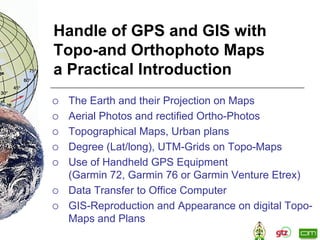
- 1. Handle of GPS and GIS with Topo-and Orthophoto Maps a Practical Introduction The Earth and their Projection on Maps Aerial Photos and rectified Ortho-Photos Topographical Maps, Urban plans Degree (Lat/long), UTM-Grids on Topo-Maps Use of Handheld GPS Equipment (Garmin 72, Garmin 76 or Garmin Venture Etrex) Data Transfer to Office Computer GIS-Reproduction and Appearance on digital Topo- Maps and Plans