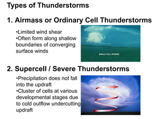
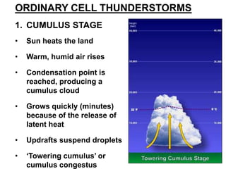
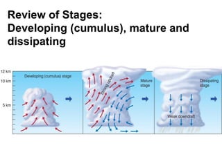
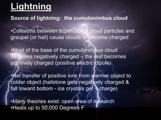
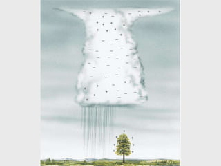
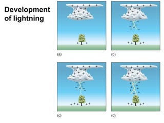
Thunderstorms can be ordinary cell or supercell storms. Ordinary cell storms have three stages: cumulus, mature with rain/hail and lightning, and dissipating. Supercell storms feature rotating updrafts and are associated with tornadoes. Lightning results from the buildup of positive and negative charges within storm clouds. It allows for the equalization of these charges through flashes that can reach temperatures over 50,000 degrees Fahrenheit.


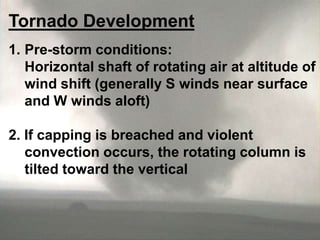
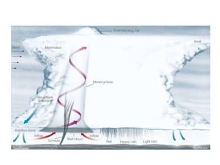
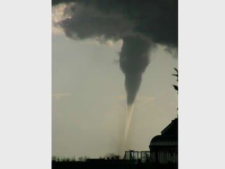
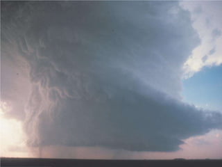
![Tornado producing supercell
[insert fig 11-29]](https://image.slidesharecdn.com/prezentacjaglennamcmanawayathunderstormsandtornadoes-131218070218-phpapp01/85/Thunderstorms-and-tornadoes-24-320.jpg)
![Global tornado frequency
[insert fig 11-32]](https://image.slidesharecdn.com/prezentacjaglennamcmanawayathunderstormsandtornadoes-131218070218-phpapp01/85/Thunderstorms-and-tornadoes-26-320.jpg)
![[insert table 112]](https://image.slidesharecdn.com/prezentacjaglennamcmanawayathunderstormsandtornadoes-131218070218-phpapp01/85/Thunderstorms-and-tornadoes-27-320.jpg)
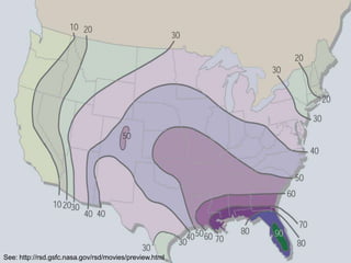
![Distribution of lightning strikes
[insert fig 11-23]](https://image.slidesharecdn.com/prezentacjaglennamcmanawayathunderstormsandtornadoes-131218070218-phpapp01/85/Thunderstorms-and-tornadoes-29-320.jpg)


![3 25 2015 severe weather ppt 014[1] with notes](https://cdn.slidesharecdn.com/ss_thumbnails/3252015severeweatherppt0141withnotes-150324083133-conversion-gate01-thumbnail.jpg?width=640&height=640&fit=bounds)


