The weather storms
•
3 likes•99 views

This document provides an overview of thunderstorms and related weather phenomena. It defines a thunderstorm as a convective storm containing lightning and thunder. Thunderstorms generally go through three stages - cumulus, mature, and dissipating. Squall lines form when multicell thunderstorms organize into a line. Supercell thunderstorms feature a strong, persistently rotating updraft. Tornadoes are rotating columns of air that extend from storm clouds to the ground. The document also discusses lightning, geographical distributions of thunderstorms, and other characteristics of thunderstorms and tornadoes.

More Related Content
What's hot
What's hot (20)
Similar to The weather storms
Similar to The weather storms (20)
More from musadoto
More from musadoto (20)
Recently uploaded
Recently uploaded (20)
The weather storms
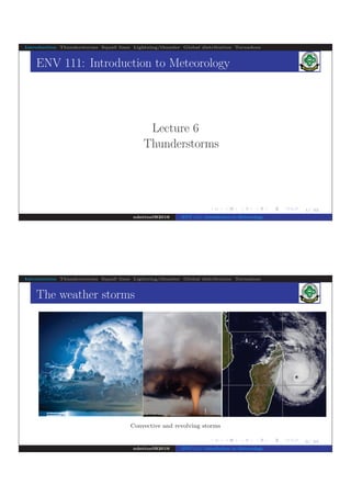
- 1. . . . . . . . . . . . . . . . . . . . . . . . . . . . . . . . . . . . . . . . . 1/ 42 Introduction Thunderstorms Squall lines Lightning/thunder Global distribution Tornadoes ENV 111: Introduction to Meteorology Lecture 6 Thunderstorms ndettoel@2016 ENV 111: Introduction to Meteorology . . . . . . . . . . . . . . . . . . . . . . . . . . . . . . . . . . . . . . . . 2/ 42 Introduction Thunderstorms Squall lines Lightning/thunder Global distribution Tornadoes The weather storms Convective and revolving storms ndettoel@2016 ENV 111: Introduction to Meteorology
- 2. . . . . . . . . . . . . . . . . . . . . . . . . . . . . . . . . . . . . . . . . 3/ 42 Introduction Thunderstorms Squall lines Lightning/thunder Global distribution Tornadoes Weather storms The atmosphere exhibit several lifting mechanisms to generate clouds and precipitation systems of different scales and intensity The instabilities include: ⇒ those that result directly in vertical mixing, such as convective instabilities ⇒ those associated with the meridional heating disparities that give rise to baroclinic instabilities and the ubiquitous fronts ⇒ low and high pressure weather systems So ”storm” is a generic term for all the potential disturbances that create upward motion in the atmosphere Many can be thunderstorms, or extratropical cyclones manifested as rain- or snowstorms ndettoel@2016 ENV 111: Introduction to Meteorology . . . . . . . . . . . . . . . . . . . . . . . . . . . . . . . . . . . . . . . . 4/ 42 Introduction Thunderstorms Squall lines Lightning/thunder Global distribution Tornadoes Weather storms Global distribution of such events vary with climate, though exhibit basic mechanisms for lifting air Thunderstorms and tornadoes are mesoscale weather storms lasting from minutes to few hours Severe thunderstorms produce tornadoes, strong winds and large hail Other atmospheric disturbances are associated with falling pressure, hence grow into large weather systems Hurricanes are macroscale weather systems at a synoptic scale (2, 000 km) lasting for a few days to a week or more ndettoel@2016 ENV 111: Introduction to Meteorology
- 3. . . . . . . . . . . . . . . . . . . . . . . . . . . . . . . . . . . . . . . . . 5/ 42 Introduction Thunderstorms Squall lines Lightning/thunder Global distribution Tornadoes Thunderstorms A thunderstorm is a convective storm containing lightning and thunder; It is characterised by turbulent vertical fluxes of heat and momentum Produces gusty surface winds (> 25 m/s), heavy rain and large hail (> 1.9 cm diameter) The storm may be a single cumulonimbus cloud, or several thunderstorms clustered together Figure 2 : Thunderstorm with a flash of a lightning in a cloud ndettoel@2016 ENV 111: Introduction to Meteorology . . . . . . . . . . . . . . . . . . . . . . . . . . . . . . . . . . . . . . . . 6/ 42 Introduction Thunderstorms Squall lines Lightning/thunder Global distribution Tornadoes Thunderstorms Thunderstorms form with rising warm and moist air in a conditionally unstable environment; i.e. no hydrostatic balance Mechanisms that cause air to rise include: ⇒ random, turbulent eddies that lift small bubbles of air ⇒ unequal heating at the surface ⇒ the effect of terrain (such as small hills) or the lifting of air along shallow boundaries of converging surface winds ⇒ large-scale uplift along mountain barriers and rising terrain ⇒ diverging upper-level winds, coupled with converging surface winds and rising air ⇒ warm air rising along a frontal zone ndettoel@2016 ENV 111: Introduction to Meteorology
- 4. . . . . . . . . . . . . . . . . . . . . . . . . . . . . . . . . . . . . . . . . 7/ 42 Introduction Thunderstorms Squall lines Lightning/thunder Global distribution Tornadoes Life cycle of a thunderstorm Figure 3 : Stages of development of an ordinary cell thunderstorm Cumulus stage: warm, humid air rises, cools and condenses into a single cumulus cloud or a cluster of clouds ndettoel@2016 ENV 111: Introduction to Meteorology . . . . . . . . . . . . . . . . . . . . . . . . . . . . . . . . . . . . . . . 8/ 42 Introduction Thunderstorms Squall lines Lightning/thunder Global distribution Tornadoes Ordinary cell thunderstorms Latent heat release keeps the rising air (up-drafts) inside the cloud warmer (less dense) than the air surrounding it Normally, neither lightning nor thunder occurs during this stage Mature stage: Cloud particles grow larger and heavier through collision-coalescence process Drier air from around the cloud is also being drawn into it through entrainment process which causes some of the raindrops to evaporate and chill the air Colder and heavier air begins to descend as a down-draft ndettoel@2016 ENV 111: Introduction to Meteorology
- 5. . . . . . . . . . . . . . . . . . . . . . . . . . . . . . . . . . . . . . . . . 9/ 42 Introduction Thunderstorms Squall lines Lightning/thunder Global distribution Tornadoes Ordinary cell thunderstorms When the cloud top reaches the stable atmosphere, the cloud takes an anvil shape, as upper-level winds spread the cloud’s ice crystals horizontally Strong up-drafts and down-drafts create severe turbulence Lightning and thunder occurs at this stage accompanied with heavy rain (and occasionally small hail) Often a down-rush of cooler air occurs at the surface, with the onset of precipitation Gust front occurs as a surface boundary separating the advancing cooler air from the surrounding warmer air ndettoel@2016 ENV 111: Introduction to Meteorology . . . . . . . . . . . . . . . . . . . . . . . . . . . . . . . . . . . . . . . . 10/ 42 Introduction Thunderstorms Squall lines Lightning/thunder Global distribution Tornadoes Ordinary cell thunderstorms Dissipating stage: The up-drafts weaken as the gust front moves away from the storm (less supply) The down-drafts dominate much of the cloud An ordinary cell thunderstorm does not normally last very long as the down-drafts cut off the storm’s fuel supply by destroying the humid up-drafts Usually the three stages take a duration of one hour or less ndettoel@2016 ENV 111: Introduction to Meteorology
- 6. . . . . . . . . . . . . . . . . . . . . . . . . . . . . . . . . . . . . . . . . 11/ 42 Introduction Thunderstorms Squall lines Lightning/thunder Global distribution Tornadoes Multicell thunderstorm Figure 4 : A model for a multi cell thunderstorm It is a thunderstorm with many cells, each in a different stage of development; usually occurring in regions of moderate-to- strong vertical wind speed shear ndettoel@2016 ENV 111: Introduction to Meteorology . . . . . . . . . . . . . . . . . . . . . . . . . . . . . . . . . . . . . . . . 12/ 42 Introduction Thunderstorms Squall lines Lightning/thunder Global distribution Tornadoes Multicell thunderstorms The up-drafts rise over the down-drafts and can generate new cells that grow to mature thunderstorms too Precipitation inside the storm does not fall into the up-draft (as in ordinary cell thunderstorm), so the storm’s fuel supply is not cut off An overshooting top occurs when convection is strong and the up-draft intense ndettoel@2016 ENV 111: Introduction to Meteorology
- 7. . . . . . . . . . . . . . . . . . . . . . . . . . . . . . . . . . . . . . . . . 13/ 42 Introduction Thunderstorms Squall lines Lightning/thunder Global distribution Tornadoes Multicell thunderstorms Mammatus clouds form when air spreads laterally into the anvil and sinks in this region The cold down-drafts at the earth’s surface, pushes outward in all directions This produces a strong gust front as the leading edge of the cold out-flowing air (also called straight-line winds as opposed to rotating winds of a tornado) ndettoel@2016 ENV 111: Introduction to Meteorology . . . . . . . . . . . . . . . . . . . . . . . . . . . . . . . . . . . . . . . . 14/ 42 Introduction Thunderstorms Squall lines Lightning/thunder Global distribution Tornadoes Squall lines Figure 5 : A model for a pre-frontal squall-line thunderstorms A squall is a strong gust of wind which may, or may not, be accompanied by a change in direction A squall line is a line of developing cumulus clouds with strong gusts of wind ndettoel@2016 ENV 111: Introduction to Meteorology
- 8. . . . . . . . . . . . . . . . . . . . . . . . . . . . . . . . . . . . . . . . . 15/ 42 Introduction Thunderstorms Squall lines Lightning/thunder Global distribution Tornadoes Squall lines So multicell thunderstorms may form as a line of thunderstorms Often, it is a result of convection along cold fronts where new cells of cumulus clouds develop constantly as the old ones die Ordinary squall lines may form along a gust front, with a stationary front, with a weak wave cyclone, or where no large-scale cyclonic storms are present ndettoel@2016 ENV 111: Introduction to Meteorology . . . . . . . . . . . . . . . . . . . . . . . . . . . . . . . . . . . . . . . . 16/ 42 Introduction Thunderstorms Squall lines Lightning/thunder Global distribution Tornadoes Squall lines Squall lines are one type of convective phenomenon called a mesoscale convective system (MCS) Many ordinary squall lines occurring in middle latitudes exhibit a structure similar to squall lines that form in the tropics Mesoscale convective systems are organized thunderstorms that can take on a variety of configurations, from the elongated squall line, to the circular mesoscale convective vortex ndettoel@2016 ENV 111: Introduction to Meteorology
- 9. . . . . . . . . . . . . . . . . . . . . . . . . . . . . . . . . . . . . . . . . 17/ 42 Introduction Thunderstorms Squall lines Lightning/thunder Global distribution Tornadoes Supercell thunderstorms Figure 6 : Model for a supercell thunderstorm A supercell is an intense, long-lasting thunderstorm with a single violently rotating up-draft It occurs in a region with strong vertical wind shear (speed and/or directional shear), where the outflow of cold air from the down-draft never undercuts the up-draft Strong wind shear create horizontal spin, which, when tilted into the up-draft, causes it to rotate ndettoel@2016 ENV 111: Introduction to Meteorology . . . . . . . . . . . . . . . . . . . . . . . . . . . . . . . . . . . . . . . . 18/ 42 Introduction Thunderstorms Squall lines Lightning/thunder Global distribution Tornadoes Lightning and thunder Figure 7 : Lightning and thunder A lightning is simply a discharge of electricity, a giant spark, It usually occurs in mature thunderstorms Lightning may take place: ⇒ within a cloud, ⇒ from one cloud to another, ⇒ from a cloud to the surrounding air, ⇒ from a cloud to the ground ndettoel@2016 ENV 111: Introduction to Meteorology
- 10. . . . . . . . . . . . . . . . . . . . . . . . . . . . . . . . . . . . . . . . . 19/ 42 Introduction Thunderstorms Squall lines Lightning/thunder Global distribution Tornadoes Lightning and thunder Thunder is shock wave with booming sound It occurs when air is extremely heated by lightning and expand explosively The lightning stroke can heat the air to an incredible 30, 000 C Questions to ponder: Why thunder is heard afterwards? How can we estimate the distance where lightning has just stroke? ndettoel@2016 ENV 111: Introduction to Meteorology . . . . . . . . . . . . . . . . . . . . . . . . . . . . . . . . . . . . . . . . 20/ 42 Introduction Thunderstorms Squall lines Lightning/thunder Global distribution Tornadoes Geographical distribution of thunderstorms Each day, more than 50, 000 thunderstorms occur throughout the world The equatorial landmasses is the most prevalent location The most conducive factors for thunderstorms formation are: ⇒ warmth ⇒ moisture ⇒ low-level convergence especially over water along the intertropical convergence zone to initiate uplifting of air ndettoel@2016 ENV 111: Introduction to Meteorology
- 11. . . . . . . . . . . . . . . . . . . . . . . . . . . . . . . . . . . . . . . . . 21/ 42 Introduction Thunderstorms Squall lines Lightning/thunder Global distribution Tornadoes Geographical distribution of thunderstorms The heat energy liberated in these storms helps the Earth maintain its heat balance by distributing heat poleward Thus, thunderstorms are less prevalent in dry climates (polar regions and the desert areas) In many areas,they form primarily in summer during the warmest part of the day when the surface air is most unstable ndettoel@2016 ENV 111: Introduction to Meteorology . . . . . . . . . . . 22/ 42 Introduction Thunderstorms Squall lines Lightning/thunder Global distribution Tornadoes Tornadoes .. ... ..... .... .. .. . ....... ... ... ... ........ ..... ............ .. .. .... .. .. . ... .. .... .. .. .. . . . ndettoel@2016 ENV 111: Introduction to Meteorology
- 12. . . . . . . . . . . . . . . . . . . . . . . . . . . . . . . . . . . . . . . . . 23/ 42 Introduction Thunderstorms Squall lines Lightning/thunder Global distribution Tornadoes Tornadoes A tornado is a rapidly rotating column of air, extending down from a cumuliform cloud, that blows around a small area of intense low pressure with a circulation that reaches the ground It circulation at the ground is either as a funnel-shaped cloud or as a swirling cloud of dust and debris Table 1 gives characteristic features of tornadoes (those occur in North America) ndettoel@2016 ENV 111: Introduction to Meteorology . . . . . . . . . . . . . . . . . . . . . . . . . . . . . . . . . . . . . . . . 24/ 42 Introduction Thunderstorms Squall lines Lightning/thunder Global distribution Tornadoes Tornadoes Table 1 : Characteristics features of tornadoes Characteristic feature Description Rotation Often anticlockwise Shapes and forms twisting rope-like funnels, cylindrical-shaped funnels, massive black wedge-shaped funnels, also like an elephant’s trunk Diameter Usually 100 − 600 m Wind speeds Often less than 100 knots Steering current south-westerlies for those form ahead an advancing cold front Duration and path length Few minutes, about 7 km Weather heavy rain, hail, thunder, lightning ndettoel@2016 ENV 111: Introduction to Meteorology
- 13. . . . . . . . . . . . . . . . . . . . . . . . . . . . . . . . . . . . . . . . . 25/ 42 Introduction Thunderstorms Squall lines Lightning/thunder Global distribution Tornadoes Tornado: formation Figure 9 : A simplified view of a supercell thunderstorm illustrating formation of a tornado Necessary conditions: ⇒ conditionally unstable atmosphere ⇒ strong vertical wind shearndettoel@2016 ENV 111: Introduction to Meteorology . . . . . . . . . . . . . . . . . . . . . . . . . . . . . . . . . . . . . . . . 26/ 42 Introduction Thunderstorms Squall lines Lightning/thunder Global distribution Tornadoes Tornado: formation In supercell thunderstorms, the drawn warm and humid air spins counter-clockwise Near the top of the storm, strong winds push the rising air to the north-east Up-draft and down-drafts are separate; the storm is sustained Vertical wind shear causes the air near the surface to rotate about a horizontal axis i.e. a vortex tube ⇒ wind directional shear in the vertical ⇒ wind speed shear in the vertical (rapid increase with height) ⇒ southerly low-level jet above weaker surface winds can cause also rotation Up-draft strength increases as pressure in the mid-levels of the thunderstorm drops due to up-draft rotation ndettoel@2016 ENV 111: Introduction to Meteorology
- 14. . . . . . . . . . . . . . . . . . . . . . . . . . . . . . . . . . . . . . . . . 27/ 42 Introduction Thunderstorms Squall lines Lightning/thunder Global distribution Tornadoes Tornado: Life cycle Figure 10 : Tornadoes at mature (L) and decaying (R) stages in America dust-whirl stage, ⇒ dust swirls upward from the the surface ⇒ short funnel extending downward from the thunderstorms base ⇒ damage is normally less severe ndettoel@2016 ENV 111: Introduction to Meteorology . . . . . . . . . . . . . . . . . . . . . . . . . . . . . . . . . . . . . . . . 28/ 42 Introduction Thunderstorms Squall lines Lightning/thunder Global distribution Tornadoes Tornado: Life cycle organised stage, ⇒ Increasing in intensity and downward extent of the funnel mature stage, ⇒ the funnel reaches its greatest width and is almost vertical ⇒ circulation usually stays in contact with the ground until it dissipates ⇒ damage is normally most severe shrinking stage ⇒ decrease in the funnel’s width but its tilt increases ⇒ damage swath narrows though it may still inflict damage decay stage ⇒ tornado is stretched into the shape of a rope ⇒ damage swath narrows though it may still inflict damage ndettoel@2016 ENV 111: Introduction to Meteorology
- 15. . . . . . . . . . . . . . . . . . . . . . . . . . . . . . . . . . . . . . . . . 29/ 42 Introduction Thunderstorms Squall lines Lightning/thunder Global distribution Tornadoes Tornado observation and distribution Figure 11 : Monthly average number of tornadoes n US from 2000 to 2010 A doppler radar discerns what goes on inside a tornado- generating thunderstorm Tornadoes occur in all regions worldwide, with thunderstorms From 1950s to 2000s, number of tornadoes in US has doubled from about 600 per year Importance of tornado intensity distributions: ⇒ basic climatology research ⇒ risk assessment ⇒ insurance industry ndettoel@2016 ENV 111: Introduction to Meteorology . . . . . . . . . . . . . . . . . . . . . . . . . . . . . . . . . . . . . . . . 30/ 42 Introduction Thunderstorms Squall lines Lightning/thunder Global distribution Tornadoes Tornado winds and clasification Figure 12 : Damaging effect of a tornado The strong winds of a tornado can destroy buildings, uproot trees, and hurl all sorts of lethal missiles into the air For an approaching tornado, it is advised to take shelter in a basement, storm shelter, or a dedicated safe room If no shelter exists, lie flat on the ground in a depression or ravine Tornadoes are classified according to their rotational wind speed (Dr. T. T. Fujita) ndettoel@2016 ENV 111: Introduction to Meteorology
- 16. . . . . . . . . . . . . . . . . . . . . . . . . . . . . . . . . . . . . . . . . 31/ 42 Introduction Thunderstorms Squall lines Lightning/thunder Global distribution Tornadoes Tornado winds and clasification The winds are estimated based on the damage caused by the storm and since 2007, a new scale ”Enhanced Fujita Scale” (EF Scale) is being used: . Table 2 : Enhanced Fujita (EF) Scale for damaging Tornado Winds Scale Category Knot Possible damage F0 Weak 56 − 74 break tree branches F1 75 − 95 snap trees F2 Strong 96 − 117 uproot large trees F3 118 − 143 F4 Violent 144 − 174 level trees, overturn cars F5 > 174 move autos over 100 meters damage steel-reinforced structures ndettoel@2016 ENV 111: Introduction to Meteorology . . . . . . . . . . . . . . . . . . . . . . . . . . . . . . . . . . . . . . . . 32/ 42 Introduction Thunderstorms Squall lines Lightning/thunder Global distribution Tornadoes Hurricanes Figure 13 : Tropical cyclone Giovana in Indian Ocean, February 9, 2012 A hurricane is one of the tropical revolving storms whose generic term is Tropical cyclone ndettoel@2016 ENV 111: Introduction to Meteorology
- 17. . . . . . . . . . . . . . . . . . . . . . . . . . . . . . . . . . . . . . . . . 33/ 42 Introduction Thunderstorms Squall lines Lightning/thunder Global distribution Tornadoes Tropical cyclonic storms Tropical cyclonic systems can be classified using either the Beaufort scale of wind intensity or the pressure deficit: System BF No. Vortex speed Pressure deficit Depression 5 17 − 21 5 mb ” 6 22 − 27 ” 7 28 − 33 Storm 8 34 − 40 15 mb ” 9 41 − 47 ” 10 48 − 55 ” 11 56 − 63 Cyclone 12 64− 30 mb The local names used for tropical cyclones include: ⇒ Cyclone ⇒ Typhoon, from Chinese word ”Taifung” meaning ”big wind”ndettoel@2016 ENV 111: Introduction to Meteorology . . . . . . . . . . . . . . . . . . . . . . . . . . . . . . . . . . . . . . . . 34/ 42 Introduction Thunderstorms Squall lines Lightning/thunder Global distribution Tornadoes Tropical cyclones Cyclones occur mostly during summer (late), though they can form at any time of the year; often in western North Pacific . Table 3 : Frequency of occurrence of tropical cyclones Region Frequency Season % Western North Pacific 30 June - October North Indian Ocean 15 April - June; October - November South Western Indian 14 December - April West Atlantic Ocean 12 July - October East Pacific (north of equator) 11 July - October South Pacific 11 December - March North and West of Australia 7 December - February ndettoel@2016 ENV 111: Introduction to Meteorology
- 18. . . . . . . . . . . . . . . . . . . . . . . . . . . . . . . . . . . . . . . . . 35/ 42 Introduction Thunderstorms Squall lines Lightning/thunder Global distribution Tornadoes Regions and tracks Figure 14 : Tracks of cyclones in regions of occurrence Cyclones originate over eastern part of tropical oceans where trade winds had long passage. The tracks are guided by basic flow in upper troposphere, Coriolis force, outflow jet, and terrain feature like an island or mountain ndettoel@2016 ENV 111: Introduction to Meteorology . . . . . . . . . . . . . . . . . . . . . . . . . . . . . . . . . . . . . . . . 36/ 42 Introduction Thunderstorms Squall lines Lightning/thunder Global distribution Tornadoes Structure of a Hurricane Dimension: 200 − 1000 km radius; 10 − 15 km high The diameter is smallest when the cyclone is closest to the equator, and it increases as the cyclone recurves poleward The cyclones originate in the doldrums over the ocean between 6 ◦ and 20 ◦ North and South, when the doldrums is farthest away from the equator However, no cyclones occur in the South Atlantic Ocean since in this ocean, the doldrums (ITCZ) never cross the equator southwards. ndettoel@2016 ENV 111: Introduction to Meteorology
- 19. . . . . . . . . . . . . . . . . . . . . . . . . . . . . . . . . . . . . . . . . 37/ 42 Introduction Thunderstorms Squall lines Lightning/thunder Global distribution Tornadoes Structure of a Hurricane Figure 15 : Hurricane Elena over the Gulf of Mexico Hurricane Elena, as one of the average storm had its central pressure of 955 mb, and sustained winds of 105 knots ndettoel@2016 ENV 111: Introduction to Meteorology . . . . . . . . . . . . . . . . . . . . . . . . . . . . . . . . . . . . . . . 38/ 42 Introduction Thunderstorms Squall lines Lightning/thunder Global distribution Tornadoes Structure of a Hurricane The storm’s thickest clouds covered an area of about 500 in diameter An eye is the centre of the storm with a relatively clear area: ⇒ Winds are light and clouds are mainly broken ⇒ Surface air pressure is lowest, around 955 mb ⇒ The width of the eye is almost 40 km The eye-wall is a ring of intense thunderstorms that whirl around the storm’s centre ⇒ It may extend upward to almost 18 km above sea level ⇒ Heaviest precipitation and the strongest winds exist here ndettoel@2016 ENV 111: Introduction to Meteorology
- 20. . . . . . . . . . . . . . . . . . . . . . . . . . . . . . . . . . . . . . . . . 39/ 42 Introduction Thunderstorms Squall lines Lightning/thunder Global distribution Tornadoes Vertical structure Figure 16 : A model depicting a vertical structure of a cyclone The vertical view of a hurricane shows that the storm is composed of an organized mass of thunderstorms ndettoel@2016 ENV 111: Introduction to Meteorology . . . . . . . . . . . . . . . . . . . . . . . . . . . . . . . . . . . . . . . 40/ 42 Introduction Thunderstorms Squall lines Lightning/thunder Global distribution Tornadoes Formation and life cycles of cyclones The Conditional Instability of the Second Kind (CISK) summarize the processes responsible for the formation of a tropical cyclone, that: Depression with falling pressure leads to horizontal inflow which attract vertical motion. The vertical motion leads condensation that cause the formation of cumulonimbus clouds and release of latent heat. This leads to further drop of pressure and the cycle continues The life cycles of a tropical cyclone are characterized as: ⇒ Formative stage: disorganised squall type of clouds and rainfall; low winds (about 34 kt); surface pressure of 1000 mb ⇒ Immature stage: wind speed at hurricane force (64 kt); clouds and rainfall spiralling inward ndettoel@2016 ENV 111: Introduction to Meteorology
- 21. . . . . . . . . . . . . . . . . . . . . . . . . . . . . . . . . . . . . . . . . 41/ 42 Introduction Thunderstorms Squall lines Lightning/thunder Global distribution Tornadoes Formation and life cycles of cyclones ⇒ Mature stage: Low pressure (900 mb or less); more steady hurricane wind force; torrential weather ⇒ Decaying stage: frictional dissipation; disruption of vortes; low moisture; move to colder areas Conditions necessary for the formation ⇒ SST of about 26.5 ◦ C. Warm ocean water favours convection instability ⇒ Enough moisture to provide latent heat of condensation ⇒ Pre-existing region of low level convergence e.g. monsoon lows, easterly waves and ITCZ ⇒ Coriolis force large enough to provide vortex ⇒ Vertical instability aloft for formation of Cbs ⇒ Weak wind shears to maintain warm air and Cbs ⇒ Upper level divergence to enhance vertical motion and low level convergence ndettoel@2016 ENV 111: Introduction to Meteorology . . . . . . . . . . . . . . . . . . . . . . . . . . . . . . . . . . . . . . . . 42/ 42 Introduction Thunderstorms Squall lines Lightning/thunder Global distribution Tornadoes Hurricane naming and Impacts (Homework) Meteorologists have devised a means to name the hurricane whenever they occur. Your are advise to read and find out why hurricanes are named and what is the system used for naming. Further find out, at which stage will a hurricane be given a name. Hurricane can also be classified as we have seen in the case for tornadoes. Then find out the system used for classifying hurricanes. Hurricane is one of the most severe weather systems hence it can cause a lot of damage. However, it is also possible that a hurricane can be of benefit somehow. therefore, discuss the possible impacts (positive and negative) of hurricanes in different sectors. Support your discussion with vivid examples. ndettoel@2016 ENV 111: Introduction to Meteorology