
More Related Content
What's hot
What's hot (20)
Similar to Sustainable Biomes.pptx
Similar to Sustainable Biomes.pptx (20)
Recently uploaded
Recently uploaded (20)
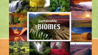
Sustainable Biomes.pptx
- 2. Lesson Intention: Success Criteria: • Describe what the topic is based on due to images shown • I can create open ended questions • I can discuss the ‘Why’ We can develop geographically centered questions and help plan an inquiry
- 3. The Dystopian Future… Imagine the world in 20 years time. It is 2042 and you are about 35 years old.
- 5. Scott Morrison and future Prime Ministers ignored the warnings about climate change. I love money! Climate change isn’t real!
- 6. The Great Barrier Reef has been destroyed.
- 7. Australia has become a giant coal and gas mine.
- 8. President Trump Jr has declared nuclear war against North Korea and Russia
- 9. Most of the world is suffering from famine because the environment has been poisoned
- 10. Scientists are suggesting that we abandon earth and leave for Mars
- 11. What could we have done to stop this?!
- 12. But before we can save the world, we need to understand the different types of habitats on earth, especially the ones that grow our food!
- 13. Pre-Test You will be provided with a map and a list of Biomes that are present all over the world. (a map displaying countries will be put on the smart) Your task is to use your knowledge of the world's environment and climates and colour code the map with reference to the Biomes List. You will have 20 minutes to complete this task to the best of your abilities. We will then come back to this task at the end of the unit to see your progress.
- 16. Lesson Intention: Success Criteria: • Describe what a biome is (definition) • I can create a graphic organiser connecting biomes to countries, continents and characteristics. • I can connect biomes to their characteristics e.g. climate We can develop an understanding of what a biome is and distinguish the difference between a terrestrial and aquatic biomes.
- 17. Unit Overview ▪ Why are biomes located where they are? ▪ What do biomes provide for humans? ▪ Will climate impact the productivity of biomes? ▪ Can technology help our most productive biomes? ▪ How can people get more from biomes? ▪ Can we guarantee food for the future population? ▪ How can Australia help food security worldwide? Looking at this picture, what do you think a biome is?
- 18. Part 1: Investigating Biomes A biome is a region that shares similar and distinctive climates, soils and vegetation. The tundra lands biome, for example, is characterised by very cold climates, extreme winds and very limited plant and animal diversity. In contrast, the tropical rainforest biome is characterised by a warm and wet climate, highly weathered soils and thick, lush vegetation. In this topic you will explore eight diverse biomes: polar lands, tundra, boreal (Taiga) forest, mountain vegetation, temperate forest, grassland, desert and tropical rainforest.
- 19. What is a Biome? ▪ Geographers divide the Earth’s surface into a number of distinct regions. ▪ Each region has particular features that make it different from other regions. ▪ One region may be hot and rainy most of the time, for example, and another might be dry and cold. ▪ This means the plant and animal life found there functions, adapts and interacts according to the conditions of the region it inhabits. ▪ A biome is a region that shares similar and unique climates, soils and vegetation. Copy heading and dot points
- 20. Terrestrial or Land Biomes ▪ The terrestrial or the land biomes are categorized according to the climate conditions and the vegetation of the region in which they are found. ▪ The vegetation also called the biological community of plants, animals, birds and other living species that is stable and dominant after the numerous years of evolutionary development. Tundra Desert Savana Mountain Vegetation Grasslands Rain forest Polar region Tropical forest Taiga (Boreal Forest) Northern Conifer Forest Mediterranean scrub forest Temperate Deciduous Forest
- 21. We are going to create a graphic organiser and use this map as reference.
- 22. Part 1: Investigating Biomes Biome Country Continent Characteristics
- 23. Characteristics ▪ Polar Lands: Antarctica ▪ Long cold winters ▪ Soil covered in ice ▪ Few plants can survive ▪ Animals such as Penguins, polar bears and arctic fox ▪ Tundra: North America ▪ Extreme cold climate ▪ Limited biodiversity (plants and animals) ▪ Boreal (Taiga) Forest: Russia + Siberia ▪ Extreme variations in climate (freezing to hot) ▪ Coniferous trees (do not drop leaves, soak up sun) ▪ Dry – limited rainfall ▪ Thin soil layer ▪ Grasslands: Every continent but Antarctica ▪ Vegetation is grass dominant ▪ Semi-arid climate ▪ Rainfall enough to support vegetation ▪ Often exploited for agriculture ▪ Desert: Australia • Hot and dry • Barren landscape with limited vegetation • Less then 10 inches of annual rainfall ▪ Mountain Vegetation: Algeria ▪ Only exists in high altitudes 10000 feet ASL ▪ Summer 15 degrees – winter can be in minus ▪ windy with erratic weather patterns
- 24. Characteristics ▪ Tropical Forests: Queensland and Amazon ▪ High animal and vegetation biodiversity ▪ Typically called rainforests ▪ High rainfall – rains almost everyday ▪ They are primarily found within the Tropic of Capricorn and the Tropic of Cancer. ▪ Can take up to 10min for a rain drop to hit the ground due to dense foliage. ▪ Temperate Forest: Eastern Asia ▪ High levels of precipitation and humidity ▪ Deciduous trees – lose leaves in winter ▪ Thick nutrient soil
- 25. Lesson Intention: Success Criteria: • I can identify what an aquatic biome is • I can describe where aquatic biomes are and name several • I can accurately map aquatic biomes We can identify what an aquatic biome is, where they are located and their characteristics.
- 26. 1. You will be split into your table groups Each group will be given these three images Think about what characteristics each biome has 2. Each group will share their ideas and a mind map of each biome created by the teacher on the board – each group must contribute.
- 27. Describe the distribution of biomes in Australia. AND Where are the different biomes in Australia?
- 28. VOCABULARY VIBE
- 29. Aquatic Biomes Aquatic biomes exist too. The world’s oceans, freshwater lakes, coral reefs and wetlands are all examples of these biomes, which are dominated by water and the plants and animals that call them home. What are some other examples of aquatic biomes?
- 30. Aquatic Biomes The aquatic biome is the largest of all the biomes, covering about 75 percent of Earth's surface. This biome is usually divided into two categories: freshwater and marine. Fresh Water Marine Lakes Ocean Rivers Estuaries Streams Wetlands
- 31. Aquatic Biomes Biome Example Characteristic Create the following table in your books and use the information from the video on the next slide to complete the table.
- 32. Aquatic Biomes
- 33. Lesson Intention: Success Criteria: • I can list all 4 spheres that exist • I can Identify how matter and energy change and cycle through the system as the spheres interact • I can analyse events and make a judgement about how that event impacts the sphere We can understand the concept of a ‘system’ as it applies to earth.
- 34. UNIT TERMINOLOGY
- 35. Environmental Spheres • What is the: • Lithosphere • Biosphere • Hydrosphere • Atmosphere?
- 36. Environmental Spheres • Earth's natural environment is made up of 4 interacting spheres. 1. The solid part of the earth's crust (rocks and soil) is known as the lithosphere. 2. All of earth's water bodies, including lakes, rivers, streams, oceans, groundwater and ice caps, are known as the hydrosphere. 3. The layer of gases surrounding the earth is known as the atmosphere. 4. All living things, including plants and animals, make up the biosphere. Earth's four spheres can be identified in the photograph. Copy into your book
- 38. Are Biomes and Ecosystems the Same? A biome is different from an ecosystem. An ecosystem is the living and non living things in an environment that result from the interaction of environmental spheres. A biome is a specific geographic area notable for the species living there. OR A biome is the habitat or environment, while an ecosystem is the interaction between living and non-living things within that environment. Copy one definition
- 39. Video on Biomes and Ecosystems ▪ https://www.youtube.com/watch?v=dTaWsFct32g&feature=youtube _gdata_player 16 minutes ▪ Fill in the table on your worksheet as the video plays
- 40. Climate Climate tells us the following about a place on the earth: ▪ How much rain and snow falls. (precipitation) ▪ How hot or cold it is. (temperature) ▪ The number of hours that the sun shines (hours of daylight). ▪ Climate is the weather a place has over a long period of time (50 years). Weather may change each day, but climate is the type of weather that people expect for the region in which they live. What is the difference between weather and climate?
- 41. Climate Graphs Climate Graphs are very useful in comparing the annual temperature and rainfall of places around the world. They are very easy to plot and read. These simple steps should show you how to draw one and then how to read it.
- 42. Steps to Plotting Climate Graphs 1. Plot on the rainfall as a column graph, coloured blue. 2. Plot on the temperature as a line graph, coloured red. The dots should be in the middle of the column. 3. Label the axes (rainfall, temperature and months) and the heading (name of the place) 4. Find the total rainfall for the year (add all the bars together) 5. Calculate the temperature range (the difference between the highest temperature and the lowest one). E.g Max 40C. Min -40C, range =80C
- 43. Climate Graphs ▪ The blue bars show the precipitation by month. The precipitation scale is on the left ▪ The red dots on the curved line show the temperature by month. The temperature scale is on the right.
- 44. Climate graph for Newcastle:
- 48. Worksheets ▪ Climate graph for Halifax, Nova Scotia ▪ Climographs
- 49. Transfer the data on these graphs to complete your own climate graph. You will need to figure out what the temperature range and total precipitation is for each month.
- 50. Grasslands • Grasslands are found where it is too dry for forests and too wet for deserts. • Also known as prairies (USA), steppes (Asia) or savannahs (Africa). • Much of the world’s food and fibre comes from plants and animals that live in the world’s grasslands. • Rice, wheat and corn (which are all grasses) provide the bulk of the human population’s food, and many animals that are farmed to provide meat and milk also live in the grasslands biome. African Savannah
- 51. Grasslands Much of Australia can be considered grassland and many of our native animals, such as kangaroos, wallabies and wombats, thrive in this biome. Australian grasslands
- 52. • Grasslands are dotted with individual trees, providing little cover for the wildlife that live there. • Animal survival adaptations: • The zebra’s stripes make it difficult for a predator to see it clearly. • The giraffe has evolved in such a way that its long neck allows it to source food at the tops of trees. • Many are nocturnal, allowing them to avoid the main heat of the day e.g. prairie dog, barn owl and grey wolf Grassland Animals US Prairie Mongolian Steppe
- 53. Case Study: The American Prairie It is estimated that 30 million bison lived in North America in the 1500s. Within 400 years this had fallen to about 1000. In this photograph, taken in the 1870s, a pile of bison skulls waits to be crushed for fertiliser. Worksheet
- 54. Hot Deserts High daytime temperature Low night time temperature Soils are dry and salty- little can grow Vegetation is stunted and widely spaced Plants and animals are highly adapted to their surroundings
- 55. Tropical Rainforests ▪ It is estimated that about half of all the plant, animal and insect species in the world live in tropical forests. ▪ Many of these are among the wettest places on Earth and are therefore known as rainforests. ▪ They can be considered to make up the world’s richest biome and the abundance of life can be astounding.
- 56. Tropical Rainforests In Brazil, for example, researchers found that a single pond contained more fish species than exist in all of Europe’s rivers.
- 57. Tropical Rainforests In Peru, a single tree was found to contain 43 ant species; this is more than the total number in all of the British Isles.
- 58. Tropical Rainforests One hectare of South American rainforest may contain over 750 different types of trees, and one- fifth of all of the world’s birds live in the Amazon rainforest.
- 59. Tropical Rainforests ▪ This explosion of life is due to the ideal growing conditions that occur in the tropics. ▪ These places experience the most stable climate conditions on the planet with virtually no seasonal changes in rainfall, temperature or available sunlight throughout the year. ▪ Most days are the same in the rainforest: hot and wet. It rains virtually every day, often in torrential downpours. The temperature hovers between about 26°C and 32°C all year round. Summarise into your books: Why do rainforests produce such a large variety of species?
- 61. Describe the distribution of Eastern Australia’s rainforests. OR Where do you find Australian rainforests? Refer to particular places and states and use compass directions in your answer. Note: Rainforests are also found in the Northern Territory and Western Australia
- 62. Rainforests have provided humans with many resources for thousands of years. These resources are known as ecosystem services . The Gifts of the Rainforest
- 63. Flow Chart Worksheet- Rainforests Page 51 of textbook
- 64. Rainforest Documentary ▪ https://www.youtube.com/watch?v=hb3b-A6QAc8 8 mins ▪ The __________ benefits can never outweigh the _____ _____ costs. ▪ Doing so has far reaching ___________ on not only the region but the world. ▪ Once it’s _____ it can never be ______ .
- 65. Video- Biomes That Produce Our Food ▪ https://www.youtube.com/w atch?v=xp0Rz36hSzs ▪ 5 mins ▪ Think about how the land is used and issues of sustainability.
- 66. Design a World Tour- Extension Activity Design a world tour that includes at least one visit to each type of biome. Research where you will go using a map that shows the world biomes, and then list the countries you would visit on this tour. Include some of the activities you might do at each place, based on the biome’s climate and geographical conditions.
- 67. Changes to the Natural Environment ▪ The last ______ years have seen more ________ change to the Earth’s _______ than in any other _______ in the Earth’s ________. ▪ Over _____ of the world’s ________ land area has been _________ into __________ or housing to provide food, ________, shelter and _______ to the world’s people – and this area is ___________. ▪ All around the world the _________ biomes of forests, _________, tundra and even __________ are being converted into _________.
- 68. Revision- Quick Write ▪ For the 1st 2 weeks of the term, we have looked at an overview of biomes. ▪ What have you learnt/what is your understanding of this topic? ▪ Write down your answer on the paper provided.
- 70. Brainstorm How can humans change the environment for their benefit? “Man” 3 ½ minutes https://www.youtube.com/watch?v=WfGMYdalClU Sample infographic:
- 71. Changes to the Natural Environment ▪ The last 300 years have seen more extensive change to the Earth’s biomes than in any other period in the Earth’s history. ▪ Over half of the world’s liveable land area has been converted into farmland or housing to provide food, fibre, shelter and fuel to the world’s people – and this area is expanding. ▪ All around the world the natural biomes of forests, grasslands, tundra and even deserts are being converted into farms. Write
- 73. Source 1.24 shows the extent of biome change around the world since 1700. Answer these in your book: a Describe the change to the amount of wilderness areas from 1700 to 2000. b Which 2 types of land use have increased the most? Why do you think this is the case?
- 74. Changing Vegetation Farmers make many changes to the natural environment in order to grow crops and raise farm animals. The greatest changes are made to the natural vegetation. 1. Forests are cut down, burnt and replaced with a single plant species 2. Wetlands and swamps are drained 3. Vast areas of native grasses are replaced with crops such as wheat and rice. Copy the heading and numbered points
- 75. For Against “A small-scale farmer should have unlimited capacity to farm their own land for the purpose of providing food for their family and community.” OR “A small-scale farmer should be able to do whatever they like with their own land to grow food”. 1. Copy one of the quotes in your book. 2. Draw a table in your books like the one below. 3. Put in a few arguments for and against the statement above. 4. Underneath, write a paragraph-long answer where you give your own opinion of the quote. Do you agree or disagree and why?
- 76. Changes to Forests • Around the world about 5 million hectares of forest is converted for agricultural use every year: an area about two-thirds the size of Tasmania. • Most of this change takes place in tropical forests, particularly in South America. • In Australia, around 50 million hectares of forests and woodland have been cleared for farming or affected by logging since European settlement. Read only
- 77. Deforestation in the Amazon
- 78. Changes to Forests • In the developing world, there is a strong link between deforestation and poverty. • Millions of people who live below the poverty line and struggle to meet their daily food requirements are becoming small-scale slash-and- burn farmers. • Over time, as soil fertility declines, the farmers and their animals move into a new patch of forest and begin the process again. • In Madagascar, for example, where 80 per cent of the population lives in poverty, only 10 per cent of the natural forest remains. Describe the link between poverty and deforestation in your own words.
- 79. What is Sustainability? Sustainability addresses the ongoing capacity of Earth to maintain all life. Sustainable patterns of living meet the needs of the present without compromising the ability of future generations to meet their needs.
- 80. Case Study: Greening the Deserts Sustainable? • In Saudi Arabia, sections of the desert have been transformed into farmland for the purpose of growing crops. • These crops use the water from aquifers (groundwater) to survive • In Saudi Arabia, water is extracted from the aquifers by drilling deep into the ground under the desert floor and pumping it to the surface sprinkler system. Each circular field shown in green is approximately 1 kilometre wide • Geographers and environmental scientists now believe that this type of farming has become unsustainable – both environmentally and economically. • In time, supplies of water in the aquifer will become totally depleted as they are being used far more quickly than they can be replenished. • The high cost associated with accessing water from the aquifers also means that crops grown in this way will soon become too expensive to buy. Is using this groundwater a sustainable practice? Why or why not?
- 81. Changes to Grasslands • Because the world’s most important food crops − rice, wheat and corn − are grasses, they grow best in the world’s grasslands biome. However, clearing of native grasses to plant these crops can have devastating effects on the natural environment. • Across much of Australia, North and South America, Asia and Africa, native grasses have been cleared and replaced by these three crops to provide food. Impact on Biome Harvesting makes soil less fertile Chemical fertilisers affect soil and cause pollution Pesticides pollute air, soil and water Exposed soil can be washed away by wind and water
- 82. Case Study: Palm Oil and Orangutans
- 83. Topographic Maps ▪ Topographic maps have been overlaid with a grid. What can we do with topographic maps? ▪ We can find out the distance from one place to another ▪ We can work out the height of the land. ▪ We can work out the direction from one place to another ▪ We can use scale on the map ▪ We can find places using the grid on the map and area and grid reference
- 85. Horizontal before vertical- you have to walk before you can climb Area Reference: Gives the location of one square on the grid e.g. AR4274 Grid references give a more specific location within the square e.g. GR412751
- 89. Kokoda Trail Topographic Map Worksheet
- 90. What Have We Done So Far 1.Introduction to Biomes ✔ 2.Changing Biomes ✔ 3.Biomes That Produce Food 4.Challenges to Food Production 5.Food Security
- 91. Part 3- Biomes that Produce Food
- 92. Where Does My Food Come From? ▪ Make a list of all the places that you (or your carers) buy food from e.g. supermarkets, butchers, fruit shops, general stores, farmers markets, takeaway, restaurants ▪ Do you grow any food yourself? If so, what do you grow? Write heading and answer questions in book
- 93. Where Does My Food Come From? 1. Make a list of 10 pre-packaged foods that you or your family eats. 2. Next to each one, write down where you think they come from. 3. Check with a partner to see if they agree ▪ I will look up the answers for you
- 94. “People in developing countries are more likely to know where all of their food comes from, than people in developed countries” Do you agree or disagree with this statement, and why? Write the statement and answer in your book In the developing world, the majority of people’s food comes from what they can grow and gather themselves. They spend a lot of their life tending to crops and animals. In developed countries like Australia, a lot of our food comes pre-packaged in supermarkets and we may be unsure of where it came from.
- 95. Explain why each of the white areas in the following regions and countries may be unsuitable for agriculture: Australia, South America, North Africa, Central Asia.
- 96. For each region, list 4 crops that Australia uses
- 98. Factors that Influence Farming What are some natural and human problems that farmers have to face? Copy the mind-map into your books
- 99. “Farm smarter, not harder” ▪ What does this mean to you? ▪ Write 1-2 sentences in your book
- 100. The Green Revolution ▪ The Green Revolution saw a massive change in farming technology. ▪ It occurred between 1930 and 1960 ▪ New technologies included: New, high-yielding varieties (HYVs) of cereals Synthetic fertilisers and pesticides ▪ The "Father of the Green Revolution“ received the Nobel Peace Prize in 1970, for saving over a billion people from starvation ▪ https://www.youtube.com/watch?v=HucSCNQ01X4 Write