Download to read offline


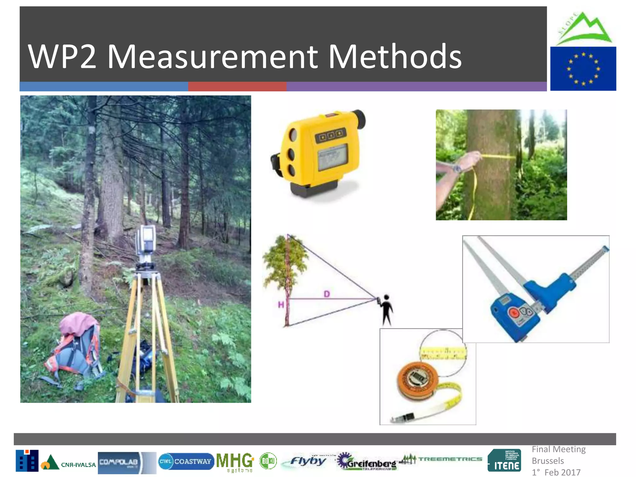
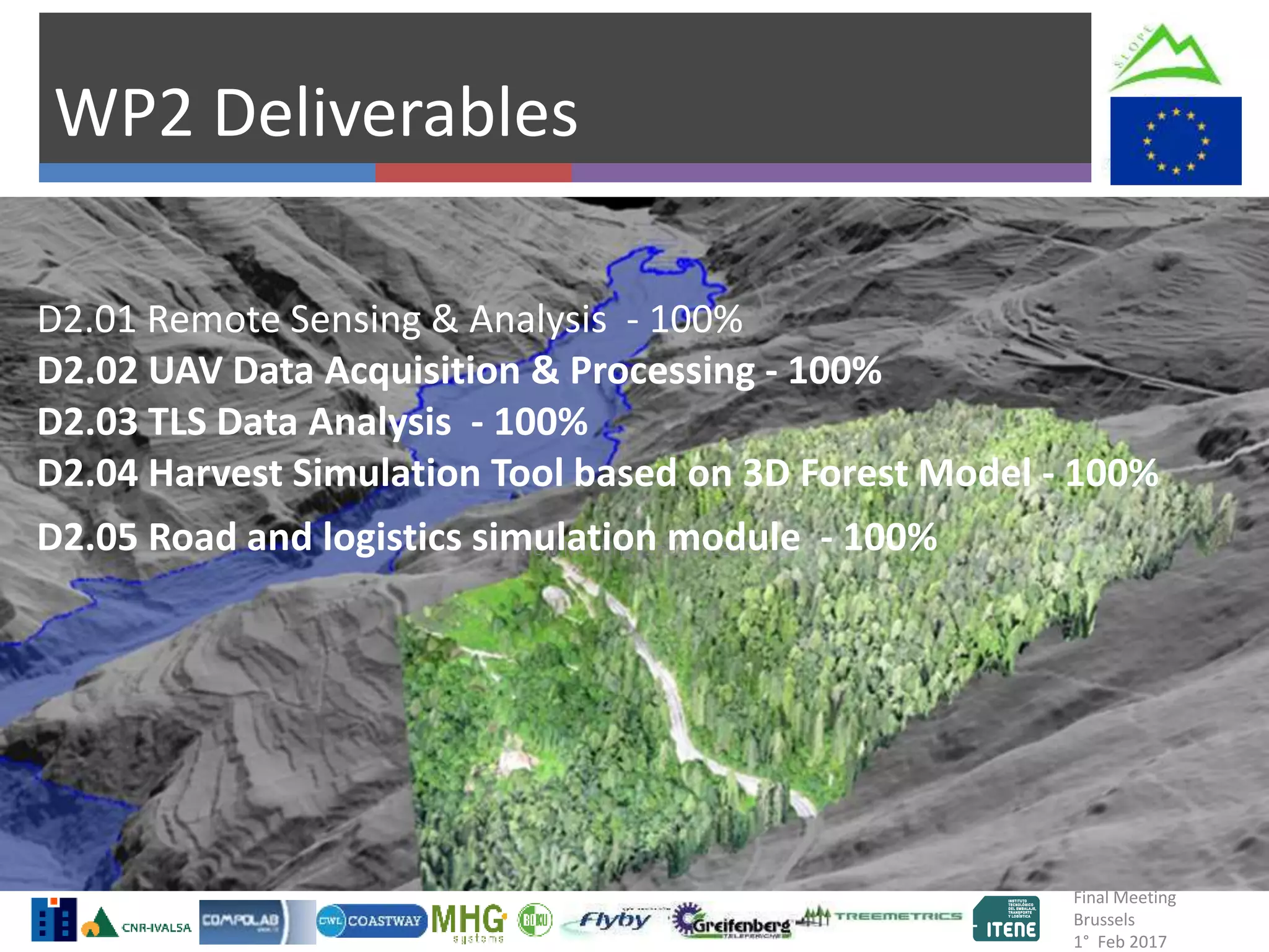
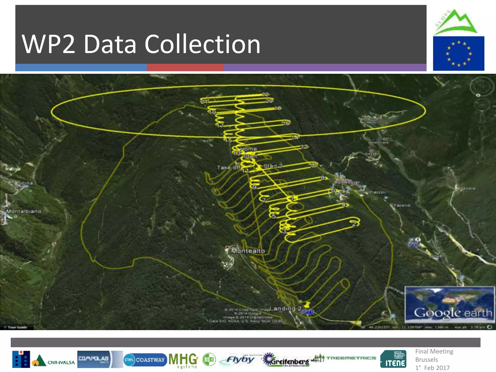
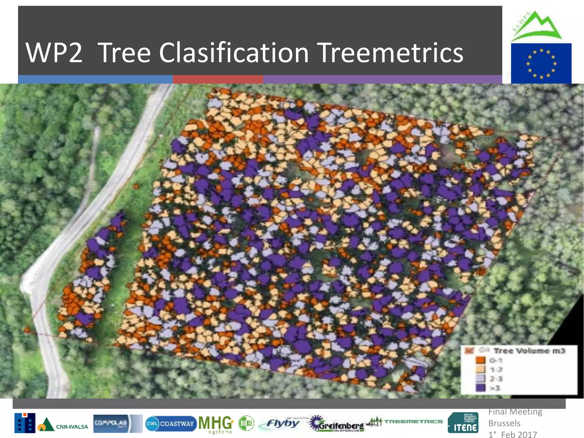


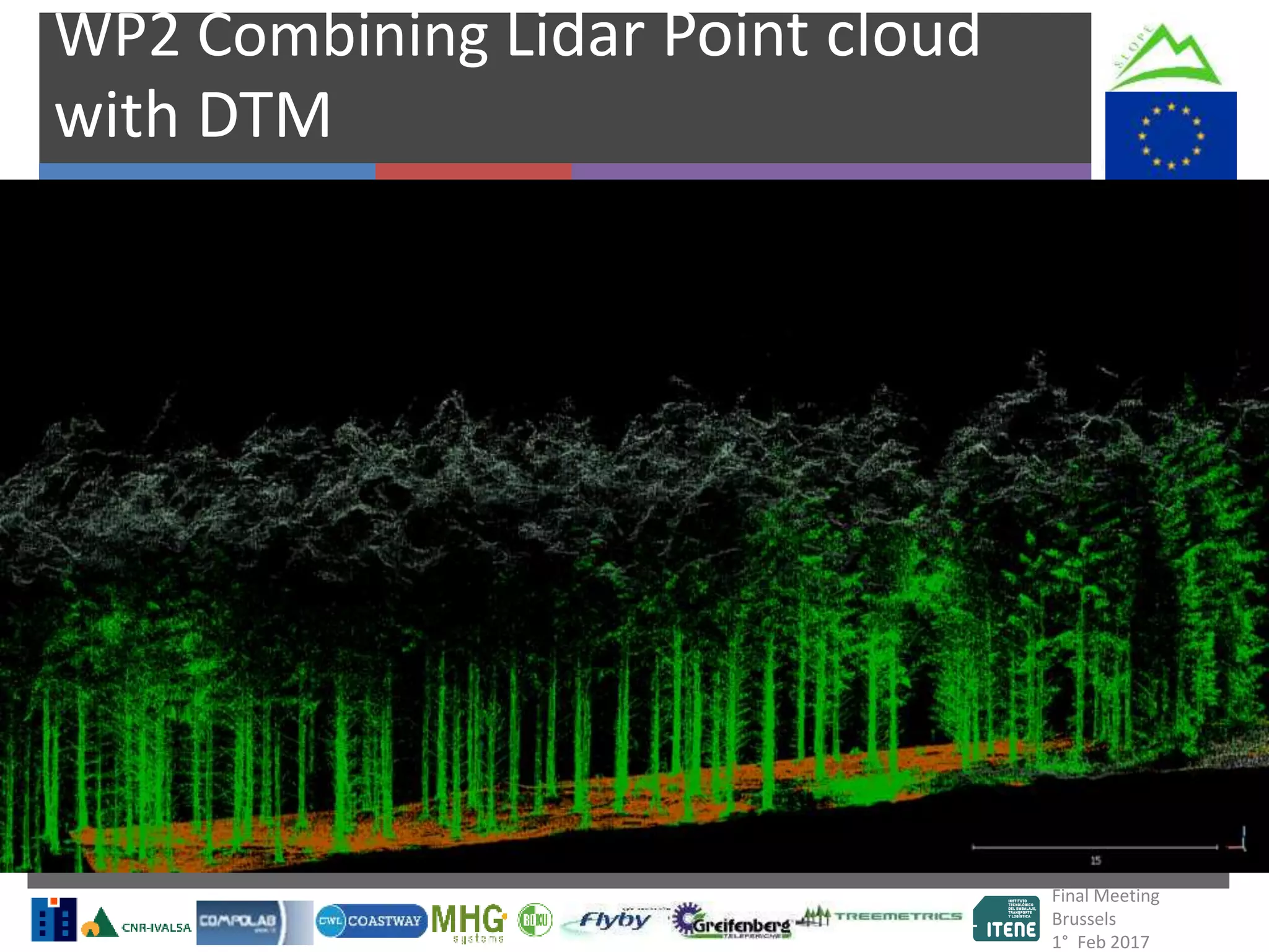


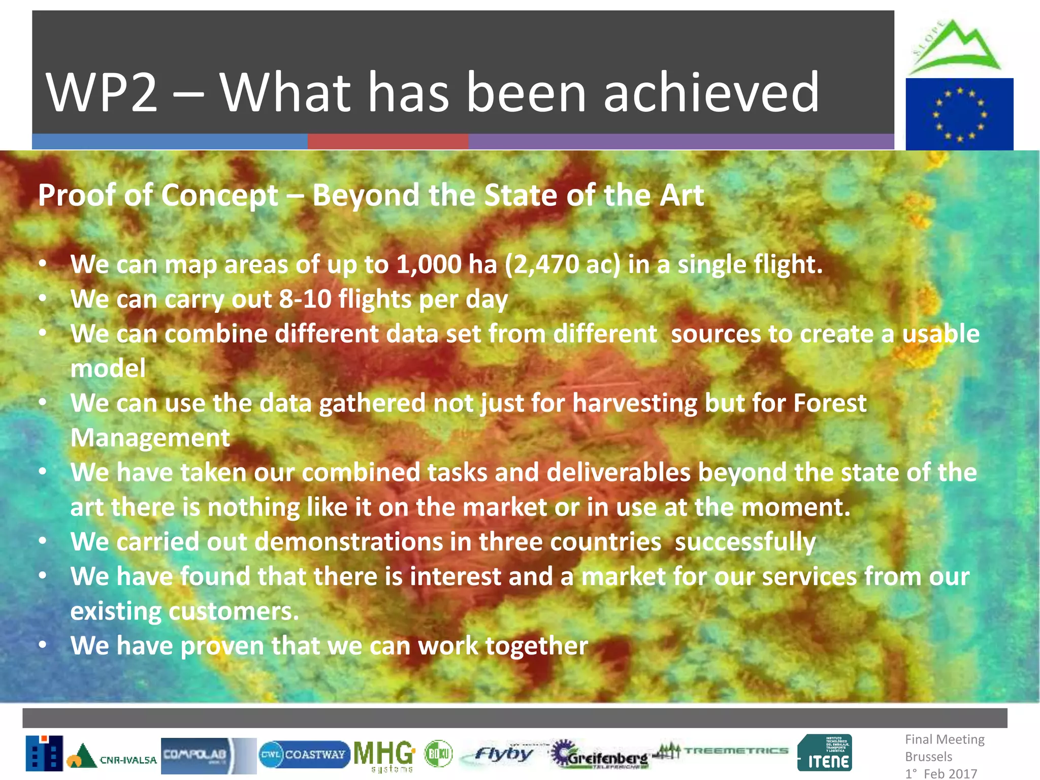


This document summarizes the final meeting of the WP2 Slope Project in Brussels on February 1, 2017. It discusses the completion of deliverables, data collection from various partners, tree classification and detection methods, estimation of environmental parameters, combining data sets from different sources, logistics modeling, and analytics. The meeting highlights that the project has proven the concept of combining data from remote sensing, UAVs, and TLS to map up to 1,000 hectares in a single flight and provide useful data for both harvesting and long-term forest management - providing a solution beyond the state of the art.


