Download to read offline
![Formec 2015
4-8/Oct/2015
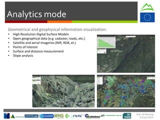
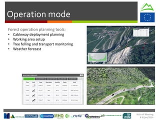
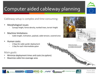
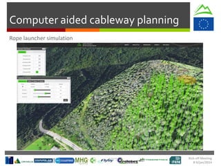
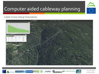
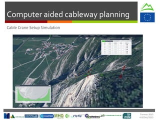
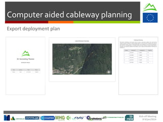
Computer aided cableway planning
1. Take measures: draw polygonal area lines to detect landing zone or other operational areas
2. Assess cable launch feasibility [experimental]
3. Draw cable lines:
1. Add at least 2 pylons by click or coordinates
2. Check constraints
3. Modify cable line (adjust tension, add/remove/move pylons)
4. Export data](https://image.slidesharecdn.com/formec2015v-161130132248/85/SLOPE-2nd-workshop-presentation-1-12-320.jpg)

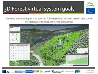
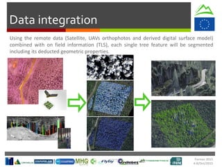
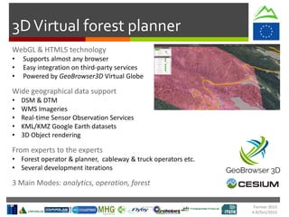
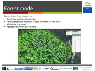
The SLOPE project aims to optimize forest production through a 3D virtual forest system to support harvesting operations in mountainous areas. The system will integrate data from forest surveys, digital terrain and forest models, and real-time sensor data to create a digital model of the forest. This model will then support various harvesting planning and monitoring tasks, such as cableway deployment planning, working area setup, and tree felling monitoring. The system is being developed as a web-based application to allow easy access and integration with other services. It will track the entire process from tree tagging to sawmill processing.


![[Webinar] Faster Turnarounds: Equipment Replacement & Upgrades](https://cdn.slidesharecdn.com/ss_thumbnails/fasterturnaroundswebinarfinal-160505152438-thumbnail.jpg?width=640&height=640&fit=bounds)


