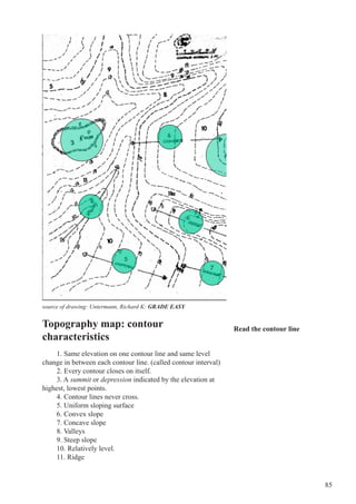
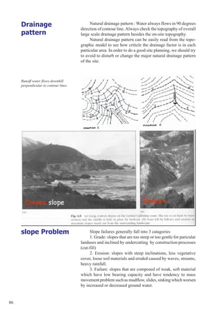
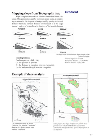
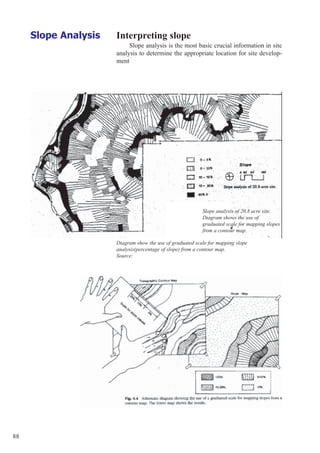
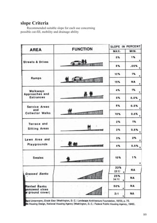
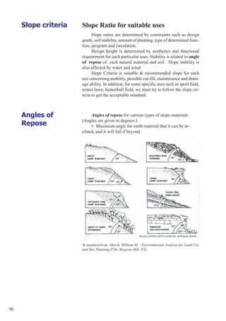
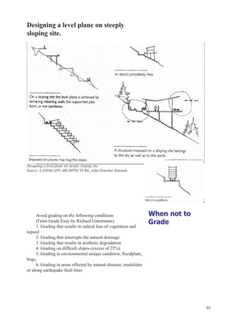
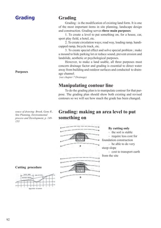
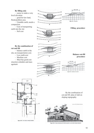
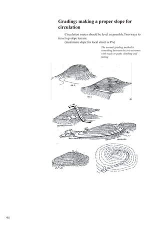
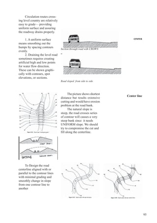
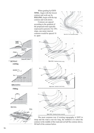
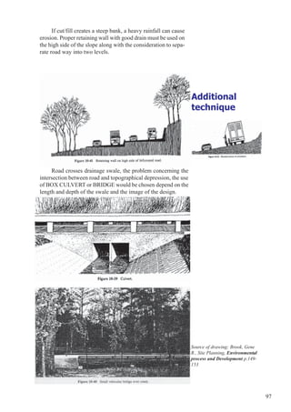
This document discusses slope analysis and grading techniques using topographic maps. It begins by explaining how topographic maps use contour lines to represent elevation and slope. Slope analysis involves calculating the gradient percentage between contours to determine suitable land uses based on slope criteria. Grading techniques are described for creating level areas, circulation routes, and addressing special site conditions. Cutting, filling, and balanced cut-fill methods are outlined. Drainage and erosion considerations are also discussed.


![[Deck] What's New in Spark-Iceberg Integration via DSV2.pptx](https://cdn.slidesharecdn.com/ss_thumbnails/deckwhatsnewinspark-icebergintegrationviadsv2-260210005337-25955b12-thumbnail.jpg?width=640&height=640&fit=bounds)


