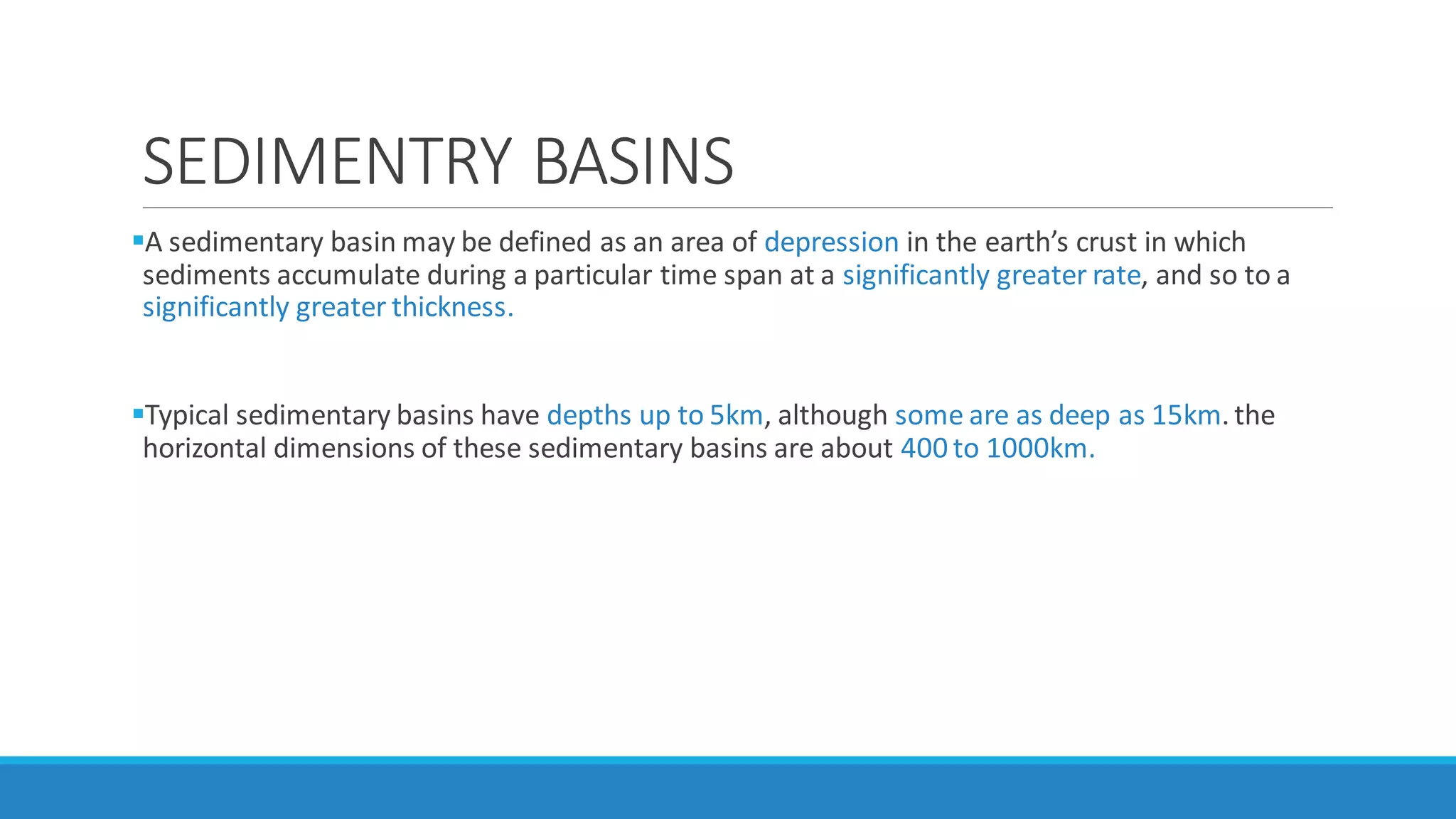
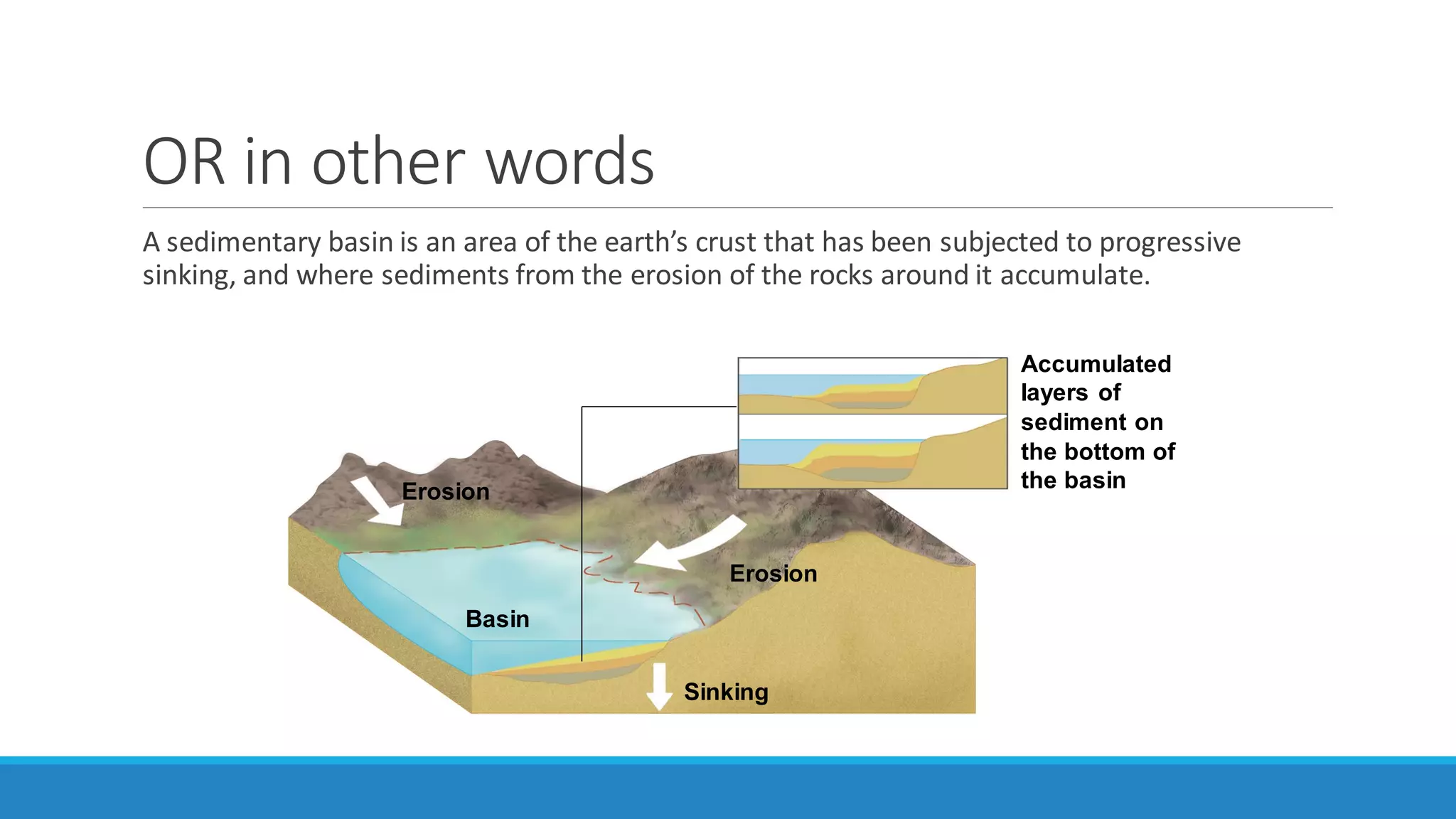
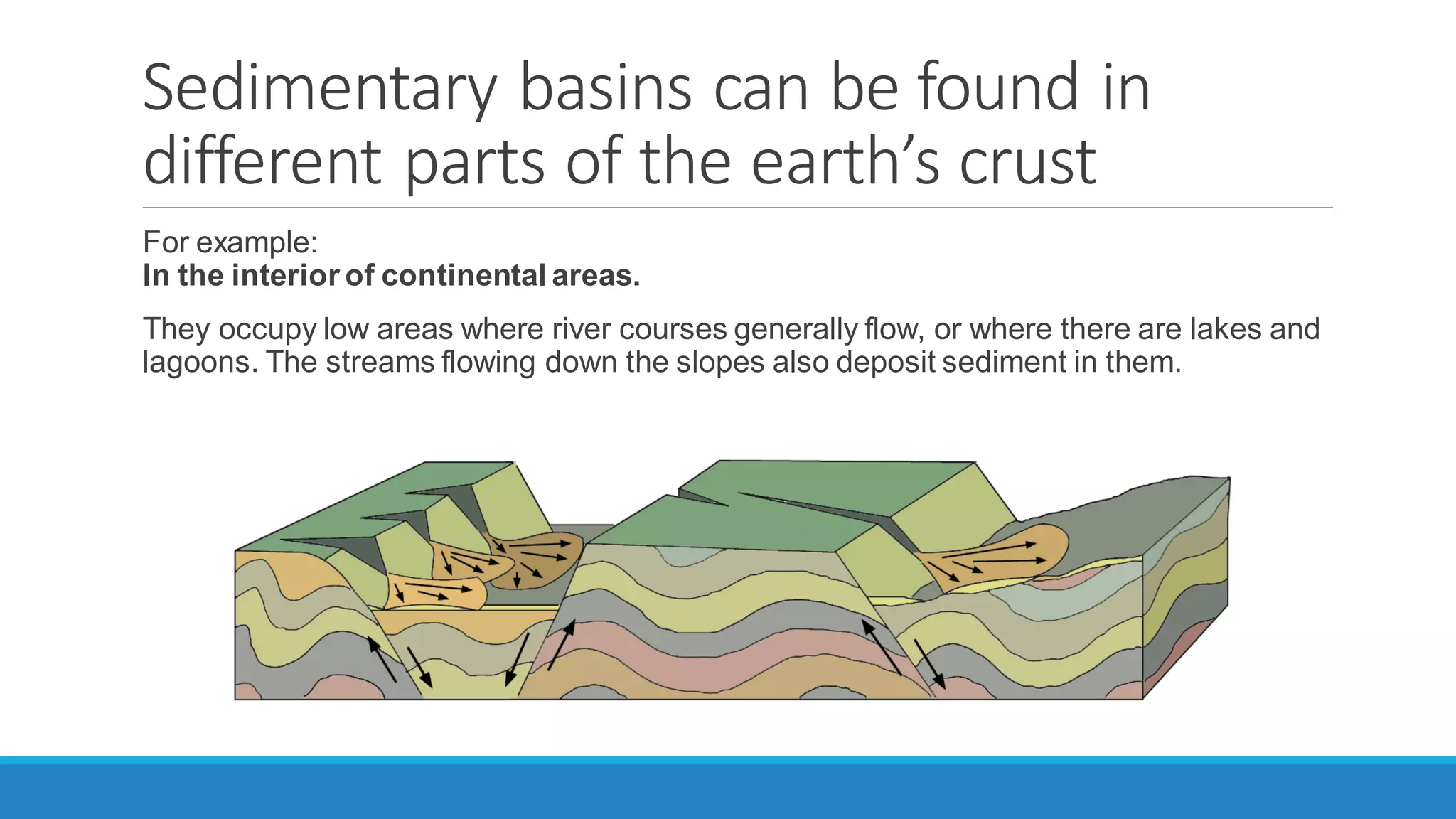
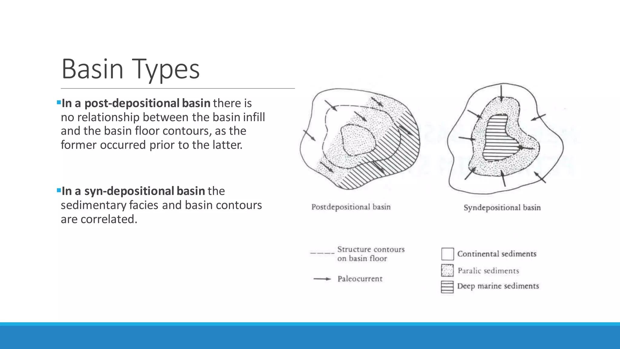
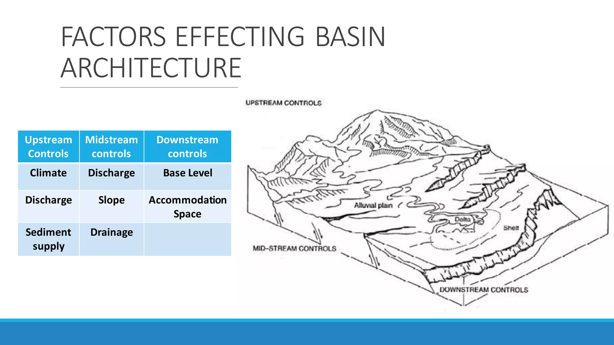
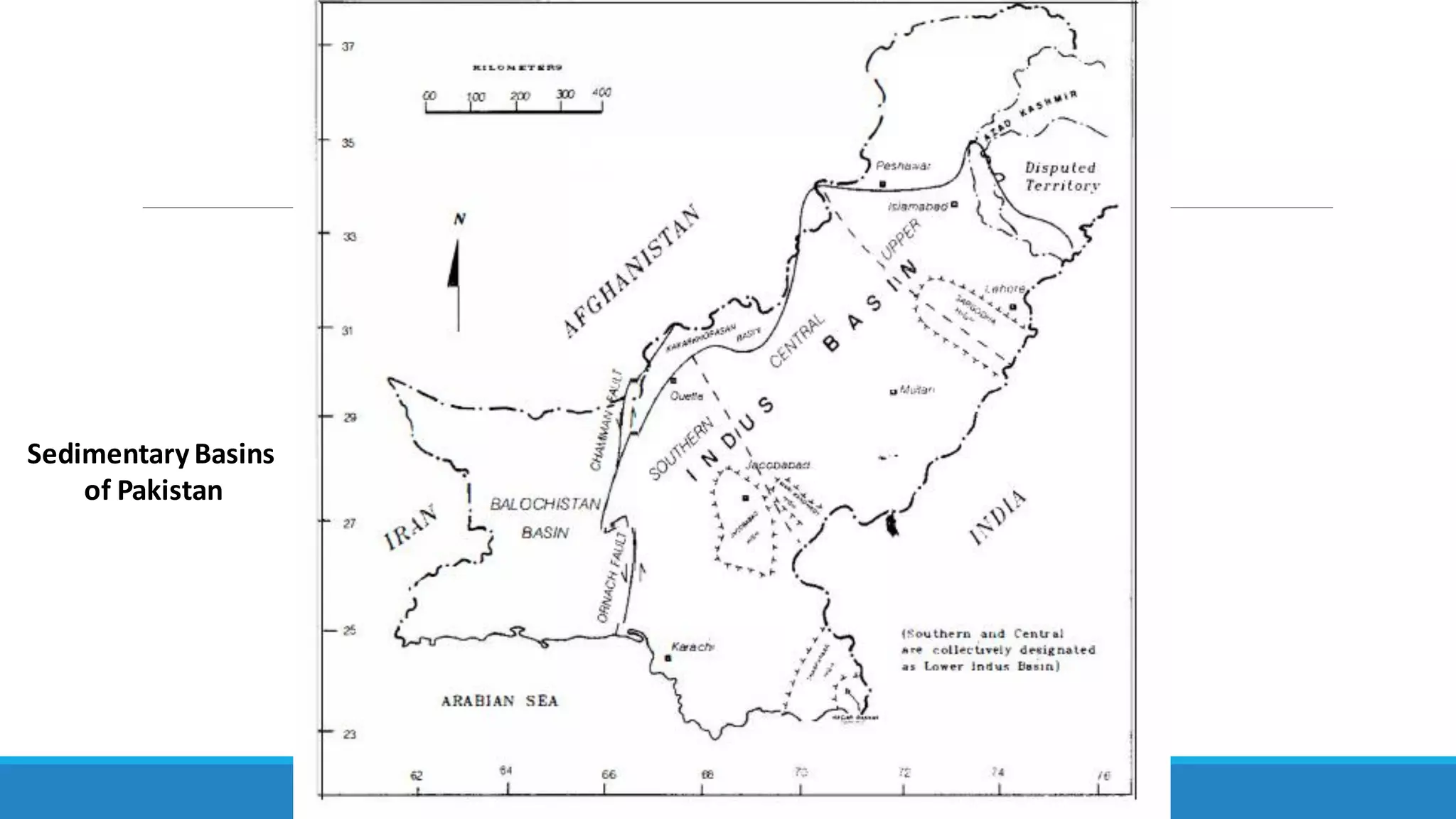
sedimentary basin may be defined as an area of depression in the earth’s crust in which sediments accumulate during a particular time span at a significantly greater rate, and so to a significantly greater thickness.
2. SEDIMENTRY BASINS
A sedimentary basin may be defined as an area of depression in the earth’s crust in which
sediments accumulate during a particular time span at a significantly greater rate, and so to a
significantly greater thickness.
Typical sedimentary basins have depths up to 5km, although some are as deep as 15km. the
horizontal dimensions of these sedimentary basins are about 400 to 1000km.
3. OR in other words
A sedimentary basin is an area of the earth’s crust that has been subjected to progressive
sinking, and where sediments from the erosion of the rocks around it accumulate.
Erosion
Basin
Accumulated
layers of
sediment on
the bottom of
the basin
Erosion
Sinking
4. Sedimentary basins can be found in
different parts of the earth’s crust
For example:
In the interior of continental areas.
They occupy low areas where river courses generally flow, or where there are lakes and
lagoons. The streams flowing down the slopes also deposit sediment in them.
5. Sedimentary basins can be found in
different parts of the earth’s crust
In coastal areas:
They occupy the areas where major rivers flow into the sea. When these basins are filled
in, they usuallyform swampsor deltas.
6. Basin Types
In a post-depositional basin there is
no relationship between the basin infill
and the basin floor contours, as the
former occurred prior to the latter.
In a syn-depositional basin the
sedimentary facies and basin contours
are correlated.
7. Remote Sensing
This satellite image from NASA shows the
southeastern Zagros mountains, with giant
anticlines and pierced salt domes that
locally develop into salt glaciers (black).
This region is devoid of major oil fields but
it is quite underexplored
11. Worldwide basins
There are more than 65,000 oil and gas basins and fields of all sizes in the world.
However, 94% of known oil fields is concentrated in fewer than 1500 giant and major fields.
Most of the world's largest oilfields are located in the Middle East, but there are also supergiant
(>10 billion bbls) oilfields in India, Brazil, Mexico, Venezuela, Kazakhstan, and Russia.
12. GENERATION OF SEDIMENTRY BASINS:
Basins are generated by plate tectonics.
The Earth's crust is made up of about 20 rigid plates, these plates are in constant slow motion
these plate motions are primary cause of basin formation.
14. Accommodationspace: Accommodationis defined as the space available for sediment
accumulation. Factors effecting are Tectonics and Eustasy.
Eustasy: The worldwide sea level change measure from the center of the earth.
Base level:Measure from the local moving datum usually basement.
18. Pakistan's total sedimentary basinal area is approximately 827,000 sq km.
ln terms of genesis and different geological histories, Pakistan comprises two main sedimentary
basins
Indus Basin
Baluchistan Basin
Welded together during Cretaceous/Paleocene along Ornach Nal/Chamnan
Strike slip faults.
20. Minor basin
There is yet another newly identified smaller basin, termed as Kakar Khorasan Basin also
referred to as Pishin Basin
This basin came into existence due to the interaction of Indian and Eurasian plates and is
classified as Median Basin.
Some basins of Pakistan:
Potwar Basin
PeshawarBasin
Campbellpur Basin
Siwaliks Basin
23. The main feature which controlled the sedimentation in the proto-lndus Basin up to Jurassic was
Precambrian Indian Shield whose topographic highs exist in the form of
Kirana Hills(Sargodha High)
Nagar Parkar Ridge.
It is the Sargodha High which is considered to be a divide between Upper Indus Basin and Lower
Indus Basin
The Early Jurassic saw the first breakup of the supercontinent Pangea which disturbed the
equilibrium.
24. Following is the classification of Indus Basin:
Upper Indus Basin:
Kohat sub-Basin
Potwar sub-Basin
Lower Indus Basin:
Central Indus Basin
Southern Indus Basin
25. UPPER INDUS BASIN
This basin is located in the northern Pakistan and is separated from the Lower Indus Basin by
Sargodha High.
The northern and eastern boundaries coincide with the Main Boundary Thrust (MBT) - the
southern most of the major Himalayanthrusts.
The MBT runs through the Margala Hills, Kala Chitta and Kohat Ranges.
Western boundary of the basin is marked by an uplift of Pre-Eocene sediments and eastward
directed thrusting to the west of Bannu.
The basin is further subdivided into
Potwar, to the east and
Kohat, to the west, by river Indus
26.
27. Regardless of the smalI size of the Potwar and Kohat sub basins they depict important facies
variations.
Potwar sub-Basin preserves the sediments from Precambrian to Quaternary age in the
subsurface and alI of these are exposed in the Salt Range, a southern most thrust.
The Trans-Indus Ranges in south of the Kohat sub-Basinexpose sediments from Cambrian to
Pliocene age.
Both Kohat and Potwar sub-basins are characterized by an unconformity between Cambrian and
Permian.
28. Mesozoic sediments are also exposed around the basin rim.
However, their presence is governed by PrePaleocene erosion which progressively cut into the
older sequence from the Trans-Indus Ranges in the west to East Potwar through Salt Range.
In the Kohat sub-Basin, west of the Potwar sub-Basin, Eocene through Siwaliks strata are
involved in a complex fold and thrust belt in which Eocene Salt occupies the cores of many of the
anticlines.
Moreover, Paleocene and Eocene stratigraphy is more complete in Kohat sub-Basin.
29. LOWER INDUS BASIN (SOUTHERNANDCENTRALINDUSBASINS)
Different classification schemes have been given to this basin by various experts. In this book
the scheme being used is as follows:
Central Indus Basin:
a. Punjab Platform
b. Sulaiman Depression
EastSulaiman Depression
Zindapir Inner Folded Zone
Mari Bugti Inner Folded Zone
c. Sulaiman Fold Belt
Thar Platform(Sindh Monocline)
KarachiTrough
Kirthar Foredeep
Kirthar Fold Belt
OffshoreIndus
The Central and Southern Indus basins are separated by Jacobabad and Mari
Kandhkot highs
Together termed as the sukkur rift
30. Central Indus Basin
The basin is separated from Upper Indus Basin by the
Sargodha High and Pezu uplift in the north.
It is bounded by Indian Shield in the east, marginal zone
of Indian Plate in the west, and Sukkur Rift in the south
The oldest rocks exposed in this basin are of Triassic age
(Wulgai Formation) while the oldest rocks penetrated
through drilling are of Precambrian Salt Range
Formation on Punjab Platform.
31. The basin comprises, from east to west, three
main units on the basis of the topography of
Indian Shield and later development, (Raza et
al, 1989):
Punjab Platform
SulaimanDepression
SulaimanFold Belt
32. SOUTHERN INDUS BASIN
This basin is located just south of Sukkur Rift - a divide
between Central and Southern Indus Basins.
It comprises the following four main parts:
Thar Platform
Karachi Trough
Kirther Foredeep
Kirther Fold belt
Offshore Indus