Downloaded 383 times


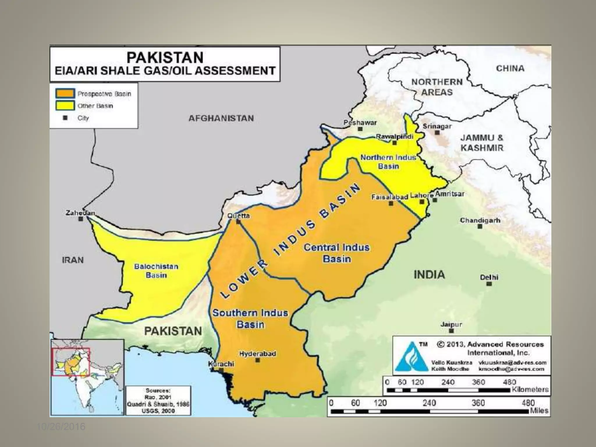


The document discusses the geological characteristics and petroleum potential of the southern Indus basin, highlighting its formation due to tectonic activities related to the divergence of the Indo-Pakistan subcontinent from Gondwanaland. It details various geological structures, stratigraphy, and the success of exploration efforts leading to significant oil and gas discoveries in the lower Indus basin, including potential reservoirs and source rocks. The document also addresses the implications of seismicity on hydrocarbon generation and the overall geological evolution of the region.
Date: 10/26/2016; Speakers: Dr. Naveed Ahsan, H. Jawad Sohail, Hammad Ahmad Sheikh.
Lower Indus Basin as an extension basin related to Gondwanaland rifting; seismicity suggests hydrocarbon potential in this region.
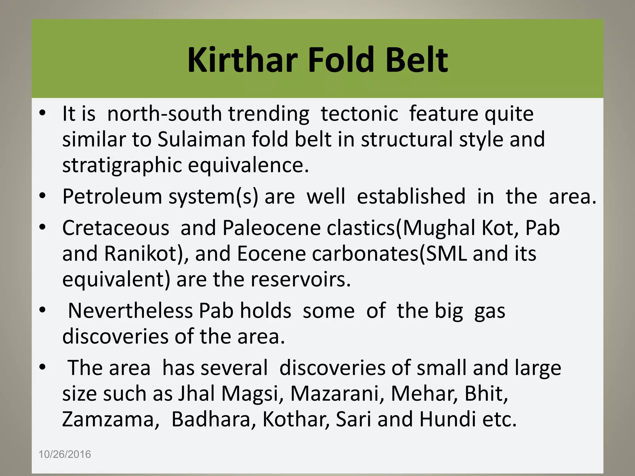
Key tectonic events include rifting, uplift, and collision; discusses features and sediment types present in the basin.
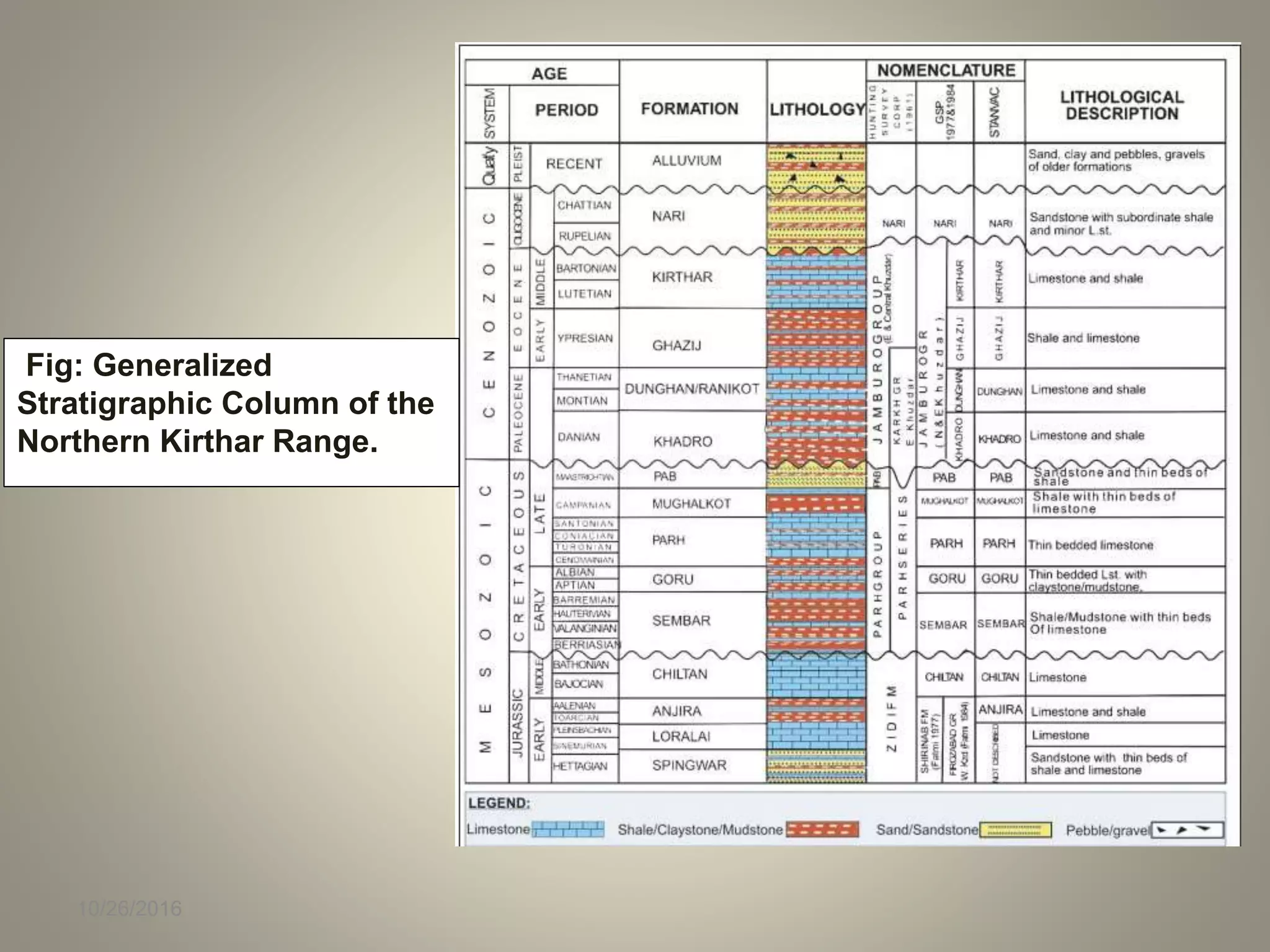
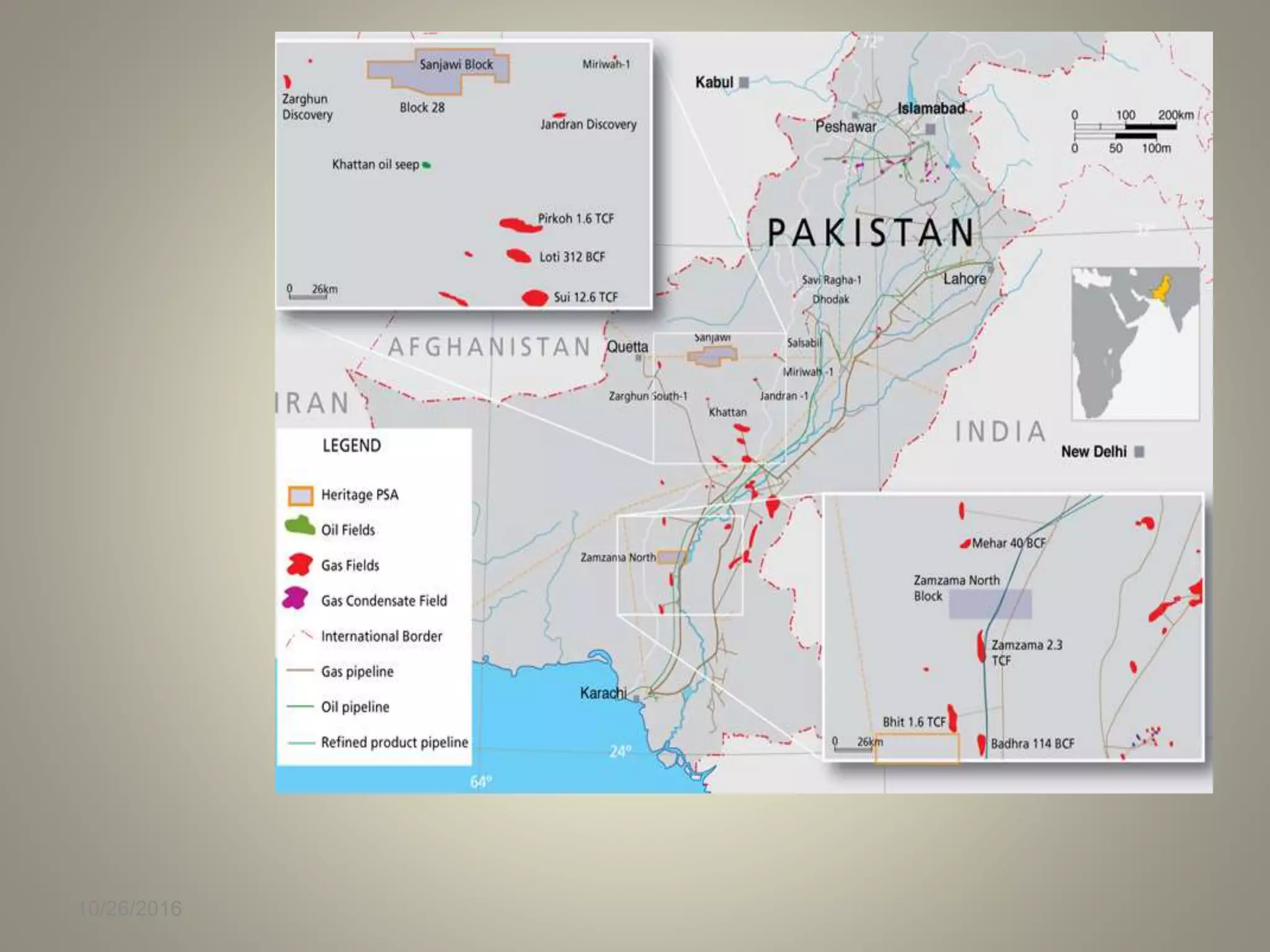
Description of the stratigraphic subdivisions of the Lower Indus Basin; highlights discovered reserves and formations.
Limited exploration history with 15 wells drilled; mentions single sub-commercial producing well.
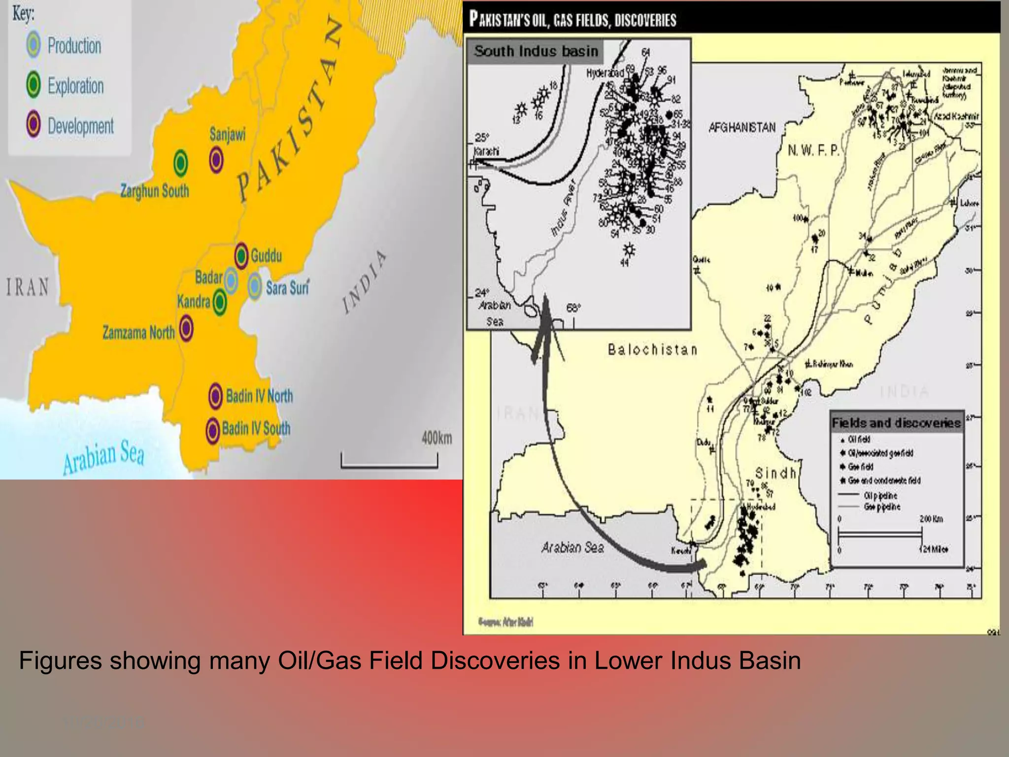
High success rate of petroleum discoveries throughout the basin; notable discoveries in the Lower Goru Formation.
Illustrates various oil/gas fields discovered in the Lower Indus Basin.
Details on potential hydrocarbon reservoirs; discusses thickness, porosity, and historical production data.
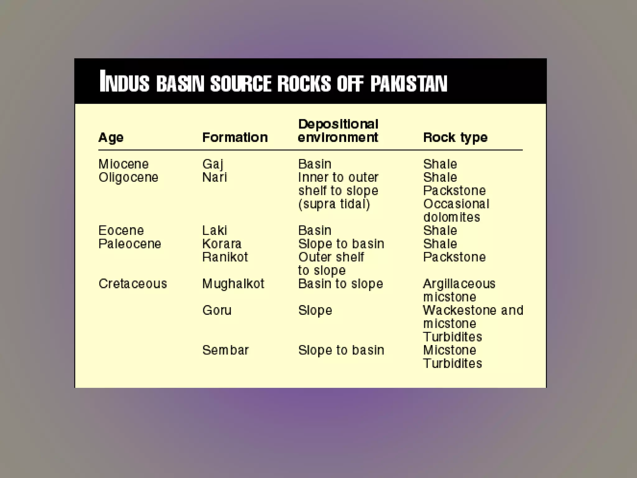
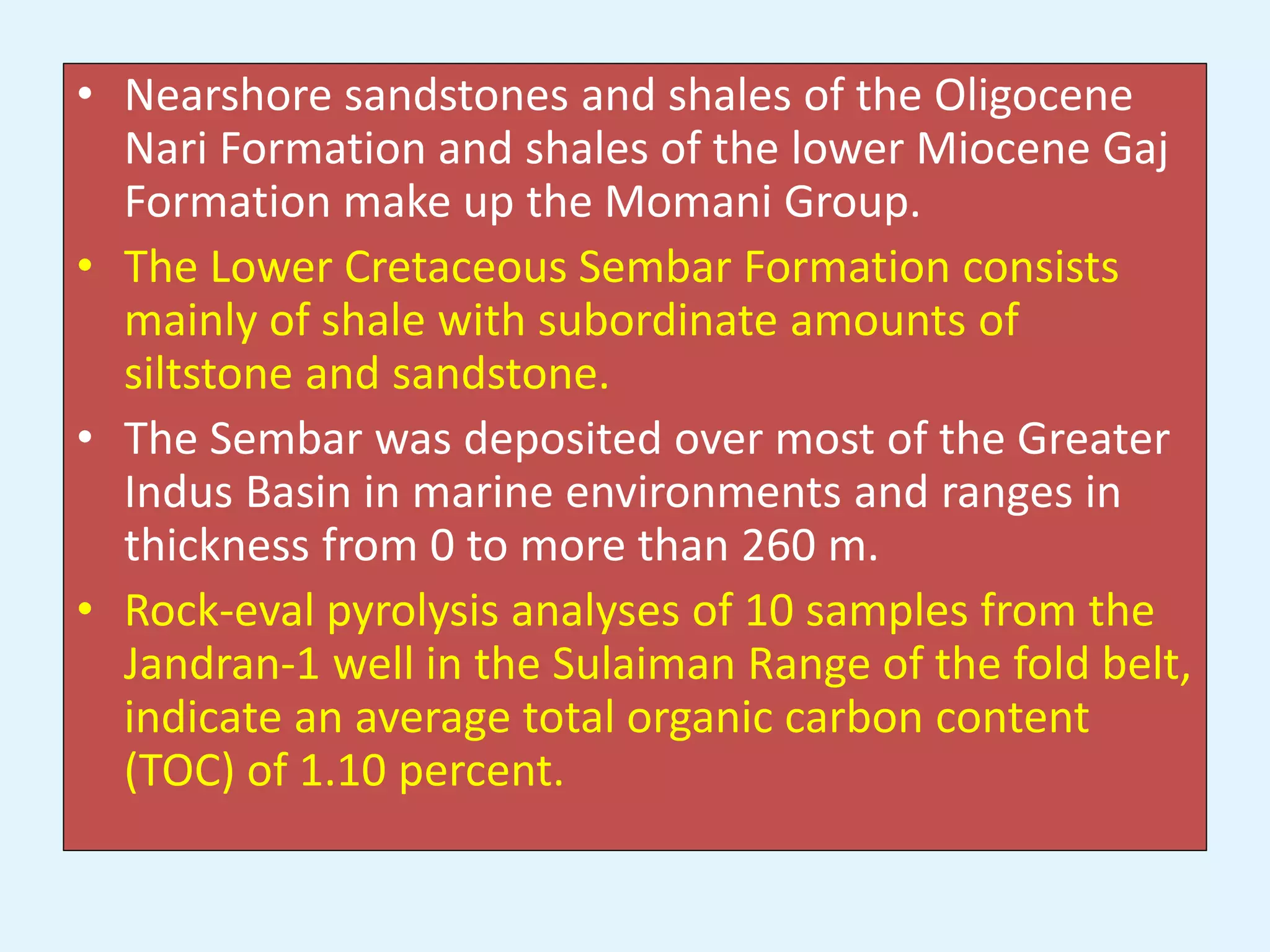
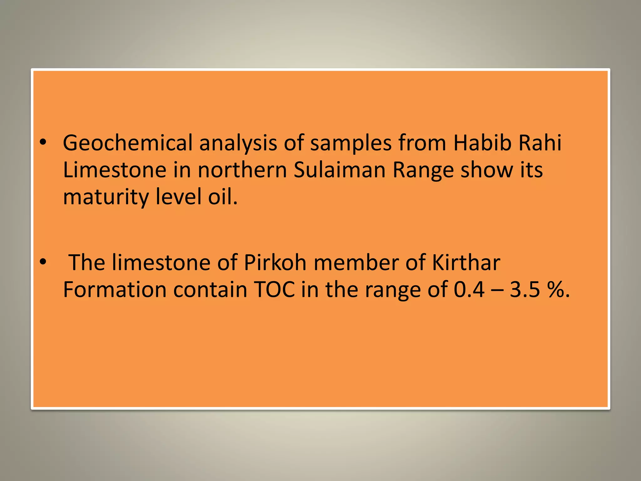
Key source rocks in the Lower Indus Basin; mentions total organic carbon content and geological formations.
Describes seals present in reservoirs and trap formations related to rifting and hydrocarbon migration.
List of references utilized for Geological Survey and Petroleum plays in Pakistan.


![Cole, J. M. & Crittenden, S., 1997_sundabasins[1]](https://cdn.slidesharecdn.com/ss_thumbnails/colecrittenden1997sundabasins1-161228015153-thumbnail.jpg?width=640&height=640&fit=bounds)


